A research study to the initiative, development, functioning, benefits and effects of vibrant social - urban places in Amsterdam and Berlin which stimulate the livability and vitality of neighborhoods, quarters and the city as a whole and are developed by local initiatives (artists, local entrepreneurs, local inhabitants)
Patrick Geddes was a Scottish biologist, sociologist, and pioneering town planner in the late 19th/early 20th century. He developed several influential theories including the valley section, constellation theory, and the concept of "conurbation." The valley section model illustrated the relationship between a region's physical geography, occupations, and human settlements. The constellation theory addressed how multiple unequal cities could plan cooperatively as a region. Geddes coined the term "conurbation" to describe the merging of cities, towns, and urban areas into continuous built-up areas through population growth. He sought to integrate social and environmental factors into urban planning approaches.
This document provides information about Ranganathan Street in Chennai, India. It describes the history and location of the street, which has been a major commercial area since the 1920s. The street is home to many small shops and vendors selling goods like clothing, jewelry, produce, and electronics. It is very crowded throughout the year, but especially during festivals like Deepavali. The document includes maps and diagrams showing land use, building heights, connectivity, street cross-sections, and more. It also discusses issues like lack of parking, sidewalk encroachment, and improper infrastructure that contribute to the street's congestion.
Placemaking: Building our Cities around placesPriya Vakil
ThinkPhi is on a journey to build cities that are healthy and sustainable. We are doing this by using Placemaking - a design philosophy that explores how spaces in a community can be better utilised.
And this is philosophy, we constantly use when having discussion on helping design sustainable cities.
Urban Design at different levels of PlanningYajush Sonar
This document provides guidelines for urban design in several areas:
1. It discusses the basics of urban design including its multi-disciplinary nature and focus on designing places for people.
2. Guidelines are given for massing and intensity in urban fringe and rural areas, including respecting the natural environment and providing linkages between urban and rural spaces.
3. Recommendations are made for development height profiles including stepping down heights from city centers to edges and maintaining view corridors.
Urban squares have historically served as important public gathering spaces, often located at crossroads of trade routes. They function to provide shelter from traffic and represent psychological parking areas within cities. Factors that influence squares include surrounding buildings, proportions, entrance angles and central features. Squares can take different forms such as closed spaces enclosed by uniform buildings, dominated squares oriented around a focal point, nuclear squares with a central monument, grouped squares that combine into a whole, and amorphous squares without coherent shape. Over time, squares may evolve as new structures are added or old ones changed or destroyed.
Current Concepts of Urban Regeneration slides for Urban Dynamics & Regeneration course.
Master of Science in Sustainable Urban Design, Razak Faculty, UTM Kuala Lumpur
FINAL B.ARCH THESIS PRESENTATION IIT ROORKEE:
City Centre ,Rohini ,Delhi ,Thesis project (2013)
A Mixed use development project comprises of diverse activities and functions located at the
sprawling District centre in Rohini with site area of 16 acres.With a AIM to explore the symbiotic
character of COMMERCE and CULTURE and to evolve a contemporary model of conventional
Indian market.
Clarence Perry was an American urban planner who promoted the concept of the neighbourhood unit in the 1920s. He advocated for self-contained residential communities centered around a school, with arterial roads along the perimeter and a hierarchy of internal streets. Neighbourhood units were intended to be walkable, with amenities like parks, playgrounds, and shopping areas accessible within a quarter mile. The goal was to improve quality of life by fostering social interaction and providing safe spaces separated from traffic and industrial areas. Perry's model influenced planning in U.S. cities in the early 20th century.
Putrajaya is a planned city in Malaysia established in 1995 as the new federal administrative center. It has a total area of 4931 hectares and a population of 88,300. The city was developed to relieve pressure on Kuala Lumpur's infrastructure by providing a new location for government offices and facilities. Putrajaya was planned following concepts of sustainable development, with over 55% of the area designated for government use, 32% for commercial, and 13% for affordable housing. Major features include roads, bridges, and a monorail line, as well as large green spaces and man-made lakes throughout the city.
This document identifies a site in Matara, Sri Lanka for urban regeneration. The site consists of a shopping complex owned by the Matara Municipal Council with 129 shops, but only 28 are currently functioning. It also includes the Star Fort, which has lost its original context, and a general hospital. These three separate functions currently disturb and fail each other, leading to an overall failure of the site area. Urban decline in the area is evidenced by out migration, a drop in economic activities and land values, and increased unemployment and social unrest. The document performs an analysis of the context and current issues of the site to determine why regeneration is needed.
The document summarizes the HUDA City Centre Metro Station in Gurgaon. Some key points:
- The six-story metro station was designed by Vishwannath Associates to include shopping, offices and a rooftop cafeteria.
- It is located at the junction of Sector Road and Arya Samaj Road, surrounded by hospitals, shopping complexes, residences and offices.
- Analysis found the building circulation on the ground floor could be improved for safety and accessibility. The parking is also insufficient given the high volume of users.
- With upcoming developments like Appu Ghar and a commercial complex, user volume is expected to substantially increase, placing more demand
The document provides a history of the development of Chennai city from its establishment in 1637. It details how the city grew from a small fishing village called Madraspatnam due to establishment of St. George fort by the British. The city's growth was supported by development of trade activities in the port and construction of roads connecting the coast to surrounding areas. Major institutions, housing developments, and infrastructure projects over the 20th century further accelerated the expansion of Chennai. The study area saw tremendous growth due to establishment of educational institutes and implementation of development plans after independence.
London is located in southeast England on the River Thames. It has a population of over 14 million and a temperate climate. Some key landmarks include Buckingham Palace, Big Ben, and Tower Bridge. The document discusses the landforms, climate, and cultural factors that have influenced London's urban form, as well as common building materials like brick and stone. It also describes the major road, cycling, and walking path networks that define London's transportation routes.
George Town is the historic core area of Chennai that has experienced traffic congestion, poor infrastructure, and lack of land due to commercial activities and narrow streets. The Chennai Metropolitan Development Authority has undertaken several redevelopment strategies for George Town, including removing encroachments, shifting wholesale markets to Koyambedu to reduce congestion, and road widening projects while protecting heritage buildings. Lessons for redeveloping other congested areas include promoting mixed land use and improving infrastructure.
Town planning and architecture
HISTORY OF GARDEN CITY
FEATURES OF GARDENCITY
EXAMPLES O GARDEN CITY
REFERENCE -TOWN PLANNING AND ARCHITECTURE ,R S AGRAWAL
This document discusses different types of riverfront development and advantages of riverfront projects. It provides details about a specific project along the Haihe River in Tianjin, China that redeveloped the riverfront for flood control, tourism, recreation, and economic activity. The project included new land uses, transportation improvements, and public open spaces along the river to revitalize the area. It also describes a riverfront redevelopment project in Hamburg, Germany along the Elbe River that protected the area from floods while improving public access and activating the waterfront.
The document summarizes the existing conditions of the road network, land use patterns, built environment, and public spaces in Hackney central, London. It finds that the area has busy streets with traffic congestions and unclear pedestrian links, making it difficult to get around. It also has strong local landmarks like churches that provide clarity. However, the overhead railway line obstructs views and isolates some spaces. The pedestrian links and public spaces lack signage and have unsafe crossings, while green spaces are underdeveloped and underutilized.
Placemaking involves designing public spaces to serve the people and bring communities together through mixed uses, successful streets, open spaces, appropriate urban scale, movement frameworks, and a sense of place. It is about making spaces that people gravitate towards and that capture the soul of a neighborhood by creating local identity and embracing the people, buildings, events, and nature in an area. The goal is to take back the public realm and create character and meaning to make a space a living place for the community.
The Miami Beach Soundscape project redesigned a 2.5 acre site adjacent to Frank Gehry's New World Symphony building to create an open green space for the community. West 8 designed undulating topography, meandering pathways, seating walls, and pergolas providing shade. The design was intended to attract younger generations to classical music through outdoor movies and concerts. Since opening, the space has seen great success in attracting the local community and transforming the area into a cultural destination through the day and night.
This document summarizes the key aspects of a master plan submitted for a settlement. It discusses:
1. The need for master plans arose due to unplanned growth of cities following industrialization and wars, which led to overcrowding and lack of infrastructure.
2. A master plan is a statutory document that guides the orderly development of a city over a horizon year through land use planning and regulations. It addresses issues like transportation, housing, employment and provision of utilities and services.
3. The key components of the master plan submitted include analyses of the existing conditions, projected population and land requirements, and development proposals to organize land use and infrastructure over the plan period. It provides guidelines for implementation and monitoring of
Clarence Perry was an early 20th century American planner who developed the concept of the neighborhood unit. The neighborhood unit aimed to design self-contained residential areas that promoted community and protected residents from industrial areas and traffic. Key elements included centering the neighborhood around an elementary school, placing arterial streets on the perimeter, and dedicating 10% of land to parks and open space. The ideal neighborhood unit size was 5,000-6,000 people and 160 acres to allow children to walk half a mile to school and residents to access local services. Neighborhood planning principles focused on size, boundaries, internal streets, land use mix, and locating community facilities to encourage social interaction.
This document discusses urban morphology and the determinants of urban form. It begins by defining key terms like form, urban form, and urban morphology. It then describes the two main types of urban form - organic and grid oriented. The main determinants that shape urban form are described as natural (e.g. topography, climate) and man-made (e.g. political, religious, economic). Specific examples of each determinant are provided with images to illustrate how the determinant influenced the urban form. The document also includes a glossary defining terms commonly used in urban design like urban block, public realm, grain, and density.
This document is a thesis report submitted by Mokshika Balana for their B.Arch 10th semester at Guru Nanak Dev University. It discusses the proposed design of a Central Business District in Amritsar, Punjab. The objectives are to provide commercial, cultural and social activities in an accessible environment. The methodology includes a literature review on CBDs, case studies of existing CBDs, site analysis, and formulation of a design concept and proposal. Key aspects to be addressed include connectivity, safety, comfort and compatibility of land uses.
Urban design is the process of shaping the physical setting of cities and villages. It deals with groups of buildings and the spaces between them, including streets, paths, gardens and squares. Urban design considers aesthetics and how the physical environment will be used. It requires input from multiple fields like engineering, ecology, history and transport planning. The best urban design involves interdisciplinary teams to create places that are good to live in, attractive to visit, establish community identity, reduce crime, and be socially and economically successful.
Urban conservation provides cultural and economic benefits. Culturally, it preserves historic architecture, streetscapes, and sites that give cities a unique identity and sense of place. Economically, conserving urban heritage increases income opportunities from tourism as well as making cities more livable and competitive. Improving conservation and management of historic assets in cities generates civic pride while attracting investment and spending from tourists, thereby boosting local economies.
This document discusses the hierarchy of urban green spaces in cities. It aims to study the relationship between urban greens and city structure, ecology, and character. The objectives are to define urban green, identify limitations to green space growth, discuss integration of greens at different scales (city, neighborhood, street, building), analyze case studies, and compare existing scenarios to standards. It then discusses types of urban green spaces like parks and greenways. The benefits of urban green spaces are also outlined, including environmental, social, and economic advantages. The document analyzes Chandigarh as a case study for its meticulously planned hierarchy of open spaces integrated throughout the city. It describes the city's green areas like the Leisure Valley and major parks
The document summarizes Kevin Lynch's book "The Image of the City" which explores how people mentally perceive and navigate urban environments. It discusses Lynch's concepts of imageability, legibility, and the five elements that comprise a city's mental image for people - paths, edges, districts, nodes, and landmarks. It provides examples of Lynch's analysis of the mental images of Boston, Jersey City, and Los Angeles.
The document discusses two architectural projects:
1) Multi-National City in New York by Martin/Baxi Architects, which proposed towers at the World Trade Center site that varied in height algorithmically and contained memorial spaces and parks at the top.
2) Parc de la Villette in Paris by Bernard Tschumi Architects, which manifested Tschumi's theory of deconstructivism through follies (nodes) of different functions that navigate users through the park and are organized by a grid. The projects explore relationships between nodes, paths, and integrating structural and spatial networks.
The document discusses models of popularity and sharing on social networks and websites. It outlines 5 observations about social networks today, including the rise of second generation networks and object-mediated sociality. It then describes 3 models of popularity: watercooler conversations around shared objects, viral sharing of interesting content, and tag-based social sharing. The document concludes with 10 principles for designing websites and systems to encourage sharing, such as making them personally useful and useful, allowing different levels of participation, and adding elements of serendipity, independence, and play.
Jason Baumann, Coordinator of Collection Assessment & LGBT Collections at The New York Public Library, speak at a March 22nd SLA-NY Diversity Committee event.
Community Management: Developing a Social Business StrategyMall of America
Community management as a discipline is constantly evolving. What used to be the moderation of forums, blogs, Facebook pages, Twitter, (insert social tool here) is fast becoming a highly strategic and developed marketplace. On the corporate business-to-consumer side, community management may live within corporate communications, but the tactics involved and effects of real-time mediums on the organization as a whole largely affects everything. At Mall of America, community management is in a growth phase from the former to developing social business practices that function much like any other department within the organization. In this workshop, Lisa Grimm and Bridget Jewell of Mall of America will offer several case studies that show how community management and social business is affecting the organization. In addition, we will draft a faux community engagement strategy as a group so that attendees can take away practical application of topics covered in the workshop.
This document discusses strategies for municipal resource mobilization for urban infrastructure projects including public-private partnerships. It outlines various legal frameworks governing municipal finances and infrastructure development. It describes conventional sources of municipal revenue such as taxes, fees, and grants. It also discusses non-conventional strategies like pooled financing, value capture financing, and public-private partnerships. For PPP projects, it notes different models for water, waste, and sewerage infrastructure and highlights factors for ensuring successful PPP implementation like clear purposes, risk sharing, service standards, and transparency. Common challenges to municipal resource mobilization are also summarized.
This document discusses barrier-free and universal design considerations for buildings. It defines barrier-free design as architecture that is accessible to people with disabilities through features like ramps. The seven principles of universal design aim to make designs usable by all people to the greatest extent possible, without need for adaptation. The document then provides examples of barrier-free design considerations for various architectural elements like entries and exits, ramps, doors, staircases, passages, toilets, lighting, and more. It emphasizes the importance of accessibility and inclusion in design.
R City Mall is a 1.2 million square foot shopping mall located in Ghatkopar, Mumbai owned by Runwal Group. The mall houses over 139 stores and restaurants spread across various floors catering to youth, women, families and entertainment. It has seen increasing footfall over the years reaching over 20 million annually. The mall aims to provide an international shopping experience while highlighting local brands and culture.
There are two main types of retail locations: unplanned and planned. Unplanned locations include freestanding sites, urban areas like central business districts, inner cities, and gentrified areas, and main streets. Planned locations include shopping centers in various formats like convenience centers, power centers, enclosed malls, lifestyle centers, mixed-use developments, outlet centers, and theme/festival centers. New developments combine multiple formats. Other nontraditional locations include pop-up stores, stores-within-stores, kiosks, and airports. The selection of a retail location type depends on factors like the target market's shopping behavior, market density, and the retailer's uniqueness. Societal and legal considerations can also
Rommy Joyce, Graduate Student in Civil & Environmental Engineering at Stanford University
Sustainable Urban Systems Symposium
Stanford University, June 2016
The document provides an overview of the Public Financial Management Act (PFMA) and Municipal Financial Management Act (MFMA) of South Africa. It discusses key aspects of each act, including that the PFMA provides a framework for accounting officer functions and roles, while the MFMA takes a more instructive approach. It also outlines the roles and responsibilities of various entities under the acts, such as National and Provincial Treasuries, municipal councils, mayors, municipal managers, and chief financial officers. The presentation aims to modernize municipal finance management and promote better governance.
This document summarizes the key characteristics of London and problems within its Central Business District (CBD). London is the capital and largest city of England, with a population of over 7 million people. As the center of business and commerce, London's CBD experiences high land values and lack of space. This leads to pollution from traffic and industry, as well as urban decline as businesses and residents relocate outside the CBD. The city administration has implemented measures to address these problems, such as restrictions on traffic and pollution.
The document discusses issues related to urban shopping malls in Australia. It provides background on the size and economic impact of the Australian shopping mall industry. The research objectives are to explore current and future consumer and retailer issues influencing mall success, likely future trends, and how malls can adapt. A literature review covers topics like shopper typologies, utilitarian vs. hedonic shopping motives, and the rise of experiential consumption. Interviews with industry experts revealed several themes, including the importance of food offerings, demand for innovation, and the need to leverage emerging technologies and define a strategic point of difference. The success of malls relies on their ability to evolve by determining their community role and harnessing new opportunities.
urban design principles in CBD Belapur, Navi Mumbaiayan baraniya
It is the study of Urban Design principles by Kevin Lynch in CBD of Belapur. All the elements and principles have been followed wisely. It is the small case study to study features and elements of Urban Design.
sample balanced scorecard for the mall management industry, illustrating some of the key objectives & metrics that should be monitored by professionals in the mall managment industry.
The document discusses strategies for reviving struggling malls in India. It notes that according to a real estate consulting firm, only 25% of India's 500+ malls are profitable, with the rest struggling. Some key reasons for mall failures include poor location, lack of multiplexes and entertainment options, and an imbalanced tenant mix without appropriate anchor stores. The document also outlines challenges faced by mall developers in India and provides recommendations for improving mall performance through factors like effective tenant mix and marketing.
The document summarizes Kevin Lynch's book "Image of the City". Lynch studied how people perceive and understand cities based on mental maps. He identified 5 key elements that shape a person's mental map of a city: paths, edges, districts, nodes, and landmarks. Lynch also coined the terms "imageability" and "wayfinding". The book was influential in urban planning and psychology. It provided a framework to evaluate a city's form and image from a resident's perspective.
Central Business District or CBD is the focal point of a city. It is the commercial, office, retail, and cultural center of the city and usually is the center point for transportation networks.
Check for more presentations at - www.archistudent.net
This document discusses ribbon development and its disadvantages. Ribbon development refers to linear development along major roads where buildings like houses, shops, and factories extend in a long strip alongside the main road. Some key disadvantages of ribbon development mentioned include increased costs for utilities, lack of community and social life, difficult future expansion, impacts from traffic like noise and pollution, wastage of interior land, safety issues from mixing local and through traffic, and reduced road capacity and efficiency. The document also notes the complex challenges involved in solving the problem of ribbon development which requires coordinated efforts from various stakeholders.
This document outlines the requirements for Project Two of the Elements of Natural Built Environment course. It has two parts:
Part A is an individual assignment to create an A4 booklet investigating and describing a town or city, including its history, principles of urban planning, and guidelines for better future towns.
Part B is a group assignment to propose a new, improved "town center" through A2 presentation boards and a physical model. The town center design must consider geometry, sustainability, green space, and features to meet the population's needs.
The goals are to understand components of the built environment, examine the relationship between nature and development, and apply lessons to planning a livable future town center.
This document outlines the requirements for Project Two of the Elements of Natural Built Environment course. It has two parts:
Part A is an individual assignment to produce an A4 booklet describing a city or town and investigating cities/towns, town planning principles, and guidelines for better future towns.
Part B is a group assignment to propose a new, improved "town center" through A2 presentation boards and a physical model. The town center design must consider geometry, sustainability, green approaches, and focus areas like squares and civic buildings.
The project aims to expose students to natural and built environment elements and their relationships, and allow students to apply principles in proposing a better future town center design.
This document outlines the requirements for Project Two of the Elements of Natural Built Environment course. It has two parts:
Part A is an individual assignment to create an A4 booklet investigating and describing a town or city, including its history, principles of urban planning, and guidelines for better future towns.
Part B is a group assignment to propose a new, improved "town center" through A2 presentation boards and a physical model. The town center design must consider geometry, sustainability, green space, and features to meet the population's needs.
The goals are to understand components of the built environment, examine the relationship between nature and development, and apply lessons to planning a livable future town center.
This document outlines the requirements for Project Two of the Elements of Natural Built Environment course. It has two parts:
Part A is an individual assignment to create an A4 booklet investigating and describing a town or city, including its history, principles of urban planning, and guidelines for better future towns.
Part B is a group assignment to propose a new, improved "town center" through A2 presentation boards and a physical model. The town center design must consider geometry, sustainability, green space, and features to meet the population's needs.
The goals are to understand components of the built environment, examine the relationship between nature and development, and apply lessons to planning a livable future town center.
This document outlines the requirements for a two-part final project on the built environment for an architecture course. For Part A (20%), students will individually research and document in an A4 booklet a past, present, and future city as well as a town planning principle. They will also investigate and describe the city or town where they live. For Part B (20%), students will work in groups to propose a new, better future town center through A2 presentation boards and a physical model made of recyclable materials. The project aims to expose students to natural and built environment elements and their relationships through exploring case studies and proposing an improved town design.
This document outlines the requirements for a two-part final project on the built environment for an architecture course. For Part A (20%), students will individually research and document in an A4 booklet a past, present, and future city as well as a town planning principle. They will also investigate and describe the city or town where they live. For Part B (20%), students will work in groups to propose a new, improved future town center through A2 presentation boards and a physical model using recyclable materials. The project aims to expose students to natural and built environment elements and their relationships through exploring case studies and proposing a better future town.
Presentation by Oto Hudec, Technical University of Košice
Advanced Brainstorm Carrefour (ABC): ‘Smart People in Smart Cities’ Matej Bel University, Banská Bystrica, Slovakia (August, 2016)
1. This document outlines the requirements for a two-part final project in a course on natural and built environments.
2. For Part A (individual), students must create an A4 pamphlet and process journal to propose a new city called "X City". They must research city components and propose a design for "X City" considering population size, location, and other guidelines.
3. For Part B (group), students must build a physical model and presentation boards explaining their selected city design in more detail. They must choose an underground, water, forest, or high-rise city type and consider zoning, transportation, infrastructure and sustainability in their plan.
1. This document outlines the requirements for a two-part school project on the built environment and future cities.
2. For Part A (individual), students must create an A4 pamphlet and process journal to propose a new city called "X City". They must research different city types and components to inform their proposal.
3. For Part B (group), students will produce a physical model and presentation about their selected city type - either underground, underwater, forest-based, skyscraper, or mountain. They must consider the city layout, zoning, transportation, sustainability and more.
1. This document outlines the requirements for a two-part final project on built environments and future cities.
2. For Part A (individual), students must create a pamphlet and process journal proposing a new city called "X City".
3. For Part B (group), students will create a physical model and presentation boards further detailing the proposed "X City" concept.
4. The project aims to have students investigate components of natural and built environments, and propose ideas for a sustainable and livable future city.
1. This document outlines the requirements for a two-part school project on the built environment and future cities.
2. For Part A (individual), students must create an A4 pamphlet and process journal to propose a new city called "X City". They must research different city types and components to inform their proposal.
3. For Part B (group), students will produce a physical model and presentation about their selected city type - either underground, underwater, forest-based, skyscraper, or mountain. They must consider the city layout, zoning, transportation, sustainability and more.
1. This document outlines the requirements for a two-part final project on built environments and future cities.
2. For Part A (individual), students must create a pamphlet and process journal proposing a new city called "X City".
3. For Part B (group), students will create a physical model and presentation boards further detailing their assigned "X City".
4. The project aims to have students investigate and propose elements of sustainable, livable future cities through these deliverables.
1. This document outlines the requirements for a two-part final project in a course on natural and built environments.
2. For Part A (individual), students must create an A4 pamphlet and process journal to propose a new city called "X City". They must research city components and propose a design for "X City" considering population size, location, and other guidelines.
3. For Part B (group), students must build a physical model and presentation boards explaining their selected city design in more detail. They must consider the city form, zoning, transportation, sustainability and other factors.
1. This document outlines the requirements for a two-part final project on built environments and future cities.
2. For Part A (individual), students must create a pamphlet and process journal proposing a new city called "X City".
3. For Part B (group), students will create a physical model and presentation boards further detailing their group's selected "X City".
4. The project aims to have students investigate and propose elements of sustainable, livable future cities through these deliverables.
1. This document outlines the requirements for a two-part school project on the built environment and future cities.
2. For Part A (individual), students must create an A4 pamphlet and process journal to propose a new city called "X City". They must research different city types and components to inform their proposal.
3. For Part B (group), students will produce a physical model and presentation about their selected city type - either underground, underwater, forest-integrated, skyscraper or mountain city - for a population of 100,000-250,000 people.
4. The proposal must consider the city layout, zoning, transportation, infrastructure, sustainability, services and how it will meet the
1. This document outlines the requirements for a two-part final project on built environments and future cities.
2. For Part A (individual), students must create a pamphlet and process journal proposing a new city called "X City".
3. For Part B (group), students will create a physical model and presentation boards further detailing their group's selected "X City".
4. The project aims to have students investigate and propose elements of sustainable, livable future cities through these deliverables.
1. This document outlines the requirements for a two-part school project on the built environment and future cities.
2. For Part A (individual), students must create an A4 pamphlet and process journal to propose a new city called "X City". They must research different city types and components to inform their proposal.
3. For Part B (group), students will produce a physical model and presentation boards showing their selected city type in more detail. Options include underground, underwater, forest-integrated, or skyscraper cities.
4. The proposal for "X City" should consider aspects like layout, zoning, transportation, sustainability, and meeting the needs of a population of 100,000-250
1. This document outlines the requirements for a two-part final project on built environments and future cities.
2. For Part A (individual), students must create a pamphlet and process journal proposing a new city called "X City".
3. For Part B (group), students will create a physical model and presentation boards further detailing their assigned "X City".
4. The project aims to have students investigate and propose elements of sustainable, livable future cities through these deliverables.
1. This document outlines the requirements for a two-part final project in a course on natural and built environments.
2. For Part A (individual), students must create an A4 pamphlet and process journal to propose a new city called "X City". They must research city components and propose a design for "X City" considering population size, location, and other guidelines.
3. For Part B (group), students must build a physical model and presentation boards explaining their selected city design in more detail. They must choose an underground, water, forest, or high-rise city type and consider zoning, infrastructure, sustainability, and other factors.
Similar to Urban nodes of soft infrastructure in Amsterdam and Berlin (20)
This report explores the significance of border towns and spaces for strengthening responses to young people on the move. In particular it explores the linkages of young people to local service centres with the aim of further developing service, protection, and support strategies for migrant children in border areas across the region. The report is based on a small-scale fieldwork study in the border towns of Chipata and Katete in Zambia conducted in July 2023. Border towns and spaces provide a rich source of information about issues related to the informal or irregular movement of young people across borders, including smuggling and trafficking. They can help build a picture of the nature and scope of the type of movement young migrants undertake and also the forms of protection available to them. Border towns and spaces also provide a lens through which we can better understand the vulnerabilities of young people on the move and, critically, the strategies they use to navigate challenges and access support.
The findings in this report highlight some of the key factors shaping the experiences and vulnerabilities of young people on the move – particularly their proximity to border spaces and how this affects the risks that they face. The report describes strategies that young people on the move employ to remain below the radar of visibility to state and non-state actors due to fear of arrest, detention, and deportation while also trying to keep themselves safe and access support in border towns. These strategies of (in)visibility provide a way to protect themselves yet at the same time also heighten some of the risks young people face as their vulnerabilities are not always recognised by those who could offer support.
In this report we show that the realities and challenges of life and migration in this region and in Zambia need to be better understood for support to be strengthened and tuned to meet the specific needs of young people on the move. This includes understanding the role of state and non-state stakeholders, the impact of laws and policies and, critically, the experiences of the young people themselves. We provide recommendations for immediate action, recommendations for programming to support young people on the move in the two towns that would reduce risk for young people in this area, and recommendations for longer term policy advocacy.
Jennifer Schaus and Associates hosts a complimentary webinar series on The FAR in 2024. Join the webinars on Wednesdays and Fridays at noon, eastern.
Recordings are on YouTube and the company website.
https://www.youtube.com/@jenniferschaus/videos
Jennifer Schaus and Associates hosts a complimentary webinar series on The FAR in 2024. Join the webinars on Wednesdays and Fridays at noon, eastern.
Recordings are on YouTube and the company website.
https://www.youtube.com/@jenniferschaus/videos
About Potato, The scientific name of the plant is Solanum tuberosum (L).Christina Parmionova
The potato is a starchy root vegetable native to the Americas that is consumed as a staple food in many parts of the world. Potatoes are tubers of the plant Solanum tuberosum, a perennial in the nightshade family Solanaceae. Wild potato species can be found from the southern United States to southern Chile
Synopsis (short abstract) In December 2023, the UN General Assembly proclaimed 30 May as the International Day of Potato.
Monitoring Health for the SDGs - Global Health Statistics 2024 - WHOChristina Parmionova
The 2024 World Health Statistics edition reviews more than 50 health-related indicators from the Sustainable Development Goals and WHO’s Thirteenth General Programme of Work. It also highlights the findings from the Global health estimates 2021, notably the impact of the COVID-19 pandemic on life expectancy and healthy life expectancy.
The Antyodaya Saral Haryana Portal is a pioneering initiative by the Government of Haryana aimed at providing citizens with seamless access to a wide range of government services
RFP for Reno's Community Assistance CenterThis Is Reno
Property appraisals completed in May for downtown Reno’s Community Assistance and Triage Centers (CAC) reveal that repairing the buildings to bring them back into service would cost an estimated $10.1 million—nearly four times the amount previously reported by city staff.
Urban nodes of soft infrastructure in Amsterdam and Berlin
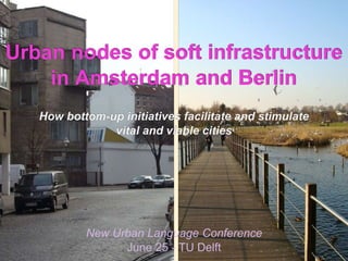
1. 1
Urban nodes of soft infrastructure
in Amsterdam and Berlin
How bottom-up initiatives facilitate and stimulate
vital and viable cities
New Urban Language Conference
June 25 - TU Delft
2. Janssen & Johann | Research for Urbanism | Amsterdam - Berlin | info@janssen-johann.euJanssen & Johann | Research for Urbanism | Amsterdam - Berlin | info@janssen-johann.eu
0. Structure:
1) Relevance: Academic and public demand for vital and viable
neighborhoods and cities, adapted to the needs of (local)
residents, developed by and with democratic involvement of the
civic society and inhabitants
2) Research subject: Urban nodes of soft Infrastructure in
Amsterdam and Berlin
3) Case Studies: Park Frankendeal (AMS) and ExRotaprint
(BER)
- Features, characteristics, functions and effects
- Development process: actors, obstacles and barriers
4) Findings and Discussion: Characteristics, consequences and
limits of civic driven urban development in European cities
2
3. Janssen & Johann | Research for Urbanism | Amsterdam - Berlin | info@janssen-johann.euJanssen & Johann | Research for Urbanism | Amsterdam - Berlin | info@janssen-johann.eu
Academic and public demand for vital and
viable neighborhoods and cities, adapted
to the needs of (local) residents,
developed by and with democratic
involvement of the civic society and
inhabitants
1. Relevance:
3
5. Janssen & Johann | Research for Urbanism | Amsterdam - Berlin | info@janssen-johann.euJanssen & Johann | Research for Urbanism | Amsterdam - Berlin | info@janssen-johann.eu
SfA Open Call (2010)
Finding new answers and research on
innovative urban arrangements and
strategies that could respond to current and
future economic and social issues, trends
and conditions concerning the urban and
social program of the city
5
6. Janssen & Johann | Research for Urbanism | Amsterdam - Berlin | info@janssen-johann.euJanssen & Johann | Research for Urbanism | Amsterdam - Berlin | info@janssen-johann.eu
SfA Open Call (2010)
Background (findings):
- A (growing) gap between the concerns and policies of urban
planners and (local) authorities and the societal challenges and
issues in the field of education, healthcare, welfare, sports, arts
and culture, leisure, transportation and public space for meeting.
- Lack of involvement of local social and civic organizations and
citizens in urban planning and development and supply of local
community services and facilities.
- Lacking funds (partly due to the financial crises of 2008) with
traditional parties responsible for urban development and a
strong social and communal infrastructure.
6
7. Janssen & Johann | Research for Urbanism | Amsterdam - Berlin | info@janssen-johann.euJanssen & Johann | Research for Urbanism | Amsterdam - Berlin | info@janssen-johann.eu
The phenomenon of the informal city and organic
(DIY) planning attracts more and more attention
from the urban and spatial academic research
community and urban research literature
7
8. Janssen & Johann | Research for Urbanism | Amsterdam - Berlin | info@janssen-johann.euJanssen & Johann | Research for Urbanism | Amsterdam - Berlin | info@janssen-johann.eu 8
2. Research subject:
Bottom-up originated, developed and
operated Urban nodes of soft
infrastructure in Amsterdam and Berlin
9. Janssen & Johann | Research for Urbanism | Amsterdam - Berlin | info@janssen-johann.euJanssen & Johann | Research for Urbanism | Amsterdam - Berlin | info@janssen-johann.eu 9
Definition:
1) Urban nodes of soft infrastructure are local, community
oriented urban initiatives that manifest themselves in unused
locations and spaces, like wastelands, released plots, vacant
offices, school buildings and abandoned factories.
2) On a structural basis they offer a broad and coherent mix of
cultural, economic, recreational and social facilities, functions
and services to the local neighborhood and broader city.
3) Attracted by their often appealing appearance and offered
facilities and functions, local residents, city dwellers, tourists
and other groups come to these places, to meet, work,
recreate and make use of the offered facilities and services.
10. Janssen & Johann | Research for Urbanism | Amsterdam - Berlin | info@janssen-johann.euJanssen & Johann | Research for Urbanism | Amsterdam - Berlin | info@janssen-johann.eu 10
Examples:
ExRotaprint (BER): Former printing machine factory in a monumental (modernistic) complex which
now contain studios, offices, craft businesses, childcare, training centers, a neighborhood canteen, a
conference and debate space and several community projects
HC AthenA (AMS): New clubhouse from a large, young hockey club, in which the building contains
a rehabilitation and physiotherapy practice, a joint gym, club canteen, a homework school, sports
BSO, a Cancer Care Center and open house for elderly and cancer patients
Timorplein complex (AMS): Large former (historical) school complex that now houses a hostel,
an educational and conference organization, craft businesses, offices for creatives, a movie theater
and restaurants with art and culture stage and large terrace and public playground
Park Frankendael (AMS): Large ecological park with several particular historical gardens, plenty of
space for water (storage), several (ecological) playgrounds, scouting and childcare organizations and
two special hospitality establishments with fidelity capability, focus on art & culture, et cetera
……… ……
ufaFabrik (BER): A large former film studio site with art and culture stage, catering, hotel,
conference center, sports and games facilities, a petting zoo, crafts, shopping, festivals, community
center and various forms of renewable energy
Brotfabrik (BER): The Brotfabrik is a cinema-cum-art and cultural center in an old, converted and
extended baker shop / bakery, with various community events and a neighborhood cafe, a beer
garden and a large terrace on the self-designed square in front of the door
11. Janssen & Johann | Research for Urbanism | Amsterdam - Berlin | info@janssen-johann.euJanssen & Johann | Research for Urbanism | Amsterdam - Berlin | info@janssen-johann.eu 11
1) What are the (specific) features and characteristics of bottom-
up originated and developed Urban nodes of soft
infrastructure?
2) How do these urban nodes emerge, develop and work and
what drives and motivates their initiators?
3) Which stakeholders (actors) are closely involved in the
genesis, functioning and success of these vital urban nodes?
4) What are the benefits of these bottom-up Urban nodes and
what is their impact on the viability and vitality of the district,
neighborhood, or city as a whole?
5) What sort of problems are encountered when setting up and
operating bottom-up (Urban) nodes and what sort of
resistance and obstacles are met?
Research Questions:
12. Janssen & Johann | Research for Urbanism | Amsterdam - Berlin | info@janssen-johann.euJanssen & Johann | Research for Urbanism | Amsterdam - Berlin | info@janssen-johann.eu 12
Researched nodes in Amsterdam
13. Janssen & Johann | Research for Urbanism | Amsterdam - Berlin | info@janssen-johann.euJanssen & Johann | Research for Urbanism | Amsterdam - Berlin | info@janssen-johann.eu 13
Researched nodes in Berlin
14. Janssen & Johann | Research for Urbanism | Amsterdam - Berlin | info@janssen-johann.euJanssen & Johann | Research for Urbanism | Amsterdam - Berlin | info@janssen-johann.eu 14
15. Janssen & Johann | Research for Urbanism | Amsterdam - Berlin | info@janssen-johann.euJanssen & Johann | Research for Urbanism | Amsterdam - Berlin | info@janssen-johann.eu 15
16. Janssen & Johann | Research for Urbanism | Amsterdam - Berlin | info@janssen-johann.euJanssen & Johann | Research for Urbanism | Amsterdam - Berlin | info@janssen-johann.eu 16
3. Case study (detailed) examples:
Park Frankendael (Amsterdam - Oost)
ExRotaprint (Berlin - Wedding)
- Features, characteristics, functions and
effects
- Development process: actors, obstacles
and barriers
17. Janssen & Johann | Research for Urbanism | Amsterdam - Berlin | info@janssen-johann.euJanssen & Johann | Research for Urbanism | Amsterdam - Berlin | info@janssen-johann.eu 17
Park Frankendael (Amsterdam - Oost)
18. Janssen & Johann | Research for Urbanism | Amsterdam - Berlin | info@janssen-johann.euJanssen & Johann | Research for Urbanism | Amsterdam - Berlin | info@janssen-johann.eu 18
Park Frankendael: Functions and facilities
Kunst- en cultuurgebouw
Moes- en kruidentuin
Hondenuitlaatzone
Waterberging
Cultureel erfgoed
Ecologische hoofdzone
Rococo tuin
Volkstuinencomplex
Schoolwerktuinen
19. Janssen & Johann | Research for Urbanism | Amsterdam - Berlin | info@janssen-johann.euJanssen & Johann | Research for Urbanism | Amsterdam - Berlin | info@janssen-johann.eu 19
Park Frankendael: Development process
20. Janssen & Johann | Research for Urbanism | Amsterdam - Berlin | info@janssen-johann.euJanssen & Johann | Research for Urbanism | Amsterdam - Berlin | info@janssen-johann.eu
Janssen & Johann | Research for Urbanism | Amsterdam - Berlin | info@janssen-johann.eu
20
Idea and
initiation phase
Exploitation and
(regular) operation phase
Realization phase
Concept, design, finance
and acceptance phase
Neighbor-
hood, civil
society
Users
Real estate
parties
Financiers
Politics
Media
Government
admini-
stration
Initiators
Park Frankendael: Actor involvement / activity
21. Janssen & Johann | Research for Urbanism | Amsterdam - Berlin | info@janssen-johann.euJanssen & Johann | Research for Urbanism | Amsterdam - Berlin | info@janssen-johann.eu 21
Leisure activities and facilities
Employment and local economy
Livability neighborhood
Local real-estate value
Imago & popularity
Art & cultural activities
Park Frankendael: Benefits and revenues
Health & wellbeing
Environment and ecology
22. Janssen & Johann | Research for Urbanism | Amsterdam - Berlin | info@janssen-johann.euJanssen & Johann | Research for Urbanism | Amsterdam - Berlin | info@janssen-johann.eu 22
Park Frankendael: Benefits and revenues
=> Employment (direct and induced): about 45 fte
=> Induced tax revenues: about 1 million euro per annum
=> Long term social, ecological and economic value: about 45 million euro
=> uplift in real-estate value (neighborhood): more then 100 million euro
=> Significant positive effects on physical and mental health and wellbeing of visitors
=> Significant positive effects on wellbeing and physical health of inhabitants of East Amsterdam
=> Significant positive effects on the livability of surrounding neighborhoods
=> Ranks fifth in most popular parks of Amsterdam
=> Yearly around 250.000 visitors
=> Amongst the highest valued parks of Amsterdam
=> Several popular catering places
=> Several popular playgrounds
=> Culture and heritage centre en historical monuments
=> Several extraordinary (historical) gardens and wandering areas
=> Important role as storage area and bufferzone for water (flood) and rain
=> Part of the ecological main structure of Amsterdam, nesting of several protected birds
=> Important function in lowering high city temperatures and the level of particulates
23. Janssen & Johann | Research for Urbanism | Amsterdam - Berlin | info@janssen-johann.euJanssen & Johann | Research for Urbanism | Amsterdam - Berlin | info@janssen-johann.eu 23
ExRotaprint (Berlin - Wedding)
24. Janssen & Johann | Research for Urbanism | Amsterdam - Berlin | info@janssen-johann.euJanssen & Johann | Research for Urbanism | Amsterdam - Berlin | info@janssen-johann.eu 24
ExRotaprint: Functions and facilities
25. Janssen & Johann | Research for Urbanism | Amsterdam - Berlin | info@janssen-johann.euJanssen & Johann | Research for Urbanism | Amsterdam - Berlin | info@janssen-johann.eu 25
ExRotaprint: Development process
26. Janssen & Johann | Research for Urbanism | Amsterdam - Berlin | info@janssen-johann.euJanssen & Johann | Research for Urbanism | Amsterdam - Berlin | info@janssen-johann.eu
Janssen & Johann | Research for Urbanism | Amsterdam - Berlin | info@janssen-johann.eu
26
ExRotaprint: Actor involvement / activity
Idea and
initiation phase
Exploitation and
(regular) operation phase
Realization phase
Concept, design, finance
and acceptance phase
Neighbor-
hood, civil
society
Users
Real estate
parties
Financiers
Politics
Media
Government
admini-
stration
Initiators
27. Janssen & Johann | Research for Urbanism | Amsterdam - Berlin | info@janssen-johann.euJanssen & Johann | Research for Urbanism | Amsterdam - Berlin | info@janssen-johann.eu 27
Local economy
Employment (direct and indirect)
Livability neighborhood
Local real-estate value
Imago & popularity
Art & cultural activities
ExRotaprint: Benefits and revenues
Health & wellbeing
Emancipation and empowerment
28. Janssen & Johann | Research for Urbanism | Amsterdam - Berlin | info@janssen-johann.euJanssen & Johann | Research for Urbanism | Amsterdam - Berlin | info@janssen-johann.eu 28
ExRotaprint: Benefits and revenues
=> Employment (direct and induced: artists, entrepreneurs, et cetera): about 304 fte
=> Direct and induced tax revenues: about 3,4 million euro per annum
=> Long term social, ecological and economic value of ExRotaprint: tens of millions (euro)
=> Uplift in real-estate value (neighborhood): more then 70 million euro
=> Strong improvement of job opportunities for drop-outs and non German speaking inhabitants of Wedding
=> Small but significant positive effects on physical and mental health and wellbeing of visitors and users
=> Strong positive effects on the livability of surrounding neighborhoods in the district Wedding
=> Important role in emancipation and empowerment of people living in the district Wedding
=> Important role in educating people in the district Wedding
=> driver of growing popularity of Wedding and real-estate in Wedding and improved imago of Wedding
=> Yearly around 150.000 visitors (10.000 unique), many of them from abroad
=> Amongst the highest ranked modernistic monuments in Berlin
=> Large playground / green field: meeting place for the neighborhood
=> Popular canteen for workers and local inhabitants
=> Cultural and debating centre
=> Important (modernistic) architectural and urban monument
=> not applicable
29. Janssen & Johann | Research for Urbanism | Amsterdam - Berlin | info@janssen-johann.euJanssen & Johann | Research for Urbanism | Amsterdam - Berlin | info@janssen-johann.eu 29
Kunstquartier Bethanien (Berlin - Kreuzberg)
30. Janssen & Johann | Research for Urbanism | Amsterdam - Berlin | info@janssen-johann.euJanssen & Johann | Research for Urbanism | Amsterdam - Berlin | info@janssen-johann.eu 30
Kunstquartier Bethanien: Functions and facilities
31. Janssen & Johann | Research for Urbanism | Amsterdam - Berlin | info@janssen-johann.euJanssen & Johann | Research for Urbanism | Amsterdam - Berlin | info@janssen-johann.eu 31
Kunstquartier Bethanien: Development process
32. Janssen & Johann | Research for Urbanism | Amsterdam - Berlin | info@janssen-johann.euJanssen & Johann | Research for Urbanism | Amsterdam - Berlin | info@janssen-johann.eu 32
Characteristics, consequences and limits of
civic driven development of Urban nodes of
soft infrastructure in European cities
4. Findings and Discussion:
33. Janssen & Johann | Research for Urbanism | Amsterdam - Berlin | info@janssen-johann.euJanssen & Johann | Research for Urbanism | Amsterdam - Berlin | info@janssen-johann.eu 33
1) Successful Urban nodes of soft infrastructure are conspicuous places
with a broad and eclectic offer of community oriented functions and
facilities, including attractive cheap catering and place for meeting
2) Bottom-up initiated Urban nodes of soft infrastructure often have
considerable (local) economic, social and cultural impact and are
important drivers of innovation
3) Origination and succes of bottom-up initiated Urban nodes of soft
infrastructure cannot be planned by politics, planners or developers
4) Initiators of Urban nodes are barely noted or acknowledged by politics
and traditional stakeholders involved in urban planning and
development
5) Origination of urban nodes is often hindered by planners and politics
6) German initiators generally operate much looser and independent from
(local) authorities then their Dutch counterparts.
Findings:
34. Janssen & Johann | Research for Urbanism | Amsterdam - Berlin | info@janssen-johann.euJanssen & Johann | Research for Urbanism | Amsterdam - Berlin | info@janssen-johann.eu 34
Hard /
physical
infra-
structure
Neigh-
borhood /
civil society
Real estate
parties
Users
Traditional urban development actors
Soft
infrastructur
e
parties
Urban
development
Commercial
companies
Soft infra-
structure
Spaces
(housing,
working)
Media
Financiers
Politics
Government
(admini-
stration)
35. Janssen & Johann | Research for Urbanism | Amsterdam - Berlin | info@janssen-johann.euJanssen & Johann | Research for Urbanism | Amsterdam - Berlin | info@janssen-johann.eu 35
Real estate
parties
Users
Bottom-up urban development (actors)
Politics
Media
Neigh-
borhood
civil society
Urban node
(places)
Government
(admini-
stration)
Financiers
Soft infra-
structure
Initiators
36. Janssen & Johann | Research for Urbanism | Amsterdam - Berlin | info@janssen-johann.euJanssen & Johann | Research for Urbanism | Amsterdam - Berlin | info@janssen-johann.eu 36
Urban
node
Users
Initiators
Actors involved (detail)
Voorziening
aanbieders
Buurt
bewoners
(groepen)
ParticipantenHuurder -
aanbieders
Kleine
ondernemers
freelancers
Reïntegratie
aanbieders
Huurders
ontmoeten en
maken gebruik
van voorzieningen
huren
ruimte
bieden diensten en
voorzieningen aan
Kunstenaars
huren ateliers en
studioruimte
investeren en
organiseren mee
laten er mensen
reïntegreren
huren
huren werkruimte
Maat-
schappelijke
organisaties
huren
kantoorruimte
Neigh-
borhood
civil society
Buurt
bewoners
Buurt
bewoners /
ondernemers
(lokale)
Experts
Sym-
pathisanten
Vrijwilligers
maken
gebruik van
lobbyen
tegen
helpen,
ondersteunen
lobbyen voor
schenken
geld
adviseren
(vrijwillig)
gaan mee-
participeren
Tegen
standers
Sym-
pathisanten
37. Janssen & Johann | Research for Urbanism | Amsterdam - Berlin | info@janssen-johann.euJanssen & Johann | Research for Urbanism | Amsterdam - Berlin | info@janssen-johann.eu 37
Government
(admini-
stration)
Urban node
(location)
Initiators
Financiers
Groter
publiek
Banken
Overheid
Fondsen
MVO
Stichtingen
Participanten
Beleggers
lenen
kopen en
verpachten
lenen,
investeren
investeren,
co-financieren
crowdfunden
(investeren,
schenken)
schenken
subsidiëren,
lenen,
investeren
Bestuurders
Ambtelijke
diensten
Centraal
stedelijke
bestuurdersLokale
(stadsdeel)
bestuurders
Gemeentelijk
grondbedrijf
Gemeentelijk
ontwikkelings
bedrijf
Advies- en
expertise
centrum
Vrienden,
familie en
relaties
lenen,
investeren
Provinciale
bestuurders
Actors involved (detail)
adviseert
bepalen en voeren
beleid uit
adviseert,
zet standaarden,
verkoopt - verhuurt
dragen visie uit,
bepalen beleid
adviseert,
ontwikkelt,
financiert
dragen visie uit,
bepalen beleid
dragen visie uit,
bepalen beleid
dragen visie uit,
bepalen beleid
38. Janssen & Johann | Research for Urbanism | Amsterdam - Berlin | info@janssen-johann.euJanssen & Johann | Research for Urbanism | Amsterdam - Berlin | info@janssen-johann.eu 38
Knooppunt
(locatie)
Real-estate
parties
Initiatief
nemer(s)
Vastgoed
beheerders Gemeentelijk
vastgoed
adviseurs
Vastgoed
eigenaren
Ontwik-
kelaars
Gemeentelijk
vastgoed of
grondbedrijf
Media
verkopen of
verhuren
faciliteren verhuur,
beheer of overname
van vastgoed
nemen vastgoed
in beheer
kopen vastgoed
en ontwikkelen
bepaalt erfpacht,
grond- en vastgoedprijs
of verkooppropcedure
Centrale
stad
politici
Lokale
(stadsdeel)
politici
steunen of
verwerpen
steunen of
verwerpen
Politics
besteden
aandacht aan
Landelijke
politici
steunen of
verwerpen
Actors involved (detail)
39. Janssen & Johann | Research for Urbanism | Amsterdam - Berlin | info@janssen-johann.euJanssen & Johann | Research for Urbanism | Amsterdam - Berlin | info@janssen-johann.eu 39
Discussion: Key issues
- There is still a large gap between the informal (civic) actors and the complex,
official urban planning regime with its formal procedures, goals, language, et
cetera
- Governmental and urban planning practice still are mainly focussed on top-
down (blueprint) planning and involvement of traditional urban development
stakeholders
- Politics, planners, developers, architects and users are mainly focussed on
products (buildings, square meters) and financial outcomes, instead of
dynamic processes, soft outcomes and facilities and (soft) infrastructure
promoting the vitality and viability of neighborhoods and cities
- Governmental and urban planning practice still are mainly sectoral organized
which hinders initiatives and integral policy development focussed on viable
and vital cities and neighborhoods
40. Janssen & Johann | Research for Urbanism | Amsterdam - Berlin | info@janssen-johann.euJanssen & Johann | Research for Urbanism | Amsterdam - Berlin | info@janssen-johann.eu 40
Urban node
(Place)
Neigborhood
civil society
Initiators
Soft
infrastructure
parties
Users
Traditional vs bottom-up development
Media
Traditional
urban development
(facilities, services,
infrastructure, public
space and buildings)
Gap
Politics
Real-estate
parties
Financiers
Government
(admini-
stration)
41. Janssen & Johann | Research for Urbanism | Amsterdam - Berlin | info@janssen-johann.euJanssen & Johann | Research for Urbanism | Amsterdam - Berlin | info@janssen-johann.eu
Discussion: Issues that need attention
- The legal form of Urban node initiatives (in the Netherlands)
- The valuation and transfer of communal land and buildings on Urban node
initiators / local community and civic initiatives
- Valuation and acknowledgment of the importance of the proceeds, effects
and impact of bottom-up initiated Urban nodes of soft infrastructure on the
vitality and viability of neighborhoods and cities
- Financing / funding the development of Urban nodes; specifically the
purchase of land and buildings
- Financing / subsidizing Urban node exploitation
- Mobilization of sufficient financial and real-estate expertise to create a good
plan and build a solid business case for development of the Urban node
- Cooperation between local (urban) authorities, traditional urban development
parties and bottom-up initiators of Urban nodes of soft infrastructure
41
42. Janssen & Johann | Research for Urbanism | Amsterdam - Berlin | info@janssen-johann.euJanssen & Johann | Research for Urbanism | Amsterdam - Berlin | info@janssen-johann.eu 42
Discussion: Conclusion
Instead of thinking in financial soundness and financial results of plans,
in bricks, volume and involvement of professional parties, local
authorities should put more trust in passionate, often highly skilled
citizens who want to improve and develop the local urban environment
and social infrastructure. More attention should given by (local)
authorities in creating circumstances and a planning and development
structure that stimulates the arise and development of sustainable, vital,
viable neighborhood and city quarters through local, urban bottom-up
initiatives.
43. Janssen & Johann | Research for Urbanism | Amsterdam - Berlin | info@janssen-johann.euJanssen & Johann | Research for Urbanism | Amsterdam - Berlin | info@janssen-johann.eu 43
Acknowledgements
1) The Creative Industries Fund NL, formerly the Netherlands
Architecture Fund (SfA), especially Maarten Tas and Tim de
Boer
2) All those who have contributed with their knowledge, input and
enthusiasm to the success of this research project. Special
thanks goes to the interviewees; founders of urban nodes and
other stakeholders like, administrators, civil servants, experts,
et cetera
3) Members of the consultative group: Vincent Kompier, Stefan
Metaal, Jan Poolen and Eric Frijters
4) Jeroen Bakker for ICT support
5) Yvonne Siegmund for designing schemes and diagrams
44. Janssen & Johann | Research for Urbanism | Amsterdam - Berlin | info@janssen-johann.euJanssen & Johann | Research for Urbanism | Amsterdam - Berlin | info@janssen-johann.eu 44
Website: www.vitaleknooppunten.nl
45. Janssen & Johann | Research for Urbanism | Amsterdam - Berlin | info@janssen-johann.euJanssen & Johann | Research for Urbanism | Amsterdam - Berlin | info@janssen-johann.eu 45
Researchers:
Rainer Johann (Master of Science and Doctorate) works as an urbanist in research,
teaching and practice. Former visiting Professor at Bauhaus-University Weimar (2007).
Since 2008 assistant professor at HCU Hamburg, department of Urban and
Neighborhood Planning. Studied Architecture in Cologne (2000) and Urban planning in
Delft (2002). Worked with ASTOC (Cologne), UrbanUnlimited (Rotterdam), De
Architekten Cie (Amsterdam) and with The Netherlands Environmental Assessment
Agency (Den Haag). Since 2012 partner at Janssen & Johann, Studio for Urbanism
(Amsterdam - Berlin).
Nico Janssen (Master of Science and Arts) works as an independent researcher,
strategist and policy-adviser specialized in scenarioplanning, innovation and the creative
and cultural industries. Studied Management and Engineering and Applied Psychology
at the University Twente in Enschede. Former councillor at the district Amsterdam East
and strategist and partner at The Ruijter Strategy (Amsterdam), Consultant at The Dutch
Municipality Bank (The Hague) and lecturer and researcher at the Amsterdam University
of Applied Sciences. Since 2012 partner at Janssen & Johann, Studio for Urbanism
(Amsterdam - Berlin).