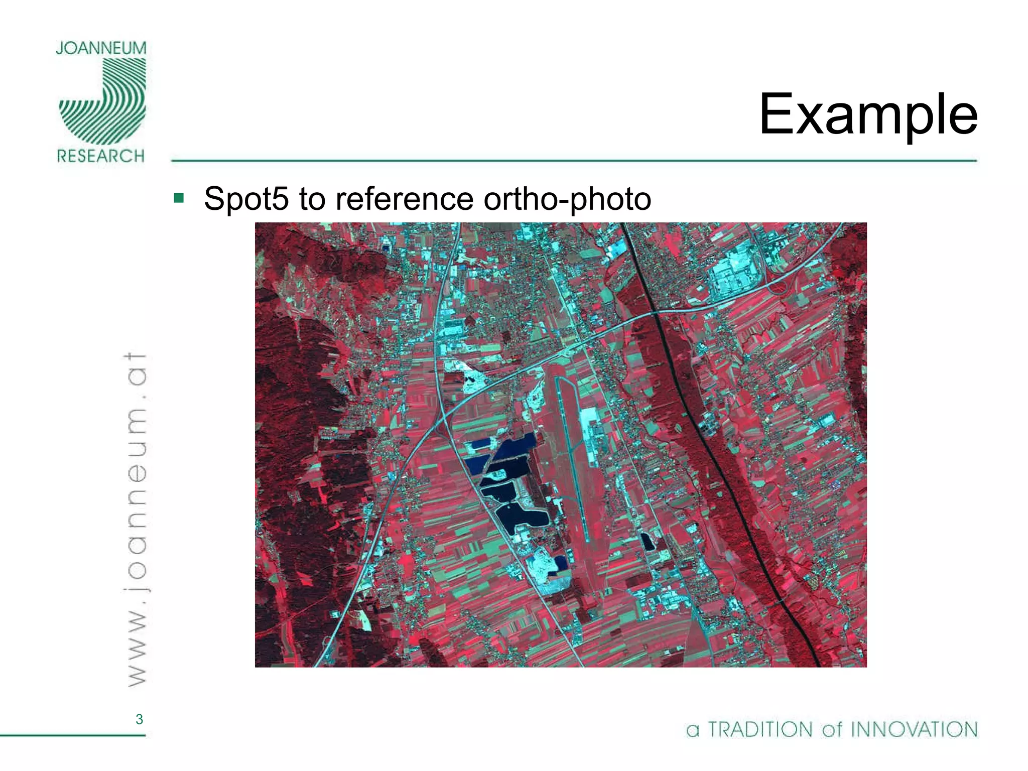
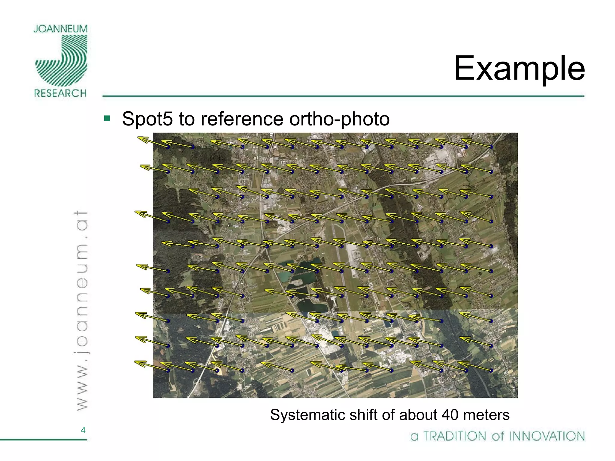
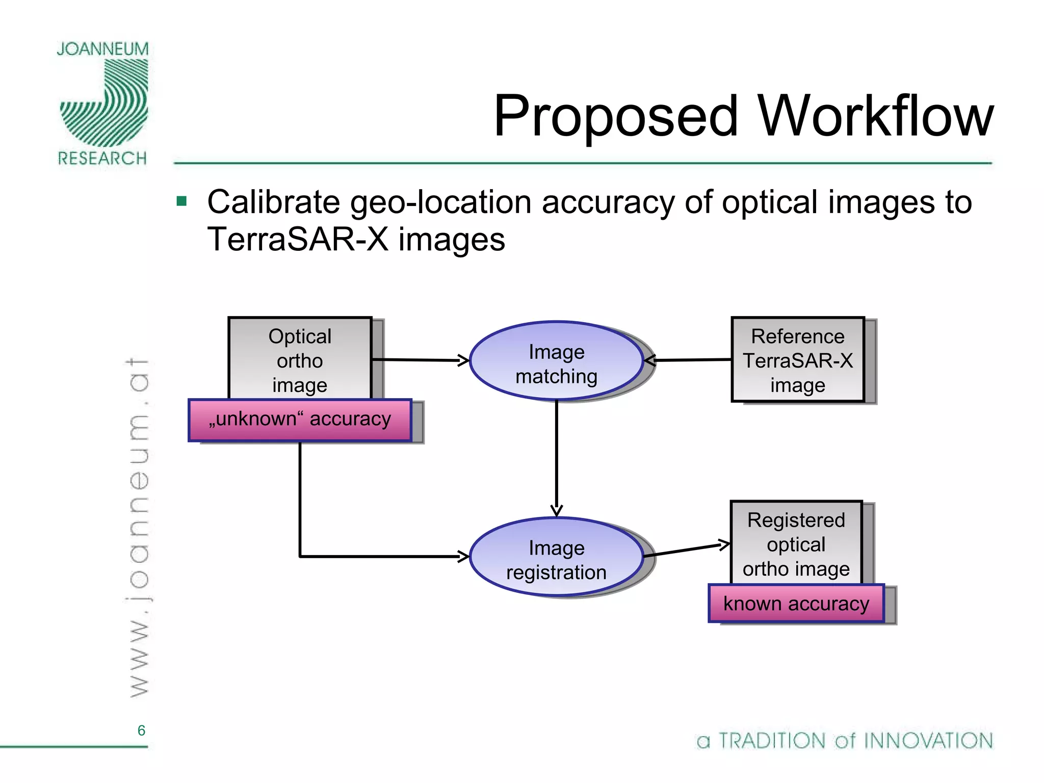
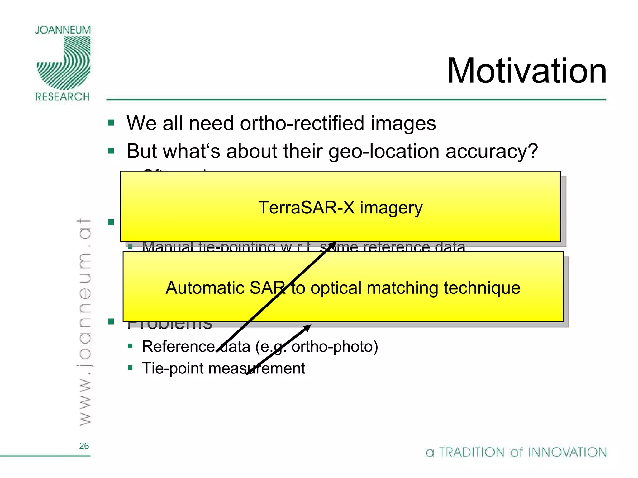
The document proposes using TerraSAR-X radar imagery to calibrate the geo-location accuracy of optical satellite sensors. It presents an automatic workflow to register optical orthoimages to TerraSAR-X references using bilateral filtering and mutual information matching. Initial displacements of 20-40m in optical data were reduced to below 5m, verifying TerraSAR-X provides an accurate reference for calibration.


![TerraSAR-X as Reference Data TanDEM-X mission launched in June 2010 Collect interferometric SAR data in StripMap mode Goal: Generate a worldwide DSM, 12m GSD and 2m relative vertical accuracy (beyond SRTM or ASTER) Absolute geo-location accuracy of StripMap data is better than 3m [Bresnahan, 2009; Raggam et al., 2010] [Krieger et al., 2005] Bi-static mode TerraSAR-X data is being collected worldwide the amplitude information serves as our reference database with an accuracy better than 3m](https://image.slidesharecdn.com/perko-2011-igarss-presentation-v2-110727150833-phpapp02/75/perko_2011_IGARSS_presentation_v2-ppt-5-2048.jpg)
![SAR to Optical Matching TerraSAR-X – amplitude, 5m GSD [2200x1600 pixels]](https://image.slidesharecdn.com/perko-2011-igarss-presentation-v2-110727150833-phpapp02/75/perko_2011_IGARSS_presentation_v2-ppt-7-2048.jpg)
![SAR to Optical Matching RapidEye, band 1-3, 5m GSD [2200x1600 pixels]](https://image.slidesharecdn.com/perko-2011-igarss-presentation-v2-110727150833-phpapp02/75/perko_2011_IGARSS_presentation_v2-ppt-8-2048.jpg)
![SAR to Optical Matching TerraSAR-X – amplitude, 5m GSD [300x200 pixels]](https://image.slidesharecdn.com/perko-2011-igarss-presentation-v2-110727150833-phpapp02/75/perko_2011_IGARSS_presentation_v2-ppt-9-2048.jpg)
![SAR to Optical Matching RapidEye, band 1-3, 5m GSD [300x200 pixels]](https://image.slidesharecdn.com/perko-2011-igarss-presentation-v2-110727150833-phpapp02/75/perko_2011_IGARSS_presentation_v2-ppt-10-2048.jpg)
![Algorithm: Pre-processing Purpose Noise reduction Remove details which are not visible in SAR data Bilateral filtering Edge preserving smoothing Does not change geometric properties Applicable for additive noise Adapted for multiplicative noise (SAR) [Tomasi and Manduchi, 1998]](https://image.slidesharecdn.com/perko-2011-igarss-presentation-v2-110727150833-phpapp02/75/perko_2011_IGARSS_presentation_v2-ppt-11-2048.jpg)
![Algorithm: Pre-processing Remove noise, speckle and unwanted details original filtered TerraSAR-X Ortho photo [150x150 pixels @ 5m GSD]](https://image.slidesharecdn.com/perko-2011-igarss-presentation-v2-110727150833-phpapp02/75/perko_2011_IGARSS_presentation_v2-ppt-12-2048.jpg)
![Algorithm: Image Matching Areal mutual-information maximization „ similar“ concept as normalized cross-correlation (NCC) However, also works with non-linear dependencies Produces correct matches also in cases where NCC fails 151x151 reference window Additional subpixel interpolation technique [Pluim et al., 2003]](https://image.slidesharecdn.com/perko-2011-igarss-presentation-v2-110727150833-phpapp02/75/perko_2011_IGARSS_presentation_v2-ppt-13-2048.jpg)
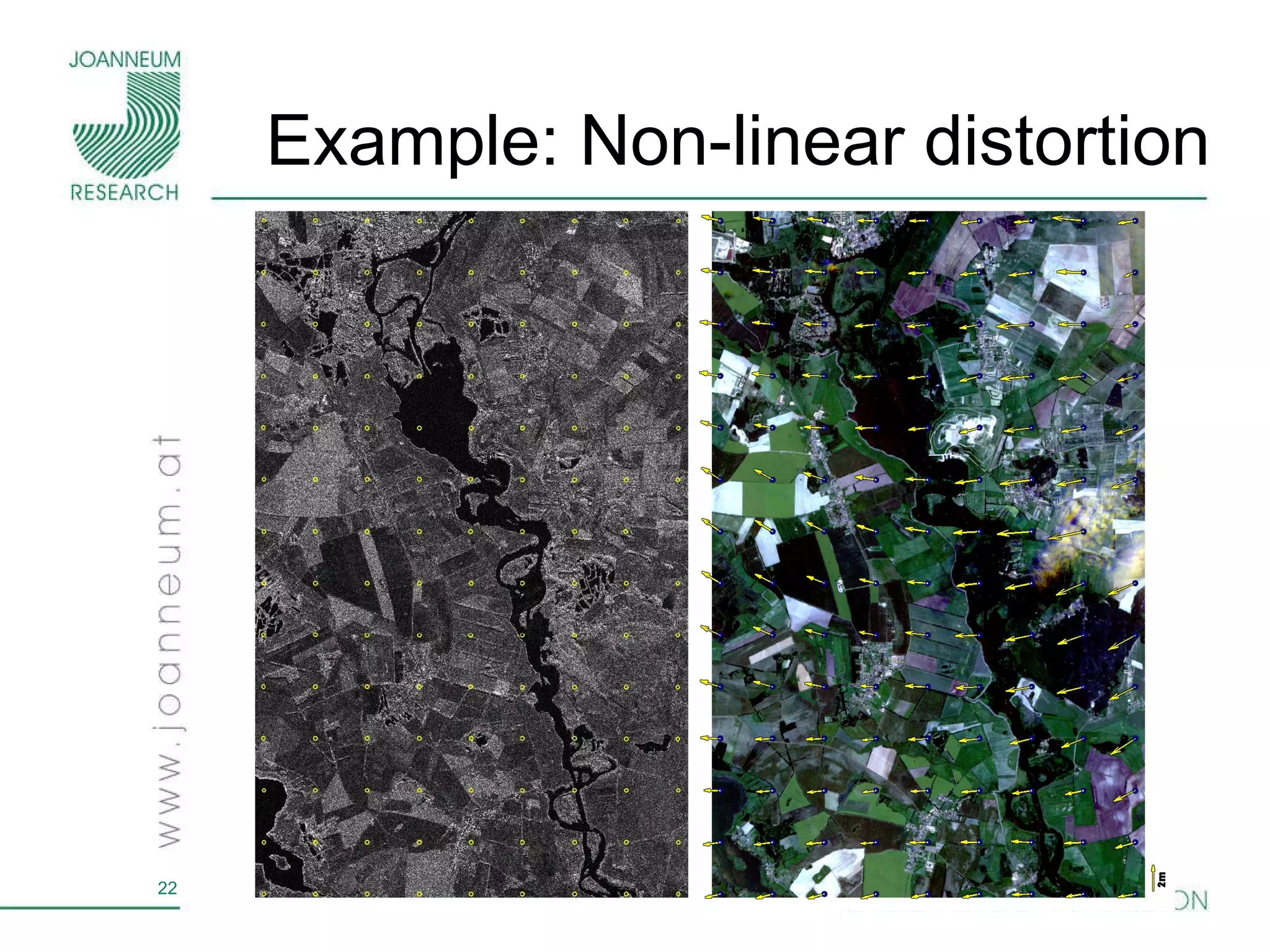
![SAR specific Aspects Side looking geometry introduces geometric shifts in range direction when DTMs are used in the ortho-rectification process Fuse ASC and DSC imagery SAR ascending SAR descending Ortho photo [80x64 pixels @ 5m GSD]](https://image.slidesharecdn.com/perko-2011-igarss-presentation-v2-110727150833-phpapp02/75/perko_2011_IGARSS_presentation_v2-ppt-14-2048.jpg)
![Results: Visual Interpretation Spot 5 Ikonos PAN RapidEye Ortho photo TerraSAR-X initial matching [75x75 pixels @ 5m GSD]](https://image.slidesharecdn.com/perko-2011-igarss-presentation-v2-110727150833-phpapp02/75/perko_2011_IGARSS_presentation_v2-ppt-16-2048.jpg)
![Results: Numerical Analysis Registering TerraSAR-X to ortho-photo Ascending and descending fusion [m]](https://image.slidesharecdn.com/perko-2011-igarss-presentation-v2-110727150833-phpapp02/75/perko_2011_IGARSS_presentation_v2-ppt-17-2048.jpg)
![Results: Numerical Analysis Optical to SAR calibration Initial displacements of 20 to 40m drop below 5m in sub-pixel range (5m GSD data) in the geo-local accuracy range of TerraSAR-X Stripmap data [m]](https://image.slidesharecdn.com/perko-2011-igarss-presentation-v2-110727150833-phpapp02/75/perko_2011_IGARSS_presentation_v2-ppt-18-2048.jpg)

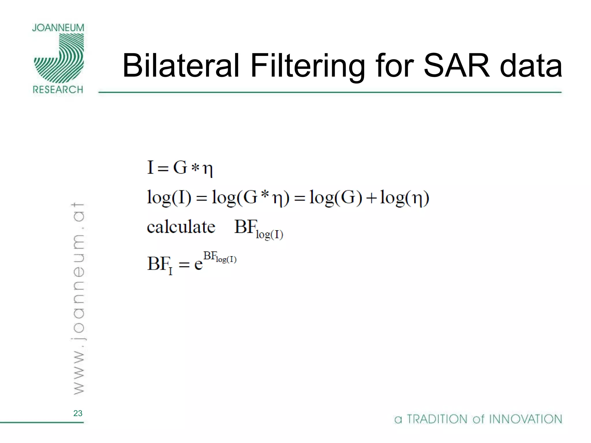


![Algorithm: Pre-processing Bilateral Filtering - remove noise, speckle and unwanted details original filtered TerraSAR-X Ortho photo [150x150 pixels @ 5m GSD]](https://image.slidesharecdn.com/perko-2011-igarss-presentation-v2-110727150833-phpapp02/75/perko_2011_IGARSS_presentation_v2-ppt-27-2048.jpg)


