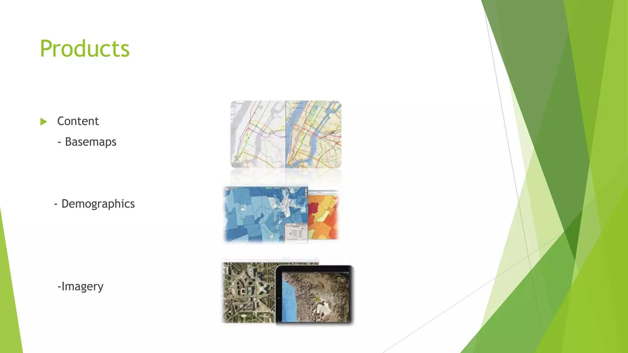
ESRI/ESRI NeA
Prepared by:
Hesham Gamal
What is GIS?
 The first documented application of what could be classed as a GIS was in
France in 1832.
 The French geographer Charles Picquet represented the 48 districts
of the city of Paris by halftone color gradient according to the
number of deaths by cholera.
 A similar situation led to John Snow depicting cholera deaths in
London using points on a map in 1854.
What is GIS?
 A geographic information system (GIS) lets us visualize, question, analyze,
and interpret data to understand relationships, patterns, and trends.
 GIS benefits organizations of all sizes and in almost every industry.
 During the seventies and eighties developments in spatial
awareness and how to handle spatial data were being
made in key academic centres such as Harvard and
ESRI.
History of Esri
 In 1969, Esri president Jack Dangermond and his wife, Laura, founded
Environmental Systems Research Institute, Inc. (Esri), in Redlands, California.
 The company's early mission was to organize and analyze geographic
information to help land planners and land resource managers make
well-informed environmental decisions.
 These studies resulted in maps that showed constraints and
opportunities for development.
History of Esri
 In the mid-1970s, San Diego County, California, selected Esri to develop a
polygon information overlay system (PIOS), which became the company's first
foray into creating a geographic information system (GIS).
History of Esri
 A global company from the beginning, Esri began developing relationships
with like-minded companies in Germany, Japan, Australia, and Canada,
forming the foundation of today's large international network of distributors.
 Esri developers began formulating concepts that ultimately led to
the release in 1982 of ARC/INFO, the first commercial GIS.
History of Esri
 The first Esri International User Conference was held in 1981
with 16 attendees. It has grown substantially over the years,
today attracting more than 14,000 attendees.
GIS Goes Mainstream
 Today, over 1,600 organizations belong to the Esri Partner Network.
 In the 1990s, Esri's first desktop solution, ArcView, opened up the
possibilities of GIS to a whole new group of users.
GIS Goes Mainstream
 Esri increased its support for GIS education in schools and expanded
its own training programs and facilities.
 Esri Press was launched, which now has nearly 100 titles.
 During the late 1990s, Esri reengineered ARC/INFO to develop
a modular and scalable GIS platform that would work both
on the desktop and across the enterprise.
The result was ArcGIS.
GIS Goes Mainstream
 Not Just for Professionals Anymore.
 Esri strived to make GIS more accessible by introducing ArcGIS Explorer,
a free tool for viewing and sharing geospatial information.
GIS Goes Mainstream
 In 2004, Esri released ArcGIS 9, which enhanced the desktop platform and
added a development framework and server platform.
GIS Goes Mainstream
 2012: The maps are provided as a map service, one of many services available
via ArcGIS Online.
Numbers
 Revenue: More than $776 million per year.
 Emplyees: 2,700 (US) (2009 statistics).
 10 regional offices in the US and more than 80 distributors outside
the US.
Esri NeA (Northeast Africa)
 Egypt
 South Sudan
 Sudan
 Libya
 Chad
Esri NeA (Northeast Africa)
 Member of ALKAN Group, one of Egypt’s leading holding companies, with more
than 40-years’ experience in a range of business lines.
 AlKAN Group :
employ over 3,000 employees.
The annual turnover: L.E. 1.5 billion.
Esri NeA (Northeast Africa)
 1994: Esri NeA was estabilished.
 2005: 1st Esri-Branded Company in the Middle East.
 2007: 1st CMMI certified GIS company in the region.
Products
 ArcGIS:
-ArcGIS for Desktop
-ArcGIS Online
-ArcGIS for Server
Products
 ArcGIS
ArcGIS for Desktop
-Create Intelligent Visualizations.
-Transform Your Data into Actionable Information.
-Be a Trusted Source of Relevant Information.
Products
 ArcGIS
ArcGIS Online
-Make Maps Your Way
-Connect with People Using GIS
Products
 ArcGIS
ArcGIS for Server
-Make GIS Available Everywhere
-Keep Your GIS under Your Complete Control
Products
 Location Analytics
-Maps for Office
Make dynamic maps of your
spreadsheet data right in Excel.
share your maps through ArcGIS
Online or copy them into your
PowerPoint presentation or document.
Products
 ArcGIS for Developer
Products
 Content
- Basemaps
- Demographics
-Imagery
Products
 Focused Solutions
- CityEngine
Industries
 Aid and Development
 Business
 Defense and Intelligence
 Education
 Government
 Health and Human Services
 Mapping and Charting
 Natural Resources
 Utilities and Communications
 Public Safety
 Transportation
Visit:
www.Esri.com www.EsriNeA.com

Get to know Esri \ Esri NeA

  • 1.
  • 2.
    What is GIS? The first documented application of what could be classed as a GIS was in France in 1832.  The French geographer Charles Picquet represented the 48 districts of the city of Paris by halftone color gradient according to the number of deaths by cholera.  A similar situation led to John Snow depicting cholera deaths in London using points on a map in 1854.
  • 3.
    What is GIS? A geographic information system (GIS) lets us visualize, question, analyze, and interpret data to understand relationships, patterns, and trends.  GIS benefits organizations of all sizes and in almost every industry.  During the seventies and eighties developments in spatial awareness and how to handle spatial data were being made in key academic centres such as Harvard and ESRI.
  • 4.
    History of Esri In 1969, Esri president Jack Dangermond and his wife, Laura, founded Environmental Systems Research Institute, Inc. (Esri), in Redlands, California.  The company's early mission was to organize and analyze geographic information to help land planners and land resource managers make well-informed environmental decisions.  These studies resulted in maps that showed constraints and opportunities for development.
  • 5.
    History of Esri In the mid-1970s, San Diego County, California, selected Esri to develop a polygon information overlay system (PIOS), which became the company's first foray into creating a geographic information system (GIS).
  • 6.
    History of Esri A global company from the beginning, Esri began developing relationships with like-minded companies in Germany, Japan, Australia, and Canada, forming the foundation of today's large international network of distributors.  Esri developers began formulating concepts that ultimately led to the release in 1982 of ARC/INFO, the first commercial GIS.
  • 7.
    History of Esri The first Esri International User Conference was held in 1981 with 16 attendees. It has grown substantially over the years, today attracting more than 14,000 attendees.
  • 8.
    GIS Goes Mainstream Today, over 1,600 organizations belong to the Esri Partner Network.  In the 1990s, Esri's first desktop solution, ArcView, opened up the possibilities of GIS to a whole new group of users.
  • 9.
    GIS Goes Mainstream Esri increased its support for GIS education in schools and expanded its own training programs and facilities.  Esri Press was launched, which now has nearly 100 titles.  During the late 1990s, Esri reengineered ARC/INFO to develop a modular and scalable GIS platform that would work both on the desktop and across the enterprise. The result was ArcGIS.
  • 10.
    GIS Goes Mainstream Not Just for Professionals Anymore.  Esri strived to make GIS more accessible by introducing ArcGIS Explorer, a free tool for viewing and sharing geospatial information.
  • 11.
    GIS Goes Mainstream In 2004, Esri released ArcGIS 9, which enhanced the desktop platform and added a development framework and server platform.
  • 12.
    GIS Goes Mainstream 2012: The maps are provided as a map service, one of many services available via ArcGIS Online.
  • 13.
    Numbers  Revenue: Morethan $776 million per year.  Emplyees: 2,700 (US) (2009 statistics).  10 regional offices in the US and more than 80 distributors outside the US.
  • 14.
    Esri NeA (NortheastAfrica)  Egypt  South Sudan  Sudan  Libya  Chad
  • 15.
    Esri NeA (NortheastAfrica)  Member of ALKAN Group, one of Egypt’s leading holding companies, with more than 40-years’ experience in a range of business lines.  AlKAN Group : employ over 3,000 employees. The annual turnover: L.E. 1.5 billion.
  • 16.
    Esri NeA (NortheastAfrica)  1994: Esri NeA was estabilished.  2005: 1st Esri-Branded Company in the Middle East.  2007: 1st CMMI certified GIS company in the region.
  • 17.
    Products  ArcGIS: -ArcGIS forDesktop -ArcGIS Online -ArcGIS for Server
  • 18.
    Products  ArcGIS ArcGIS forDesktop -Create Intelligent Visualizations. -Transform Your Data into Actionable Information. -Be a Trusted Source of Relevant Information.
  • 19.
    Products  ArcGIS ArcGIS Online -MakeMaps Your Way -Connect with People Using GIS
  • 20.
    Products  ArcGIS ArcGIS forServer -Make GIS Available Everywhere -Keep Your GIS under Your Complete Control
  • 21.
    Products  Location Analytics -Mapsfor Office Make dynamic maps of your spreadsheet data right in Excel. share your maps through ArcGIS Online or copy them into your PowerPoint presentation or document.
  • 22.
  • 23.
    Products  Content - Basemaps -Demographics -Imagery
  • 24.
  • 25.
    Industries  Aid andDevelopment  Business  Defense and Intelligence  Education  Government  Health and Human Services  Mapping and Charting  Natural Resources  Utilities and Communications  Public Safety  Transportation
  • 26.