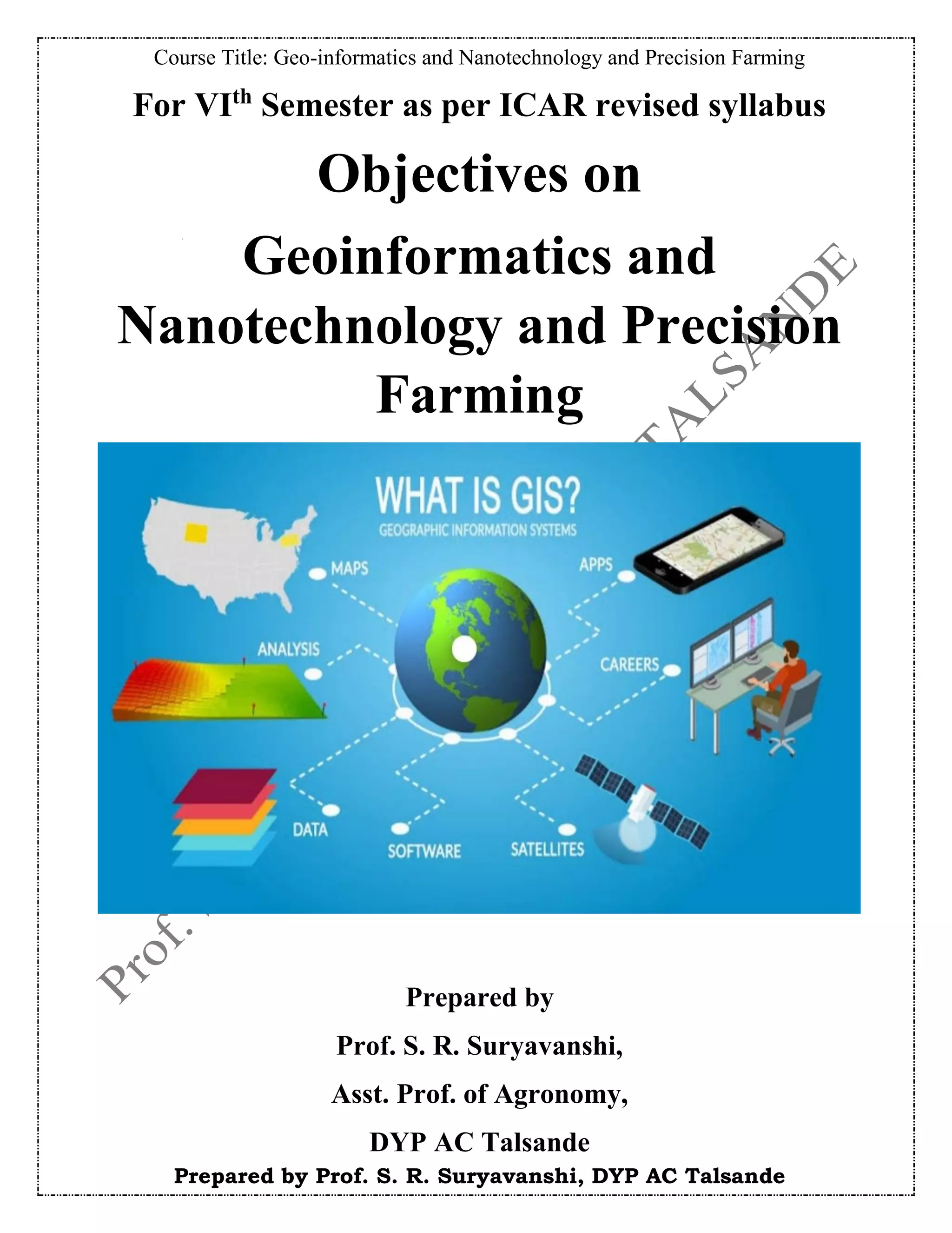
SlideShare a Scribd company logo
1 of 30
Download to read offline
Course Title: Geo-informatics and Nanotechnology and Precision Farming
Prepared by Prof. S. R. Suryavanshi, DYP AC Talsande
For VIth
Semester as per ICAR revised syllabus
Objectives on
Geoinformatics and
Nanotechnology and Precision
Farming
Prepared by
Prof. S. R. Suryavanshi,
Asst. Prof. of Agronomy,
DYP AC Talsande
Course Title: Geo-informatics and Nanotechnology and Precision Farming
Prepared by Prof. S. R. Suryavanshi, DYP AC Talsande
1) Precision Agriculture, Concept, tools & techniques
Q. 1. Fill in the blanks.
a) Precision agriculture also known as __________agriculture as needed farming &site specific
crop management.
b) The concept of precision is strictly based on ____________.
c) The goal of grid soil sampling is to generate a map of nutrients and water requirement is called
________
d) In India overall fertilizer consumption rate ____.
e) _______as a system for capturing, storing, checking, manipulating, analyzing & displaying data
which are spatially referenced to earth.
Q. 2. Match the pairs.
a) Sensor technology i)Grain flow sensor
b) Uncorrected GPS signal accuracy ii)To measure humidity, vegetation etc.
c) PLF system iii)Fertilizer & pesticide application
d) VRT technique iv)Information about livestock
e) Yield monitor v)300 feet
Q. 3. True or false.
a) The unique character of GPS is precision in time and space.
b) GPS systems help users to record positional information with an accuracy between 10 to 0.1m.
c) Mass flow sensors works on principal of transmitting beams of microwave energy
d) Seeding/sowing critical stage in crop growing.
e) Precision farming can be utilized in every crop.
Q. 4. Choose correct option.
a) Grid soil sampling use the same principle of soil sampling but ____the intensity of sampling
i)Increases ii)Decreases
iii)Remain constant iv)none of the above
b) BMPS stands for __
i)Bad Management Practice ii)Best management Practice
iii)Brief Management Practice iv)Brief Management process
c) Which of the following is correct sentence
Precision farming deals with _____
i)Decrease productivity with decreasing
production cost.
ii)Decrease productivity with increasing
production cost.
iii)Increase productivity with increasing
production cost
iv)Increase productivity with decreasing
production cost.
d) ____is the key information in agricultural decision making policy formulation policy.
i)GIS ii) Geo-information
iii) Agro-geoinformation iv)GPS
e) Which of the following is automatic technology
i)GIS ii)GPS
iii)VRT iv)None
Course Title: Geo-informatics and Nanotechnology and Precision Farming
Prepared by Prof. S. R. Suryavanshi, DYP AC Talsande
Ans Key:
Q. 5. Do as directed
a) Give long form of i)SSCM. ii)DGPS
b) Write use of DGPS
c) What are the two steps of precision farming?
d) Define Precision agriculture.
e) Give any two comments of precision farming.
f) Give any two applications of geo-informatics.
Q. 2. Q. 3. Q. 4.
a) ii) a) True a) i)
b) V) b) False (100 to 0.01m) b) ii)
c) iv) c) True c) iv)
d) iii) d) True d) iii)
e) i) e) False (can not used in every crop) e) iii)
Q. 1.
a) Satellite
b) GPS
c) Application map
d) 84.3 kg/ha
e) Geographic information system
Q. 5.
a) i)Site Specific Crop Management
ii)Differential Global Positioning System
b) Precise location of activities
c) 1)Identification &assessment of variability
2) Management of variability.
d) Precision agriculture is technique of applying right amount inputs at right location at right time
to enhance production.
e) GIS, GPS.
f) i)crop yield management
ii) pest and disease management.
Course Title: Geo-informatics and Nanotechnology and Precision Farming
Prepared by Prof. S. R. Suryavanshi, DYP AC Talsande
2) Geo-informatics system- Concept, tools & techniques
Q. 1. Fill in the blanks.
a) _________ helps to conversion of raw data of GIS into maps
b) ______&_______are forms of geo-spatial data
c) The imagine file format originally created by ________
d) A popular public domain raster data is the _______
e) ________define the range of distinct value the Raster can store
Q. 2. Match the pairs.
a) .dbf i) Attribute index
b) .shp ii) Attribute information
c) .shx iii)Spatial index
d) .ain iv)Feature geometry
e) .sbn v)Feature geometry index
Q. 3. True or false.
a) Geographical data describe Building
b) GIS is computer based tool
c) GIS helps to make maps
d) GIS have ability to link data sets together by geographically
e) Raster are in parts and define by their pixel depth
Q. 4. Choose correct option.
a) a) Mapmakers use GIS to
i)store geographical information ii)use geographical information
iii)view geographical information iv)store ,use & view geographical information
b) The information GIS entered and stored as
i)panels ii)layers
iii)single panel iv)dual panel
c) The users Use GIS to
i)complex analysis only ii) Display maps only
iii)complex analysis and display maps iv)none of above
d) GIS deals with which kind of data
i) Numerical ii)Binary
iii)spatial iv) complex
e) Spatial Data also called as
i)Geodatabase ii)Mono database
iii) current Data base iv)None of above
Q. 5. Do as directed
a) Write down any one use of GIS?
b) Full Form Of GIS?
c) Write down three main system of GIS?
d) Write down component of GIS?
e) Define GIS ?
f) Define Geo-spatial Data ?
Course Title: Geo-informatics and Nanotechnology and Precision Farming
Prepared by Prof. S. R. Suryavanshi, DYP AC Talsande
Ans Key:
3) Crop discrimination & yield monitoring
Q. 1. Fill in the blanks.
a) ………. is an important step for development and management of crop monitoring systems
b) Most valuable sources of spatial data for precision agriculture is ………..
c) The ratio of the actual yield to the field average is called as ………..
d) ………….. is essential in dividing a large farm into management zones.
e) ………….. can be used to develop digital maps that transform spatial information.
Q. 2. Match the pairs.
a) Yield mapping i)Graphic document
b) Grain flow sensor ii)Satellite signal
c) GPS antenna iii)Georeferenced data
Q. 1.
a) GIS software
b) Raster based & vector based
c) ERDAS
d) GeoTIFF
e) Pixel depth
Q. 2. Q. 3. Q. 4.
a) ii a) True a) iv
b) iv b) True b) ii
c) v c) True c) iii
d) i d) True d) iii
e) iii e) True e) i
Q. 5.
a) Used in map making
b) Geographical Information System
c) Data acquisition system, Database management system, Visualization & reporting
system
d) Software, Hardware, Spatial database, Producers, Expertise
e) Geographic Information System (GIS) is a computer system build to capture, store,
manipulate, analyze, manage and display all kinds of spatial or geographical data.
F) Geographical data that has geographical aspect to it , or positioning is called as
geospatial data
Course Title: Geo-informatics and Nanotechnology and Precision Farming
Prepared by Prof. S. R. Suryavanshi, DYP AC Talsande
d) Travel speed sensor iv) Grain volume
e) Soil mapping v)GPS receiver
Q. 3. True or false.
a) Travel speed is measured with a ultrasonic sensor.
b) Yield maps cannot be used in precision agriculture.
c) GPS is used for calculating yield at each location.
d) Soil mapping provides a structured representation of knowledge about the distribution of soils
across the landscape.
e) Yield maps represent the input of crop production.
Q. 4. Choose correct option.
a) Yield monitoring equipment was introduced in the early……….
i) 1999 ii)2000
iii)1992 iv)1990
b) Which sensor is used by some mapping systems to improve accuracy of grain flow
measurements.
i) Grain moisture sensor ii) clean grain elevator speed sensor
iii) Grain flow sensor iv)Travel speed sensor
c) Typical values of grain crops ranging from ………..
i) 10-12 sec ii) 15-16 sec
iii) 14-16 sec iv) 18-20 sec
d) ………….is powerful set of tools for collecting, storing, and retrieving the data .
i) Precision agriculture ii) Yield monitoring
iii) GIS iv) GPS
e) Automated farm machineries are operated with the help of ………
i) SVM ii) NGIS
iii) MLC iv) SSNM
Q. 5. Do as directed
a) Define yield mapping.
b) Which sensor distinguishes measurements logged during turns.
c) Define soil mapping.
Course Title: Geo-informatics and Nanotechnology and Precision Farming
Prepared by Prof. S. R. Suryavanshi, DYP AC Talsande
d) Which system is used to operating automated farm machineries.
e) Write full form of NDVI.
f) Which map is one of the most valuable sources of spatial data for precision agriculture.
Ans Key:
Q. 1.
a) Crop discrimination
b) Yield map
c) Normalized yield
d) Remote sensing
e) GIS software
Q. 2. Q. 3. Q. 4.
a) Georeferenced data a) True a) 1990
b) Grain volume b) False b) Clean grain elevator
speed sensor
c) Satellite signal c) False c) 10-12 sec
d) GPS receiver d) True d) GIS
e) Graphic document e) False e) NGIS
Q. 5.
a) It is the process of collecting georeferenced data on crop yield and
characteristics, such as moisture content, while the crop is being harvested.
b) Header position sensor.
c) It is an approximation of the reality of the land, and one whose accuracy
increases at higher densities of observation and more detailed scales.
d) NGIS ( Navigation Geographic Information system)
e) Normalized Difference Vegetation Index.
f) Yield map.
Course Title: Geo-informatics and Nanotechnology and Precision Farming
Prepared by Prof. S. R. Suryavanshi, DYP AC Talsande
6) Remote sensing- Concepts, applications
Q. 1. Fill in the blanks.
a) ........ Data provides the actual synoptic view of large area at a time .
b) The collection of information relating to object without being physical contact with them is
called as.......
c) The full form of GIS........ and GPS...........
d) ....... Sensor detects natural radiation that is emitted or reflected by the object
e) Map maker is called as......
Q. 2. Match the pairs.
a) Passive Sensor i) Map maker
b) Active Remote Sensing ii) Infra-red
c) Cartographer iii) Geographic Information System
d) Microwave Sensing iv) RADAR
e) GIS v) Very long Wavelength
Q. 3. True or false.
a) Sound waves are used in sonar types of remote sensing.
b) Radar is used to detect things under water.
c) Radar is example if active remote sensing.
d) Remote sensing is not good to use when comparing an area after tsunami and then after tsunami.
e) Passive sensor detects artificial radiation that is emitted or reflected by the object.
Q. 4. Choose correct option.
a) A Map maker is called as
i) Cartographer ii) Photographer
iii) Geographer iv) Map quester
b) The first time Remote sensing were
i) Paintings From air balloon ii) TV remote control
iii) Sketches from french map maker iv) aerial photos
c) Sound waves are used in what type a of remote sensing
i) Radar ii) microwave
iii) Infra-red iv) sonar
d) What sensing is used under water to detect things
i) Infra-red ii) Radar
iii sonar iv) Microwave
e) Types of remote sensing
i) Passive sensor ii) Active Remote sensing
iii) Both i & ii iv) None of these
Course Title: Geo-informatics and Nanotechnology and Precision Farming
Prepared by Prof. S. R. Suryavanshi, DYP AC Talsande
Ans Key:
Q. 5. Do as directed
a) Definition of Remote sensing?
b) Enlist Application of Remote sensing ?
c) Full form of GPS and GIS
d) What is passive sensing ?
e) What is Active Sensing ?
f) Enlist types of Remote sensing ?
Q. 1.
a) Satellite
b) Remote sensing
c) Geographical information systems and global positioning system
d) Passive sensor
e) Cartographer
Q. 5.
a) The collection of information relating to object without being physical contact with them is called
as remote Sensing
b) Metrology, forest, Botany, hydrology, Planting application, urban ,sea ,rock etc.
c) Global positioning system and global information systems
d) Detect natural radiation that is emitted or reflected by the object or surrounding area being
observed.
e) On the other hand, emits energy in order to scan objects and areas where upon a sensor then
detects and measures the radiation that is reflected or backscattered from the target.
A) Active remote sensing
B) passive sensor
Q. 2. Q. 3. Q. 4.
a) Infrared a) True a) Cartographer
b) RADAR b) True b) Aerial photos
c) Map maker c) True c) Sonar
d) Very long Wavelength d) False d) Sonar
e) Geographic information
system
e) False e) Both I& ii
Course Title: Geo-informatics and Nanotechnology and Precision Farming
Prepared by Prof. S. R. Suryavanshi, DYP AC Talsande
7) Image processing
Q. 1. Fill in the blanks.
a) _________ is an act of examining image for the purpose of the identifying object ang
judging their significance.
b) _________________is used to correct uneven sensor over whole image and
_________________ to correct the geometric distribution due to earth's rotation.
c) Image can be enhanced by simple___________.
d) In ____________classification the computer programs automatically group the pixels in
image into separate clusters, depending on their spectral features.
e) Each class of land cover is referred as a_______" and each product of classification is
known as___________.
Q. 2. Match the pairs.
a) Pre-processing i)shadow
b) Image enhancement ii) theme
c) Bio-geophysical parameter iii) linear gray level stretching
d) Class of land cover iv)stratospheric zone
e) Identification of object v) Initial processing of raw data
Q. 3. True or false.
a) Initial processing of raw data is usually carried out in pre-processing step of image
processing.
b) GCP is stand for global control point.
c) Supervised classification, the computer program automatically groups the hpixels in image
into separate clusters depending on their spectral features.
d) A multi resolution approach is also a useful strategy when dealing with high resolution
imagery.
e) Each class of land cover is referred as map.
Q. 4. Choose correct option.
a) An image enhancement pixel values ranges between ________and________.
i)1 and 200 ii)0 and 250
iii) 0 and 255 iv0 and 1
b) Which are the following are the types of classification
i)supervised ii)unsupervised
iii)Both iv)none
c) Which of the following is not the element of image Intepretation ?
i) colour ii)size
iii) structure iv)texture
d) LCCS stands for.........
i) Large colour composites ii) less colour composites
iii) liner class composites iv) liner colour composites
e) .......... is the smallest element image.
i) point ii)pixel
iii)polygon iv)non
Course Title: Geo-informatics and Nanotechnology and Precision Farming
Prepared by Prof. S. R. Suryavanshi, DYP AC Talsande
Ans Key:
Q. 5. Do as directed
a) Define image processing.
b) Give the types of image classification.
c) Give the types of image processing.
d) Give the full form of FCC.
e) Write the basic maps used in thematic map presentation.
f) Define thematic map.
Q. 1.
a) Image processing
b) Radiometric correction and geometric correction
c) Linear gray level streching
d) Unsupervised
e) Theme and thematic map
Q. 2. Q. 3. Q. 4.
a) v a) True. a) 0 and 255
b) iii b) False. (GCP stands for ground
control point)
b) Both
c) iv c) False. (In unsupervised
classification)
c) Structure
d) ii d) True d) Less colour composites
e) i e) False. (Theme) e) Pixel
Q. 5.
a) Image processing=the act of examination images to identify objects and judge their significance
by Concedering their their location is known as image processing.
b) a) Supervised b) unsupervised
c) a) Digital image . B) Analog image .
d) False colour composites
e) Topographic map, plan/ortho photomap.
f) Thematic map =A map that displays the spatial distribution of an attribute that relates to a single
topic, theme, or subject of discours.
Course Title: Geo-informatics and Nanotechnology and Precision Farming
Prepared by Prof. S. R. Suryavanshi, DYP AC Talsande
8) Global positioning system- Components & its functions
Q. 1. Fill in the blanks.
a) ________tool of precision agriculture is used in determination of boundaries.
b) Master control station is located at _________ country.
c) GNSS stands for ___________.
d) Mapping is one of important function of _____.
e) GPS is started by _______ in 1973.
Q. 2. Match the pairs.
a) Satellite i) Colorado
b) Remote tracking station ii) 1970s
c) Master control station iii) Space segment
d) GPS iv) California
e) Alternate master control station v) Hawaii
Q. 3. True or false.
a) User segment of GPS includes satellites.
b) India have Alternate master station of control segment of GPS at Guvahati.
c) Airplane and boat pilots use GPS for navigation.
d) GPS was invented before independence of India.
e) GPS works mainly through three segments.
Q. 4. Choose correct option.
a) Mapmakers use GPS to verify the..
i) Boundaries ii) Towns
iii) Roads iv) Places
b) GPS was invented in..
i) 1960s ii) 1980s
iii) 1970s iv) 1990s
c) GPS includes..
i) Space segment ii) User segment
iii) Control segment iv) All of the above
d) GPS stands for
i) Geo positioning system ii) Geographic position system
iii) Global positioning system iv) Global people survey
e) GPS can be applicable for
i) Population count ii) Both i and iii
iii) Military iv) None of the above
Course Title: Geo-informatics and Nanotechnology and Precision Farming
Prepared by Prof. S. R. Suryavanshi, DYP AC Talsande
Ans Key:
Q. 5. Do as directed
a) Give the segments of GPS.
b) Give two functions of GPS.
c) Mention any of receivers of global positioning system on basis of accuracy.
d) Give full form of – GIS, GNSS.
e) What is GPS?
f) Give minimum two major sectors in which GPS is applied.
Q. 2. Q. 3. Q. 4.
a) iii a) False a) i
b) v b) False b) iii
c) i c) True c) iv
d) ii d) False d) iii
e) iv e) True e) iii
Q. 1.
a) GPS
b) United states of America
c) Global Navigation Satellite System
d) GPS
e) Defense department of USA
Q. 5.
a) 1. space segment, 2. control segment, 3. user segment.
b) 1. navigation, 2. mapping
c) 1.DGPS, 2.RTK GPS, 3.dual frequency GPS.
d) GIS :- Geographic information system, GNSS :- Global Navigation Satellite System.
e) The Global Positioning System (GPS) is a space-based satellite navigation system that
provides location and time information in all weather condition, anywhere on or near earth.
f) 1.Defense 2.Agriculture
Course Title: Geo-informatics and Nanotechnology and Precision Farming
Prepared by Prof. S. R. Suryavanshi, DYP AC Talsande
9) Introduction to crop simulation model
Q. 1. Fill in the blanks.
a) _________ is a simplified representation of a system or a process.
b) _____________ is considered as act of mimicry.
c) The full form of IBSNAT is _________.
d) The full form of DSSAT is___________.
e) The full form of CERES is ____________.
Q. 2. Match the pairs.
a) Mechanistic model i)defines behavior in a simple manner
b) Static model ii)time is not included as variable
c) Dynamic model iii)based on physical selection
d) Descriptive model iv)outputs are given along with probabilities
e) Stochastic model v)Time is included as variable
Q. 3. True or false.
a) Mechanical models system use statistical techniques.
b) Verification is used for evaluation of truthfulness or correctness.
c) Validation is used for evaluation of model for its usefulne5.
d) Stochastic models include time as variable.
e) Statistical models are expressed as regression equations
Q. 4. Choose correct option.
a) Modelling and simulation concepts were given by?
i)Zeigler ii)Zedler
iii) Dalton iv)none of the above
b) _________ is the hypothetical, abstract representation of the objects properties.
i) Base Model ii)modelling
iii)simulation iv)crop model
c) __________ is used to design crop Ideotypes.
i)GIS ii) GPS
iii)Crop simulation models iv)Precision agriculture
d) _________ model has been used to evaluate erosion risks due to cropping practices.
i)EPIC ii)APSIM
iii)COTTAM iv)DSSAT
e) Most crucial steps in preparing simulation models are?
i)validation ii)calibration
iii)data input iv)both (I) and (ii)
Course Title: Geo-informatics and Nanotechnology and Precision Farming
Prepared by Prof. S. R. Suryavanshi, DYP AC Talsande
Ans Key:
Q. 5. Do as directed
a) Expand: APSIM
b) Expand: AAS
c) Define model.
d) Define simulation.
e) Name the simulation model used in sugarcane.
f) Define crop model.
Q. 1.
a) Model
b) Simulation
c) The International Benchmark Site Network For Agrotechnology Transfer
d) Decision Support System for Agrotechnology transfer
e) The Crop Environment Resource Synthesis
Q. 2. Q. 3. Q. 4.
a) iii a) False a) Zeigler
b) ii b) True b) Base model
c) v c) True c) Crop simulation models
d) i d) False d) EPIC
e) iv e) True e) Both (I) and (II)
Q. 5.
a) Agricultural production system simulator
b) Agromet advisory system
c) A model is a simplified representation of a system or a process.
d) A simulation is the imitation of the operation of real world process or system over time.
e) APSIM
f) Crop model is a simple representation of a crop.
Course Title: Geo-informatics and Nanotechnology and Precision Farming
Prepared by Prof. S. R. Suryavanshi, DYP AC Talsande
10) Uses of crop stimulation model for optimization of agricultural inputs
Q. 1. Fill in the blanks.
a) ....... Is a new discipline & back ground literature is scarce.
b) Researchers used the modelling approach to design ........for specific environment
.
c) The ....... Model has been used a long the same line in South African Sugar
industry.
d) For crop stimulation model knowledge of .....&.........is essential .
e) .....&....towards modelling is the limitations of crop stimulation modelling .
Q. 2. Match the pairs.
a) Environmental impact i)Erosion risk
b) EPIC model ii)Genetic improvement
c) CANEGRO model iii)percolation ,N losses
d) APSIM software iv)Sugar industry
e) NTKenaf model v)Integration of knowledge
Q. 3. True or false.
a) Model performance is limited to quality of output data.
b) Model estimate potential of yield
c) Models can help to formulate hypothesis &improve efficiency of field
experiment.
d) Model is applied as a research tool
e) A model is not a tool for improving critical thought not substitute of it.
Q. 4. Choose correct option.
a) ......model has been used to evaluate erosion risk due to cropping practices &
tillage.
i)EPIC model ii) CANEGRO model
iii)NTKenaf model iv)DSSAT model
b) Choose correct application of Crop Stimulation Model.
i)As a research tools ii) As a crop system management tool
iii)As a policy analysis iv) All of above
c) Which software allows integration of knowledge across crop as well as across
discipline for particular crop.
i)CANEGRO ii)NTKenaf
iii)APSIM iv)EPIC
d) Stimulation model applied in.....purpose
i)As a research ii)village
iii)industry iv)None of these
e) Application of as a research tool includes.....
i)research understanding ii)Genetic improvement
iii)Integration of knowledge iv) All of above
Course Title: Geo-informatics and Nanotechnology and Precision Farming
Prepared by Prof. S. R. Suryavanshi, DYP AC Talsande
Ans Key:
Q. 5. Do as directed
a) Who developed the Agricultural model.
b) Where the stimulation model is applied?
c) Which are the non climatic causes by which yield is reduced .
d) Detailed & mechanistic model.
e) Model used in south African sugar industry
f) For fertilizers recommendation which model is given.
Q. 1.
a) Crop modelling
b) Crop ideotypes
c) CANEGRO
d) Computer & Computer language
e) Awareness & acceptance
Q. 2. Q. 3. Q. 4.
a) Percolation, N losses a) False a) EPIC model
b) Erosion risk b) True b) All of these
c) Sugar industry c) True c) APSIM
d) Integration of
knowledge
d) True d) As a Research
e) Genetic improvement e) False e) All of these
Q. 5.
a) Agricultural scientist
b) Research, teaching, farm & resource management, policy analysis & production
forecasts.
c) Delayed sowing, soil fertility, pest and diseases .
d) Genetic improvement
e) CANEGRO model
f) STCR model
Course Title: Geo-informatics and Nanotechnology and Precision Farming
Prepared by Prof. S. R. Suryavanshi, DYP AC Talsande
11) STCR approach for precision agriculture
Q. 1. Fill in the blanks.
a) _______is important tool to monitor the soil health and resilience.
b) Critical level concept was developed by______
c) Soil fertility status is high, when nutrient index is_______
d) Basic cation saturation approach was useful for________
e) STCR stands for_____
Q. 2. Match the pairs.
a) DRIS approach i)To maintain soil fertility status for future years
b) Zinc ii)Ca:K ratio is very high
c) Calcareous soil iii)Ca, Mg and K
d) Basic cation saturation approach iv)List the nutrients in order of their importance
e) Build up and maintenance v) <0.6
Q. 3. True or false.
a) Sufficiency approach aims to maximize the profitability in a future years.
b) Assessment of specific soil condition which can be improved by using soil amendments.
c) During general recommendation variation in soil fertility is taken into consideration.
d) DRIS is the holistic approach to the mineral nutrition of the soil.
e) Quantitative approach is irrespective of yield goal and variation in soil type.
Q. 4. Choose correct option.
a) Soil fertility status is low, when nutrient index is
i)<0.25 ii)<1.3
iii)<1.5 iv)<1.0
b) Which of the following approach is irrespective of yield goal and variation in soil type
i)Basic cation saturation ii)Build up and maintenance
iii)Sufficiency iv)Quantitative approach
c) Ca:K ratio was very high in
i)Sandy soil ii)Calcareous soil
iii)Red soil iv)Black soil
d) The SSNM recommendation could be evolved on the basis of
i)Chemical analysis ii)Biological analysis
iii)Soil cum plant analysis iv)None of the above
e) Critical limit of Fe is
i)<4.3 ii)<4.1
iii)<4.5 iv)<3.9
Q. 5. Do as directed
Course Title: Geo-informatics and Nanotechnology and Precision Farming
Prepared by Prof. S. R. Suryavanshi, DYP AC Talsande
Ans key:
Q. 5 Do as directed
a) Soil testing is the scientific diagnostic tool to evaluate soil fertility for recommending balanced
nutrients to crops to achieve profitability, higher production, improving fertilizer use efficiency
& reduces the environment pollution.
b) Nutrient Index=(NLx1) +(NMx2) +(NHx3) /NT
c) To maximize the profitability in a given years.
d) SSNP- Site Specific Nutrient Management
DRIS- Diagnosis and Recommendation Integrated system
e) SSNM is a new approach nutrient recommendation is mainly based on indigenous nutrient supply
of the soil and nutrient demand of crop for achieving targeted yield.
f) Fe- <4.5, Zn- <0.6, B- <0.05, Mn- <2.0, Cu- <0.2, Mo- <0.05.
a) Define soil testing.
b) Give formula of NI.
c) What is the goal of sufficiency approach?
d) Give full form of SSNM & DRIS.
e) Define SSNM.
f) Write critical limits of micronutrients.
Q. 1 Fill in the blanks.
a) Soil testing
b) Cate & Nelson
c) >2.5
d) recommendation of Ca, Mg,K
e) Soil Test Crop Response
Q. 2 Match the pairs.
a) List the nutrients in order of importance
b) < 0.6
c) Ca:k ratio is very high
d)Ca,Mg,K
e) to maintain soil fertility for future year
Q.3 True or False
a) False
b) True
c) False
d) True
e) False
Q. 4 Choose correct option
a) Sufficiency approach
b) <1.5
c) Calcareous Soil
d) Soil cum plant analysis
e) <4.5
Course Title: Geo-informatics and Nanotechnology and Precision Farming
Prepared by Prof. S. R. Suryavanshi, DYP AC Talsande
12) Nanotechnology- Concepts and techniques
Q. 1. Fill in the blanks.
a) A nanometer is___ the diameter of a human pair.
b) ____is a multidisciplinary science.
c) One mole of water for instance weights__ gr.
d) Nanometer is conventionally definited as___.
e) 1 nanometer is ___of one metre.
Q. 2. Match the pairs.
a) Nanoscale i) nano-gift
b) Nanoparticle ii) 1 to 100nm
c) Seed iii) 6.022×10^23
d) One mole of any material iv)used to detect pathogens
e) Nanosensors v) Arrangement into orded layers
Q. 3. True or false.
a) Nanotechnology isn't art and science of manipulating matter at the nanoscale.
b) Size of nanoparticle is 10 to 100nm
c) In nanoparticle production two methods.
d) Nano technology is a multi-disciplinary science.
e) Smart seed cannot be used for germination.
Q. 4. Choose correct option.
a) Method of Nanoparticle production.
i) Bottom up ii)down
iii) top up iv)low
b) In bottom up method which types of steps .
i) parallel ii) perpendicular
iii) rectangle type iv) triangle
c) A disturbing fact is that the fertilizer use efficiency is __N?
i)10% ii)15%
iii)30% iv)20-50%
d) A disturbing fact is that the fertilizer use efficiency is _%P?
i)10-25% ii)32%
iii)35% iv)5-10%
Course Title: Geo-informatics and Nanotechnology and Precision Farming
Prepared by Prof. S. R. Suryavanshi, DYP AC Talsande
e) CMC stands for _____
i) Carbon Monoxide cellulose ii) Carboxy Methyl Cellulose
iii) Carbon Methyl Cellulose iv) Corboxy Methyl Carbon
Q. 5. Do as directed
a) Definition of nanotechnology.
b) Nanotechnology used in?
c) One mole of any material Contains ?
d) Nanosensor can be used to detect?
e) Nanometer scale?
f) State use of nano-sensor.
Ans Key:
Q. 1.
a) 1/80000
b) Multidisciplinary
c) 18 gm
d) 1 to 100 nm
e) One billionth
Q. 2. Q. 3. Q. 4.
a) ii a) False a) i
b) v b) False b) i
c) i c) True c) iv
d) iii d) True d) i
e) iv e) False e) ii
Q. 5.
a) It is defined as science & technology of such tiny things, of that materials less than 100nm in
size.
b) Used in physical and chemical properties of a substance to explore & medicine in agriculture.
c) 6.022×10^23
d) Pathogens
e) 1 to 100nm
f) To detect pathogens.
Course Title: Geo-informatics and Nanotechnology and Precision Farming
Prepared by Prof. S. R. Suryavanshi, DYP AC Talsande
13) Brief introduction about nano-scale effect
Q. 1. Fill in the blanks.
a) The term nano is adapted from the _____word meaning _______
b) ______is a top down fabrication technique where a bulk material is reduced in size to Nano
scale pattern
c) ________is important technique for both characterization and synthesis of Nano material
d) A fascinating and powerful result of quantum effect of the nanoscale is the concept of _____
of properties
e) _____nanoparticle used as plant fertilizer mung bean to enhance crop production
Q. 2. Match the pairs.
a) Hydrazine i)stabilizing agent
b) Polyvinyl pyrrolidone ii)reducing agent
c) Chitosan iii)prevent conidiophores develop
d) Silver nanoparticles iv) antifungal agent
e) Zno nanoparticles v) antimicrobial agent
Q. 3. True or false.
a) Nanoscale gold appear as a red or purple
b) When particle size is made to nano scale properties such as melting point, flurosense, electrical
conductivity, chemical reactivity changes as a function of the size of particle
c) Sodium Nano fertilizer used to enhance crop production of pennisetum amaricanum
d) Importance of nano scale delivery system in agriculture is because of its improve solubility
and stability to degrade in the environment
e) Carbon nanotubes can be used as a regulator of seed germination and plant growth
Q. 4. Choose correct option.
a) Size of nano particles is
i)1-100nm ii)1-10nm
iii)1-1000nm iv)none of these
b) 1nm=------meter
i)10-8 ii)10-9
iii)10-7 iv)10-6
c) Nano particles can be produced by
i)bottom up approach ii)top down approach
iii)both 1&2 iv)none of these
d) Carbon nanotube discovered by S Ligima in
i)1991 ii)1995
iii)1998 iv)2000
e) Scanning acoustic microscope developed by Calvin Quate in
i)1950 ii)1960
iii)1970 iv)1980
Course Title: Geo-informatics and Nanotechnology and Precision Farming
Prepared by Prof. S. R. Suryavanshi, DYP AC Talsande
Ans Key:
Q. 5. Do as directed
a) Define nanoparticle.
b) Give two drawback of bottom up approach of synthesis of nano particles
c) Write two uses of nano material in agriculture
d) Write two principle factor causes the properties of nano material to differ significantly from
other materials
e) Who give the idea of nanotechnology
f) Which method is used for physical synthesis of metallic nanoparticles
Q. 2. Q. 3. Q. 4.
a) ii a) True a) i
b) i b) True b) ii
c) iv c) False (zinc ) c) iii
d) v d) True d) i
e) iii e) True e) iii
Q. 5.
a) Nanoparticle is defined as a particle of matter that is between 1 and 100 nm in diameter
b) 1-contamination from precursor chemicals, 2-generation of hazardous by product
c) Bio sensors for aqua culture, Analysis of gene expression and regulation, Nano sensors
d) Increased relative surface area and quantum effect
e) The idea of nanotechnology was first time introduce in 1959 by Richard Feynman a physicist at
Caltech, Attrition and pyrolysis
Q. 1.
a) Greek &dwarf
b) Lithography
c) Scanning probe microscopy
d) Tunability
e) TiO2
Course Title: Geo-informatics and Nanotechnology and Precision Farming
Prepared by Prof. S. R. Suryavanshi, DYP AC Talsande
14) Nano-pesticides, nano-fertilizers and nano-sensors
Q. 1. Fill in the blanks.
a) Nano fertilizers are nutrient carriers of nanodiamens ranging from __ to __.
b) ________ can be used to detect pathogens as well as micro and nano conditions in the field.
c) ________ act as a reservoir for nutrients that are slowly released on demand.
d) ________ have been developed as carriers of pesticides at low cost, for extended release and
better contact with plants.
e) ________ is an object that has at least one dimension in nanometer scale.
Q. 2. Match the pairs.
a) Nano pesticide i) Nutrient use efficiency
b) Encapsulation ii) Polymer film
c) Nano sensor iii) Clay nanotubes
d) Zeolite iv)Honey comb like structure
e) Nano fertilizers v) Nano cantilevers
Q. 3. True or false.
a) Nano fertilizers are ecofriendly in nature.
b) Urea fertilized zeolite chips can be used as fast release nitrogen fertilizer.
c) Nano pesticides will increase the rate of application.
d) Zeolite holds nutrients in the root zone of plants to use when required.
e) Nano fertilizers decreases the nutrient use efficiency.
Q. 4. Choose correct option.
a) CRF refers to
i) Continuous Releasing Fertilizer ii) Constant Rate of Fertilizer
iii) Controlled Rate of Fertilizer iv) Controlled Release Fertilizers
b) Nano sensors are used to detect
i) Pathogens ii) Temperature of soil
iii) Pesticide level of soil iv) All of these
c) Nano fertilizers are nutrient carriers of nanodiamensions ranging from...
i) 10 to 20 nm ii) 30 to 40 nm
iii) 15 to 30 nm iv) 20 to 30 nm
d) _____ can be used as slow released nitrogen fertilizer.
i) Ammonium chloride ii) Both
iii) Urea fertilized zeolite chips iv) None of these
e) One mole of water for instance weights ___ gm.
i) 10 ii) 18
iii) 20 iv) 15
Course Title: Geo-informatics and Nanotechnology and Precision Farming
Prepared by Prof. S. R. Suryavanshi, DYP AC Talsande
Ans Key:
Q. 5. Do as directed
a) Define Nano sensors.
b) Name the nano fertilizer used as slow Release fertilizer in sulphur deficient soil.
c) Give the full form of CDA.
d) Give any two devices used as nanosensors.
e) Give any two formulation types of nanopesticides.
f) Give the full form of CRFs.
Q. 1.
a) 30 to 40 nm
b) Nanosensors
c) Zeolite
d) Clay nanotubes
e) Nano-material
Q. 2. Q. 3. Q. 4.
a) iii) Clay nanotubes a) True a) iv) Controlled Release
Fertilizer
b) i) Polymer film b) False (Urea fertilized zeolite
can be used as slow release N
fertilizer)
b) iv) All of these
c) v) Nano cantilevers c) False (It decrease the rate of
application)
c) ii) 30 to 40 nm
d) iv) Honey comb like
structure
d) True d) iii) Urea fertilized zeolite
chips
e) i) Nutrient use
efficiency
e) False (It increases the NUE) e) 18 gm
Q. 5.
a) 'Nano sensors' are any biological, chemical or surgical sensory points used to convey information
about nanoparticles to macroscopic world.
b) Sulphur Nano coating fertilizers
c) CDA - Controlled Droplet Application
d) Nanocantilevers, carbon nanotube, nanowires
e) Formulation types of nanopesticides- Nanoemulsions, nanocapsules.
f) Control Release Fertilizer.
Course Title: Geo-informatics and Nanotechnology and Precision Farming
Prepared by Prof. S. R. Suryavanshi, DYP AC Talsande
15) Use of nanotechnology in seed and water for scaling up farm productivity
Q. 1. Fill in the blanks.
a) Use of ______ can help to alert the pollen contamination.
b) Tracking of sold seeds could to done with _______.
c) Full form of CNTs _______.
d) _________ as new pores for water permeation by penetration of seed coat and act as a passage
to channelize the water from the substrate into the seed.
e) _________ are used for analytical detection of contaminants in water samples.
Q. 2. Match the pairs.
a) Nanocoating i)Smart seed
b) Natarajan and Siva Subramanian ii)Quantum dots
c) Nano filtration iii)Zn,Mn,Pa,Pt,Au,Ag
d) Nanosensors iv)Carbon nanotubes and alumina fibers
e) Su and Li v)Titanium oxide nanowires or palladium nanoparticles
Q. 3. True or false.
a) Conventional methods can clean water by back flushing.
b) Smart seeds reduce seed rate.
c) Carbon nanotubes can be used to facilitate germination in rainfed crops.
d) Nanofibrius alumina filter helps to remove negatively charged contaminants.
e) Carbon nanotube membrane removes water contaminants.
Q. 4. Choose correct option.
a) CNTs stand for
i)Carbon nano technique ii)Carbon nanotube
iii)Carbon nanotechnology iv)All of these
b) Seeds imbibed with nanoencapsutions with specific bacterial strain called as
i)Seed encapsulation ii)Nano barcodes
iii)Smart seed iv)All of these
c) Su and Li(2004) developed a technique known as
i)Quantum dots ii)Nanotechnology
iii)Nanoparticle technique iv)Both (i) & (ii)
Course Title: Geo-informatics and Nanotechnology and Precision Farming
Prepared by Prof. S. R. Suryavanshi, DYP AC Talsande
Ans Key:
Q. 1.
a) Bionanosensors
b) Nanobarcodes
c) Carbon nanotubes
d) Carbon nanotubes
e) Nanosensors
Q. 2. Q. 3. Q. 4.
a) iii a) False a) ii
b) i b) True b) iii
c) iv c) True c) i
d) v d) True d) i
e) ii e) True e) iv
d) Removal of toxic elements and liquid impurities can be done by
i)Nanotechnology ii)Nanosensors
iii)Nanoparticles iv)Nanomembrane
e) Water purification using nanotechnology exploits
i)Nanoscopic materials for
nanofiltration
ii)Nanoscopic pores for zeolite filtration membranes
iii)Nanocatalyst and magnetic
particles
iv)All of these
Q. 5. Do as directed
a) Which elements are used for nanocoating of seeds?
b) Give the use of carbon nanotubes.
c) Give function of carbon nanotube membrane.
d) Two applications of nanotechnology in agriculture.
e) Give the advantages of nanofilters.
f) Give some applications of nanotechnology in seed science.
Course Title: Geo-informatics and Nanotechnology and Precision Farming
Prepared by Prof. S. R. Suryavanshi, DYP AC Talsande
Q. 5.
a) Zn,Mn,Pa,Pt,Au,Ag
b) They serve as new pores for water permeation by penetration of seed coat and act as passage to
channelise the water from the substrate into the seeds.
c) They can remove all kinds of water contaminants including turbidity, oil, bacteria, viruses and
organic contaminants.
d) Nanotechnology in seed science, Nanotechnology in water use
e) They require less pressure to pass water across the filter, they are more efficient.
f) Nanocoating of seeds, Nanobarcodes, Bionanosensors, Coatting seeds with nanomembrane,
Carbon nanotubes.
Course Title: Geo-informatics and Nanotechnology and Precision Farming
Prepared by Prof. S. R. Suryavanshi, DYP AC Talsande
16) Use of nanotechnology in fertilizer & plant protection for scaling up farm
productivity
Q. 1. Fill in the blanks.
a) Nanotechnology has provided the nanostructure material as controlled vector known as
b) Naturally occuring minerals having a honey comb like layered crystal structure known as
c) …………….. act as reservoir for nutrients that are slowly released on demand
d) Fertilizers can be coated with ……………… that facilitate slow and steady release of nutrients.
e) ………………. are used for herbicide application which claim to include nano materials.
Q. 2. Match the pairs.
a) Nanosulfactant i) smart fertilizer
b) Nanomaterial ii)40-70%
c) Nitrogen iii)50-90%
d) Phosphorus iv) glyphosate
e) Controlled release Vector v) kaolin
Q. 3. True or false.
a) Smart fertilizers enhance nutrient use efficiency and increase cast of cultivation
b) Nanofertilizer and nanocomposites are excellent alternative to soluble fertilizer
c) Nano pesticide will reduce the rate of application
d) Size of CDA is(4-28 um)
e) CDA is controlled droplet Applicant
Q. 4. Choose correct option.
a) controlled release vector known as
i) Smart fertilizer ii) complex fertilizer
iii) mixed fertilizer iv) simple fertilizer
b) Nano pesticide should be applied time classical formulation
i)10-15 ii)20-25
iii)3-4 iv)5-10
c) fertilizer with Sulphur nano coatings are used as
i) Slow release fertilizer ii) fast release fertilizer
iii) volatile fertilizer iv) captan
d) Nanosize fungicide is
i) mancozeb ii) AXX
iii) propiconazole iv) carbendazim
e) ……….is used for pre-emergence and post-emergence application for grassy weeds
i) pendimethalin ii) fluchloralin
iii) paraquat iv) Atrazine
Course Title: Geo-informatics and Nanotechnology and Precision Farming
Prepared by Prof. S. R. Suryavanshi, DYP AC Talsande
Ans key:
Q. 5. Do as directed
a) clay nanotubes are also known as
b) CDA stands for
c) Examples of Nano sized fungicide.
d) Examples of Nano material which can be used as potential application.
e) CMC stands for
f) approach used to improve insecticidal value
Q. 1.
a) Smart fertilizer
b) Zeolites
c) Zeolites
d) Nano membranes
e) Adjuvants
Q. 2. Q. 3. Q. 4.
a) iv a) False a) i
b) v b) True b) i
c) ii c) True c) i
d) iii d) False d) ii
e) i e) False e) iv
Q. 5.
a) Halloysite
b) Controlled droplet Application
c) Banner M , AXX , Syngent
d) Kaolin, Polymeric biocompatible NPs, Polymeric chitosan NPs
e) Carboxy-methyl cellulose
f Nanoencopsulation
Prof. S. R. Suryavanshi,
Asst. Prof. of Agronomy,
DYP AC Talsande
Mob. No. 9890495037

More Related Content

What's hot

nutrient use efficiency
nutrient use efficiencynutrient use efficiency
nutrient use efficiencyShowkat Eytoo
 
Fertilizer recommendation using geospatial technology
Fertilizer recommendation using geospatial technologyFertilizer recommendation using geospatial technology
Fertilizer recommendation using geospatial technologyVinodbharti6
 
Site Specific nutrient Management for Precision Agriculture - Anjali Patel (I...
Site Specific nutrient Management for Precision Agriculture - Anjali Patel (I...Site Specific nutrient Management for Precision Agriculture - Anjali Patel (I...
Site Specific nutrient Management for Precision Agriculture - Anjali Patel (I...Rahul Raj Tandon
 
Geographic information system (GIS) and its application in precision farming
Geographic information system (GIS) and its application in precision farmingGeographic information system (GIS) and its application in precision farming
Geographic information system (GIS) and its application in precision farmingDr. M. Kumaresan Hort.
 
Global positioning system (gps) and its application in precision farming
Global positioning system (gps) and its application in precision farmingGlobal positioning system (gps) and its application in precision farming
Global positioning system (gps) and its application in precision farmingDr. M. Kumaresan Hort.
 
Soil mapping approach in gis
Soil mapping approach in gisSoil mapping approach in gis
Soil mapping approach in gisSakthivel R
 
Soil mapping , remote sensing and use of sensors in precision farming
Soil mapping , remote sensing and use of  sensors in precision farmingSoil mapping , remote sensing and use of  sensors in precision farming
Soil mapping , remote sensing and use of sensors in precision farmingDr. M. Kumaresan Hort.
 
Remote sensing in agriculture
Remote sensing in agricultureRemote sensing in agriculture
Remote sensing in agricultureChitra Nair
 
DRIS METHOD OF SOIL
DRIS METHOD OF SOILDRIS METHOD OF SOIL
DRIS METHOD OF SOILShekhAlisha
 
Agrometeorology ppt rawe
Agrometeorology ppt raweAgrometeorology ppt rawe
Agrometeorology ppt raweANURAG BERA
 
REMOTE SENSING AND GIS
REMOTE SENSING AND GISREMOTE SENSING AND GIS
REMOTE SENSING AND GISTEAM AGRI
 
Integarted nutrient management
Integarted nutrient managementIntegarted nutrient management
Integarted nutrient managementAnkush Singh
 
Integrated nutrient management
Integrated nutrient managementIntegrated nutrient management
Integrated nutrient managementAshok Naik
 

What's hot (20)

nutrient use efficiency
nutrient use efficiencynutrient use efficiency
nutrient use efficiency
 
Fertilizer recommendation using geospatial technology
Fertilizer recommendation using geospatial technologyFertilizer recommendation using geospatial technology
Fertilizer recommendation using geospatial technology
 
Site Specific nutrient Management for Precision Agriculture - Anjali Patel (I...
Site Specific nutrient Management for Precision Agriculture - Anjali Patel (I...Site Specific nutrient Management for Precision Agriculture - Anjali Patel (I...
Site Specific nutrient Management for Precision Agriculture - Anjali Patel (I...
 
Geographic information system (GIS) and its application in precision farming
Geographic information system (GIS) and its application in precision farmingGeographic information system (GIS) and its application in precision farming
Geographic information system (GIS) and its application in precision farming
 
Global positioning system (gps) and its application in precision farming
Global positioning system (gps) and its application in precision farmingGlobal positioning system (gps) and its application in precision farming
Global positioning system (gps) and its application in precision farming
 
Soil mapping approach in gis
Soil mapping approach in gisSoil mapping approach in gis
Soil mapping approach in gis
 
Nutrient use efficiency
Nutrient  use efficiency Nutrient  use efficiency
Nutrient use efficiency
 
PRECISION AGRICULTURE
PRECISION AGRICULTUREPRECISION AGRICULTURE
PRECISION AGRICULTURE
 
Soil mapping , remote sensing and use of sensors in precision farming
Soil mapping , remote sensing and use of  sensors in precision farmingSoil mapping , remote sensing and use of  sensors in precision farming
Soil mapping , remote sensing and use of sensors in precision farming
 
Remote sensing in agriculture
Remote sensing in agricultureRemote sensing in agriculture
Remote sensing in agriculture
 
DRIS METHOD OF SOIL
DRIS METHOD OF SOILDRIS METHOD OF SOIL
DRIS METHOD OF SOIL
 
Agrometeorology ppt rawe
Agrometeorology ppt raweAgrometeorology ppt rawe
Agrometeorology ppt rawe
 
Crop modelling.pptx
Crop modelling.pptxCrop modelling.pptx
Crop modelling.pptx
 
Quality of irrigation water
Quality of irrigation water Quality of irrigation water
Quality of irrigation water
 
REMOTE SENSING AND GIS
REMOTE SENSING AND GISREMOTE SENSING AND GIS
REMOTE SENSING AND GIS
 
Integarted nutrient management
Integarted nutrient managementIntegarted nutrient management
Integarted nutrient management
 
Integrated nutrient management
Integrated nutrient managementIntegrated nutrient management
Integrated nutrient management
 
tillage
tillagetillage
tillage
 
Soil fertility evaluation
Soil fertility evaluationSoil fertility evaluation
Soil fertility evaluation
 
Precision agriculture
Precision agriculturePrecision agriculture
Precision agriculture
 

Similar to Objectives on Geoinformatics and Nanotechnology and Precision Farming

Artificial Intelligence and IoT's
Artificial Intelligence and IoT'sArtificial Intelligence and IoT's
Artificial Intelligence and IoT'sAmruta Raut
 
Geographical information system and its application in horticulture
Geographical information system and its application in horticultureGeographical information system and its application in horticulture
Geographical information system and its application in horticultureAparna Veluru
 
revisedseminar-190807104447.pdf
revisedseminar-190807104447.pdfrevisedseminar-190807104447.pdf
revisedseminar-190807104447.pdfambika bhandari
 
Geographical Information System
Geographical Information SystemGeographical Information System
Geographical Information SystemDevegowda S R
 
Building capacities for digital soil organic carbon mapping
Building capacities for digital soil organic carbon mappingBuilding capacities for digital soil organic carbon mapping
Building capacities for digital soil organic carbon mappingExternalEvents
 
PRECISE AGRICULTURE USING GPS
PRECISE AGRICULTURE USING GPSPRECISE AGRICULTURE USING GPS
PRECISE AGRICULTURE USING GPSAbhiram Kanigolla
 
INTRODUCTION TO GIS
INTRODUCTION TO GISINTRODUCTION TO GIS
INTRODUCTION TO GISHamzaAhmad91
 
Module for principles and application of precision agriculture
Module for principles and application of precision agricultureModule for principles and application of precision agriculture
Module for principles and application of precision agricultureJAWI Herbs Centre
 
Global information system ppt
Global information system pptGlobal information system ppt
Global information system pptGhayasHaiderSajid
 
Object-Oriented Image Processing Of An High Resolution Satellite Imagery With...
Object-Oriented Image Processing Of An High Resolution Satellite Imagery With...Object-Oriented Image Processing Of An High Resolution Satellite Imagery With...
Object-Oriented Image Processing Of An High Resolution Satellite Imagery With...CSCJournals
 
Application of Modern Geographical Tools & Techniques in Planning and Develo...
Application  of Modern Geographical Tools & Techniques in Planning and Develo...Application  of Modern Geographical Tools & Techniques in Planning and Develo...
Application of Modern Geographical Tools & Techniques in Planning and Develo...Prof Ashis Sarkar
 
Amin tayyebi: Big Data and Land Use Change Science
Amin tayyebi: Big Data and Land Use Change ScienceAmin tayyebi: Big Data and Land Use Change Science
Amin tayyebi: Big Data and Land Use Change Scienceknowdiff
 
Remote sensing ang GIS
Remote sensing ang GISRemote sensing ang GIS
Remote sensing ang GISVijayarani31
 
National Map of Organic Carbon in the Soils and Mantle of Mexico
National Map of Organic Carbon in the Soils and Mantle of MexicoNational Map of Organic Carbon in the Soils and Mantle of Mexico
National Map of Organic Carbon in the Soils and Mantle of MexicoExternalEvents
 
Land use land cover mapping for smart village using gis
Land use land cover mapping for smart village using gisLand use land cover mapping for smart village using gis
Land use land cover mapping for smart village using gisSumit Yeole
 
Various aspects of Precision Farming.pptx
Various aspects of Precision Farming.pptxVarious aspects of Precision Farming.pptx
Various aspects of Precision Farming.pptxTechzArena
 

Similar to Objectives on Geoinformatics and Nanotechnology and Precision Farming (20)

Artificial Intelligence and IoT's
Artificial Intelligence and IoT'sArtificial Intelligence and IoT's
Artificial Intelligence and IoT's
 
Chapter1 is344(intro-to-gis)
Chapter1 is344(intro-to-gis)Chapter1 is344(intro-to-gis)
Chapter1 is344(intro-to-gis)
 
Geographical information system and its application in horticulture
Geographical information system and its application in horticultureGeographical information system and its application in horticulture
Geographical information system and its application in horticulture
 
revisedseminar-190807104447.pdf
revisedseminar-190807104447.pdfrevisedseminar-190807104447.pdf
revisedseminar-190807104447.pdf
 
Geographical Information System
Geographical Information SystemGeographical Information System
Geographical Information System
 
Building capacities for digital soil organic carbon mapping
Building capacities for digital soil organic carbon mappingBuilding capacities for digital soil organic carbon mapping
Building capacities for digital soil organic carbon mapping
 
PRECISE AGRICULTURE USING GPS
PRECISE AGRICULTURE USING GPSPRECISE AGRICULTURE USING GPS
PRECISE AGRICULTURE USING GPS
 
INTRODUCTION TO GIS
INTRODUCTION TO GISINTRODUCTION TO GIS
INTRODUCTION TO GIS
 
Module for principles and application of precision agriculture
Module for principles and application of precision agricultureModule for principles and application of precision agriculture
Module for principles and application of precision agriculture
 
Global information system ppt
Global information system pptGlobal information system ppt
Global information system ppt
 
Object-Oriented Image Processing Of An High Resolution Satellite Imagery With...
Object-Oriented Image Processing Of An High Resolution Satellite Imagery With...Object-Oriented Image Processing Of An High Resolution Satellite Imagery With...
Object-Oriented Image Processing Of An High Resolution Satellite Imagery With...
 
Assignment agus
Assignment agusAssignment agus
Assignment agus
 
Application of Modern Geographical Tools & Techniques in Planning and Develo...
Application  of Modern Geographical Tools & Techniques in Planning and Develo...Application  of Modern Geographical Tools & Techniques in Planning and Develo...
Application of Modern Geographical Tools & Techniques in Planning and Develo...
 
Amin tayyebi: Big Data and Land Use Change Science
Amin tayyebi: Big Data and Land Use Change ScienceAmin tayyebi: Big Data and Land Use Change Science
Amin tayyebi: Big Data and Land Use Change Science
 
Ar24289294
Ar24289294Ar24289294
Ar24289294
 
Remote sensing ang GIS
Remote sensing ang GISRemote sensing ang GIS
Remote sensing ang GIS
 
National Map of Organic Carbon in the Soils and Mantle of Mexico
National Map of Organic Carbon in the Soils and Mantle of MexicoNational Map of Organic Carbon in the Soils and Mantle of Mexico
National Map of Organic Carbon in the Soils and Mantle of Mexico
 
Land use land cover mapping for smart village using gis
Land use land cover mapping for smart village using gisLand use land cover mapping for smart village using gis
Land use land cover mapping for smart village using gis
 
Various aspects of Precision Farming.pptx
Various aspects of Precision Farming.pptxVarious aspects of Precision Farming.pptx
Various aspects of Precision Farming.pptx
 
Gis
GisGis
Gis
 

More from SHIVAJI SURYAVANSHI

RAINFED AGRICULTURE & WATERSHED MANAGEMENT
RAINFED AGRICULTURE & WATERSHED MANAGEMENTRAINFED AGRICULTURE & WATERSHED MANAGEMENT
RAINFED AGRICULTURE & WATERSHED MANAGEMENTSHIVAJI SURYAVANSHI
 
Principles of Organic Farming theory notes (AGRO-248)
Principles of Organic Farming theory notes (AGRO-248)Principles of Organic Farming theory notes (AGRO-248)
Principles of Organic Farming theory notes (AGRO-248)SHIVAJI SURYAVANSHI
 
Objectives on Farming System & Sustainable Agriculture
Objectives on Farming System & Sustainable AgricultureObjectives on Farming System & Sustainable Agriculture
Objectives on Farming System & Sustainable AgricultureSHIVAJI SURYAVANSHI
 
Objectives on Fundamentals of Agronomy-II
Objectives on Fundamentals of Agronomy-IIObjectives on Fundamentals of Agronomy-II
Objectives on Fundamentals of Agronomy-IISHIVAJI SURYAVANSHI
 
WOMEN IN AGRICULTURE: MULTIFACETED ROLES AND TASKS, WORK STRESS FACTORS, NUTR...
WOMEN IN AGRICULTURE: MULTIFACETED ROLES AND TASKS, WORK STRESS FACTORS, NUTR...WOMEN IN AGRICULTURE: MULTIFACETED ROLES AND TASKS, WORK STRESS FACTORS, NUTR...
WOMEN IN AGRICULTURE: MULTIFACETED ROLES AND TASKS, WORK STRESS FACTORS, NUTR...SHIVAJI SURYAVANSHI
 
ROLE OF WOMEN IN HOUSEHOLD DECISION MAKING, DRUDGERY REDUCTION FOR FARM WOMEN...
ROLE OF WOMEN IN HOUSEHOLD DECISION MAKING, DRUDGERY REDUCTION FOR FARM WOMEN...ROLE OF WOMEN IN HOUSEHOLD DECISION MAKING, DRUDGERY REDUCTION FOR FARM WOMEN...
ROLE OF WOMEN IN HOUSEHOLD DECISION MAKING, DRUDGERY REDUCTION FOR FARM WOMEN...SHIVAJI SURYAVANSHI
 
FACTORS AFFECTING CROP PRODUCTION
FACTORS AFFECTING CROP PRODUCTIONFACTORS AFFECTING CROP PRODUCTION
FACTORS AFFECTING CROP PRODUCTIONSHIVAJI SURYAVANSHI
 
HISTORY OF AGRICULTURAL DEVELOPMENT IN ANCIENT INDIA, AGRICULTURE IN CIVILIZA...
HISTORY OF AGRICULTURAL DEVELOPMENT IN ANCIENT INDIA, AGRICULTURE IN CIVILIZA...HISTORY OF AGRICULTURAL DEVELOPMENT IN ANCIENT INDIA, AGRICULTURE IN CIVILIZA...
HISTORY OF AGRICULTURAL DEVELOPMENT IN ANCIENT INDIA, AGRICULTURE IN CIVILIZA...SHIVAJI SURYAVANSHI
 
AGRICULTURE, ITS HISTORY & SCOPE IN INDIA AND MAHARASHTRA
AGRICULTURE, ITS HISTORY & SCOPE IN INDIA AND MAHARASHTRAAGRICULTURE, ITS HISTORY & SCOPE IN INDIA AND MAHARASHTRA
AGRICULTURE, ITS HISTORY & SCOPE IN INDIA AND MAHARASHTRASHIVAJI SURYAVANSHI
 
SCOPE OF AGRICULTURE IN INDIA AND MAHARASHTRA
SCOPE OF AGRICULTURE IN INDIA AND MAHARASHTRASCOPE OF AGRICULTURE IN INDIA AND MAHARASHTRA
SCOPE OF AGRICULTURE IN INDIA AND MAHARASHTRASHIVAJI SURYAVANSHI
 
AGRICULTURE, ITS HISTORY & SCOPE IN INDIA AND MAHARASHTRA
AGRICULTURE, ITS HISTORY & SCOPE IN INDIA AND MAHARASHTRAAGRICULTURE, ITS HISTORY & SCOPE IN INDIA AND MAHARASHTRA
AGRICULTURE, ITS HISTORY & SCOPE IN INDIA AND MAHARASHTRASHIVAJI SURYAVANSHI
 
CROP PRODUCTION AND FACTORS AFFECTING IT
CROP PRODUCTION AND FACTORS AFFECTING ITCROP PRODUCTION AND FACTORS AFFECTING IT
CROP PRODUCTION AND FACTORS AFFECTING ITSHIVAJI SURYAVANSHI
 
Classification of soil water &amp; soil moisture characteristics curve
Classification of soil water &amp; soil moisture characteristics curveClassification of soil water &amp; soil moisture characteristics curve
Classification of soil water &amp; soil moisture characteristics curveSHIVAJI SURYAVANSHI
 
Integrated disease management of cucurbitacious crops
Integrated disease management of cucurbitacious cropsIntegrated disease management of cucurbitacious crops
Integrated disease management of cucurbitacious cropsSHIVAJI SURYAVANSHI
 

More from SHIVAJI SURYAVANSHI (20)

Horticultural crops information
Horticultural crops informationHorticultural crops information
Horticultural crops information
 
RAINFED AGRICULTURE & WATERSHED MANAGEMENT
RAINFED AGRICULTURE & WATERSHED MANAGEMENTRAINFED AGRICULTURE & WATERSHED MANAGEMENT
RAINFED AGRICULTURE & WATERSHED MANAGEMENT
 
Principles of Organic Farming theory notes (AGRO-248)
Principles of Organic Farming theory notes (AGRO-248)Principles of Organic Farming theory notes (AGRO-248)
Principles of Organic Farming theory notes (AGRO-248)
 
Objectives on Farming System & Sustainable Agriculture
Objectives on Farming System & Sustainable AgricultureObjectives on Farming System & Sustainable Agriculture
Objectives on Farming System & Sustainable Agriculture
 
Objectives on Fundamentals of Agronomy-II
Objectives on Fundamentals of Agronomy-IIObjectives on Fundamentals of Agronomy-II
Objectives on Fundamentals of Agronomy-II
 
WOMEN IN AGRICULTURE: MULTIFACETED ROLES AND TASKS, WORK STRESS FACTORS, NUTR...
WOMEN IN AGRICULTURE: MULTIFACETED ROLES AND TASKS, WORK STRESS FACTORS, NUTR...WOMEN IN AGRICULTURE: MULTIFACETED ROLES AND TASKS, WORK STRESS FACTORS, NUTR...
WOMEN IN AGRICULTURE: MULTIFACETED ROLES AND TASKS, WORK STRESS FACTORS, NUTR...
 
ROLE OF WOMEN IN HOUSEHOLD DECISION MAKING, DRUDGERY REDUCTION FOR FARM WOMEN...
ROLE OF WOMEN IN HOUSEHOLD DECISION MAKING, DRUDGERY REDUCTION FOR FARM WOMEN...ROLE OF WOMEN IN HOUSEHOLD DECISION MAKING, DRUDGERY REDUCTION FOR FARM WOMEN...
ROLE OF WOMEN IN HOUSEHOLD DECISION MAKING, DRUDGERY REDUCTION FOR FARM WOMEN...
 
FACTORS AFFECTING CROP PRODUCTION
FACTORS AFFECTING CROP PRODUCTIONFACTORS AFFECTING CROP PRODUCTION
FACTORS AFFECTING CROP PRODUCTION
 
HISTORY OF AGRICULTURAL DEVELOPMENT IN ANCIENT INDIA, AGRICULTURE IN CIVILIZA...
HISTORY OF AGRICULTURAL DEVELOPMENT IN ANCIENT INDIA, AGRICULTURE IN CIVILIZA...HISTORY OF AGRICULTURAL DEVELOPMENT IN ANCIENT INDIA, AGRICULTURE IN CIVILIZA...
HISTORY OF AGRICULTURAL DEVELOPMENT IN ANCIENT INDIA, AGRICULTURE IN CIVILIZA...
 
AGRICULTURE, ITS HISTORY & SCOPE IN INDIA AND MAHARASHTRA
AGRICULTURE, ITS HISTORY & SCOPE IN INDIA AND MAHARASHTRAAGRICULTURE, ITS HISTORY & SCOPE IN INDIA AND MAHARASHTRA
AGRICULTURE, ITS HISTORY & SCOPE IN INDIA AND MAHARASHTRA
 
SCOPE OF AGRICULTURE IN INDIA AND MAHARASHTRA
SCOPE OF AGRICULTURE IN INDIA AND MAHARASHTRASCOPE OF AGRICULTURE IN INDIA AND MAHARASHTRA
SCOPE OF AGRICULTURE IN INDIA AND MAHARASHTRA
 
AGRICULTURE, ITS HISTORY & SCOPE IN INDIA AND MAHARASHTRA
AGRICULTURE, ITS HISTORY & SCOPE IN INDIA AND MAHARASHTRAAGRICULTURE, ITS HISTORY & SCOPE IN INDIA AND MAHARASHTRA
AGRICULTURE, ITS HISTORY & SCOPE IN INDIA AND MAHARASHTRA
 
CROP PRODUCTION AND FACTORS AFFECTING IT
CROP PRODUCTION AND FACTORS AFFECTING ITCROP PRODUCTION AND FACTORS AFFECTING IT
CROP PRODUCTION AND FACTORS AFFECTING IT
 
Movement of soil water
Movement of soil waterMovement of soil water
Movement of soil water
 
Classification of soil water &amp; soil moisture characteristics curve
Classification of soil water &amp; soil moisture characteristics curveClassification of soil water &amp; soil moisture characteristics curve
Classification of soil water &amp; soil moisture characteristics curve
 
Soil water plant relationship
Soil water plant relationshipSoil water plant relationship
Soil water plant relationship
 
Irrigation
Irrigation Irrigation
Irrigation
 
Classification of soil water
Classification of soil waterClassification of soil water
Classification of soil water
 
Integrated disease management of cucurbitacious crops
Integrated disease management of cucurbitacious cropsIntegrated disease management of cucurbitacious crops
Integrated disease management of cucurbitacious crops
 
Fym
FymFym
Fym
 

Recently uploaded

Alper Gobel In Media Res Media Component
Alper Gobel In Media Res Media ComponentAlper Gobel In Media Res Media Component
Alper Gobel In Media Res Media ComponentInMediaRes1
 
ECONOMIC CONTEXT - PAPER 1 Q3: NEWSPAPERS.pptx
ECONOMIC CONTEXT - PAPER 1 Q3: NEWSPAPERS.pptxECONOMIC CONTEXT - PAPER 1 Q3: NEWSPAPERS.pptx
ECONOMIC CONTEXT - PAPER 1 Q3: NEWSPAPERS.pptxiammrhaywood
 
Proudly South Africa powerpoint Thorisha.pptx
Proudly South Africa powerpoint Thorisha.pptxProudly South Africa powerpoint Thorisha.pptx
Proudly South Africa powerpoint Thorisha.pptxthorishapillay1
 
MICROBIOLOGY biochemical test detailed.pptx
MICROBIOLOGY biochemical test detailed.pptxMICROBIOLOGY biochemical test detailed.pptx
MICROBIOLOGY biochemical test detailed.pptxabhijeetpadhi001
 
“Oh GOSH! Reflecting on Hackteria's Collaborative Practices in a Global Do-It...
“Oh GOSH! Reflecting on Hackteria's Collaborative Practices in a Global Do-It...“Oh GOSH! Reflecting on Hackteria's Collaborative Practices in a Global Do-It...
“Oh GOSH! Reflecting on Hackteria's Collaborative Practices in a Global Do-It...Marc Dusseiller Dusjagr
 
AmericanHighSchoolsprezentacijaoskolama.
AmericanHighSchoolsprezentacijaoskolama.AmericanHighSchoolsprezentacijaoskolama.
AmericanHighSchoolsprezentacijaoskolama.arsicmarija21
 
Crayon Activity Handout For the Crayon A
Crayon Activity Handout For the Crayon ACrayon Activity Handout For the Crayon A
Crayon Activity Handout For the Crayon AUnboundStockton
 
Enzyme, Pharmaceutical Aids, Miscellaneous Last Part of Chapter no 5th.pdf
Enzyme, Pharmaceutical Aids, Miscellaneous Last Part of Chapter no 5th.pdfEnzyme, Pharmaceutical Aids, Miscellaneous Last Part of Chapter no 5th.pdf
Enzyme, Pharmaceutical Aids, Miscellaneous Last Part of Chapter no 5th.pdfSumit Tiwari
 
18-04-UA_REPORT_MEDIALITERAСY_INDEX-DM_23-1-final-eng.pdf
18-04-UA_REPORT_MEDIALITERAСY_INDEX-DM_23-1-final-eng.pdf18-04-UA_REPORT_MEDIALITERAСY_INDEX-DM_23-1-final-eng.pdf
18-04-UA_REPORT_MEDIALITERAСY_INDEX-DM_23-1-final-eng.pdfssuser54595a
 
Difference Between Search & Browse Methods in Odoo 17
Difference Between Search & Browse Methods in Odoo 17Difference Between Search & Browse Methods in Odoo 17
Difference Between Search & Browse Methods in Odoo 17Celine George
 
Employee wellbeing at the workplace.pptx
Employee wellbeing at the workplace.pptxEmployee wellbeing at the workplace.pptx
Employee wellbeing at the workplace.pptxNirmalaLoungPoorunde1
 
call girls in Kamla Market (DELHI) 🔝 >༒9953330565🔝 genuine Escort Service 🔝✔️✔️
call girls in Kamla Market (DELHI) 🔝 >༒9953330565🔝 genuine Escort Service 🔝✔️✔️call girls in Kamla Market (DELHI) 🔝 >༒9953330565🔝 genuine Escort Service 🔝✔️✔️
call girls in Kamla Market (DELHI) 🔝 >༒9953330565🔝 genuine Escort Service 🔝✔️✔️9953056974 Low Rate Call Girls In Saket, Delhi NCR
 
Like-prefer-love -hate+verb+ing & silent letters & citizenship text.pdf
Like-prefer-love -hate+verb+ing & silent letters & citizenship text.pdfLike-prefer-love -hate+verb+ing & silent letters & citizenship text.pdf
Like-prefer-love -hate+verb+ing & silent letters & citizenship text.pdfMr Bounab Samir
 
Gas measurement O2,Co2,& ph) 04/2024.pptx
Gas measurement O2,Co2,& ph) 04/2024.pptxGas measurement O2,Co2,& ph) 04/2024.pptx
Gas measurement O2,Co2,& ph) 04/2024.pptxDr.Ibrahim Hassaan
 
ECONOMIC CONTEXT - LONG FORM TV DRAMA - PPT
ECONOMIC CONTEXT - LONG FORM TV DRAMA - PPTECONOMIC CONTEXT - LONG FORM TV DRAMA - PPT
ECONOMIC CONTEXT - LONG FORM TV DRAMA - PPTiammrhaywood
 
How to Make a Pirate ship Primary Education.pptx
How to Make a Pirate ship Primary Education.pptxHow to Make a Pirate ship Primary Education.pptx
How to Make a Pirate ship Primary Education.pptxmanuelaromero2013
 
Computed Fields and api Depends in the Odoo 17
Computed Fields and api Depends in the Odoo 17Computed Fields and api Depends in the Odoo 17
Computed Fields and api Depends in the Odoo 17Celine George
 
CELL CYCLE Division Science 8 quarter IV.pptx
CELL CYCLE Division Science 8 quarter IV.pptxCELL CYCLE Division Science 8 quarter IV.pptx
CELL CYCLE Division Science 8 quarter IV.pptxJiesonDelaCerna
 

Recently uploaded (20)

Alper Gobel In Media Res Media Component
Alper Gobel In Media Res Media ComponentAlper Gobel In Media Res Media Component
Alper Gobel In Media Res Media Component
 
ECONOMIC CONTEXT - PAPER 1 Q3: NEWSPAPERS.pptx
ECONOMIC CONTEXT - PAPER 1 Q3: NEWSPAPERS.pptxECONOMIC CONTEXT - PAPER 1 Q3: NEWSPAPERS.pptx
ECONOMIC CONTEXT - PAPER 1 Q3: NEWSPAPERS.pptx
 
Proudly South Africa powerpoint Thorisha.pptx
Proudly South Africa powerpoint Thorisha.pptxProudly South Africa powerpoint Thorisha.pptx
Proudly South Africa powerpoint Thorisha.pptx
 
MICROBIOLOGY biochemical test detailed.pptx
MICROBIOLOGY biochemical test detailed.pptxMICROBIOLOGY biochemical test detailed.pptx
MICROBIOLOGY biochemical test detailed.pptx
 
“Oh GOSH! Reflecting on Hackteria's Collaborative Practices in a Global Do-It...
“Oh GOSH! Reflecting on Hackteria's Collaborative Practices in a Global Do-It...“Oh GOSH! Reflecting on Hackteria's Collaborative Practices in a Global Do-It...
“Oh GOSH! Reflecting on Hackteria's Collaborative Practices in a Global Do-It...
 
AmericanHighSchoolsprezentacijaoskolama.
AmericanHighSchoolsprezentacijaoskolama.AmericanHighSchoolsprezentacijaoskolama.
AmericanHighSchoolsprezentacijaoskolama.
 
Crayon Activity Handout For the Crayon A
Crayon Activity Handout For the Crayon ACrayon Activity Handout For the Crayon A
Crayon Activity Handout For the Crayon A
 
Enzyme, Pharmaceutical Aids, Miscellaneous Last Part of Chapter no 5th.pdf
Enzyme, Pharmaceutical Aids, Miscellaneous Last Part of Chapter no 5th.pdfEnzyme, Pharmaceutical Aids, Miscellaneous Last Part of Chapter no 5th.pdf
Enzyme, Pharmaceutical Aids, Miscellaneous Last Part of Chapter no 5th.pdf
 
18-04-UA_REPORT_MEDIALITERAСY_INDEX-DM_23-1-final-eng.pdf
18-04-UA_REPORT_MEDIALITERAСY_INDEX-DM_23-1-final-eng.pdf18-04-UA_REPORT_MEDIALITERAСY_INDEX-DM_23-1-final-eng.pdf
18-04-UA_REPORT_MEDIALITERAСY_INDEX-DM_23-1-final-eng.pdf
 
Difference Between Search & Browse Methods in Odoo 17
Difference Between Search & Browse Methods in Odoo 17Difference Between Search & Browse Methods in Odoo 17
Difference Between Search & Browse Methods in Odoo 17
 
Employee wellbeing at the workplace.pptx
Employee wellbeing at the workplace.pptxEmployee wellbeing at the workplace.pptx
Employee wellbeing at the workplace.pptx
 
Model Call Girl in Bikash Puri Delhi reach out to us at 🔝9953056974🔝
Model Call Girl in Bikash Puri  Delhi reach out to us at 🔝9953056974🔝Model Call Girl in Bikash Puri  Delhi reach out to us at 🔝9953056974🔝
Model Call Girl in Bikash Puri Delhi reach out to us at 🔝9953056974🔝
 
ESSENTIAL of (CS/IT/IS) class 06 (database)
ESSENTIAL of (CS/IT/IS) class 06 (database)ESSENTIAL of (CS/IT/IS) class 06 (database)
ESSENTIAL of (CS/IT/IS) class 06 (database)
 
call girls in Kamla Market (DELHI) 🔝 >༒9953330565🔝 genuine Escort Service 🔝✔️✔️
call girls in Kamla Market (DELHI) 🔝 >༒9953330565🔝 genuine Escort Service 🔝✔️✔️call girls in Kamla Market (DELHI) 🔝 >༒9953330565🔝 genuine Escort Service 🔝✔️✔️
call girls in Kamla Market (DELHI) 🔝 >༒9953330565🔝 genuine Escort Service 🔝✔️✔️
 
Like-prefer-love -hate+verb+ing & silent letters & citizenship text.pdf
Like-prefer-love -hate+verb+ing & silent letters & citizenship text.pdfLike-prefer-love -hate+verb+ing & silent letters & citizenship text.pdf
Like-prefer-love -hate+verb+ing & silent letters & citizenship text.pdf
 
Gas measurement O2,Co2,& ph) 04/2024.pptx
Gas measurement O2,Co2,& ph) 04/2024.pptxGas measurement O2,Co2,& ph) 04/2024.pptx
Gas measurement O2,Co2,& ph) 04/2024.pptx
 
ECONOMIC CONTEXT - LONG FORM TV DRAMA - PPT
ECONOMIC CONTEXT - LONG FORM TV DRAMA - PPTECONOMIC CONTEXT - LONG FORM TV DRAMA - PPT
ECONOMIC CONTEXT - LONG FORM TV DRAMA - PPT
 
How to Make a Pirate ship Primary Education.pptx
How to Make a Pirate ship Primary Education.pptxHow to Make a Pirate ship Primary Education.pptx
How to Make a Pirate ship Primary Education.pptx
 
Computed Fields and api Depends in the Odoo 17
Computed Fields and api Depends in the Odoo 17Computed Fields and api Depends in the Odoo 17
Computed Fields and api Depends in the Odoo 17
 
CELL CYCLE Division Science 8 quarter IV.pptx
CELL CYCLE Division Science 8 quarter IV.pptxCELL CYCLE Division Science 8 quarter IV.pptx
CELL CYCLE Division Science 8 quarter IV.pptx
 

Objectives on Geoinformatics and Nanotechnology and Precision Farming

  • 1. Course Title: Geo-informatics and Nanotechnology and Precision Farming Prepared by Prof. S. R. Suryavanshi, DYP AC Talsande For VIth Semester as per ICAR revised syllabus Objectives on Geoinformatics and Nanotechnology and Precision Farming Prepared by Prof. S. R. Suryavanshi, Asst. Prof. of Agronomy, DYP AC Talsande
  • 2. Course Title: Geo-informatics and Nanotechnology and Precision Farming Prepared by Prof. S. R. Suryavanshi, DYP AC Talsande 1) Precision Agriculture, Concept, tools & techniques Q. 1. Fill in the blanks. a) Precision agriculture also known as __________agriculture as needed farming &site specific crop management. b) The concept of precision is strictly based on ____________. c) The goal of grid soil sampling is to generate a map of nutrients and water requirement is called ________ d) In India overall fertilizer consumption rate ____. e) _______as a system for capturing, storing, checking, manipulating, analyzing & displaying data which are spatially referenced to earth. Q. 2. Match the pairs. a) Sensor technology i)Grain flow sensor b) Uncorrected GPS signal accuracy ii)To measure humidity, vegetation etc. c) PLF system iii)Fertilizer & pesticide application d) VRT technique iv)Information about livestock e) Yield monitor v)300 feet Q. 3. True or false. a) The unique character of GPS is precision in time and space. b) GPS systems help users to record positional information with an accuracy between 10 to 0.1m. c) Mass flow sensors works on principal of transmitting beams of microwave energy d) Seeding/sowing critical stage in crop growing. e) Precision farming can be utilized in every crop. Q. 4. Choose correct option. a) Grid soil sampling use the same principle of soil sampling but ____the intensity of sampling i)Increases ii)Decreases iii)Remain constant iv)none of the above b) BMPS stands for __ i)Bad Management Practice ii)Best management Practice iii)Brief Management Practice iv)Brief Management process c) Which of the following is correct sentence Precision farming deals with _____ i)Decrease productivity with decreasing production cost. ii)Decrease productivity with increasing production cost. iii)Increase productivity with increasing production cost iv)Increase productivity with decreasing production cost. d) ____is the key information in agricultural decision making policy formulation policy. i)GIS ii) Geo-information iii) Agro-geoinformation iv)GPS e) Which of the following is automatic technology i)GIS ii)GPS iii)VRT iv)None
  • 3. Course Title: Geo-informatics and Nanotechnology and Precision Farming Prepared by Prof. S. R. Suryavanshi, DYP AC Talsande Ans Key: Q. 5. Do as directed a) Give long form of i)SSCM. ii)DGPS b) Write use of DGPS c) What are the two steps of precision farming? d) Define Precision agriculture. e) Give any two comments of precision farming. f) Give any two applications of geo-informatics. Q. 2. Q. 3. Q. 4. a) ii) a) True a) i) b) V) b) False (100 to 0.01m) b) ii) c) iv) c) True c) iv) d) iii) d) True d) iii) e) i) e) False (can not used in every crop) e) iii) Q. 1. a) Satellite b) GPS c) Application map d) 84.3 kg/ha e) Geographic information system Q. 5. a) i)Site Specific Crop Management ii)Differential Global Positioning System b) Precise location of activities c) 1)Identification &assessment of variability 2) Management of variability. d) Precision agriculture is technique of applying right amount inputs at right location at right time to enhance production. e) GIS, GPS. f) i)crop yield management ii) pest and disease management.
  • 4. Course Title: Geo-informatics and Nanotechnology and Precision Farming Prepared by Prof. S. R. Suryavanshi, DYP AC Talsande 2) Geo-informatics system- Concept, tools & techniques Q. 1. Fill in the blanks. a) _________ helps to conversion of raw data of GIS into maps b) ______&_______are forms of geo-spatial data c) The imagine file format originally created by ________ d) A popular public domain raster data is the _______ e) ________define the range of distinct value the Raster can store Q. 2. Match the pairs. a) .dbf i) Attribute index b) .shp ii) Attribute information c) .shx iii)Spatial index d) .ain iv)Feature geometry e) .sbn v)Feature geometry index Q. 3. True or false. a) Geographical data describe Building b) GIS is computer based tool c) GIS helps to make maps d) GIS have ability to link data sets together by geographically e) Raster are in parts and define by their pixel depth Q. 4. Choose correct option. a) a) Mapmakers use GIS to i)store geographical information ii)use geographical information iii)view geographical information iv)store ,use & view geographical information b) The information GIS entered and stored as i)panels ii)layers iii)single panel iv)dual panel c) The users Use GIS to i)complex analysis only ii) Display maps only iii)complex analysis and display maps iv)none of above d) GIS deals with which kind of data i) Numerical ii)Binary iii)spatial iv) complex e) Spatial Data also called as i)Geodatabase ii)Mono database iii) current Data base iv)None of above Q. 5. Do as directed a) Write down any one use of GIS? b) Full Form Of GIS? c) Write down three main system of GIS? d) Write down component of GIS? e) Define GIS ? f) Define Geo-spatial Data ?
  • 5. Course Title: Geo-informatics and Nanotechnology and Precision Farming Prepared by Prof. S. R. Suryavanshi, DYP AC Talsande Ans Key: 3) Crop discrimination & yield monitoring Q. 1. Fill in the blanks. a) ………. is an important step for development and management of crop monitoring systems b) Most valuable sources of spatial data for precision agriculture is ……….. c) The ratio of the actual yield to the field average is called as ……….. d) ………….. is essential in dividing a large farm into management zones. e) ………….. can be used to develop digital maps that transform spatial information. Q. 2. Match the pairs. a) Yield mapping i)Graphic document b) Grain flow sensor ii)Satellite signal c) GPS antenna iii)Georeferenced data Q. 1. a) GIS software b) Raster based & vector based c) ERDAS d) GeoTIFF e) Pixel depth Q. 2. Q. 3. Q. 4. a) ii a) True a) iv b) iv b) True b) ii c) v c) True c) iii d) i d) True d) iii e) iii e) True e) i Q. 5. a) Used in map making b) Geographical Information System c) Data acquisition system, Database management system, Visualization & reporting system d) Software, Hardware, Spatial database, Producers, Expertise e) Geographic Information System (GIS) is a computer system build to capture, store, manipulate, analyze, manage and display all kinds of spatial or geographical data. F) Geographical data that has geographical aspect to it , or positioning is called as geospatial data
  • 6. Course Title: Geo-informatics and Nanotechnology and Precision Farming Prepared by Prof. S. R. Suryavanshi, DYP AC Talsande d) Travel speed sensor iv) Grain volume e) Soil mapping v)GPS receiver Q. 3. True or false. a) Travel speed is measured with a ultrasonic sensor. b) Yield maps cannot be used in precision agriculture. c) GPS is used for calculating yield at each location. d) Soil mapping provides a structured representation of knowledge about the distribution of soils across the landscape. e) Yield maps represent the input of crop production. Q. 4. Choose correct option. a) Yield monitoring equipment was introduced in the early………. i) 1999 ii)2000 iii)1992 iv)1990 b) Which sensor is used by some mapping systems to improve accuracy of grain flow measurements. i) Grain moisture sensor ii) clean grain elevator speed sensor iii) Grain flow sensor iv)Travel speed sensor c) Typical values of grain crops ranging from ……….. i) 10-12 sec ii) 15-16 sec iii) 14-16 sec iv) 18-20 sec d) ………….is powerful set of tools for collecting, storing, and retrieving the data . i) Precision agriculture ii) Yield monitoring iii) GIS iv) GPS e) Automated farm machineries are operated with the help of ……… i) SVM ii) NGIS iii) MLC iv) SSNM Q. 5. Do as directed a) Define yield mapping. b) Which sensor distinguishes measurements logged during turns. c) Define soil mapping.
  • 7. Course Title: Geo-informatics and Nanotechnology and Precision Farming Prepared by Prof. S. R. Suryavanshi, DYP AC Talsande d) Which system is used to operating automated farm machineries. e) Write full form of NDVI. f) Which map is one of the most valuable sources of spatial data for precision agriculture. Ans Key: Q. 1. a) Crop discrimination b) Yield map c) Normalized yield d) Remote sensing e) GIS software Q. 2. Q. 3. Q. 4. a) Georeferenced data a) True a) 1990 b) Grain volume b) False b) Clean grain elevator speed sensor c) Satellite signal c) False c) 10-12 sec d) GPS receiver d) True d) GIS e) Graphic document e) False e) NGIS Q. 5. a) It is the process of collecting georeferenced data on crop yield and characteristics, such as moisture content, while the crop is being harvested. b) Header position sensor. c) It is an approximation of the reality of the land, and one whose accuracy increases at higher densities of observation and more detailed scales. d) NGIS ( Navigation Geographic Information system) e) Normalized Difference Vegetation Index. f) Yield map.
  • 8. Course Title: Geo-informatics and Nanotechnology and Precision Farming Prepared by Prof. S. R. Suryavanshi, DYP AC Talsande 6) Remote sensing- Concepts, applications Q. 1. Fill in the blanks. a) ........ Data provides the actual synoptic view of large area at a time . b) The collection of information relating to object without being physical contact with them is called as....... c) The full form of GIS........ and GPS........... d) ....... Sensor detects natural radiation that is emitted or reflected by the object e) Map maker is called as...... Q. 2. Match the pairs. a) Passive Sensor i) Map maker b) Active Remote Sensing ii) Infra-red c) Cartographer iii) Geographic Information System d) Microwave Sensing iv) RADAR e) GIS v) Very long Wavelength Q. 3. True or false. a) Sound waves are used in sonar types of remote sensing. b) Radar is used to detect things under water. c) Radar is example if active remote sensing. d) Remote sensing is not good to use when comparing an area after tsunami and then after tsunami. e) Passive sensor detects artificial radiation that is emitted or reflected by the object. Q. 4. Choose correct option. a) A Map maker is called as i) Cartographer ii) Photographer iii) Geographer iv) Map quester b) The first time Remote sensing were i) Paintings From air balloon ii) TV remote control iii) Sketches from french map maker iv) aerial photos c) Sound waves are used in what type a of remote sensing i) Radar ii) microwave iii) Infra-red iv) sonar d) What sensing is used under water to detect things i) Infra-red ii) Radar iii sonar iv) Microwave e) Types of remote sensing i) Passive sensor ii) Active Remote sensing iii) Both i & ii iv) None of these
  • 9. Course Title: Geo-informatics and Nanotechnology and Precision Farming Prepared by Prof. S. R. Suryavanshi, DYP AC Talsande Ans Key: Q. 5. Do as directed a) Definition of Remote sensing? b) Enlist Application of Remote sensing ? c) Full form of GPS and GIS d) What is passive sensing ? e) What is Active Sensing ? f) Enlist types of Remote sensing ? Q. 1. a) Satellite b) Remote sensing c) Geographical information systems and global positioning system d) Passive sensor e) Cartographer Q. 5. a) The collection of information relating to object without being physical contact with them is called as remote Sensing b) Metrology, forest, Botany, hydrology, Planting application, urban ,sea ,rock etc. c) Global positioning system and global information systems d) Detect natural radiation that is emitted or reflected by the object or surrounding area being observed. e) On the other hand, emits energy in order to scan objects and areas where upon a sensor then detects and measures the radiation that is reflected or backscattered from the target. A) Active remote sensing B) passive sensor Q. 2. Q. 3. Q. 4. a) Infrared a) True a) Cartographer b) RADAR b) True b) Aerial photos c) Map maker c) True c) Sonar d) Very long Wavelength d) False d) Sonar e) Geographic information system e) False e) Both I& ii
  • 10. Course Title: Geo-informatics and Nanotechnology and Precision Farming Prepared by Prof. S. R. Suryavanshi, DYP AC Talsande 7) Image processing Q. 1. Fill in the blanks. a) _________ is an act of examining image for the purpose of the identifying object ang judging their significance. b) _________________is used to correct uneven sensor over whole image and _________________ to correct the geometric distribution due to earth's rotation. c) Image can be enhanced by simple___________. d) In ____________classification the computer programs automatically group the pixels in image into separate clusters, depending on their spectral features. e) Each class of land cover is referred as a_______" and each product of classification is known as___________. Q. 2. Match the pairs. a) Pre-processing i)shadow b) Image enhancement ii) theme c) Bio-geophysical parameter iii) linear gray level stretching d) Class of land cover iv)stratospheric zone e) Identification of object v) Initial processing of raw data Q. 3. True or false. a) Initial processing of raw data is usually carried out in pre-processing step of image processing. b) GCP is stand for global control point. c) Supervised classification, the computer program automatically groups the hpixels in image into separate clusters depending on their spectral features. d) A multi resolution approach is also a useful strategy when dealing with high resolution imagery. e) Each class of land cover is referred as map. Q. 4. Choose correct option. a) An image enhancement pixel values ranges between ________and________. i)1 and 200 ii)0 and 250 iii) 0 and 255 iv0 and 1 b) Which are the following are the types of classification i)supervised ii)unsupervised iii)Both iv)none c) Which of the following is not the element of image Intepretation ? i) colour ii)size iii) structure iv)texture d) LCCS stands for......... i) Large colour composites ii) less colour composites iii) liner class composites iv) liner colour composites e) .......... is the smallest element image. i) point ii)pixel iii)polygon iv)non
  • 11. Course Title: Geo-informatics and Nanotechnology and Precision Farming Prepared by Prof. S. R. Suryavanshi, DYP AC Talsande Ans Key: Q. 5. Do as directed a) Define image processing. b) Give the types of image classification. c) Give the types of image processing. d) Give the full form of FCC. e) Write the basic maps used in thematic map presentation. f) Define thematic map. Q. 1. a) Image processing b) Radiometric correction and geometric correction c) Linear gray level streching d) Unsupervised e) Theme and thematic map Q. 2. Q. 3. Q. 4. a) v a) True. a) 0 and 255 b) iii b) False. (GCP stands for ground control point) b) Both c) iv c) False. (In unsupervised classification) c) Structure d) ii d) True d) Less colour composites e) i e) False. (Theme) e) Pixel Q. 5. a) Image processing=the act of examination images to identify objects and judge their significance by Concedering their their location is known as image processing. b) a) Supervised b) unsupervised c) a) Digital image . B) Analog image . d) False colour composites e) Topographic map, plan/ortho photomap. f) Thematic map =A map that displays the spatial distribution of an attribute that relates to a single topic, theme, or subject of discours.
  • 12. Course Title: Geo-informatics and Nanotechnology and Precision Farming Prepared by Prof. S. R. Suryavanshi, DYP AC Talsande 8) Global positioning system- Components & its functions Q. 1. Fill in the blanks. a) ________tool of precision agriculture is used in determination of boundaries. b) Master control station is located at _________ country. c) GNSS stands for ___________. d) Mapping is one of important function of _____. e) GPS is started by _______ in 1973. Q. 2. Match the pairs. a) Satellite i) Colorado b) Remote tracking station ii) 1970s c) Master control station iii) Space segment d) GPS iv) California e) Alternate master control station v) Hawaii Q. 3. True or false. a) User segment of GPS includes satellites. b) India have Alternate master station of control segment of GPS at Guvahati. c) Airplane and boat pilots use GPS for navigation. d) GPS was invented before independence of India. e) GPS works mainly through three segments. Q. 4. Choose correct option. a) Mapmakers use GPS to verify the.. i) Boundaries ii) Towns iii) Roads iv) Places b) GPS was invented in.. i) 1960s ii) 1980s iii) 1970s iv) 1990s c) GPS includes.. i) Space segment ii) User segment iii) Control segment iv) All of the above d) GPS stands for i) Geo positioning system ii) Geographic position system iii) Global positioning system iv) Global people survey e) GPS can be applicable for i) Population count ii) Both i and iii iii) Military iv) None of the above
  • 13. Course Title: Geo-informatics and Nanotechnology and Precision Farming Prepared by Prof. S. R. Suryavanshi, DYP AC Talsande Ans Key: Q. 5. Do as directed a) Give the segments of GPS. b) Give two functions of GPS. c) Mention any of receivers of global positioning system on basis of accuracy. d) Give full form of – GIS, GNSS. e) What is GPS? f) Give minimum two major sectors in which GPS is applied. Q. 2. Q. 3. Q. 4. a) iii a) False a) i b) v b) False b) iii c) i c) True c) iv d) ii d) False d) iii e) iv e) True e) iii Q. 1. a) GPS b) United states of America c) Global Navigation Satellite System d) GPS e) Defense department of USA Q. 5. a) 1. space segment, 2. control segment, 3. user segment. b) 1. navigation, 2. mapping c) 1.DGPS, 2.RTK GPS, 3.dual frequency GPS. d) GIS :- Geographic information system, GNSS :- Global Navigation Satellite System. e) The Global Positioning System (GPS) is a space-based satellite navigation system that provides location and time information in all weather condition, anywhere on or near earth. f) 1.Defense 2.Agriculture
  • 14. Course Title: Geo-informatics and Nanotechnology and Precision Farming Prepared by Prof. S. R. Suryavanshi, DYP AC Talsande 9) Introduction to crop simulation model Q. 1. Fill in the blanks. a) _________ is a simplified representation of a system or a process. b) _____________ is considered as act of mimicry. c) The full form of IBSNAT is _________. d) The full form of DSSAT is___________. e) The full form of CERES is ____________. Q. 2. Match the pairs. a) Mechanistic model i)defines behavior in a simple manner b) Static model ii)time is not included as variable c) Dynamic model iii)based on physical selection d) Descriptive model iv)outputs are given along with probabilities e) Stochastic model v)Time is included as variable Q. 3. True or false. a) Mechanical models system use statistical techniques. b) Verification is used for evaluation of truthfulness or correctness. c) Validation is used for evaluation of model for its usefulne5. d) Stochastic models include time as variable. e) Statistical models are expressed as regression equations Q. 4. Choose correct option. a) Modelling and simulation concepts were given by? i)Zeigler ii)Zedler iii) Dalton iv)none of the above b) _________ is the hypothetical, abstract representation of the objects properties. i) Base Model ii)modelling iii)simulation iv)crop model c) __________ is used to design crop Ideotypes. i)GIS ii) GPS iii)Crop simulation models iv)Precision agriculture d) _________ model has been used to evaluate erosion risks due to cropping practices. i)EPIC ii)APSIM iii)COTTAM iv)DSSAT e) Most crucial steps in preparing simulation models are? i)validation ii)calibration iii)data input iv)both (I) and (ii)
  • 15. Course Title: Geo-informatics and Nanotechnology and Precision Farming Prepared by Prof. S. R. Suryavanshi, DYP AC Talsande Ans Key: Q. 5. Do as directed a) Expand: APSIM b) Expand: AAS c) Define model. d) Define simulation. e) Name the simulation model used in sugarcane. f) Define crop model. Q. 1. a) Model b) Simulation c) The International Benchmark Site Network For Agrotechnology Transfer d) Decision Support System for Agrotechnology transfer e) The Crop Environment Resource Synthesis Q. 2. Q. 3. Q. 4. a) iii a) False a) Zeigler b) ii b) True b) Base model c) v c) True c) Crop simulation models d) i d) False d) EPIC e) iv e) True e) Both (I) and (II) Q. 5. a) Agricultural production system simulator b) Agromet advisory system c) A model is a simplified representation of a system or a process. d) A simulation is the imitation of the operation of real world process or system over time. e) APSIM f) Crop model is a simple representation of a crop.
  • 16. Course Title: Geo-informatics and Nanotechnology and Precision Farming Prepared by Prof. S. R. Suryavanshi, DYP AC Talsande 10) Uses of crop stimulation model for optimization of agricultural inputs Q. 1. Fill in the blanks. a) ....... Is a new discipline & back ground literature is scarce. b) Researchers used the modelling approach to design ........for specific environment . c) The ....... Model has been used a long the same line in South African Sugar industry. d) For crop stimulation model knowledge of .....&.........is essential . e) .....&....towards modelling is the limitations of crop stimulation modelling . Q. 2. Match the pairs. a) Environmental impact i)Erosion risk b) EPIC model ii)Genetic improvement c) CANEGRO model iii)percolation ,N losses d) APSIM software iv)Sugar industry e) NTKenaf model v)Integration of knowledge Q. 3. True or false. a) Model performance is limited to quality of output data. b) Model estimate potential of yield c) Models can help to formulate hypothesis &improve efficiency of field experiment. d) Model is applied as a research tool e) A model is not a tool for improving critical thought not substitute of it. Q. 4. Choose correct option. a) ......model has been used to evaluate erosion risk due to cropping practices & tillage. i)EPIC model ii) CANEGRO model iii)NTKenaf model iv)DSSAT model b) Choose correct application of Crop Stimulation Model. i)As a research tools ii) As a crop system management tool iii)As a policy analysis iv) All of above c) Which software allows integration of knowledge across crop as well as across discipline for particular crop. i)CANEGRO ii)NTKenaf iii)APSIM iv)EPIC d) Stimulation model applied in.....purpose i)As a research ii)village iii)industry iv)None of these e) Application of as a research tool includes..... i)research understanding ii)Genetic improvement iii)Integration of knowledge iv) All of above
  • 17. Course Title: Geo-informatics and Nanotechnology and Precision Farming Prepared by Prof. S. R. Suryavanshi, DYP AC Talsande Ans Key: Q. 5. Do as directed a) Who developed the Agricultural model. b) Where the stimulation model is applied? c) Which are the non climatic causes by which yield is reduced . d) Detailed & mechanistic model. e) Model used in south African sugar industry f) For fertilizers recommendation which model is given. Q. 1. a) Crop modelling b) Crop ideotypes c) CANEGRO d) Computer & Computer language e) Awareness & acceptance Q. 2. Q. 3. Q. 4. a) Percolation, N losses a) False a) EPIC model b) Erosion risk b) True b) All of these c) Sugar industry c) True c) APSIM d) Integration of knowledge d) True d) As a Research e) Genetic improvement e) False e) All of these Q. 5. a) Agricultural scientist b) Research, teaching, farm & resource management, policy analysis & production forecasts. c) Delayed sowing, soil fertility, pest and diseases . d) Genetic improvement e) CANEGRO model f) STCR model
  • 18. Course Title: Geo-informatics and Nanotechnology and Precision Farming Prepared by Prof. S. R. Suryavanshi, DYP AC Talsande 11) STCR approach for precision agriculture Q. 1. Fill in the blanks. a) _______is important tool to monitor the soil health and resilience. b) Critical level concept was developed by______ c) Soil fertility status is high, when nutrient index is_______ d) Basic cation saturation approach was useful for________ e) STCR stands for_____ Q. 2. Match the pairs. a) DRIS approach i)To maintain soil fertility status for future years b) Zinc ii)Ca:K ratio is very high c) Calcareous soil iii)Ca, Mg and K d) Basic cation saturation approach iv)List the nutrients in order of their importance e) Build up and maintenance v) <0.6 Q. 3. True or false. a) Sufficiency approach aims to maximize the profitability in a future years. b) Assessment of specific soil condition which can be improved by using soil amendments. c) During general recommendation variation in soil fertility is taken into consideration. d) DRIS is the holistic approach to the mineral nutrition of the soil. e) Quantitative approach is irrespective of yield goal and variation in soil type. Q. 4. Choose correct option. a) Soil fertility status is low, when nutrient index is i)<0.25 ii)<1.3 iii)<1.5 iv)<1.0 b) Which of the following approach is irrespective of yield goal and variation in soil type i)Basic cation saturation ii)Build up and maintenance iii)Sufficiency iv)Quantitative approach c) Ca:K ratio was very high in i)Sandy soil ii)Calcareous soil iii)Red soil iv)Black soil d) The SSNM recommendation could be evolved on the basis of i)Chemical analysis ii)Biological analysis iii)Soil cum plant analysis iv)None of the above e) Critical limit of Fe is i)<4.3 ii)<4.1 iii)<4.5 iv)<3.9 Q. 5. Do as directed
  • 19. Course Title: Geo-informatics and Nanotechnology and Precision Farming Prepared by Prof. S. R. Suryavanshi, DYP AC Talsande Ans key: Q. 5 Do as directed a) Soil testing is the scientific diagnostic tool to evaluate soil fertility for recommending balanced nutrients to crops to achieve profitability, higher production, improving fertilizer use efficiency & reduces the environment pollution. b) Nutrient Index=(NLx1) +(NMx2) +(NHx3) /NT c) To maximize the profitability in a given years. d) SSNP- Site Specific Nutrient Management DRIS- Diagnosis and Recommendation Integrated system e) SSNM is a new approach nutrient recommendation is mainly based on indigenous nutrient supply of the soil and nutrient demand of crop for achieving targeted yield. f) Fe- <4.5, Zn- <0.6, B- <0.05, Mn- <2.0, Cu- <0.2, Mo- <0.05. a) Define soil testing. b) Give formula of NI. c) What is the goal of sufficiency approach? d) Give full form of SSNM & DRIS. e) Define SSNM. f) Write critical limits of micronutrients. Q. 1 Fill in the blanks. a) Soil testing b) Cate & Nelson c) >2.5 d) recommendation of Ca, Mg,K e) Soil Test Crop Response Q. 2 Match the pairs. a) List the nutrients in order of importance b) < 0.6 c) Ca:k ratio is very high d)Ca,Mg,K e) to maintain soil fertility for future year Q.3 True or False a) False b) True c) False d) True e) False Q. 4 Choose correct option a) Sufficiency approach b) <1.5 c) Calcareous Soil d) Soil cum plant analysis e) <4.5
  • 20. Course Title: Geo-informatics and Nanotechnology and Precision Farming Prepared by Prof. S. R. Suryavanshi, DYP AC Talsande 12) Nanotechnology- Concepts and techniques Q. 1. Fill in the blanks. a) A nanometer is___ the diameter of a human pair. b) ____is a multidisciplinary science. c) One mole of water for instance weights__ gr. d) Nanometer is conventionally definited as___. e) 1 nanometer is ___of one metre. Q. 2. Match the pairs. a) Nanoscale i) nano-gift b) Nanoparticle ii) 1 to 100nm c) Seed iii) 6.022×10^23 d) One mole of any material iv)used to detect pathogens e) Nanosensors v) Arrangement into orded layers Q. 3. True or false. a) Nanotechnology isn't art and science of manipulating matter at the nanoscale. b) Size of nanoparticle is 10 to 100nm c) In nanoparticle production two methods. d) Nano technology is a multi-disciplinary science. e) Smart seed cannot be used for germination. Q. 4. Choose correct option. a) Method of Nanoparticle production. i) Bottom up ii)down iii) top up iv)low b) In bottom up method which types of steps . i) parallel ii) perpendicular iii) rectangle type iv) triangle c) A disturbing fact is that the fertilizer use efficiency is __N? i)10% ii)15% iii)30% iv)20-50% d) A disturbing fact is that the fertilizer use efficiency is _%P? i)10-25% ii)32% iii)35% iv)5-10%
  • 21. Course Title: Geo-informatics and Nanotechnology and Precision Farming Prepared by Prof. S. R. Suryavanshi, DYP AC Talsande e) CMC stands for _____ i) Carbon Monoxide cellulose ii) Carboxy Methyl Cellulose iii) Carbon Methyl Cellulose iv) Corboxy Methyl Carbon Q. 5. Do as directed a) Definition of nanotechnology. b) Nanotechnology used in? c) One mole of any material Contains ? d) Nanosensor can be used to detect? e) Nanometer scale? f) State use of nano-sensor. Ans Key: Q. 1. a) 1/80000 b) Multidisciplinary c) 18 gm d) 1 to 100 nm e) One billionth Q. 2. Q. 3. Q. 4. a) ii a) False a) i b) v b) False b) i c) i c) True c) iv d) iii d) True d) i e) iv e) False e) ii Q. 5. a) It is defined as science & technology of such tiny things, of that materials less than 100nm in size. b) Used in physical and chemical properties of a substance to explore & medicine in agriculture. c) 6.022×10^23 d) Pathogens e) 1 to 100nm f) To detect pathogens.
  • 22. Course Title: Geo-informatics and Nanotechnology and Precision Farming Prepared by Prof. S. R. Suryavanshi, DYP AC Talsande 13) Brief introduction about nano-scale effect Q. 1. Fill in the blanks. a) The term nano is adapted from the _____word meaning _______ b) ______is a top down fabrication technique where a bulk material is reduced in size to Nano scale pattern c) ________is important technique for both characterization and synthesis of Nano material d) A fascinating and powerful result of quantum effect of the nanoscale is the concept of _____ of properties e) _____nanoparticle used as plant fertilizer mung bean to enhance crop production Q. 2. Match the pairs. a) Hydrazine i)stabilizing agent b) Polyvinyl pyrrolidone ii)reducing agent c) Chitosan iii)prevent conidiophores develop d) Silver nanoparticles iv) antifungal agent e) Zno nanoparticles v) antimicrobial agent Q. 3. True or false. a) Nanoscale gold appear as a red or purple b) When particle size is made to nano scale properties such as melting point, flurosense, electrical conductivity, chemical reactivity changes as a function of the size of particle c) Sodium Nano fertilizer used to enhance crop production of pennisetum amaricanum d) Importance of nano scale delivery system in agriculture is because of its improve solubility and stability to degrade in the environment e) Carbon nanotubes can be used as a regulator of seed germination and plant growth Q. 4. Choose correct option. a) Size of nano particles is i)1-100nm ii)1-10nm iii)1-1000nm iv)none of these b) 1nm=------meter i)10-8 ii)10-9 iii)10-7 iv)10-6 c) Nano particles can be produced by i)bottom up approach ii)top down approach iii)both 1&2 iv)none of these d) Carbon nanotube discovered by S Ligima in i)1991 ii)1995 iii)1998 iv)2000 e) Scanning acoustic microscope developed by Calvin Quate in i)1950 ii)1960 iii)1970 iv)1980
  • 23. Course Title: Geo-informatics and Nanotechnology and Precision Farming Prepared by Prof. S. R. Suryavanshi, DYP AC Talsande Ans Key: Q. 5. Do as directed a) Define nanoparticle. b) Give two drawback of bottom up approach of synthesis of nano particles c) Write two uses of nano material in agriculture d) Write two principle factor causes the properties of nano material to differ significantly from other materials e) Who give the idea of nanotechnology f) Which method is used for physical synthesis of metallic nanoparticles Q. 2. Q. 3. Q. 4. a) ii a) True a) i b) i b) True b) ii c) iv c) False (zinc ) c) iii d) v d) True d) i e) iii e) True e) iii Q. 5. a) Nanoparticle is defined as a particle of matter that is between 1 and 100 nm in diameter b) 1-contamination from precursor chemicals, 2-generation of hazardous by product c) Bio sensors for aqua culture, Analysis of gene expression and regulation, Nano sensors d) Increased relative surface area and quantum effect e) The idea of nanotechnology was first time introduce in 1959 by Richard Feynman a physicist at Caltech, Attrition and pyrolysis Q. 1. a) Greek &dwarf b) Lithography c) Scanning probe microscopy d) Tunability e) TiO2
  • 24. Course Title: Geo-informatics and Nanotechnology and Precision Farming Prepared by Prof. S. R. Suryavanshi, DYP AC Talsande 14) Nano-pesticides, nano-fertilizers and nano-sensors Q. 1. Fill in the blanks. a) Nano fertilizers are nutrient carriers of nanodiamens ranging from __ to __. b) ________ can be used to detect pathogens as well as micro and nano conditions in the field. c) ________ act as a reservoir for nutrients that are slowly released on demand. d) ________ have been developed as carriers of pesticides at low cost, for extended release and better contact with plants. e) ________ is an object that has at least one dimension in nanometer scale. Q. 2. Match the pairs. a) Nano pesticide i) Nutrient use efficiency b) Encapsulation ii) Polymer film c) Nano sensor iii) Clay nanotubes d) Zeolite iv)Honey comb like structure e) Nano fertilizers v) Nano cantilevers Q. 3. True or false. a) Nano fertilizers are ecofriendly in nature. b) Urea fertilized zeolite chips can be used as fast release nitrogen fertilizer. c) Nano pesticides will increase the rate of application. d) Zeolite holds nutrients in the root zone of plants to use when required. e) Nano fertilizers decreases the nutrient use efficiency. Q. 4. Choose correct option. a) CRF refers to i) Continuous Releasing Fertilizer ii) Constant Rate of Fertilizer iii) Controlled Rate of Fertilizer iv) Controlled Release Fertilizers b) Nano sensors are used to detect i) Pathogens ii) Temperature of soil iii) Pesticide level of soil iv) All of these c) Nano fertilizers are nutrient carriers of nanodiamensions ranging from... i) 10 to 20 nm ii) 30 to 40 nm iii) 15 to 30 nm iv) 20 to 30 nm d) _____ can be used as slow released nitrogen fertilizer. i) Ammonium chloride ii) Both iii) Urea fertilized zeolite chips iv) None of these e) One mole of water for instance weights ___ gm. i) 10 ii) 18 iii) 20 iv) 15
  • 25. Course Title: Geo-informatics and Nanotechnology and Precision Farming Prepared by Prof. S. R. Suryavanshi, DYP AC Talsande Ans Key: Q. 5. Do as directed a) Define Nano sensors. b) Name the nano fertilizer used as slow Release fertilizer in sulphur deficient soil. c) Give the full form of CDA. d) Give any two devices used as nanosensors. e) Give any two formulation types of nanopesticides. f) Give the full form of CRFs. Q. 1. a) 30 to 40 nm b) Nanosensors c) Zeolite d) Clay nanotubes e) Nano-material Q. 2. Q. 3. Q. 4. a) iii) Clay nanotubes a) True a) iv) Controlled Release Fertilizer b) i) Polymer film b) False (Urea fertilized zeolite can be used as slow release N fertilizer) b) iv) All of these c) v) Nano cantilevers c) False (It decrease the rate of application) c) ii) 30 to 40 nm d) iv) Honey comb like structure d) True d) iii) Urea fertilized zeolite chips e) i) Nutrient use efficiency e) False (It increases the NUE) e) 18 gm Q. 5. a) 'Nano sensors' are any biological, chemical or surgical sensory points used to convey information about nanoparticles to macroscopic world. b) Sulphur Nano coating fertilizers c) CDA - Controlled Droplet Application d) Nanocantilevers, carbon nanotube, nanowires e) Formulation types of nanopesticides- Nanoemulsions, nanocapsules. f) Control Release Fertilizer.
  • 26. Course Title: Geo-informatics and Nanotechnology and Precision Farming Prepared by Prof. S. R. Suryavanshi, DYP AC Talsande 15) Use of nanotechnology in seed and water for scaling up farm productivity Q. 1. Fill in the blanks. a) Use of ______ can help to alert the pollen contamination. b) Tracking of sold seeds could to done with _______. c) Full form of CNTs _______. d) _________ as new pores for water permeation by penetration of seed coat and act as a passage to channelize the water from the substrate into the seed. e) _________ are used for analytical detection of contaminants in water samples. Q. 2. Match the pairs. a) Nanocoating i)Smart seed b) Natarajan and Siva Subramanian ii)Quantum dots c) Nano filtration iii)Zn,Mn,Pa,Pt,Au,Ag d) Nanosensors iv)Carbon nanotubes and alumina fibers e) Su and Li v)Titanium oxide nanowires or palladium nanoparticles Q. 3. True or false. a) Conventional methods can clean water by back flushing. b) Smart seeds reduce seed rate. c) Carbon nanotubes can be used to facilitate germination in rainfed crops. d) Nanofibrius alumina filter helps to remove negatively charged contaminants. e) Carbon nanotube membrane removes water contaminants. Q. 4. Choose correct option. a) CNTs stand for i)Carbon nano technique ii)Carbon nanotube iii)Carbon nanotechnology iv)All of these b) Seeds imbibed with nanoencapsutions with specific bacterial strain called as i)Seed encapsulation ii)Nano barcodes iii)Smart seed iv)All of these c) Su and Li(2004) developed a technique known as i)Quantum dots ii)Nanotechnology iii)Nanoparticle technique iv)Both (i) & (ii)
  • 27. Course Title: Geo-informatics and Nanotechnology and Precision Farming Prepared by Prof. S. R. Suryavanshi, DYP AC Talsande Ans Key: Q. 1. a) Bionanosensors b) Nanobarcodes c) Carbon nanotubes d) Carbon nanotubes e) Nanosensors Q. 2. Q. 3. Q. 4. a) iii a) False a) ii b) i b) True b) iii c) iv c) True c) i d) v d) True d) i e) ii e) True e) iv d) Removal of toxic elements and liquid impurities can be done by i)Nanotechnology ii)Nanosensors iii)Nanoparticles iv)Nanomembrane e) Water purification using nanotechnology exploits i)Nanoscopic materials for nanofiltration ii)Nanoscopic pores for zeolite filtration membranes iii)Nanocatalyst and magnetic particles iv)All of these Q. 5. Do as directed a) Which elements are used for nanocoating of seeds? b) Give the use of carbon nanotubes. c) Give function of carbon nanotube membrane. d) Two applications of nanotechnology in agriculture. e) Give the advantages of nanofilters. f) Give some applications of nanotechnology in seed science.
  • 28. Course Title: Geo-informatics and Nanotechnology and Precision Farming Prepared by Prof. S. R. Suryavanshi, DYP AC Talsande Q. 5. a) Zn,Mn,Pa,Pt,Au,Ag b) They serve as new pores for water permeation by penetration of seed coat and act as passage to channelise the water from the substrate into the seeds. c) They can remove all kinds of water contaminants including turbidity, oil, bacteria, viruses and organic contaminants. d) Nanotechnology in seed science, Nanotechnology in water use e) They require less pressure to pass water across the filter, they are more efficient. f) Nanocoating of seeds, Nanobarcodes, Bionanosensors, Coatting seeds with nanomembrane, Carbon nanotubes.
  • 29. Course Title: Geo-informatics and Nanotechnology and Precision Farming Prepared by Prof. S. R. Suryavanshi, DYP AC Talsande 16) Use of nanotechnology in fertilizer & plant protection for scaling up farm productivity Q. 1. Fill in the blanks. a) Nanotechnology has provided the nanostructure material as controlled vector known as b) Naturally occuring minerals having a honey comb like layered crystal structure known as c) …………….. act as reservoir for nutrients that are slowly released on demand d) Fertilizers can be coated with ……………… that facilitate slow and steady release of nutrients. e) ………………. are used for herbicide application which claim to include nano materials. Q. 2. Match the pairs. a) Nanosulfactant i) smart fertilizer b) Nanomaterial ii)40-70% c) Nitrogen iii)50-90% d) Phosphorus iv) glyphosate e) Controlled release Vector v) kaolin Q. 3. True or false. a) Smart fertilizers enhance nutrient use efficiency and increase cast of cultivation b) Nanofertilizer and nanocomposites are excellent alternative to soluble fertilizer c) Nano pesticide will reduce the rate of application d) Size of CDA is(4-28 um) e) CDA is controlled droplet Applicant Q. 4. Choose correct option. a) controlled release vector known as i) Smart fertilizer ii) complex fertilizer iii) mixed fertilizer iv) simple fertilizer b) Nano pesticide should be applied time classical formulation i)10-15 ii)20-25 iii)3-4 iv)5-10 c) fertilizer with Sulphur nano coatings are used as i) Slow release fertilizer ii) fast release fertilizer iii) volatile fertilizer iv) captan d) Nanosize fungicide is i) mancozeb ii) AXX iii) propiconazole iv) carbendazim e) ……….is used for pre-emergence and post-emergence application for grassy weeds i) pendimethalin ii) fluchloralin iii) paraquat iv) Atrazine
  • 30. Course Title: Geo-informatics and Nanotechnology and Precision Farming Prepared by Prof. S. R. Suryavanshi, DYP AC Talsande Ans key: Q. 5. Do as directed a) clay nanotubes are also known as b) CDA stands for c) Examples of Nano sized fungicide. d) Examples of Nano material which can be used as potential application. e) CMC stands for f) approach used to improve insecticidal value Q. 1. a) Smart fertilizer b) Zeolites c) Zeolites d) Nano membranes e) Adjuvants Q. 2. Q. 3. Q. 4. a) iv a) False a) i b) v b) True b) i c) ii c) True c) i d) iii d) False d) ii e) i e) False e) iv Q. 5. a) Halloysite b) Controlled droplet Application c) Banner M , AXX , Syngent d) Kaolin, Polymeric biocompatible NPs, Polymeric chitosan NPs e) Carboxy-methyl cellulose f Nanoencopsulation Prof. S. R. Suryavanshi, Asst. Prof. of Agronomy, DYP AC Talsande Mob. No. 9890495037