1. Precision agriculture aims to optimize agricultural production by accounting for spatial and temporal variability in soils, crops, and the environment. Key principles include mapping fields, using GPS for precise data collection, yield monitoring, grid soil sampling, remote sensing, and GIS systems.
2. Precision agriculture techniques help quantify on-farm variability related to soil properties, water content, and other factors that impact crop growth. Understanding spatial and temporal scales is important for effective field management.
3. By collecting and analyzing detailed data on yield, soils, and crop conditions within individual fields, precision agriculture helps farmers identify problems and optimize the use of inputs like fertilizer or water on a variable-rate basis. This improves efficiency, productivity and
Appropriate mechanization of small farmsSandeep Pawar
Increasing food production to feed the growing population is a primary challenge of Indian
farming system. Indian agriculture is characterized by millions of small and marginal
farmers. About 100 million farm families with 250 million workers (50% of work force)
contribute not more than 14 % to GDP. One of the major reasons behind these figures is lack
of appropriate mechanization mainly in small farms in India. One of the main causes for low
agricultural productivity in most of the developing countries, including India, is the lack of
appropriate machineries that suit the requirements of small scale farms. Thus many farms are
deemed as unproductive and inefficient. Need of appropriate mechanization for Indian farms
is defined in the report. This study report attempts to throw a light on other countries
scenario in case of mechanization and possible learning so as to improve outcomes in
agriculture in India.
When we think of agriculture we think of cultivation,
plant life, soil fertility, types of crops, terrestrial environment,
etc. But in today’s world we associate with agriculture terms
like climate change, irrigation facilities, technological
advancements, synthetic seeds, advanced machinery etc. In
short we are interested in how science of today can help us in
the field of agriculture. And so comes into the picture
Precision Agriculture (PA).
The general definition is information and technology
based farm management system to identify, analyze and
manage spatial and temporal variability within fields for
optimum productivity and profitability, sustainability and
protection of the land resource by minimizing the production
costs. Simply put, precision farming is an approach where
inputs are utilized in precise amounts to get increased average
yields compared to traditional cultivation techniques. Hence it
is a comprehensive system designed to optimize production
with minimal adverse impact on our terrestrial system. [1]
The three major components of precision agriculture
are information, technology and management. Precision
farming is information-intense. Precision Agriculture is a
management strategy that uses information technologies to
collect valuable data from multiple sources. This type of analyzing data gives idea what to do in upcoming years to tackle the situations.
The growth of ICTs have fostered a push towards introducing digital technologies to address some of the challenges in agriculture. However, without a strategic approach, mainstreaming and scaling up these solutions become a huge challenge.
The FAO-ITU E-agriulture Strategy framework http://www.fao.org/3/a-i5564e.pdf assists countries to sustainably identify, design, develop and mainstream digital agriculture services and solutions.
A session on "Digitalization of Agriculture" at Entrepreneurship Conclave organized by Shailesh J. Mehta School of Management, Indian Institute of Technology Bombay.
India being agricultural driven country faces lot of challenges in agricultural sector because of several reasons. I have listed how GIS Technology can help in overcoming such issues
Precision agriculture is an art and science of utilizing innovative, site-specific techniques for management of spatial and temporal variability using affordable technologies… for enhancing output, efficiency, and profitability of agricultural production in an environmentally responsible manner
These are the notes for Precision Farming useful in the course of Bsc(agriculture & food business) from Amity university or what so ever you are in.. All the best for your degree.!
Agriculture plays a dominant role in economies of both developed and undeveloped countries. Agricultural remote sensing is not new, starts in back 1950s, but recent technological advances have made the benefits of remote sensing accessible to most agricultural producers. Pakistan is a country of different agro-climatic regions.
The soil is a major part of the natural environment and is vital to the existence of life on the planet.
Satellite imagery will provide the visible boundaries of soil types and a shallow penetration of soils.
Agriculture machinery plays a significant role to enhance the productivity.
Geo-informatics is the science that gather data regarding field conditions (Accurately). These are computational model cum strong algorithm based machinery or equipment to obtain real time data with precise application
GPS-based applications in precision farming are being used for farm planning, field mapping, soil sampling, tractor guidance, crop scouting, variable rate applications, and yield mapping. GPS allows farmers to work during low visibility field conditions such as rain, dust, fog, and darkness.
“Connecting data streams to make irrigation science easier to implement” by Justin Gibson at the 2023 Water for Food Global Conference. A recording of the presentation can be found on the conference playlist: https://youtube.com/playlist?list=PLSBeKOIXsg3JNyPowwJj6NDSpx4vlnCYj.
PRECISION FARMING
It is an approach where inputs are utilized in precise amounts to get increased average yields, compared to traditional cultivation techniques. It is also known as precision Agriculture, A science of improving crop yield and assisting management decisions using high technology sensor and analysis tools. It is an approach to farm management that uses information technology (IT).
The French Revolution, which began in 1789, was a period of radical social and political upheaval in France. It marked the decline of absolute monarchies, the rise of secular and democratic republics, and the eventual rise of Napoleon Bonaparte. This revolutionary period is crucial in understanding the transition from feudalism to modernity in Europe.
For more information, visit-www.vavaclasses.com
Model Attribute Check Company Auto PropertyCeline George
In Odoo, the multi-company feature allows you to manage multiple companies within a single Odoo database instance. Each company can have its own configurations while still sharing common resources such as products, customers, and suppliers.
2024.06.01 Introducing a competency framework for languag learning materials ...Sandy Millin
http://sandymillin.wordpress.com/iateflwebinar2024
Published classroom materials form the basis of syllabuses, drive teacher professional development, and have a potentially huge influence on learners, teachers and education systems. All teachers also create their own materials, whether a few sentences on a blackboard, a highly-structured fully-realised online course, or anything in between. Despite this, the knowledge and skills needed to create effective language learning materials are rarely part of teacher training, and are mostly learnt by trial and error.
Knowledge and skills frameworks, generally called competency frameworks, for ELT teachers, trainers and managers have existed for a few years now. However, until I created one for my MA dissertation, there wasn’t one drawing together what we need to know and do to be able to effectively produce language learning materials.
This webinar will introduce you to my framework, highlighting the key competencies I identified from my research. It will also show how anybody involved in language teaching (any language, not just English!), teacher training, managing schools or developing language learning materials can benefit from using the framework.
Palestine last event orientationfvgnh .pptxRaedMohamed3
An EFL lesson about the current events in Palestine. It is intended to be for intermediate students who wish to increase their listening skills through a short lesson in power point.
Synthetic Fiber Construction in lab .pptxPavel ( NSTU)
Synthetic fiber production is a fascinating and complex field that blends chemistry, engineering, and environmental science. By understanding these aspects, students can gain a comprehensive view of synthetic fiber production, its impact on society and the environment, and the potential for future innovations. Synthetic fibers play a crucial role in modern society, impacting various aspects of daily life, industry, and the environment. ynthetic fibers are integral to modern life, offering a range of benefits from cost-effectiveness and versatility to innovative applications and performance characteristics. While they pose environmental challenges, ongoing research and development aim to create more sustainable and eco-friendly alternatives. Understanding the importance of synthetic fibers helps in appreciating their role in the economy, industry, and daily life, while also emphasizing the need for sustainable practices and innovation.
Unit 8 - Information and Communication Technology (Paper I).pdfThiyagu K
This slides describes the basic concepts of ICT, basics of Email, Emerging Technology and Digital Initiatives in Education. This presentations aligns with the UGC Paper I syllabus.
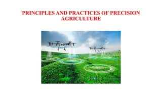
3. PRINCIPLES AND PRACTICES OF PRECISION AGRICULTURE:
1. Mapping
2. GPS receiver
3. Yield monitoring and mapping
4. Grid soil sampling and VRT
5. Remote sensing
6. GIS
7. Quantifying on Farm Variability
8. Soil Variation
9. Variability of Soil Water Content
10. Time and Space Scales
4. 1. Mapping:
• Maps are one of the most effective ways to present data.
• GIS mapping is the process of inputting data layers into GIS
software to produce a map.
• Maps present users with legible information that raw data can’t
display on its own.
• The most crucial and initial stage in precision agriculture is the
creation of maps for crop and soil attributes.
• These maps will measure geographic variability and serve as the
framework for its management.
• The acquisition of exact location coordinates using the GPS improves
data collection both before and during crop production.
5.
6. 2. Global Positioning System (GPS) receivers
• The global positioning system (GPS) is a network of satellites and
receiving devices used to determine the location of something on Earth.
• GPS receivers are programmed to receive information about where
each satellite is at any given moment.
• A GPS receiver determines its own location by measuring the time it
takes for a signal to arrive at its location from at least four satellites.
• Because radio waves travel at a constant speed, the receiver can use the
time measurements to calculate its distance from each satellite.
7. • Since this information is given in real time, it is possible to receive
continuous position updates while moving.
• It is possible to map measurements of soil and crops when one has
access to precise location data at all times.
• Users can return to specified spots to sample or treat certain areas
using GPS receivers, which can be carried into the field or installed
on tools.
8. 3. Yield monitoring and mapping:
• Yield mapping refers to the process of collecting georeferenced
data on crop yield and characteristics, such as moisture content,
while the crop is being harvested.
• Various methods, using a range of sensors, have been developed
for mapping crop yields.
• The information needed for yield maps can be obtained from yield
monitors when connected to a GPS receiver.
• For appropriate management decisions, yield assessments are
crucial.
9. The basic components of a grain yield mapping system include:
1. Grain flow sensor - determines grain volume harvested
2. Grain moisture sensor - compensates for grain moisture variability
3. Clean grain elevator speed sensor - used by some mapping systems to improve
accuracy of grain flow measurements
4. GPS antenna - receives satellite signal
5. Yield monitor display with a GPS receiver – geo reference and record data
6. Header position sensor - distinguishes measurements logged during turns
7. Travel speed sensor - determines the distance the combine travels during a
certain logging interval (Sometimes travel speed is measured with a GPS
receiver or a radar or ultrasonic sensor.)
However, while analyzing a yield map, it is also important to take into account the
soil, terrain, and other environmental elements.
• When used effectively, yield data offers significant feedback for assessing the
effects of managed inputs like seed, herbicides, fertilizer amendments, and
cultural techniques like irrigation and tillage.
10. 4. Grid soil sampling and variable-rate Technology (VRT):
• A group of soil cores collected at random sites within the sampling
region are pooled and evaluated in a lab.
• Based on the results of the soil test, crop experts propose fertilizer
application.
• The same concepts of soil sampling are applied in grid soil
sampling, however sampling intensity is increased.
11. • The geographic location of soil samples gathered in a systematic
grid also provides the ability to plot the data.
• The creation of a map of nutrient requirements is the aim of grid
soil sampling.
• A crop nutrient requirements are interpreted for each soil sample
after laboratory analysis of grid soil samples.
• The whole collection of soil samples are then used to plot the map
for applying fertiliser.
• A computer that is mounted on a variable-rate fertiliser spreader
has the application map loaded into it.
• The computer instructs a product-delivery controller to alter the
quantity and/or type of fertiliser product in accordance with the
application map by using the application map and a GPS receiver.
12. 5. Remote sensing:
• The process of acquisition of information about an object or
phenomenon without making physical contact with the object is called
remote sensing.
• Data sensors might be simple hand-held gadgets, aircraft mounts, or
satellite-based systems.
• The use of remotely sensed data can be used to assess the health of
crops. In aerial photographs, plant stress resulting from moisture,
nutrients, compaction, crop diseases, and other issues with plant health
are frequently visible.
• Near-infrared pictures captured by electronic cameras have a strong
correlation with healthy plant tissue.
• When used in a timely manner, remote sensing can identify in-season
variability that influences agricultural output and help managers make
adjustments that will increase the profitability of the currently
harvested crop.
13. • Crop stress can be located and measured using remotely sensed
photographs.
• Analyzing these photos can assist identify the root cause of specific
crop stress factors.
• A spot treatment strategy that maximizes the usage of agricultural
pesticides can then be created and put into action using the
photographs.
• The most common method is to take pictures using satellites like
LANDSAT or SPOT.
• In order to calibrate the measurement and generate maps, it is
assumed that measurements are made with ground truth accuracy.
• In order to track seasonally fluctuating crop yield, stress, weed
infestation, and extent within a field, these photos enable mapping
of crop, pest, and soil attributes.
14. 6. Geographic information systems (GIS):
• A geographic information system (GIS) is a computer system for
capturing, storing, checking, and displaying data related to positions
on Earth’s surface.
• The ability to record layers of data, including yields, maps from soil
surveys, data from remote sensors, crop scouting reports, and
measurements of soil nutrients, is a key feature of an agricultural
GIS.
• The GIS may display data that has been georeferenced, giving
interpretation a visual element.
• By merging and modifying different data layers, the GIS may be
utilised to analyse different management scenarios in addition to
storing and displaying data.
15.
16.
17. 7. Quantifying on Farm Variability:
• Grain yield often varies within agricultural fields as a result of the
variation in soil characteristics, competition from weeds,
management practices and their causal interactions. To implement
appropriate management decisions, yield variability needs to be
explained and quantified.
• Each farm provides a different management problem.
• SSNM, SSWM, STCR, etc…
• It would be too expensive to instantly adopt all of the methods
mentioned above, and not all of them will be useful in identifying
the reasons of variability in an area.
• The best course of action is to take a gradual approach, employing
one or two instruments at a time and carefully assessing the
outcomes.
18. 8. Soil Variation:
• A spatial variable is soil variation.
• Soils vary continuously within fields and between farms. Surface
variation may be easily seen, but nutrient variability is usually not
obvious.
• This field could be extended with other variables to produce a
network of interconnected components.
• Soil sampling strategies for site-specific nutrient management are
based on grid sampling or zone sampling.
• Satellite imagery quality and pixel, Aerial Imagery, Electromagnetic
Sensors, Multiyear Yield Maps
19. 9. Variability of Soil Water Content:
• It is a known fact that the amount of water in the soil changes over
time and place in a field, and this temporal and geographical
variability in soil water content patterns.
• Variability of soil water content can result from spatial differences
in soil parent material, plant transpiration, erosion, compaction and
other processes that affect soil structure.
• A solid foundation for precise water management may be
established by understanding the underlying stable soil water
distribution, which would also result in energy, water, equipment,
labour, and production efficiency savings.
20. 10. Time and Space Scales:
• Precision Agriculture requires an understanding of time and space scales.
• Time scales are critical because operations occur when they will benefit
the crop most.
• Space scales become a fundamental principle of field management
because inputs and cultural practices are varied with soil type, pest
population, or crop maturity.
• The challenge is to determine how to use time and space scales to
advantage in developing an improved understanding of agricultural
management.
• To fully achieve the goals of precision agriculture, management must be
applied in a space and time context.
• The challenge of monitoring in space and time is important to document
the changes that are naturally occurring within a field.
• To fully realize the potential impact of principles of precision agriculture
on environmental quality, however, will require the design and
implementation of experiments in space and time.