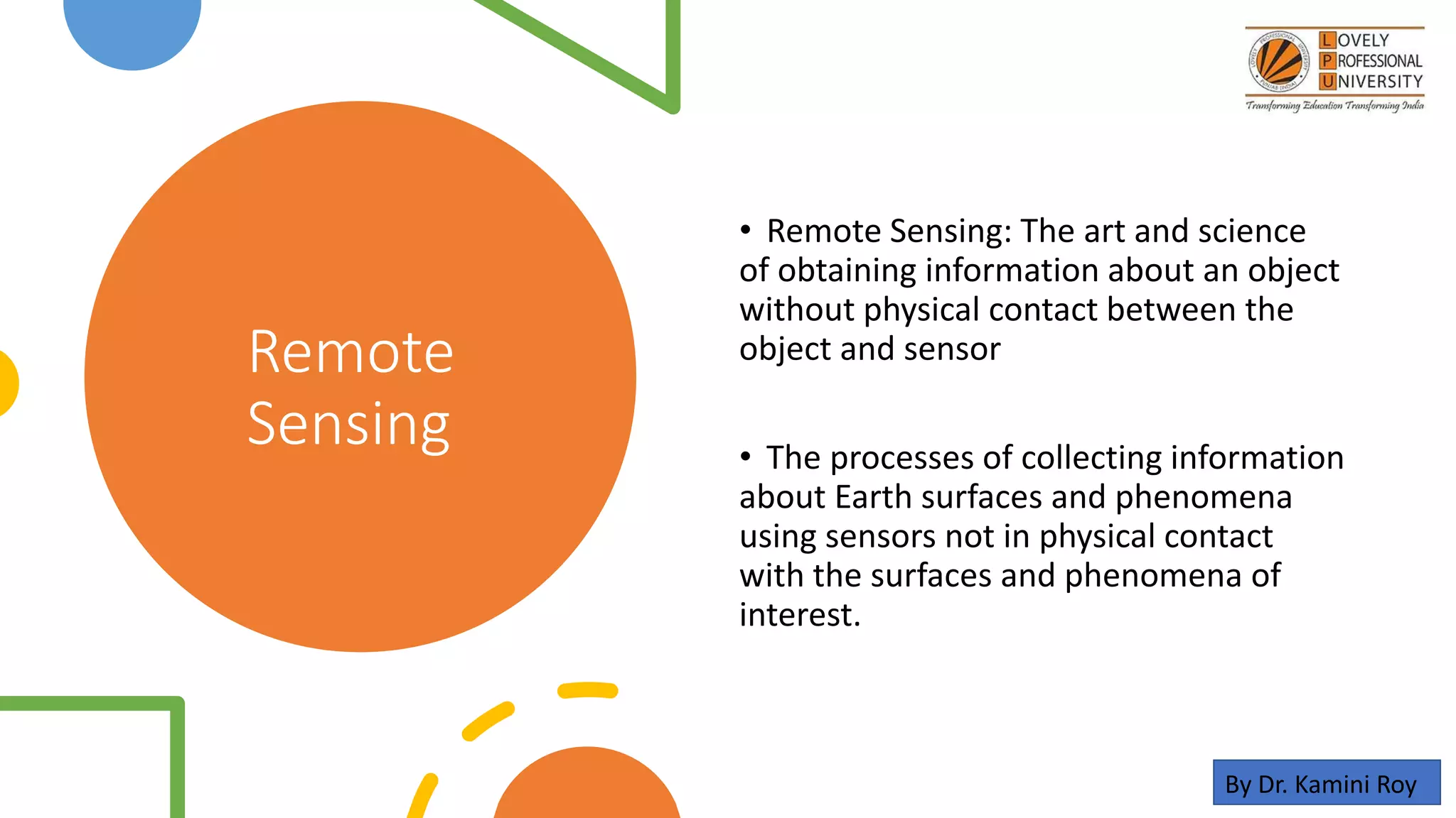
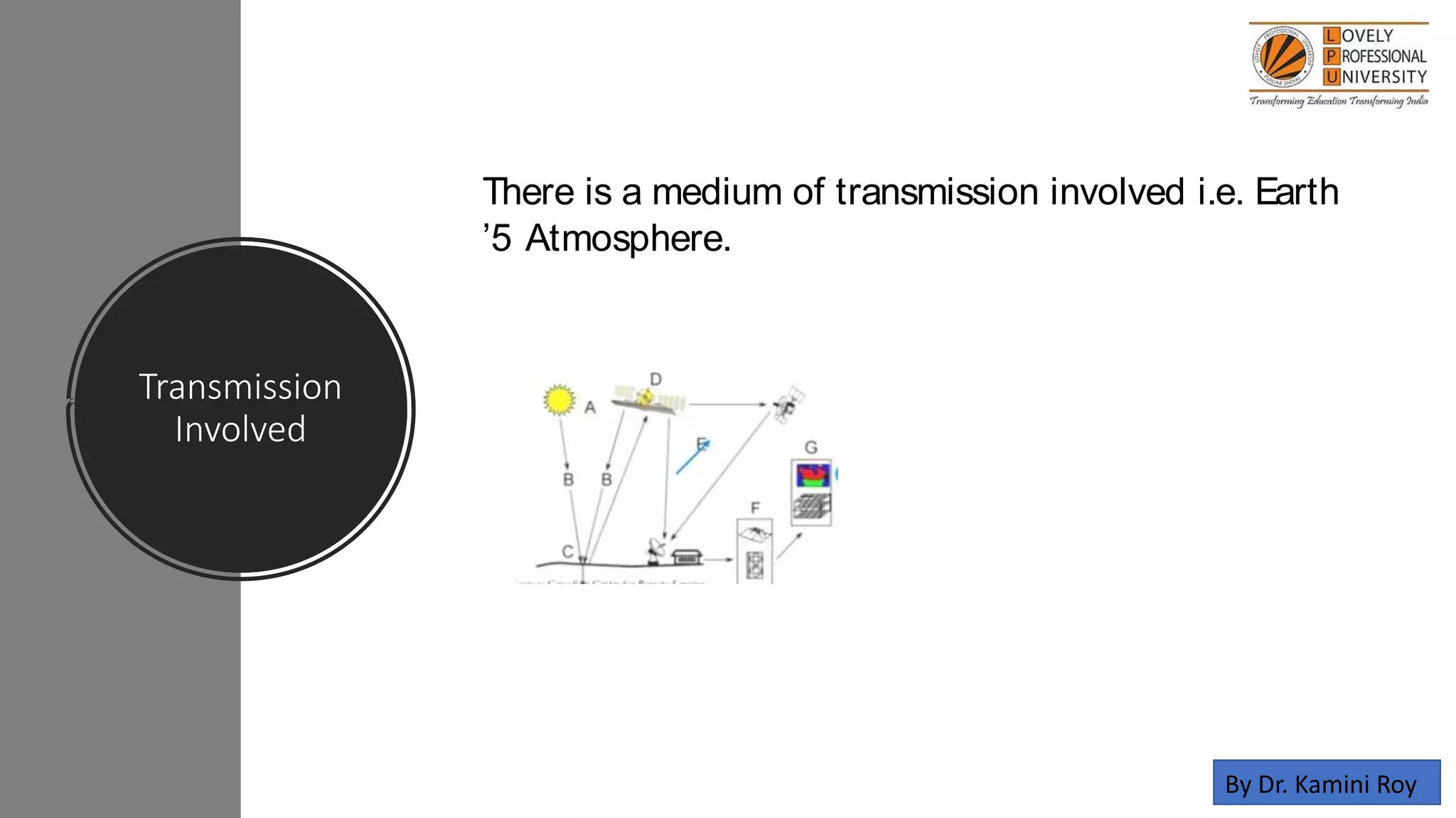
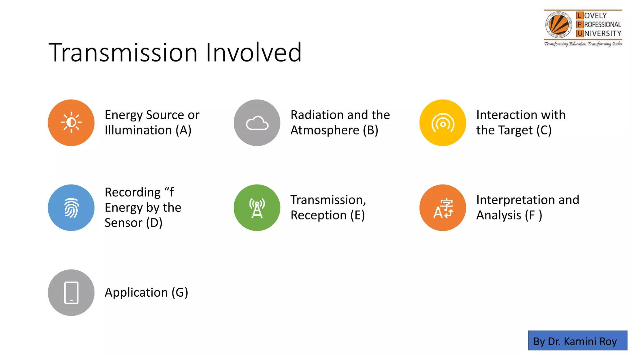
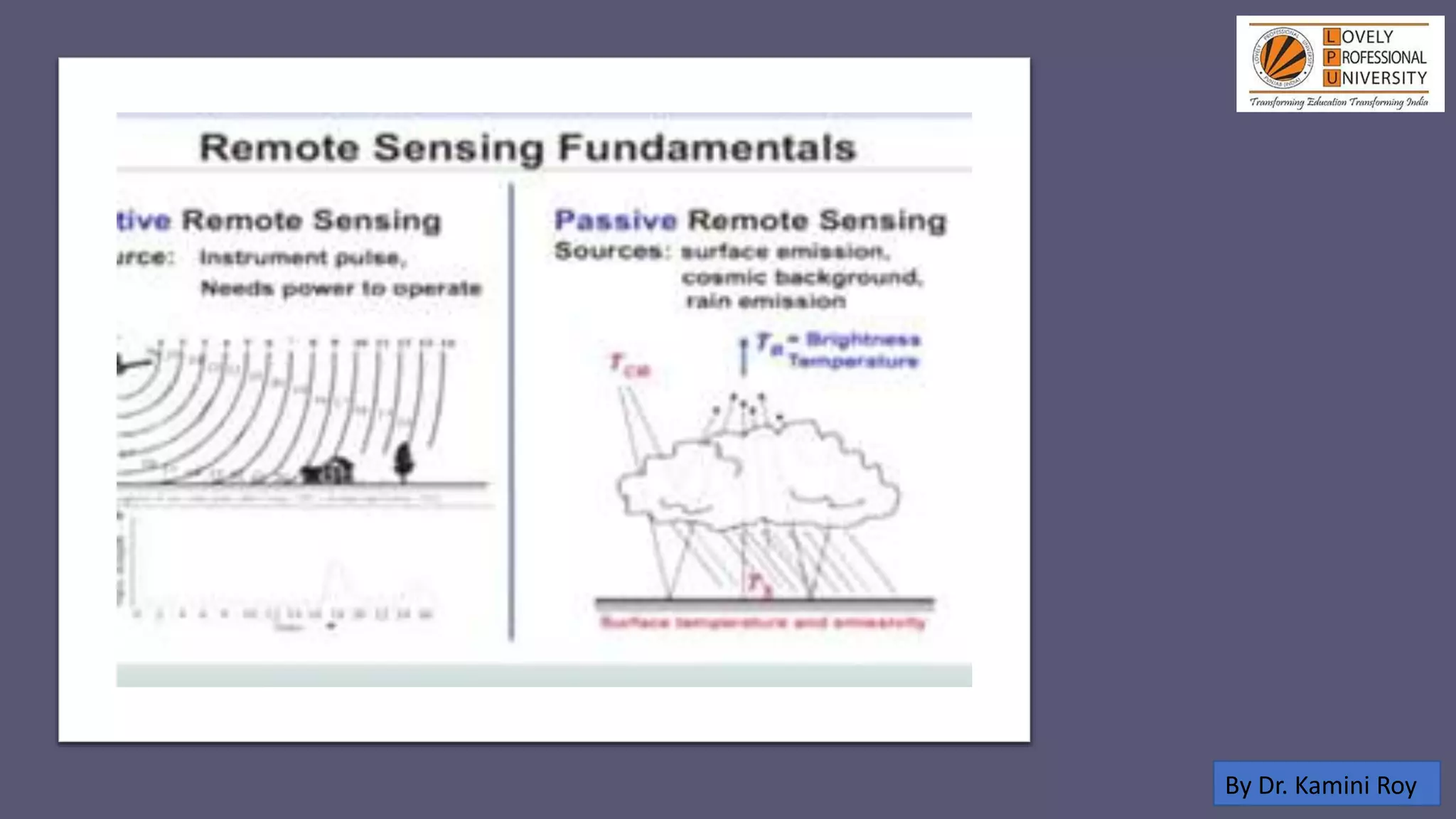
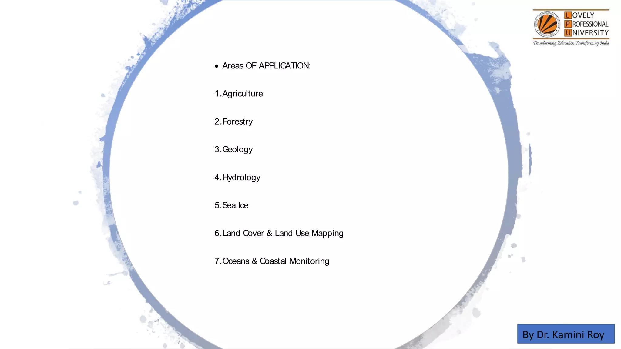
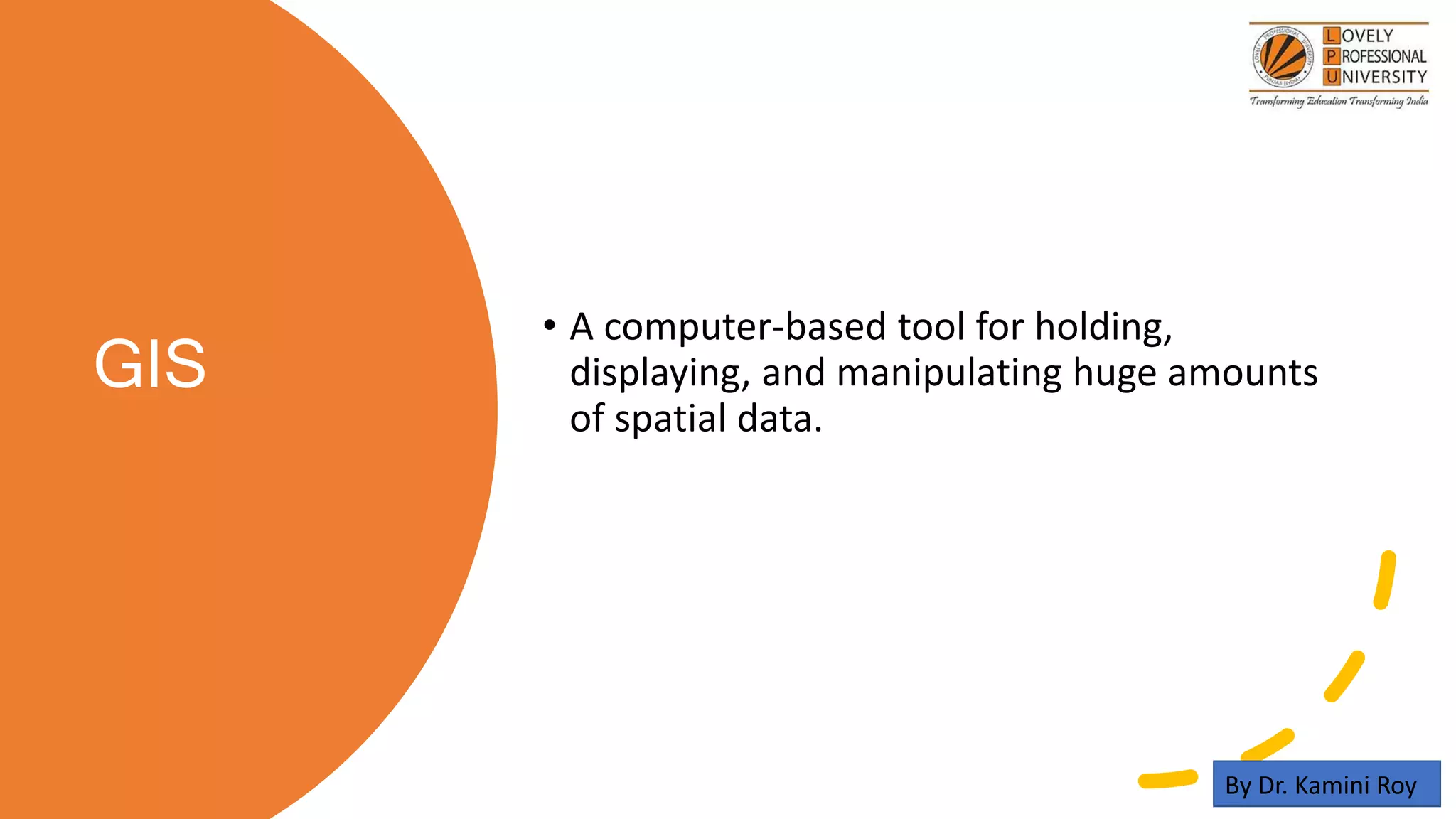
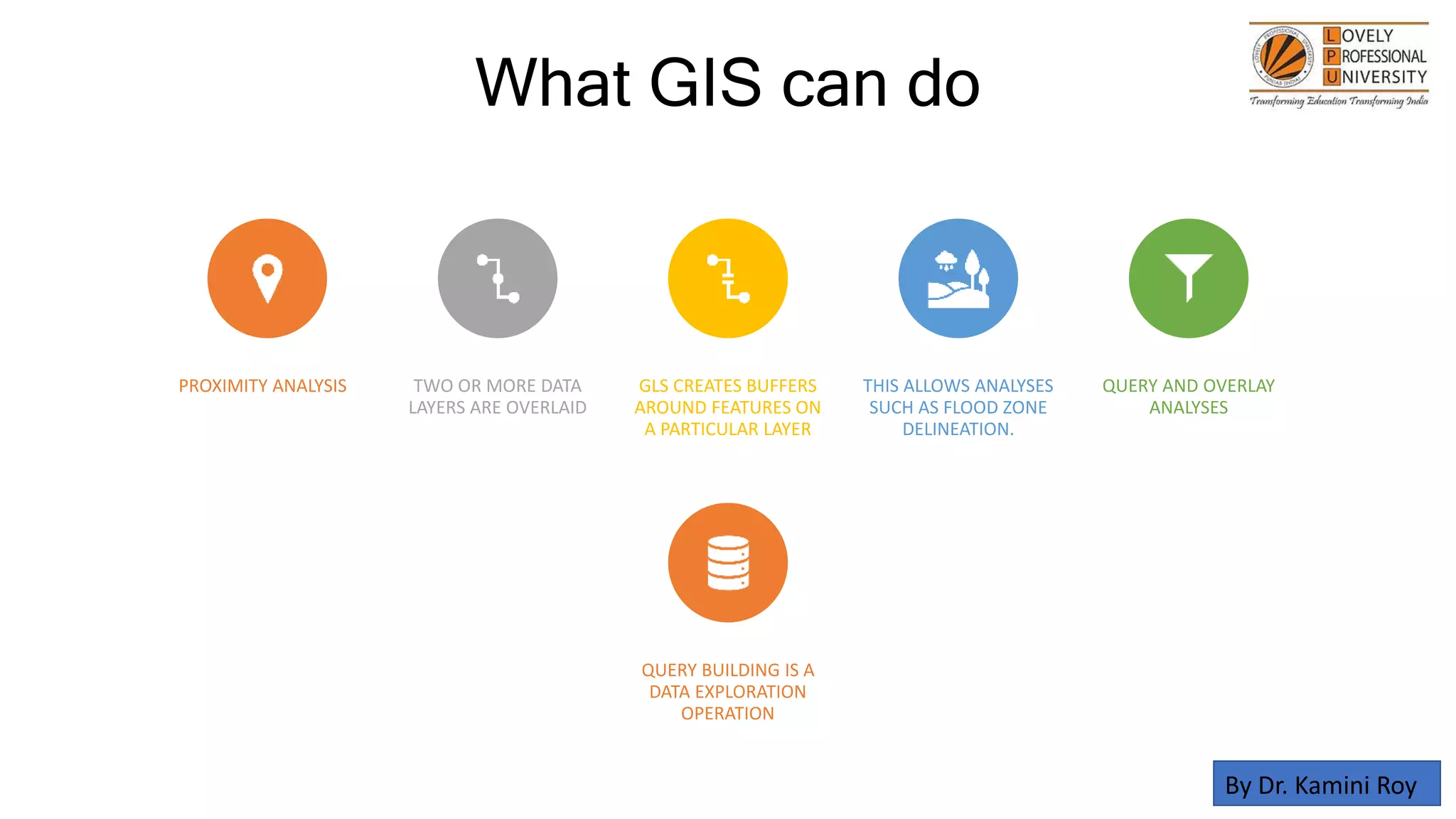
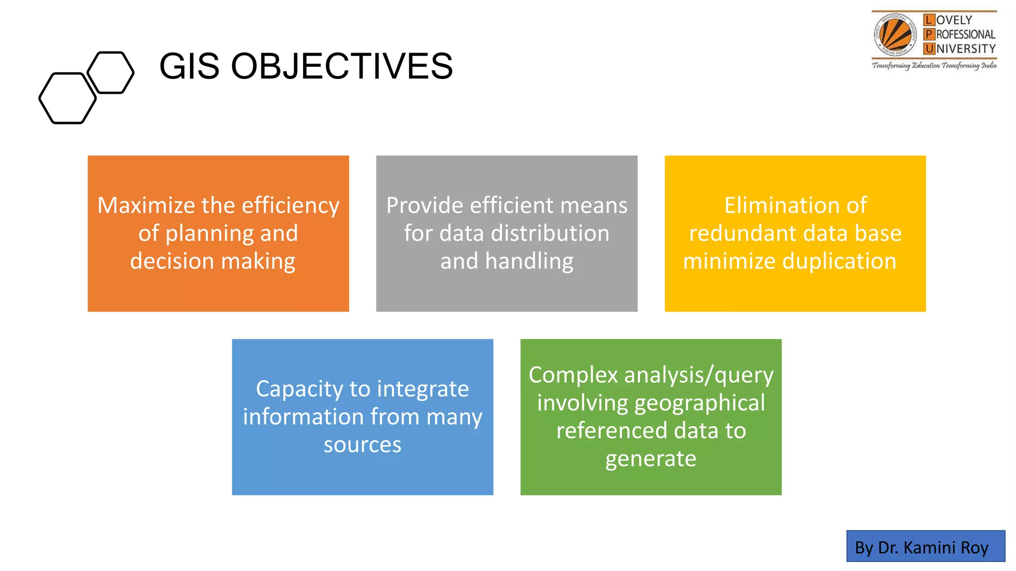
GIS and Remote Sensing in Diagnosis and Management of Problem Soil for agriculture, soil science, agronomy, forestry, land management and planning with audio by Dr. Kamini Roy
this slide includes recent approaches to evaluate cropping system.
It includes system profitability,relative production efficiency,land use efficienct(LUE),Calculation of LUE,energy efficiency,specific energy,Rotational intensity,Cropping intensity,Multiple cropping index(MCI),Land equivalent ratio (LER),Relative yields total (RYT),Crop equivalent yields (CEY),Relative Spread Index
This ppt is about the distribution of wasteland and problem soils. Those lands are wastelands which are ecologically unstable,
whose topsoil has nearly been completely lost, and
which have developed toxicity in the root zones or growth of most plants, both annual crops and trees”.
In recent years, the talk on Organic Farming is going on. how can we control the weed plants in the field without using the herbicide the question. there are several methods traditionally used and scientifically proved methods are discussed here.
Pulses are a very important source of protein in Indian diets as majority of population is vegetarian. however, the production of pulses is not keeping pace with the growing population in the country. lentil is one of the important Rabi pulses. it is one of the oldest pulse crops and the most nutritious of the pulses. it is also used as a cover crop to check the soil erosion in problem areas. lentil contributes about 6% in total pulses area as well as production of India. It is mostly eaten as "DAL". the pulse is first converted into split pulse or 'dal' by the removal of skin and the separation of the fleshy cotyledons. It is cooked easily and hence preferred. It is good for patients too. Lentil contains about 11% water, 25% protein and 60% carbohydrates. It is also rich in calcium, iron and niacin
The Contingency plans cover contingency strategies to be taken up by farmers in response to major weather related aberrations such as delay in onset and breaks in monsoon causing early, mid and late season droughts, floods, unusual rains, extreme weather events such as heat wave, cold wave, frost, hailstorm and cyclone.
Introduction
enlist of problematic soil
Salt affected soil
Characteristic of salt affected soil
Comparison between salt affected soil
Reclamation of Saline soils
Reclamation of sodic soils
Reclamation of saline-sodic soils
Acidic soils
Reclamation of acidic soil
Acid Sulphate soils and its management
Calcareous soil
The climate and earth sciences have recently undergone a rapid transformation from a data-poor
to a data-rich environment. In particular, massive amount of data about Earth and its
environment is now continuously being generated by a large number of Earth observing satellites
as well as physics-based earth system models running on large-scale computational platforms.
These massive and information-rich datasets offer huge potential for understanding how the
Earth's climate and ecosystem have been changing and how they are being impacted by humans’
actions. This talk will discuss various challenges involved in analyzing these massive data sets
as well as opportunities they present for both advancing machine learning as well as the science
of climate change in the context of monitoring the state of the tropical forests and surface water
on a global scale.
GWP - Flood Hazard Mapping for Small Island Developing States using GIS and L...Esri UK
Due to accelerating climatic and environmental changes, flood hazard modelling and mapping is an increasingly important issue. Flood hazard mapping in developing nations is often restricted to few areas and rarely available for national-scale infrastructure risk analysis and spatial planning, as traditional modelling approaches are inherently affected by increasing uncertainties and require a large number of datasets. In this session, learn how GWP Consultants overcame this difficulty using a simple GIS-based geomorphological approach, using Samoa as a case study. LiDAR-derived high-resolution Digital Elevation Models and ArcGIS analysis techniques were used to model and map flood hazards. Hear how Collector was used to assist with field activities (validating GIS-based flood hazard products and producing a drainage infrastructure database), significantly reducing time inputs. ArcGIS Online platform capabilities were used to deliver flood hazard products and improve risk communication to relevant stakeholders, including the Government of Samoa, World Bank, and United Nations Development Programme.
Land Health Surveillance Information for decision makingCIMMYT
Remote sensing –Beyond images
Mexico 14-15 December 2013
The workshop was organized by CIMMYT Global Conservation Agriculture Program (GCAP) and funded by the Bill & Melinda Gates Foundation (BMGF), the Mexican Secretariat of Agriculture, Livestock, Rural Development, Fisheries and Food (SAGARPA), the International Maize and Wheat Improvement Center (CIMMYT), CGIAR Research Program on Maize, the Cereal System Initiative for South Asia (CSISA) and the Sustainable Modernization of the Traditional Agriculture (MasAgro)
Model Attribute Check Company Auto PropertyCeline George
In Odoo, the multi-company feature allows you to manage multiple companies within a single Odoo database instance. Each company can have its own configurations while still sharing common resources such as products, customers, and suppliers.
The French Revolution, which began in 1789, was a period of radical social and political upheaval in France. It marked the decline of absolute monarchies, the rise of secular and democratic republics, and the eventual rise of Napoleon Bonaparte. This revolutionary period is crucial in understanding the transition from feudalism to modernity in Europe.
For more information, visit-www.vavaclasses.com
Ethnobotany and Ethnopharmacology:
Ethnobotany in herbal drug evaluation,
Impact of Ethnobotany in traditional medicine,
New development in herbals,
Bio-prospecting tools for drug discovery,
Role of Ethnopharmacology in drug evaluation,
Reverse Pharmacology.
Unit 8 - Information and Communication Technology (Paper I).pdfThiyagu K
This slides describes the basic concepts of ICT, basics of Email, Emerging Technology and Digital Initiatives in Education. This presentations aligns with the UGC Paper I syllabus.
How to Make a Field invisible in Odoo 17Celine George
It is possible to hide or invisible some fields in odoo. Commonly using “invisible” attribute in the field definition to invisible the fields. This slide will show how to make a field invisible in odoo 17.
Synthetic Fiber Construction in lab .pptxPavel ( NSTU)
Synthetic fiber production is a fascinating and complex field that blends chemistry, engineering, and environmental science. By understanding these aspects, students can gain a comprehensive view of synthetic fiber production, its impact on society and the environment, and the potential for future innovations. Synthetic fibers play a crucial role in modern society, impacting various aspects of daily life, industry, and the environment. ynthetic fibers are integral to modern life, offering a range of benefits from cost-effectiveness and versatility to innovative applications and performance characteristics. While they pose environmental challenges, ongoing research and development aim to create more sustainable and eco-friendly alternatives. Understanding the importance of synthetic fibers helps in appreciating their role in the economy, industry, and daily life, while also emphasizing the need for sustainable practices and innovation.
This is a presentation by Dada Robert in a Your Skill Boost masterclass organised by the Excellence Foundation for South Sudan (EFSS) on Saturday, the 25th and Sunday, the 26th of May 2024.
He discussed the concept of quality improvement, emphasizing its applicability to various aspects of life, including personal, project, and program improvements. He defined quality as doing the right thing at the right time in the right way to achieve the best possible results and discussed the concept of the "gap" between what we know and what we do, and how this gap represents the areas we need to improve. He explained the scientific approach to quality improvement, which involves systematic performance analysis, testing and learning, and implementing change ideas. He also highlighted the importance of client focus and a team approach to quality improvement.
GIS and Remote Sensing in Diagnosis and Management of Problem Soil with audio by Dr. Kamini Roy
1. Remote
sensing and
GIS in
diagnosis and
management
of problem
soil
• By- Dr. Kamini Roy
• Associate Professor, Agricultural Chemistry and
soil science,
• Lovely Professional University, Phagwara
• (First ICAR Accredited University)
By Dr. Kamini Roy
2. Remote
Sensing
• Remote Sensing: The art and science
of obtaining information about an object
without physical contact between the
object and sensor
• The processes of collecting information
about Earth surfaces and phenomena
using sensors not in physical contact
with the surfaces and phenomena of
interest.
By Dr. Kamini Roy
4. Transmission Involved
Energy Source or
Illumination (A)
Radiation and the
Atmosphere (B)
Interaction with
the Target (C)
Recording “f
Energy by the
Sensor (D)
Transmission,
Reception (E)
Interpretation and
Analysis (F )
Application (G)
By Dr. Kamini Roy
6. Areas OF APPLICATION:
1.Agriculture
2.Forestry
3.Geology
4.Hydrology
5.Sea Ice
6.Land Cover & Land Use Mapping
7.Oceans & Coastal Monitoring
By Dr. Kamini Roy
12. Scope Mapping & updating of city/town maps
Urban sprawl monitoring
TOWN PLANNING FACILITY MANAGEMENT 615
DATABASE DEVELOPMENT
BETTER DECISION SUPPORT.
PLANNING & MANAGEMENT
RAPID INFON-NATION
UPDATION LNFMSTRUCTUM
DEVELOPMENT MONITORING
By Dr. Kamini Roy
13. GIS
• A computer-based tool for holding,
displaying, and manipulating huge amounts
of spatial data.
By Dr. Kamini Roy
14. What GIS can do
PROXIMITY ANALYSIS TWO OR MORE DATA
LAYERS ARE OVERLAID
GLS CREATES BUFFERS
AROUND FEATURES ON
A PARTICULAR LAYER
THIS ALLOWS ANALYSES
SUCH AS FLOOD ZONE
DELINEATION.
QUERY AND OVERLAY
ANALYSES
QUERY BUILDING IS A
DATA EXPLORATION
OPERATION
By Dr. Kamini Roy
15. GIS OBJECTIVES
Maximize the efficiency
of planning and
decision making
Provide efficient means
for data distribution
and handling
Elimination of
redundant data base
minimize duplication
Capacity to integrate
information from many
sources
Complex analysis/query
involving geographical
referenced data to
generate
By Dr. Kamini Roy
16. Acknowledge and Thanks
Author is immensely thankful to all the
websites and books whom I contacted to make
these slides more informative and attractive
By Dr. Kamini Roy