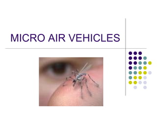
Micro air vehicles (MAVs), or micro aerial vehicles, are a class of unmanned aerial vehicles (UAVs) with size restrictions that allow them to access hazardous environments inaccessible to ground vehicles. They are controlled remotely and often used for military and special operation applications. Some key advantages of MAVs include keeping security personnel out of harm's way in dangerous situations, maintaining direct communication with pilots, and enabling individual control of vehicles for a wide range of missions. India has developed several MAVs, including the Nishant, Rustom, Dhaksha, and Netra drones, for surveillance and reconnaissance operations.
Micro-sized Unmanned Aerial Vehicles (UAVs) or micro Air Vehicles (MAVs),are used to acquire real-time visual information for a wide range of applications.
Unmanned Aerial Vehicles (UAVs) are aircrafts that fly without any humans being onboard. They are either remotely piloted, or piloted by an onboard computer. This kind of aircrafts can be used in different military missions such as surveillance, reconnaissance, battle damage assessment, communications relay, minesweeping, hazardous substances detection and radar jamming. However they can be used in other than military missions like detection of hazardous objects on train rails and investigation of infected areas. Aircrafts that are able of hovering and vertical flying can also be used for indoor missions like counter terrorist operations.
This is a report on ‘drones-an introduction&design’.In this
report I tried to give an introduction about drones or unmanned
aerial vehicles (UAVs) and some preliminary design parameters.
Introduction portion consists of drone history, technology, uses,
and the current generation of drones. Design portion includes
parameters like aerodynamics, payload, endurance, speed and
range, navigation systems and communications.
It is a presentation on the drone, UAV, fixed wing, application of drone, fix wing drone, surveillance using a drone, agriculture using a drone, mapping with a drone, research with a drone, military drone usage, types of UAV
An unmanned aerial vehicle (UAV), commonly known as a Drone, is an aircraft without a human pilot on board. UAVs can be remote controlled aircraft (e.g. flown by a pilot at a ground control station) or can fly autonomously based on pre-programmed flight plans or more complex dynamic automation systems
A UAV is defined as being capable of controlled, sustained level flight and powered by a jet or reciprocating engine. In addition, a cruise missile can be considered to be a UAV, but is treated separately on the basis that the vehicle is the weapon.
Unmanned Aerial Vehicles (UAVs) are aircrafts that fly without any humans being onboard. They are either remotely piloted, or piloted by an onboard computer. This kind of aircrafts can be used in different military missions such as surveillance, reconnaissance, battle damage assessment, communications relay, minesweeping, hazardous substances detection and radar jamming. However they can be used in other than military missions like detection of hazardous objects on train rails and investigation of infected areas. Aircrafts that are able of hovering and vertical flying can also be used for indoor missions like counter terrorist operations
To download this ppt click on this link
https://adf.ly/PdL4V
Remote sensing –Beyond images
Mexico 14-15 December 2013
The workshop was organized by CIMMYT Global Conservation Agriculture Program (GCAP) and funded by the Bill & Melinda Gates Foundation (BMGF), the Mexican Secretariat of Agriculture, Livestock, Rural Development, Fisheries and Food (SAGARPA), the International Maize and Wheat Improvement Center (CIMMYT), CGIAR Research Program on Maize, the Cereal System Initiative for South Asia (CSISA) and the Sustainable Modernization of the Traditional Agriculture (MasAgro)
Dr George Grozev presented a seminar titled "Potential use of drones for infrastructure inspection and survey: as part of the SMART Seminar Series on 27th March 2018.
More information: http://www.uoweis.co/event/potential-use-of-drones-for-infrastructure-inspection-and-survey/
Keep updated with future events: http://www.uoweis.co/events/category/smart-infrastructure-facility/
uav
flight control andd mission planning
Payloads and means of Controlling Payloads
Reconnaissance/SurveillancePayloads
Design Issues Related to Carriage and Delivery of Weapons
radar and other payloads
Design and Structural Analysis for an Autonomous UAV System Consisting of Sla...IOSR Journals
Abstract: An Unmanned Aerial Vehicle (UAV) is an aircraft without a human pilot. It can either be controlled manually by a pilot on the ground using a trans-receiver or it can be programmed to operate autonomously. In this proposed control system, multiple slave Micro Aerial Vehicles(MAV) are dispatched from a master UAV for surveillance. All the MAVs are synchronized with each other through the master UAV which highlights their purpose and position. The master UAV acts as a mobile base for the surveillance, it stores the data collected by the MAVs and transmits them to a remote base. A design of the UAV-MAV system and its performance analysis is presented.
Keywords- Autonomous control, Characteristics, Linux, Master / Slave Aerial Vehicles, NX 8.0 Nastran, Surveillance.
Design and Structural Analysis for an Autonomous UAV System Consisting of Sla...IOSR Journals
An Unmanned Aerial Vehicle (UAV) is an aircraft without a human pilot. It can either be controlled manually by a pilot on the ground using a trans-receiver or it can be programmed to operate autonomously. In this proposed control system, multiple slave Micro Aerial Vehicles(MAV) are dispatched from a master UAV for surveillance. All the MAVs are synchronized with each other through the master UAV which highlights their purpose and position. The master UAV acts as a mobile base for the surveillance, it stores the data collected by the MAVs and transmits them to a remote base. A design of the UAV-MAV system and its performance analysis is presented.
This chapter discusses how the human operators exercise control over the UAV and its payloads.
There r some key functions av
Piloting the aircraft: making the inputs to the control surfaces and propulsion system required to take off, fly some specified flight path, and land.
Controlling the payloads: turning them on and off, pointing them as needed, and performing any real-time interpretation of their outputs that is required to perform the mission of the UAS.
Commanding the aircraft: carrying out the mission plan, including any changes that must be made in response to events that occur during the mission.
Mission planning: determining the plan for the mission based on the tasking that comes from the “customer” for whom the UAS is flying the mission.
Target Detection, Recognition, and Identification:Imaging sensors are used to detect, recognize, and identify targets.
The successful accomplishment of these tasks depends on the interrelationship of the system resolution, target contrast, atmosphere, and display characteristics
One of the most common missions for a UAV is reconnaissance and/or wide-area surveillance.
These missions require the UAV and its operator to search large areas on the ground, looking for some type of target or activity. An example might be to search a valley looking for signs of an enemy advance.
There are three general types of search:
1. Point
2. Area
3. Route
An autonomous underwater vehicle (AUV) is a robot which travels underwater without requiring input from an operator. AUVs constitute part of a larger group of undersea systems known as unmanned underwater vehicles, a classification that includes non-autonomous remotely operated underwater vehicles (ROVs) – controlled and powered from the surface by an operator/pilot via an umbilical or using remote control. In military applications AUVs are more often referred to simply as unmanned undersea vehicles (UUVs).
Ocean Optics: Fundamentals & Naval Applications Technical Training Short Cour...Jim Jenkins
This 2-day course is de¬signed for scientists, engi¬neers, and managers who wish to learn the fundamentals of ocean optics and how they are used to predict detectability of submerged objects such as swimmers or submarines. Examples will be provided on how much optical conditions vary by depth, by geographic location and season, and by wavelength. Examples from the in situ online databases and from satellite climatologies will be provided.
Explore the innovative world of trenchless pipe repair with our comprehensive guide, "The Benefits and Techniques of Trenchless Pipe Repair." This document delves into the modern methods of repairing underground pipes without the need for extensive excavation, highlighting the numerous advantages and the latest techniques used in the industry.
Learn about the cost savings, reduced environmental impact, and minimal disruption associated with trenchless technology. Discover detailed explanations of popular techniques such as pipe bursting, cured-in-place pipe (CIPP) lining, and directional drilling. Understand how these methods can be applied to various types of infrastructure, from residential plumbing to large-scale municipal systems.
Ideal for homeowners, contractors, engineers, and anyone interested in modern plumbing solutions, this guide provides valuable insights into why trenchless pipe repair is becoming the preferred choice for pipe rehabilitation. Stay informed about the latest advancements and best practices in the field.
Final project report on grocery store management system..pdfKamal Acharya
In today’s fast-changing business environment, it’s extremely important to be able to respond to client needs in the most effective and timely manner. If your customers wish to see your business online and have instant access to your products or services.
Online Grocery Store is an e-commerce website, which retails various grocery products. This project allows viewing various products available enables registered users to purchase desired products instantly using Paytm, UPI payment processor (Instant Pay) and also can place order by using Cash on Delivery (Pay Later) option. This project provides an easy access to Administrators and Managers to view orders placed using Pay Later and Instant Pay options.
In order to develop an e-commerce website, a number of Technologies must be studied and understood. These include multi-tiered architecture, server and client-side scripting techniques, implementation technologies, programming language (such as PHP, HTML, CSS, JavaScript) and MySQL relational databases. This is a project with the objective to develop a basic website where a consumer is provided with a shopping cart website and also to know about the technologies used to develop such a website.
This document will discuss each of the underlying technologies to create and implement an e- commerce website.
Hybrid optimization of pumped hydro system and solar- Engr. Abdul-Azeez.pdffxintegritypublishin
Advancements in technology unveil a myriad of electrical and electronic breakthroughs geared towards efficiently harnessing limited resources to meet human energy demands. The optimization of hybrid solar PV panels and pumped hydro energy supply systems plays a pivotal role in utilizing natural resources effectively. This initiative not only benefits humanity but also fosters environmental sustainability. The study investigated the design optimization of these hybrid systems, focusing on understanding solar radiation patterns, identifying geographical influences on solar radiation, formulating a mathematical model for system optimization, and determining the optimal configuration of PV panels and pumped hydro storage. Through a comparative analysis approach and eight weeks of data collection, the study addressed key research questions related to solar radiation patterns and optimal system design. The findings highlighted regions with heightened solar radiation levels, showcasing substantial potential for power generation and emphasizing the system's efficiency. Optimizing system design significantly boosted power generation, promoted renewable energy utilization, and enhanced energy storage capacity. The study underscored the benefits of optimizing hybrid solar PV panels and pumped hydro energy supply systems for sustainable energy usage. Optimizing the design of solar PV panels and pumped hydro energy supply systems as examined across diverse climatic conditions in a developing country, not only enhances power generation but also improves the integration of renewable energy sources and boosts energy storage capacities, particularly beneficial for less economically prosperous regions. Additionally, the study provides valuable insights for advancing energy research in economically viable areas. Recommendations included conducting site-specific assessments, utilizing advanced modeling tools, implementing regular maintenance protocols, and enhancing communication among system components.
Saudi Arabia stands as a titan in the global energy landscape, renowned for its abundant oil and gas resources. It's the largest exporter of petroleum and holds some of the world's most significant reserves. Let's delve into the top 10 oil and gas projects shaping Saudi Arabia's energy future in 2024.
Sachpazis:Terzaghi Bearing Capacity Estimation in simple terms with Calculati...Dr.Costas Sachpazis
Terzaghi's soil bearing capacity theory, developed by Karl Terzaghi, is a fundamental principle in geotechnical engineering used to determine the bearing capacity of shallow foundations. This theory provides a method to calculate the ultimate bearing capacity of soil, which is the maximum load per unit area that the soil can support without undergoing shear failure. The Calculation HTML Code included.
Immunizing Image Classifiers Against Localized Adversary Attacksgerogepatton
This paper addresses the vulnerability of deep learning models, particularly convolutional neural networks
(CNN)s, to adversarial attacks and presents a proactive training technique designed to counter them. We
introduce a novel volumization algorithm, which transforms 2D images into 3D volumetric representations.
When combined with 3D convolution and deep curriculum learning optimization (CLO), itsignificantly improves
the immunity of models against localized universal attacks by up to 40%. We evaluate our proposed approach
using contemporary CNN architectures and the modified Canadian Institute for Advanced Research (CIFAR-10
and CIFAR-100) and ImageNet Large Scale Visual Recognition Challenge (ILSVRC12) datasets, showcasing
accuracy improvements over previous techniques. The results indicate that the combination of the volumetric
input and curriculum learning holds significant promise for mitigating adversarial attacks without necessitating
adversary training.
2. What Are MAVS(AV’S) ?
• A micro air vehicle
(MAV), or micro aerial
vehicle, is a class of
unmanned aerial vehicles
(UAV) that has a size
restriction . The small craft
allows remote observation
of hazardous
environments inaccessible
to ground vehicles.
3. What Are Unmanned Aerial Vehicles ?
• An unmanned aerial
vehicle (UAV), commonly
known as drone, is an
aircraft without a human pilot
aboard. Its flight is controlled
either autonomously by
onboard computers or by the
remote control of a pilot on
the ground or in another
vehicle.
• They are usually deployed
for military and special
operation applications.
4. What Is Remote Control Vehicle ?
• A remote control vehicle
is defined as any vehicle
that is controlled by a
means that does not restrict
its motion with an origin
external to the device. This
is often a radio control
device, cable between
control and vehicle, or an
infrared controller.
5. WHY MAV’S ? WHY NOT SOMETHING
BIGGER ?
Keeps security personnel
out of harms from any
hazardous or dangerous
situations.
Direct connectivity to
pilot or crew.
Can be individually
controlled.
Can be used for a wide
range of new missions
(even unthought-of
before).
12. The TUAV1000 shown in Fig. 1 has three
servo units for the left and right elevons
and an electrically driven propeller. Its
wingspan is 1000 mm and carries a wire-
less video system as payload.
The actual flight control system is
shown in Fig. 3, which weighs only
about 24 g
17. MEMS Gyroscope
• A gyroscope is a device for
measuring or maintaining the
orientation, based on the
principles of the conservation
of momentum.
• Gyroscopes are physical
sensors that detect and
measure the angular motion of
an object relative to an inertial
frame of reference.
• Transfer of energy between
two vibrating resonator is by
Coriolis acceleration.
SEM (Scanning Electron Microscope) image
of a comb drive tuning fork gyroscope
designed by Draper Lab in Cambridge, MA
19. Coriolis force
• Force exerted on a
body when it moves in
rotational reference
frame
Fc = - 2m (ω x υ)
• Acts perpendicular to
rotation axis and
velocity of body in
rotating frame
• Proportional to rotating
rate
23. The Future of MEMS Gyros
• Smaller
• Cheaper
• Not limited to Silicon
• Ti More durable
• Nano and Pico satellites
• Submarine & Aircraft
satellite launches
24. India And Its AV’S
• India is developing UAVs that are capable of flying on
solar power. The list below contains some micro drones
that Developed by DRDO (Defence Research and
Development Organisation, New Delhi and Hindustan
Aeronautics Limited, Bangalore).
DRDO Nishant
DRDO Rustom
Dhaksha
Rustom 1
Rustom-H
Rustom 2
Lakshya PTA
DRDO AURA
DRDO Netra
25. Have look at DRDO’s Rustom
• Rustom (English: Warrior) is a Medium Altitude Long Endurance
unmanned combat air vehicle (UCAV) being developed by DRDO for
the three services, Indian Army, Indian Navy and the Indian Air Force
of the Indian Armed Forces. Rustom is derived from the NAL's LCRA
(Light Canard Research Aircraft) developed by a team under the
leadership of late Prof. Rustom B. Damania in the 1980s.
Role
Remote controlled unmanned
aerial vehicle (UAV)
Manufacturer DRDO
First flight
Rustom-1: November 11, 2009
Rustom-2: February, 2014
Status
Rustom-1 MALE UAV (Prototype
flight testing)
Rustom-H HALE UAV (Under
development)
Rustom-2 UCAV (Under
development)[1]
Primary users
Indian Air Force
Indian Army, Indian Navy
26. More About Rustom
General characteristics
• Crew: none
• Payload: 95 Kg (165.3 lbs) and
350 kg (771.6 lbs) (for Rustom-1 &
Rustom-H respectively)
• Length: 5.12 m (16 ft 10 in) and
9.5 m (31 ft 2 in) (for Rustom-1 &
Rustom-H respectively)
• Wingspan: 7.9 m (25 ft 11 in) and
20.6 m (67 ft 7 in) (for Rustom-1 &
Rustom-H respectively)
• Height: Rustom-1: 2.40 m (7 ft 10
in)
• Empty weight: 720 kg (1587.33
lbs) & 1,800 kg (3968.32 lbs) (for
Rustom-1 & Rustom-H
respectively)
Performance
Maximum speed: 225 km/h
(139.81 mph)
Range:
Line of sight: 250 km(156.25
miles)
Relay Communication: 350
km (218.75 miles)
Service ceiling: 26,000 ft for
Rustom-1 and 35,000 ft for
Rustom-H (8,000 m and 10,668 m
respectively)
27. DRDO’s Netra
• The Netra is an Indian, light- weight, UAV for surveillance and
reconnaissance operations. It has been jointly developed by the
Defence Research and Development Organisation's Research and
Development Establishment (R&DE), and IdeaForge, a Mumbai-
based private firm. The UAV was featured in the hit movie 3 Idiots.
Role
Mini-unmanned aerial vehicle
(UAV)
National origin India
Manufacturer IdeaForge
Designer DRDO
First flight 3 July 2010
Introduction 30 January 2012
Status Active
Primary users
Central Reserve Police Force
Border Security Force
Produced 2010-present
Number built 24
Unit cost
2 million (US$32,600) to 5.5 million
(US$89,650)[4]
28. More About Netra
• General characteristics
• Crew: none
• Payload: High resolution CCD
camera (Thermal camera)
• Length: 90 cm (2.95 ft)
• Rotor diameter: 90 cm (2.95 ft)
• Empty weight: 1.5 Kg (3.3 lbs)
• Powerplant: 4 × External
swappable Li-Po batteries.
• Netra can be launched from a
small clearing, and it can fly up to
a distance of 2.5 km from its take-
off point. The operational altitude
of the UAV is 200 m
Performance
•Maximum speed: 30 km/hour
•Range: 2500 m(8200 ft)
•Service ceiling: 300 m (985 ft)