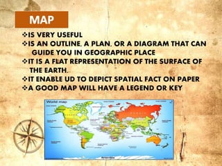
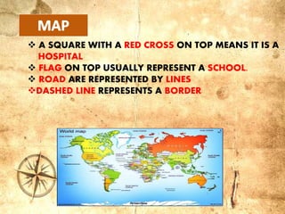
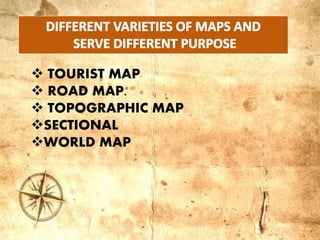
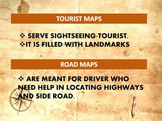
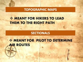
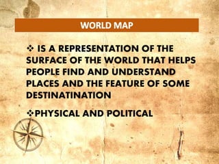
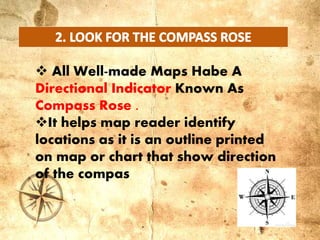
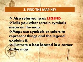
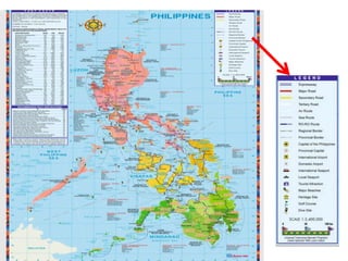
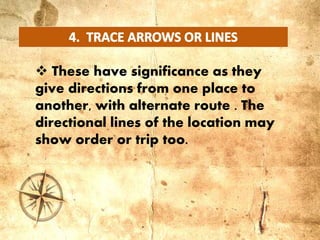
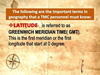
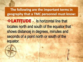
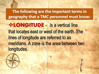
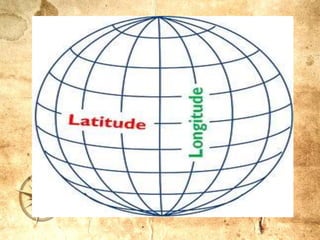
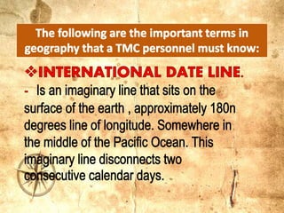
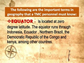
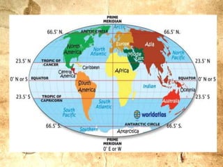
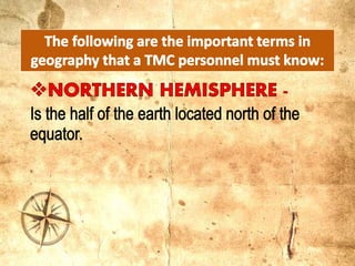
PREPARE BY: MS. CATRINA A. EBOL
IS VERY USEFUL
IS AN OUTLINE, A PLAN, OR A DIAGRAM THAT CAN
GUIDE YOU IN GEOGRAPHIC PLACE
IT IS A FLAT REPRESENTATION OF THE SURFACE OF
THE EARTH.
IT ENABLE UD TO DEPICT SPATIAL FACT ON PAPER
A GOOD MAP WILL HAVE A LEGEND OR KEY
 A SQUARE WITH A RED CROSS ON TOP MEANS IT IS A
HOSPITAL
 FLAG ON TOP USUALLY REPRESENT A SCHOOL.
 ROAD ARE REPRESENTED BY LINES
DASHED LINE REPRESENTS A BORDER
 TOURIST MAP
 ROAD MAP.
 TOPOGRAPHIC MAP
SECTIONAL
WORLD MAP
 ARE MEANT FOR DRIVER WHO
NEED HELP IN LOCATING HIGHWAYS
AND SIDE ROAD.
 SERVE SIGHTSEEING-TOURIST.
IT IS FILLED WITH LANDMARKS
 MEANT FOR PILOT TO DETERMINE
AIR ROUTES
 MEANT FOR HIKERS TO LEAD
THEM TO THE RIGHT PATH
 IS A REPRESENTATION OF THE
SURFACE OF THE WORLD THAT HELPS
PEOPLE FIND AND UNDERSTAND
PLACES AND THE FEATURE OF SOME
DESTINATINATION
PHYSICAL AND POLITICAL
 LOCATING THE BODIES OF
WATER IS EASY. FOR COLORED
AND COLOR IS
FOR LAND AREA
 All Well-made Maps Habe A
Directional Indicator Known As
Compass Rose .
It helps map reader identify
locations as it is an outline printed
on map or chart that show direction
of the compas
 Also referred to as LEGEND
Tells you what certain symbols
mean on the map
Maps use symbols or colors to
represent things and the legend
explains it.
Illustrate a box located in a corner
of the map
 These have significance as they
give directions from one place to
another, with alternate route . The
directional lines of the location may
show order or trip too.
 Geography- study of
physical structure and
inhabitants of the Earth
Maps and map reading

Maps and map reading

  • 1.
    PREPARE BY: MS.CATRINA A. EBOL
  • 2.
    IS VERY USEFUL ISAN OUTLINE, A PLAN, OR A DIAGRAM THAT CAN GUIDE YOU IN GEOGRAPHIC PLACE IT IS A FLAT REPRESENTATION OF THE SURFACE OF THE EARTH. IT ENABLE UD TO DEPICT SPATIAL FACT ON PAPER A GOOD MAP WILL HAVE A LEGEND OR KEY
  • 3.
     A SQUAREWITH A RED CROSS ON TOP MEANS IT IS A HOSPITAL  FLAG ON TOP USUALLY REPRESENT A SCHOOL.  ROAD ARE REPRESENTED BY LINES DASHED LINE REPRESENTS A BORDER
  • 4.
     TOURIST MAP ROAD MAP.  TOPOGRAPHIC MAP SECTIONAL WORLD MAP
  • 5.
     ARE MEANTFOR DRIVER WHO NEED HELP IN LOCATING HIGHWAYS AND SIDE ROAD.  SERVE SIGHTSEEING-TOURIST. IT IS FILLED WITH LANDMARKS
  • 6.
     MEANT FORPILOT TO DETERMINE AIR ROUTES  MEANT FOR HIKERS TO LEAD THEM TO THE RIGHT PATH
  • 7.
     IS AREPRESENTATION OF THE SURFACE OF THE WORLD THAT HELPS PEOPLE FIND AND UNDERSTAND PLACES AND THE FEATURE OF SOME DESTINATINATION PHYSICAL AND POLITICAL
  • 9.
     LOCATING THEBODIES OF WATER IS EASY. FOR COLORED AND COLOR IS FOR LAND AREA
  • 10.
     All Well-madeMaps Habe A Directional Indicator Known As Compass Rose . It helps map reader identify locations as it is an outline printed on map or chart that show direction of the compas
  • 11.
     Also referredto as LEGEND Tells you what certain symbols mean on the map Maps use symbols or colors to represent things and the legend explains it. Illustrate a box located in a corner of the map
  • 13.
     These havesignificance as they give directions from one place to another, with alternate route . The directional lines of the location may show order or trip too.
  • 15.
     Geography- studyof physical structure and inhabitants of the Earth