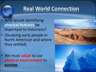
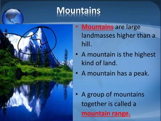
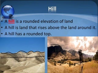
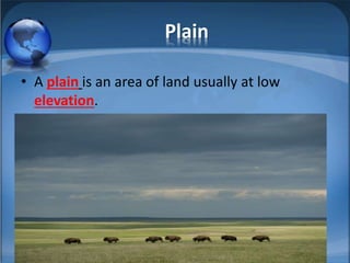
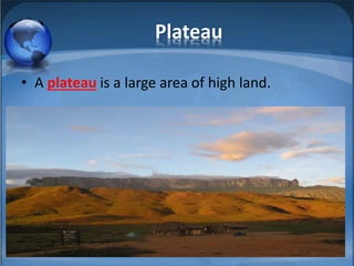
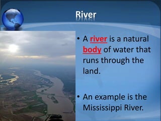
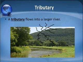
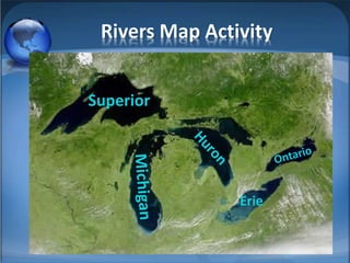
Physical Features of Geography
Mr. Barnett
6th Grade Social Studies
Plaza Middle School
Warm-up
• What are physical features?
• Describe your physical features.
Real-World Connection
• Why do we use physical features to identify places?
• Why would we tell people we live near the beach or
on the east coast?
Real World Connection
• Why would identifying
physical features be
important to historians?
• (Studying early people in
North American and where
they settled)
• We must adapt to our
physical environment to
survive.
Mountains
• Mountains are large
landmasses higher than a
hill.
• A mountain is the highest
kind of land.
• A mountain has a peak.
• A group of mountains
together is called a
mountain range.
Hill
• A hill is a rounded elevation of land
• A hill is land that rises above the land around it.
• A hill has a rounded top.
Plain
• A plain is an area of land usually at low
elevation.
Plateau
• A plateau is a large area of high land.
River
• A river is a natural
body of water that
runs through the
land.
• An example is the
Mississippi River.
Tributary
• A tributary flows into a larger river.
Gulf
• A gulf is a part of an
ocean partly or mostly
surrounded by land.
• The Gulf of Mexico is
the 10th largest body of
water in the world
Bay
• A bay is a body of water smaller than a gulf.
Island
• An island is a land form, smaller than a
continent, surrounded by water.
Peninsula
• A peninsula is a long, narrow portion of land
extending out into the ocean.
• ***It is boarded by water on 3 (three)
sides.***
Lake
• A lake is an inland body of standing water
of considerable size. Examples are the 5
(five) Great Lakes!
So Why Are Geologic Features
Important?
• They are important because they impact:
– patterns of trade
– the locations of cities and towns
– the westward movement
– agricultural and fishing industries.
Gallery Walk Directions
1. You will work in your group.
2. You will use your graphic
organizer.
3. Define the term. (use notes)
4. You will identify which picture
goes with which geography term.
5. Answer the question
Rivers Map Activity
Superior
Erie

Physical features

  • 1.
    Physical Features ofGeography Mr. Barnett 6th Grade Social Studies Plaza Middle School
  • 2.
    Warm-up • What arephysical features? • Describe your physical features.
  • 3.
    Real-World Connection • Whydo we use physical features to identify places? • Why would we tell people we live near the beach or on the east coast?
  • 4.
    Real World Connection •Why would identifying physical features be important to historians? • (Studying early people in North American and where they settled) • We must adapt to our physical environment to survive.
  • 5.
    Mountains • Mountains arelarge landmasses higher than a hill. • A mountain is the highest kind of land. • A mountain has a peak. • A group of mountains together is called a mountain range.
  • 6.
    Hill • A hillis a rounded elevation of land • A hill is land that rises above the land around it. • A hill has a rounded top.
  • 7.
    Plain • A plainis an area of land usually at low elevation.
  • 8.
    Plateau • A plateauis a large area of high land.
  • 9.
    River • A riveris a natural body of water that runs through the land. • An example is the Mississippi River.
  • 10.
    Tributary • A tributaryflows into a larger river.
  • 11.
    Gulf • A gulfis a part of an ocean partly or mostly surrounded by land. • The Gulf of Mexico is the 10th largest body of water in the world
  • 12.
    Bay • A bayis a body of water smaller than a gulf.
  • 13.
    Island • An islandis a land form, smaller than a continent, surrounded by water.
  • 14.
    Peninsula • A peninsulais a long, narrow portion of land extending out into the ocean. • ***It is boarded by water on 3 (three) sides.***
  • 15.
    Lake • A lakeis an inland body of standing water of considerable size. Examples are the 5 (five) Great Lakes!
  • 16.
    So Why AreGeologic Features Important? • They are important because they impact: – patterns of trade – the locations of cities and towns – the westward movement – agricultural and fishing industries.
  • 17.
    Gallery Walk Directions 1.You will work in your group. 2. You will use your graphic organizer. 3. Define the term. (use notes) 4. You will identify which picture goes with which geography term. 5. Answer the question
  • 18.