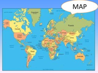
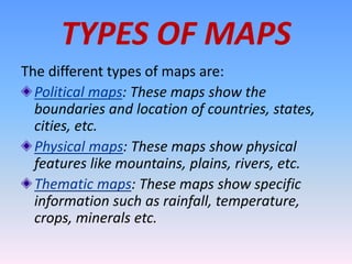
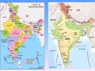
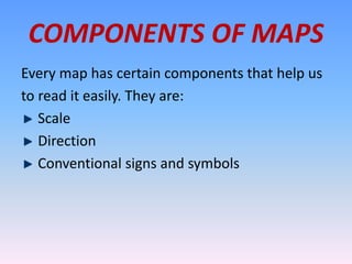
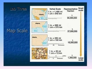
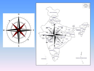
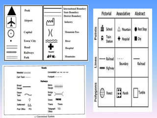
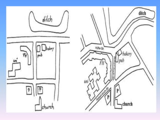
MAPS AND MAP
READING
We will learn about maps, the
different components of
maps, sketch and plans
The globe is useful to us in
many ways. But its use is very
difficult. It is also very
difficult to carry a globe
from one place to another.
So because of all these
difficulties people use maps.
MAPS
Maps are representative drawings of the large
spherical earth or a part of it on a flat paper.
They show accurate details. They can be easily
carried from one place to another. They can also
be used to understand the relationship between
different aspects.
For example: We can place the rainfall map on
the vegetation of the same area to understand
the relationship between the two.
MAP
TYPES OF MAPS
The different types of maps are:
Political maps: These maps show the
boundaries and location of countries, states,
cities, etc.
Physical maps: These maps show physical
features like mountains, plains, rivers, etc.
Thematic maps: These maps show specific
information such as rainfall, temperature,
crops, minerals etc.
COMPONENTS OF MAPS
Every map has certain components that help us
to read it easily. They are:
Scale
Direction
Conventional signs and symbols
SCALE
A scale is defined as a relation or the ratio of a
distance between places on a map and their
distance on the ground. Maps are drawn using
different using different scales. For example:
One map in an atlas can have the scale 1cm =
200km and another map in the same atlas can
have the scale 1cm = 1km. In the first one the
detailed features cannot be shown. This is called
a small scale map. In the second one the detailed
features can be shown. This is called a large scale map.
DIRECTONS
On a compass there are four directions: North (N),
South (S), East (E) and West (W). These are
cardinal directions. The directions between them
are called intermediate points. They are: north-east,
(NE), south-east (SE), south-west (SW) and north-
west (NW). Most maps have an arrow with N
written on the top. If a map has no North Line, then
the top of it is understood to be the North.
CONVENTIONAL SIGNS AND
SYMBOLS
Most maps use certain symbols which them
easy to be read. There is an international
understanding for using these symbols to show
different features. These are called conventional
signs or symbols. In the absence of these
symbols, it would be very difficult as one would
have to write the names of each and every
feature.
SKETCH
A sketch is a rough drawing that we can use to
show the location of a place. For example: shops,
temples, picnic spots, etc. Sketches have no scales
to give the accurate measurement of distances.
However such drawings are used as a base for
preparing a proper final plan or a map at a later
stage.
PLANS
Plans are drawings of a small area on a large
scale. Such drawings generally show the layout
of buildings, parks, hospitals, roads, public
gardens, playgrounds, classrooms, etc. These
are accurate drawings made by architects and
town planners. Plans are made to scale and
show correct directions.
MAPS AND MAP READING - Copy.pptx

MAPS AND MAP READING - Copy.pptx

  • 1.
    MAPS AND MAP READING Wewill learn about maps, the different components of maps, sketch and plans
  • 2.
    The globe isuseful to us in many ways. But its use is very difficult. It is also very difficult to carry a globe from one place to another. So because of all these difficulties people use maps.
  • 3.
    MAPS Maps are representativedrawings of the large spherical earth or a part of it on a flat paper. They show accurate details. They can be easily carried from one place to another. They can also be used to understand the relationship between different aspects. For example: We can place the rainfall map on the vegetation of the same area to understand the relationship between the two.
  • 4.
  • 5.
    TYPES OF MAPS Thedifferent types of maps are: Political maps: These maps show the boundaries and location of countries, states, cities, etc. Physical maps: These maps show physical features like mountains, plains, rivers, etc. Thematic maps: These maps show specific information such as rainfall, temperature, crops, minerals etc.
  • 7.
    COMPONENTS OF MAPS Everymap has certain components that help us to read it easily. They are: Scale Direction Conventional signs and symbols
  • 8.
    SCALE A scale isdefined as a relation or the ratio of a distance between places on a map and their distance on the ground. Maps are drawn using different using different scales. For example: One map in an atlas can have the scale 1cm = 200km and another map in the same atlas can have the scale 1cm = 1km. In the first one the detailed features cannot be shown. This is called a small scale map. In the second one the detailed features can be shown. This is called a large scale map.
  • 10.
    DIRECTONS On a compassthere are four directions: North (N), South (S), East (E) and West (W). These are cardinal directions. The directions between them are called intermediate points. They are: north-east, (NE), south-east (SE), south-west (SW) and north- west (NW). Most maps have an arrow with N written on the top. If a map has no North Line, then the top of it is understood to be the North.
  • 12.
    CONVENTIONAL SIGNS AND SYMBOLS Mostmaps use certain symbols which them easy to be read. There is an international understanding for using these symbols to show different features. These are called conventional signs or symbols. In the absence of these symbols, it would be very difficult as one would have to write the names of each and every feature.
  • 14.
    SKETCH A sketch isa rough drawing that we can use to show the location of a place. For example: shops, temples, picnic spots, etc. Sketches have no scales to give the accurate measurement of distances. However such drawings are used as a base for preparing a proper final plan or a map at a later stage.
  • 16.
    PLANS Plans are drawingsof a small area on a large scale. Such drawings generally show the layout of buildings, parks, hospitals, roads, public gardens, playgrounds, classrooms, etc. These are accurate drawings made by architects and town planners. Plans are made to scale and show correct directions.