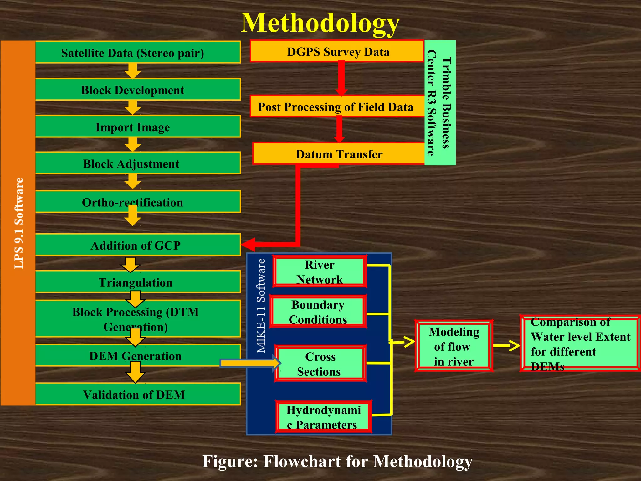
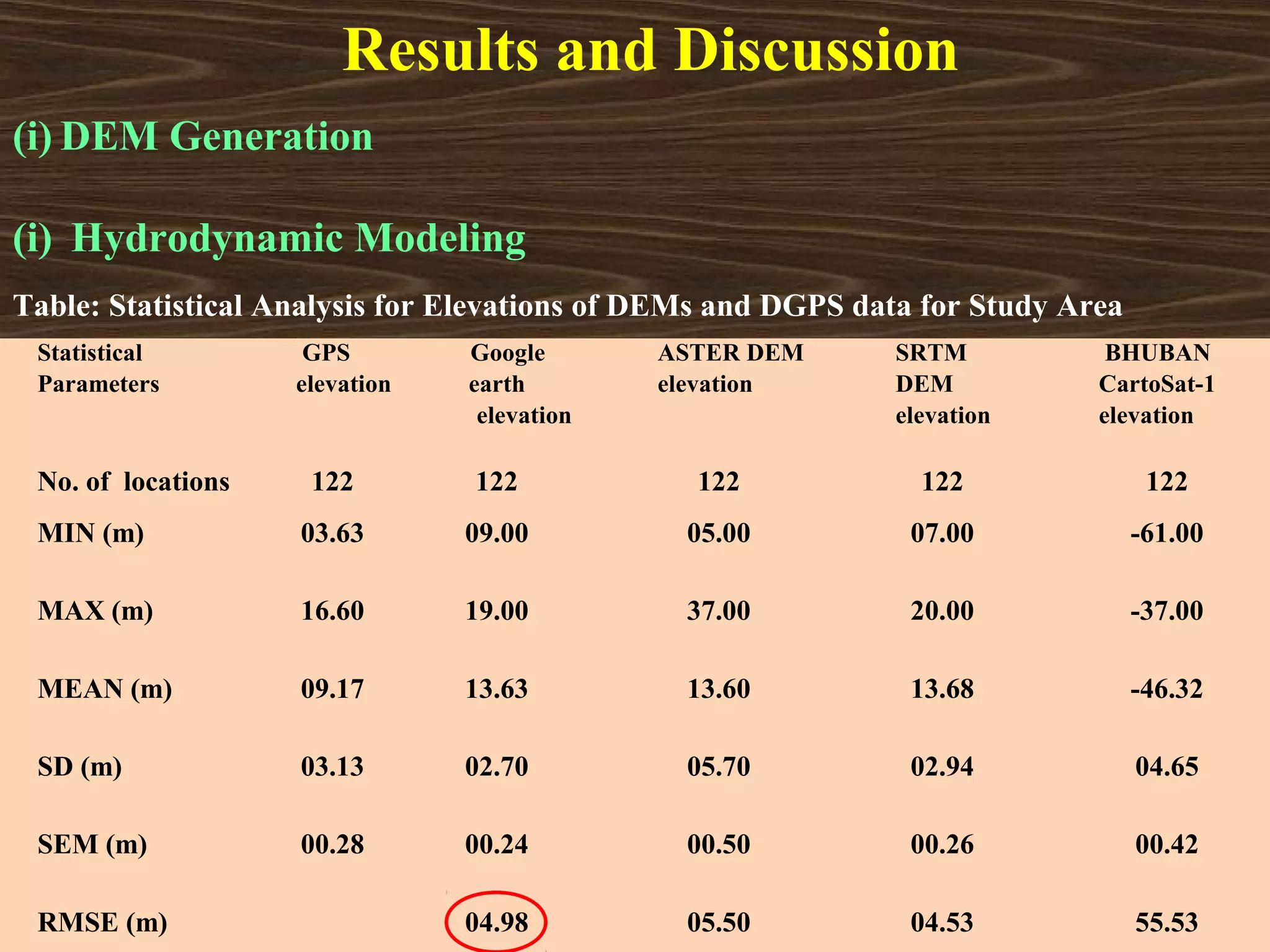
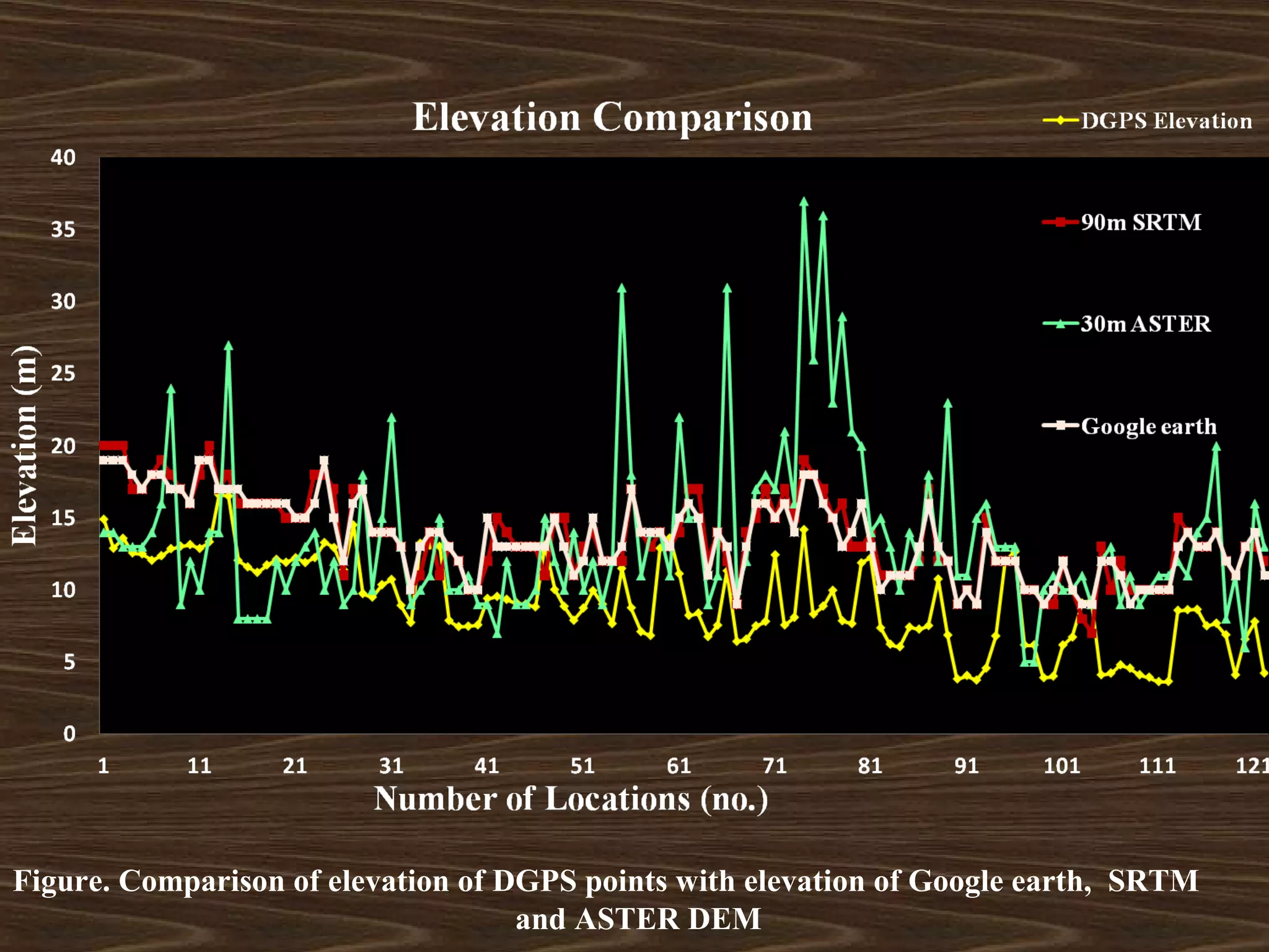
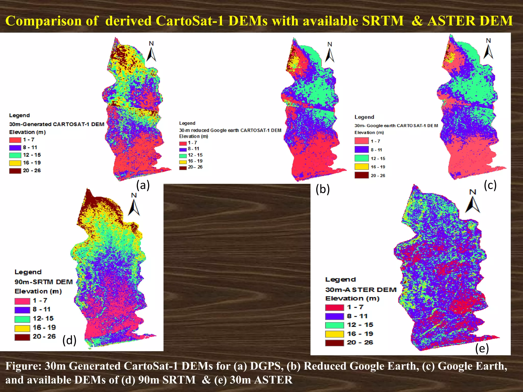
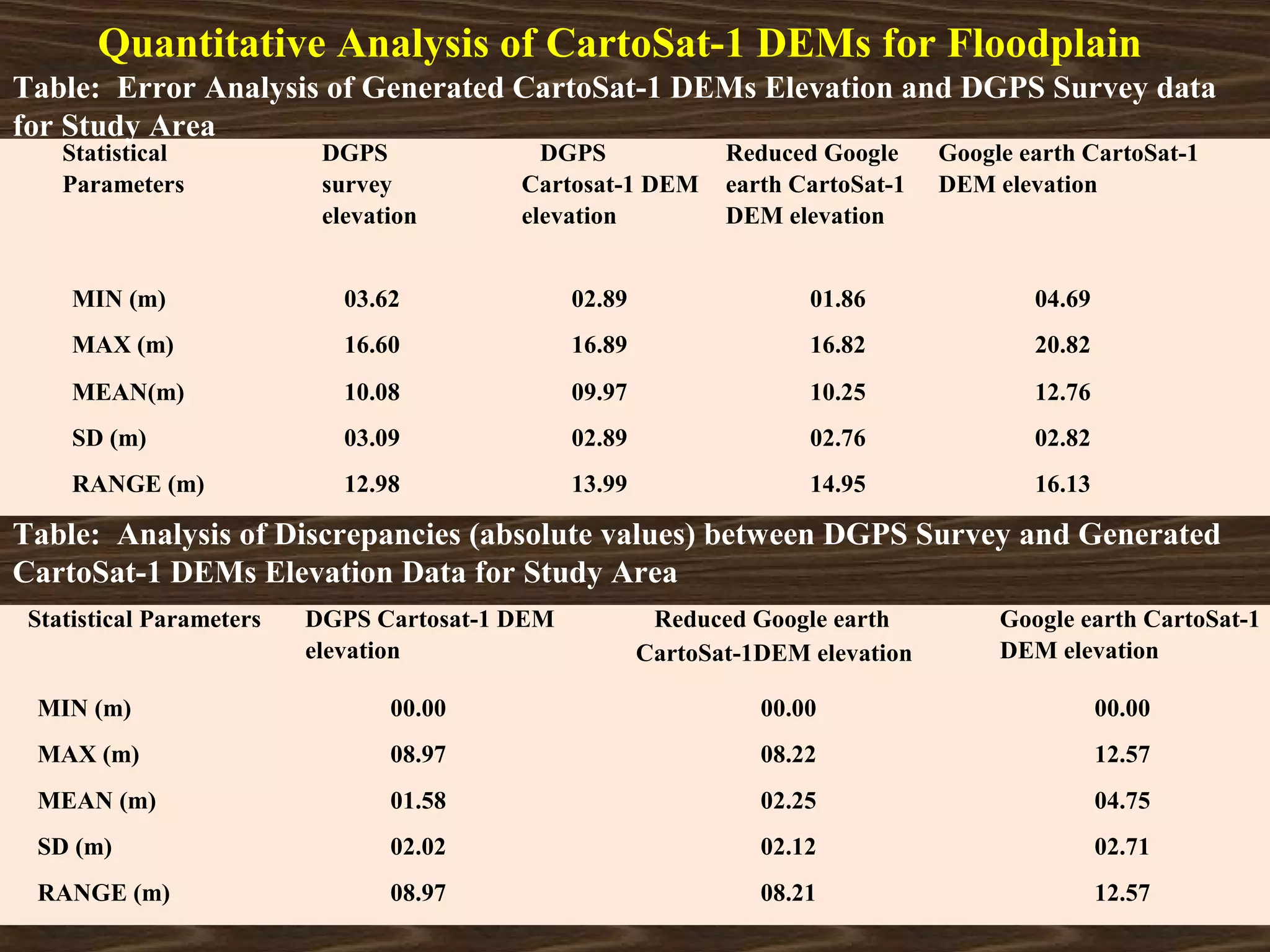
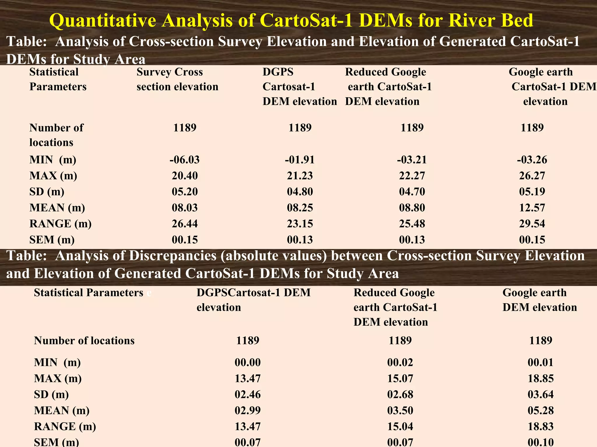
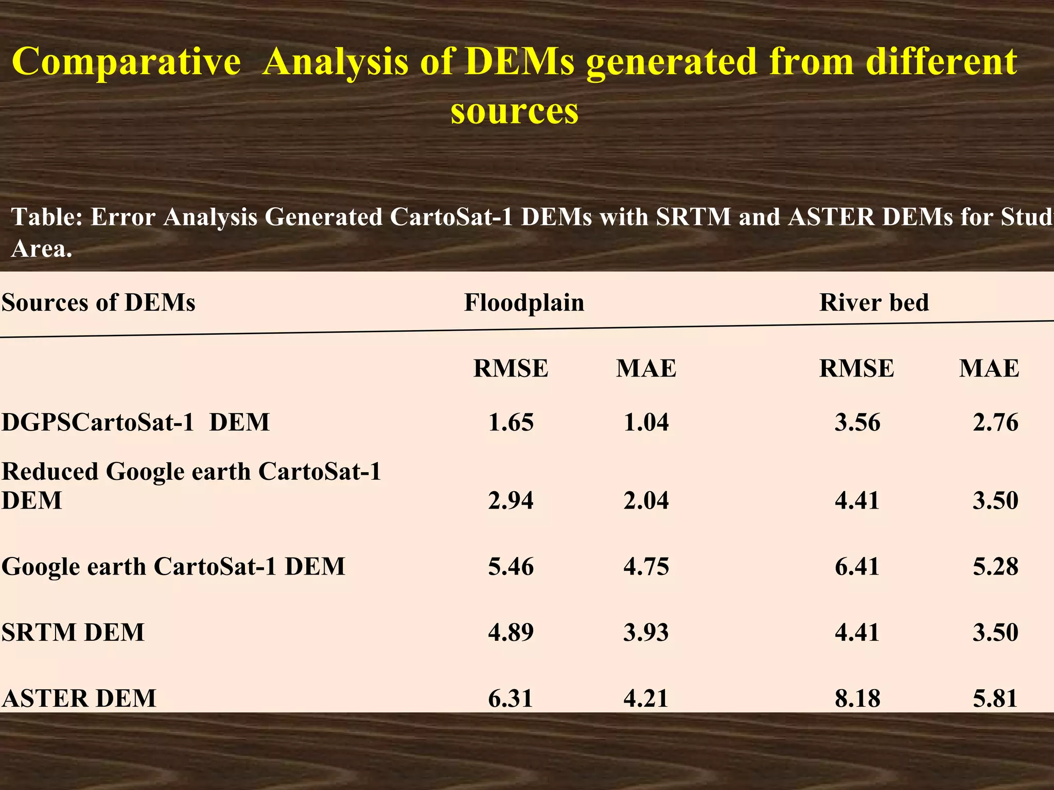
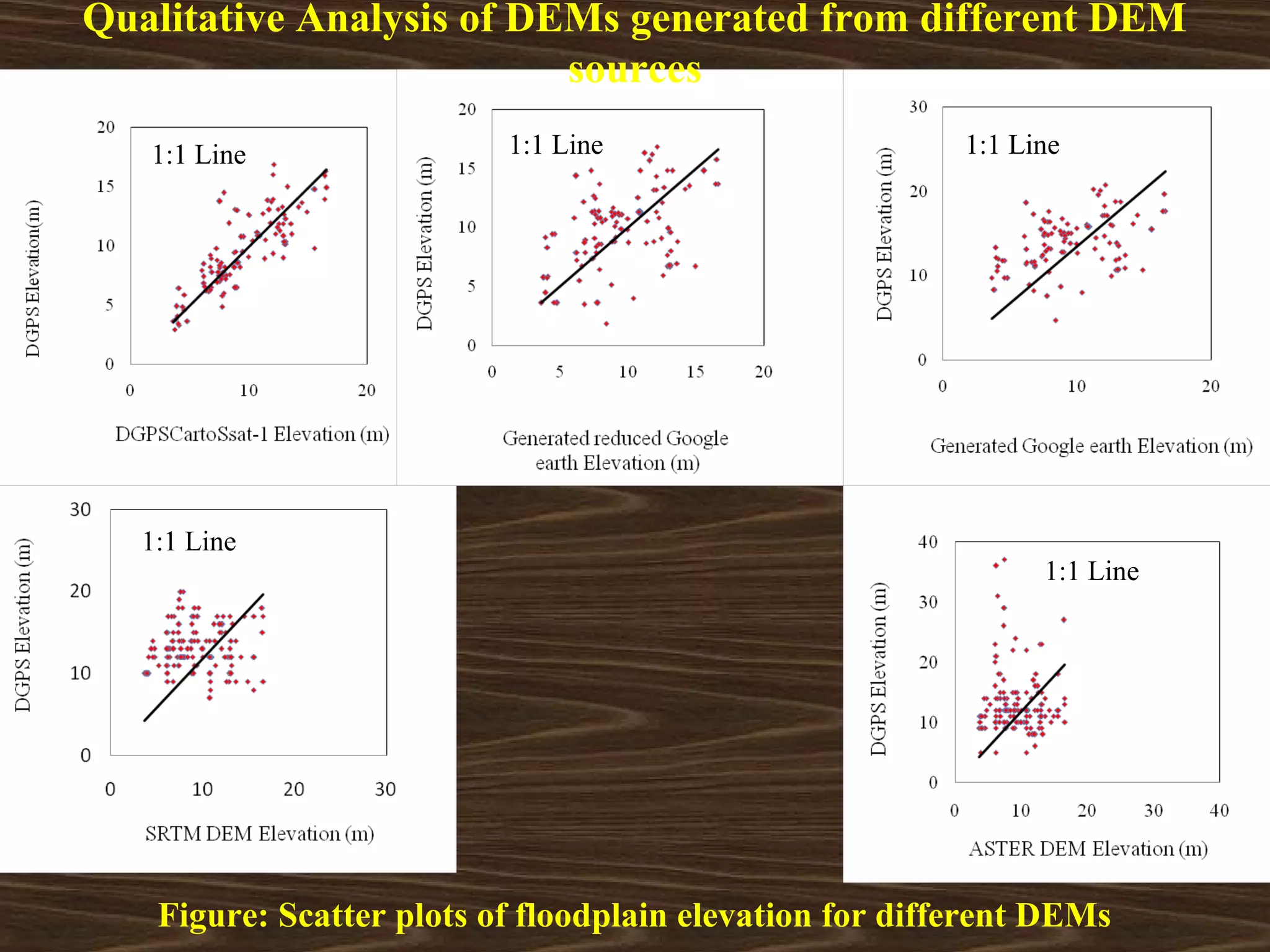
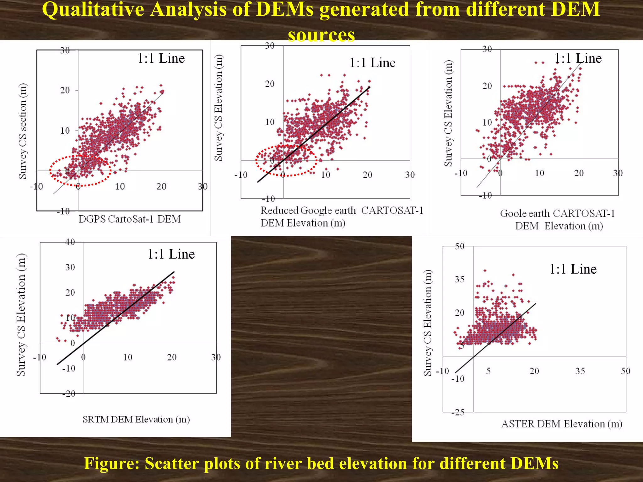
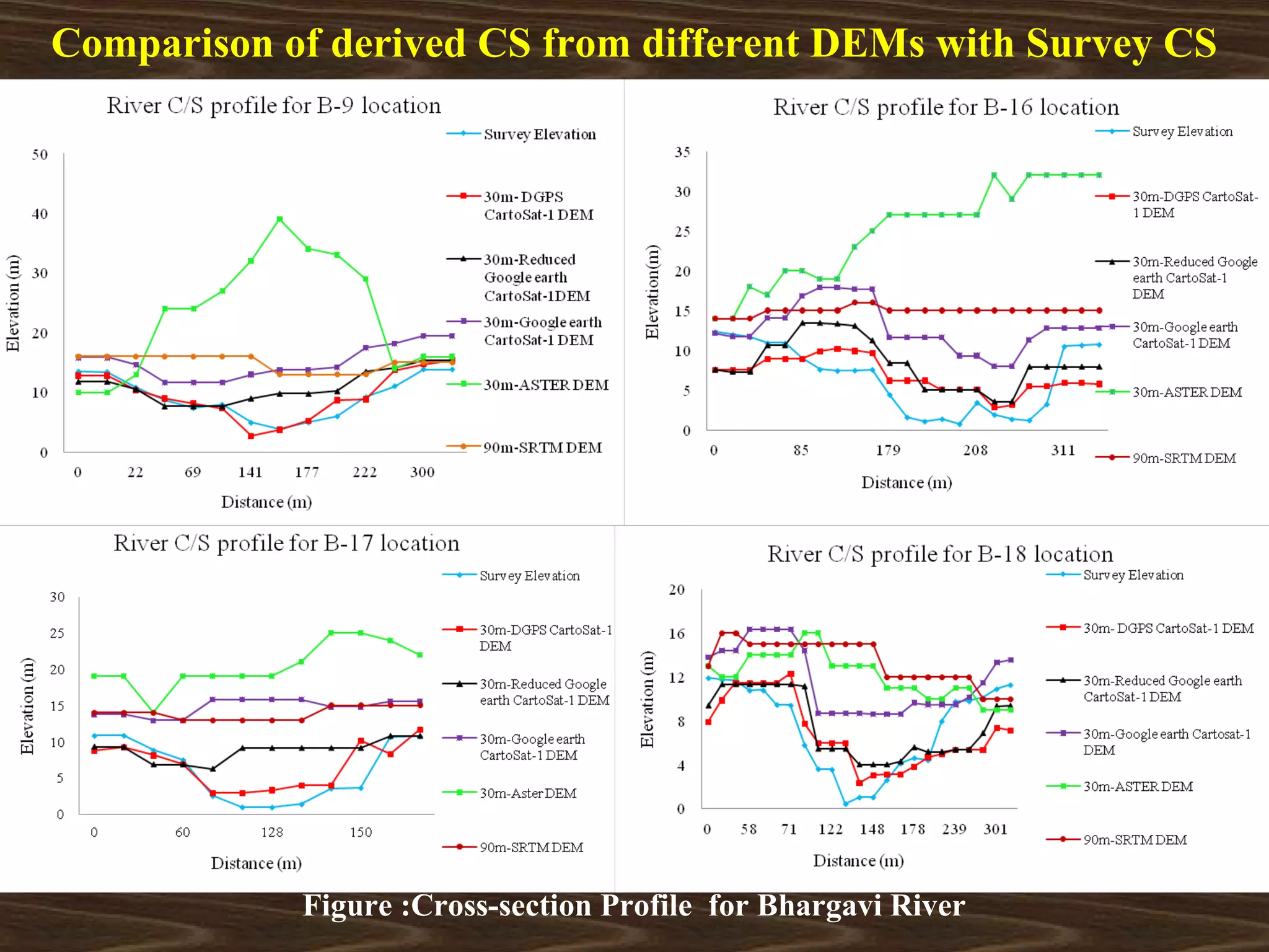
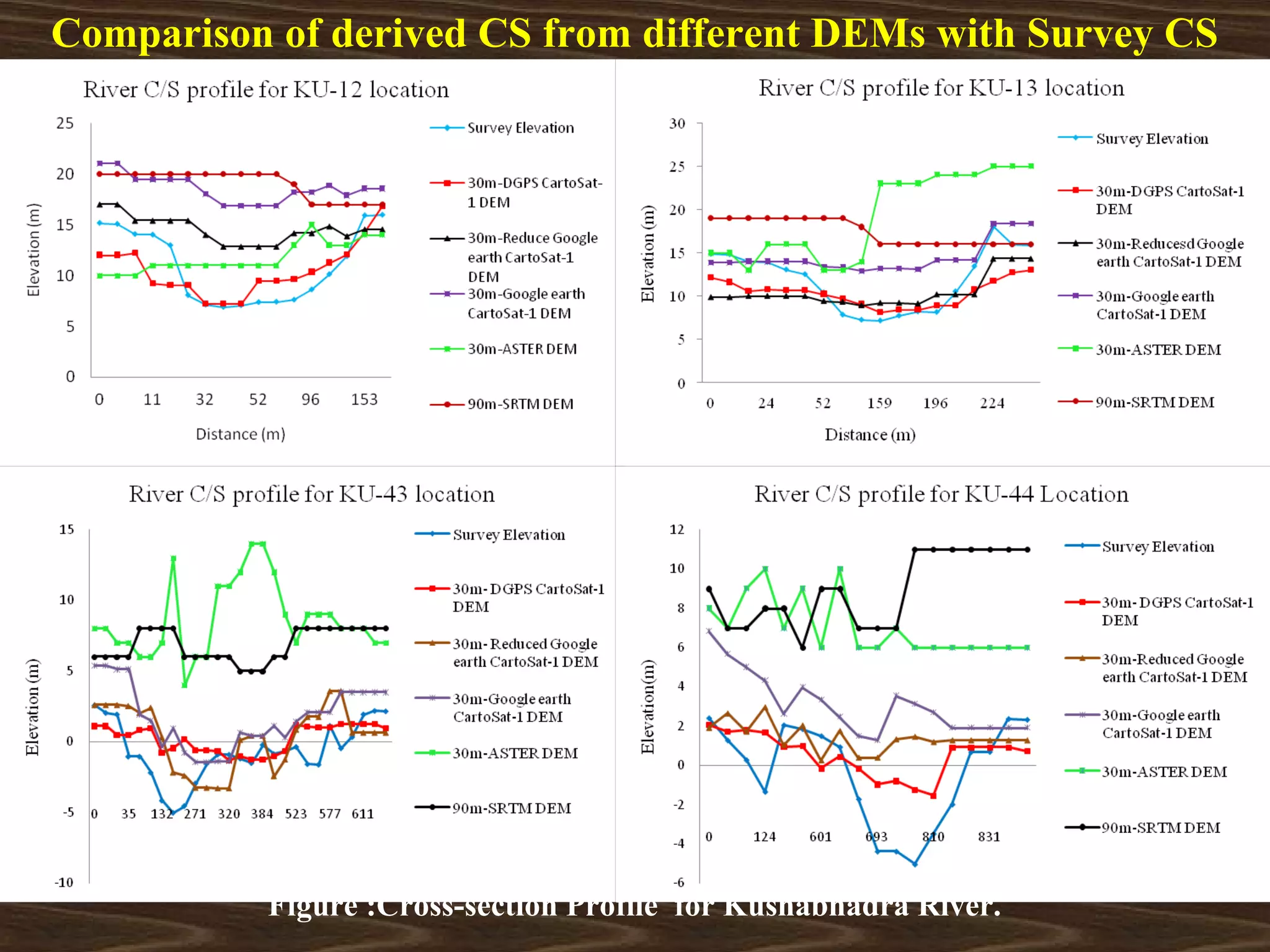
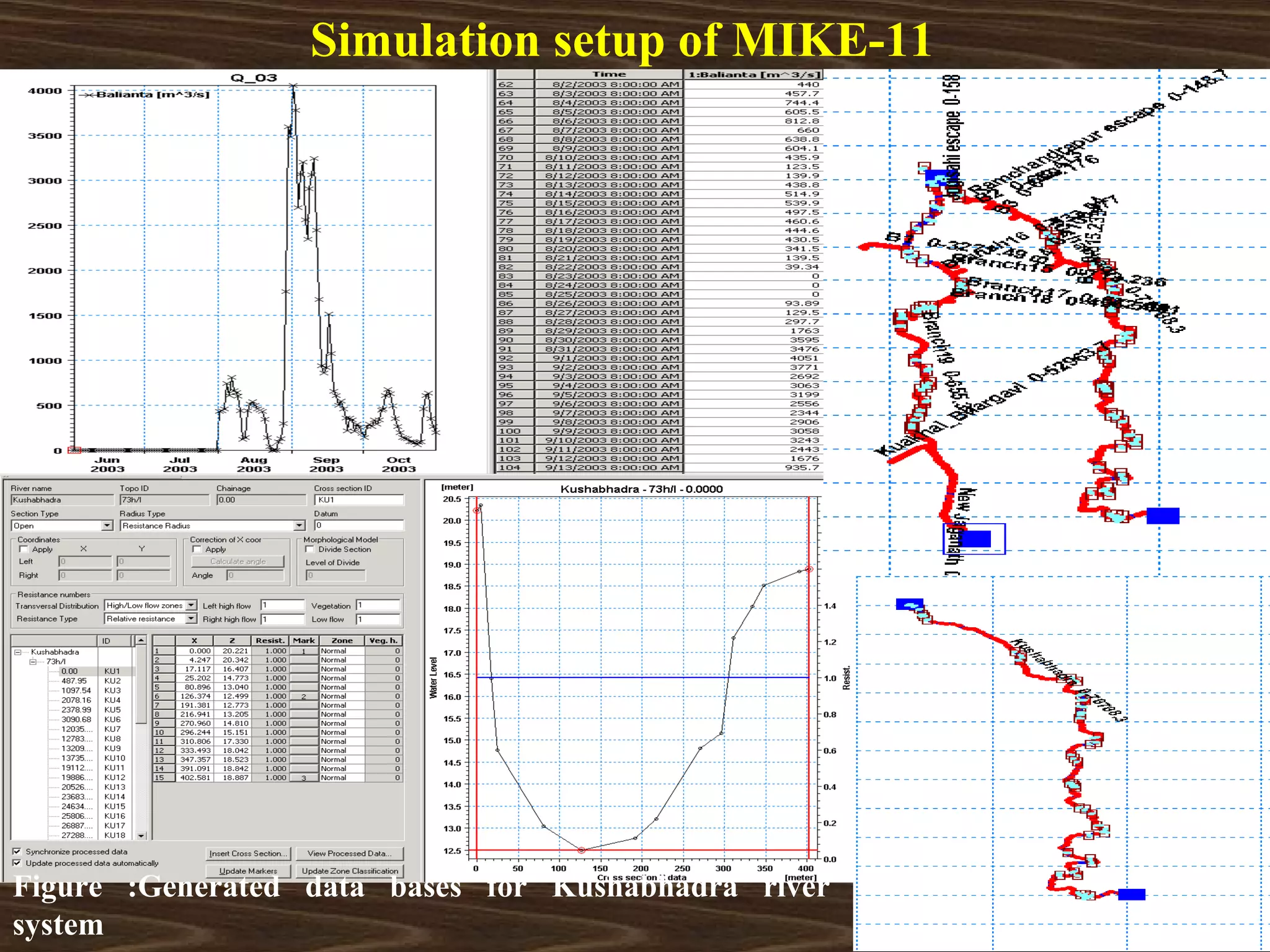
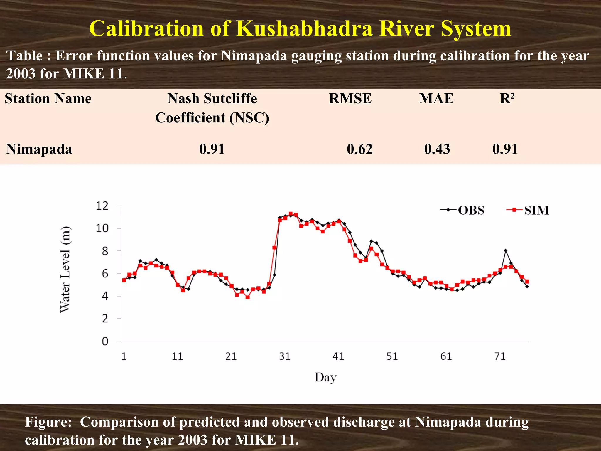
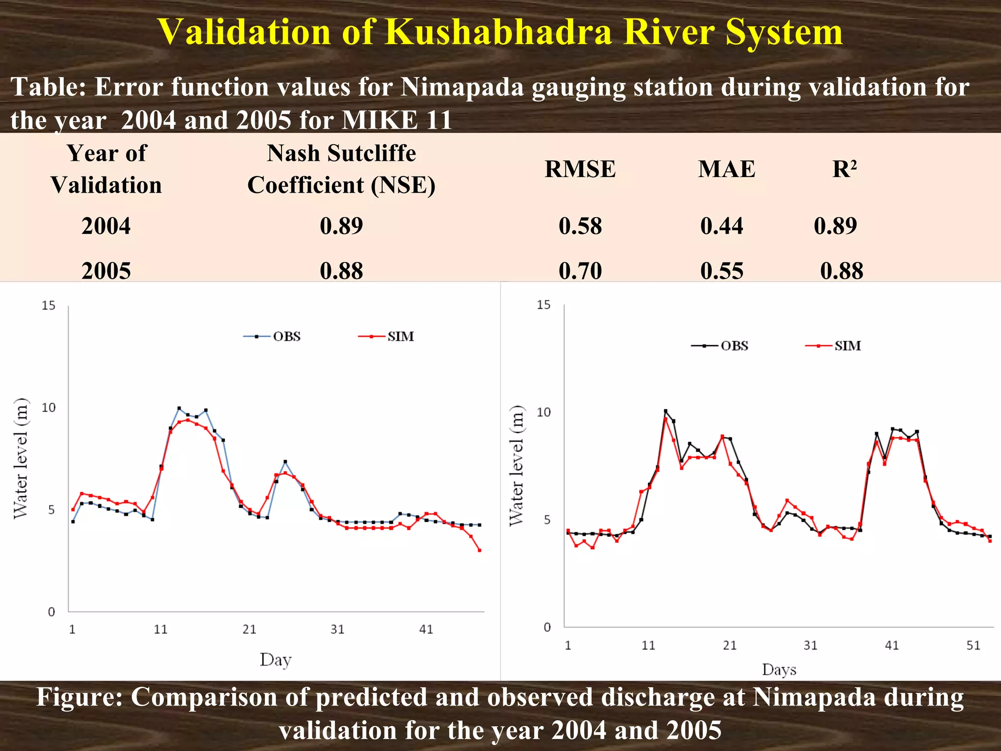
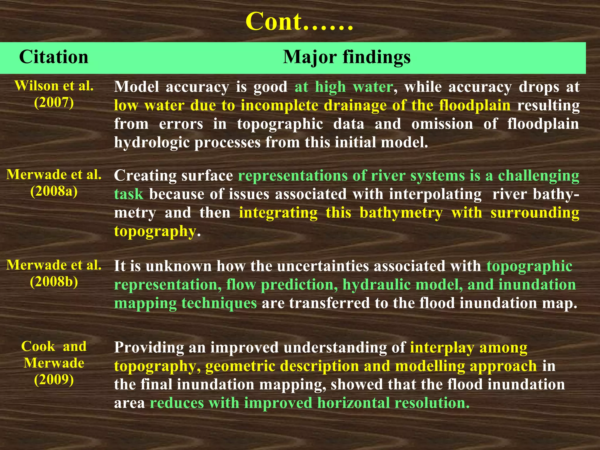
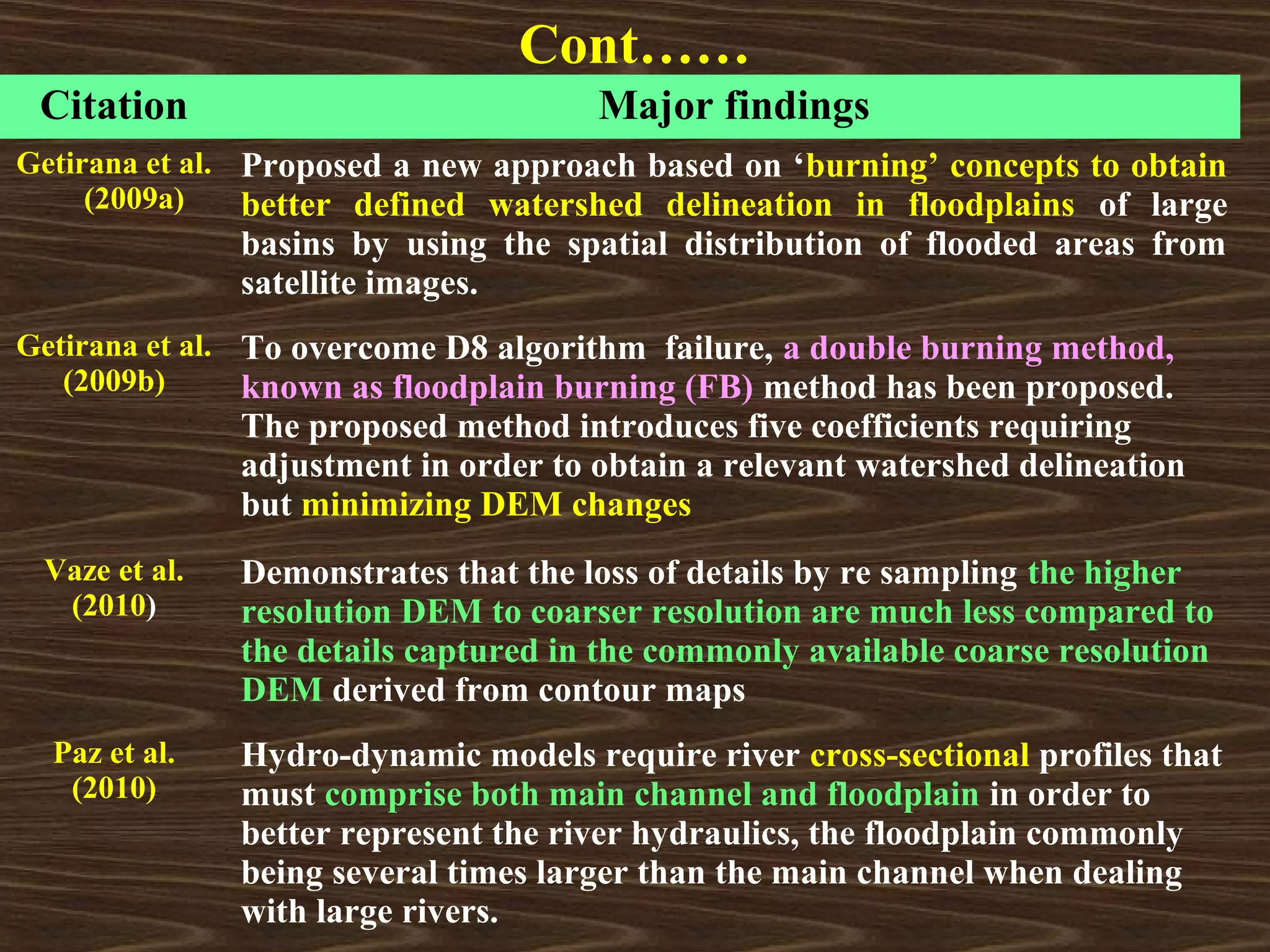
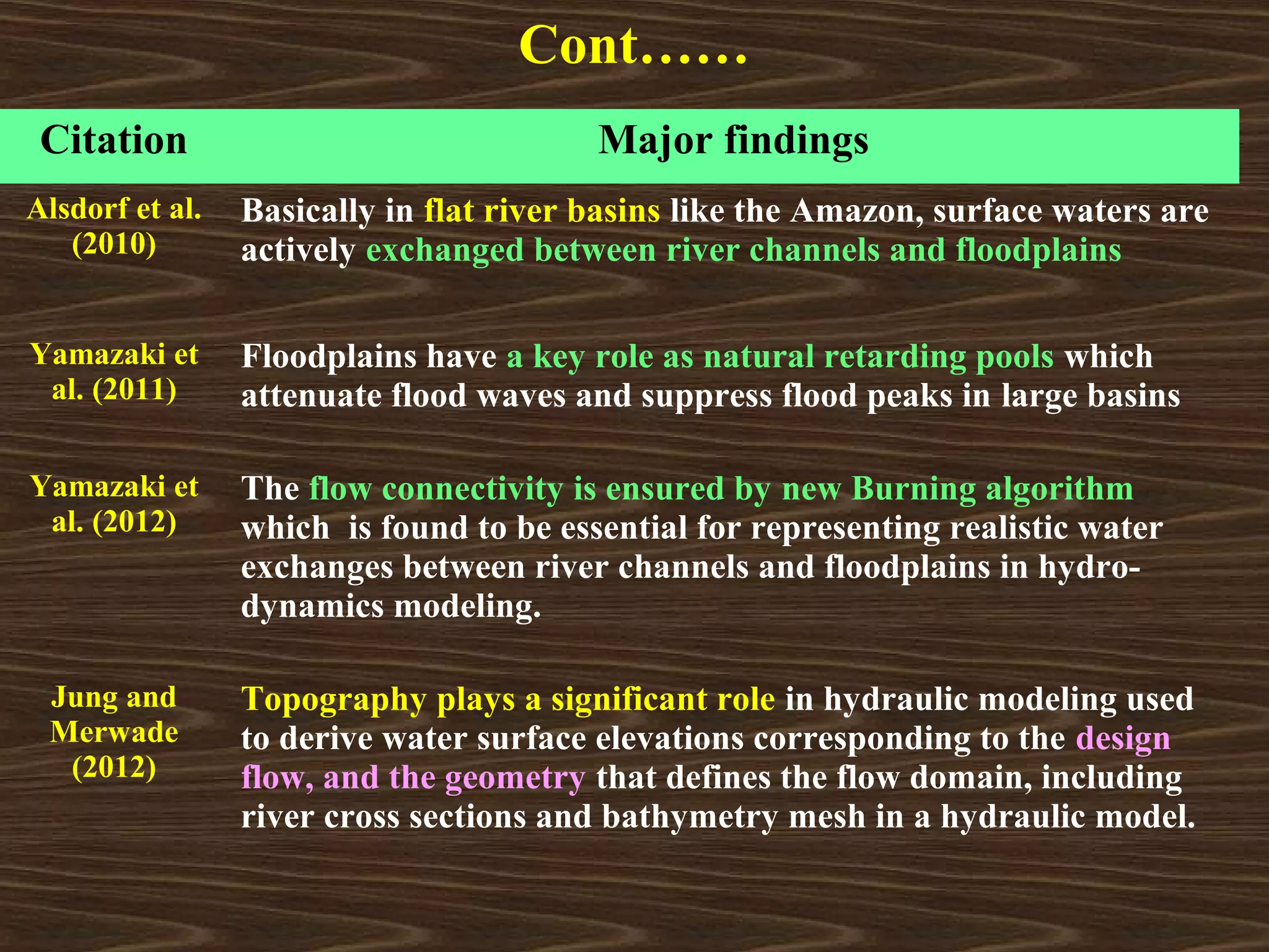
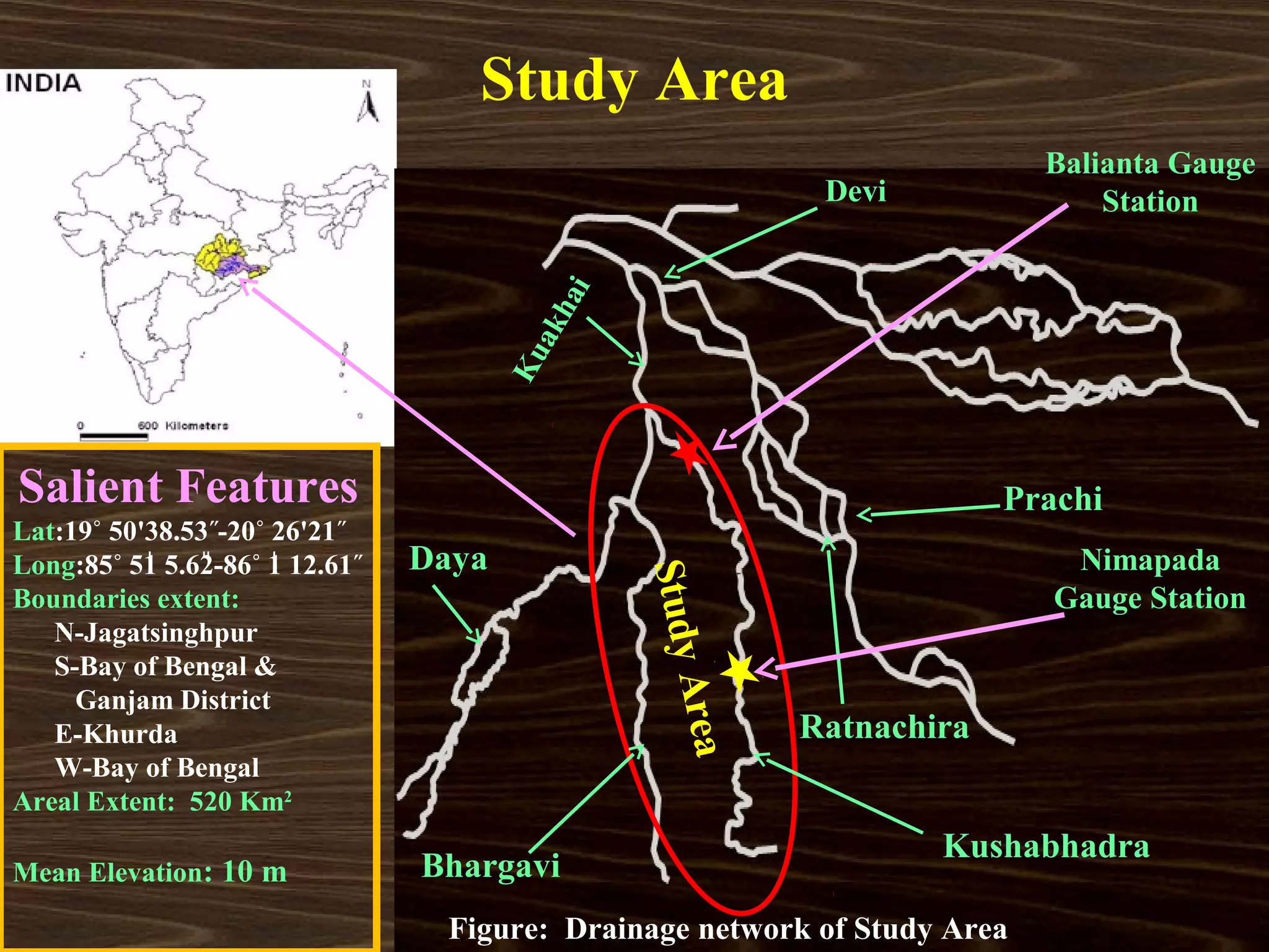
This document discusses a study that compared flood inundation maps generated from DEMs from different sources for an area in Odisha, India. The study generated Cartosat-1 DEMs and compared their accuracy to SRTM and ASTER DEMs by assessing elevation errors against field survey data. It also modeled river flow using MIKE11 and validated results against gauge station data. The study found that Cartosat-1 DEMs had less elevation error than other DEMs and improved flood inundation mapping accuracy.

![Data Used
Satellite Stereo pair
CartoSat-1(Image paired Captured in 2008 and 2009)
Field Survey Data
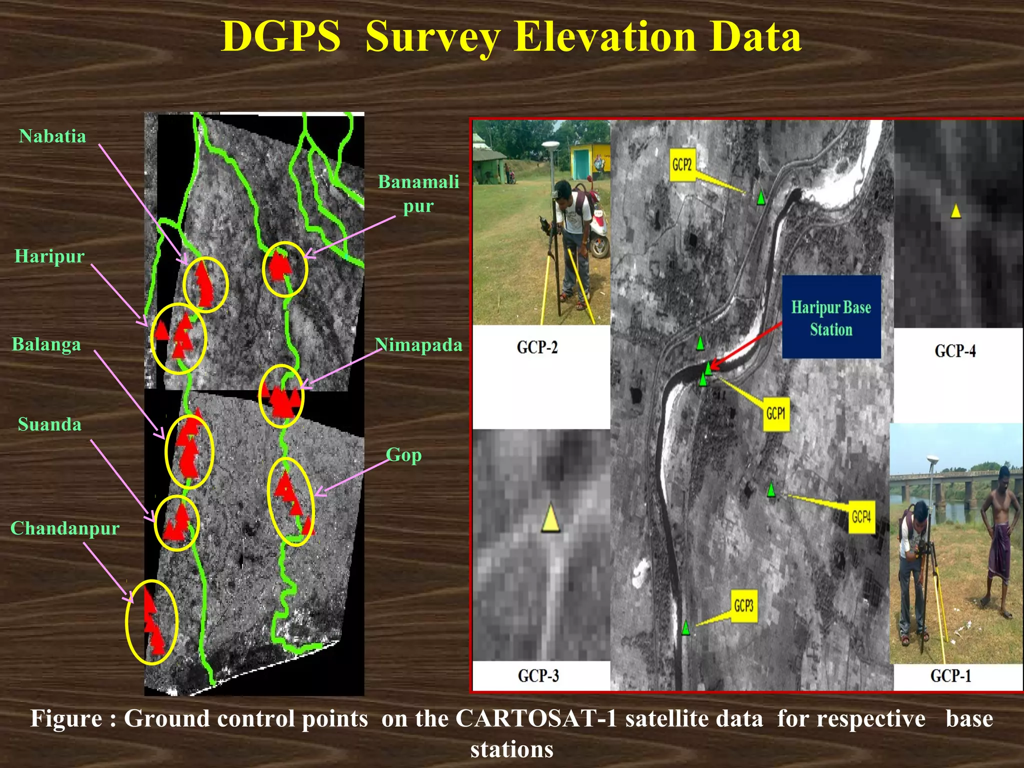
Differential Global Positioning System (DGPS) data
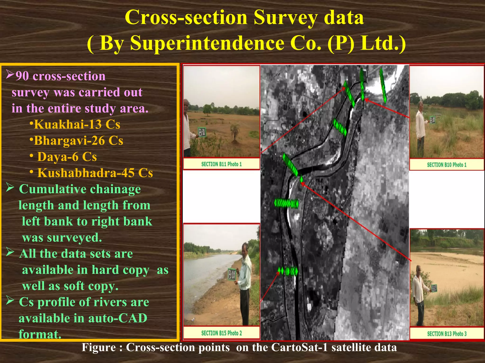
Cross-section Survey data (Superintendence Co. (P) Ltd.)
DEM Data
90m- Shuttle Radar Topography Mission (SRTM)
[http://srtm.csi.cgiar.org]
30m-Advanced Space borne Thermal Emission and
Reflection (ASTER) [https://earthexplorer.usgs.gov]
30m-CartoSat-1 [http://bhuvan.nrsc.gov.in]
Discharge and Water level Data
Balianta & Nimapada Gauge Station](https://image.slidesharecdn.com/mtechseminarondemuncertainty-130225054542-phpapp01/75/M-tech-seminar-on-dem-uncertainty-6-2048.jpg)