Download as PDF, PPTX
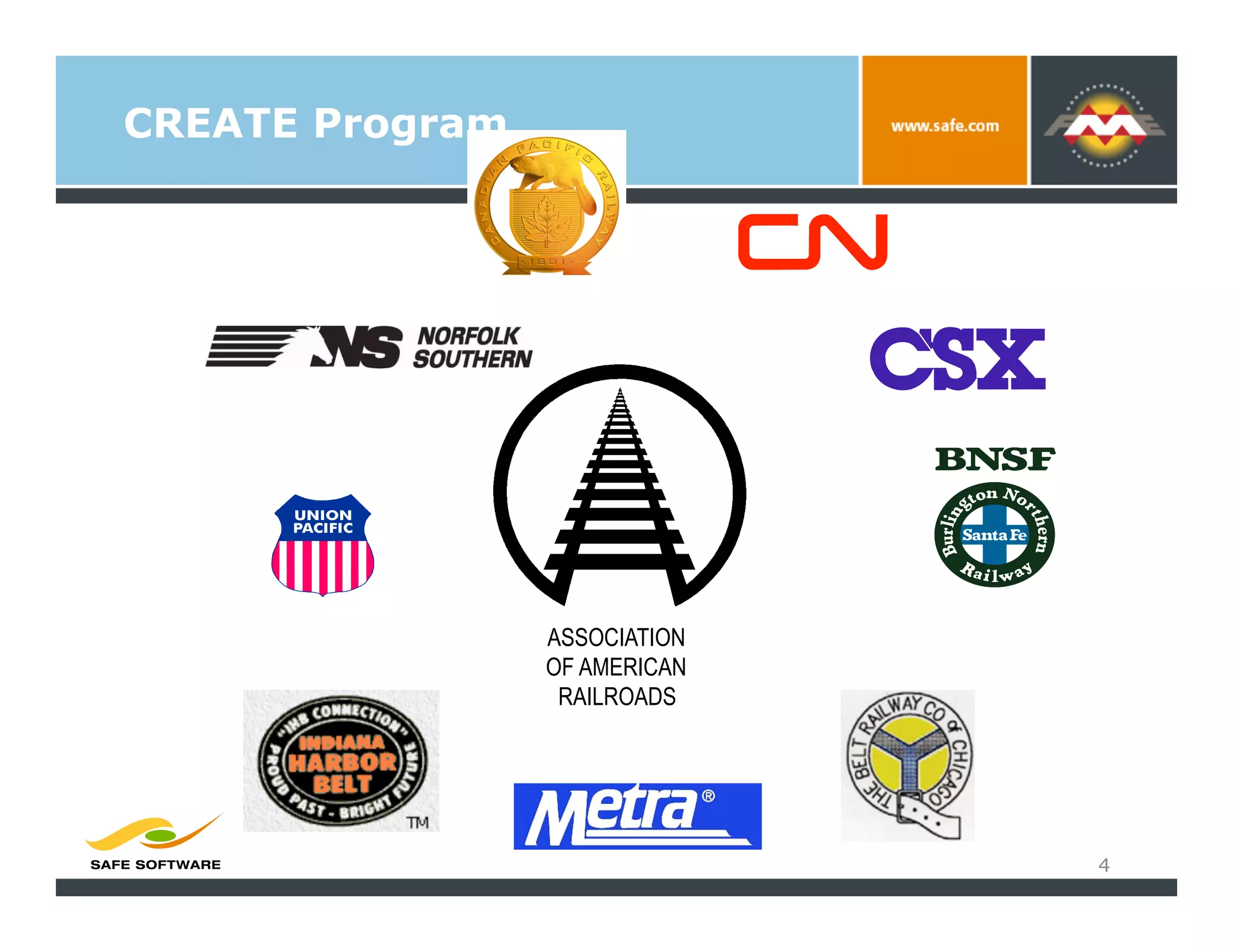
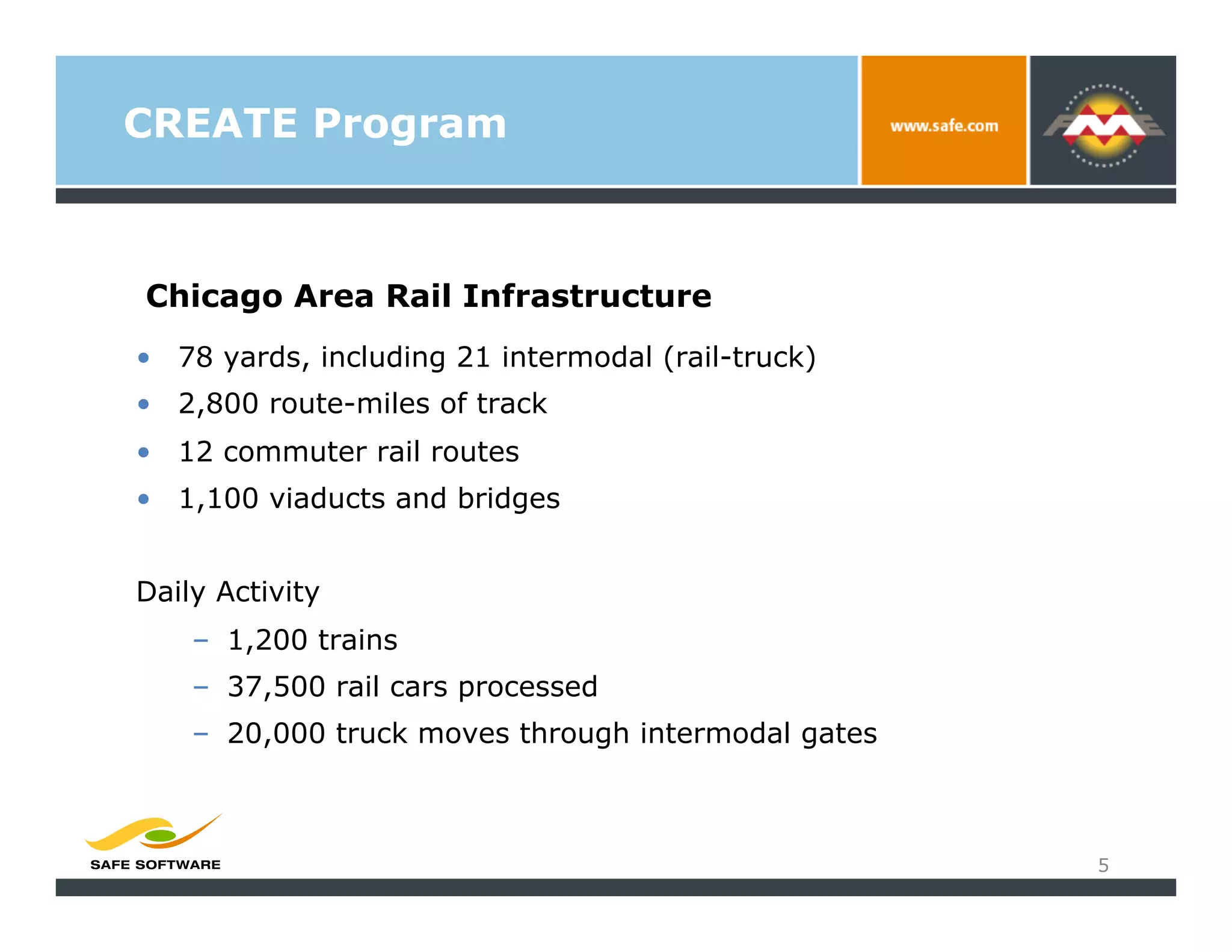
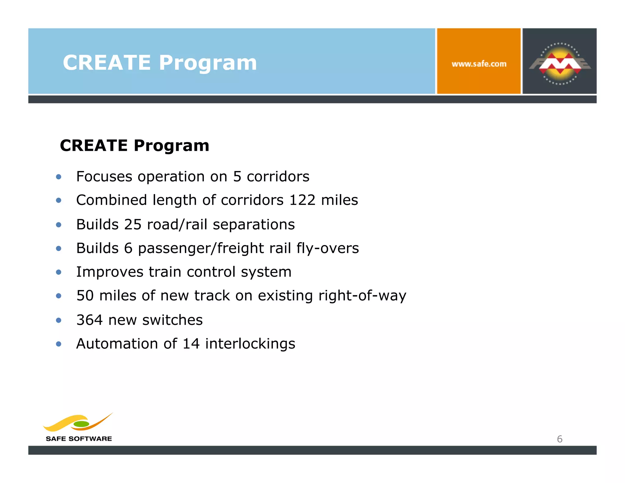
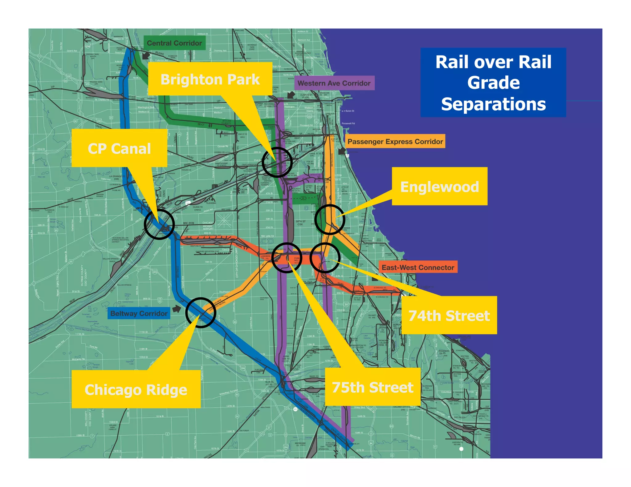
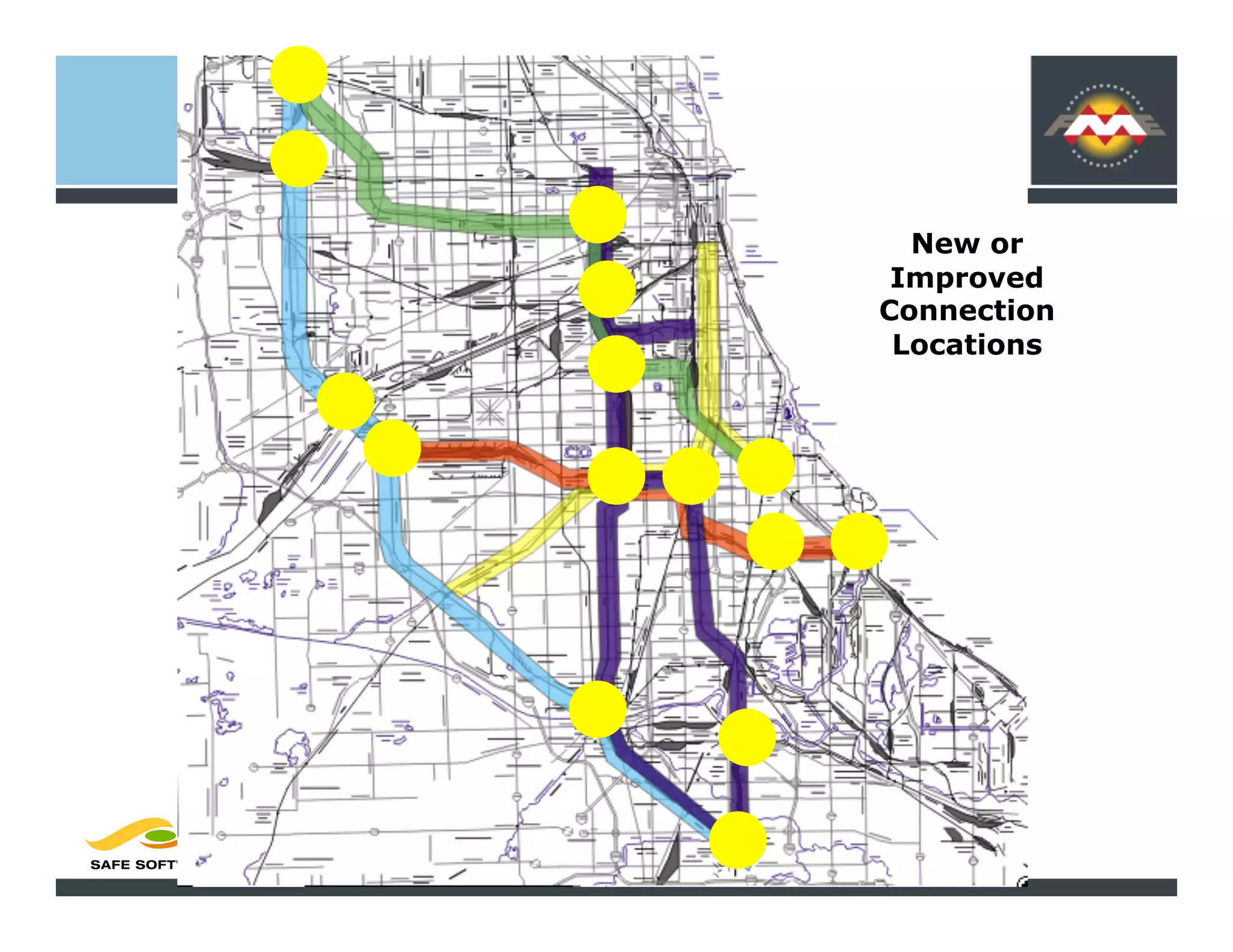
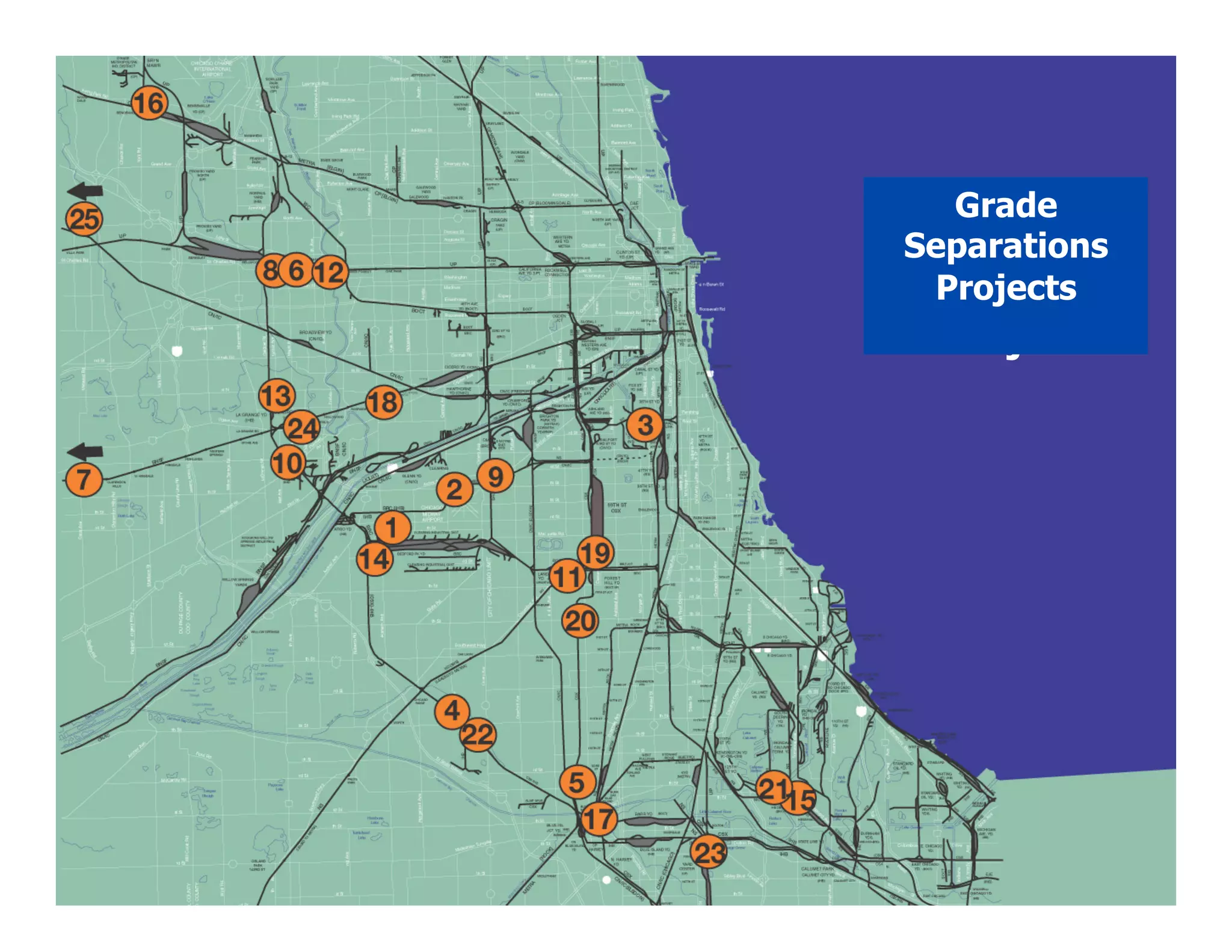
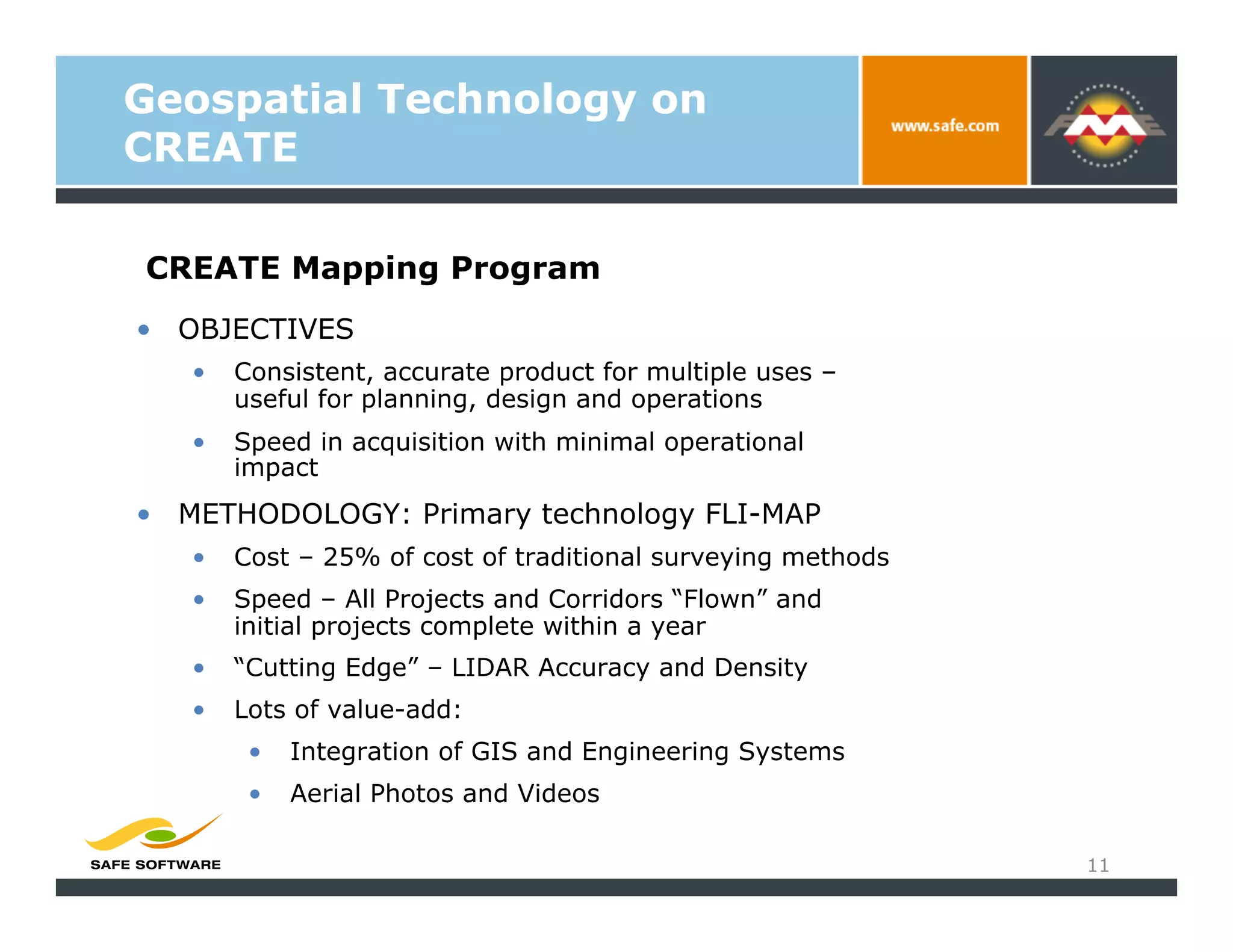
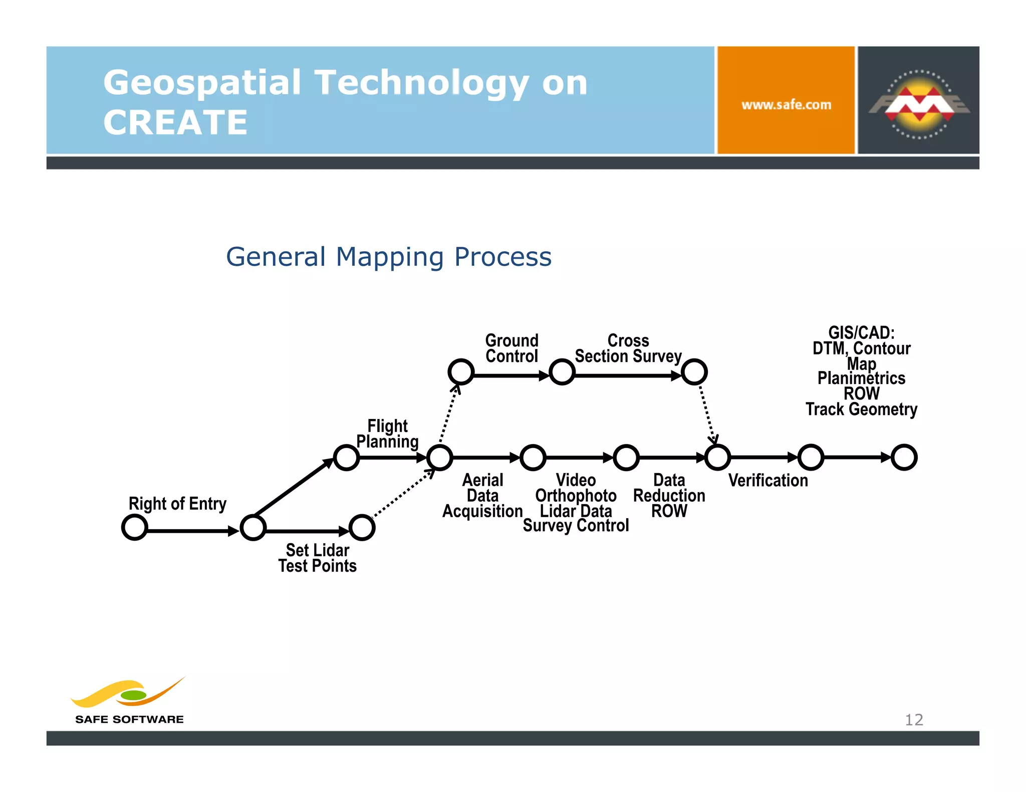
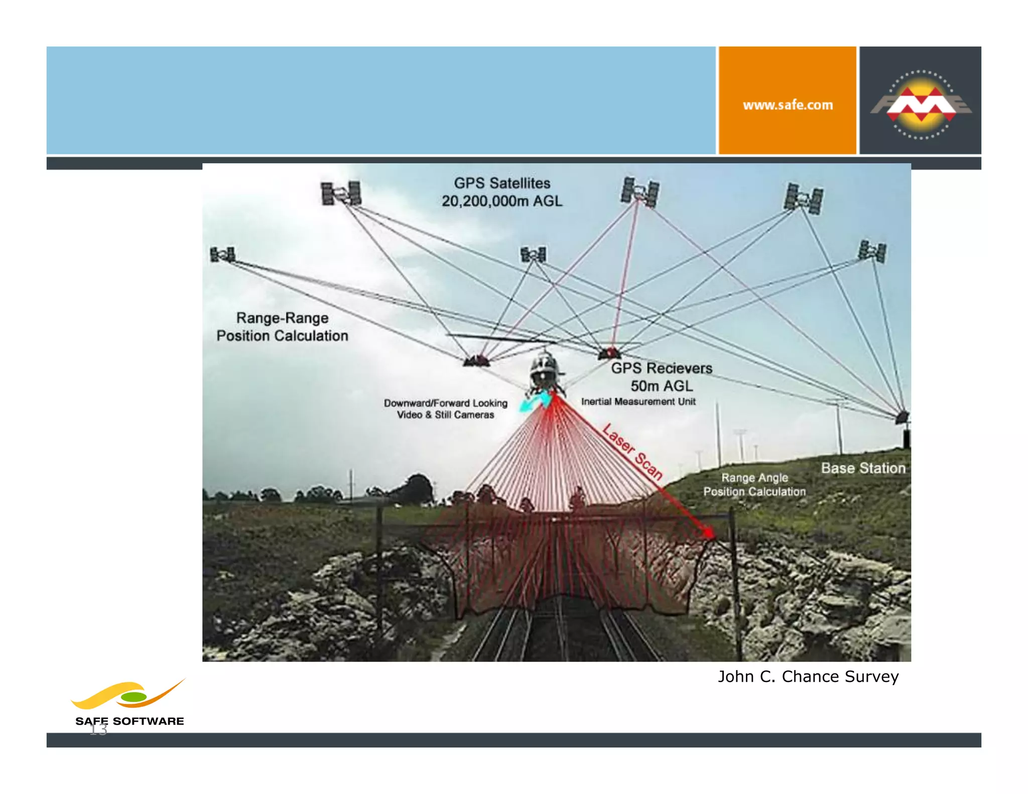
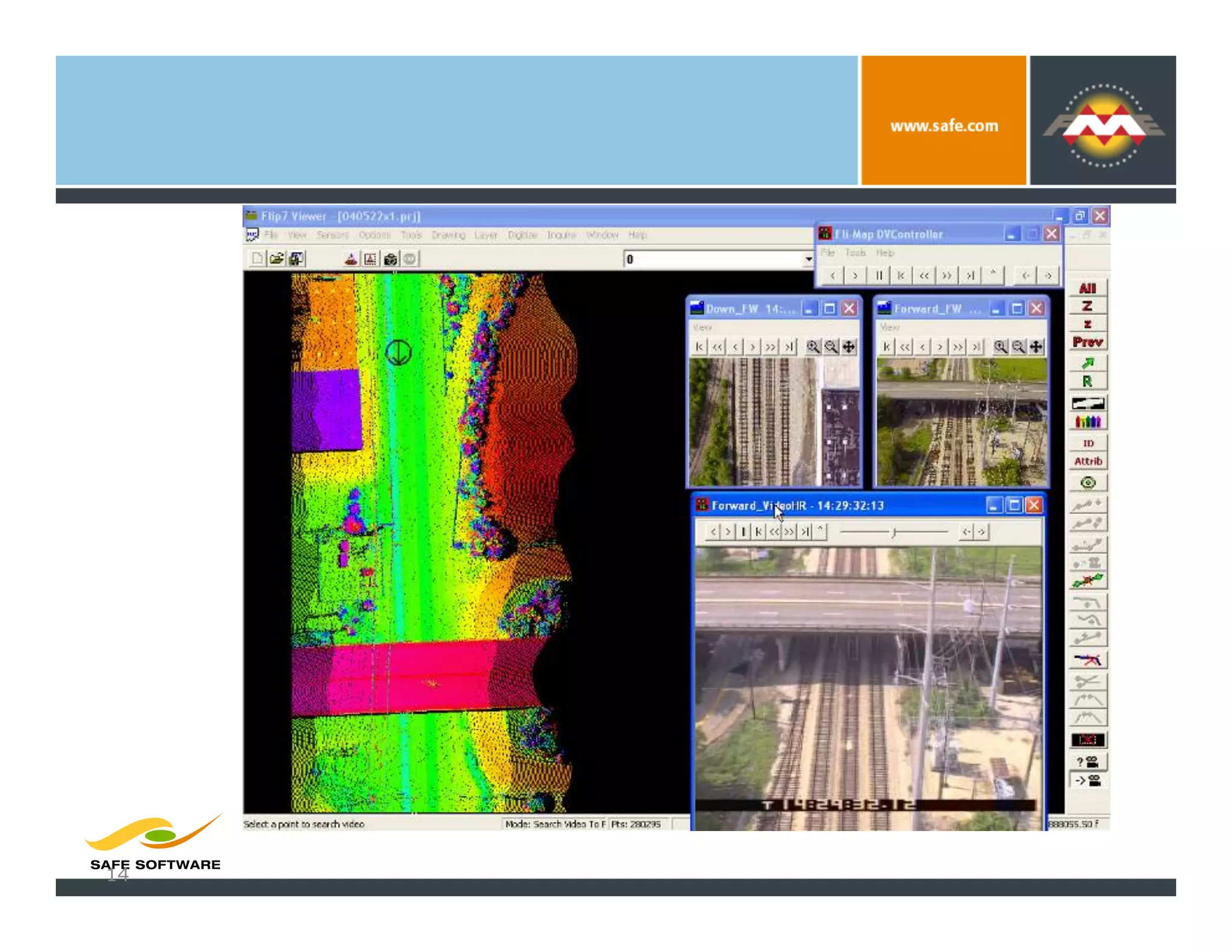
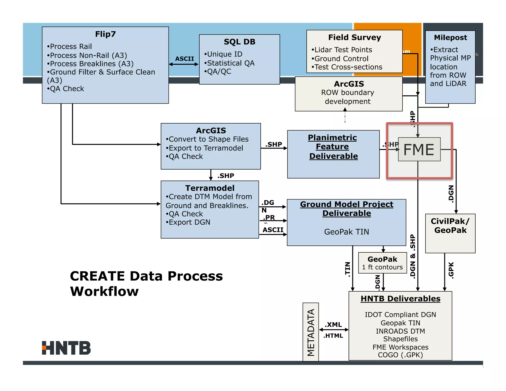
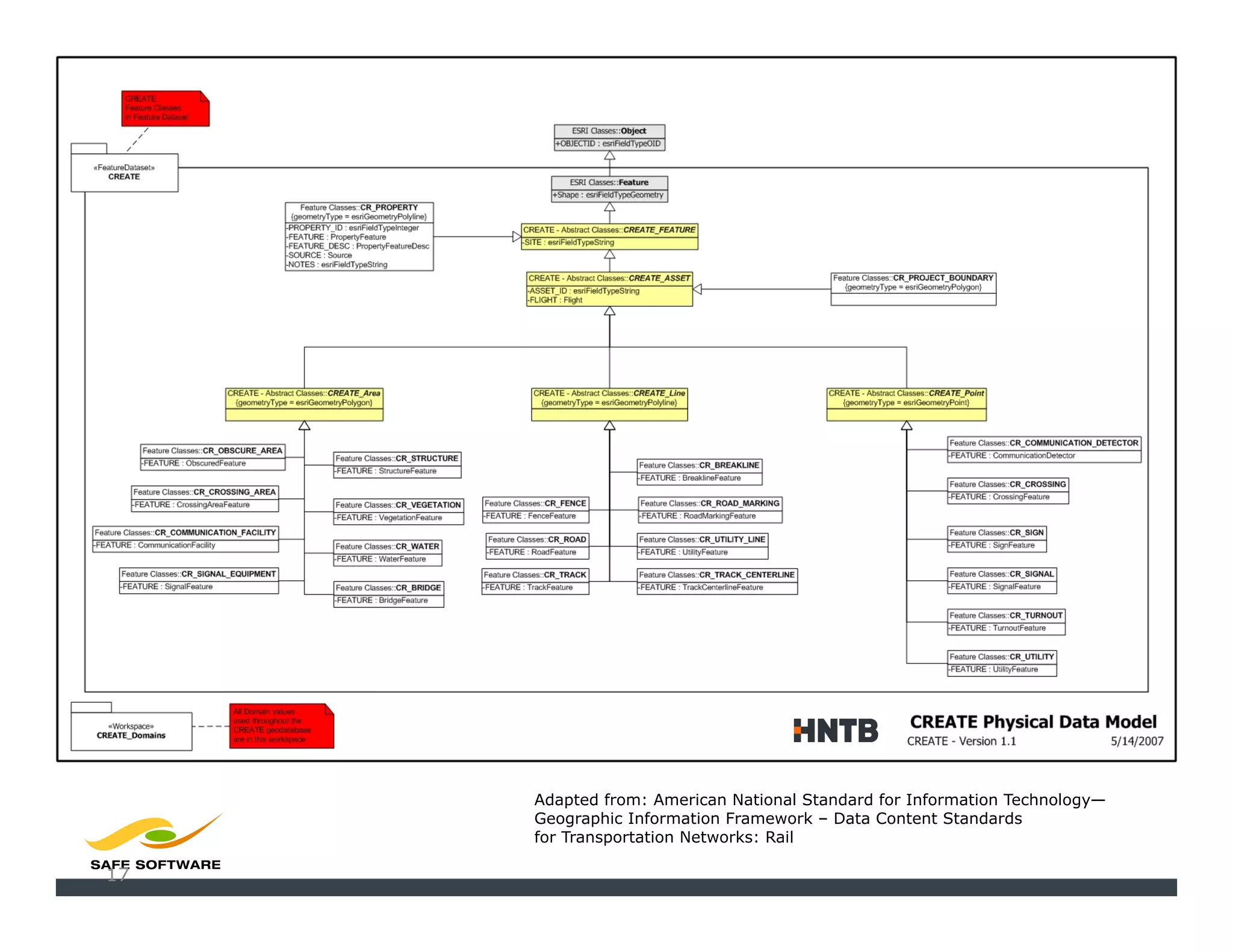
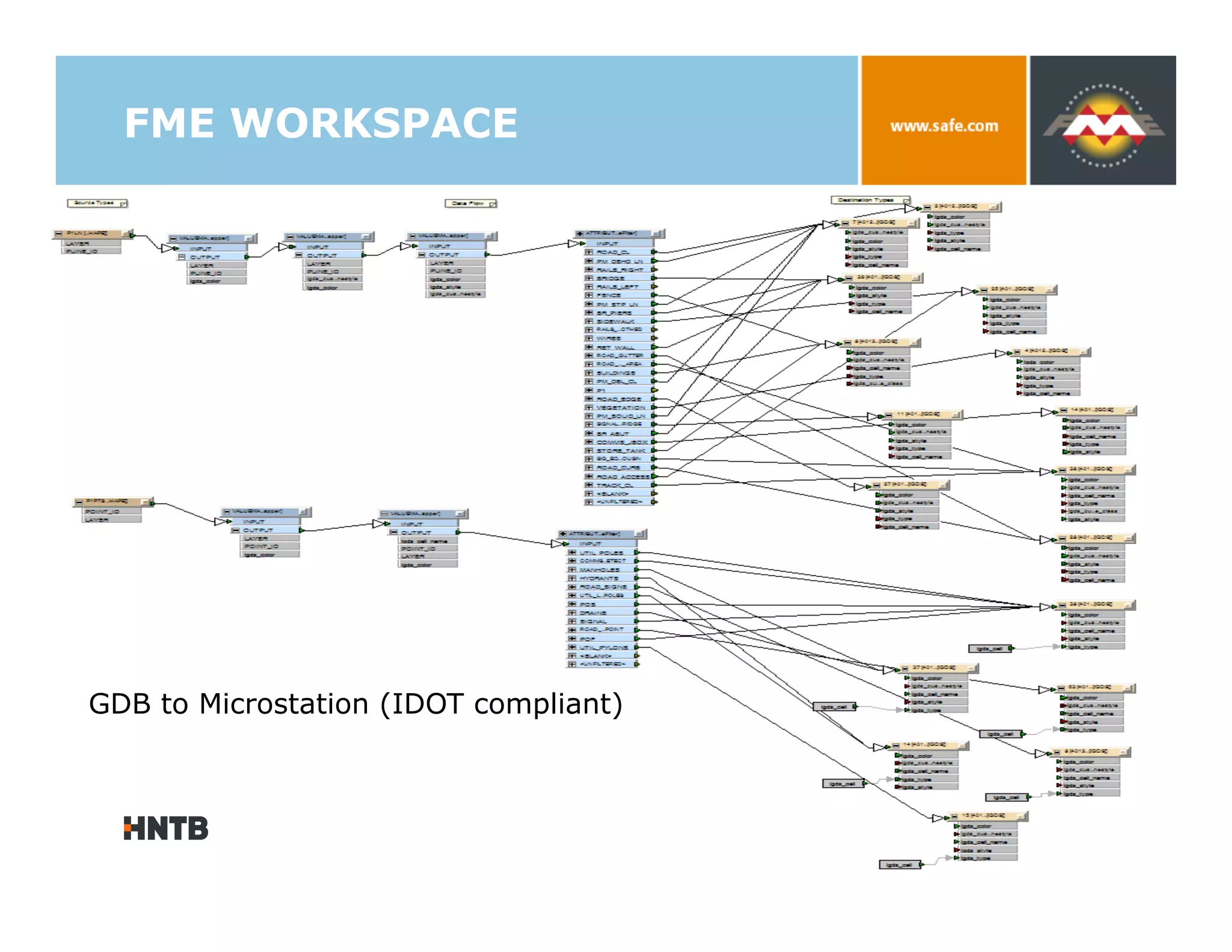
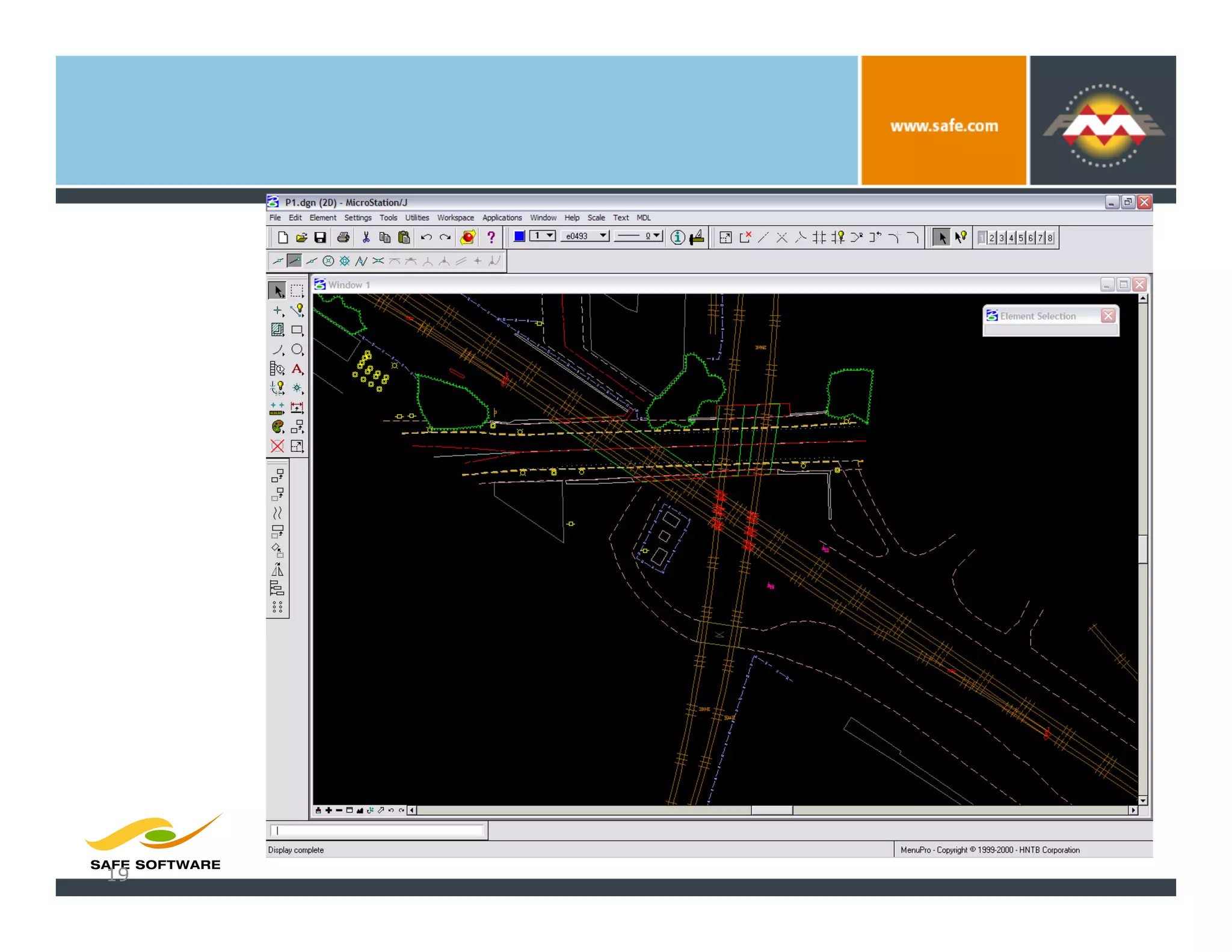
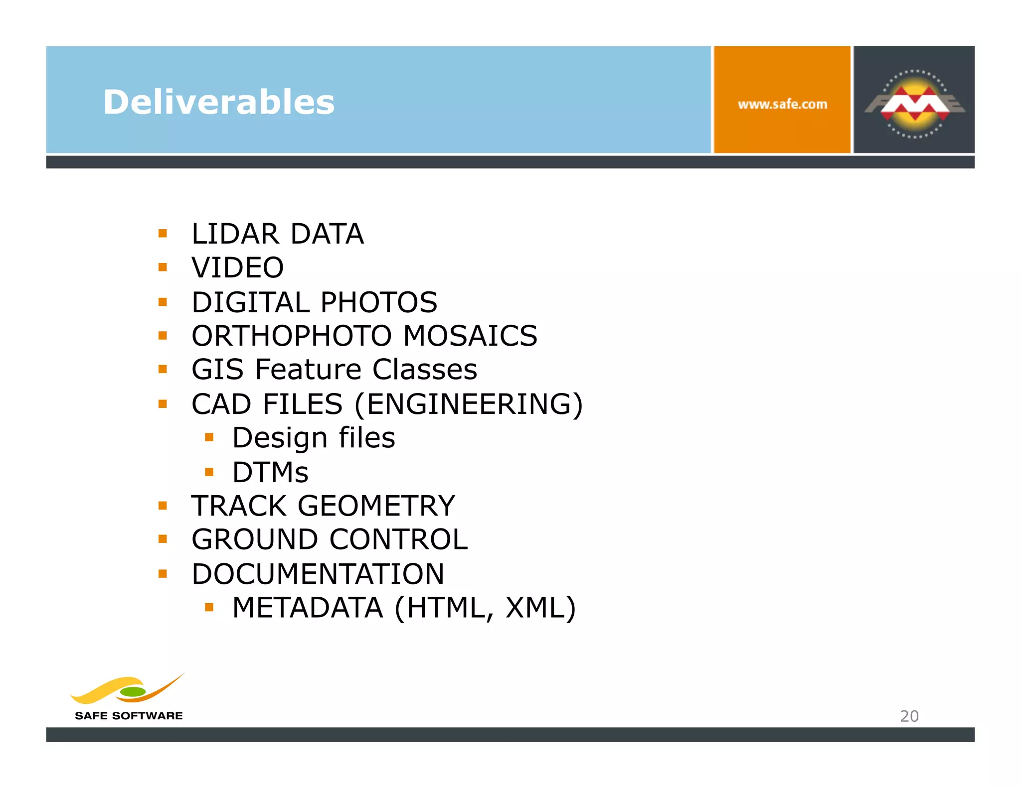

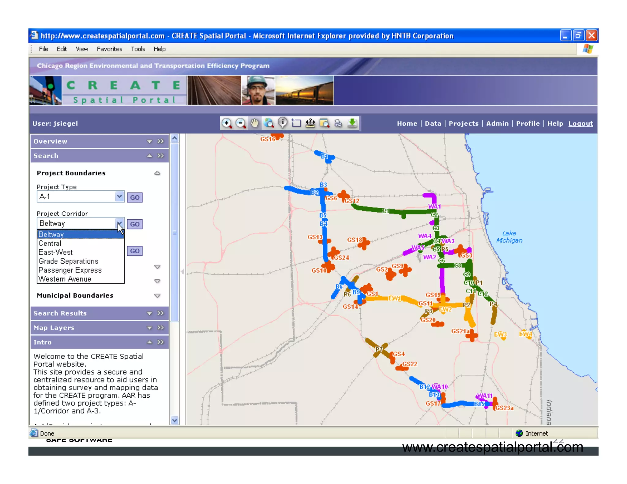
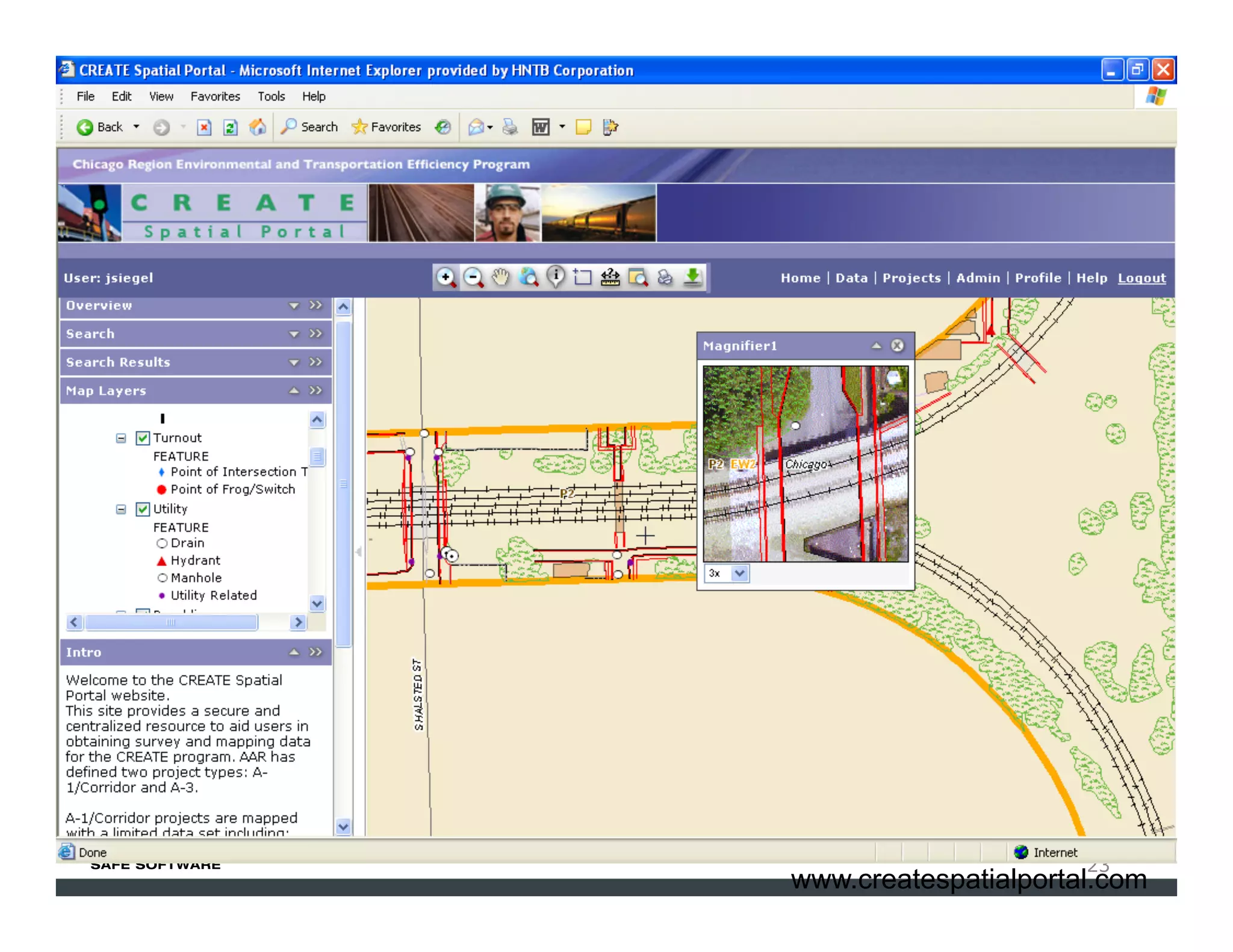
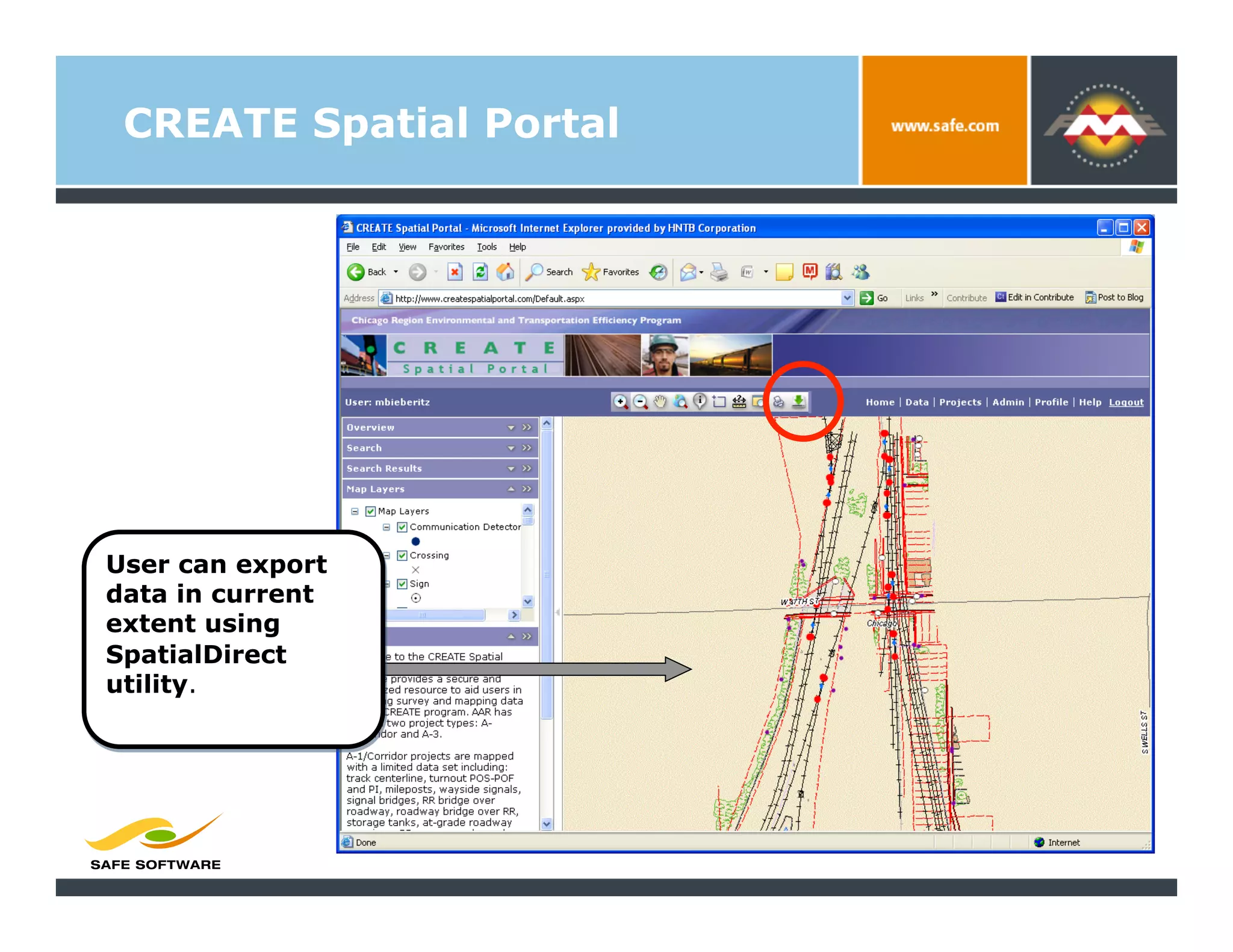
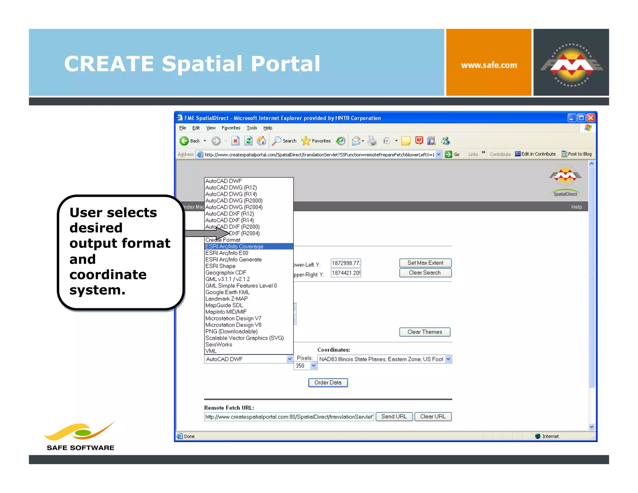
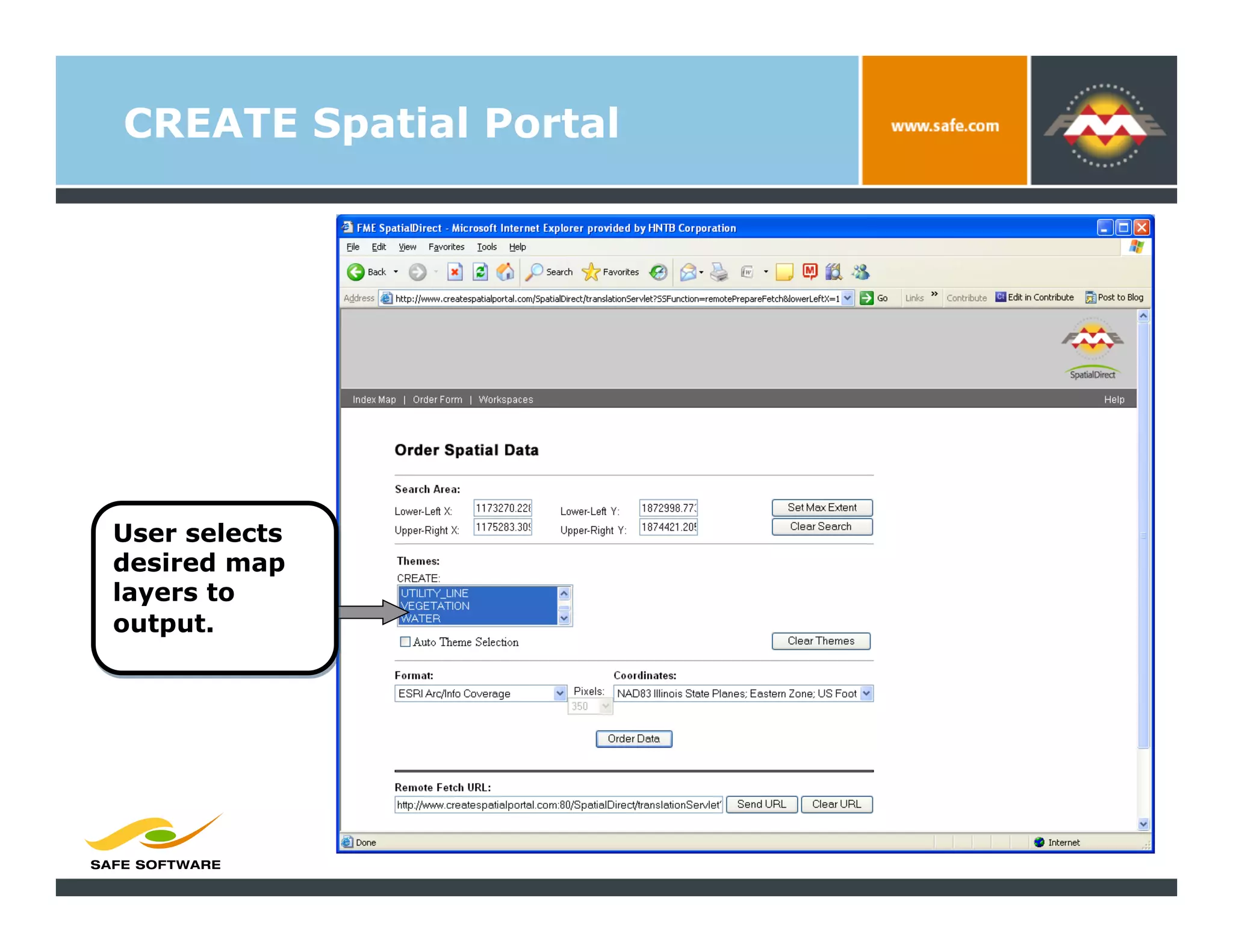
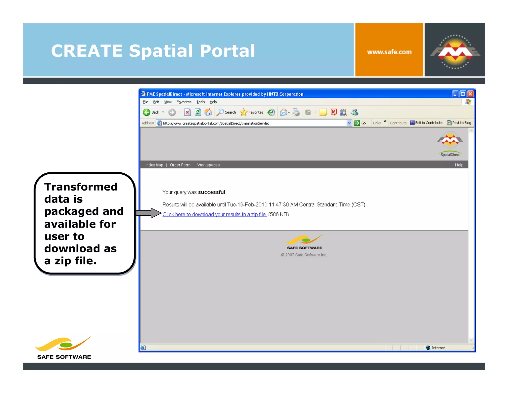
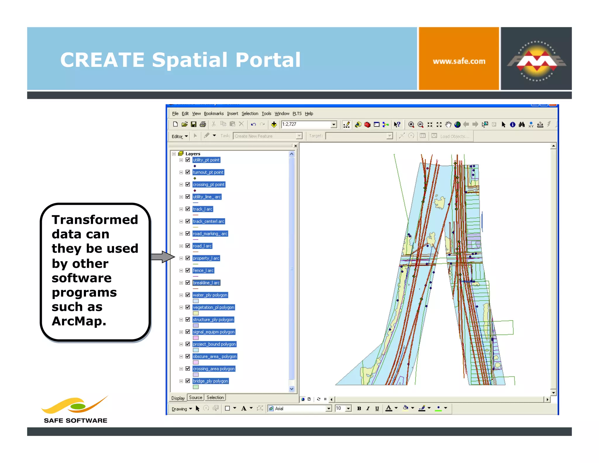
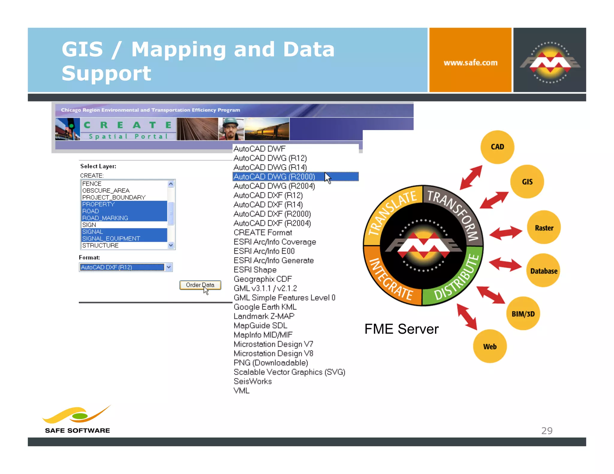
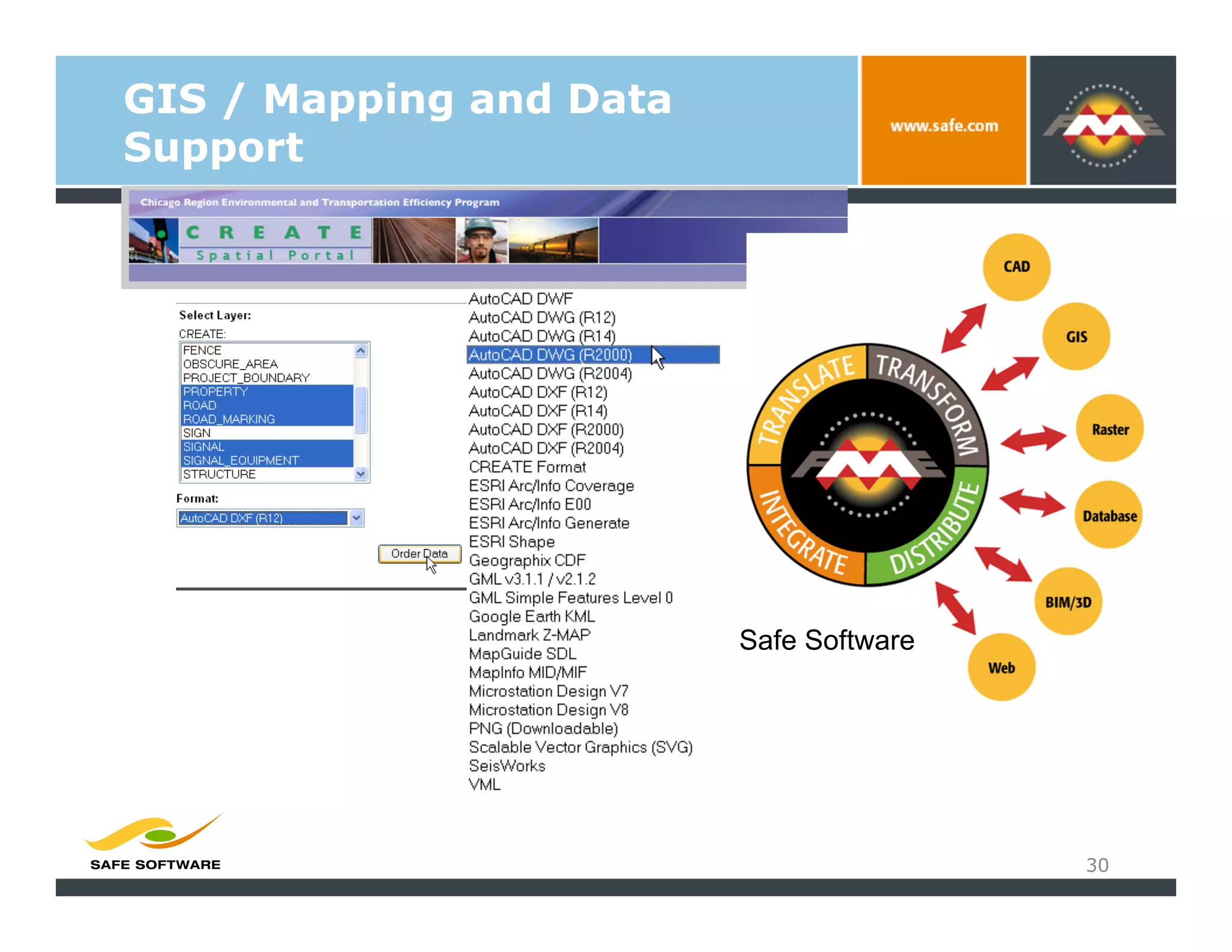


The document details the CREATE program, focusing on utilizing geospatial technology to enhance transportation efficiency and rail infrastructure in the Chicago region. It outlines objectives, methodologies, and deliverables, including the integration of LIDAR technology for data accuracy and reduced costs compared to traditional surveying methods. Additionally, it discusses the implementation of a spatial portal for data extraction and user access to various data formats.