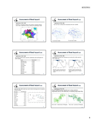
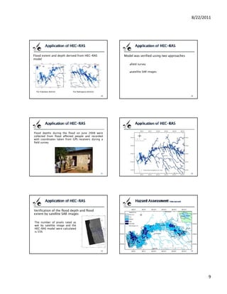
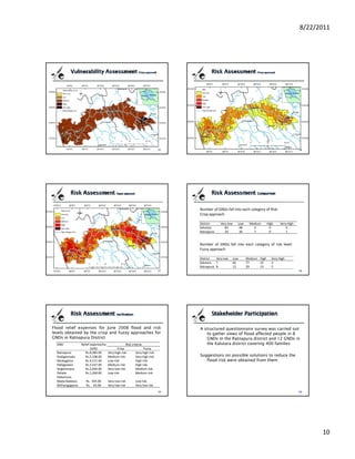
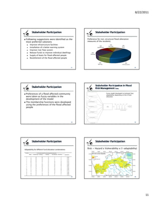
Exploring Sicily Your Comprehensive Ebook Travel Guide
PhD Presentation
1. 8/22/2011
FLOOD RISK MANAGEMENT
INCORPORATING
STAKEHOLDER PARTICIPATION
AND Introduction
CLIMATIC VARIABILITY Objective
PhD Dissertation Defence Presentation Study area and Data used
Hemalie Kalpalatha Nandalal Methods used
Supervised by
Dr. U.R. Ratnayake Results
Department of Civil Engineering
University of Peradeniya Conclusions
Peradeniya
Sri Lanka
24th August 2011
Problems related to flooding have greatly increased There has been a shift in paradigms from technical-
over recent decades because of oriented flood protection measures towards non-
population growth structural measures to reduce flood damage
development of extensive infrastructures in close Flood risk management is not only assessment and
proximity to rivers mitigation of flood risk, but also a continuous and
increased frequency of extreme rainfall events holistic
h li ti societal adaptation and mitigation
i t l d t ti d iti ti
Governments all around the world spend millions of There is a growing demand for better approaches
funds to reduce flood risk by taking flood protective for risk identification and assessment particularly at
measures; mainly in two different approaches local level
Structural measures (levees, flood walls, channel
improvements and storage reservoirs) Main scope of this research is to find non-structural
Non-structural measures (flood plain zoning, flood measures that can be taken to reduce flood risk
proofing, land use conversion, warning and evacuation, incorporating climate changes and stakeholders’
relief and rehabilitation, and flood insurance views
Investigate and incorporate climatic Kalu-Ganga river basin in Sri Lanka
variability in the process for managing flood
Population density varies from
risk 100 to 1000 persons per sq. km
in the basin area
Evaluation of flood risk using conventional
method and investigating the application of
fuzzy logic in risk assessment
Inquire how to create a management process River basin is located in an
area that receives very high
with enhanced participation of stakeholders rainfall where average annual
rainfall varies from 2000mm
Development of an information system for to 5000mm
decision makers
1
2. 8/22/2011
Kalu-Ganga river basin in Sri Lanka Kalu-Ganga river basin in Sri Lanka
Administrative divisions of the Locations of rainfall and
Kalu-Ganga river basin discharge gauging stations
Topographical data Hydro‐meteorological data / Census data
On‐line accessible topographic data sets used in this study
Type Source Description
Data set Link Coverage Horiz. Res. (m)
SRTM http://srtm.csi.cgiar.org/SELECTION/inputCoord.asp International ~ 90
Daily Rainfall data Meteorological Daily rainfall during 1986 to 2009 at 14 gauging
Department, stations
USGS http://edc.usgs.gov/products/elevation/gtopo30/gtopo30.html International ~ 900
Sri Lanka
NGDC http://www.ngdc.noaa.gov/mgg/topo/globe.html International ~ 900 Daily rainfall from 1901 to 2009 at rainfall gauging
station no. 14
GIS data used in the study
Type Scale Date of Production Source
Discharge data Irrigation Discharges at 3 gauging stations) from 1986 to
Contour Map, Land use Map, Spot heights, 1:10,000 2002 Survey Department, Sri Lanka Department, 1996 and years 2003 and 2009
Administrative boundaries Sri Lanka
LiDAR Data 2005 Survey Department, Sri Lanka Census data from the Census and Statistic Department of Sri Lanka as of
2001
Cross section data of the Kalu‐Ganga river at 2007 NBRO
100 m interval
Satellite data Field data
Social survey
Based on a sample size calculation (WHO, 2005)
200 households in each district were surveyed
Satellite/Sensor Date Source Remarks
ALOS/PALSAR 3rd March 2008 JAXA/GIC Dry day
Flood depth records
ALOS/PALSAR 3rd June 2008 JAXA/GIC Two days after a major flood At random points where flood depths could be
found from either from people or marked
surfaces were recorded with GPS coordinates
2
3. 8/22/2011
Estimation of climate variability Rainfall gauging stations were selected
Long term rainfall data were tested using
Flood hazard, vulnerability and risk standard tests
assessment
Different approaches were tested to identify any
Stakeholder participation in flood risk trend that exists in the data series to predict
management rainfall with 0.01 probability (rainfall with 100
year return period)
Using standard trends available in Microsoft Exel
Formulation of decision support system Using the parameters of the Gumbel distribution
Redistribution of rainfall among the available
rainfall gauging stations
Estimation of flood hazard Application of Rainfall-runoff model
Application of Rainfall-runoff model
Application of Inundation model
Two approaches were used to assess flood
risk
Crisp approach and
fuzzy approach
3
4. 8/22/2011
Application of inundation model Hazard assessment (for th GN division
Depth
ND
∑ A(i, j ) ⋅HI i ( j )
j =1
HFD (i) = ND
∑ A(i, j )
Area j =1
Area under flood in land unit i
HFA (i ) = × 100
Total area of land unit i
Hazard assessment (for th GN division population density (for th GN division
Standardization Poluation
HF (i ) VFD (i) =
HF S (i ) = Land area
HFmax
Hazard Factor
dependency ratio (for th GN division
HF (i ) + HF (i )
S S
HF (i ) = D A
number of persons under age 20 + number of persons aged 55 or over
2 VFA (i ) = ×100
Total population
Similar to the Hazard factors, both of these
In general, risk incorporates the concepts of
were standardized
hazard and vulnerability (for th GN division
VF (i )
VF S (i ) =
VFmax
VF ( ) was taken as the hazard factor of the
land unit as given RF (i ) = HF (i ) × VF (i )
VFP (i) + VFA (i)
S S
VF (i ) =
2
4
5. 8/22/2011
The membership functions
Population density of, 36 persons per ha need not be assigned
to either ‘low’ or ‘medium’ vulnerable category, but can be a
member of both categories, having a certain degree of
membership in each category (27% low as well as 68% medium
Basic architecture of fuzzy expert system vulnerable).
Input functions were identified Fuzzy rule base
For hazard identification the average flood
depth and flood extent of each GND due to 100 The fuzzified variables are related to each other
year rainfall were taken and fuzzy membership with a knowledge‐based rule system
functions were developed The rules describing the system can be:
Vulnerability was represented by the population
density and the dependency ratio, similar to Rule 1: If population density is low and flood depth
crisp risk evaluation is low, then the risk is low.
Rule 2: If population density is low and flood depth
is high, then the risk is medium.
Adaptation is the only response available for the
risk that will occur over the next several decades
before mitigation measures can have an effect
Increasing the adaptability of affected people to
floods or any natural disaster is a main objective
of allocating funds by governments
In this research a model was developed to
allocate available funds according to preferences
of flood affected people to improve their
adaptability to floods
5
6. 8/22/2011
Increasing the adaptability or adaptive Stakeholders involved in flood events in the
capacity of the affected people will lead to Kalu‐Ganga river basin were analysed to
reduce the vulnerability to a flood or any identify the most contributing or the most
natural disaster important stakeholders
Thus the adaptability incorporated to the They were queried to investigate their
risk formula can be written as, preferences for non‐structural flood
Risk = Hazard x Vulnerability x (1- Adaptability) alleviation measures to improve adaptability
As indicated by United Nations publications. Depending on the views of affected people
the adaptability was formulated
Adaptability = f (View1, View2, ……….)
Fuzzy model was developed to assess Providing a website for people to access
adaptability depending on the views of the flood risk information is an effective way of
stakeholders informing the public about the susceptibility
Membership function was selected such that to flooding that they may otherwise not be
if 50% of the community prefer development aware off
of infrastructure there is no improvement in
adaptability by spending more than 50% of The Adobe Dreamweaver software was used
the available funds to create flood information system
Fitted trends found for long term data series
Estimation of climate variability (all with increasing trends)
Linear y = 0.041x + 74.24
Flood hazard, vulnerability and risk Exponential y = 217.2e-2E-0x
assessment Logarithmic y = 84.07ln(x) - 481.1
Power y = 2721.x-0.38
Stakeholder participation in flood risk Trend of parameters of Gumbel distribution
management was found and that was used to determine
the rainfall at different return periods due to
Formulation of the decision support system climatic variation
6
7. 8/22/2011
Parameters of Gumbel distribution for time periods of 30 years from 1901
Plot of the trend of parameters of Gumbel distribution
For Ratnapura gauging 1901‐1930 1931‐1960 1961‐1990 1991‐2009
station (1) (2) (3) (4)
Average of the data
series 150.64 163.66 152.03 158.16
St dev. of the data series 40.38 77.15 56.35 81.08441
Scale parameter (α) 0.031 0.016 0.0227 0.015
Location parameter (m) 132.47 128.95 126.68 121.69
Comparison of the expected and observed rainfall Predicted Gumbel parameters Expected 100 year rainfall
Period of years (Basin average)
m Alpha Area ave./Arithmetic ave.
Periods of Predicted Gumbel parameters Expected 100 Maximum rainfall
years m Alpha year rainfall observed so far
1901‐1930 139.95 0.049626 220.1 232.6
1901 1930
1901‐1930 133.10 0.02900 291.7 269.2
1931‐1960 128.12 0.02206 336.5 394.4 1931‐1960 134.97 0.042695 232.5 242.7
1961‐1990 125.21 0.01801 380.5 294.9 1961‐1990 132.06 0.038640 245.8 251.1
1991‐2020 123.14 0.01513 427.0 392.5‐‐‐‐‐‐ 1991‐2020 129.99 0.035763 253.6 258.6
2021‐2050 121.54 0.01290 477.9
2021‐2050 128.39 0.033532 259.8 265.6
2051‐2080 120.23 0.01108 535.3
2051‐2081 127.08 0.031708 265.4 272.2
Gauge Comparison of the selected rainfall with rainfall at real
1 2 3 4 5 6 7 8 9 10 11 12 13 14
Stations flood events
100yr 293 320 325 356 331 447 293 479 302 271 330 292 352 406
50yr
y 268 290 289 322 302 392 269 426 275 248 300 262 315 363
20yr 235 249 240 278 263 318 236 355 239 217 261 222 266 305
10yr 210 218 203 243 233 262 211 300 212 193 231 192 228 260
2yr 143 137 105 153 154 113 146 157 139 132 153 111 129 142
7
8. 8/22/2011
Application of HEC-HMS Application of HEC-HMS
Rainfall at 14 gauging stations and runoff at 3 gauging stations Two sub-basin configurations developed with HEC-GeoHMS
from 1984 to 2009 were used to calibrate the hydrologic model
4 sub-basin model 10 sub-basin model
Application of HEC-HMS Application of HEC-HMS
Ten storm events were used for calibration and verification of Hydrographs resulted from calibrated and verified HEC-HMS model for
both models Kalu-Ganga river
Event Time period
1989 May‐June 22 days
November
1992 N b days
13 d
1993 May 26 days
1993 October 17 days
1994 May 34 days
1996 June 14 days
2003 May 13 days Rainfall runoff at Putupaula for Rainfall runoff at Putupaula for
2003 July 14 days 1994 rainfall event for 4 basin 1994 rainfall event for 10 basin
2008 May‐June 15 days model model
2008 July 14 days
Calibrated HEC-HMS model was used to derive discharges due to expected Application of HEC-RAS
100 year rainfall Flood modelling was carried out in two sections
River reach Flow data/(m3/s) separately due to the difficulty in handing large data files
Kalu Ganga 403.2
Wey Ganga 465.90
Maha Ela 123.10
123 10
Hangamuwa 263.70
NiriElle 155.70
Yatipuwa Ela 106.40
Kuru Ganga 594.50
Galathure 147.00
Elagawa 2605.50
Mawakoya 245.50
River reach - downstream of Ellagawa River reach -upstream of Ellagawa
Kuda Ganga 1260.70
8
9. 8/22/2011
Flood extent and depth derived from HEC-RAS Model was verified using two approaches
model
field survey
satellite SAR images
For Kalutara district For Ratnapura district
Flood depths during the flood on June 2008 were
collected from flood affected people and recorded
with coordinates taken from GPS receivers during a
field survey
Verification of the flood depth and flood
extent by satellite SAR images
The number of pixels rated as
wet by satellite image and the
b lli i d h
HEC-RAS model were calculated
is 55%
9
10. 8/22/2011
Number of GNDs fall into each category of Risk:
Crisp approach
District Very low Low Medium High Very High
Kalutara 83 98 4 0 0
Ratnapura 33 26 7 0 1
Number of GNDs fall into each category of risk level:
Fuzzy approach
District Very low Low Medium High Very High
Kalutara 7 66 77 32 3
Ratnapura 8 12 29 13 5
Flood relief expenses for June 2008 flood and risk A structured questionnaire survey was carried out
levels obtained by the crisp and fuzzy approaches for to gather views of flood affected people in 8
GNDs in Ratnapura District GNDs in the Ratnapura district and 12 GNDs in
GND Relief expense/ha Risk criteria the Kalutara district covering 400 families
(LKR) Crisp Fuzzy
Ratnapura Rs.8,085.00 Very high risk Very high risk
Godigamuwa Rs.5,108.00 Medium risk Very high risk Suggestions on possible solutions to reduce the
Muwagama Rs.4,511.00 Low risk High risk flood risk were obtained from them
Pallegedara Rs.2,547.00 Medium risk High risk
Angammana Rs.2,004.00 Very low risk Medium risk
Pahala‐ Rs.1,260.00 Low risk Medium risk
Hakamuva
Mada Baddara Rs. 505.00 Very low risk Low risk
Withangagama Rs. 43.00 Very low risk Very low risk
10
11. 8/22/2011
Following suggestions were identified as the Preference for non-structural flood alleviation
most preferred solutions measures of the residents
Improve infrastructure facilities 10%
10%
10% River flow
Installation of a better warning system Resettlement Boats
Improve river flow system
Release funds to improve individual dwellings 20%
Dwelling
Supply of boats for flood affected people
Resettlement of the flood affected people
10% 40%
Warning Infra structures
Preferences of a flood affected community Fuzzy model developed to estimate final
adaptability depending on the % fund
were taken as fuzzy variables in the allocation
development of the model
The membership functions were developed
using the preferences of the flood affected
people
Adaptability for different fund allocation combinations
Risk = Hazard x Vulnerability x (1-adaptability)
Number % of fund provided for each proposed developments
Boats Infrastructure Warning Dwelling Re settlement River flow Adaptability
1 5 50 20 15 5 5 0.630
2 10 60 10 20 0 0 0.731
3 20 60 10 10 0 0 0.725
4 40 20 10 10 10 10 0.533
5 50 10 0 20 10 10 0.470
6 10 10 20 20 20 20 0.599
7 10 20 20 10 20 20 0.607
8 10 30 20 20 20 10 0.623
9 0 30 20 30 10 10 0.580
10 0 10 10 10 50 20 0.584
11 10 40 10 20 10 10 0.710
12 5 33 3 30 14 15 0.584
13 10 33 12 23 11 11 0.609
14 13 41 10 28 3 5 0.773
11
12. 8/22/2011
Providing a website for people to access flood DATA
risk information is an effective way of the topographical data taken from websites,
informing the public about the susceptibility to that is the SRTM DEM data, are fairly acceptable
the best representation of the topography is
flooding that they may otherwise not be aware achieved by 1:10,000 contour maps available at
y , p
off the Department of Survey
Website Software used
HEC software series developed by US Army
Corps of Engineers of Hydrological Engineering
Centre can be used effectively in the data rich
Kalu-Ganga river basin for rainfall-runoff
modelling as well as for flood modelling
Investigation of climatic variation Hydrological and hydraulic modelling
The analysis indicated that the Gumbel The results confirmed the applicability of the
parameters of the extreme rainfall intensity over hydraulic model HEC-RAS in the prediction of
the Kalu-Ganga river basin have an increasing flood inundation in the Kalu-Ganga river basin
trend fairly accurately
The proposed method could be used to The results of this study indicate that the event
determine extreme rainfalls expected to occur if based semi distributed conceptual model HEC-
same trend in the climate change exists HMS as suitable in modelling rainfall runoff of
The method used to redistribute return periods the Kalu-Ganga river basin
among the rainfall gauging stations was very
much applicable in similar situations
Risk analysis The developed Web-based decision support
Two approaches were used to estimate the risk system provides information regarding
The conventional crisp method based flood risk
levels did not capture the risk as expected
floods to general public, decision makers
The fuzzy logic based approach has captured the and scientific community to make better
levels of indicator parameters, h
l l f i di hazard and
d d decisions i fl d risk reduction
d i i in flood i k d i
vulnerability factors, effectively and resulted in a fair
risk distribution
The adaptability model proposed could be used for
fund allocation to reduce flood risk
The novel technique presented in this research is the
application of fuzzy inference systems which can be
recommended as a good method for the evaluation
of risk
12
13. 8/22/2011
It is recommended that land use change also Instead of keeping flood related information
incorporated in future flood predictions in institutional environment it is
It is better if unsteady flow conditions are recommended to place them where anyone
applied in the flood modelling to capture the can access and use them
duration of flooding, flood wave velocity and
flooding
Apart from informative web page if an
rate of rise of water level
interactive graphical user interface using
It is better if infrastructure vulnerability for
web GIS system can be developed it will be
critical facilities are also included such as,
roads, railroads, hospitals, public buildings, more useful for decision makers at each level
police stations, water treatment or sewage
plants, airports, etc
Papers presented at local conferences
Papers presented at International conferences
1. Nandalal, H.K. and U. Ratnayake (2008), “Verification of a delineated stream network from a
DEM: Application to Kalu River in Sri Lanka”, Proceedings, The fifth National Symposium on
1. Nandalal, H.K. (2008), “Global on-line GIS Data Availability for Hydrological
Geo-Informatics, Colombo, Sri Lanka, pp. 187.
2. Nandalal, H.K. and U.R. Ratnayake (2008), “Comparison of a Digital Elevation Model with the Modeling in SriLanka”, Proceedings, Second International Symposium,
heights extracted from the contour map”, Proceedings, Peradeniya University Research Sessions, University of Sabaragamuwa, Sri Lanka, pp. 95-100
Vol 13,1, pp. 145-147. 2. Nandalal, H.K. and U.R. Ratnayake (2008), “Comparison of a river network
3. Nandalal, H.K. and U.R. Ratnayake (2009), “Editing a Digital Elevation Model to Achieve a correct delineated from different digital elevation models available in public domain”,
Stream Network: An application to Kalu-Ganga river in Sri Lanka”, Proceedings, 4th Annual Proceedings, 29th Asian Conference on Remote Sensing, CD_ROM, Colombo, Sri
Conference on Towards the Sustainable Management of Earth Resources-A Multi-disciplinary
Resources A Multi disciplinary
Lanka.
Approach, University of Moratuwa, Sri Lanka, pp. 9-12.
4. Nandalal, H.K. and U. R. Ratnayake (2009), “Effect of Different Rainfalls on Kalu-Ganga River 3. Nandalal, H.K. (2009), “Stakeholder Analysis in Flood Risk Management at
Runoff”, Abstracts, First National Symposium on Natural Resources Management (NRM2009), Ratnapura”, Presentation made at International Conference on “Impacts of
Department of Natural Resources, Sabaragamuwa University of Sri Lanka, pp. 30. Natural hazards and Disasters on Social and Economic” held at Ahungalla, Sri
5. Nandalal, H.K. and U. R. Ratnayake (2009), “Effect of Grid Size on Delineating River Network”, Lanka.
Proceedings, The Sixth National Symposium on Geo-Informatics, Colombo, Sri Lanka, pp. 75- 4. Nandalal, H.K. and U. R. Ratnayake (2009), “Flood Plain Residents’ Preferences
80.
for Non-Structural Flood Alleviation Measures in The Kalu-Ganga River,
6. Nandalal, H.K. and U. R. Ratnayake (2009), ”Modeling Kalu-Ganga River Basin for Predicting
Runoff for Different Frequency Rainfalls”, Proceeding, Peradeniya University Research Sessions, Ratnapura, Sri Lanka”, Proceedings, International Exchange Symposium,
December 2009, pp. 486-488. University of Ruhuna Sri Lanka, pp. 116-119.
7. Nandalal, H.K. and U. R. Ratnayake (2009), “Use of HEC-GeoHMS and HEC-HMS to perform grid- 5. Nandalal, H.K. and U. Ratnayake (2010), “Setting up of indices to measure
based hydrologic analysis of a watershed”, Proceedings, Annual Research Sessions, Sri Lanka vulnerability of structures during a flood”, published at “International
Association for the Advancement of Science , December 2009, In CD. Conference on Sustainable Built Environments – The state of the art”, 13-14
8. Nandalal, H.K. and U. Ratnayake (2010), “Prediction of Rainfall Incorporating Climatic
December 2010, Kandy, Sri Lanka, pp. 379-386.
Variability”, Proceeding, Peradeniya University Research Sessions, December 2010, pp. 546-548.
Journal papers
1. Nandalal, H.K. and U.R Ratnayake (2010),
“Event Based Modelling of a Watershed using
HEC-HMS”. Engineer (Journal of Institution of
Engineers, Sri Lanka), 43(2), 28-37.
2. Nandalal, H. and Ratnayake, U. (2011), Flood
risk analysis using fuzzy models. Journal of
Flood Risk Management, 4: 128–139.
doi: 10.1111/j.1753-318X.2011.01097.x
13