Download to read offline
![Potential natural vegetation maps
for western and central Kenya
Presently underutilized tools for the
selection of indigenous tree species and
their seed sources
Roeland Kindt (ICRAF / VVOB [Flanders, Belgium])
Jens-Peter B Lillesø (ICRAF / FaL [Denmark])
Paulo van Breugel (ecologist, formerly IPGRI)](https://image.slidesharecdn.com/kindtseminar724thnovember-100617013118-phpapp02/85/Kindt-seminar-7-24th-november-1-320.jpg)
![Potential natural vegetation maps
for western and central Kenya
Presently underutilized tools for the
selection of indigenous tree species and
their seed sources
Roeland Kindt (ICRAF / VVOB [Flanders, Belgium])
Jens-Peter B Lillesø (ICRAF / FaL [Denmark])
Paulo van Breugel (ecologist, formerly IPGRI)](https://image.slidesharecdn.com/kindtseminar724thnovember-100617013118-phpapp02/75/Kindt-seminar-7-24th-november-1-2048.jpg)
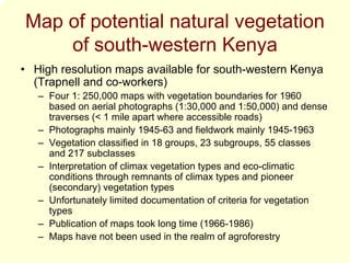
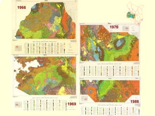
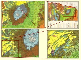
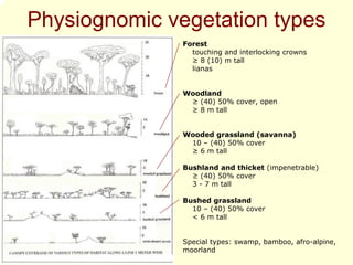

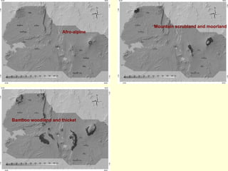
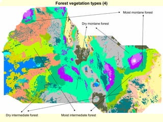
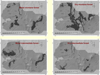
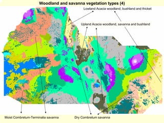
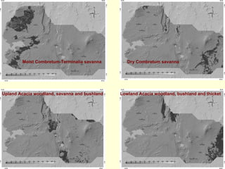

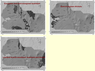
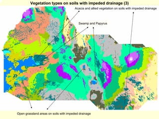
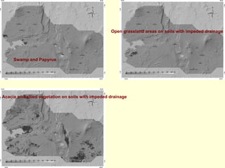
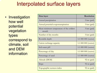
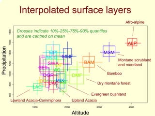
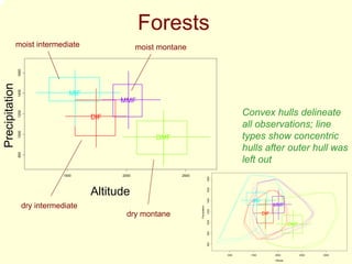
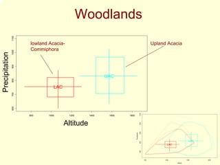
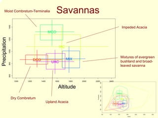
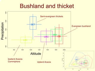
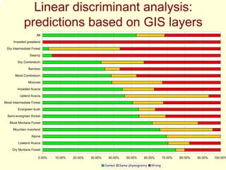
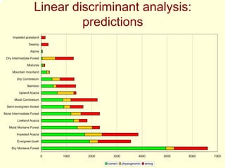
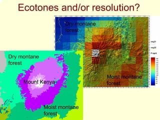
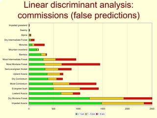
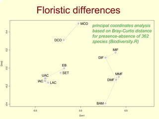
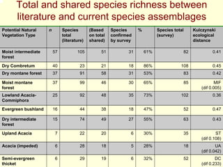
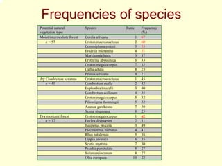
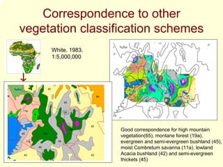
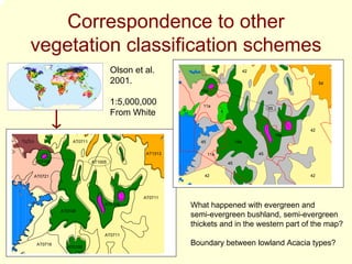

Potential natural vegetation maps for western and central Kenya can be used to select indigenous tree species for planting by indicating the ecological suitability of areas. The maps were developed in the 1960s based on aerial photographs and fieldwork, delineating 17 potential natural vegetation types classified by structure and dominant species. While the maps provide a picture of climatic and soil variation, their vegetation boundaries and original species compositions may differ from current conditions. The maps could help diversify agroecosystems by matching species to mapped vegetation types.


