Jv r hsb antwerpen dec 2010
•Download as PPT, PDF•
1 like•884 views

1. The document discusses best practices for managing navigational depth in the ports of Rotterdam, including through dredging, density surveying, and research on siltation. 2. It addresses port environment factors like tides, currents, and storms that can impact siltation. It also discusses different dredging management approaches and equipment used. 3. Density surveying techniques are outlined to map fluid mud layers and calculate navigational depth levels, including the use of echosounders, density probes, and sampling tools. Research on forces affecting siltation like currents, rivers, winds, and temperature is also summarized.
![Navigational depth ,[object Object],[object Object],[object Object],[object Object],[object Object],[object Object]](data:image/gif;base64,R0lGODlhAQABAIAAAAAAAP///yH5BAEAAAAALAAAAAABAAEAAAIBRAA7)
Recommended
Recommended
More Related Content
What's hot
What's hot (20)
Viewers also liked
Viewers also liked (10)
Similar to Jv r hsb antwerpen dec 2010
Similar to Jv r hsb antwerpen dec 2010 (20)
More from Hydrographic Society Benelux
More from Hydrographic Society Benelux (20)
Jv r hsb antwerpen dec 2010
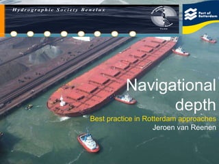
- 1. Navigational depth Best practice in Rotterdam approaches Jeroen van Reenen
- 8. Port of Rotterdam / Rijkswaterstaat
- 13. Minimum UKC Berge Stahl 343 m long 63 m wide 365.000 T 354.000 T @ 23m 3 deg roll, 1.65m
- 15. 4 Density surveying Echosounder depth 1.2 T/m3 depth
- 21. Van Veen grab
- 24. Check on measurements against calibration
- 26. TIN model
- 27. Isopach DTM
- 28. SILAS raw data Digital 200 KHz SILAS 1.2 density Echo “noise”
- 31. Monitor tracks
- 32. Long sections
- 34. Multibeam depth (240 KHz)
- 35. Navigational depth (1200 g/l)
- 40. Silas results
- 42. Free fall Beeker sampler
- 45. Siltprofiler
- 46. OBS data
- 49. Current profiles
- 51. Salinity Flud from Sea River flow Wedge mixing Surface mixing
- 54. Windforce 2009
- 57. Temperature / Siltation layer
- 58. Thank you for your attention