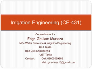
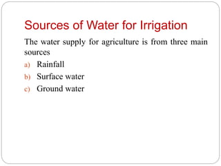
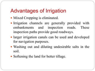
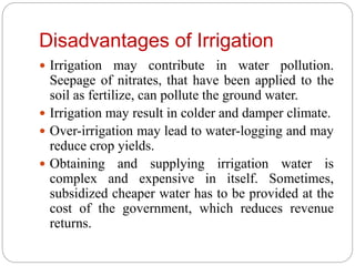
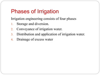
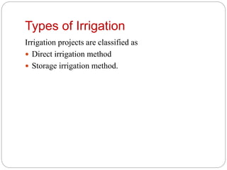
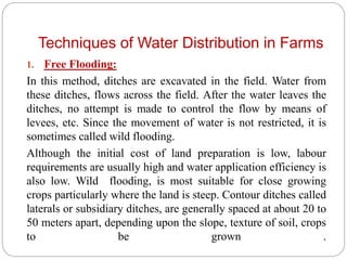
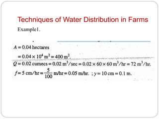
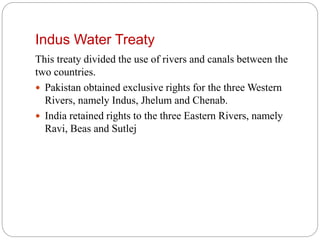
This document provides information about an irrigation engineering course taught by Engr. Ghulam Murtaza. It includes details about the instructor, course contents, textbooks, and introductory lectures. The course covers topics such as irrigation systems in Pakistan, water resources, types of irrigation, techniques of water distribution, the Indus Water Treaty, and features of the major rivers including the Sutlej, Ravi, and Chenab rivers.
Introduction:
Necessity of irrigation- scope of irrigation engineering- benefits and ill effects of irrigation- irrigation development in India- types of irrigation systems, Soil-water plant relationship: Classification of soil water- soil
moisture contents- depth of soil water available to plants-permanent
and ultimate wilting point
Water requirements of crops:
Depth of water applied during irrigation- Duty of water and deltaimprovement
of duty- command area and intensity of irrigation consumptive use of water and evapotranspiration- irrigation efficiencies- assessment of irrigation water
Topics:
1. Reservoir Classification
2. Investigations
3. Selection of Site for Reservoir
4. Zones of Storage
5. Storage Capacity and Yield
6. Mass Inflow Curve & Demand Curve
7. Calculation of Reservoir Capacity
8. Reservoir Sedimentations
9. Life of Reservoir
10. Selection of Dam
An agricultural land is said to be waterlogging when the soil pores within the roof zone of the crops are saturated to such an extent that normal circulation of air within the soil pores is totally cut off and productivity of soil is affected. Waterlogging generally occurs because of over-irrigation , high water table and the poor water management.
The yield of crop is adversely affected when the depth of water table is equal to or less then the one given below.
I have tried to discuss about the fundamental knowledge related to Irrigation and Flood Control in short. For more details anyone can visit the books that I have mentioned in my slide presentation. I have tried to cover major topics from books so that student can find it easy to understand and learn about irrigation and flood control. I hope it will help everyone who has interest to Irrigation Engineering.
GROUND WATER RECHARGE TECHNIQUES BY CH.APPARAO (Research Associate, ARS, ATP)Apparao Chodisetti
Ground water recharge is the process whereby the amount of water present in or flowing through the interstices of the sub-soil increases by natural or artificial means. Rainfall is the principal source for replenishment of recharge of ground water. Other sources include recharge from rivers, streams, irrigation water etc. An unconfined aquifer is recharged directly by local rainfall, rivers, and lakes, and the rate of recharge will be influenced by the permeability of overlying rocks and soils. A confined aquifer, on the other hand, is characterized by an overlying bed that is impermeable, and local rainfall does not influence the aquifer. It is normally recharged from lakes, rivers, and rainfall that may occur at distances ranging from a few kilometers to thousands of kilometers.
Irrigation development in India, necessity, scope, benefits
and ill effects of irrigation, types of irrigation systems, methods of irrigation, physical
and chemical properties of soils, soil nutrients, classification of irrigable soils, suitability
of soils for irrigation, quality of irrigation water, soil water plant relations in irrigation,
measurement of soil moisture, field capacity, wilting point, available water , hydraulic
conductivity, water movement through soils.
IOSR Journal of Mechanical and Civil Engineering (IOSR-JMCE) is an open access international journal that provides rapid publication (within a month) of articles in all areas of mechanical and civil engineering and its applications. The journal welcomes publications of high quality papers on theoretical developments and practical applications in mechanical and civil engineering. Original research papers, state-of-the-art reviews, and high quality technical notes are invited for publications.
About
Indigenized remote control interface card suitable for MAFI system CCR equipment. Compatible for IDM8000 CCR. Backplane mounted serial and TCP/Ethernet communication module for CCR remote access. IDM 8000 CCR remote control on serial and TCP protocol.
• Remote control: Parallel or serial interface.
• Compatible with MAFI CCR system.
• Compatible with IDM8000 CCR.
• Compatible with Backplane mount serial communication.
• Compatible with commercial and Defence aviation CCR system.
• Remote control system for accessing CCR and allied system over serial or TCP.
• Indigenized local Support/presence in India.
• Easy in configuration using DIP switches.
Technical Specifications
Indigenized remote control interface card suitable for MAFI system CCR equipment. Compatible for IDM8000 CCR. Backplane mounted serial and TCP/Ethernet communication module for CCR remote access. IDM 8000 CCR remote control on serial and TCP protocol.
Key Features
Indigenized remote control interface card suitable for MAFI system CCR equipment. Compatible for IDM8000 CCR. Backplane mounted serial and TCP/Ethernet communication module for CCR remote access. IDM 8000 CCR remote control on serial and TCP protocol.
• Remote control: Parallel or serial interface
• Compatible with MAFI CCR system
• Copatiable with IDM8000 CCR
• Compatible with Backplane mount serial communication.
• Compatible with commercial and Defence aviation CCR system.
• Remote control system for accessing CCR and allied system over serial or TCP.
• Indigenized local Support/presence in India.
Application
• Remote control: Parallel or serial interface.
• Compatible with MAFI CCR system.
• Compatible with IDM8000 CCR.
• Compatible with Backplane mount serial communication.
• Compatible with commercial and Defence aviation CCR system.
• Remote control system for accessing CCR and allied system over serial or TCP.
• Indigenized local Support/presence in India.
• Easy in configuration using DIP switches.
Forklift Classes Overview by Intella PartsIntella Parts
Discover the different forklift classes and their specific applications. Learn how to choose the right forklift for your needs to ensure safety, efficiency, and compliance in your operations.
For more technical information, visit our website https://intellaparts.com
Democratizing Fuzzing at Scale by Abhishek Aryaabh.arya
Presented at NUS: Fuzzing and Software Security Summer School 2024
This keynote talks about the democratization of fuzzing at scale, highlighting the collaboration between open source communities, academia, and industry to advance the field of fuzzing. It delves into the history of fuzzing, the development of scalable fuzzing platforms, and the empowerment of community-driven research. The talk will further discuss recent advancements leveraging AI/ML and offer insights into the future evolution of the fuzzing landscape.
Sachpazis:Terzaghi Bearing Capacity Estimation in simple terms with Calculati...Dr.Costas Sachpazis
Terzaghi's soil bearing capacity theory, developed by Karl Terzaghi, is a fundamental principle in geotechnical engineering used to determine the bearing capacity of shallow foundations. This theory provides a method to calculate the ultimate bearing capacity of soil, which is the maximum load per unit area that the soil can support without undergoing shear failure. The Calculation HTML Code included.
Automobile Management System Project Report.pdfKamal Acharya
The proposed project is developed to manage the automobile in the automobile dealer company. The main module in this project is login, automobile management, customer management, sales, complaints and reports. The first module is the login. The automobile showroom owner should login to the project for usage. The username and password are verified and if it is correct, next form opens. If the username and password are not correct, it shows the error message.
When a customer search for a automobile, if the automobile is available, they will be taken to a page that shows the details of the automobile including automobile name, automobile ID, quantity, price etc. “Automobile Management System” is useful for maintaining automobiles, customers effectively and hence helps for establishing good relation between customer and automobile organization. It contains various customized modules for effectively maintaining automobiles and stock information accurately and safely.
When the automobile is sold to the customer, stock will be reduced automatically. When a new purchase is made, stock will be increased automatically. While selecting automobiles for sale, the proposed software will automatically check for total number of available stock of that particular item, if the total stock of that particular item is less than 5, software will notify the user to purchase the particular item.
Also when the user tries to sale items which are not in stock, the system will prompt the user that the stock is not enough. Customers of this system can search for a automobile; can purchase a automobile easily by selecting fast. On the other hand the stock of automobiles can be maintained perfectly by the automobile shop manager overcoming the drawbacks of existing system.
CFD Simulation of By-pass Flow in a HRSG module by R&R Consult.pptxR&R Consult
CFD analysis is incredibly effective at solving mysteries and improving the performance of complex systems!
Here's a great example: At a large natural gas-fired power plant, where they use waste heat to generate steam and energy, they were puzzled that their boiler wasn't producing as much steam as expected.
R&R and Tetra Engineering Group Inc. were asked to solve the issue with reduced steam production.
An inspection had shown that a significant amount of hot flue gas was bypassing the boiler tubes, where the heat was supposed to be transferred.
R&R Consult conducted a CFD analysis, which revealed that 6.3% of the flue gas was bypassing the boiler tubes without transferring heat. The analysis also showed that the flue gas was instead being directed along the sides of the boiler and between the modules that were supposed to capture the heat. This was the cause of the reduced performance.
Based on our results, Tetra Engineering installed covering plates to reduce the bypass flow. This improved the boiler's performance and increased electricity production.
It is always satisfying when we can help solve complex challenges like this. Do your systems also need a check-up or optimization? Give us a call!
Work done in cooperation with James Malloy and David Moelling from Tetra Engineering.
More examples of our work https://www.r-r-consult.dk/en/cases-en/
2. Course Contents
Introduction
Definition and type of irrigation. Water Resource for
irrigation, surface water. Irrigation system of Pakistan
Canal irrigation
Elementary concept about canal head works,
selection of their site and layout, weirs and barrages,
various components and functions.
Measures adopted to control silt entry into canals, silt
ejectors and excluders. Design of weirs on permeable
foundations, sheet piles and cut off walls. Design of
irrigation channels.
Kennedy’s and Lacey’s Theories. Rational methods
for design of irrigation channels. Comparison of
3. Canal head regulators, falls, flumes, canal
outlets. Cross drainage works: types and
functions.
Canal lining: advantages and types.
Maintenance of irrigation canals.
Irrigated Agriculture
Water requirements of crops, duty of irrigation
water.
Delta of crops, consumptive use, estimation of
consumptive use, methods used for assessment
of irrigation water.
Irrigation methods and practices.
4. Soil survey and land classification
Reservoirs
Water logging and salinity:
5. Text Book
“IRRIGATION ENGINEERING & HYDRAULIC
STRUCTURES” by “Santosh Kumar Garg”.
Reference Books
1. Linslay, R.K. and Joseph, B.F. Water Resources
Engineering, McGraw Hill.
2. Siddiqui, Iqtidar H., Irrigation and Drainage
Engineering, Oxford University Press
3. Iqbal Ahmed, Irrigation Engineering and
Hydraulic Structures
7. Introduction
Plants are living beings and do require water and
air for their survival, as do human beings require.
Their requirement of water varies with their type.
Different types of plants require different
quantities of water, and at different times, till they
grow up completely.
Water is normally supplied to these plants by
nature through direct rain or through the flood
waters of rivers which inundate large land areas
during floods.
8. Introduction
Sometimes, there may be very heavy rains creating
serious floods and damaging the crops, and sometimes,
there may not be any rains at all, creating scarcity of
water for the crops. Thus, famine and scarcity conditions
are created.
In his bid to control the nature, man discovered various
methods by which the water can be stored during the
periods of excess rainfall, and to use that stored water
during periods of ‘less rainfall’ or ‘no rainfall’. The art or
the science by which it is accomplished is generally
termed as irrigation.
9. Introduction
Irrigation is an art of applying water to the land by
artificial means to fulfil the water requirements of
crops in areas specially where rainfall is
insufficient.
10. Sources of Water for Irrigation
The water supply for agriculture is from three main
sources
a) Rainfall
b) Surface water
c) Ground water
11. Need for Irrigation
Arid Zones:
For such zone annual rainfall is less than 15"
and an irrigation system is necessary.
Semi-Arid Zones:
In these areas, precipitation (annual rainfall)
ranges from 15"-30" and an irrigation system is
desirable.
Humid Zone:
For these zones the annual rainfall is more
than 30".Therefore an irrigation system is beneficial.
12. Rainfall in Pakistan
In Pakistan the mean annual rainfall ranges from less
than 4" in parts of the lower Indus region to more than
30" in the Northern foothills.
Of this annual rainfall only a small portion makes any
useful or direct contribution of irrigation water
supplies.
According to consultant experts of the World Bank the
figure ranges from1" to 17". The rest is either surface
runoff or addition to the ground water reservoir while
some is lost by evaporation.
It is estimated that the present direct contribution to the
crops is 6 MAF per annum.
13. Surface Runoff
Pakistan rivers carry the melting snow and rains from
the Northern hills down to the plains where they can be
used for irrigation.
From mid-March to mid-July (When the monsoon
breaks) the river discharges derive mainly from
melting snow.
From mid July to September rain water adds to the
volume
14. Ground Water
After rainfall and surface water, ground water is the
most important water source for irrigation.
In hilly areas this is in form of springs, wells, etc and
may be the only source for irrigation.
Using ground water by sinking tube wells may
seem to be the direct and rapid way of meeting
immediate irrigation water requirements.
However not all the available ground water may
be suitable for irrigation use.
An estimated 41.6 MAF of groundwater is pumped
annually in Pakistan
15. Advantages of Irrigation
Cooling the soil and atmosphere and thereby creating a
favorable environment especially for plants to grow.
Irrigation helps in increasing crop yields, and hence, to
attain self-sufficiency in food.
Optimum utilization of water is made possible by
irrigation.
Cheaper power generation can be obtained from water
development projects primarily designed for irrigation
alone
Development of irrigation facilities in an area helps in
extending the water supply in nearby villages and
towns, where other sources of water are not available
or are scarcely available.
16. Advantages of Irrigation
Mixed Cropping is eliminated.
Irrigation channels are generally provided with
embankments and inspection roads. These
inspection paths provide good roadways.
larger irrigation canals can be used and developed
for navigation purposes.
Washing out and diluting undesirable salts in the
soil.
Softening the land for better tillage.
17. Disadvantages of Irrigation
Irrigation may contribute in water pollution.
Seepage of nitrates, that have been applied to the
soil as fertilize, can pollute the ground water.
Irrigation may result in colder and damper climate.
Over-irrigation may lead to water-logging and may
reduce crop yields.
Obtaining and supplying irrigation water is
complex and expensive in itself. Sometimes,
subsidized cheaper water has to be provided at the
cost of the government, which reduces revenue
returns.
18. Phases of Irrigation
Irrigation engineering consists of four phases
1. Storage and diversion.
2. Conveyance of irrigation water.
3. Distribution and application of irrigation water.
4. Drainage of excess water
19. Selection of Suitable Source for
Irrigation
The selection for suitable source for irrigation
depends on the following
Reliability of the source
Quantity of water available
Quality of water
21. Types of Irrigation
Irrigation may broadly be classified into
1. Surface irrigation
2. Subsurface irrigation
1. Surface irrigation can be further classified into
1.1 Flow irrigation
1.2 Lift irrigation
2. Subsurface irrigation can be further classified into
2.1 Natural sub-irrigation
2.2 Artificial sub-irrigation
22. Types of Irrigation
1. Surface irrigation
1.1 Flow irrigation
When the water is available at a higher level, and it is
supplied to lower level, by the mere action of gravity, then
it is called Flow Irrigation.
1.2 Lift irrigation
if the water is lifted up by some mechanical or manual means,
such as by pumps, etc. and then supplied for irrigation, then it is
called Lift Irrigation.
23. Types of Irrigation
2. Subsurface irrigation
2.1 Natural sub-irrigation
When underground irrigation is achieved simply by
natural processes, without any additional extra efforts,
it is called natural sub-irrigation.
2.2 Artificial sub-irrigation
When a system of open jointed drains is artificially
laid below the soil, so as to supply water to the crops
by capillarity, then it is known as artificial sub-
irrigation
24. Techniques of Water Distribution in Farms
There are various, ways in which the irrigation water can be
applied to the fields. Their main classification is as follows
1. Free flooding
2. Border flooding
3. Check flooding
4. Basin flooding
5. Furrow irrigation method
6. Sprinkler irrigation method
7. Drip irrigation method
25. Techniques of Water Distribution in Farms
1. Free Flooding:
In this method, ditches are excavated in the field. Water from
these ditches, flows across the field. After the water leaves the
ditches, no attempt is made to control the flow by means of
levees, etc. Since the movement of water is not restricted, it is
sometimes called wild flooding.
Although the initial cost of land preparation is low, labour
requirements are usually high and water application efficiency is
also low. Wild flooding, is most suitable for close growing
crops particularly where the land is steep. Contour ditches called
laterals or subsidiary ditches, are generally spaced at about 20 to
50 meters apart, depending upon the slope, texture of soil, crops
to be grown .
26. Techniques of Water Distribution in Farms
2. Border flooding :
In this method, the land is divided into a number of
strips, separated by low levees called borders. The land
areas confined in each strip is of the order of 10 to 20
meters in width, and 100 to 400 meters in length. When
the advancing water reaches the lower end of the strip,
the supply of water to the strip is turned off.
27. Techniques of Water Distribution in Farms
A relationship between the discharge through the supply
ditch (Q), the average depth of water flowing over the
strip (y), the rate of infiltration of the soil (f), the area of
the land irrigated (A), and the approximate time required
to cover the given area with water (t), is given by the
equation
28. Techniques of Water Distribution in Farms
maximum area that can be irrigated with a supply ditch of
discharge Q and soil having infiltration capacity (f).
29. Techniques of Water Distribution in Farms
Example1.
Determine the time required to irrigate a strip of land of 0.04
hectares in area from a tube-well with a discharge of
0.02cumec. The infiltration capacity of the soil may be taken
as 5 cm/hr, and the average depth of flow on the field as
10cm.
Also determine the maximum area that can be irrigated from
this tube well.
33. Techniques of Water Distribution in Farms
3. Check flooding
Check flooding is similar to ordinary flooding except
that the water is controlled by surrounding the check area
with low and flat levees. Levees are generally
constructed along the contours, having vertical interval
of about 5 to 10 cm. These levees are connected with
cross-levees at convenient places . The confined plot area
varies from 0.2 to 0.8 hectare
34. Techniques of Water Distribution in Farms
4. Basin flooding
This method is a special type of check flooding and is
adopted specially for orchard trees. One or more trees are
generally placed in the basin, and the surface is flooded as in
check method, by ditch water, as shown in Fig.
35. Techniques of Water Distribution in Farms
5. Furrow irrigation method
In Farrow irrigation method only one-fifth to one-half of the
land surface is wetted by water.
36. Techniques of Water Distribution in Farms
6. Sprinkler irrigation method
In this farm-water application method, water is applied to the
soil in the form of a spray through a network of pipes and
pumps. It is a kind of an artificial rain.
37. Techniques of Water Distribution in Farms
7. Drip irrigation method
In this method, water is slowly and directly applied to the root
zone of the plants, thereby minimizing the losses by
evaporation and percolation.
38. Indus Water Treaty
In 1947, when Punjab was divided between the two countries,
many of the canal head-works remained with India. The
division of Punjab thus created major problems for irrigation in
Pakistan.
On April 1, 1948, India stopped the supply of water to Pakistan
from every canal flowing from India to Pakistan.
Pakistan protested and India finally agreed on an interim
agreement on May 4, 1948.
Pakistan approached the World Bank in 1952 to help settle the
problem permanently. Finally in Ayub Khan's regime that an
agreement was signed between India and Pakistan in Sep.1960.
This agreement is known as the Indus Water Treaty
39. Indus Water Treaty
This treaty divided the use of rivers and canals between the
two countries.
Pakistan obtained exclusive rights for the three Western
Rivers, namely Indus, Jhelum and Chenab.
India retained rights to the three Eastern Rivers, namely
Ravi, Beas and Sutlej
40. Irrigation System in Pakistan
Pakistan is situated in Arid Zone.
The Indus basin receives less that 15" of rainfall in a year,
with 30% of the area receiving even less than 10%.
Agriculture therefore heavily depends on irrigation.
The major rivers in Pakistan are the Indus, its left bank
tributaries are Jhelum, Chenab, Ravi and Satluj, and right
bank tributaries of Swat, Kunhar, Kabul and Kurram etc.
The annual runoff of the Indus system of rivers is estimated
as 168 MAF (Million acre ft.)
41. Irrigation System in Pakistan
Sukhur Barrage, Chushma Barrage, Rasool Barrage, Guddu
Barrage, Kotri Barrage , Head Sulemankee, Head Marala,
Head Rasool, Head Khanki, Head Bulloki etc. are
constructed for irrigation purposes.
Besides it, a vast irrigation canal system was constructed in
1960, to transfer water of western rivers to the canal
systemof eastern rivers, Beas, Ravi and Satluj.
42.
43.
44.
45.
46. Indus River Basin:
Salient Features
Catchment area of Indus is most unique in the sense that it
contains seven (7) of the world’s highest peaks after Mount
Everest. Among these include the K2 (28,253 ft), Nanga
Parbat (26,600 ft), Rakaposhi (25,552 ft) etc.;
Further to above, seven(7) glaciers situated in the Indus
catchment are among the largest in the world, namely,
Siachin, Hispar, Biafo, Baltura, Baltoro, Barpu and
Hopper.
47. Salient Features of Main Rivers - Sutlej River
Origin Western Tibet in the Kailas Mountain range and near the source
of Rivers Indus, Ganges and Bramaputra
Length 960 miles/1536 Km
CatchmentArea 47,100 Sq.miles/75,369 Sq.km (70% in India)
Pakistan portion Flows into Pakistan (Punjab) near Ferozepur and eventually joins
Chenab 3 miles u/s Punjnad Barrage
Tributary Rivers Eight major tributaries (all except Rohi Nullah join Sutlej in
India)
Largest Tributary River Beas (290 miles/464km), catchment area (6,200
Sq.miles/9,920 Sq.km)
Dams on the River Bhakra, Nangal, Pong, Pandoh (all in India),
Barrages on River Rupar Barrage, Harike Barrage, Ferozepur Barrage (India),
Sulemanki & Islam in Pakistan
48. Salient Features of Main Rivers - Ravi River
Origin Originates from the lesser Himalayas Range in India
Length 550 miles/880 Km
CatchmentArea 15,600 Sq.miles/24,960Sq.km
Pakistan portion Runs almost along the Indo-Pak Border -15km d/s Madhopur to 20
miles u/s of Shahdara (58 miles)
Tributary Rivers Five major tributaries (Ujh, Bein, Basantar, Deg, Hudiara nullahs –
upper catchments lie in India)
Largest Tributary Deg Nullah (160 miles/256km), catchment area (456 Sq.miles/730
Sq.km)
Barrages on River Madhopur Headwork (India), Balloki & Sidhnai (Pakistan)
49. Salient Features of Main Rivers - Chenab
River
Origin -Forms at the confluence of streams Bhaga &
Chandra which join at a place called Tandi in Occupied
Jammu & Kashmir state.
-Upper most part is snow covered and forms the North East
part of Himachal Pradesh
-From Tandi to Akhnur the river traverses through high
mountains
Length 770 miles/1,232 Km
CatchmentArea 26,100 Sq.miles/41,760 Sq.km
Pakistan portion The river enters Pakistan a little over Head Marala with very
sharp changes in slope (130 ft/mile above Tandi reduced to 2
ft/mile close to Trimmu)
50. Salient Features of Main Rivers - Jhelum
River
LargestTributary Kishan Ganga/Neelumh (165 miles/264km), catchment
area (2,480 Sq.miles/3,968 Sq.km)
Barrages on River Mangla Dam, Rasul Barrage
51. Salient Features of Main Rivers - Indus River
Origin -One of the largest rivers of the world and the main river
of the Indus valley;
-Originates near lake Mansarowar on north of
Himalayas range in the mountain of Kailash Parbat in
Tibet at an elevation of 18,000 ft.;
Length 925 miles/1,489 Km above Tarbela
CatchmentArea 1,80,000 Sq.miles/2,88,000 Sq.km
52.
53. Punjab
The public irrigation infrastructure in the Punjab consists of
16 barrages
2 siphons across major rivers
12 link canals and 23 major canal systems over an
aggregate length of 34,500 km.
The whole irrigation infrastructure lies within the Indus Basin
System. It serves an area of 8.58 million hectares. In
addition, there are 135 surface drainage systems including
over 670 drains, with an aggregate length of about 6,600
km, which drain an area of about 5.79 million hectares,
within the 23 canal commands.
54. Sindh
14 publicly owned canals system, which receive water
from three barrages across the River Indus. These
systems, with an aggregate length of 18,000 km of
canals, serve an area of about 5.38 million hectares.
There are 13 existing surface drainage systems in
Sindh, which serve a total area of over 3.5 million
hectares and have an aggregate length of about 4,800
km.
55. KPK
5 publicly owned irrigation systems in the Indus Basin,
which serve a total area of 0.34 million hectares. These
systems receive water from two headworks across River
Swat and Warsak Dam. In addition, there are six other canal
systems, which serve a total of 0.13 million hectares of
land.
Also has over 200 canals called `civil canals`, which are
community or privately owned. These irrigate an aggregate
area of 0.83 million hectares.
There are four surface drainage systems in KPK comprising
of 456 drains.
These serve a total area of 0.37 million hectares.
56. Balochistan
Balochistan has two canal systems, which receive
water from the Indus Basin System through Guddu
Barrage and Sukkur Barrage, located in Sindh. These
canal systems serve a total area of 0.33 million
hectares.
Feeder Canal System, has been improved recently. In
addition, there are 431 independent publicly owned
small irrigation schemes, which serve 0.14 million
hectares. There are a few privately owned small
irrigation schemes too.
57. Groundwater usage for irrigation
An estimated 41.6 MAF of groundwater is pumped
annually in Pakistan.
According to a study, more than 90% of the extracted
groundwater is used for
irrigation purposes. Groundwater reservoirs are
recharged from the rivers as
well as the seepage losses from the canals,
watercourses, farm channels and the fields.