
Recommended
More Related Content
What's hot
What's hot (20)
Viewers also liked
Viewers also liked (17)
Similar to Utility Detection & Mapping
Similar to Utility Detection & Mapping (20)
Utility Detection & Mapping
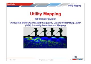
- 1. GeoRadar Utility Mapping Utility Mapping IDS Geordar division Innovative Multi Channel Multi Frequency Ground Penetrating Radar (GPR) for Utility Detection and Mapping Feb 2011 All rights reserved to IDS 1
- 2. GeoRadar Utility Mapping Index • Company presentation • Technology Principles • Why use GPR • Target Market • Detector Duo • Hi-Mod • Case studies Feb 2011 All rights reserved to IDS 2
- 3. GeoRadar Utility Mapping IDS Ingegneria dei Sistemi S.p.A. • founded in 1980 • more than 400 employees • core expertise in Applied Electromagnetics, Radar Systems, System Engineering Pisa Headquarter The offices: • head offices in Pisa • branch office in Rome • subsidiary in: • Brisbane (IDS-Australasia) • Southampton (IDS-UK) GeoRadar Office • Sao Paulo (IDS-Brazil) • Montreal (IDS-North America) Feb 2011 All rights reserved to IDS 3
- 4. GeoRadar Utility Mapping Organization Customers NAVAL AERONAUTICAL AERONAVIGATION GEORADAR DIVISION DIVISION DIVISION DIVISION Core know-how in: IDS LABORATORY - Applied Electromagnetics E.M. I.T. - Radar Systems Radar Space - System Engineering Electronic & Mechanical Systems - Information Technology Feb 2011 All rights reserved to IDS 4
- 5. GeoRadar Utility Mapping IDS GeoRadar facts • Leader in Multi-frequency, Multi-channel Ground Penetrating Radar Systems – IDS began to study GPR technology since 1991 in connection with the need of Telecom Italia of improving the capabilities of mapping subsoil Utilities – IDS was the first to introduce in GPR market the multi-frequency, multi-channel array systems, dramatically improving utilities detection performance – Since 1999 IDS began the worldwide commercialization of GPR products – IDS is now one of the key players in GPR market, with a continuously growing market share • Innovative radar interferometry technology for the Earth Environment – In 2007 IDS introduces IBIS on the market, the first Ground-Based interferometric SAR Feb 2011 All rights reserved to IDS 5
- 6. GeoRadar Utility Mapping Mission Pursuing the product excellence, through the creation of application-specific, innovative products, able to bring valuable benefits (technical, economical) to the user. Feb 2011 All rights reserved to IDS 6
- 7. GeoRadar Utility Mapping Worldwide presence Italy HQ USA office Denver IDS North America Montréal IDS UK Fareham IDS Australasia IDS Brazil Brisbane São Paulo Feb 2011 All rights reserved to IDS 7
- 8. GeoRadar Utility Mapping Technology Principles Feb 2011 All rights reserved to IDS 8
- 9. GeoRadar Utility Mapping Technology principles (1/4) The radar transmits a small pulse of EM wave through an antenna The reflected energy from the discontinuity is captured and received by the antenna. The time delay contains information on the target depth The depth and the resolution are related to the antennas frequency, to the power transmitter and to the dielectric properties of the ground. Feb 2011 All rights reserved to IDS 9
- 10. GeoRadar Utility Mapping Technology principles (2/4) The GPR is a method developed for shallow, high-resolution, subsurface investigations of the earth. GPR uses high frequency pulsed electromagnetic waves (from 25 MHz to 2,000 MHz) to acquire subsurface information. GPR Principle Feb 2011 All rights reserved to IDS 10
- 11. GeoRadar Utility Mapping Technology principles (3/4) Antenna Delay Time Feb 2011 All rights reserved to IDS 11
- 12. GeoRadar Utility Mapping Technology principles (4/4) Antenna Posi Delay Time tion Feb 2011 All rights reserved to IDS 12
- 13. GeoRadar Utility Mapping Why use GPR? DIGGING RISK FACTORS and REGULATIONS Feb 2011 All rights reserved to IDS 13
- 14. GeoRadar Utility Mapping The use of utility locating technologies The cause of many accidents during excavations/DD installations is a lack of knowledge of the subsoil conditions A 36-fiber optic cable can carry up to 870,912 circuits and generate more than $175,000 per minute in revenue In 2003, there were in the U.S. more than 104,000 hits or third-party damage to gas pipelines From: “Utility Locating Technologies: summary of responses to a Statement of Need” FLC – Federal Laboratory Consortium for Technology Transfer Washington, DC Feb 2011 All rights reserved to IDS 14
- 15. GeoRadar Utility Mapping Some of the main important incidents and main causes 1998 - Public Service Company of Colorado reported 300 primary feeder cable cuts in the state that affected 600,000 - 900,000 customers 1998 - US West cable network damage can exceed 2000/month hits (averages over 1.000/m hits) 1999 - A phone utility hit in Colorado cut off service for 12,000 customers. 1998 - A 36 fiber, fiber optic cable can carry up to 870,912 circuits, and can generate over $175,000 per minute 1993 - More than 104,000 hits to gas pipelines with a total cost exceeding $86 million. 1997 - Memphis Light, Gas and Water paid damages of $515,000 and collected damages of $793,000 for utility damage. 1993 - Tejerías, Venezuela, Explosion of a gas pipe while installing a cable: 48 deaths, 77 wounded Data from: Federal Laboratory Consortium for Technology Transfer, U.S. Department of Transportation and the U.S. Geological Survey Accident Causes 40 % utilities ruptures during excavation 29 % pipe corrosion/deterioration 31 % other causes, including the geologic one Feb 2011 All rights reserved to IDS 15
- 16. GeoRadar Utility Mapping Regulations Regulations allows the setting of standards for appropriate and professional engineering procedures. American Society of Civil Engineers: (ASCE/C-I 38-02, Standard Guideline for the Collection and Depiction of Existing Subsurface Utility Data). JUPEM: Standard Guideline for Underground Utility Mapping (AM/FM Technical Sub- Committee & National Mapping and Spatial Data Committee). NORMA ITALIANA CEI 306-8: Italian Regulations for performing preliminary surveys with Ground Probing Radar before laying underground utilities and infrastructures. KADASTER: The Ministry of Economic Affairs of Netherland has decided that Kadaster will take over the operational activities from KLIC starting on 1 October 2008. Feb 2011 All rights reserved to IDS 16
- 17. GeoRadar Utility Mapping SUE Standard SUE allows cost effective location and depiction of the exact location of underground utilities through the interaction of technology, civil engineering and geophysics: utility mapping at appropriate Quality Levels utility relocation design and coordination utility condition assessment, communication of utility data to concerned parties, utility relocation cost estimates, implementation of utility accommodation policies, and utility design. Feb 2011 All rights reserved to IDS 17
- 18. GeoRadar Utility Mapping Why use GPR technology? GPR can locate any pipes: metallic and no-metallic, (PVC, concrete, etc.). GPR allows the optimization of excavations / destructive testing and reduce their costs and associated Risks. GPR complements the surface inspection with an economic, objective, documentable, precise (quantitatively interpretable) image of the underground providing 100% of project area coverage. Feb 2011 All rights reserved to IDS 18
- 19. GeoRadar Utility Mapping Utility market needs • Mark out Survey – If the contract requires an ‘on site mark up’ of the utilities found then no permanent record is provided. • Recorded Survey – Where a full record of the survey results are to be supplied this can be done digitally ( CAD-GIS format ). Feb 2011 All rights reserved to IDS 19
- 20. GeoRadar Utility Mapping Detector Duo A dual frequency antenna radar for detecting metallic and non-metallic pipes. Collapsible trolley, easy to transport and assembly. Feb 2011 All rights reserved to IDS 20
- 21. GeoRadar Utility Mapping Shallow pipe Visible pipe Innovative Features • Deep and Shallow antennas in one compact box (250 – 700 MHz) • Antenna footprint: 60x37 cm • Real time display of deep and shallow channels in the same screen Deep pipe Invisibile pipe • Highest performance with simultaneous display of deep and shallow pipes • Highest productivity with a single scan • Only 30 minutes training required Feb 2011 All rights reserved to IDS 21
- 22. GeoRadar Utility Mapping Recorded survey • Accurate mapping of subsurface utilities is necessary for: – utility design – utility relocation design, coordination and cost estimation – reduction in delays due to utility cuts Feb 2011 All rights reserved to IDS 22
- 23. GeoRadar Utility Mapping RIS MF Hi-Mod composition The only “end-to-end” industrial solution for accurate utility mapping DAD MCh 2 Batteries FastWave 4 Dual Frequency Antennas 200/600 or 400/900 Feb 2011 All rights reserved to IDS 23
- 24. GeoRadar Utility Mapping RIS MF Hi-Mod The only end-to-end “industrial” solution for accurate utility mapping 4 dual frequency antennas (200 MHz and 600 MHz). Modular design suited to urban environment and narrow passages. High productivity post-processing SW. CAD/GIS automatic rendering. Feb 2011 All rights reserved to IDS 24
- 25. GeoRadar Utility Mapping Unique array solution in the market towed by hand RIS MF Hi-Mod: increase productivity by more than 20x! Feb 2011 All rights reserved to IDS 25
- 26. GeoRadar Utility Mapping Hi-Mod High Productivity: With a complete array of antennas you can save time and money collecting the data more than ten time faster with a superior accuracy. Meaningful and unambiguous results: thanks to fusion of longitudinal and transversal scans in the same tomographic maps and the combination of double frequency data performed with our proprietary software. Easy Rendition: Our solution comes with proprietary advanced 3D software and CAD - GIS direct format exportation in order to offer you an end to end professional utility mapping system. All terrain: Hi-Mod can handle rough terrains, sidewalks, narrow passages and grass areas without loss of accuracy. Feb 2011 All rights reserved to IDS 26
- 27. GeoRadar Utility Mapping High Productivity (1/3) Vs Mono Channel Bi Dimensional Coverage Multi Channel/array Volumetric Coverage Feb 2011 All rights reserved to IDS 27
- 28. GeoRadar Utility Mapping High Productivity (2/3) WHY AN ARRAY OF ANTENNAS? Using an array of antennas it is possible to correlate Single antenna information coming from several data channels. It helps to accurately reconstruct the path of underground utilities in complex situations. An array scan cannot be equivalent to many single Array of antennas antenna scans. The array scan has more accuracy and productivity. Feb 2011 All rights reserved to IDS 28
- 29. GeoRadar Utility Mapping High Productivity (3/3) FIELD Acquisition Phase (daily productivity): Urban Area 1 Total coverage 2 Longitudinal scans 15.000/20.000 square ft / day Transversal scans each 2 meters Non Urban Area 2 Total coverage 2 Longitudinal scans 85000/100.000 square ft / day Transversal scans each 10 meters PROCESSING phase (daily productivity): 1 15.000/20.000 square ft / day 2 85000/100.000 square ft / day Feb 2011 All rights reserved to IDS 29
- 30. GeoRadar Utility Mapping Meaningful and unambiguous results Feb 2011 All rights reserved to IDS 30
- 31. GeoRadar Utility Mapping All terrain Feb 2011 All rights reserved to IDS 31
- 32. GeoRadar Utility Mapping Process • Retrieve information • Field Acquisition • Post processing phase Feb 2011 All rights reserved to IDS 32
- 33. GeoRadar Utility Mapping Retrieve information Each utility coordination project begins with an initial investigation. Once base plans are produced, detailed coordination begins, including negotiating with all entities involved in the project. • Identify utility owners that have facilities on, or may be affected by, the project. • Contact these utility and obtain existing utility information from other sources. • Make field observations to identify visible above-ground utility features. Survey and plot resulting information. Feb 2011 All rights reserved to IDS 33
- 34. GeoRadar Utility Mapping Field Procedures Cartographic Relief Survey Grid design Longitudinal lines acquisition Transversal lines acquisition Transversal Longitudinal 0,0 Feb 2011 All rights reserved to IDS 34
- 35. GeoRadar Utility Mapping Post Processing Phase (1/4) GRED 3D UTILITIES: POST PROCESSING SOFTWARE Feb 2011 All rights reserved to IDS 35
- 36. GeoRadar Utility Mapping Post Processing Phase (2/4) GRED 3D UTILITIES: POST PROCESSING SOFTWARE Export data to CAD Feb 2011 All rights reserved to IDS 36
- 37. GeoRadar Utility Mapping Post Processing Phase (3/4) GRED 3D UTILITIES: POST PROCESSING SOFTWARE 3D view Identified pipes are automatically transferred to CAD drawings Feb 2011 All rights reserved to IDS 37
- 38. GeoRadar Utility Mapping Post Processing Phase (4/4) Export to cartographic map CAD Output: example of the cartographic map Feb 2011 All rights reserved to IDS 38
- 39. GeoRadar Utility Mapping CASE HISTORY Feb 2011 All rights reserved to IDS 39
- 40. GeoRadar Utility Mapping CASE HISTORY – Array of multi –frequency antennas 1/2 UTILITY MAPPING IDS RIS MF Bologna, Granarolo – Italy 2005; Alpitel SpA projects by IMG srl Need: Guarantee fast and reliable no digging service with the lowest risk of breaking existing pipes and cables. Dimension: Project Dimension 60.000 sq/m; 1 RIS MF system 3 technicians Feb 2011 All rights reserved to IDS 40
- 41. GeoRadar Utility Mapping CASE HISTORY – Array of multi –frequency antennas 2/2 UTILITY MAPPING IDS RIS MF Bologna, Granarolo – Italy 2005; Alpitel SpA projects by IMG srl 3D CAD Output Example in a curve 3D CAD Output Example Feb 2011 All rights reserved to IDS 41
- 42. GeoRadar Utility Mapping UTILITY DETECTION AND MAPPING IDS RIS MF and DETECTOR Florence, – Italy 2006; COMUNE DI FIRENZE (TRAMVIA SpA) by NOVATECH srl Need: Detailed characterization of near surface utility and structures prior of Florence metro rail development. Dimension: Project Dimension 200.000 sq/m; 1 RIS MF system for “mapping” 1 Detector system for “sample dig” 2 technicians Feb 2011 All rights reserved to IDS 42
- 43. GeoRadar Utility Mapping CASE HISTORY – Array of multi –frequency antennas 2/2 CAD Output: example of the cartographic map Feb 2011 All rights reserved to IDS 43
- 44. GeoRadar Utility Mapping Utility Mapping with RIS MF Hi-Mod Amsterdam – Netherland (2009) - FUGRO Various utilities 3D View with detected utilities. Radar map with detected Tomography maps related to a depth of utilities 70cm and 110 cm. Feb 2011 All rights reserved to IDS 44
- 45. GeoRadar Utility Mapping Utility mapping with RIS MF in an Industrial Plant – Brazil 1/3 Feb 2011 All rights reserved to IDS 45
- 46. GeoRadar Utility Mapping Utility mapping with RIS MF in an Industrial Plant – Brazil 2/3 GRID of acquired data Map with the detected utilities Feb 2011 All rights reserved to IDS 46
- 47. GeoRadar Utility Mapping Utility mapping with RIS MF in an Industrial Plant – Brazil 3/3 Utility Mapping: 3D View detail Feb 2011 All rights reserved to IDS 47
- 48. GeoRadar Utility Mapping UTILITY MAPPING IDS RIS MF Milano (Via Ajaccio) – Italy Utility detection and mapping for tele-heating installation (2007) by Politecnico of Milano for AEM SpA (MI) Excavation test showing the good fitting results performed by RIS-MF system: 100 % of detection! Feb 2011 All rights reserved to IDS 48