This is a presentation made to a PhD Winterschool. It shows the power of working at edges and interfaces in order to make progress in theory and practice.
Alister Scott (BCU) discusses the messy and contested rural-urban fringe (or perhaps urban-rural fringe?) and the effect of the contradictory policies relating to space and place.
‘HARIYALI’: AS A MODEL TO COMBAT LAND DEGRADATIONMalhari Survase
The development of a region is primarily based on the efficient use and planned utilisation of
available resources, hence, it is necessary to use and conserve resources, particularly land, water,
soil and vegetation with utimost care for sustainable development. The exploitation and lavish use of
resources may threaten our life cycle causing land degradation at a greater scale. Various measures
are being adopted to conserve these resources by State and Central Government. “Hariyali”
(Greenary) project as community level efforts for the conservation of natural resource are introduced
by Department of Land Resources, Ministry of Rural Development, and Government of India from
April 2003. The present investigation aims to assess the nature, consisted works, carried works and
benefits achieved through Hariyali project implemented in western hilly part of Kolhapur district,
comprising seven small watersheds of Shahuwadi tahsil.
For the present investigation the required data and information has been collected from
Block Development Officer and Tahsil Agricultural Officer, Panchayat Samiti, Shahuwadi. The field
visits to confirm the ground reality have been arranged. The topomaps has been used to analyse
geographical situation such as location, watershed demarcation, topography, landforms, drainage,
forested areas and other landuse. The findings and results are represented through tables and maps.
The analysis revels that Hariyali project has achieved great success in conserving the land, soil,
water and vegetation. Hariyali project could be a ideal model for successfully combating the land
degradation, provided the sufficient funds are made available timely and local peoples participation
is made active.
The Greenbelt Plan, together with the Growth Plan, the NEP and the ORMCP, builds on the Provincial Policy Statement (PPS) to establish a land use planning framework for the GGH that supports a thriving economy, a clean and healthy environment and social equity.
CIAT Soil Carbon Sequestration Research by Rolf Sommer, CGIAR Research Program on Water, Land and Ecosystems.
Presentation made at Soil Carbon Sequestration: Supporting NDCs and donor action. A CGIAR-wide workshop held 12 Nov 2017 at ZEF Center for Development Research, University of Bonn. Workshop organized jointly by: CGIAR Research Programs on Climate Change, Agriculture and Food Security (CCAFS); Water, Land and Ecosystems (WLE) and Forests, Trees and Agroforestry (FTA)
This presentation by Cristina Arias-Navarro (INRA) was given on the 26 of June 2019 as part of the SB50 side event – Enhancing NDC Ambition Through Soil Organic Carbon Sequestration. Country representatives and experts discussed the potential of soil organic carbon sequestration as a climate change mitigation option and gaps between countries’ current and potential commitments.
More info: https://ccafs.cgiar.org/ccafs-sb50-enhancing-ndc-ambition-through-soil-organic-carbon-sequestration
Soil Organic Carbon: 4/1000 and Land Restoration by Leigh Ann Winowiecki, World Agroforestry Centre.
Presentation made at Soil Carbon Sequestration: Supporting NDCs and donor action. A CGIAR-wide workshop held 12 Nov 2017 at ZEF Center for Development Research, University of Bonn. Workshop organized jointly by: CGIAR Research Programs on Climate Change, Agriculture and Food Security (CCAFS); Water, Land and Ecosystems (WLE) and Forests, Trees and Agroforestry (FTA)
2018 Open Space Conference - I’ve Seen Fire & Rain: Implications of the 2017 ...OpenSpaceCouncil
*Please note that animations in this presentations are not visible when viewed through Slideshare.
- Dave Koehler, Moderator, Executive Director, Sonoma Land Trust
- Jennifer Gray Thompson, Executive Director, Rebuild North Bay Foundation
- Karen Gaffney, Conservation Planning Manager, Sonoma County Ag + Open Space
- Caitlin Cornwall, Research Program Manager, Sonoma Ecology Center
These panelists spoke at the 2018 Open Space Conference - Conservation in a Time of Change - on May 10, 2018 at the Craneway Pavilion in Richmond, CA. More info on the website: http://openspacecouncil.org/community-events/conference/
Sustainable land management to mitigate and adapt to climate changeExternalEvents
This presentation was presented during the 1 Parallel session on Theme 2, Maintaining and/or increasing SOC stocks for climate change mitigation and adaptation and Land Degradation Neutrality, of the Global Symposium on Soil Organic Carbon that took place in Rome 21-23 March 2017. The presentation was made by Ms. Maria José Sanz Sanchez, from Basque Centre for Climate Change - Spain, in FAO Hq, Rome
Restoration of degraded forests and landscapes for production/delivery of mul...CIFOR-ICRAF
Presented by Himlal Baral of the Center for International Forestry Research (CIFOR) at the 3rd Asia-Pacific Rainforest Summit, on 23–25 April 2018 in Yogyakarta, Indonesia
In this presentation, representatives from the Shalom Foundation, Friends of Wildlife, IUCN, University of East Anglia UK, London School of Economics UK, and UC Berkeley US, gave an overview of understanding the Kachin situation and then helped to facilitate discussion on what can be done within the situation.
Introduction to redd+ 17 april 2017 A Presentation By Mr. Allah dad Khan Vis...Mr.Allah Dad Khan
Introduction to redd+ 17 april 2017 A Presentation By Mr. Allah dad Khan Visiting Professor the University of Agriculture Peshawar allahdad52@gmail.com
Investing in Community-based Resilience of Socio-Ecological Production Landsc...Bioversity International
Presentation by Diana Salvemini, COMDEKS Project Manager (UNDP-GEF).
This was presented during a seminar hosted at Bioversity International on 'The Indicators of Resilience in Socio-Ecological Production Landscapes and Seascapes (SEPLS)' in January 2014.
Find out more: http://www.bioversityinternational.org/research-portfolio/agricultural-ecosystems/landscapes/
Landscape Approach Initiatives and Traditional Village Systems: Leaning for S...SIANI
This study was presented during the conference “Production and Carbon Dynamics in Sustainable Agricultural and Forest Systems in Africa” held in September, 2010.
The role of strategic spatial plans in managing urban-rural relationshipsPrivate
Recent decades have witnessed a huge change in the global structure of the human population, with the majority of people now living in urban environments. Rural-to-urban migration flows, mainly due to labour opportunities in urban areas, are responsible for the majority of this growth. Such events aggravate the urban-rural divide and compromise sustainable land-use systems. Hence, planning and managing urban areas and rural hinterlands require integrative spatial planning strategies, as well as strong land use management policies. In this regard, strategic spatial plans have been increasingly developed in many urban regions worldwide, as a means to achieve sustainable land use patterns, guide the location of physical infrastructures and shape urban-rural dynamics. It is realistic, therefore, to expect that strategic spatial plans may contribute to fostering the linkage between urban centres and rural hinterlands. This study reviews the content of strategic plans and other spatial policy documents currently in force in European and North American urban regions. The central goal of this study is to analyse the policies and measures in the plans to understand the role strategic spatial plans play in balancing the urban-rural nexus. The findings allow us to distinguish three dominant approaches, which reflect spatial patterns: i) strategic plans in European cases are focused on promoting brownfield redevelopment and stimulating polycentricity as a counter-urbanization measure; ii) strategic plans in Canadian cases demonstrate strong preoccupations with farmland protection for food security in striving for a more equal development of urban and rural areas; iii) strategic plans in assessed US cases are mainly focused on curbing urban sprawl and avoiding further land take for urban and infrastructure development, while rural hinterlands are largely neglected. The study concludes by outlining recommendations intended to support strategic planning processes and sustainable land management.
Similar to Going beyond boundaries: Doing interdisciplinary research in the rural urban fringe. (20)
National Ecosystem Assessment Follow on special edition BSBEtalk
Built and natural Environment edition looking at applications of research in practice using ecosystem services but guided by the principles of the ecosystem approach.
Presentation by Prof Mark Reed and Dr Jasper Kenter to Nexus Network in 2014. Shared values are:
1. The values that bind us together as communities, societies and cultures (‘communal’, ‘societal’ and ‘cultural’ values)
2. Our moral principles and overarching life goals (‘transcendental’ values)
3. Other-regarding values and values in relation to society
4. The values that arise from deliberation and group-based decisions (‘deliberated’ and ‘group’ values)
Sustainable Uplands: learning to manage future changeBSBEtalk
Overview of the findings of the RELU Sustainable Uplands project by Prof Mark Reed, with links to Payments for Ecosystem Services, Visitor Payback schemes and the UK Peatland Code
"Understanding the Carbon Cycle: Processes, Human Impacts, and Strategies for...MMariSelvam4
The carbon cycle is a critical component of Earth's environmental system, governing the movement and transformation of carbon through various reservoirs, including the atmosphere, oceans, soil, and living organisms. This complex cycle involves several key processes such as photosynthesis, respiration, decomposition, and carbon sequestration, each contributing to the regulation of carbon levels on the planet.
Human activities, particularly fossil fuel combustion and deforestation, have significantly altered the natural carbon cycle, leading to increased atmospheric carbon dioxide concentrations and driving climate change. Understanding the intricacies of the carbon cycle is essential for assessing the impacts of these changes and developing effective mitigation strategies.
By studying the carbon cycle, scientists can identify carbon sources and sinks, measure carbon fluxes, and predict future trends. This knowledge is crucial for crafting policies aimed at reducing carbon emissions, enhancing carbon storage, and promoting sustainable practices. The carbon cycle's interplay with climate systems, ecosystems, and human activities underscores its importance in maintaining a stable and healthy planet.
In-depth exploration of the carbon cycle reveals the delicate balance required to sustain life and the urgent need to address anthropogenic influences. Through research, education, and policy, we can work towards restoring equilibrium in the carbon cycle and ensuring a sustainable future for generations to come.
Artificial Reefs by Kuddle Life Foundation - May 2024punit537210
Situated in Pondicherry, India, Kuddle Life Foundation is a charitable, non-profit and non-governmental organization (NGO) dedicated to improving the living standards of coastal communities and simultaneously placing a strong emphasis on the protection of marine ecosystems.
One of the key areas we work in is Artificial Reefs. This presentation captures our journey so far and our learnings. We hope you get as excited about marine conservation and artificial reefs as we are.
Please visit our website: https://kuddlelife.org
Our Instagram channel:
@kuddlelifefoundation
Our Linkedin Page:
https://www.linkedin.com/company/kuddlelifefoundation/
and write to us if you have any questions:
info@kuddlelife.org
Natural farming @ Dr. Siddhartha S. Jena.pptxsidjena70
A brief about organic farming/ Natural farming/ Zero budget natural farming/ Subash Palekar Natural farming which keeps us and environment safe and healthy. Next gen Agricultural practices of chemical free farming.
Willie Nelson Net Worth: A Journey Through Music, Movies, and Business Venturesgreendigital
Willie Nelson is a name that resonates within the world of music and entertainment. Known for his unique voice, and masterful guitar skills. and an extraordinary career spanning several decades. Nelson has become a legend in the country music scene. But, his influence extends far beyond the realm of music. with ventures in acting, writing, activism, and business. This comprehensive article delves into Willie Nelson net worth. exploring the various facets of his career that have contributed to his large fortune.
Follow us on: Pinterest
Introduction
Willie Nelson net worth is a testament to his enduring influence and success in many fields. Born on April 29, 1933, in Abbott, Texas. Nelson's journey from a humble beginning to becoming one of the most iconic figures in American music is nothing short of inspirational. His net worth, which estimated to be around $25 million as of 2024. reflects a career that is as diverse as it is prolific.
Early Life and Musical Beginnings
Humble Origins
Willie Hugh Nelson was born during the Great Depression. a time of significant economic hardship in the United States. Raised by his grandparents. Nelson found solace and inspiration in music from an early age. His grandmother taught him to play the guitar. setting the stage for what would become an illustrious career.
First Steps in Music
Nelson's initial foray into the music industry was fraught with challenges. He moved to Nashville, Tennessee, to pursue his dreams, but success did not come . Working as a songwriter, Nelson penned hits for other artists. which helped him gain a foothold in the competitive music scene. His songwriting skills contributed to his early earnings. laying the foundation for his net worth.
Rise to Stardom
Breakthrough Albums
The 1970s marked a turning point in Willie Nelson's career. His albums "Shotgun Willie" (1973), "Red Headed Stranger" (1975). and "Stardust" (1978) received critical acclaim and commercial success. These albums not only solidified his position in the country music genre. but also introduced his music to a broader audience. The success of these albums played a crucial role in boosting Willie Nelson net worth.
Iconic Songs
Willie Nelson net worth is also attributed to his extensive catalog of hit songs. Tracks like "Blue Eyes Crying in the Rain," "On the Road Again," and "Always on My Mind" have become timeless classics. These songs have not only earned Nelson large royalties but have also ensured his continued relevance in the music industry.
Acting and Film Career
Hollywood Ventures
In addition to his music career, Willie Nelson has also made a mark in Hollywood. His distinctive personality and on-screen presence have landed him roles in several films and television shows. Notable appearances include roles in "The Electric Horseman" (1979), "Honeysuckle Rose" (1980), and "Barbarosa" (1982). These acting gigs have added a significant amount to Willie Nelson net worth.
Television Appearances
Nelson's char
Diabetes is a rapidly and serious health problem in Pakistan. This chronic condition is associated with serious long-term complications, including higher risk of heart disease and stroke. Aggressive treatment of hypertension and hyperlipideamia can result in a substantial reduction in cardiovascular events in patients with diabetes 1. Consequently pharmacist-led diabetes cardiovascular risk (DCVR) clinics have been established in both primary and secondary care sites in NHS Lothian during the past five years. An audit of the pharmaceutical care delivery at the clinics was conducted in order to evaluate practice and to standardize the pharmacists’ documentation of outcomes. Pharmaceutical care issues (PCI) and patient details were collected both prospectively and retrospectively from three DCVR clinics. The PCI`s were categorized according to a triangularised system consisting of multiple categories. These were ‘checks’, ‘changes’ (‘change in drug therapy process’ and ‘change in drug therapy’), ‘drug therapy problems’ and ‘quality assurance descriptors’ (‘timer perspective’ and ‘degree of change’). A verified medication assessment tool (MAT) for patients with chronic cardiovascular disease was applied to the patients from one of the clinics. The tool was used to quantify PCI`s and pharmacist actions that were centered on implementing or enforcing clinical guideline standards. A database was developed to be used as an assessment tool and to standardize the documentation of achievement of outcomes. Feedback on the audit of the pharmaceutical care delivery and the database was received from the DCVR clinic pharmacist at a focus group meeting.
UNDERSTANDING WHAT GREEN WASHING IS!.pdfJulietMogola
Many companies today use green washing to lure the public into thinking they are conserving the environment but in real sense they are doing more harm. There have been such several cases from very big companies here in Kenya and also globally. This ranges from various sectors from manufacturing and goes to consumer products. Educating people on greenwashing will enable people to make better choices based on their analysis and not on what they see on marketing sites.
Characterization and the Kinetics of drying at the drying oven and with micro...Open Access Research Paper
The objective of this work is to contribute to valorization de Nephelium lappaceum by the characterization of kinetics of drying of seeds of Nephelium lappaceum. The seeds were dehydrated until a constant mass respectively in a drying oven and a microwawe oven. The temperatures and the powers of drying are respectively: 50, 60 and 70°C and 140, 280 and 420 W. The results show that the curves of drying of seeds of Nephelium lappaceum do not present a phase of constant kinetics. The coefficients of diffusion vary between 2.09.10-8 to 2.98. 10-8m-2/s in the interval of 50°C at 70°C and between 4.83×10-07 at 9.04×10-07 m-8/s for the powers going of 140 W with 420 W the relation between Arrhenius and a value of energy of activation of 16.49 kJ. mol-1 expressed the effect of the temperature on effective diffusivity.
Alert-driven Community-based Forest monitoring: A case of the Peruvian Amazon
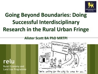
Going beyond boundaries: Doing interdisciplinary research in the rural urban fringe.
1. Going Beyond Boundaries: Doing
Successful Interdisciplinary
Research in the Rural Urban Fringe
Alister Scott BA PhD MRTPI
relu
Rural Economy and
Land Use Programme
2. relu
Rural Economy and
Land Use Programme
Plan
1. Re-discovering the
rural urban fringe
2. Interdisciplinary
Investigations
3. ‘Disintegrated’
Narratives
4. Opportunity Narratives
5. Critical Reflections
3. relu
Rural Economy and
Land Use Programme
My purpose.....To boldly go…
• Beyond boundaries
• Beyond environment
• Beyond planning
• Beyond status quo
• Beyond comfort zones
4. relu
Rural Economy and
Land Use Programme
Rediscovering the rural urban
fringe.
P10 Farley and Roberts
2011
5. relu
Rural Economy and
Land Use Programme
Re-discovering the
Rural-Urban Fringe
Messy space where town
& countryside meet
Arena where growth
issues are contested
DEFINITION
Land Use (edge)
Green Belt (barrier)
Values and Lifestyles
(commuter)
Urban-rural relationships
(complex)
6. relu
Rural Economy and
Land Use Programme
Rediscovering the rural-urban
fringe
7. Academic Commentary
Dominant 20C space (OECD
2011)
Dynamic and productive
environments (Spedding 2004)
Misunderstood space (Gallent
2006)
A ‘weed’ (Cresswell 1997)
Battleground for urban and rural
uses (Hough 1990)
Landscape out of order
(Qvistrom 2007)
relu
Rural Economy and
Land Use Programme
11. relu
Rural Economy and
Land Use Programme
Uniting Academic, Policy,
Practice and Scalar divides
Birmingham City University -
Birmingham School of the
Built Environment
University of Aberdeen -
Aberdeen Centre for
Environmental Sustainability
Forest Research
National Farmers Union
David Jarvis Associates
Natural England
Localise West Midlands
Green Economics Institute
Birmingham Environment Partnership
West Midlands Rural Affairs Forum
Worcestershire County Council
West Midlands Regional Assembly
12. relu
Rural Economy and
Land Use Programme
Seeking Interdisciplinarity
• Drawing on experience
and expertise of team
members
• Production of Separate
reflective ‘pieces’ on
• Spatial Planning (built)
• Ecosystem Approach
(natural)
Building interdisciplinarity across the
rural domain
13. relu
Rural Economy and
Land Use Programme
Theoretical Roots 1:
Spatial Planning
EUROCITIES (2004) The Pegasus files: a practical guide to integrated area-based urban planning EUROCITIES,
Brussels
14. relu
Rural Economy and
Land Use Programme
Ingredients of Spatial
Planning
1. Culture change (Nadin, 2007)
2. Positivity (Mommaas and Jansen, 2008)
3. Applied Common Sense (Collier 2010)
4. Place making ( Davoudi and Pendlebury 2010).
5. Evidence-based (UCL and Deloitte 2007)
6. Multiple (Fluid) Scales (Allmendinger and
Haughton 2006)
7. Multiple Sectors (Jordan and Halpin 2006:
Morphet, 2010)
8. Long Termism (Low, 2002)
15. relu
Rural Economy and
Land Use Programme
Theoretical Roots 2:
Ecosystem Approach
16. relu
Rural Economy and
Land Use Programme
Ecosystem Approach
"the Ecosystem Approach is a strategy for the
integrated management of land, water and
living resources that promotes conservation
and sustainable use in an equitable way“
(Convention on Biological Diversity, COP 7 Decision VII/11)
humans inherently part
of nature
17. • 12 Malawi Principles : Convention on Biological
Diversity (2004)
• Resilience (Kay et al 1999)
• Systems Thinking (Ludwig Von Bertalanffy, 1901)
• Holism (Maltby et al. 2013)
• Adaptive Management (Vasishth, 2008)
• Justice and Equity (Spash 2008)
• Connectivity (Opdam, et al 2006)
relu
Rural Economy and
Land Use Programme
Ingredients of the Ecosystem
Approach
18. relu
Rural Economy and
Land Use Programme
Improvised Interdisciplinarity
• Thoughtpieces were
synthesized by myself
within a discussion
piece
• Critical explorations of
SP and EA to define
common principles.
Building interdisciplinarity across the
rural domain
19. relu
Rural Economy and
Land Use Programme
Conceptual Framework
Natural Environment Built Environment
20. relu
Rural Economy and
Land Use Programme
Comment and Questions
• This up front
investment in new
lenses were key to our
model of
interdisciplinarity
Building interdisciplinarity across the
rural domain
22. relu
Rural Economy and
Land Use Programme
Narrative 1 Natural vs Built
Environment Divide
Natural Environment lens
1. Natural Environment White
Paper
2. Habitat and Landscape
3. DEFRA
4. Ecosystem Approach
5. Classifying and Valuing
6. National Ecosystem Assessment
7. Integrated Biodiversity
Development Areas
8. Nature Improvement Areas
9. Local Nature Partnerships
Built Environment lens
1. National Planning Policy
Framework
2. Local
3. DCLG
4. Spatial Planning
5. Zoning and Ordering
6. Sustainability Assessments
7. Development/Neighbourhood
Plans
8. Enterprise Zones / Green Belts
9. Local Enterprise Partnerships
23. relu
Rural Economy and
Land Use Programme
Theory
Natural Environment lens
1. National Ecosystem
Assessment
2. Integrated Biodiversity
Development Areas
3. Nature Improvement Areas
4. Local Nature Partnerships
Built Environment lens
1. Zoning and Ordering
2. Sustainability Assessments
3. Development/Neighbourhood
Plans
4. Enterprise Zones / Green
Belts
5. Local Enterprise Partnerships
SuRCase Project University of Liverpool Eurocities 2004
24. relu
Rural Economy and
Land Use Programme
Policy Focus
Natural Environment lens
1. Natural Environment White
Paper
2. Habitat and Landscape
3. DEFRA
4. Ecosystem Approach
5. Classifying and Valuing
6. National Ecosystem Assessment
7. Integrated Biodiversity
Development Areas
8. Nature Improvement Areas
9. Local Nature Partnerships
Built Environment lens
1. National Planning Policy
Framework
2. Local
3. DCLG
4. Spatial Planning
5. Zoning and Ordering
6. Sustainability Assessments
7. Development/Neighbourhood
Plans
8. Enterprise Zones / Green Belts
9. Local Enterprise Partnerships
25. relu
Rural Economy and
Land Use Programme
Government
Natural Environment lens
1. em Approach
2. Classifying and Valuing
3. National Ecosystem
Assessment
4. Integrated Biodiversity
Development Areas
5. Nature Improvement Areas
6. Local Nature Partnerships
Built Environment lens
1. al Planning
2. Zoning and Ordering
3. Sustainability Assessments
4. Development/Neighbourhood
Plans
5. Enterprise Zones / Green
Belts
6. Local Enterprise Partnerships
26. relu
Rural Economy and
Land Use Programme
Government Policy
Natural Environment lens
1. Habitat and Landscape
2. DEFRA
3. Ecosystem Approach
4. Classifying and Valuing
5. National Ecosystem
Assessment
6. Integrated Biodiversity
Development Areas
7. Nature Improvement Areas
8. Local Nature Partnerships
Built Environment lens
1. DCLG
2. Spatial Planning
3. Zoning and Ordering
4. Sustainability Assessments
5. Development/Neighbourhood
Plans
6. Enterprise Zones / Green
Belts
7. Local Enterprise Partnerships
27. relu
Rural Economy and
Land Use Programme
Scale
Natural Environment lens
1. DEFRA
2. Ecosystem Approach
3. Classifying and Valuing
4. National Ecosystem
Assessment
5. Integrated Biodiversity
Development Areas
6. Nature Improvement Areas
7. Local Nature Partnerships
Built Environment lens
1. DCLG
2. Spatial Planning
3. Zoning and Ordering
4. Sustainability Assessments
5. Development/Neighbourhood
Plans
6. Enterprise Zones / Green
Belts
7. Local Enterprise Partnerships
28. relu
Rural Economy and
Land Use Programme
New Designation
Natural Environment lens Built Environment lens
1. Local Enterprise
Partnerships
Forest of Bowland Nature
Improvement Area
Birmingham Enterprise Zone
29. relu
Rural Economy and
Land Use Programme
New Partnerships
Natural Environment lens
1. National Ecosystem
Assessment
2. Integrated Biodiversity
Development Areas
3. Nature Improvement Areas
4. Local Nature Partnerships
Built Environment lens
1. Development/Neighbourhood
Plans
2. Enterprise Zones / Green
Belts
3. Local Enterprise Partnerships
30. relu
Rural Economy and
Land Use Programme
Building interdisciplinarity across the
rural domain
31. relu
Rural Economy and
Land Use Programme
Narrative 2: Whose
Authority?
• Urban centres full
• Limited Room
• Expansion outside
boundaries
• Duty to Co-operate vs
Duty to Protect
• Scalar tension produces
different optimal
outcomes
32. relu
Rural Economy and
Land Use Programme
Narrative 2: Whose
Authority?
• Whose boundaries are
best; spoilt for choice
• Administrative
boundaries vs. natural
boundaries
33. relu
Rural Economy and
Land Use Programme
Narrative 3: Exemplar or
Unsustainable Development?
• Pembrokeshire Coast
National Park Authority
H8 Policy
• Welsh Assembly
Government LID study
• 10 year battle
• Who wins?
Scott 2001: Adams et al
2014 in press
Building interdisciplinarity across the
rural domain
34. relu
Rural Economy and
Land Use Programme
Narrative 4: building
sustainable communities?
35. relu
Rural Economy and
Land Use Programme
Common Missing Ingredient
in These Narratives?
Building interdisciplinarity across the rural
domain
36. Natural Environment lens Built Environment lens
relu
Rural Economy and
Land Use Programme
The Missing Ingredient?
1. Local Enterprise
Partnerships
38. relu
Rural Economy and
Land Use Programme
Seek out new evidence
• Workshops (Team led)
• Visioning exercises
• Hampton Peterborough
and N Worcestershire
39. relu
Rural Economy and
Land Use Programme
Building interdisciplinarity across the
rural domain
40. relu
Rural Economy and
Land Use Programme
Workshops
• Each workshop had
report produced
• All respondents
circulated with requests
for further feedback
and responses
• Final report.
Building interdisciplinarity across the
rural domain
41. relu
Rural Economy and
Land Use Programme
Conceptual Framework
Natural Environment Built Environment
42. relu
Rural Economy and
Land Use Programme
TIME: Learning and
Applying Lessons
• To boldly go………….
• “Path to excellence is
paved with failure”
• Critical examination of
past policy
interventions in the RUF
West Midland Planners learning
lessons from Regional Planning
43. relu
Rural Economy and
Land Use Programme
TIME: Learning and
Applying Lessons
“What about Ebenezer Howard and his visions
these were long term; we don't have this kind
of thinking anymore ... Why ?” BCU
44. relu
Rural Economy and
Land Use Programme
TIME: Learning and
Applying Lessons
Countryside Management
Approach
Integrated remit
Field-based
Needs based
BUT
Funding vulnerability
Rarely linked to statutory
planning policy and plans
46. relu
Rural Economy and
Land Use Programme
CONNECTIONS:
Securing Multi-functionality
Building interdisciplinarity across the
rural domain
47. relu
Rural Economy and
Land Use Programme
CONNECTIONS: Securing
Multifunctionality
“Green infrastructure planning across landscape
scale areas crossing administrative
boundaries.... The role of infrastructure
planning is crucial but needs to be at the right
scale”. BEP
48. relu
Rural Economy and
Land Use Programme
CONNECTIONS: Securing
Multifunctionality
49. VALUES: Achieving Creative Fringes
relu
Rural Economy and
Land Use Programme
by Challenging Convention
“How can we bring about a cultural shift to get
away from taking it for granted that
population and consumption per capita will
continue to grow” BEP
50. relu
Rural Economy and
Land Use Programme
Differing VALUES of Fringe
(Collier &Scott 2012)
Building interdisciplinarity across the
rural domain
51. relu
Rural Economy and
Land Use Programme
VALUES: Achieving Creative
Fringes by Challenging Convention
“Land value is the main barrier to RUF being
used for local food production and other
innovative things ......” LWM
52. VALUES: Achieving Creative Fringes
relu
Rural Economy and
Land Use Programme
by Challenging Convention
Baseline £ Value of Green Services Multiple Benefits
• Heat island
• Flood protection
• Food production
• Pollination
• Water quality
• Soil quality
• Carbon sequestration
• Biodiversity
• Health
• Recreation
53. VALUES: Achieving Creative Fringes
relu
Rural Economy and
Land Use Programme
by Challenging Convention
Baseline £ Value of Green Services Multiple Benefits
• Heat island
• Flood protection
• Food production
• Pollination
• Water quality
• Soil quality
• Carbon sequestration
• Biodiversity
• Health
• Recreation
54. VALUES: Achieving Creative Fringes
relu
Rural Economy and
Land Use Programme
by Challenging Convention
Chemin De Fer - Paris
Sandwell: Urban Agriculture
55. VALUES: Achieving Creative Fringes by
relu
Rural Economy and
Land Use Programme
Challenging Convention
• “..... Green Belt just
protects now very
affluent commuter belt
settlements ........ This
culture of negativity
and restriction restricts
freedom of manoeuvre
for planners and the
development industry”.
WMRAF
56. relu
Rural Economy and
Land Use Programme
Discussion: Re-inventing the
Fringe
• Orchestrate bold new visions of the fringe
• Secure multiple benefits from/for economy,
nature and community
• Enable adaptation through experimentation
and creativity
• Employ core principles of equity (social &
environmental) & quality of life
• Cross boundaries to identify opportunities
57. relu
Rural Economy and
Land Use Programme
Delivering Unconventional
Outputs
58. relu
Rural Economy and
Land Use Programme
Delivering Unconventional
Outputs
59. • Making a new research and practice journey
together
• Co-producing new research model or making
it up as we go along
• Using Reflexivity and Social Learning (Shorthall
2008)
• Building future collaborations and projects
relu
Rural Economy and
Land Use Programme
Reflections
60. relu
Rural Economy and
Land Use Programme
Delivering Unconventional
Outputs
61. relu
Rural Economy and
Land Use Programme
Final word
• “The fringe is not just the
place where town meets
country but a collection of
dynamic and productive
environments set in
inspiring cultural
landscapes, meeting the
needs of both the present
and helping to change the
way we live in the future”.
Nick Spedding 2004
Editor's Notes
The goal of this talk is therefore set within the rhetoric of the spatial explorer ...to
Use of the word fuzzy signifies soft and fluid boundaries of the RUF
Important addition to many definitions by looking at the people who shape the area. See RUF defined by nature/interests of people who live there as much as land uses. This brings into RUF zone commuter areas in what might have been seen as previously rural.
Having built a team uniting academics and policy practitioners we effectively Our starting point involved individual reflective pieces drawing on experiences of Spatial Planning and the Ecosystem Approach. Despite their different foundations and philosophies the rhetoric has remarkable convergence . These terms emerging from a contents analysis of the reflective pieces form the starting point from which our resultant framework was produced .”
Vertical integration: (also international/global perspective e.g. in terms of climate change / CO2 and other gases)
Horizontal integration: Priorities and framing of criteria/themes may change over time (new situations, knowledge, insights, identified needs)
Culture change: moving from control and regulation to more positive verbs requires support to planners and also other agencies.
Positivity as above (oil tanker syndrome.)
Applied common sense: look at your contributions on moodle. Lessons learnt about a plan .
Place making look at place but also connections and interrelationships between places, flows. Emphasis on quality through masterplanning that make things happen.
Evidence based it is a capital mistake to ‘plan’ before you have data (or plan!). Issue of pragmatism and identifying sources of good evidence not just quantitative
Scales from global to neighbourhood but also landscape scale. Scales are fluid not rigid.
Sectors crossing sectoral boundaries in a 2 way process. See health, crime and recreation
Partnerships principal delivery vehicle for SP
Tools need new tools to check that planning is joined up see role of SEA; capacity studies.
Long termism and restablishement of vision.
Connections become a focus of SP networks as part of a system. Avoid studying places, people in isolation.
Values are important in terms of the different vlaues people have aboutp laces and change but Also the vlaues that planners themselves have, Beware of the latter as it is rarely epxlicit. Gunder and Hiller 2007 responsible spatial planning concerns the ‘avoidance of avoidance’: the moral responsibility to acknowledge and recognize there are other perspectives available and to actually do something about them. Inch 2010 traces way 2 planners see their world through practice. (role of your learning log).
Inclusion : key role of stakeholders in SP but more than involvement. Early but issue of WHO; HOW WHEN and HOW MUCH and SO WHAT
Social Learning the need to reflect on what you have leanrt thruogh experiecne and interaction across new domains. Happens over time .
The natural environment is based on reward , whilst the built environment is based on restraint and control.
2. The natural environment is driven by the Natural Environment White Paper whilst the built environment is being driven by the emerging National Planning Policy Framework with limited connection between the two.
3. The natural environment is focussed at the habitat and landscape scale whilst the built environment is currently moving towards a local scale.
4. The natural environment is overseen by Defra with its delivery agencies (Natural England, Environment Agency and Forestry Commission) whilst the built environment is over seen by the Department for the Communities and Local Government with its delivery agencies being local authorities.
5. The natural environment champions the ecosystem approach whilst the built environment champions spatial planning.
6. The natural environment classifies habitats and species whilst the built environment zones and orders using land use plans.
7. The natural environment uses the UK National Ecosystem Assessment whilst the built environment uses Sustainability Assessments incorporating Strategic Environmental Assessment.
8. The natural environment currently uses the umbrella of Integrated Biodiversity Delivery Areas whilst the built environment uses the umbrella of Development plans.
9. The natural environment is promoting Nature Improvement Areas for environmental funding whilst the built environment is promoting enterprise zones for economic funding.
10. The natural environment is developing Local Nature Partnerships whilst the Built Environment has developed Local Enterprise partnerships.
The method built on work that i did in 2004 for the Welsh Assembly (what kind of countryside do we want)
At each viewpoint we split the group up into 3 and led separate discussions about the RUF past, present and future. The talks were taped and transcribed and also each member was given a notebook to put down their views including those voiced and unvoiced. Each view was on a separate page of paper so as you can see we had a debreif session at the end where everybody could see the range of resposnes at each site across all groups. (also had a nice cream tea!)
“However, it’s important to realise that every part of the GI network doesn’t have to deliver against each one these benefits. For example in a SSSI, biodiversity conservation and enhancement may take priority, whereas in new residential development climate change resilience, sustainable transport and community cohesion may come to the fore.
“Many of the actions that would result from effective Green Infrastructure planning also support the ecosystem approach, whether or not this is factored into the decision-making process.
“Take for example a watercourse. Watercourses are an obvious linear feature which can thread through and link up urban and rural areas, making them a natural part of the Green Infrastructure network. The Green Infrastructure led management of the watercourse could include influencing appropriate management of the floodplain or the re-naturalisation of the watercourse, protecting or restoring its natural functions. This is good for the environment and good for nearby communities.
“It is here that the inherent multifunctionality of Green Infrastructure immediately takes it beyond just planning, or just ecology. However, to make Green Infrastructure happen, a wide range of partners need to work together.
“The Green Infrastructure approach is gaining popularity in town and country planning because it integrates different environmental themes, such as biodiversity and the historic environment, in a way which provides a holistic understanding of the natural and built environment. And then puts this into a format which can be applied including being used proactively by planners in policy development, masterplans and informing their decisions on development.
“The key point is that the sum value of the Green Infrastructure network is greater than its constituent parts.”
the green infrastructure in Birmingham evaluated within this ecosystem assessment has been valued at £11.8 million annually or £420.5 million capitalised over 50 years
the green infrastructure in Birmingham evaluated within this ecosystem assessment has been valued at £11.8 million annually or £420.5 million capitalised over 50 years