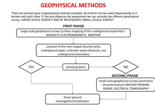
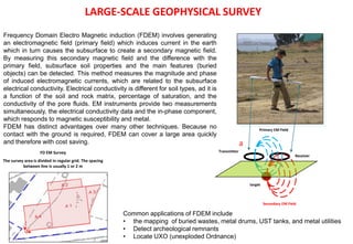
Downloaded 25 times

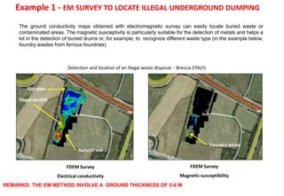
![Example 2 - EM SURVEY TO LOCATE ILLEGAL UNDERGROUND DUMPING
0 50 100 150 200
Distanza [m]
0 50 100 150 200
-120
-90
-60
-30
0
Distanza[m]
143500
145500
147500
149500
151500
Illegal disposal 1
Tyre waste illegal disposal – Old trench excavation filled with
tyre wire waste (HIGH CONDUCTIVITY)
Illegal disposal 2
Old gravel pit excavation filled with rubber waste (LOW
CONDUCTIVITY)
Mapping of an illegal waste disposal - Cuneo (ITALY)](https://image.slidesharecdn.com/geophysicalsurveyfortheriskmanagement-150826073651-lva1-app6891/85/Geophysical-survey-for-the-risk-management-8-320.jpg)
![0 5 10 15 20 25 30 35 40 45
Distance [m]
-7
-6
-5
-4
-3
-2
-1
0
Profondità[m]
0 1 2 3 4 5 6 7 8 9 10 11 12 13 14 15 16 17 18 19 20 21 22 23 24 25 26 27 28 29 30 31 32 33 34 35 36 37 38 39 40 41 42 43 44 45 46 47
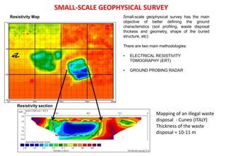
The plume of contamination usually show a strong
contrast with the natural soil or groundwater. The oil (and
all hydrocarbons) have a high electrical resistivity, and
can be easily recognized with the geoelectrical survey
LNAPL
MW3
Linea ERT7
GWL
DNAPL
Underground pipe
Floating oil
Polluted water
3 3.2 3.4 3.6 3.8 4 4.2 4.4
<3
(log-resistivity)
Natural soil
Oil tak
Source of the contamination
LNAPL
Example 3 – ERT SECTION TO LOCATE THE CONTAMINATION PLUME OF
PLASTIFICANT OIL IN THE GROUNDWATER TABLE
Mapping of the pollution plume due to a leakage
from an oil storage tank (project not citable)](https://image.slidesharecdn.com/geophysicalsurveyfortheriskmanagement-150826073651-lva1-app6891/85/Geophysical-survey-for-the-risk-management-11-320.jpg)

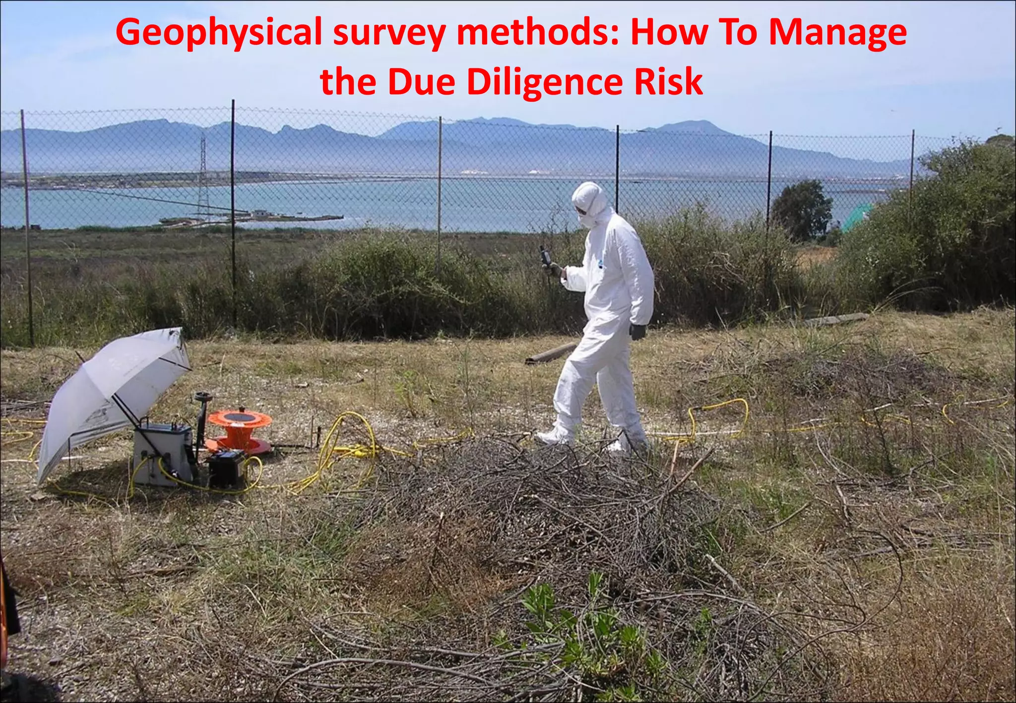
This document discusses managing risk through geophysical survey methods for due diligence assessments. It describes how non-invasive geophysical surveys such as electromagnetic, ground penetrating radar, and electrical resistivity tomography can identify subsurface hazards cost effectively by mapping buried utilities, tanks, waste, and other underground anomalies before invasive investigations. Large scale surveys identify potential risks while small scale surveys characterize identified anomalies to better inform follow up actions.