Downloaded 166 times


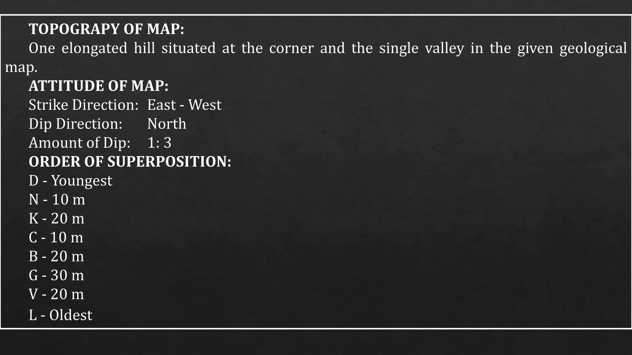


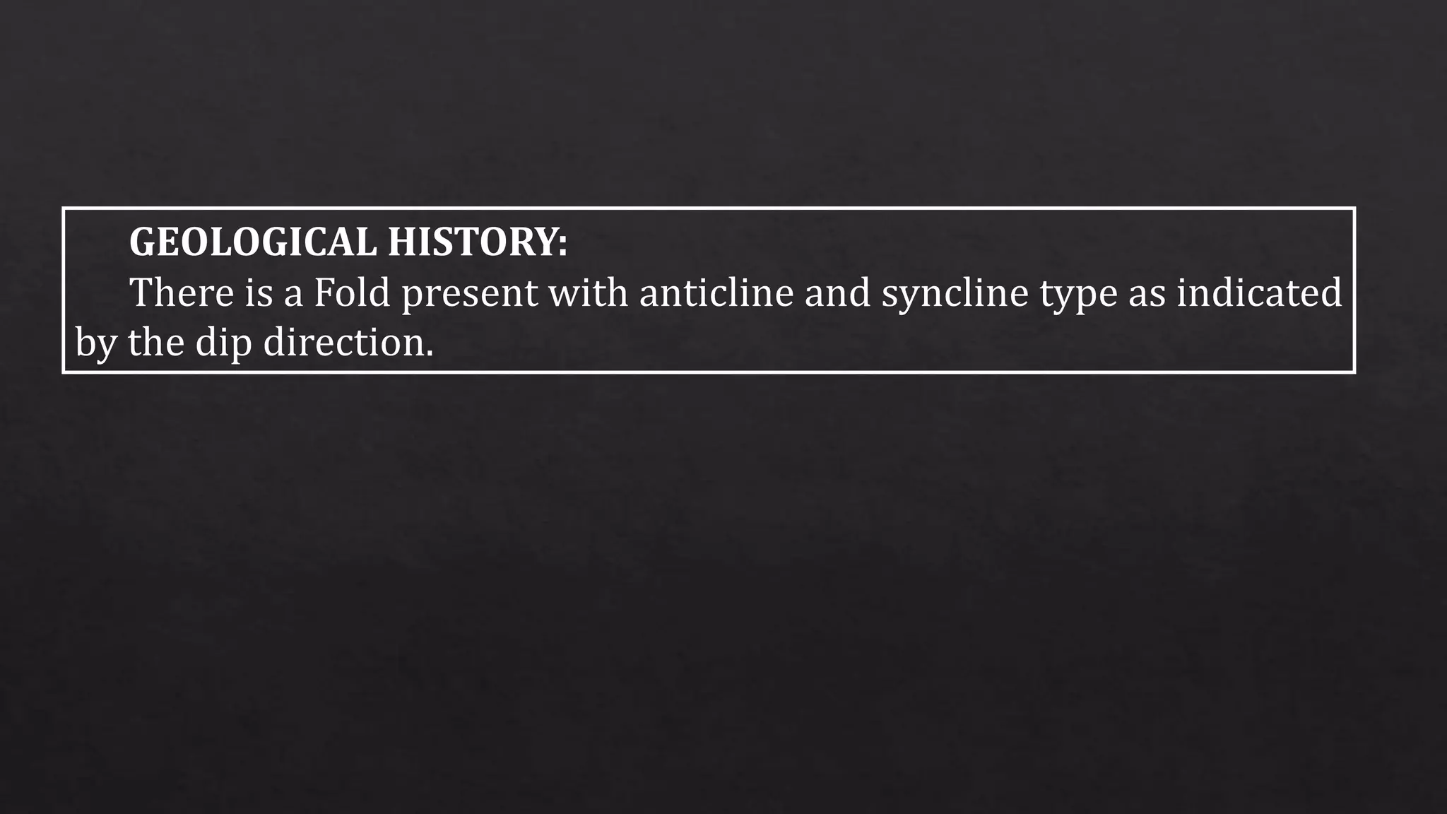


Bed C was deposited first and was successively overlain by beds J, O, D, and S. The area was then folded to form an anticline in the west and a syncline in the east, as indicated by the changing dip directions. A valley runs west to east across the folded strata.


