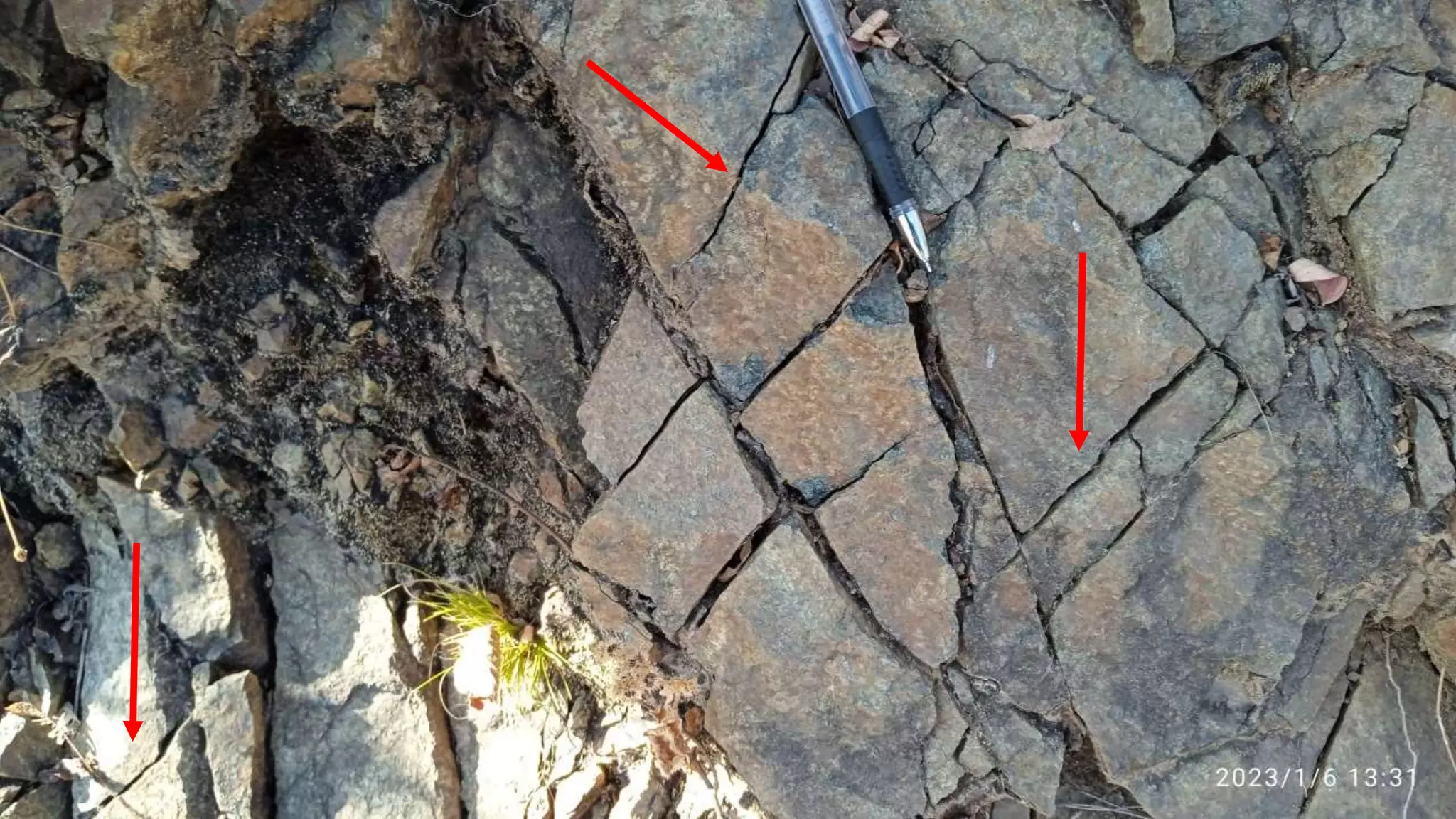
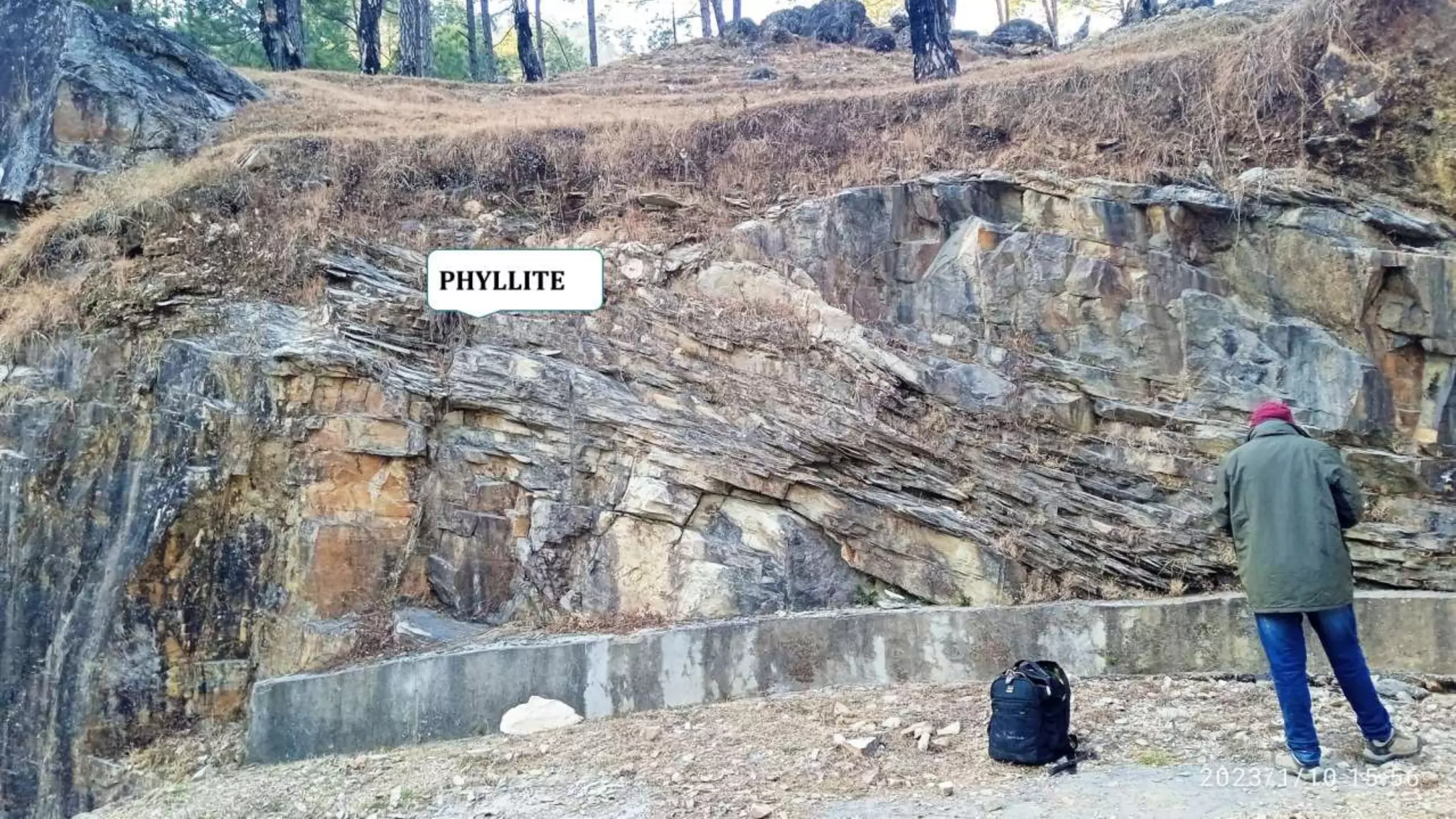
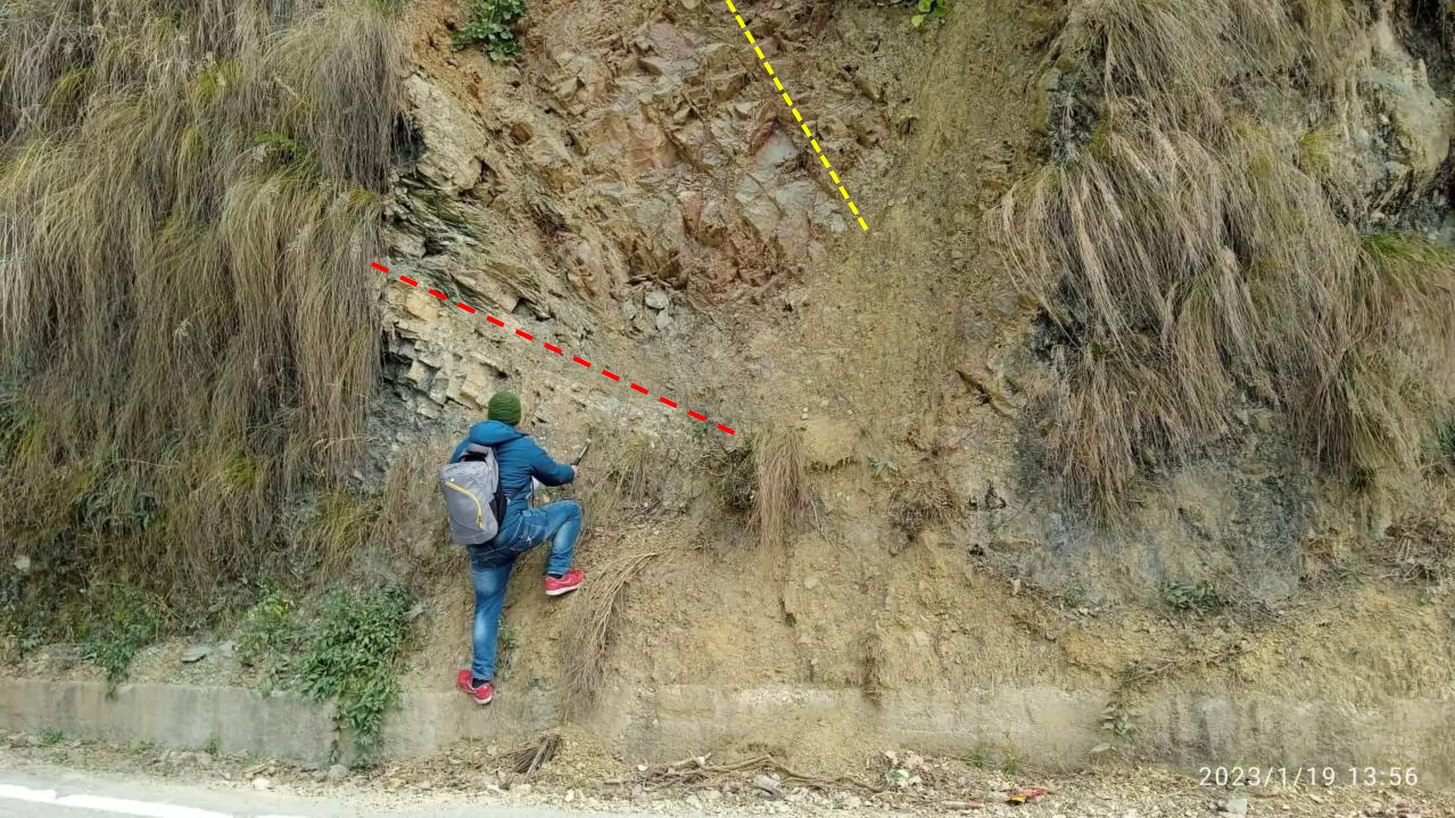
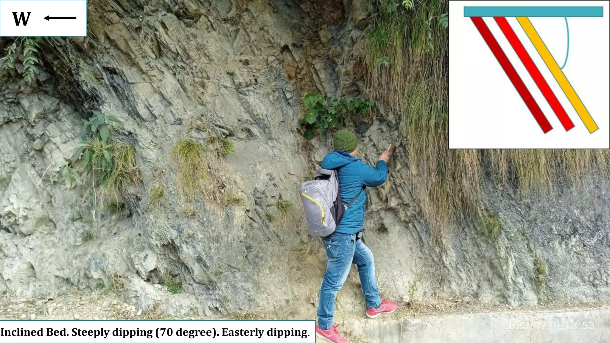
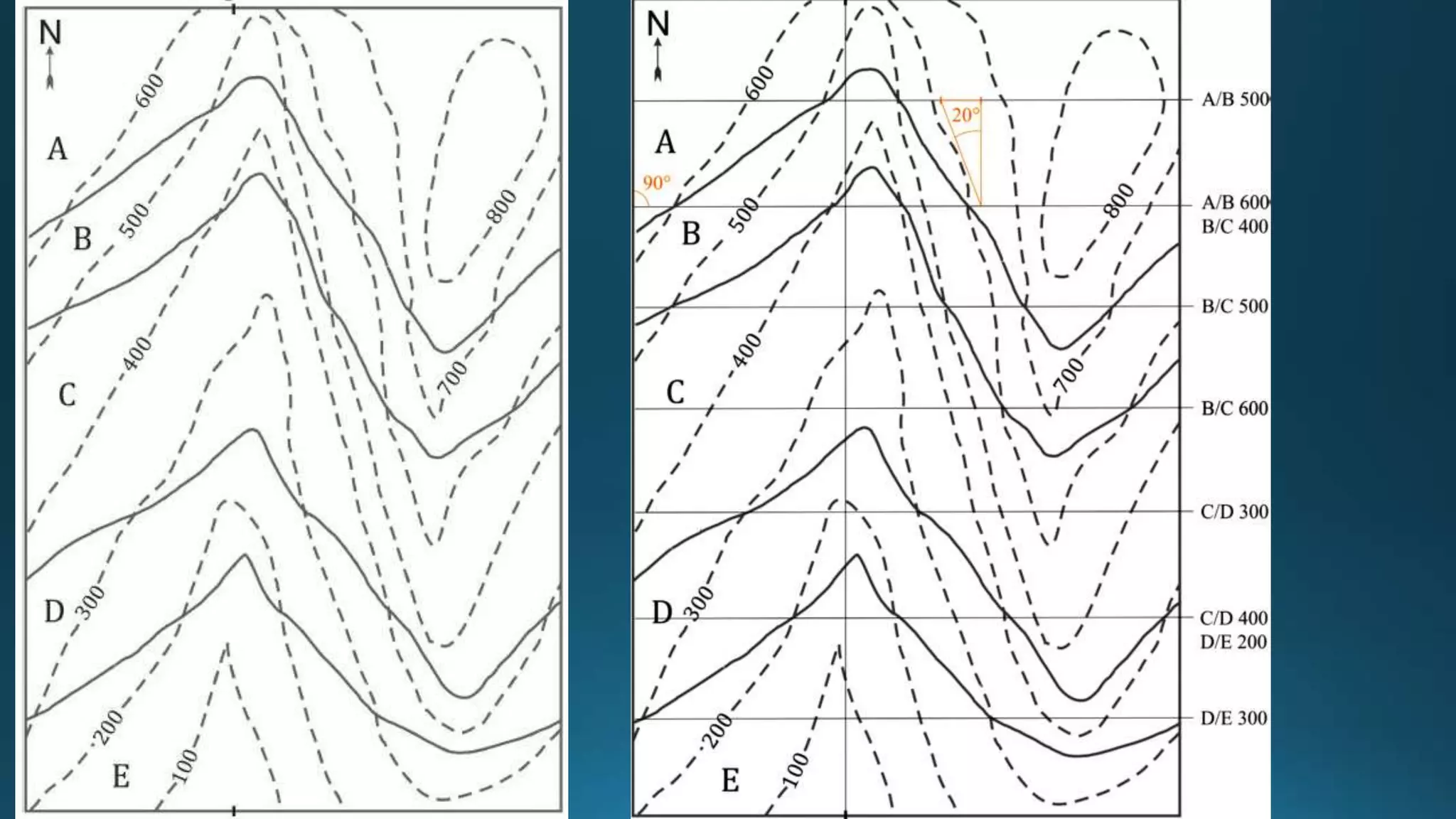
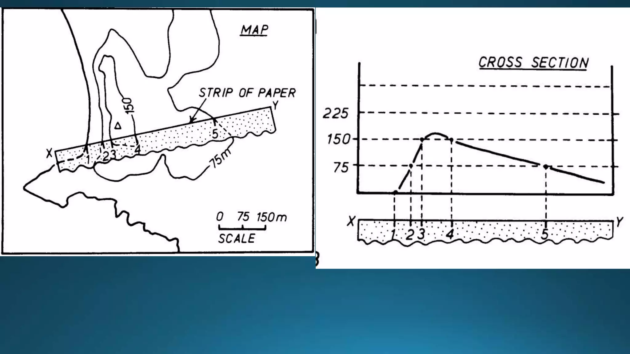
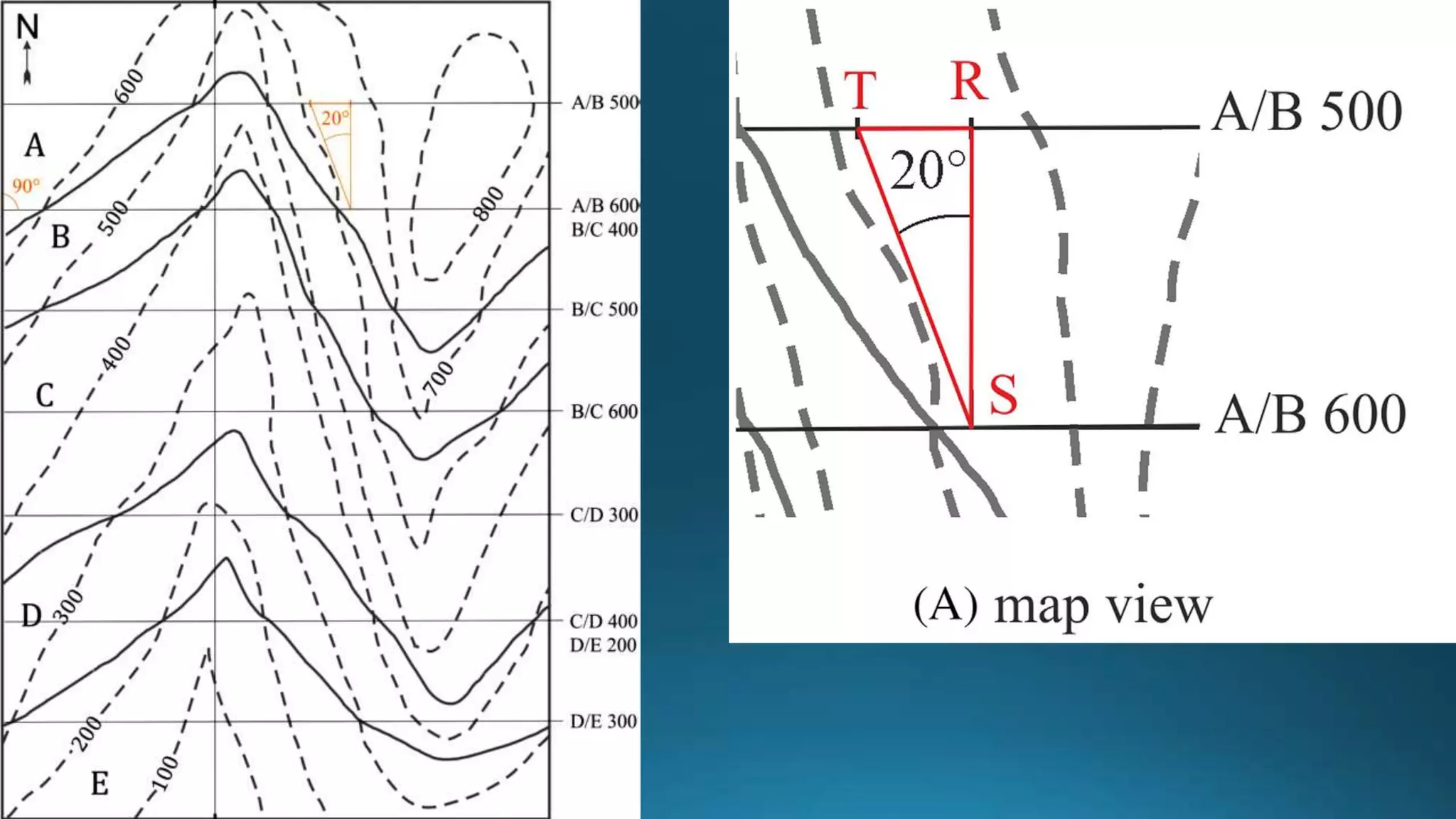
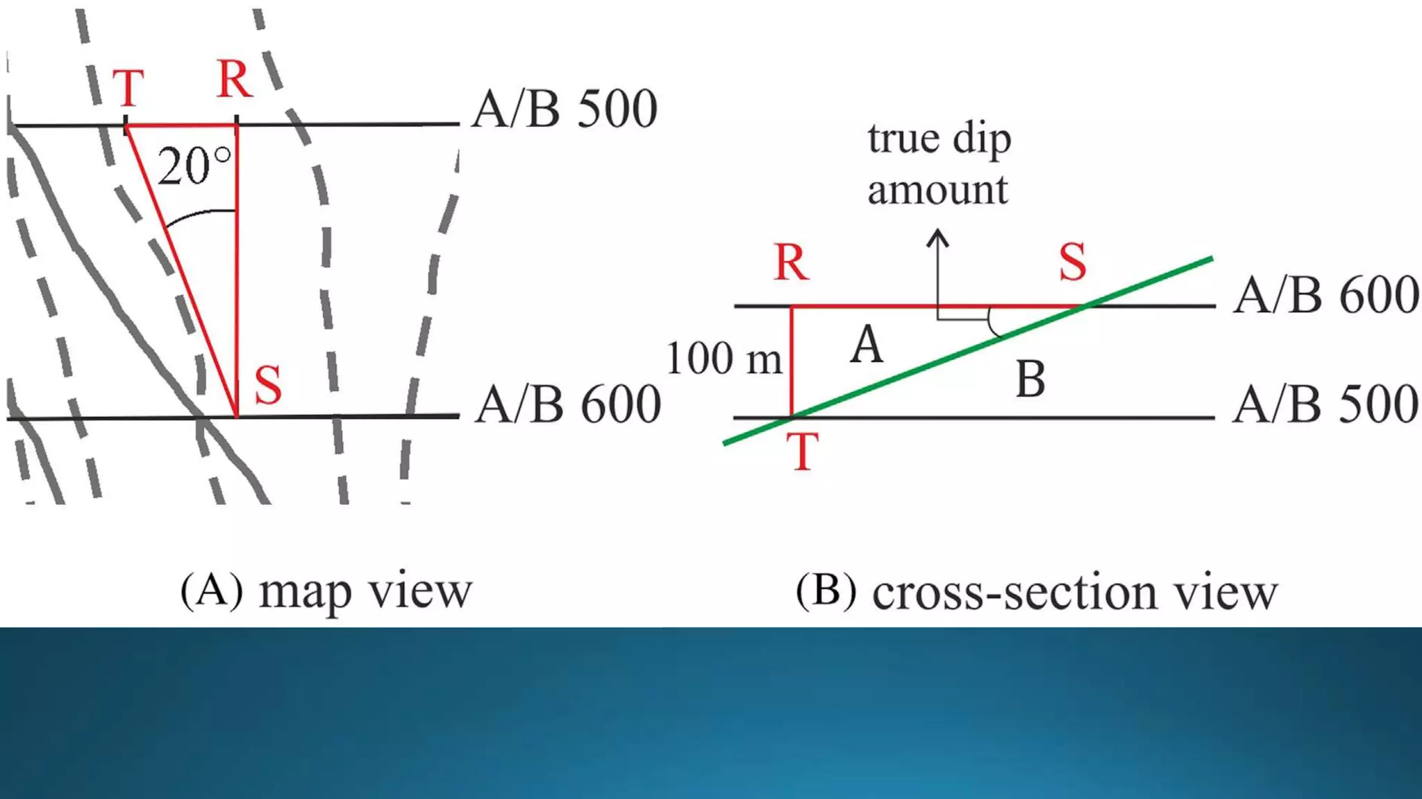
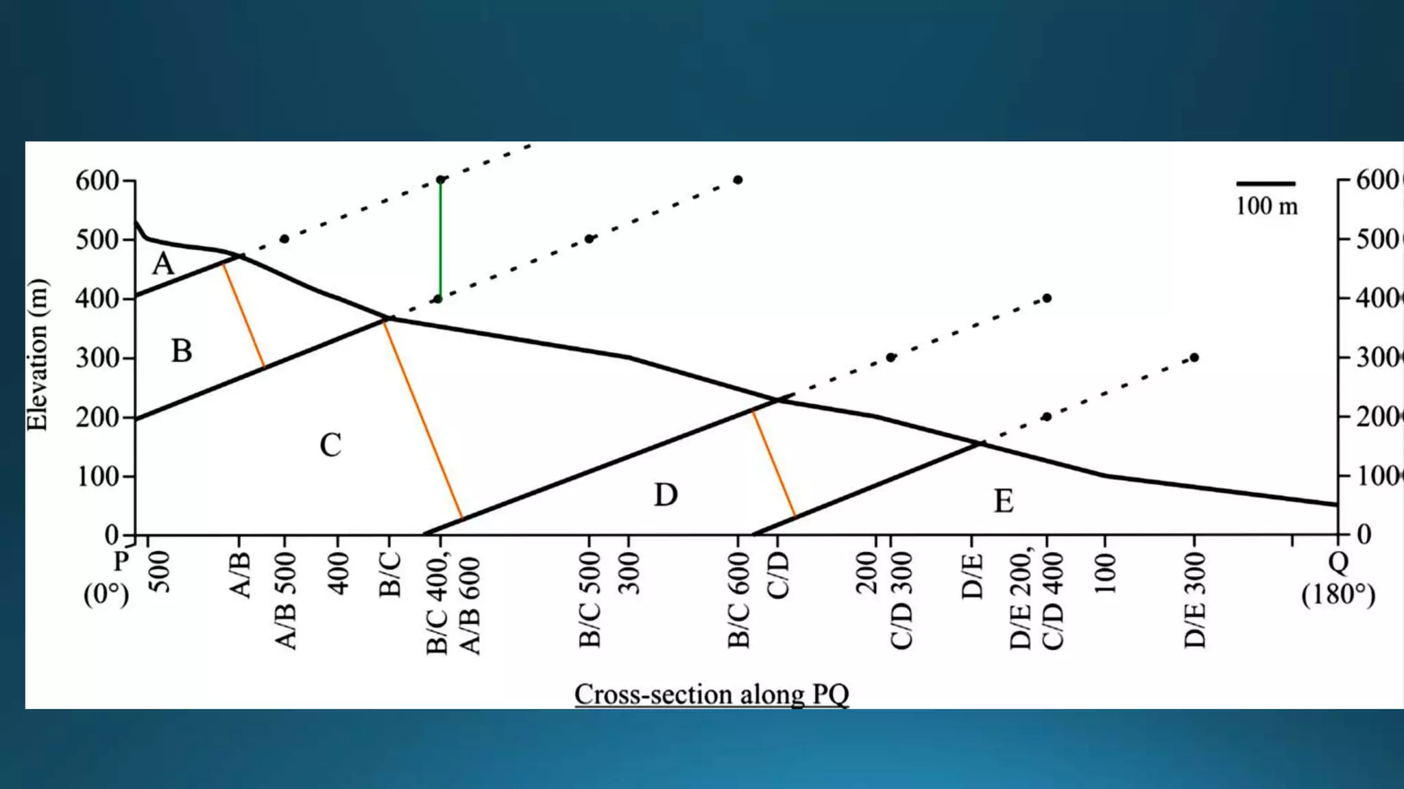
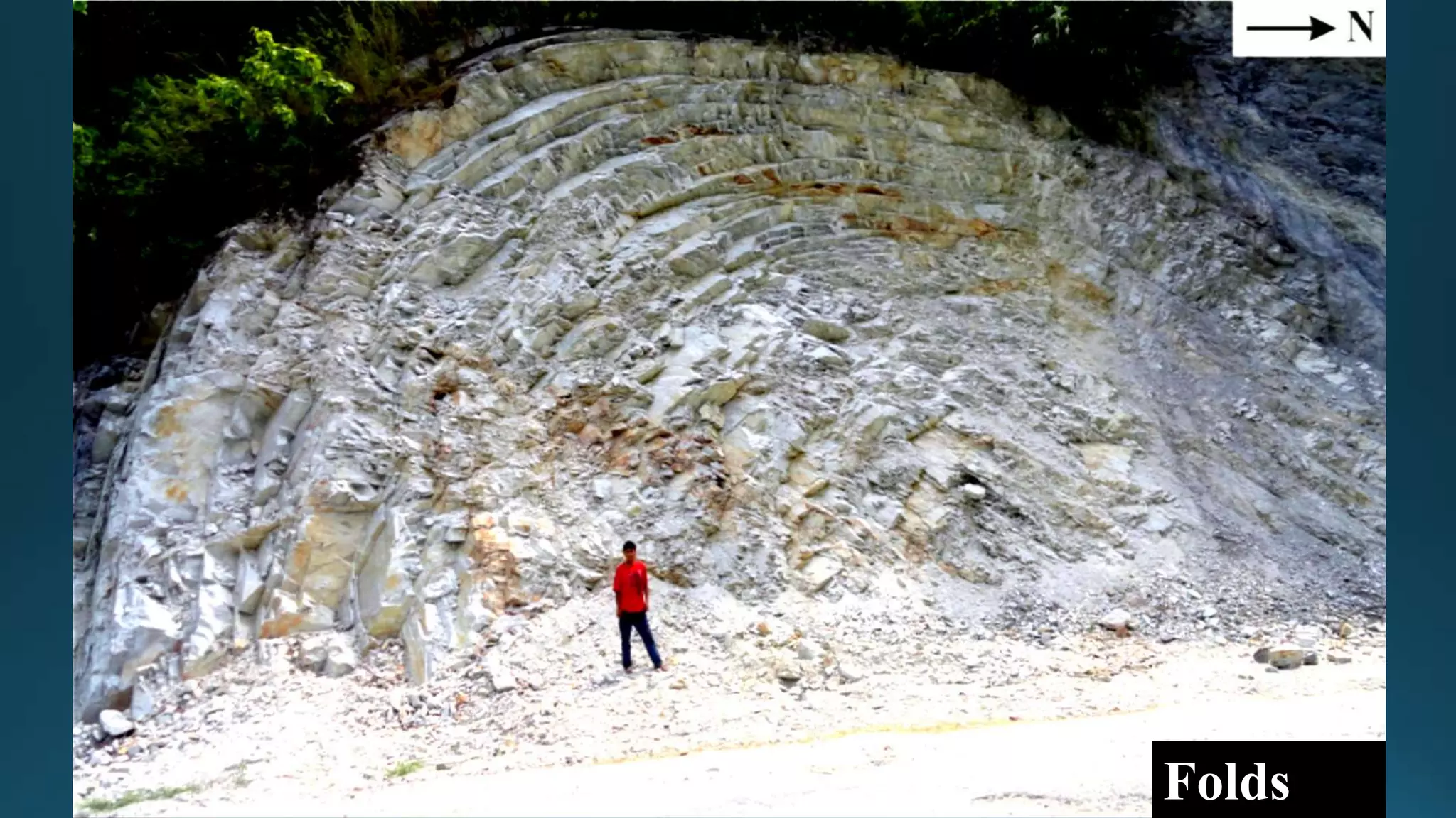
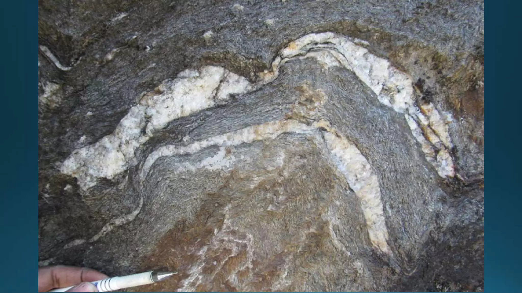
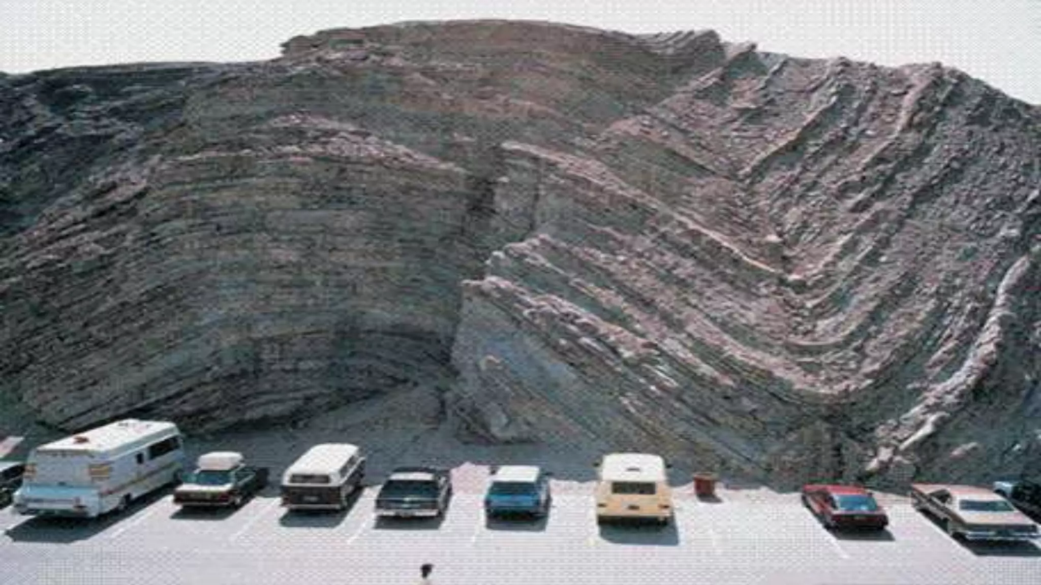
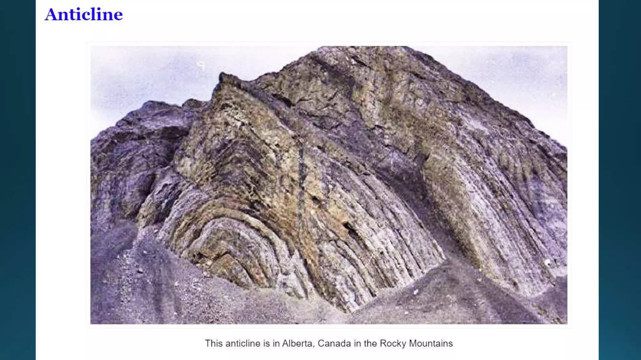
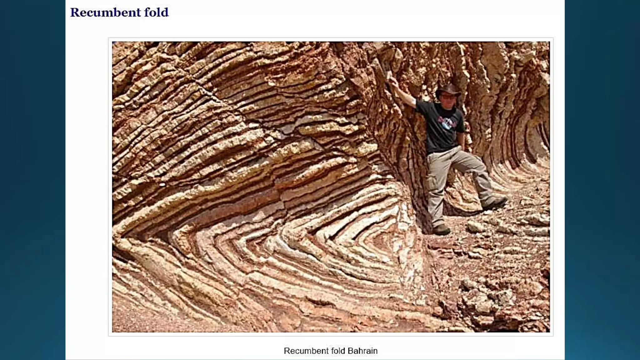
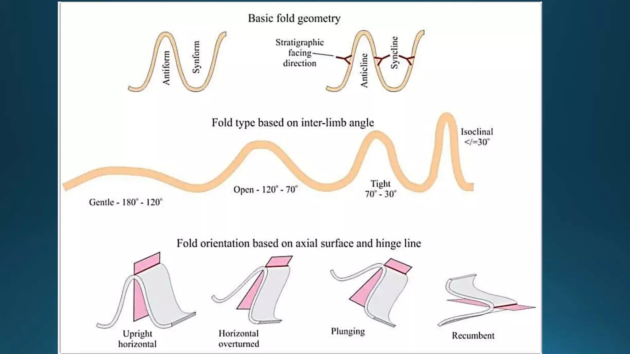
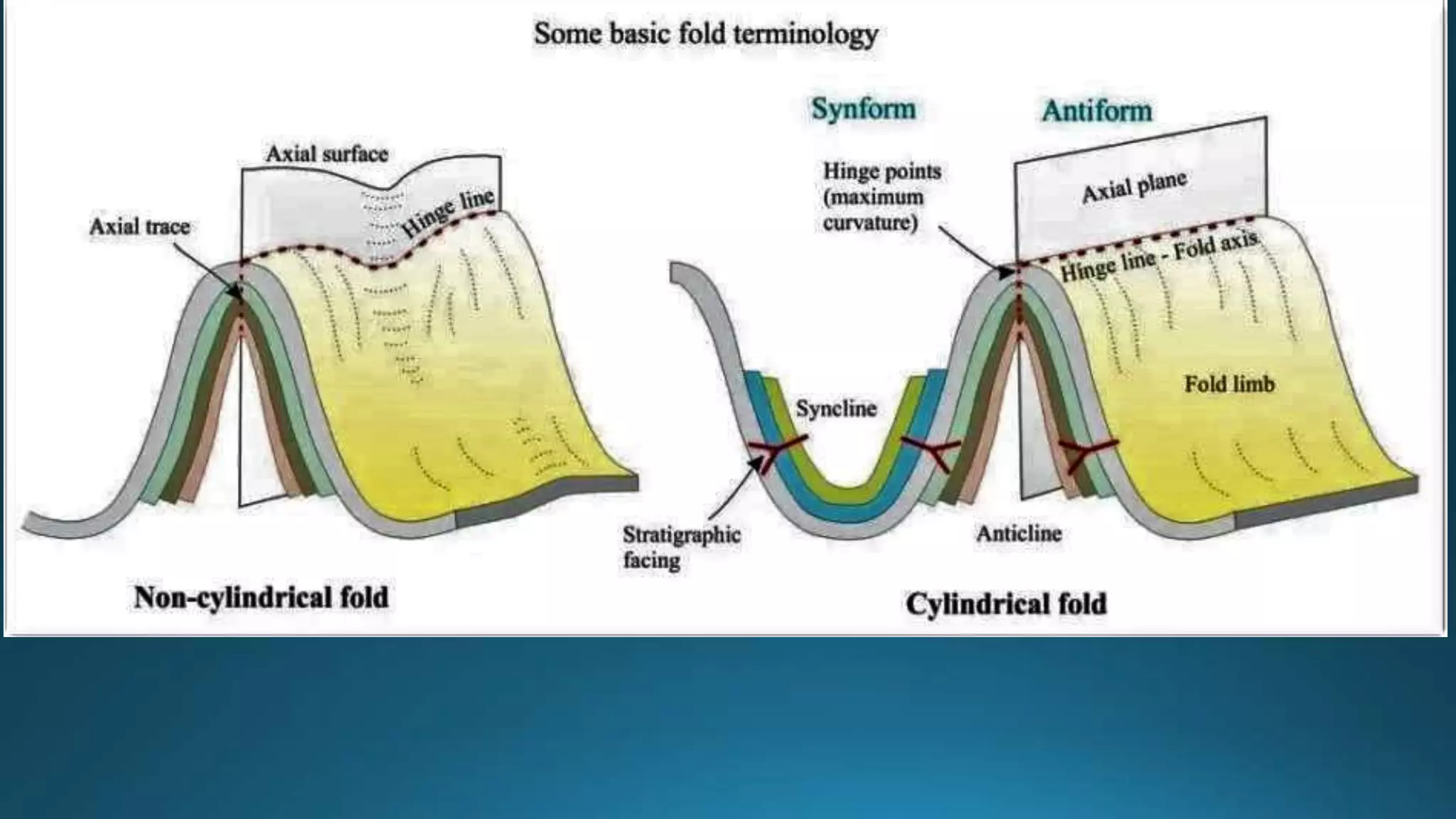
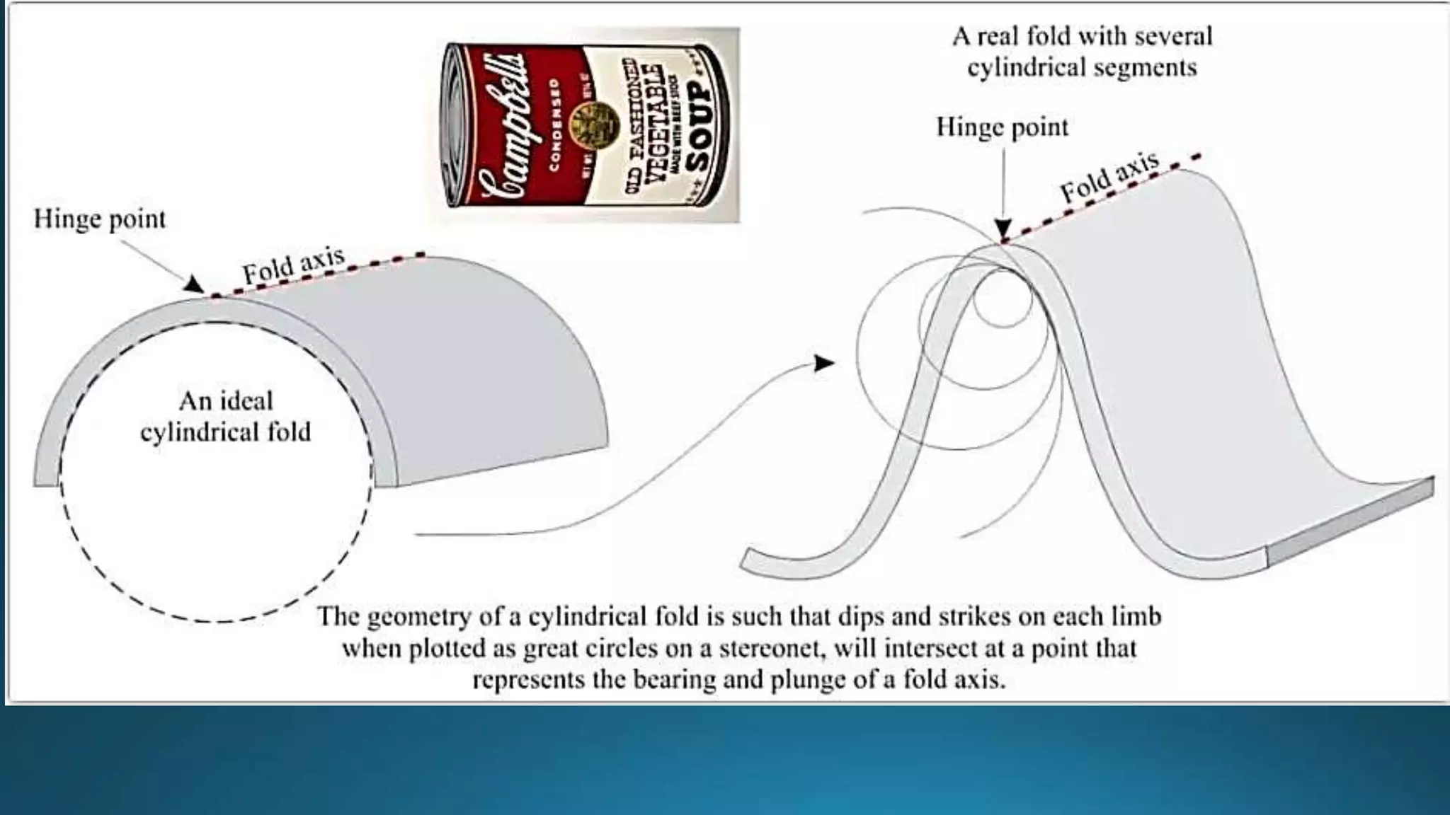
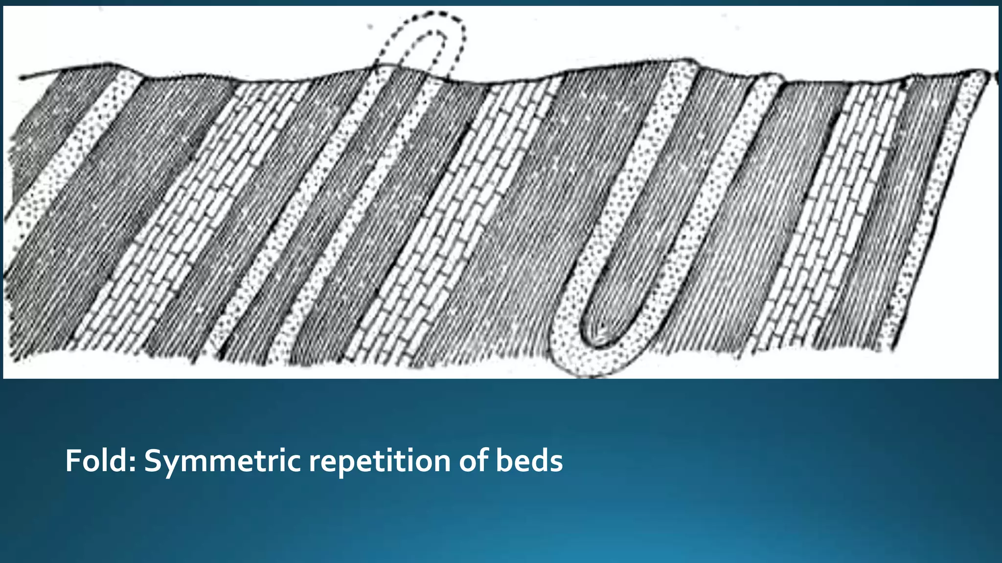
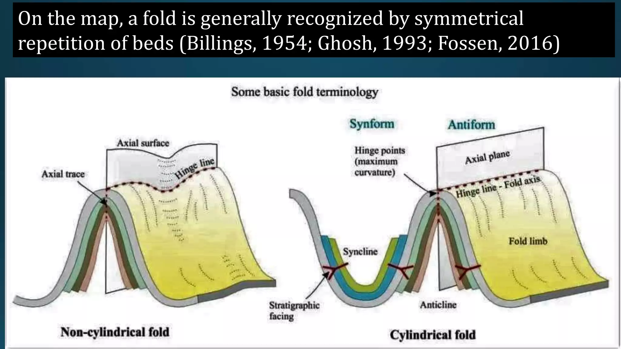
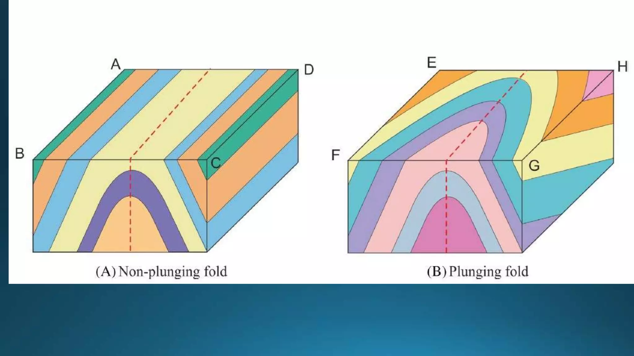
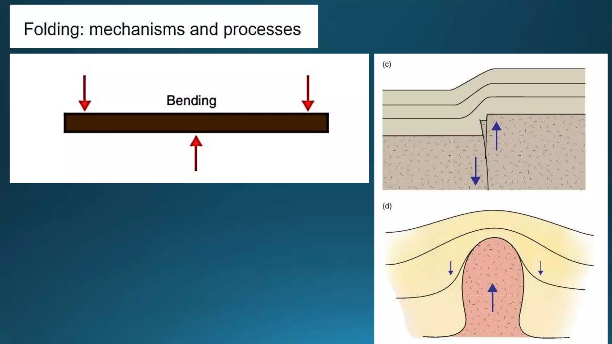
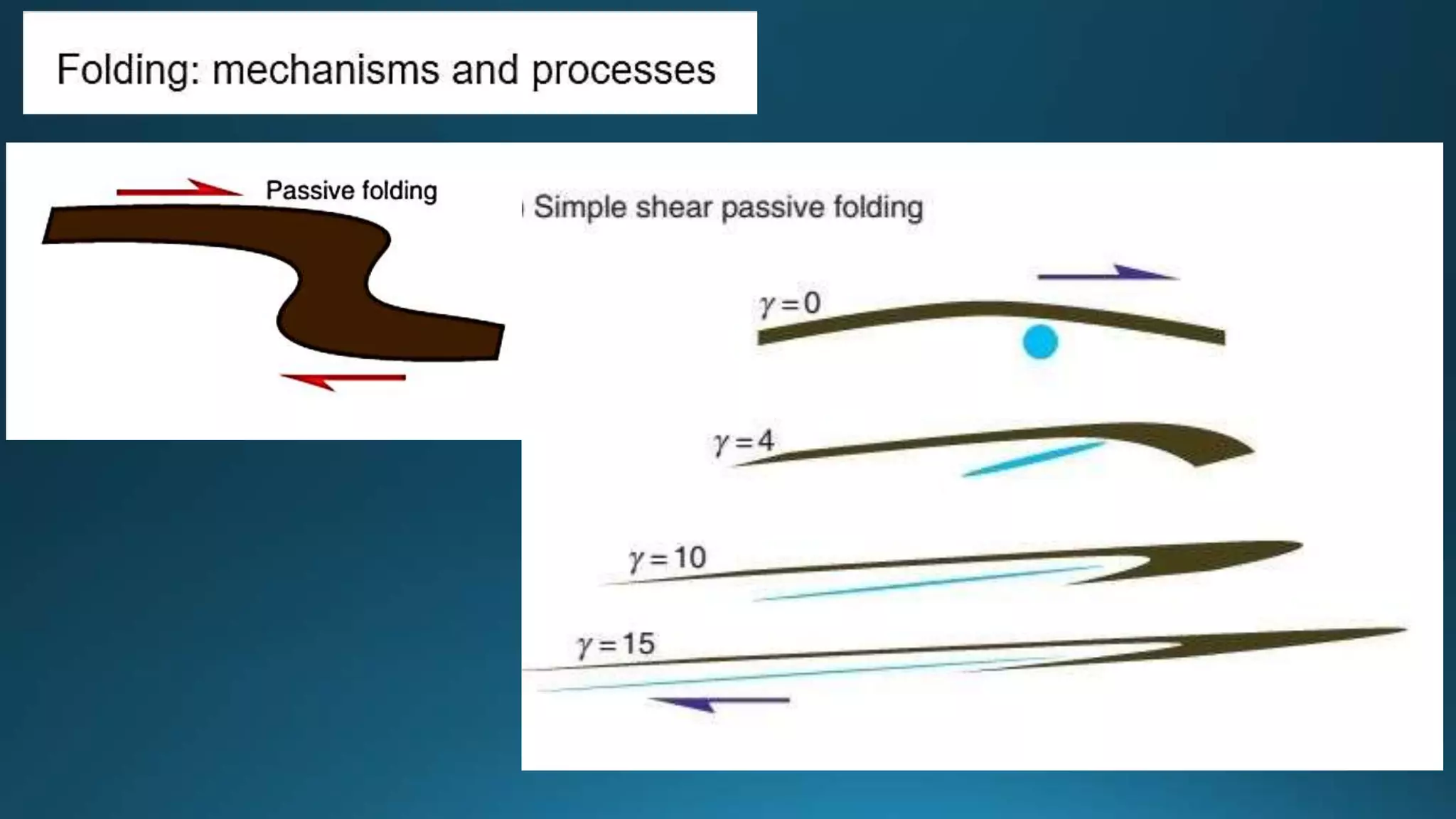
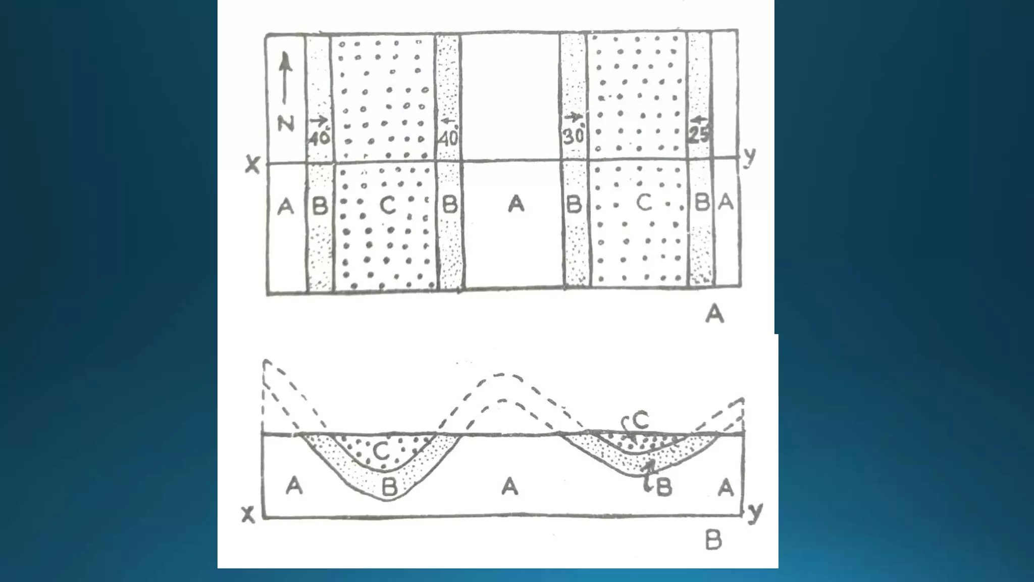
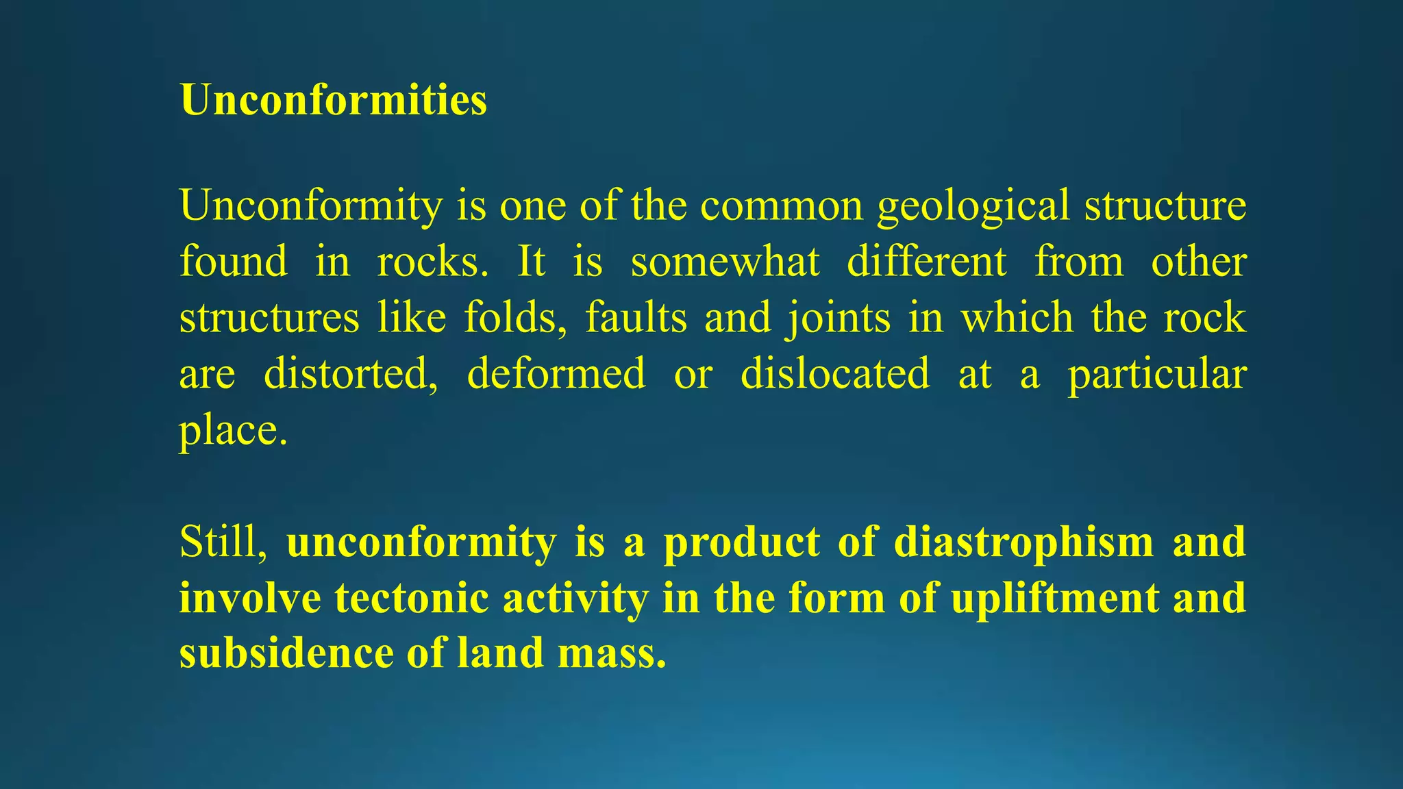
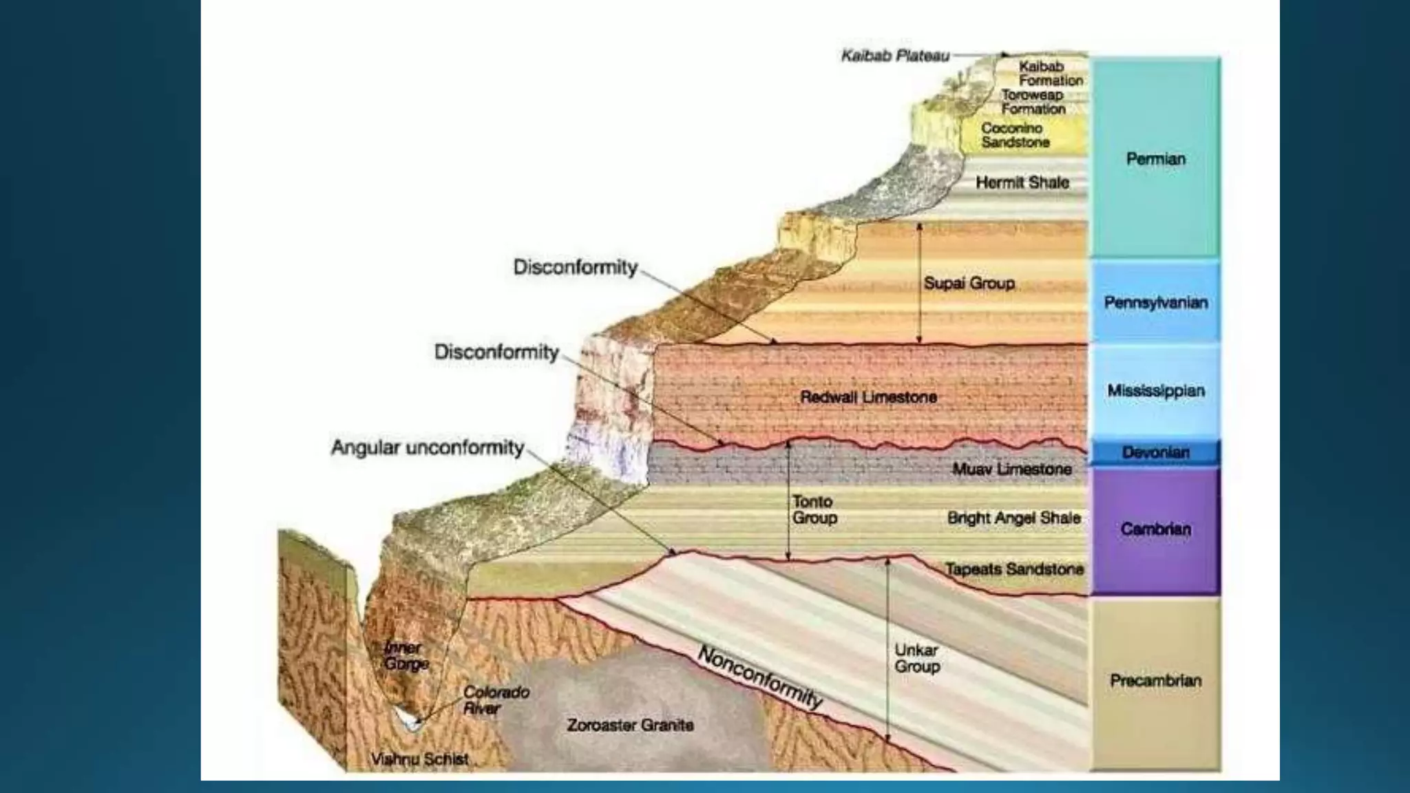
This presentation gives detailed information about earthquake , its types , waves , faults , especially in asian countries .A detailed case study of earthquake In NEPAL in 2015 is also covered in this with pictures . Also how it is measured and its warning system , vulnerability, deployment and future aspects has been covered .
HOPE YOU LIKE IT AND GET FULL INFORMATION!!!!!
Structural geology is the study of the three-dimensional distribution of rock units concerning their deformational histories.
The primary goal of structural geology is to use measurements of present-day rock geometries to uncover information about the history of deformation (strain) in the rocks, and ultimately, to understand the stress field that resulted in the observed strain and geometries.
Students, digital devices and success - Andreas Schleicher - 27 May 2024..pptxEduSkills OECD
Andreas Schleicher presents at the OECD webinar ‘Digital devices in schools: detrimental distraction or secret to success?’ on 27 May 2024. The presentation was based on findings from PISA 2022 results and the webinar helped launch the PISA in Focus ‘Managing screen time: How to protect and equip students against distraction’ https://www.oecd-ilibrary.org/education/managing-screen-time_7c225af4-en and the OECD Education Policy Perspective ‘Students, digital devices and success’ can be found here - https://oe.cd/il/5yV
Model Attribute Check Company Auto PropertyCeline George
In Odoo, the multi-company feature allows you to manage multiple companies within a single Odoo database instance. Each company can have its own configurations while still sharing common resources such as products, customers, and suppliers.
2024.06.01 Introducing a competency framework for languag learning materials ...Sandy Millin
http://sandymillin.wordpress.com/iateflwebinar2024
Published classroom materials form the basis of syllabuses, drive teacher professional development, and have a potentially huge influence on learners, teachers and education systems. All teachers also create their own materials, whether a few sentences on a blackboard, a highly-structured fully-realised online course, or anything in between. Despite this, the knowledge and skills needed to create effective language learning materials are rarely part of teacher training, and are mostly learnt by trial and error.
Knowledge and skills frameworks, generally called competency frameworks, for ELT teachers, trainers and managers have existed for a few years now. However, until I created one for my MA dissertation, there wasn’t one drawing together what we need to know and do to be able to effectively produce language learning materials.
This webinar will introduce you to my framework, highlighting the key competencies I identified from my research. It will also show how anybody involved in language teaching (any language, not just English!), teacher training, managing schools or developing language learning materials can benefit from using the framework.
We all have good and bad thoughts from time to time and situation to situation. We are bombarded daily with spiraling thoughts(both negative and positive) creating all-consuming feel , making us difficult to manage with associated suffering. Good thoughts are like our Mob Signal (Positive thought) amidst noise(negative thought) in the atmosphere. Negative thoughts like noise outweigh positive thoughts. These thoughts often create unwanted confusion, trouble, stress and frustration in our mind as well as chaos in our physical world. Negative thoughts are also known as “distorted thinking”.
How to Create Map Views in the Odoo 17 ERPCeline George
The map views are useful for providing a geographical representation of data. They allow users to visualize and analyze the data in a more intuitive manner.
The French Revolution, which began in 1789, was a period of radical social and political upheaval in France. It marked the decline of absolute monarchies, the rise of secular and democratic republics, and the eventual rise of Napoleon Bonaparte. This revolutionary period is crucial in understanding the transition from feudalism to modernity in Europe.
For more information, visit-www.vavaclasses.com
Welcome to TechSoup New Member Orientation and Q&A (May 2024).pdfTechSoup
In this webinar you will learn how your organization can access TechSoup's wide variety of product discount and donation programs. From hardware to software, we'll give you a tour of the tools available to help your nonprofit with productivity, collaboration, financial management, donor tracking, security, and more.
The Art Pastor's Guide to Sabbath | Steve ThomasonSteve Thomason
What is the purpose of the Sabbath Law in the Torah. It is interesting to compare how the context of the law shifts from Exodus to Deuteronomy. Who gets to rest, and why?
The Art Pastor's Guide to Sabbath | Steve Thomason
Structural Geology for Civil Engineering
1. Structural Geology
Under the influence of tectonic plate forces, the rocks that make up the earth's
crust experience diverse deformations, dislocations, and disturbances. As a
result, geological structures such as folds, faults, joints, and unconformities
appear in the rocks. The specific way of formation, causes, types, classification,
significance, and so on.
Geological structures changed the basic physical properties of rock, making it
more or less suited for civil engineering purposes. Dam site sedimentary rocks
with an upstream dip supplied an acceptable geological arrangement, whereas
the same rock with a downstream dip provided an unfavorable geological
setup.
6. Representing a Basin in Various ways: Schematic Diagram
Representation of a basin in various ways. Schematic diagrams. (A) Three-dimensional view. Height horizons are marked.
(B) Note how the height contours look similar to those in map view. The height increases as one moves away from the
center (as indicated by the arrow “i”).
7. Representation of a basin in various ways. Schematic diagrams. (B) Note how the height
contours look similar to those in map view. The height increases as one moves away from
the center (as indicated by the arrow “i”). (C) Vertical section along MN marked in (A).
8. A solid line on the map represents a plane and the plane is:
horizontal—if the line is parallel to the height contours (i.e., the broken lines);
9. A solid line on the map represents a plane and the plane is:
inclined—if the solid line is curved and cuts the height contours;
On the map, the curvature of the solid line decreases as the bed steepens.
On the map, the curvature of the solid line increases as the bed gently dipping.
10. What is Dip ?
Bedding and other geological layers and planes that are not
horizontal are said to dip. The dip is the slope of a geological
surface.
There are two aspects to the dip of a plane:
(a)the direction of dip towards which the plane slopes; and
(b) Angle of dip is that plane makes with a horizontal plane. The
direction of dip can be visualized as the direction in which water
would flow if poured onto the plane. The angle of dip is an angle
between 0° (for horizontal planes) and 90° (for vertical planes).
11. What is Dip ?
Bedding and other geological layers and planes that are not
horizontal are said to dipping. Dip is the slope of a geological surface.
12.
13. A solid line on the map represents a plane and the plane is:
vertical—A straight solid line cuts across height contours that indicates a vertical plane for
an undulating topography. However, in a planar topography, both inclined and vertical
planes appear as straight lines.
14. What is a strike line ?
Strike lines of a single plane are mutually parallel.
Successive strike lines of equal interval (500 m, 400 m,
300 m, etc.) are equidistant from each other. Steeper
planes produce more close-spaced strike lines.
What is Stratum Contour?
stratum contours are the orthographic/map projection of
strike lines on a horizontal surface.
15.
16.
17.
18.
19.
20.
21.
22. Folds
• Folds are the most common geological structures found in rocks.
When a set of horizontal layers are subjected to compressive
forces, they bend either upward or downward. The bend
noticed in rocks are called folds. • In terms of their nature too, folds
may occur as single local bends or may occur repeatedly and
intricately folded to the tectonic history of the region.
35. Causes and Effects of Folding
• Most of the important folds, as already pointed out, are due to
tectonic causes. But a few folds of a minor type are due to non-tectonic
causes,
• Mainly, the compressive and shear type of tectonic forces are
responsible for the folding phenomenon. Igneous intrusion of viscous
magmas such as laccoliths and lopoliths also contribute to folding.
• Non-tectonic causes like landslides, creeping, differential compaction,
isostatic setting and glaciations too are responsible for some folds.
These are minor in terms of frequency of occurrence and magnitude.
36. On the map, a fold is generally recognized by symmetrical
repetition of beds (Billings, 1954; Ghosh, 1993; Fossen, 2016)
37.
38. General way to distinguish the folded and unfolded litho-contacts on the map.
A. Litho-contacts separating the litho units P, Q, R crop out in a way that a dark blue line
joining the hinges of the contour Vs and outcrop Vs (almost) coincides. This indicates the
unfolded nature of the litho-contacts.
39. B. Here a line joining the hinges of the contour Vs (red broken line) and that of
the outcrop Vs (green broken line) are away from each other. This indicates
that the litho-contacts are folded. A’. Strike lines drawn for case A.
40.
41.
42.
43.
44.
45. Faults
• From the Civil engineering point of view, faults are the most
unfavorable and undesirable geological structures at the site for any
given purpose, i.e. for location of reservoir; as foundations site for
construction of dams, importance bridges or huge buildings, for
tunneling; for laying roads, railways tracks, etc.
• This is because faults considerably weaken the rocks and render the
sites in which they occur as unfavorable places for all constructional
purposes.
• Further, as long as the faults are active, the site is unstable and
susceptible to upward, downward or sideward movement along the
fault plane, thereby making the places highly hazardous for foundation
purposes. Thus, by virtue of the
harm they are capable of causing, faults are necessarily investigated
with special care in dealing with any major construction.
60. Unconformities
Unconformity is one of the common geological structure
found in rocks. It is somewhat different from other
structures like folds, faults and joints in which the rock
are distorted, deformed or dislocated at a particular
place.
Still, unconformity is a product of diastrophism and
involve tectonic activity in the form of upliftment and
subsidence of land mass.
61.
62. Formation of unconformity involves:
Unconformities are resulted due to tectonic activity in form
of uplift or subsidence of land.
It is referred to a period of non-deposition. Break in
sedimentation or deposition.
Next phase of Deposition or sedimentation cycle, where new
sedimentation produce another set of conformable beds.
Any deposition when takes place, that is totally in horizontal
fashion. Later due to tectonic movement the layers or beds
are tilted (except in case of cross-bedding- which are formed
under fluvial (riverine) or Aeolian (wind) environment.
66. Disconformity
Underlying (older) rock and
overlying (younger)
sedimentary rock strata are
parallel and contact plane is
an erosional surface (look
for weathering surface,
boulders/pebbles of older
rock in younger). But gap in
geological record.
67. Paraconformity
A gap in geological system, but no
evidence of erosion, no evidence of
gap in time,
Plane above and below are parallel.
Short period of non depositional,
mostly local extension (local
unconformity).
69. References
Billings, M.P., 2013. Structural Geology, PHI learning private limited, Delhi. Pp 408-419
Bose N., Mukherjee, S., Map interpretation for structural Geologists.
Davis, G.H., Reynolds, S.J. 1996. Structural geology of rocks and regions. John Wiley & Sons, Inc.
New York, 776 p.
Hobbs, B. E., Means, W. D., Williams, Paul F., 1976. An Outline of Structural Geology, John Wiley
and Sons, INC. U.S.A. Pp 213-288, 571 p.
Ramsey, J.G., 1967. Folding and fracturing of rocks. McGraw-Hill Book Co., New York, 560 p.
Ramsey, J.G., and M.I. Huber. 1987. The techniques of modern structural geology, v.2. Folds and
fractures. Academic Press, London, 381 p.