Downloaded 137 times


![Finding Nearby Places
Python, Perl, PHP, Java etc
python-geohash
○ Encode/Decode
○ BoundingBox
{'s': 12.919921875,
'e': 77.6513671875,
'w': 77.607421875,
'n': 12.9638671875}
○ Neighbours
['ezefx','ezefr','ezefp','ezs40',
'ezs41','ezs43','ezs49','ezs48']](https://image.slidesharecdn.com/geohash-120925144734-phpapp01/85/Geohash-12-320.jpg)
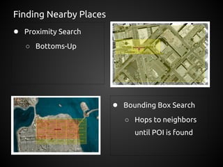
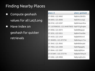
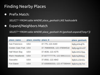


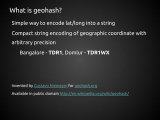
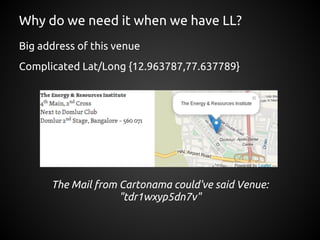
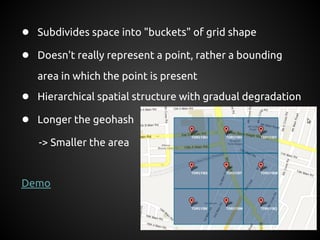
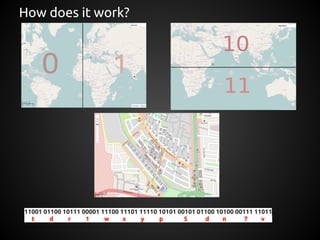
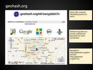
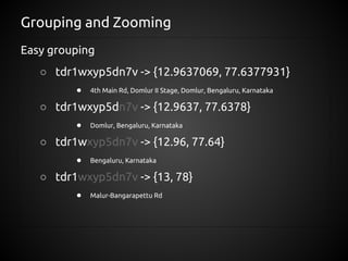
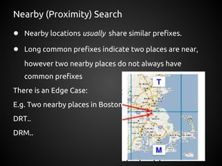
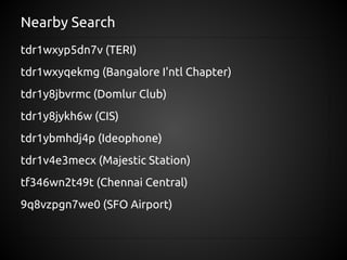
Geohash encodes latitude and longitude coordinates into alphanumeric strings to simplify representation and allow for proximity searches. It subdivides geographic areas into nested grid "buckets" represented by strings, with longer strings indicating smaller areas. This hierarchical structure allows nearby locations to be identified by searching for records with similar geohash prefixes. While it approximates location rather than representing a single point, geohash enables easy grouping, zooming, and proximity searches of geographic data in databases.