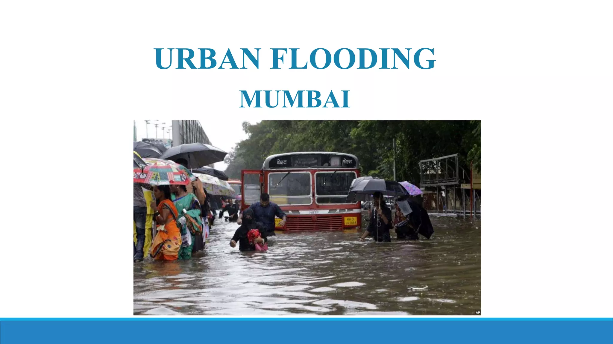
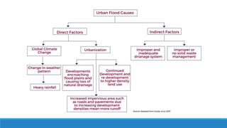
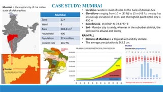
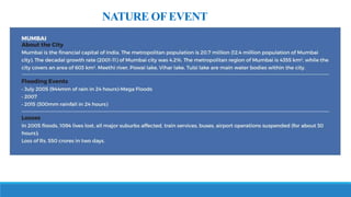
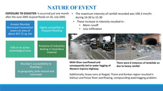
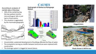
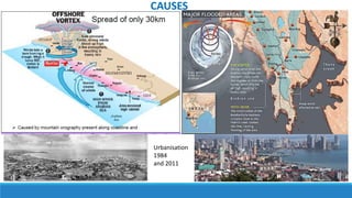
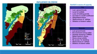
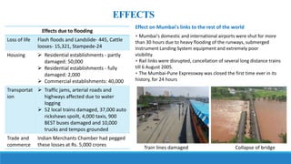
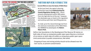
1) Mumbai is prone to urban flooding due to heavy rainfall that exceeds the capacity of its drainage systems. The 2005 floods inundated large parts of the city, disrupting transport and killing over 400 people.
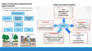
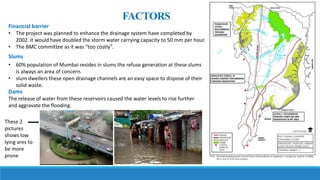
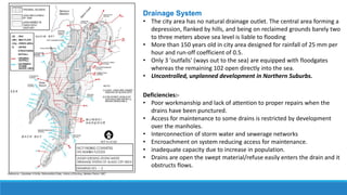
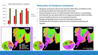
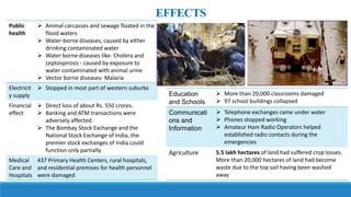
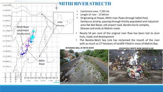
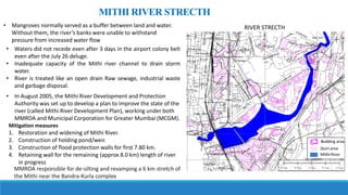
2) Uncontrolled development has reduced open spaces and destroyed mangroves that previously absorbed excess rainfall. The narrow Mithi River is choked with waste and cannot drain water effectively.
3) Flooding affected housing, transport, businesses and critical infrastructure. Efforts since then have focused on widening drains, restoring the Mithi River, and improving disaster response systems. However, rapid urbanization continues to exacerbate flooding risks.


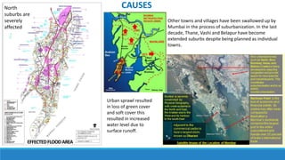
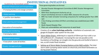
![INITIALRELIEFMEASURES
Flood relief operations
• Free food grains were provided by the Government of Maharashtra [GOM] and
MCGM.
• About 5.5 lakh people were evacuated to safer places. About 1.94 lakh people
were in camps
A hygiene awareness campaign has been initiated by the government.
1. Disbursement of Family packs
2. Mobilization of two Indian Red Cross society’s [IRCS] National Disaster
Response Team [NDRT] members for logistics and relief support.
3. Deployment of Additional Mass Water Treatment Unit [TWAU]
Relief measures taken immediately
Clearing of Solid waste and debris
A total of 16307 carcasses were disposed of
including those of 15000 sheep and goats
Disinfection of open spaces and waste
collection
Mosquito control measures
Insecticide was sprayed and fogging operations
completed in 1174 vulnerable locations
Immediately after the outbreak of
leptospirosis took preventive measures for
water borne diseases
Provided healthcare services though 130
medical teams that have treated 3 lac patients
at their door steps through health camps and
outreach program
The Fire Brigade and the "Rescue Teams" of
MCGM undertook 282 rescue operations](https://image.slidesharecdn.com/finalflood-180203034251/85/flood-23-320.jpg)