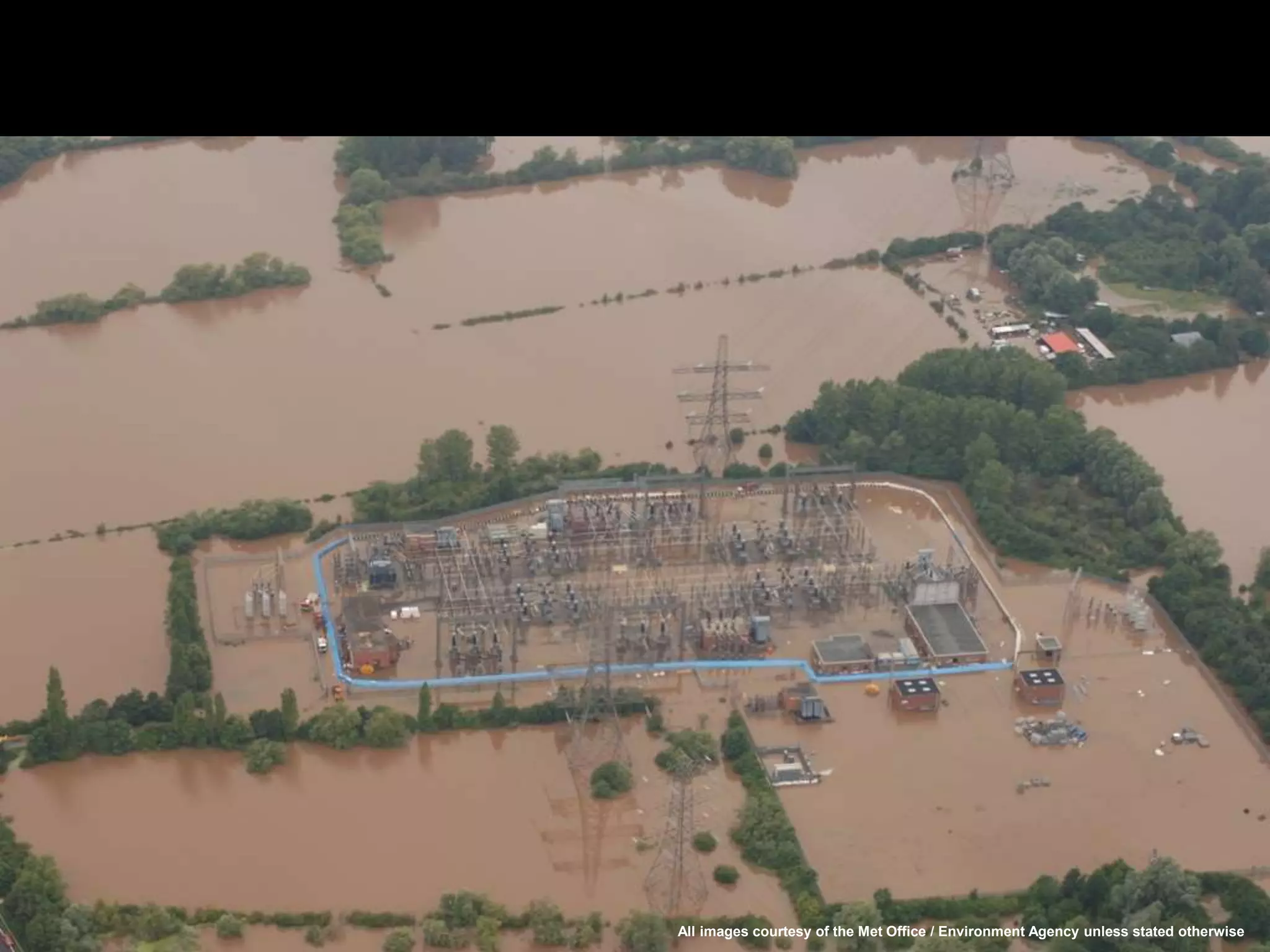
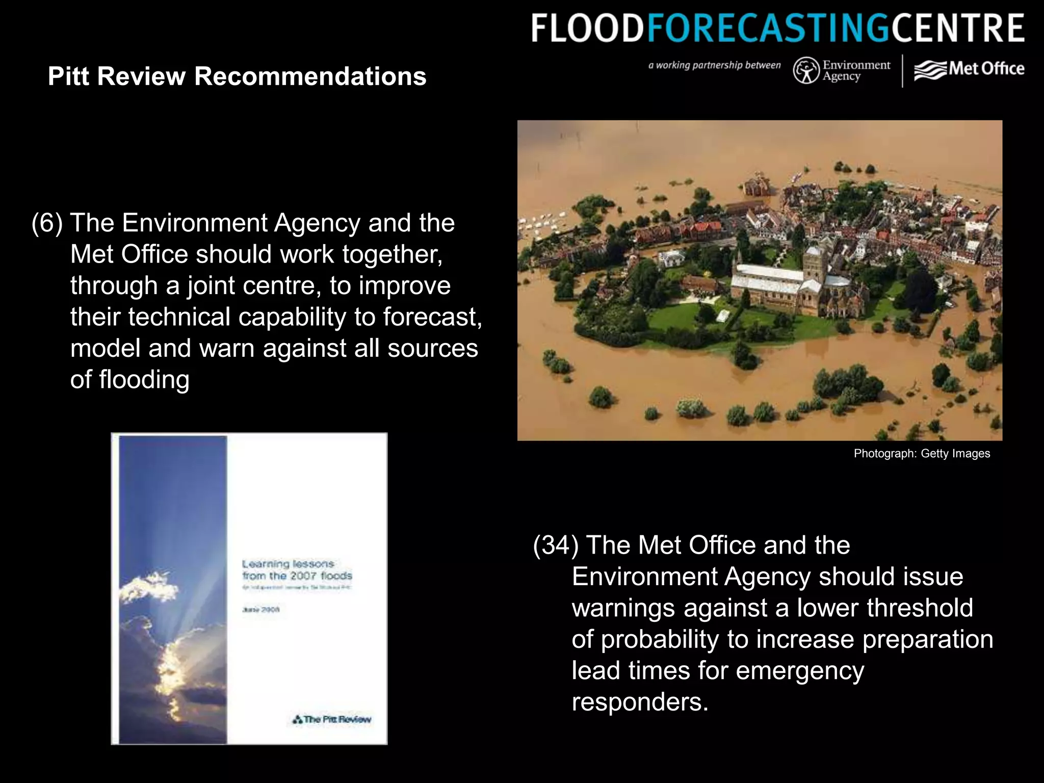
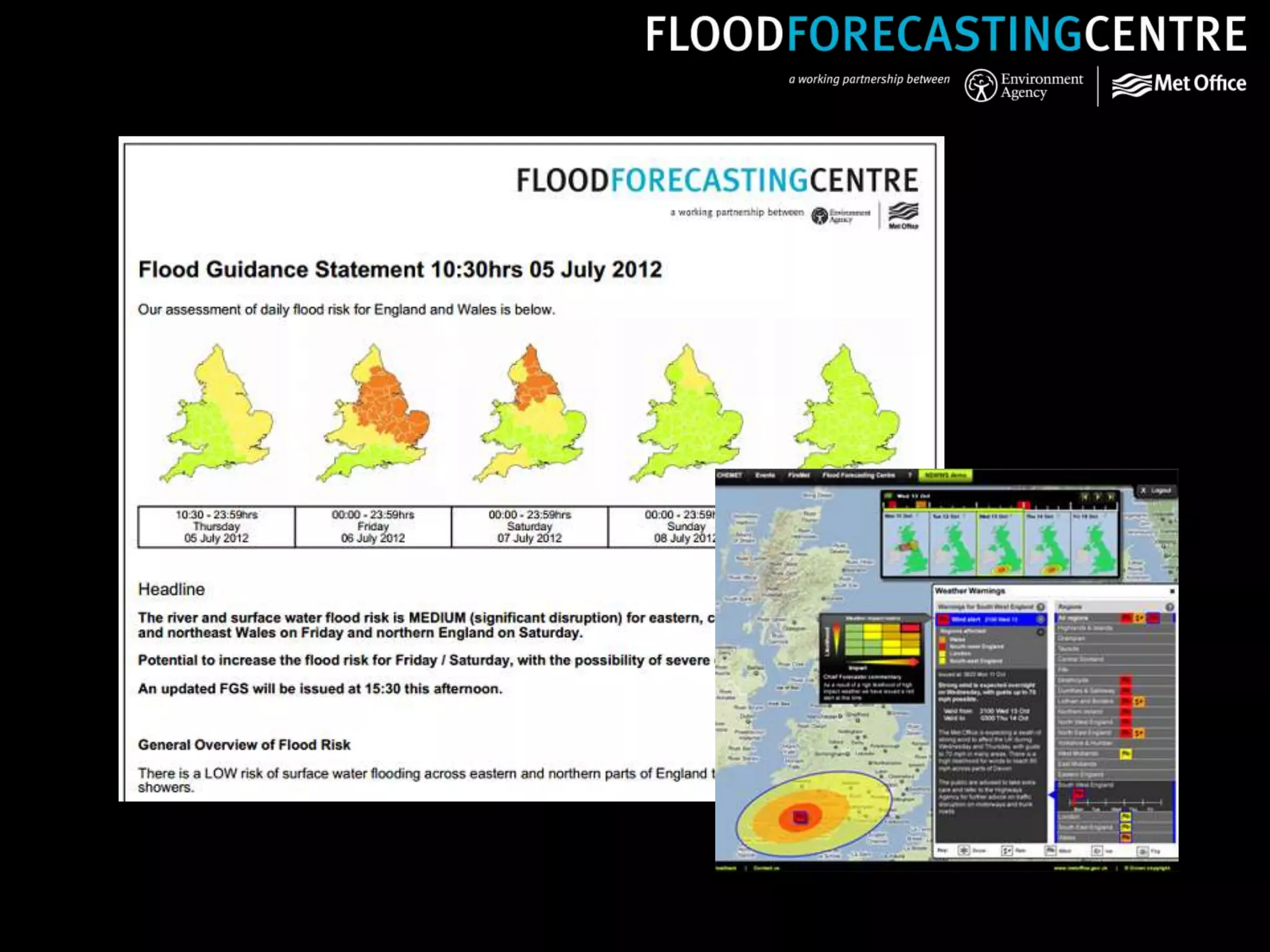
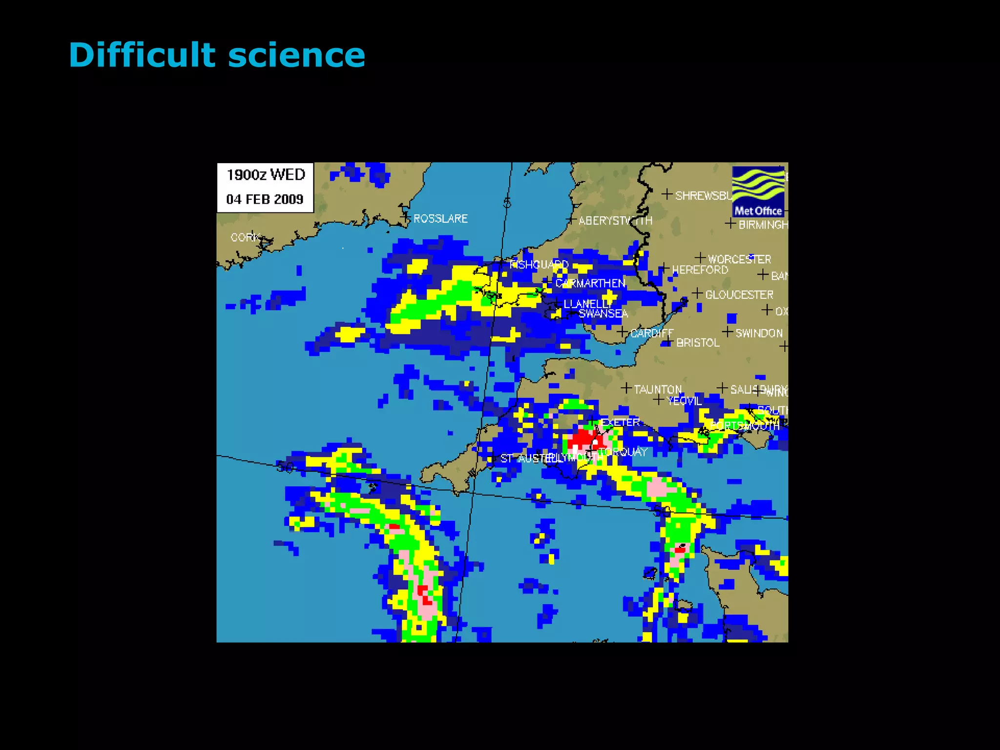
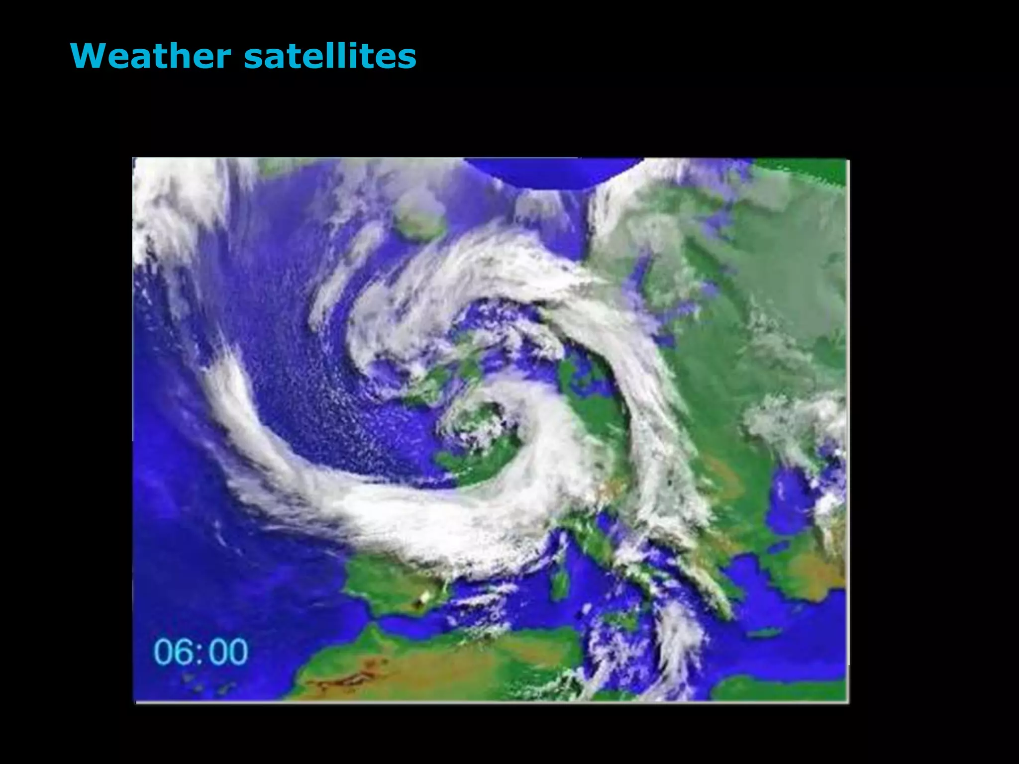
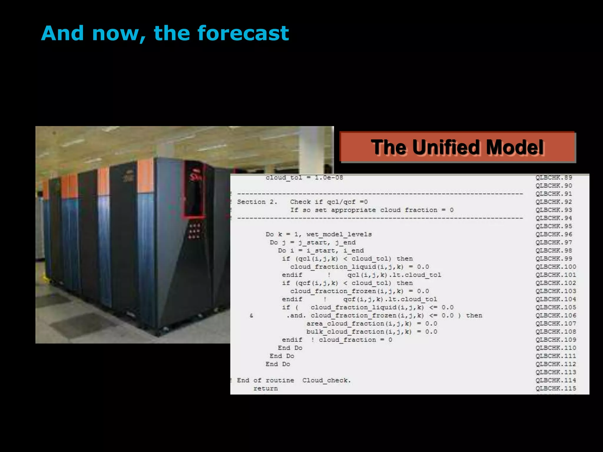
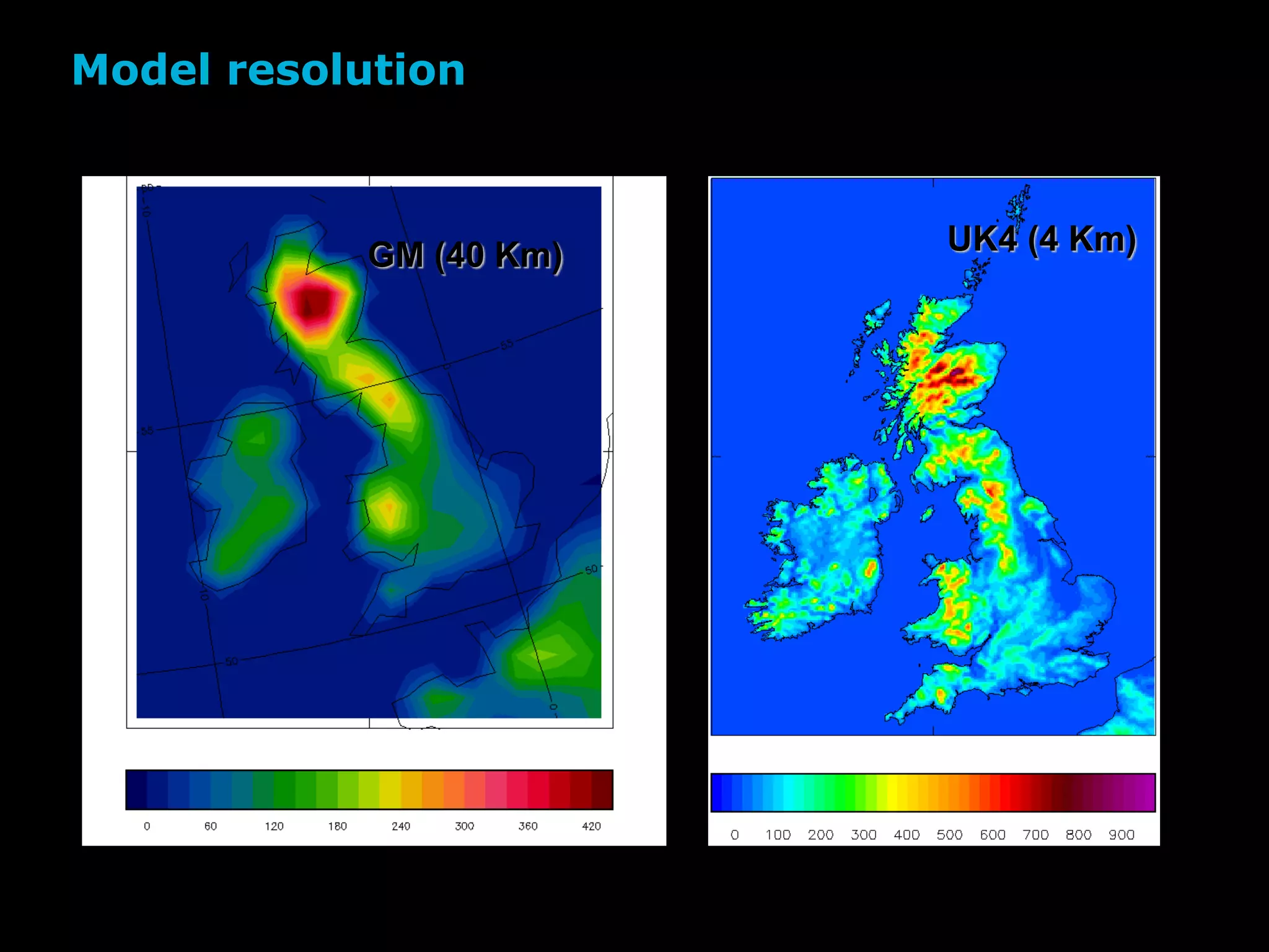
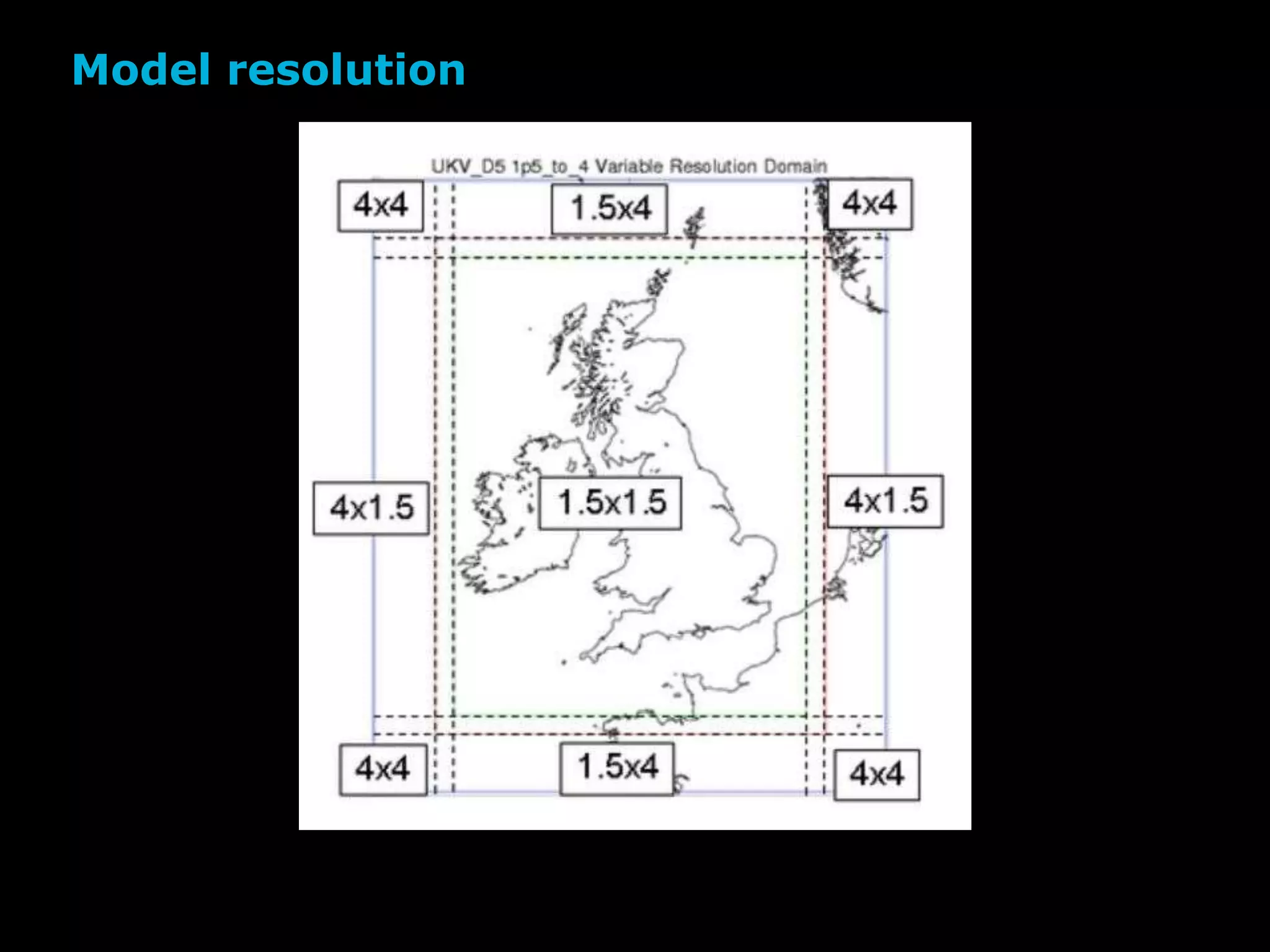
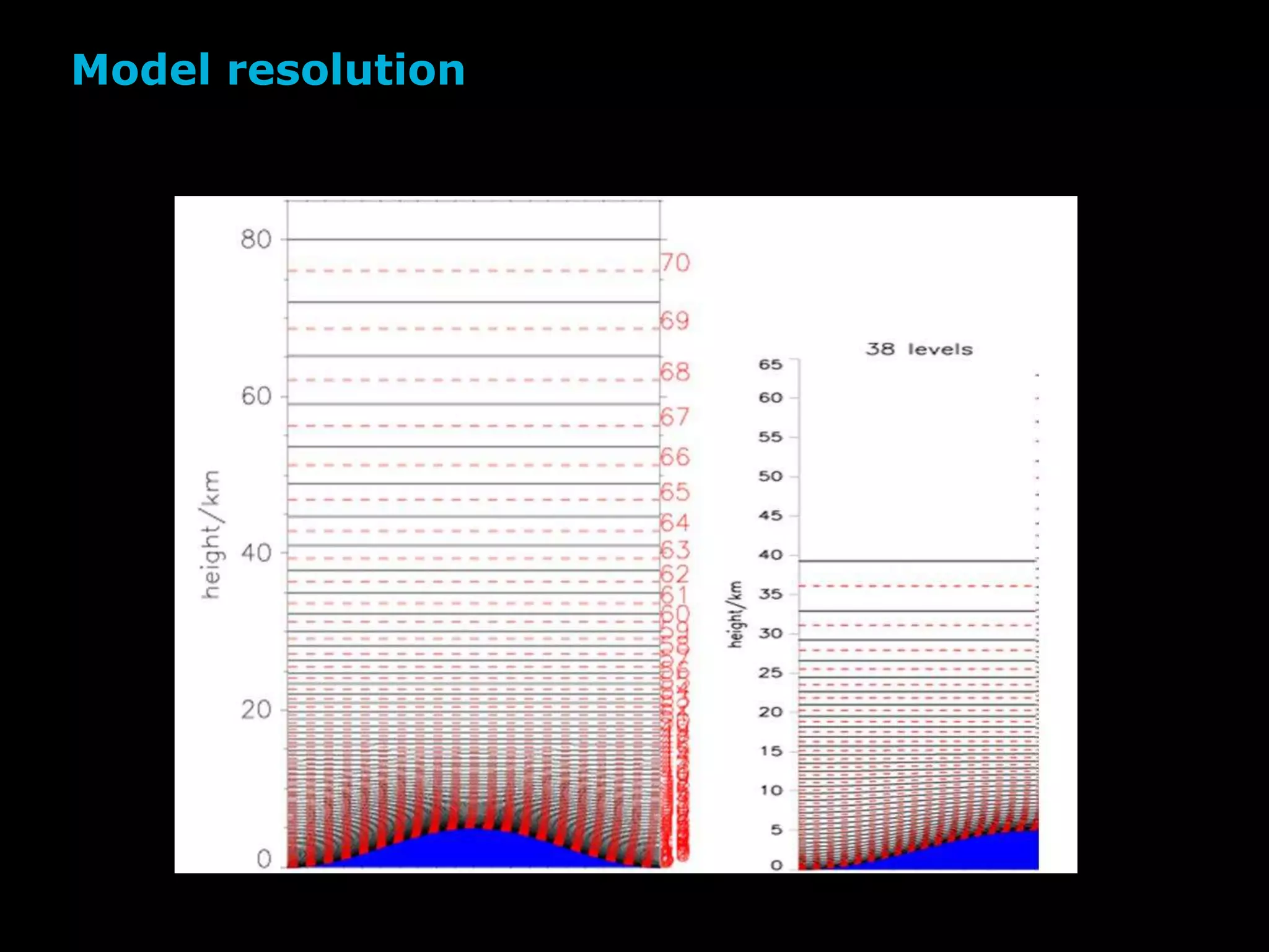
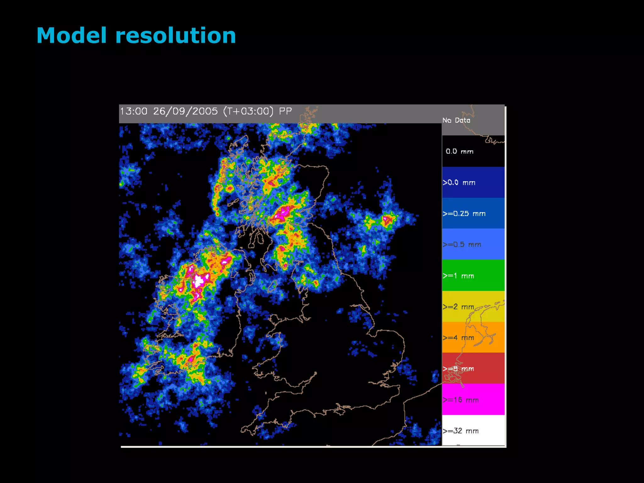
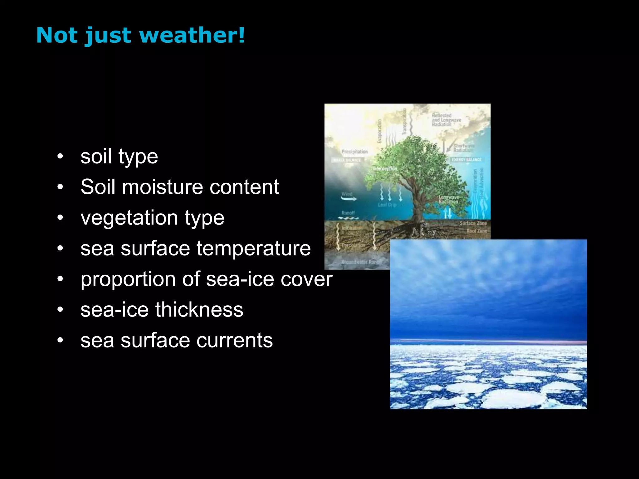
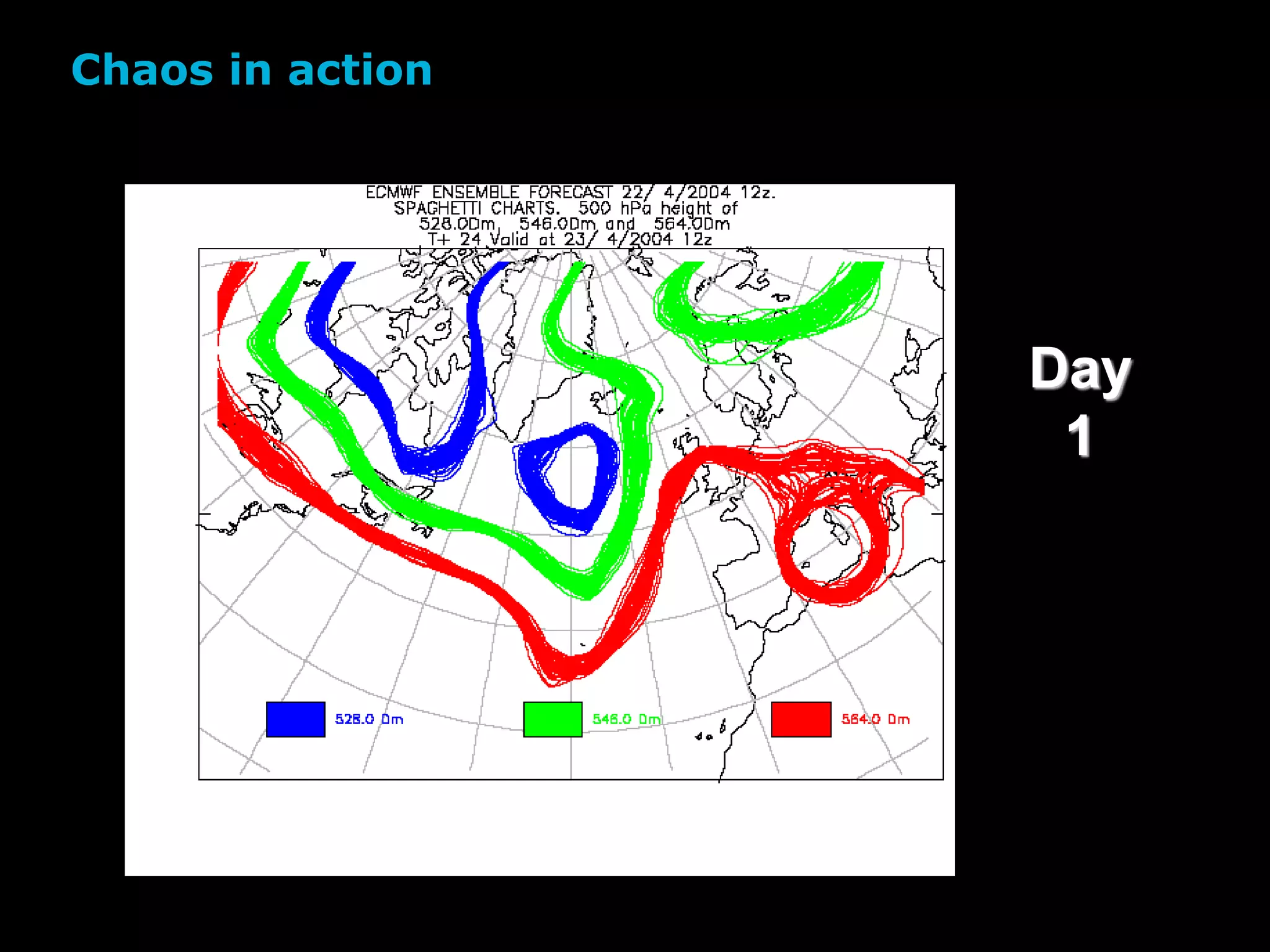
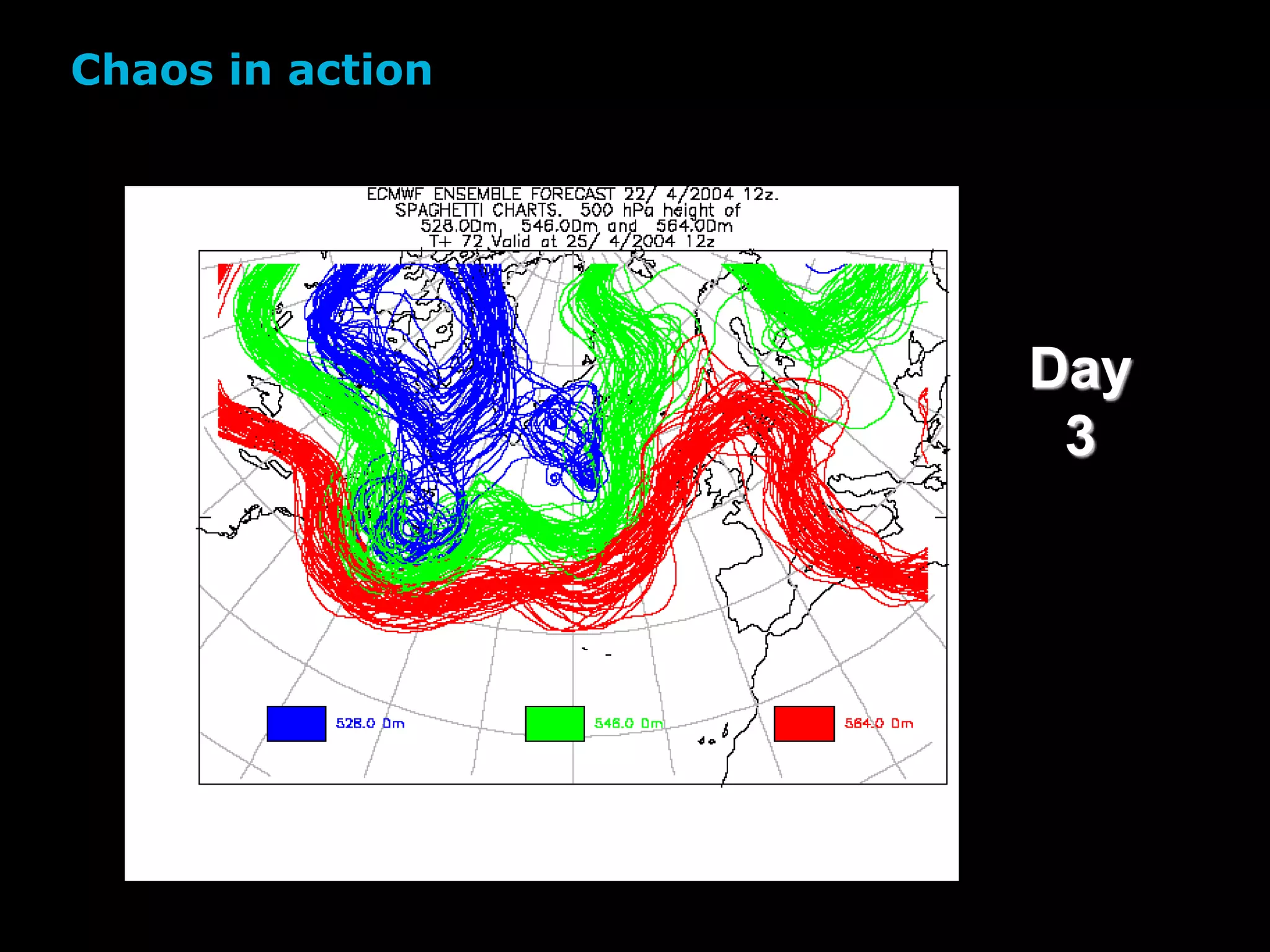
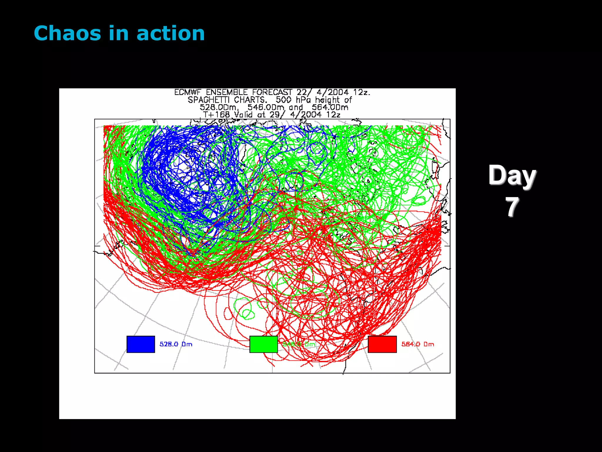
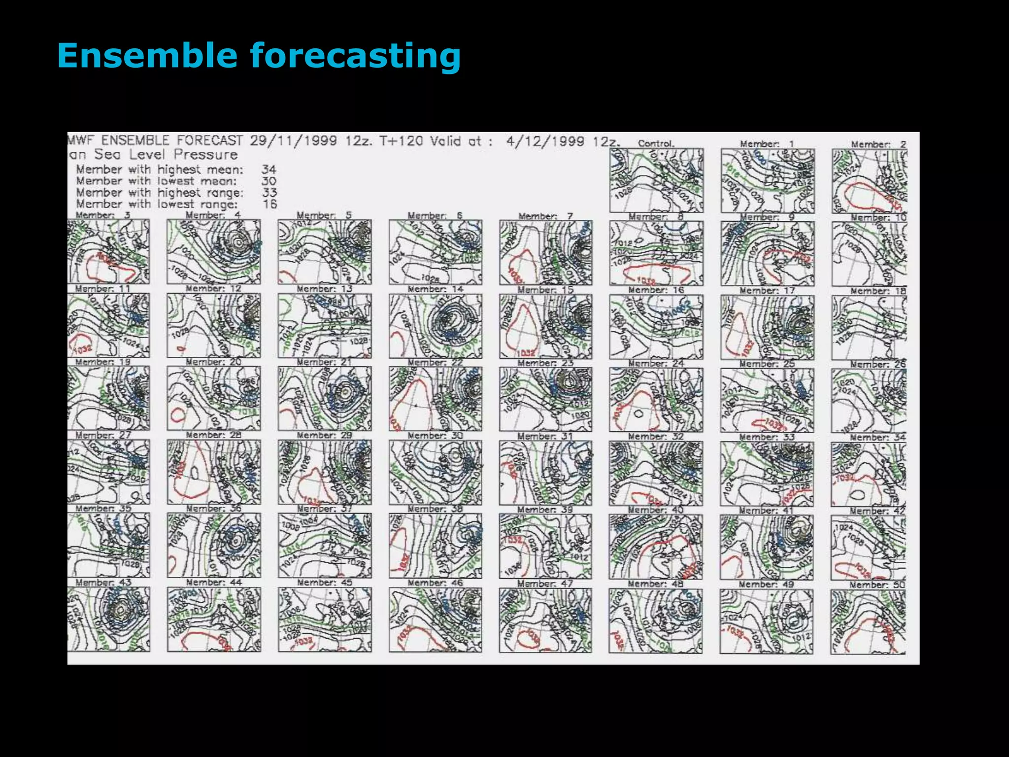
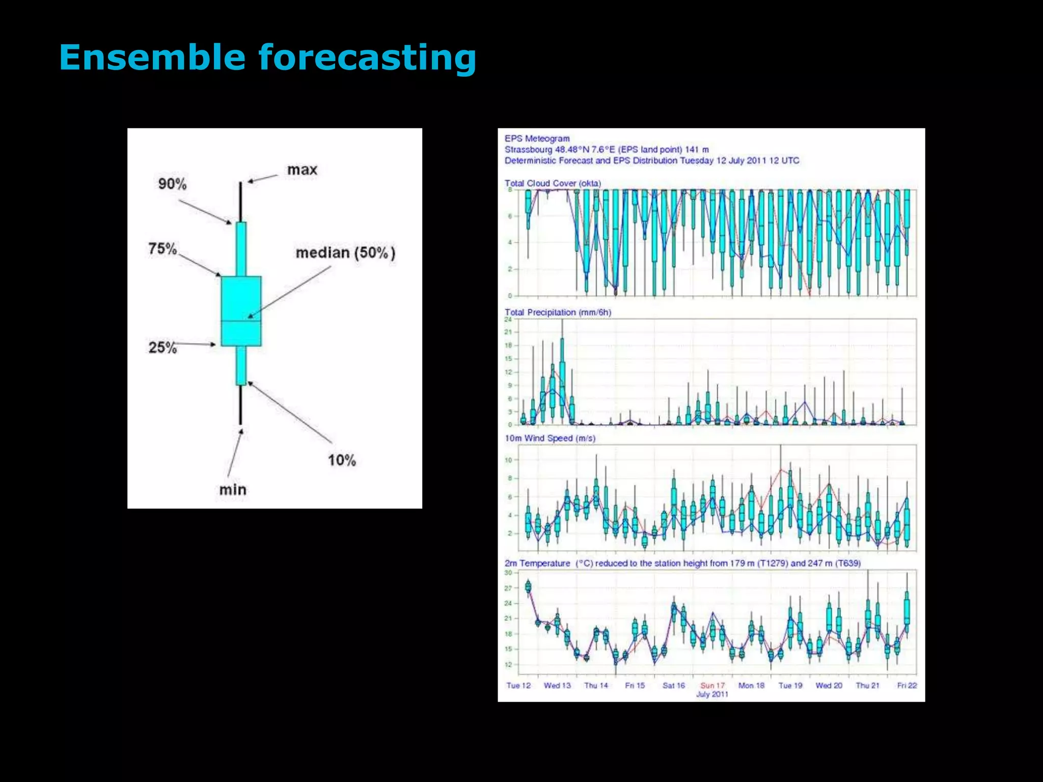
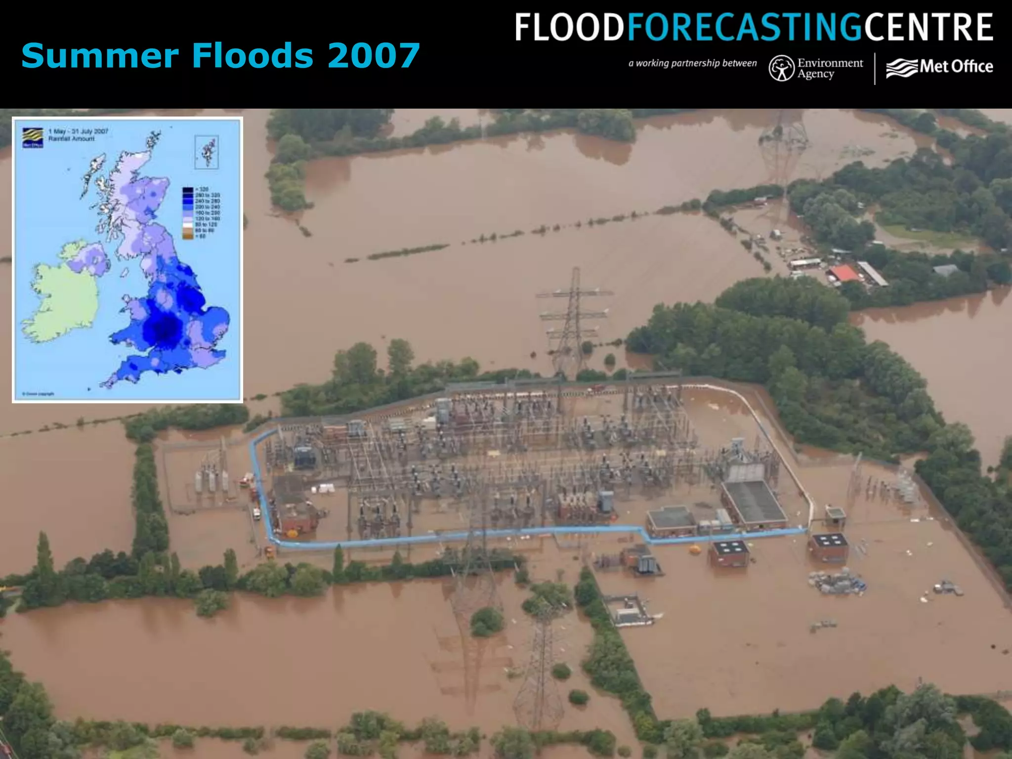
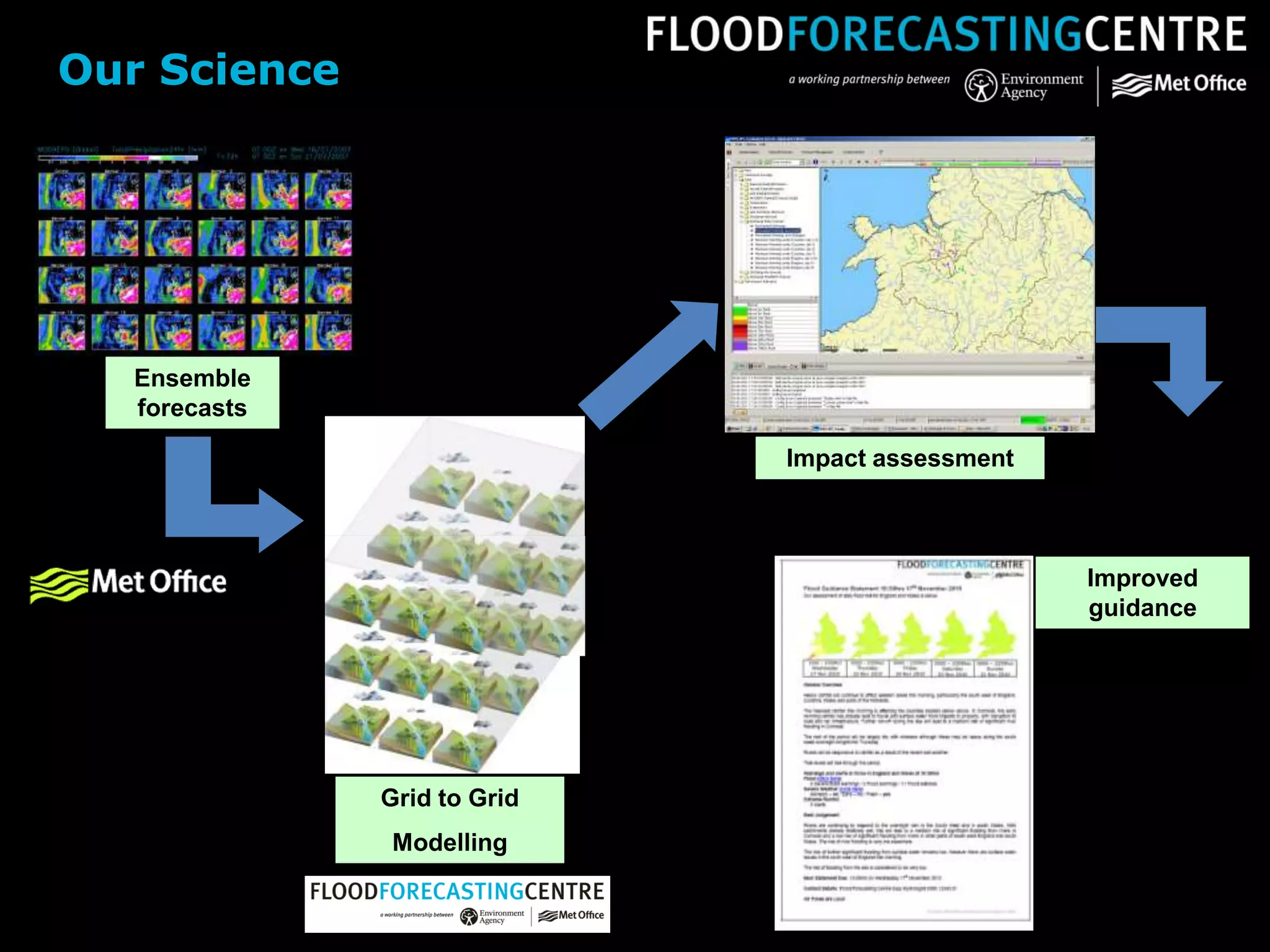
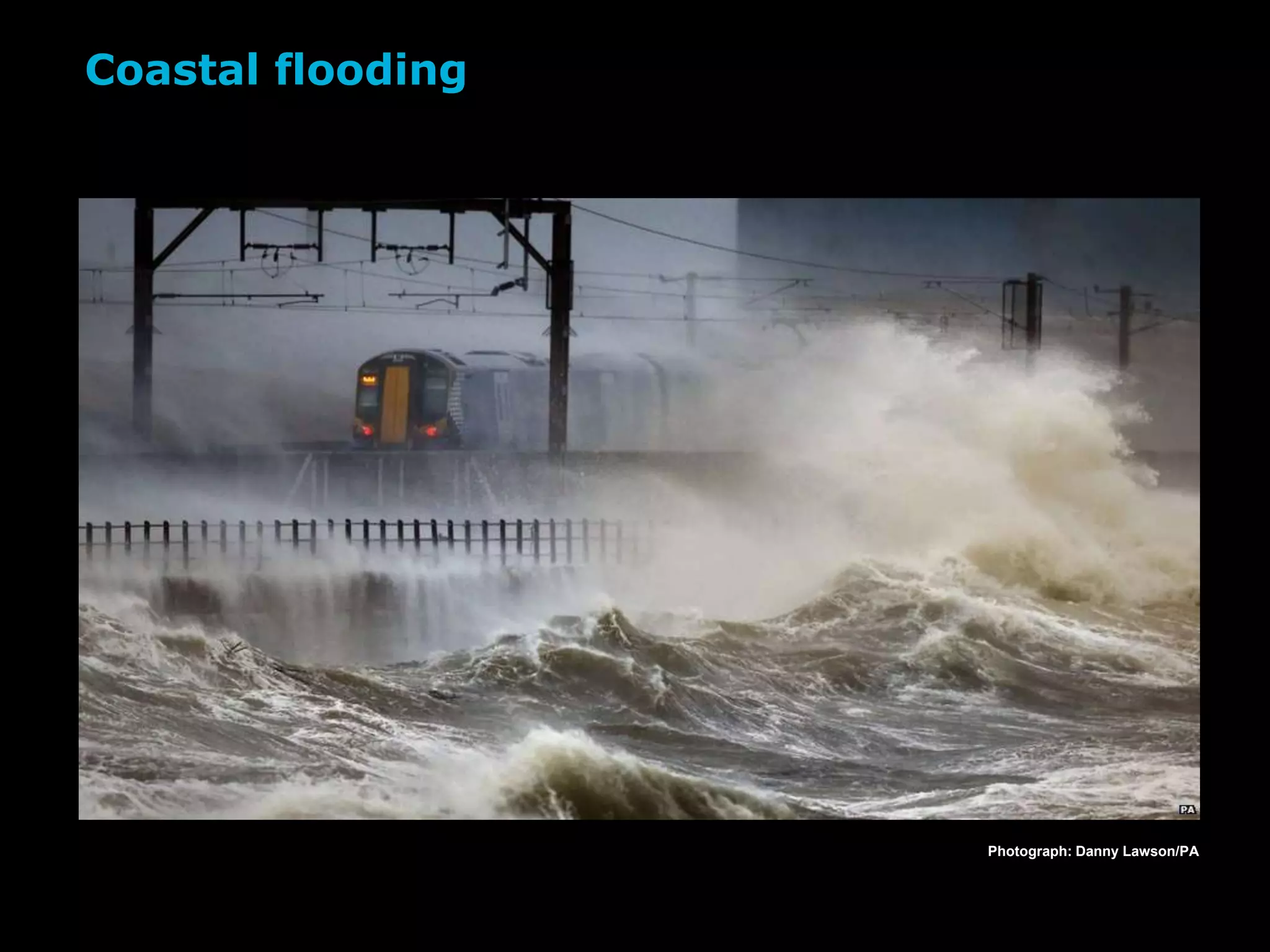
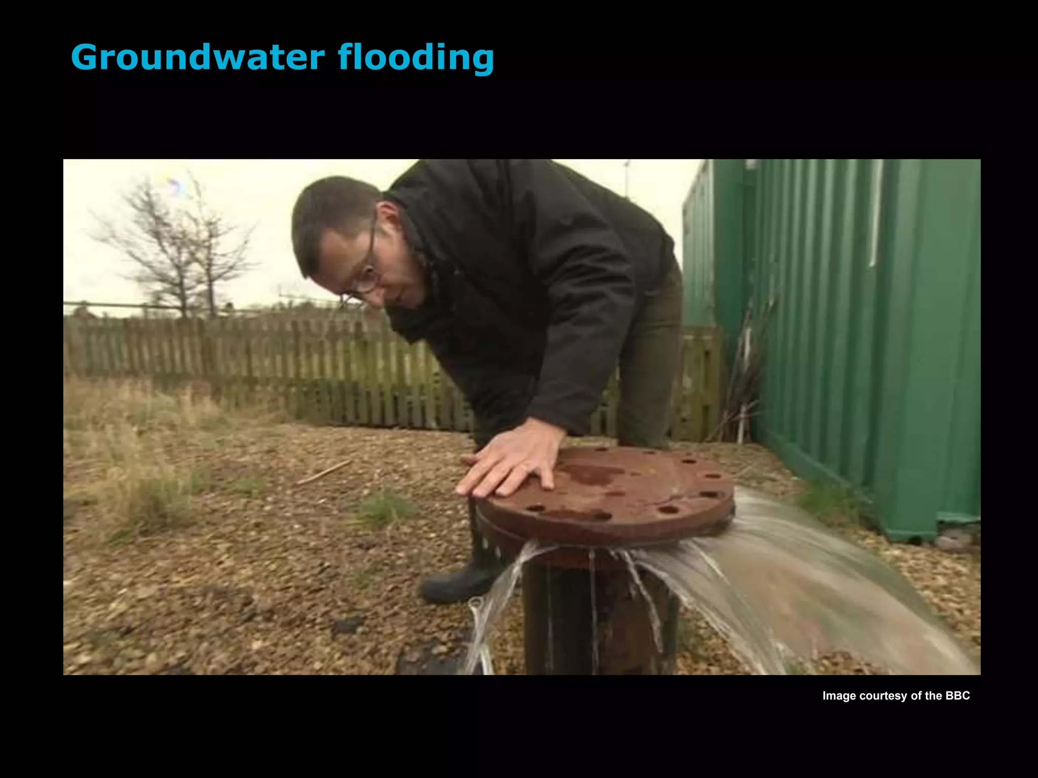
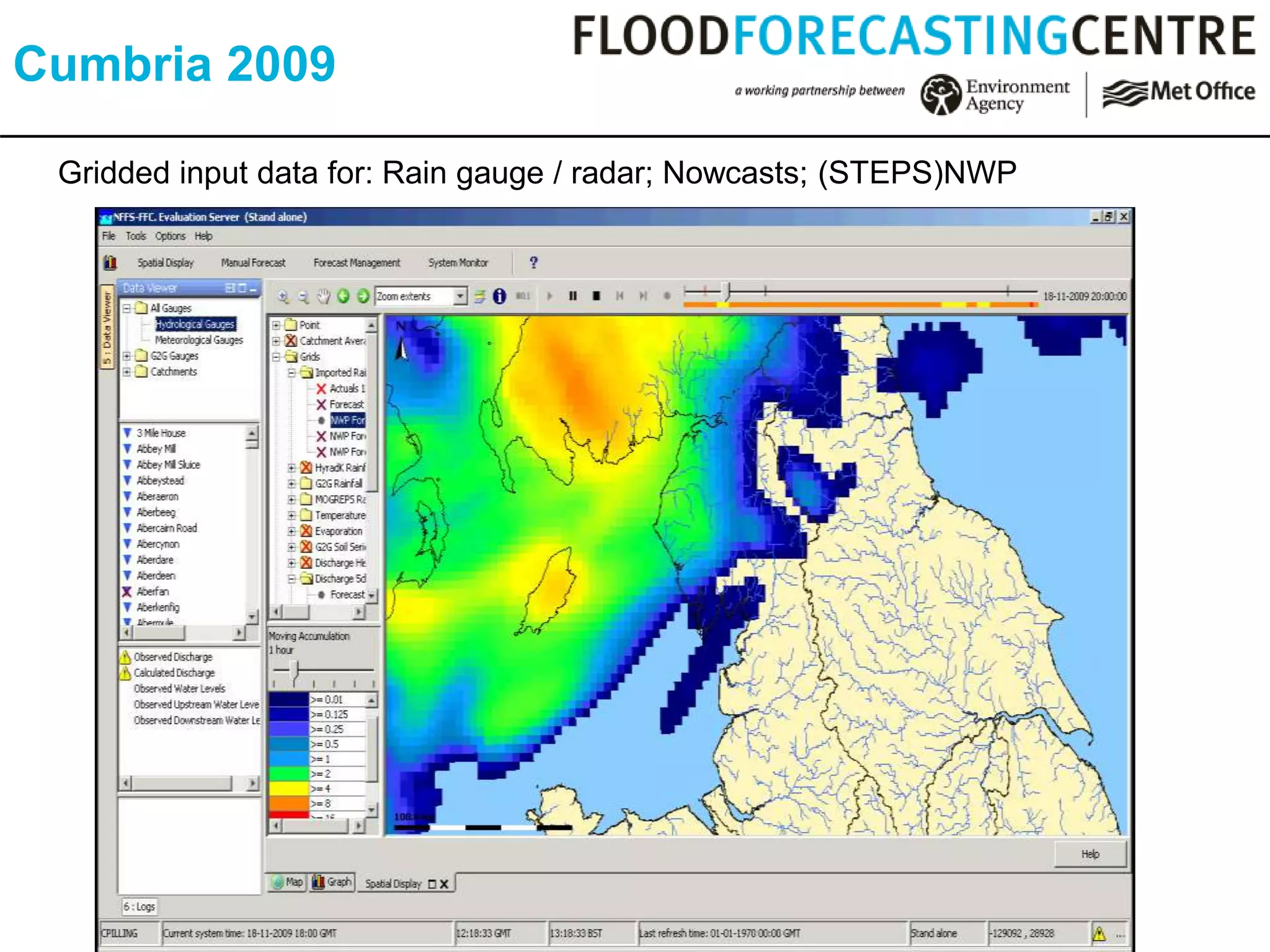
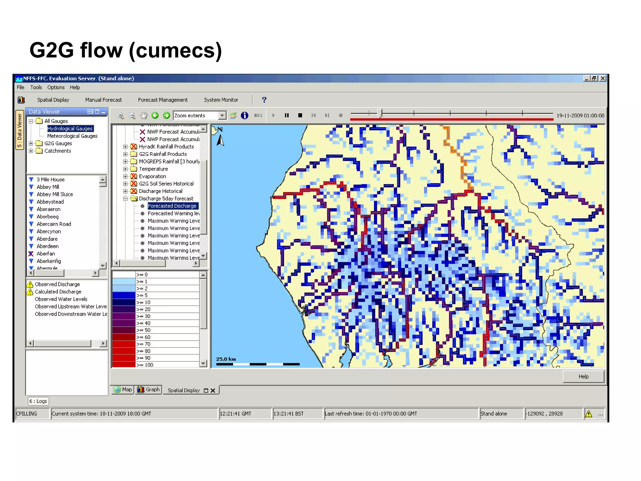
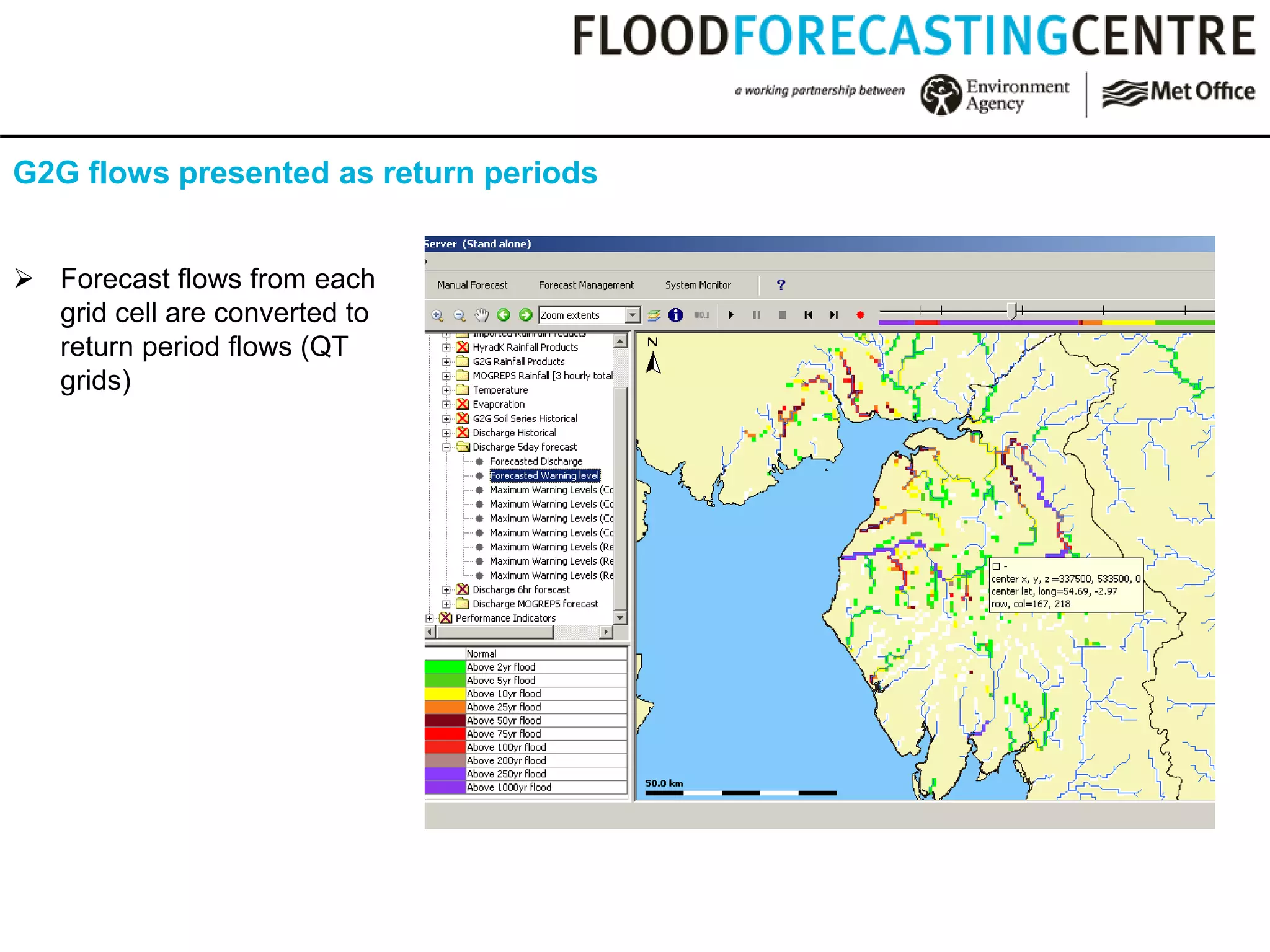
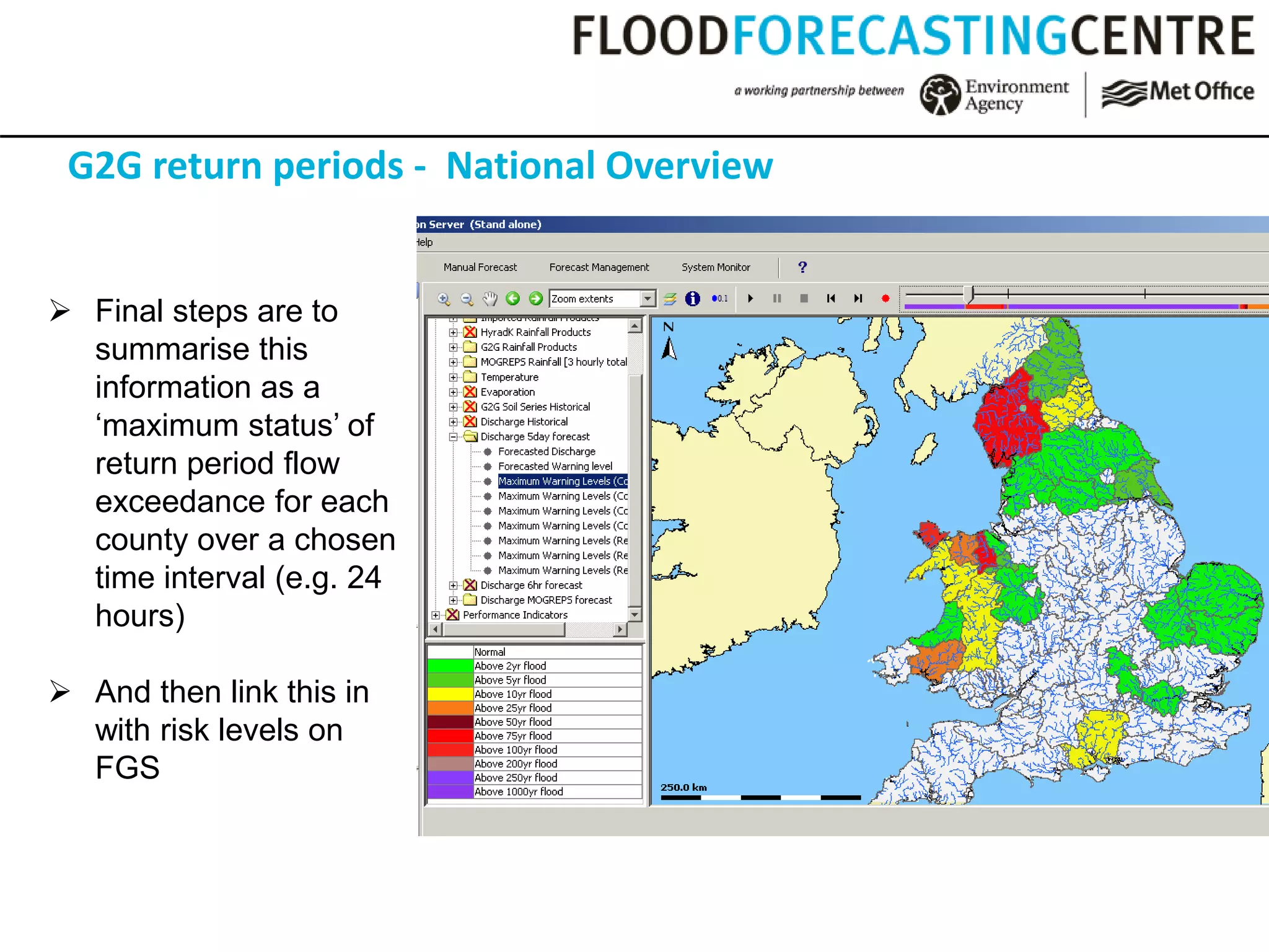
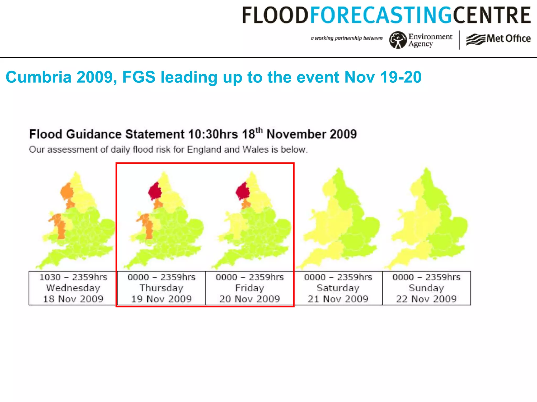
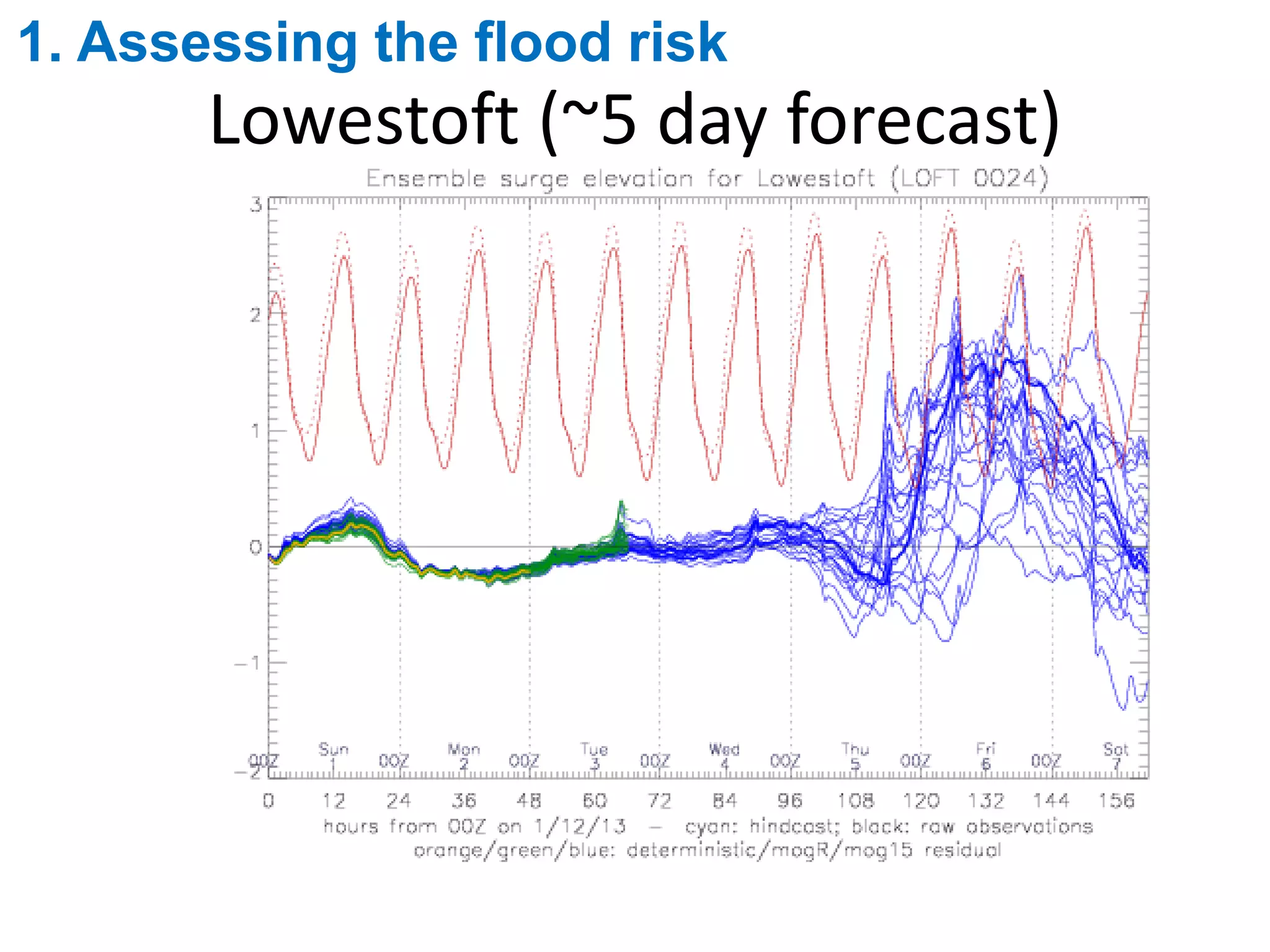
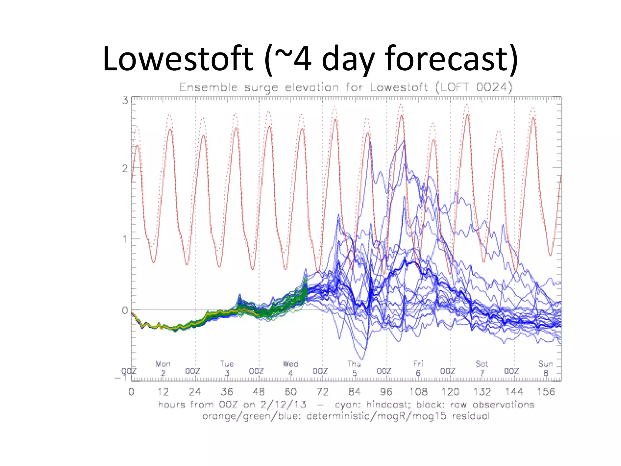
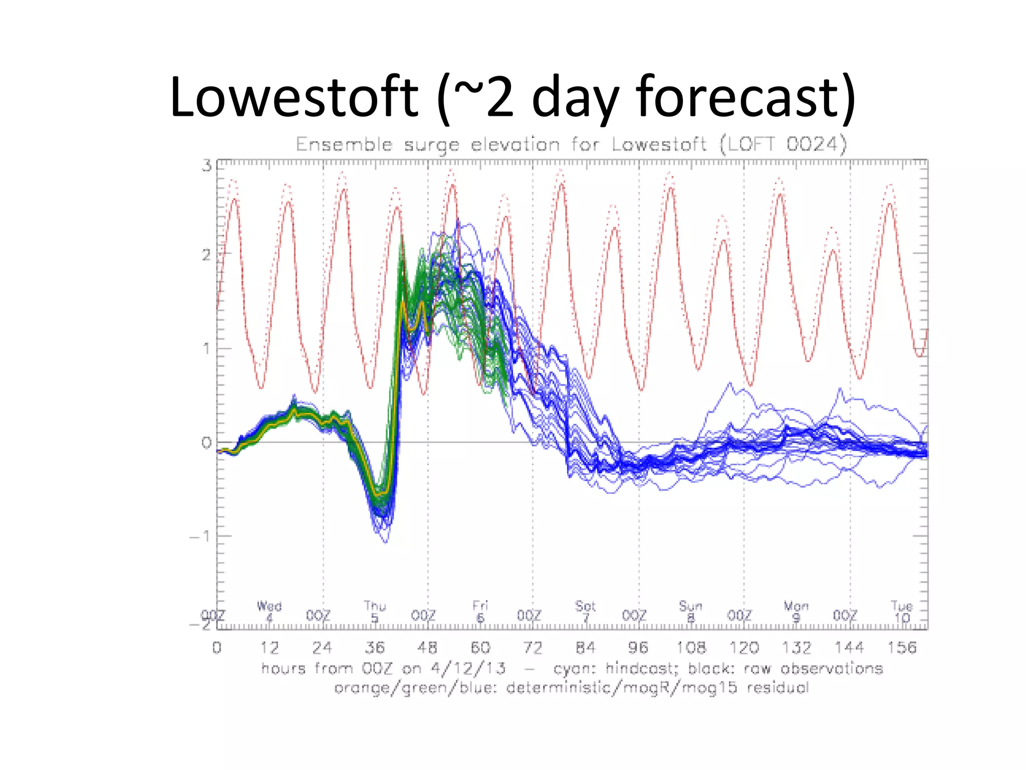
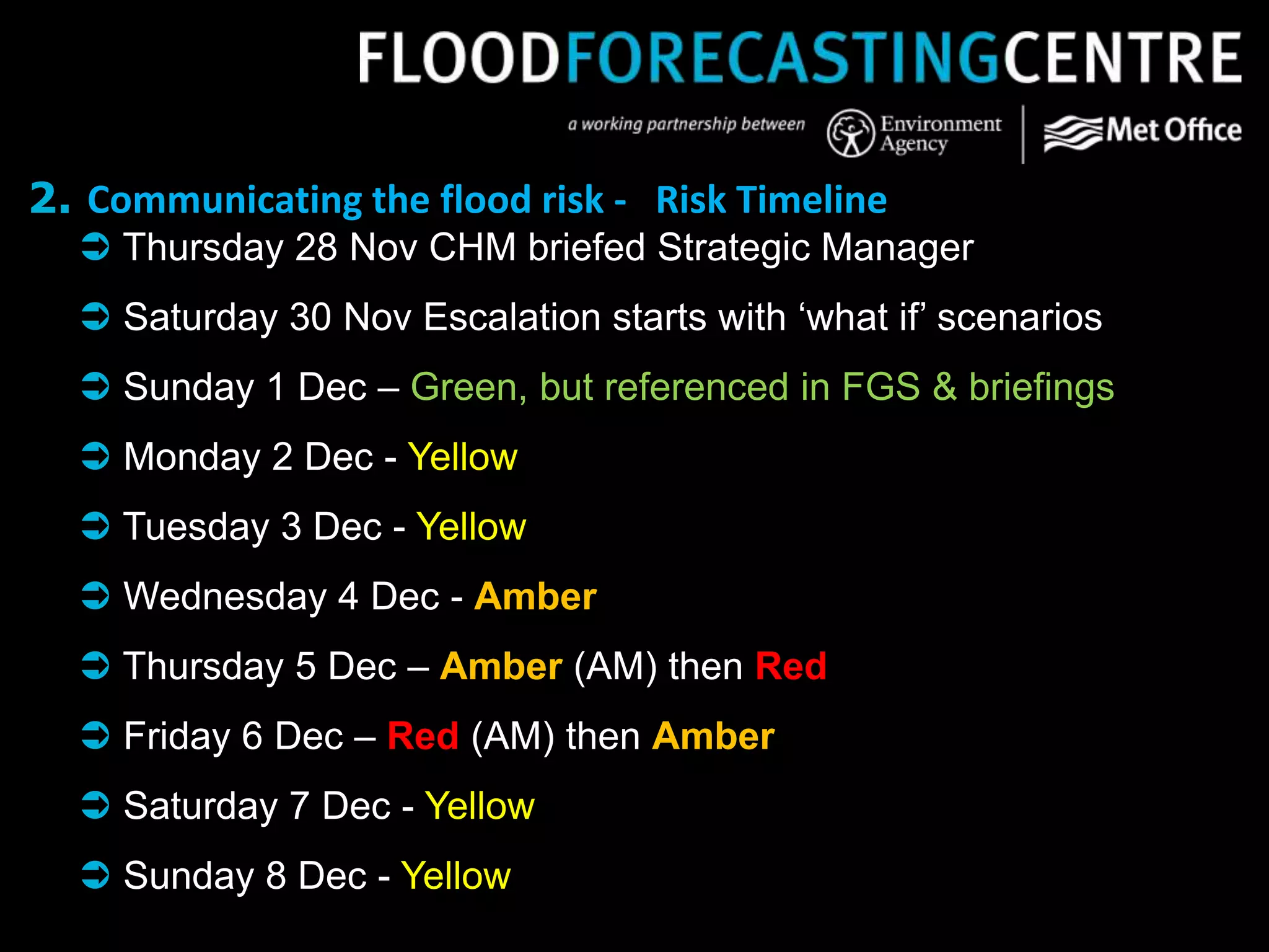
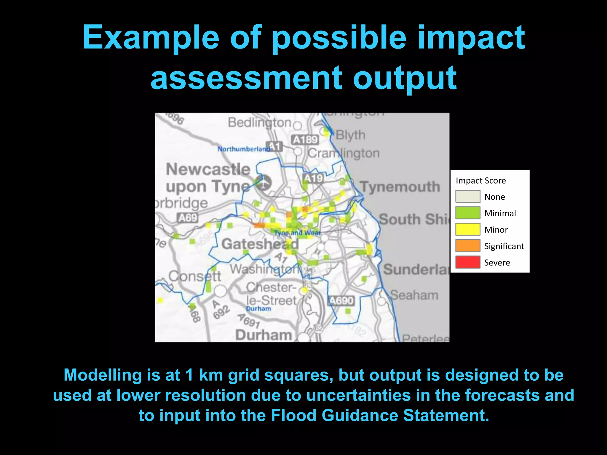
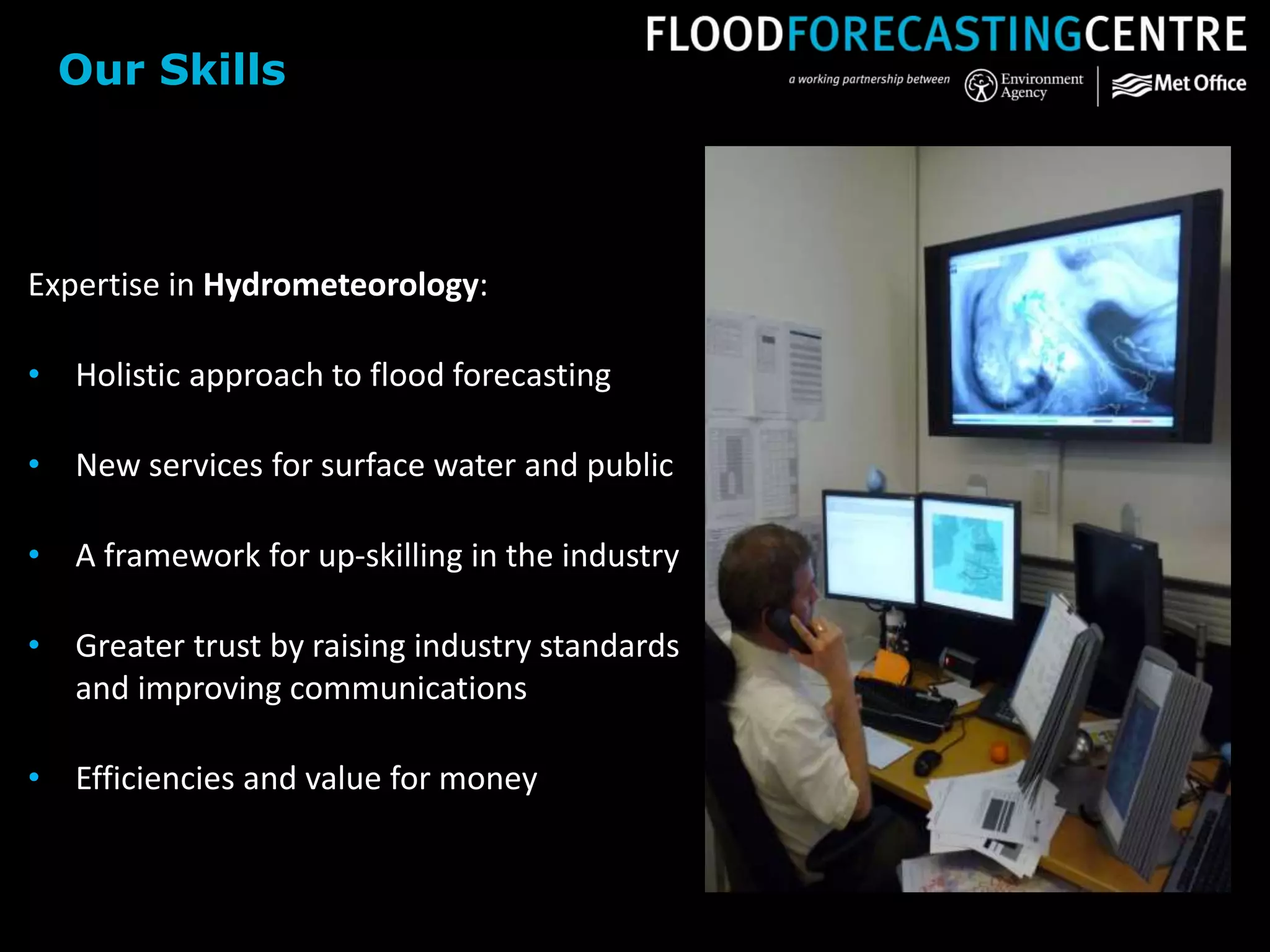
All images courtesy of the Met Office / Environment Agency unless stated otherwise
Summer Floods 2007
All images courtesy of the Met Office / Environment Agency unless stated otherwise
(6) The Environment Agency and the
Met Office should work together,
through a joint centre, to improve
their technical capability to forecast,
model and warn against all sources
of flooding
(34) The Met Office and the
Environment Agency should issue
warnings against a lower threshold
of probability to increase preparation
lead times for emergency
responders.
Pitt Review Recommendations
Photograph: Getty Images
Difficult science
Difficult science
Surface observations
Upper air
Aircraft
Over 130,000 observations per day
Weather satellites
The Unified Model
And now, the forecast
GM (40 Km) UK4 (4 Km)
Model resolution
Model resolution
Model resolution
Model resolution
• soil type
• Soil moisture content
• vegetation type
• sea surface temperature
• proportion of sea-ice cover
• sea-ice thickness
• sea surface currents
Not just weather!
Day
1
Chaos in action
Day
3
Chaos in action
Day
7
Chaos in action
Ensemble forecasting
Summer Floods 2007
Ensemble
forecasts
Grid to Grid
Modelling
Impact assessment
Improved
guidance
Our Science
Fluvial (river) flooding
© Vagner Vidal/INS News Agency
Pluvial (flash) flooding
Image courtesy of the BBC
Coastal flooding
Photograph: Danny Lawson/PA
Groundwater flooding
Image courtesy of the BBC
Gridded input data for: Rain gauge / radar; Nowcasts; (STEPS)NWP
Cumbria 2009
G2G flow (cumecs)
 Forecast flows from each
grid cell are converted to
return period flows (QT
grids)
G2G flows presented as return periods
G2G return periods - National Overview
 Final steps are to
summarise this
information as a
‘maximum status’ of
return period flow
exceedance for each
county over a chosen
time interval (e.g. 24
hours)
 And then link this in
with risk levels on
FGS
Cumbria 2009, FGS leading up to the event Nov 19-20
Lowestoft (~5 day forecast)
1. Assessing the flood risk
Lowestoft (~4 day forecast)
Lowestoft (~2 day forecast)
2. Communicating the flood risk - Risk Timeline
 Thursday 28 Nov CHM briefed Strategic Manager
 Saturday 30 Nov Escalation starts with ‘what if’ scenarios
 Sunday 1 Dec – Green, but referenced in FGS & briefings
 Monday 2 Dec - Yellow
 Tuesday 3 Dec - Yellow
 Wednesday 4 Dec - Amber
 Thursday 5 Dec – Amber (AM) then Red
 Friday 6 Dec – Red (AM) then Amber
 Saturday 7 Dec - Yellow
 Sunday 8 Dec - Yellow
Example of possible impact
assessment output
Impact Score
None
Minimal
Minor
Significant
Severe
Modelling is at 1 km grid squares, but output is designed to be
used at lower resolution due to uncertainties in the forecasts and
to input into the Flood Guidance Statement.
Expertise in Hydrometeorology:
• Holistic approach to flood forecasting
• New services for surface water and public
• A framework for up-skilling in the industry
• Greater trust by raising industry standards
and improving communications
• Efficiencies and value for money
Our Skills

Flood Forecasting - Peter Gibbs