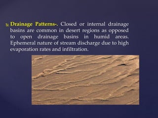
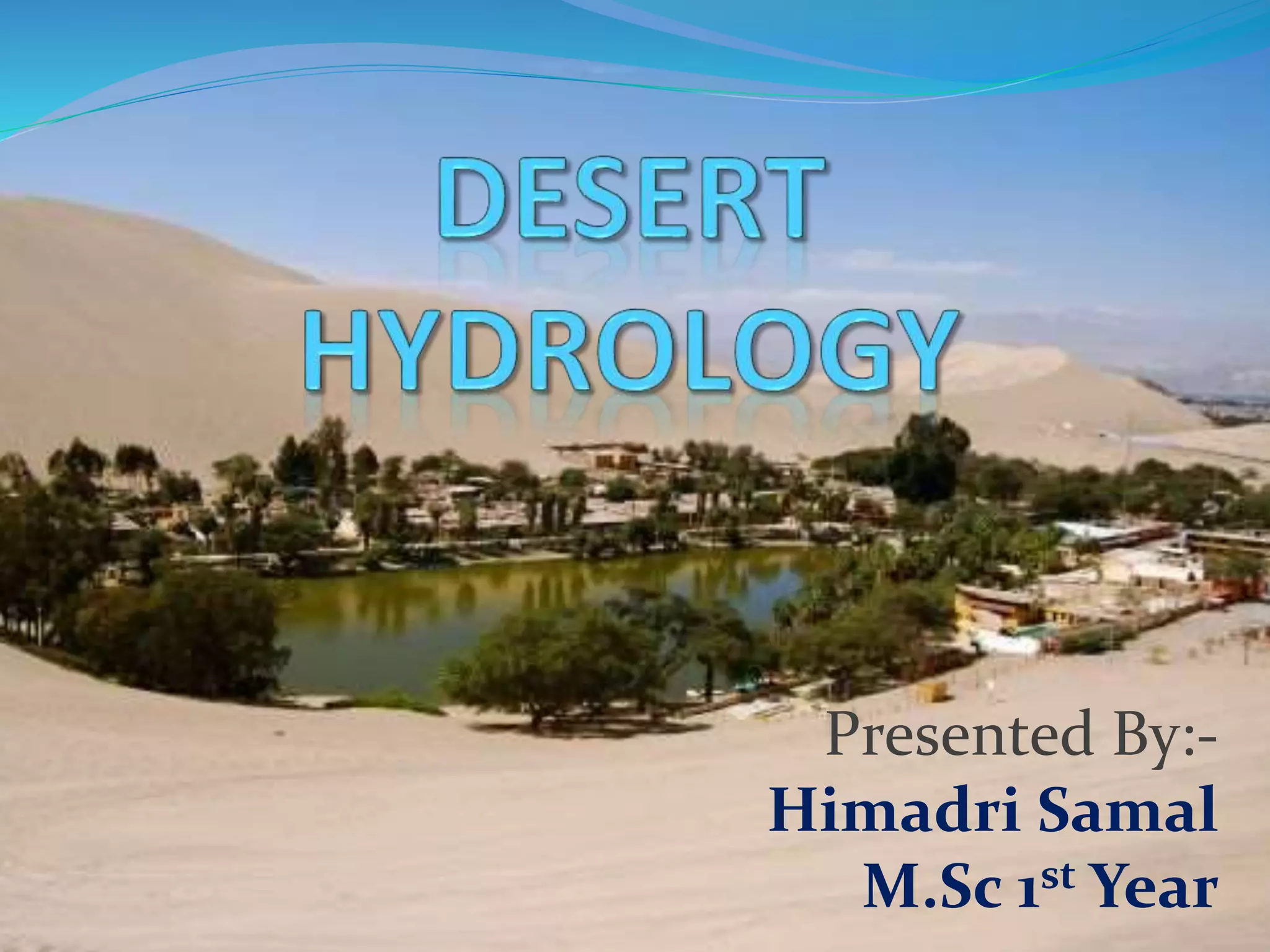
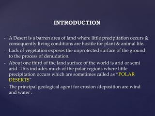
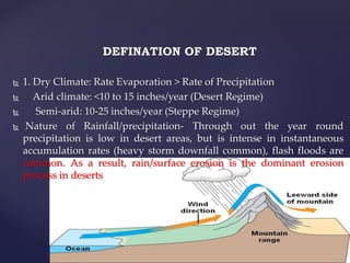
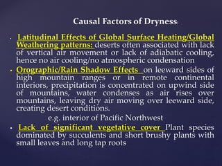
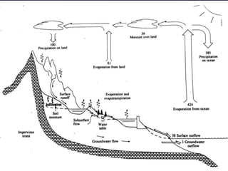
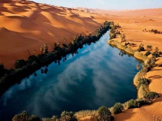
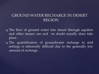
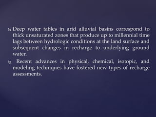
Presented By:-
Himadri Samal
M.Sc 1st Year
INTRODUCTION
• A Desert is a barren area of land where little precipitation occurs &
consequently living conditions are hostile for plant & animal life.
• Lack of vegetation exposes the unprotected surface of the ground
to the process of denudation.
• About one third of the land surface of the world is arid or semi
arid .This includes much of the polar regions where little
precipitation occurs which are sometimes called as “POLAR
DESERTS”
• The principal geological agent for erosion /deposition are wind
and water .
DEFINATION OF DESERT
 1. Dry Climate: Rate Evaporation > Rate of Precipitation
 Arid climate: <10 to 15 inches/year (Desert Regime)
 Semi-arid: 10-25 inches/year (Steppe Regime)
 Nature of Rainfall/precipitation- Through out the year round
precipitation is low in desert areas, but is intense in instantaneous
accumulation rates (heavy storm downfall common), flash floods are
common. As a result, rain/surface erosion is the dominant erosion
process in deserts
Causal Factors of Dryness:
 Latitudinal Effects of Global Surface Heating/Global
Weathering patterns: deserts often associated with lack
of vertical air movement or lack of adiabatic cooling,
hence no air cooling/no atmospheric condensation
 Orographic/Rain Shadow Effects on leeward sides of
high mountain ranges or in remote continental
interiors, precipitation is concentrated on upwind side
of mountains, water condenses as air rises over
mountains, leaving dry air moving over leeward side,
creating desert conditions.
e.g. interior of Pacific Northwest
 Lack of significant vegetative cover Plant species
dominated by succulents and short brushy plants with
small leaves and long tap roots
CHARACTERISTICS OF DESERT
Wind Vs. Water As Erosion Agent:
 Although wind is a significant factor in desert conditions,
water is still the dominant agent of erosion capable of moving
larger fragments and quantities of sediment at any given
instant
 Weathering-
 Physical weathering dominant in desert region i.e. processes
as salt wedging, thermal expansion, frost wedging, and plant
rooting. Generally chemical weathering is very slow or very
little due to the lack or shortage of water
 Sand
 Desert sand generated during the physical weathering
process, as opposed to clay dominated soils in
humid/chemically weathered areas. Sand can be readily
washed by surface runoff and is in the size range applicable for
wind transport.
HYDROLOGY
 Hydrology is the scientific study of the movement,
distribution and quality of water on earth.
 It is divided into
 Surface water hydrology
 Ground water hydrology
 Mainly desert hydrology depends on ground water hydrology.
Hydrological cycle of desert
 Drainage Patterns-. Closed or internal drainage
basins are common in desert regions as opposed
to open drainage basins in humid areas.
Ephemeral nature of stream discharge due to high
evaporation rates and infiltration.
 Dominated by ephemeral streams: streams which only flow during
seasonal or storm events. Most of the time these drainages exist as dry
washes aka arroyos or wadis.
 . Exotic streams - perennial streams that flow year round through the
desert, but these are relatively rare and sustained by water with
headlands outside of the desert region in a more humid environment.
 In desert region several lake basins are present
 Perennial Lakes
 Playa Lakes are round hollows in the grounds.They are EPHEMERAL
meaning that they are only present at certain times of the year.
 Pluvial Lakes is a landlocked basin which fills with rain water during
Glaciation,precipitation is higher .PLUVIAL lakes that have since
evaporated & dried out may also be referred as Paleolakes
{
DETERMINATION OF GROUND WATER IN
DESERT
 The flow of ground water into desert through aquifers
and other means can and no doubt usually does take
place
 Underground water are abundant in desert is commonly
recognised because of the presence of oases and the fact
that many have been constructed.
GROUND WATER RECHARGE IN DESERT
REGION
 The flow of ground water into desert through aquifers
and other means can and no doubt usually does take
place .
 The quantification of groundwater recharge in arid
settings is inherently difficult due to the generally low
amount of recharge.
 Deep water tables in arid alluvial basins correspond to
thick unsaturated zones that produce up to millennial time
lags between hydrologic conditions at the land surface and
subsequent changes in recharge to underlying ground
water.
 Recent advances in physical, chemical, isotopic, and
modeling techniques have fostered new types of recharge
assessments.
 Mainly ground water recharge in Arid region is due to the El
Nino or Monsoon event of nature.
 But these features are un common in this region .So in these
region very low amount of ground water recharge will occur.
 In these region mainly lower the thickness of saturated zone
and higher the thickness of unsaturated zone. For that reason
evaporation is higher in Arid region.
Desert Groundwater Contamination
 High levels of inorganic elements and low levels of
organic element found in desert.
 Inorganic elements including arsenic, boron, fluoride,
molybdenum, strontium, vanadium, uranium detect in
high concentrations in the desert region.
 The human-made organic chemical constituents and
nitrates are present at high concentrations in the desert
aquifers.
THANKING
YOU…
SPECIAL THANKS
RAKESH,M.Sc 2nd Year
Pondicherry University

DESERT HYDROLOGY

  • 1.
  • 2.
    INTRODUCTION • A Desertis a barren area of land where little precipitation occurs & consequently living conditions are hostile for plant & animal life. • Lack of vegetation exposes the unprotected surface of the ground to the process of denudation. • About one third of the land surface of the world is arid or semi arid .This includes much of the polar regions where little precipitation occurs which are sometimes called as “POLAR DESERTS” • The principal geological agent for erosion /deposition are wind and water .
  • 3.
    DEFINATION OF DESERT 1. Dry Climate: Rate Evaporation > Rate of Precipitation  Arid climate: <10 to 15 inches/year (Desert Regime)  Semi-arid: 10-25 inches/year (Steppe Regime)  Nature of Rainfall/precipitation- Through out the year round precipitation is low in desert areas, but is intense in instantaneous accumulation rates (heavy storm downfall common), flash floods are common. As a result, rain/surface erosion is the dominant erosion process in deserts
  • 4.
    Causal Factors ofDryness:  Latitudinal Effects of Global Surface Heating/Global Weathering patterns: deserts often associated with lack of vertical air movement or lack of adiabatic cooling, hence no air cooling/no atmospheric condensation  Orographic/Rain Shadow Effects on leeward sides of high mountain ranges or in remote continental interiors, precipitation is concentrated on upwind side of mountains, water condenses as air rises over mountains, leaving dry air moving over leeward side, creating desert conditions. e.g. interior of Pacific Northwest  Lack of significant vegetative cover Plant species dominated by succulents and short brushy plants with small leaves and long tap roots
  • 5.
    CHARACTERISTICS OF DESERT WindVs. Water As Erosion Agent:  Although wind is a significant factor in desert conditions, water is still the dominant agent of erosion capable of moving larger fragments and quantities of sediment at any given instant  Weathering-  Physical weathering dominant in desert region i.e. processes as salt wedging, thermal expansion, frost wedging, and plant rooting. Generally chemical weathering is very slow or very little due to the lack or shortage of water  Sand  Desert sand generated during the physical weathering process, as opposed to clay dominated soils in humid/chemically weathered areas. Sand can be readily washed by surface runoff and is in the size range applicable for wind transport.
  • 6.
    HYDROLOGY  Hydrology isthe scientific study of the movement, distribution and quality of water on earth.  It is divided into  Surface water hydrology  Ground water hydrology  Mainly desert hydrology depends on ground water hydrology.
  • 8.
  • 9.
     Drainage Patterns-.Closed or internal drainage basins are common in desert regions as opposed to open drainage basins in humid areas. Ephemeral nature of stream discharge due to high evaporation rates and infiltration.
  • 10.
     Dominated byephemeral streams: streams which only flow during seasonal or storm events. Most of the time these drainages exist as dry washes aka arroyos or wadis.  . Exotic streams - perennial streams that flow year round through the desert, but these are relatively rare and sustained by water with headlands outside of the desert region in a more humid environment.  In desert region several lake basins are present  Perennial Lakes  Playa Lakes are round hollows in the grounds.They are EPHEMERAL meaning that they are only present at certain times of the year.  Pluvial Lakes is a landlocked basin which fills with rain water during Glaciation,precipitation is higher .PLUVIAL lakes that have since evaporated & dried out may also be referred as Paleolakes
  • 11.
  • 12.
    DETERMINATION OF GROUNDWATER IN DESERT  The flow of ground water into desert through aquifers and other means can and no doubt usually does take place  Underground water are abundant in desert is commonly recognised because of the presence of oases and the fact that many have been constructed.
  • 14.
    GROUND WATER RECHARGEIN DESERT REGION  The flow of ground water into desert through aquifers and other means can and no doubt usually does take place .  The quantification of groundwater recharge in arid settings is inherently difficult due to the generally low amount of recharge.
  • 16.
     Deep watertables in arid alluvial basins correspond to thick unsaturated zones that produce up to millennial time lags between hydrologic conditions at the land surface and subsequent changes in recharge to underlying ground water.  Recent advances in physical, chemical, isotopic, and modeling techniques have fostered new types of recharge assessments.
  • 17.
     Mainly groundwater recharge in Arid region is due to the El Nino or Monsoon event of nature.  But these features are un common in this region .So in these region very low amount of ground water recharge will occur.  In these region mainly lower the thickness of saturated zone and higher the thickness of unsaturated zone. For that reason evaporation is higher in Arid region.
  • 18.
    Desert Groundwater Contamination High levels of inorganic elements and low levels of organic element found in desert.  Inorganic elements including arsenic, boron, fluoride, molybdenum, strontium, vanadium, uranium detect in high concentrations in the desert region.  The human-made organic chemical constituents and nitrates are present at high concentrations in the desert aquifers.
  • 19.