Download as PDF, PPTX
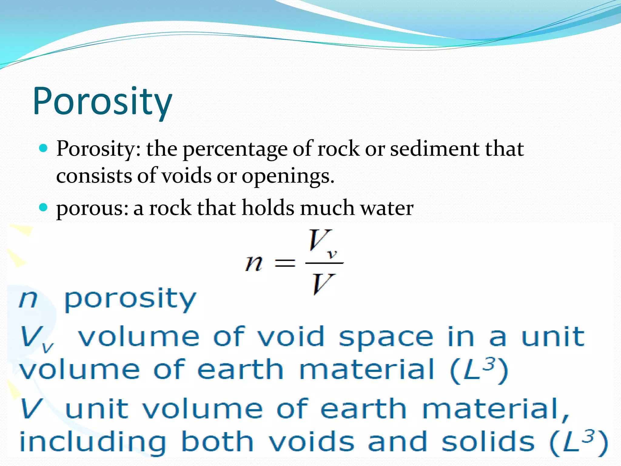
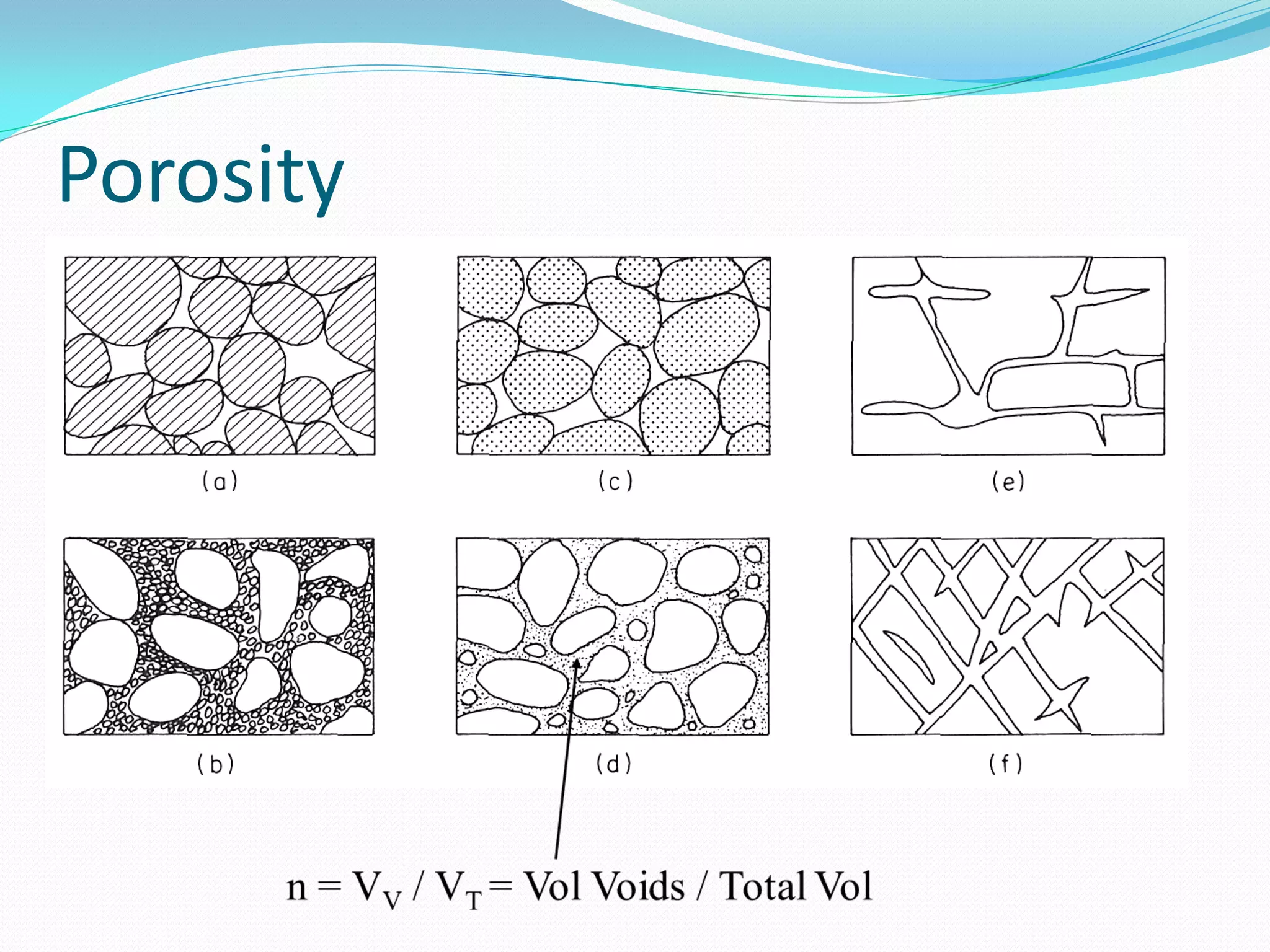
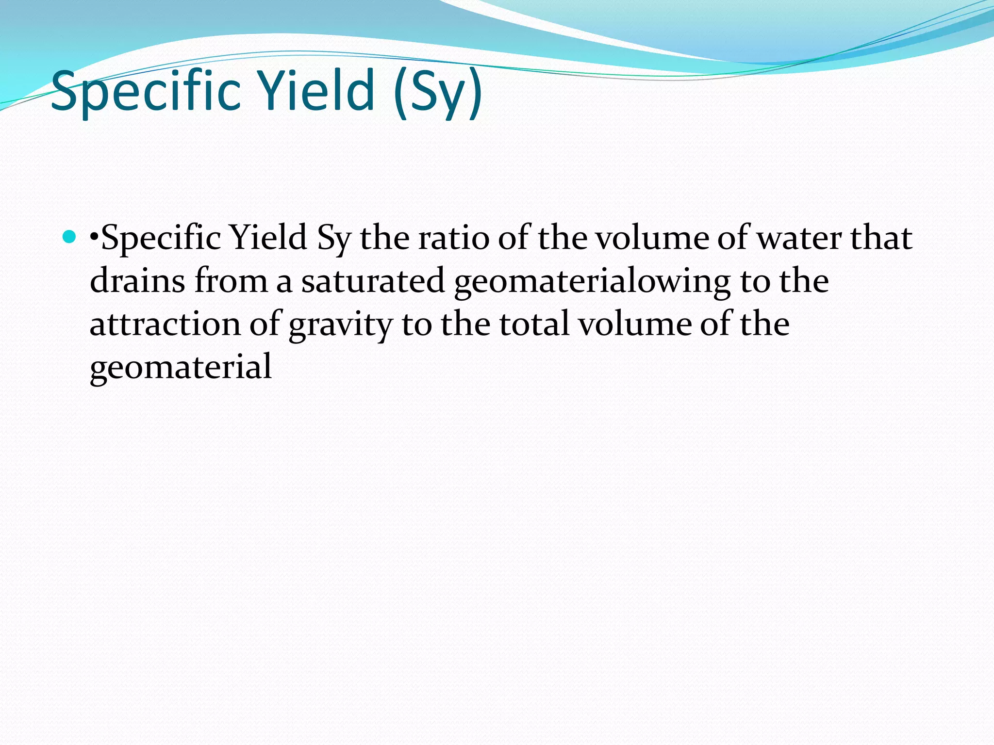
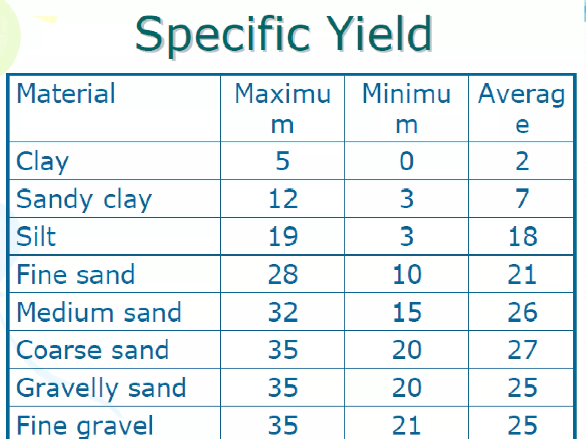
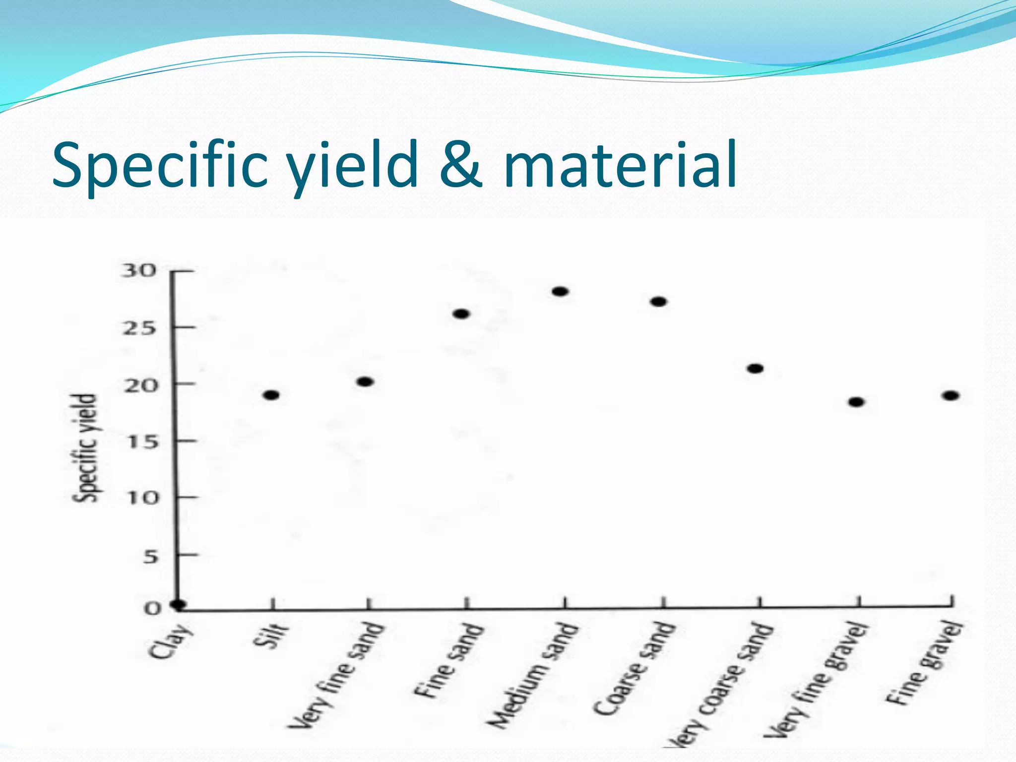
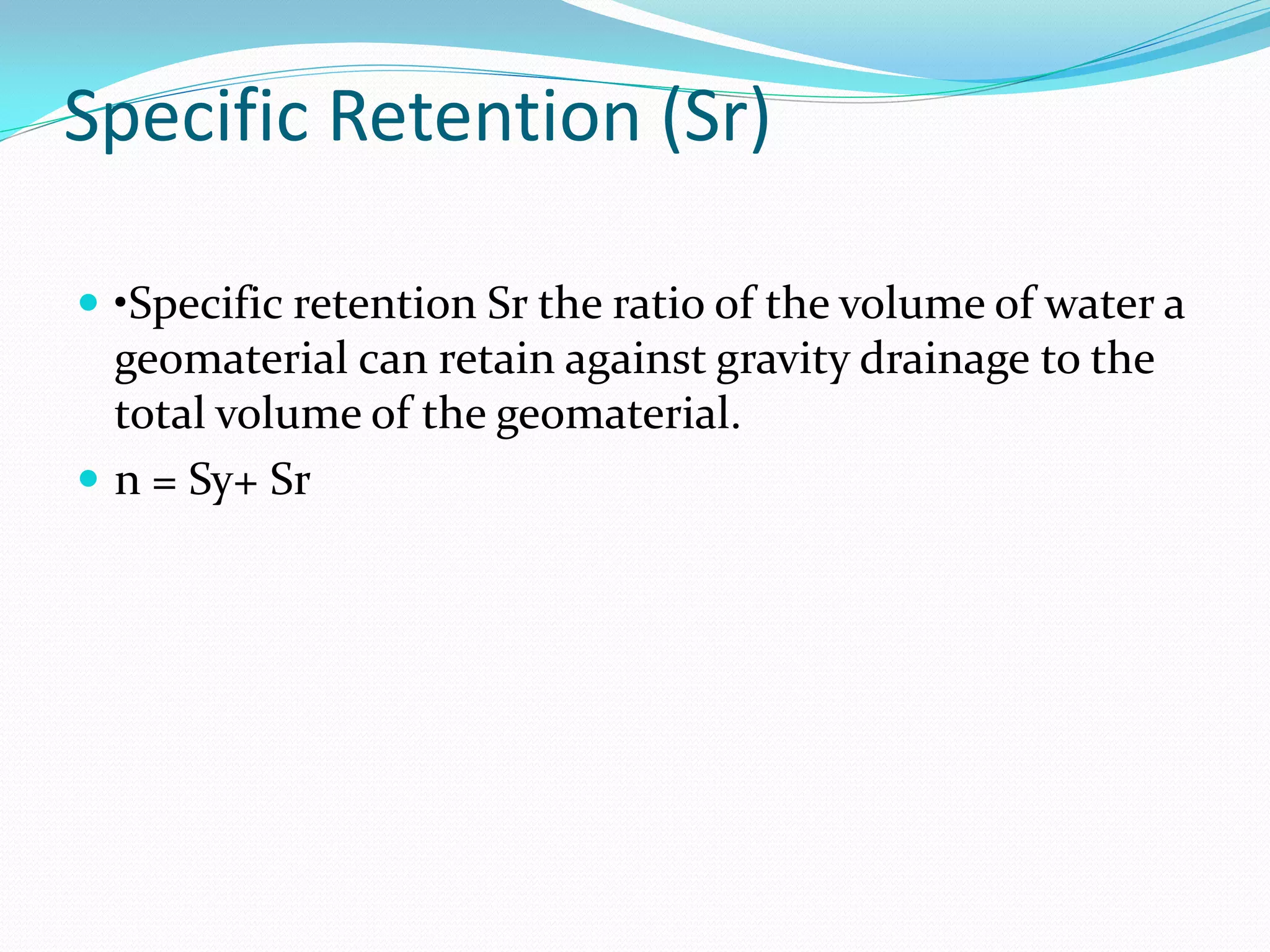
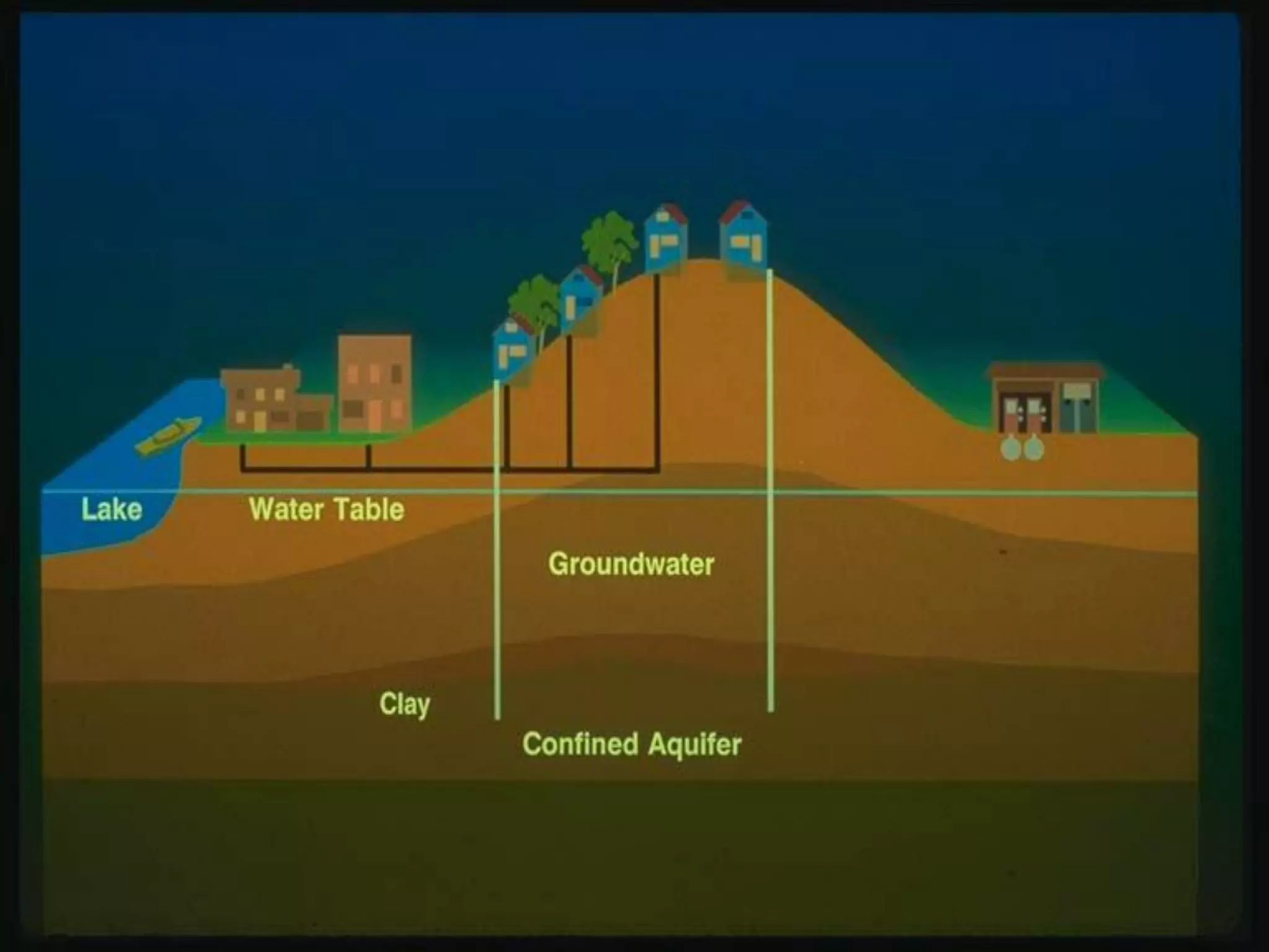
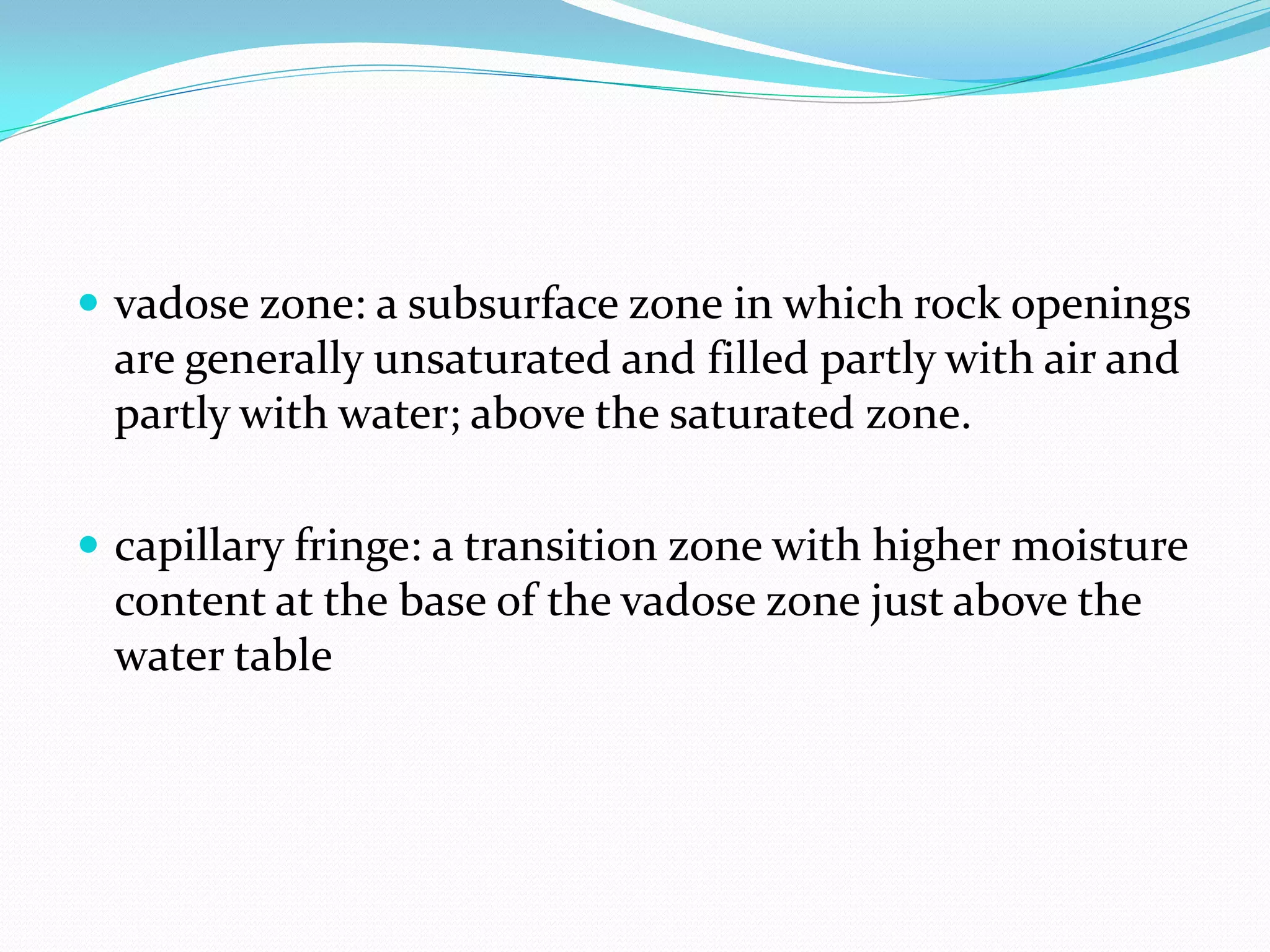
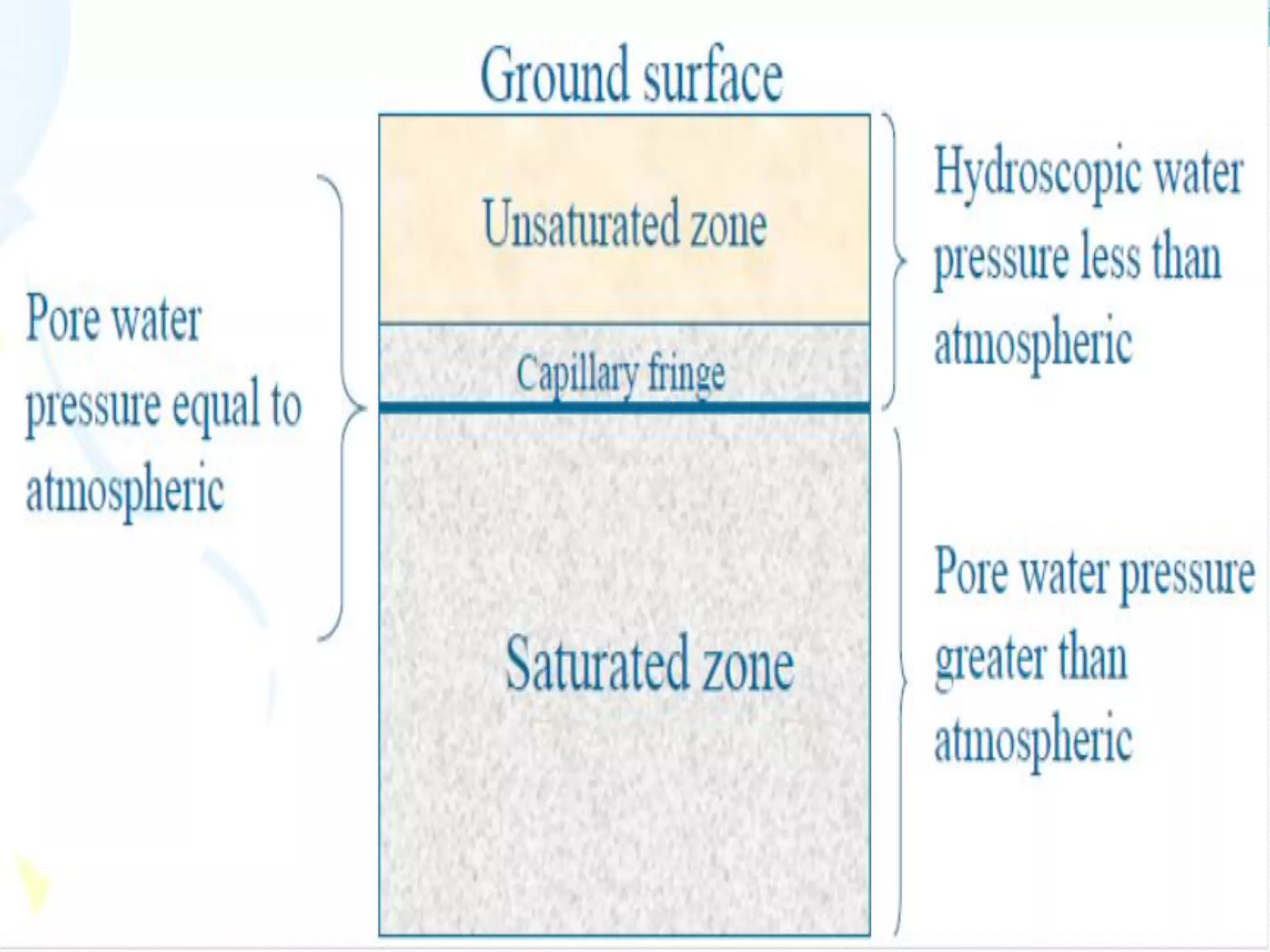
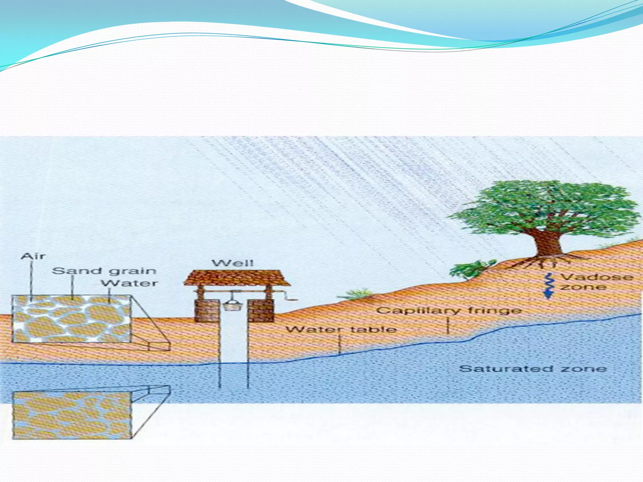
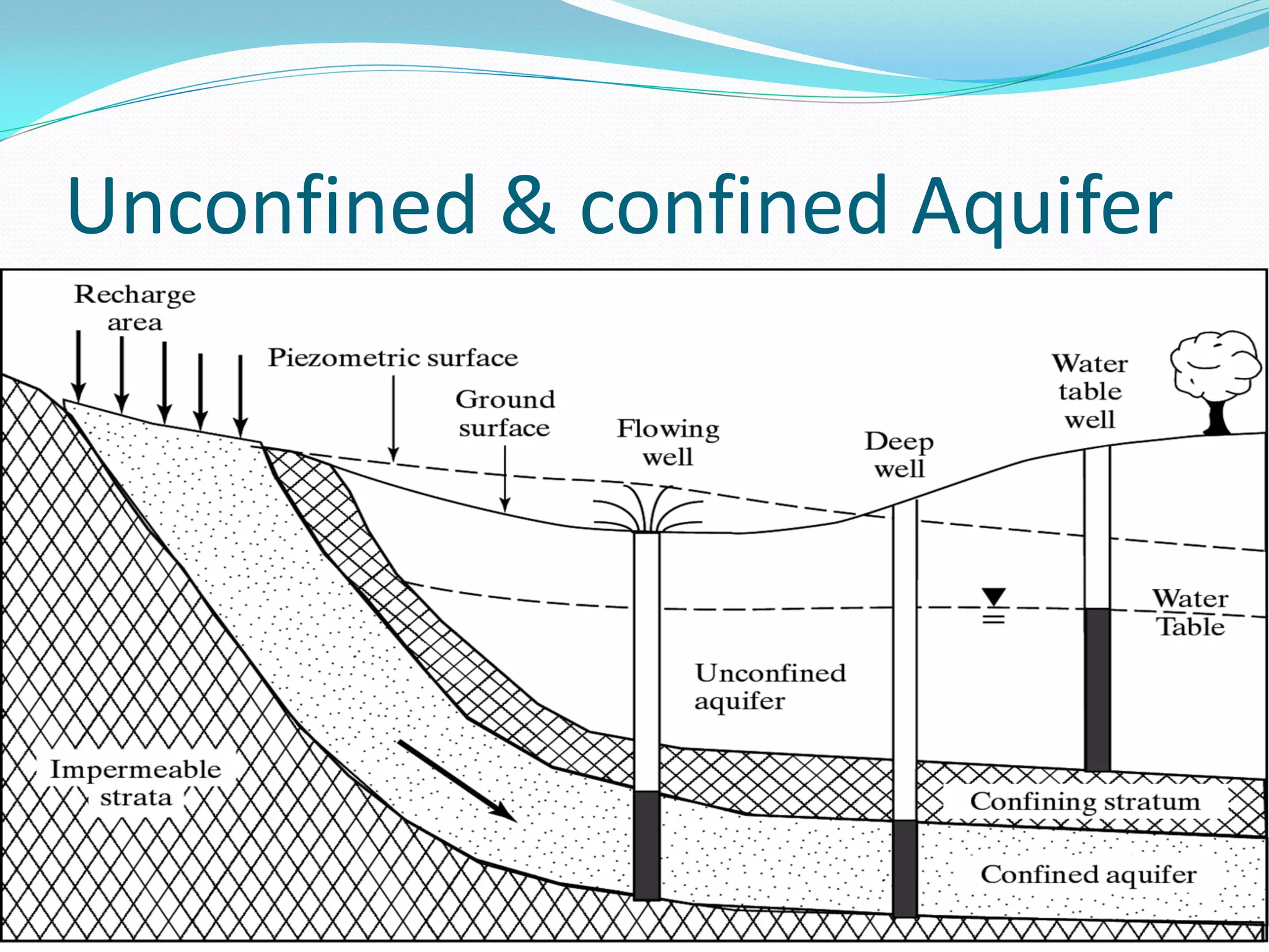
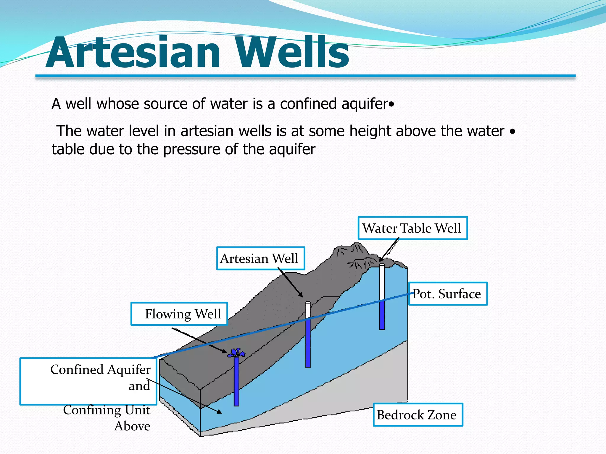
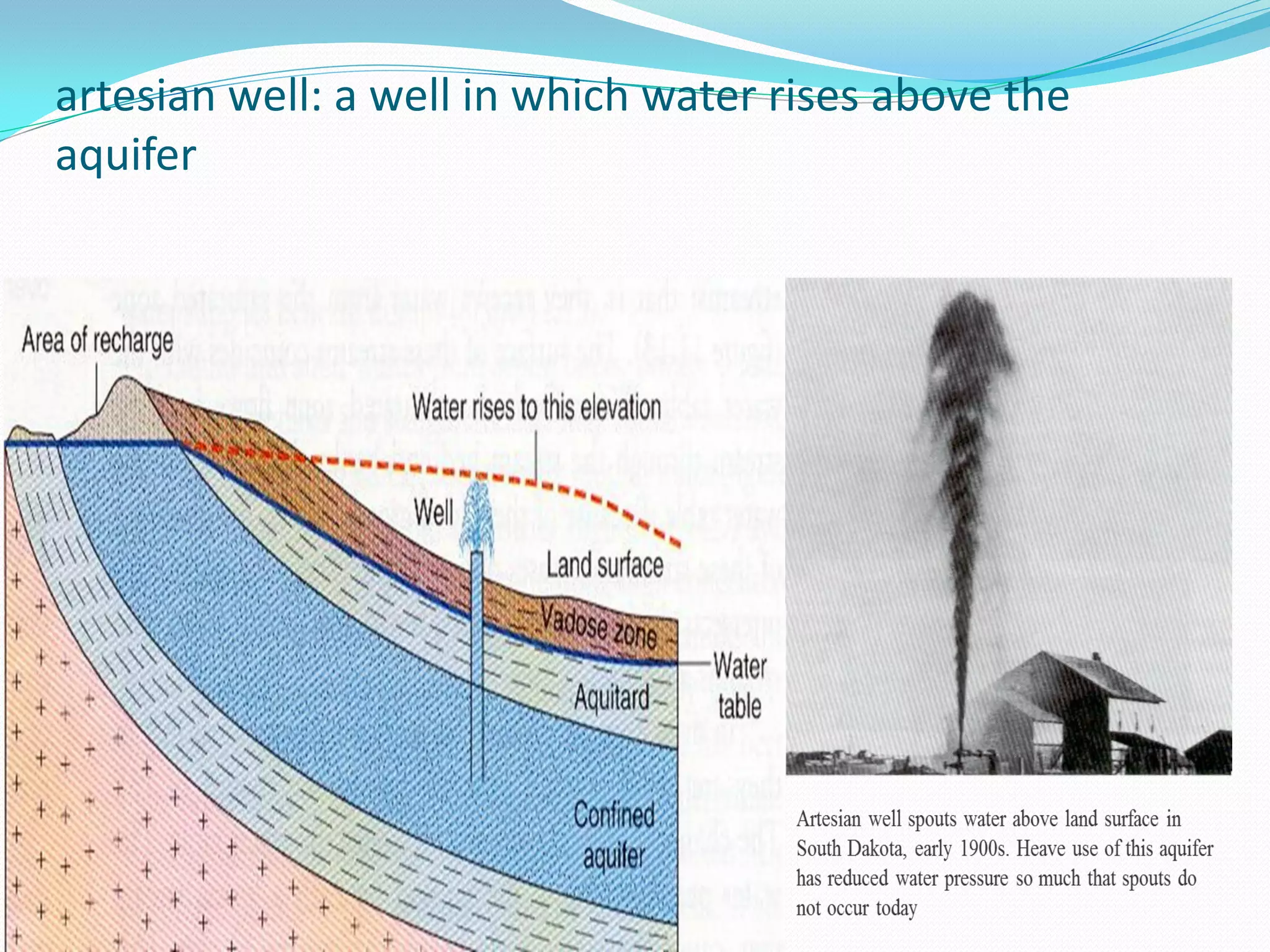
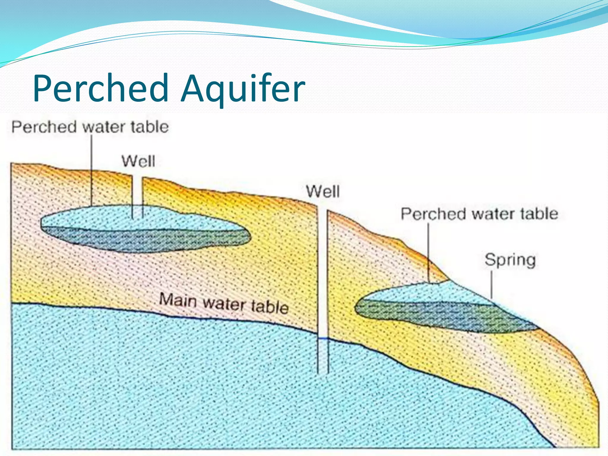
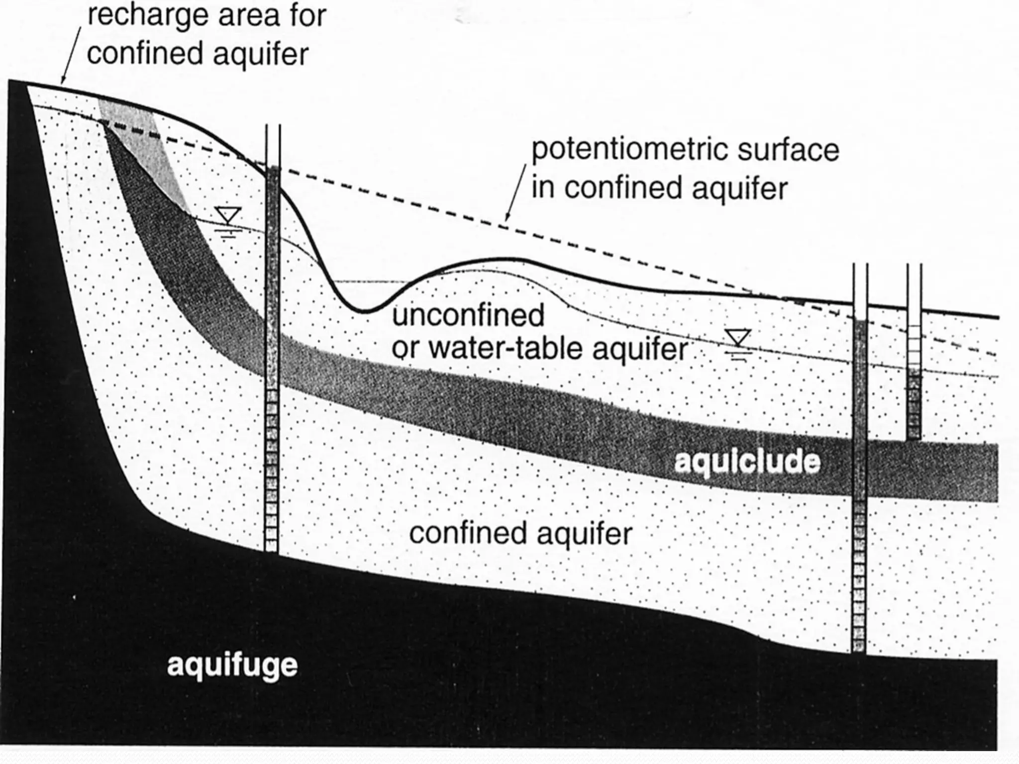
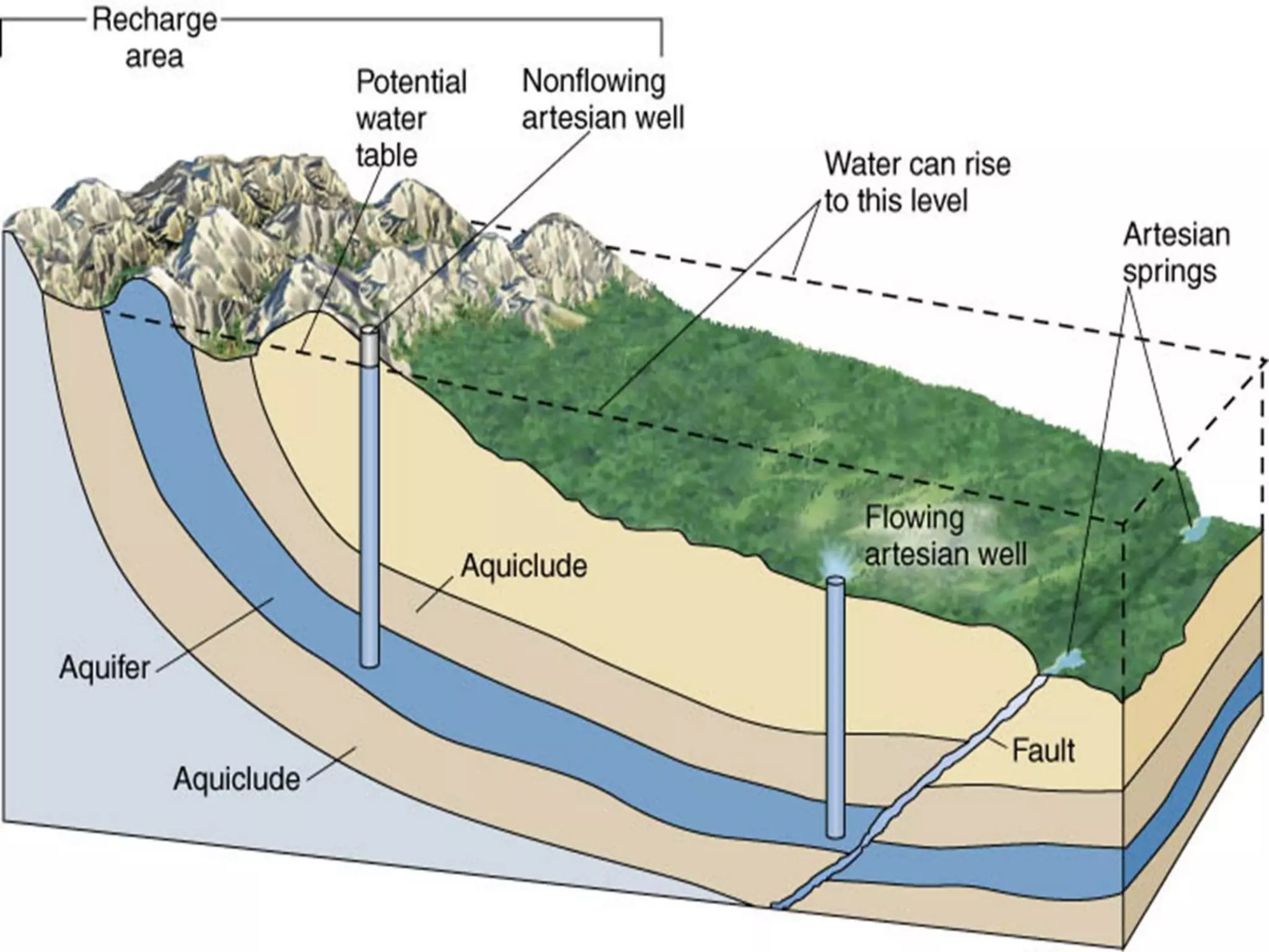
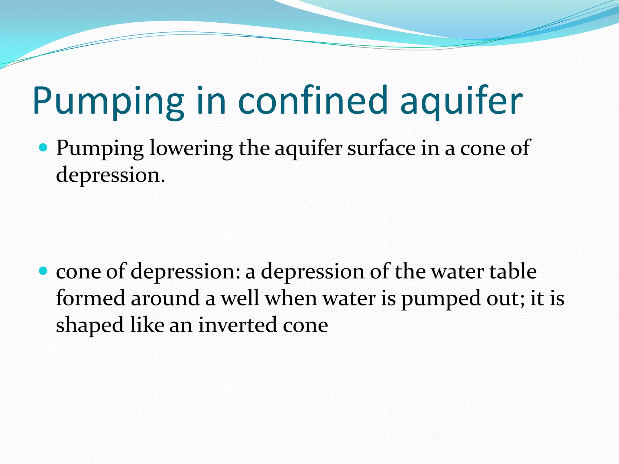
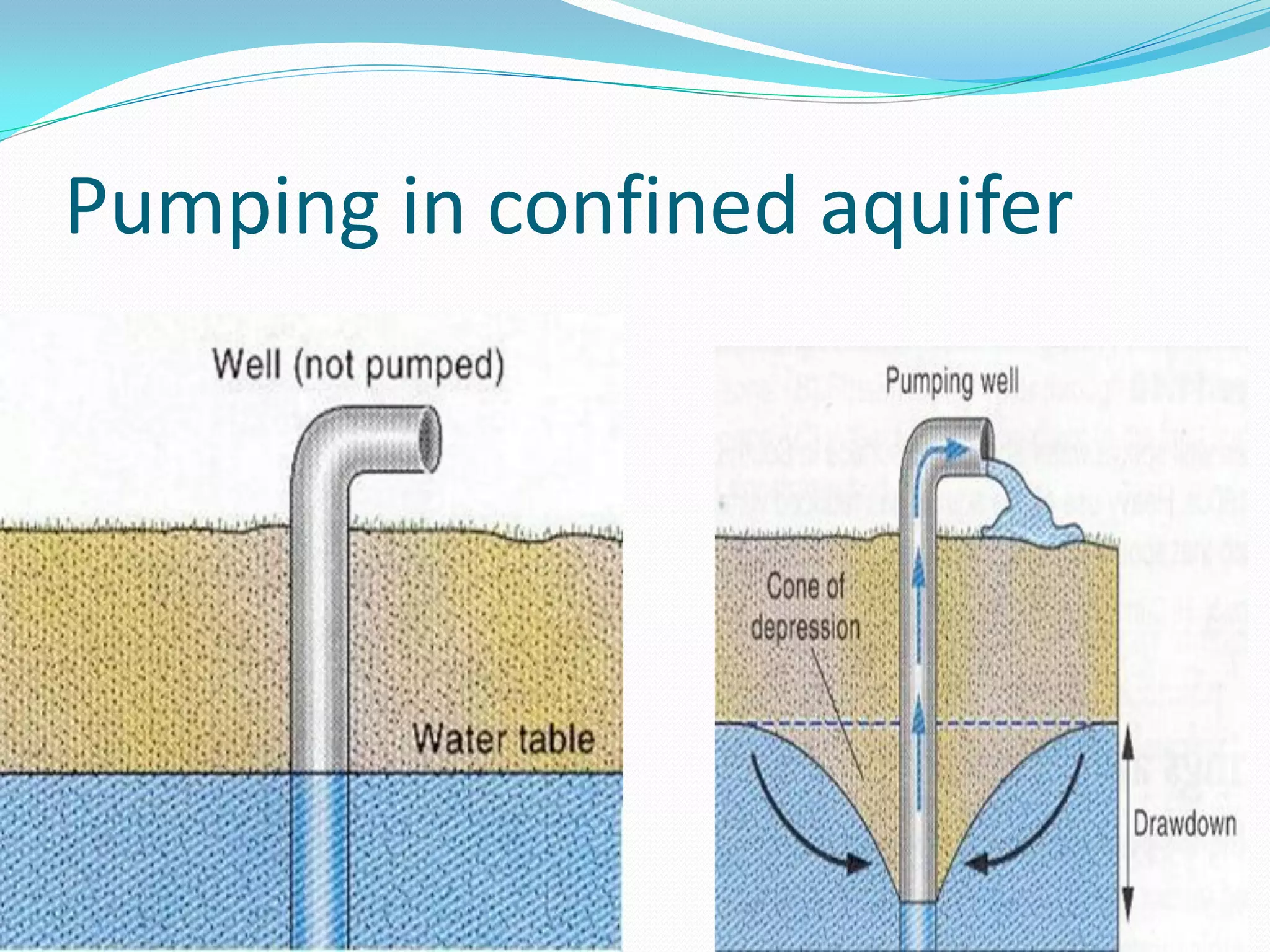
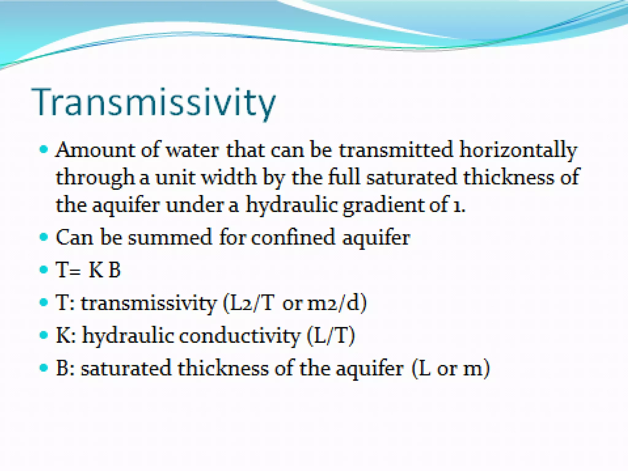
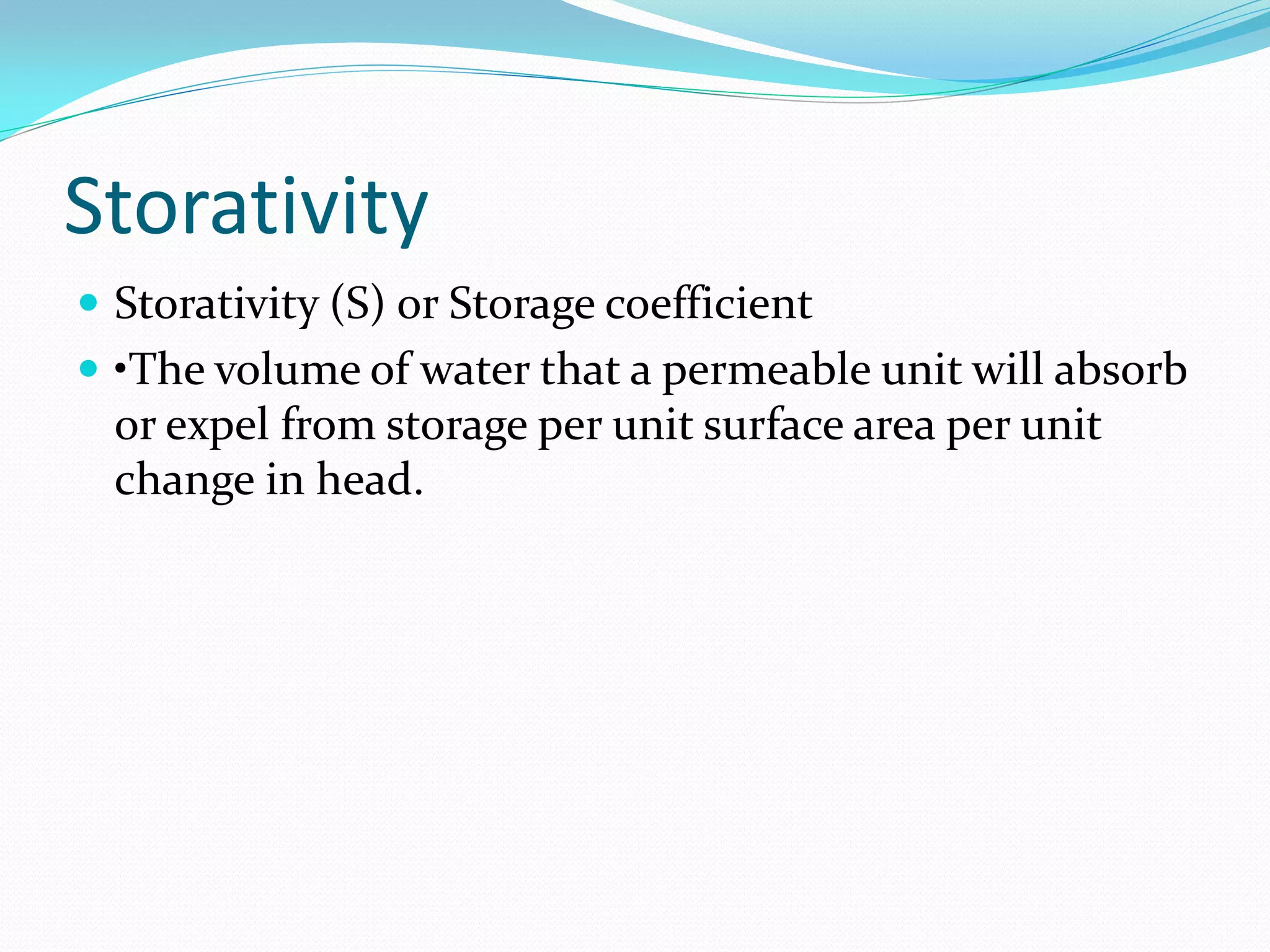
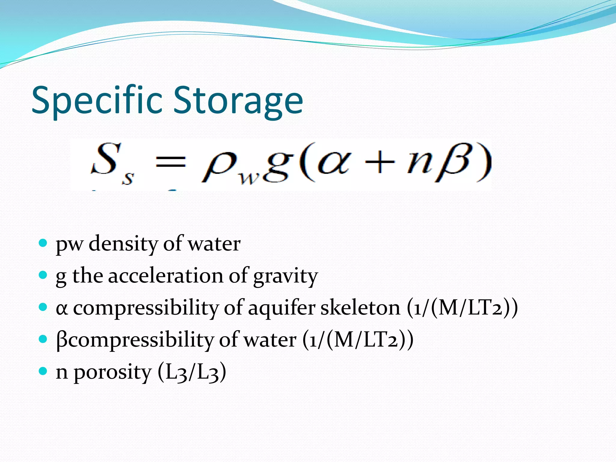
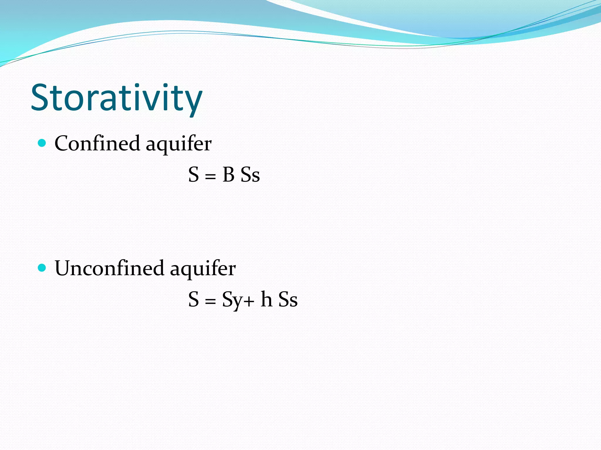
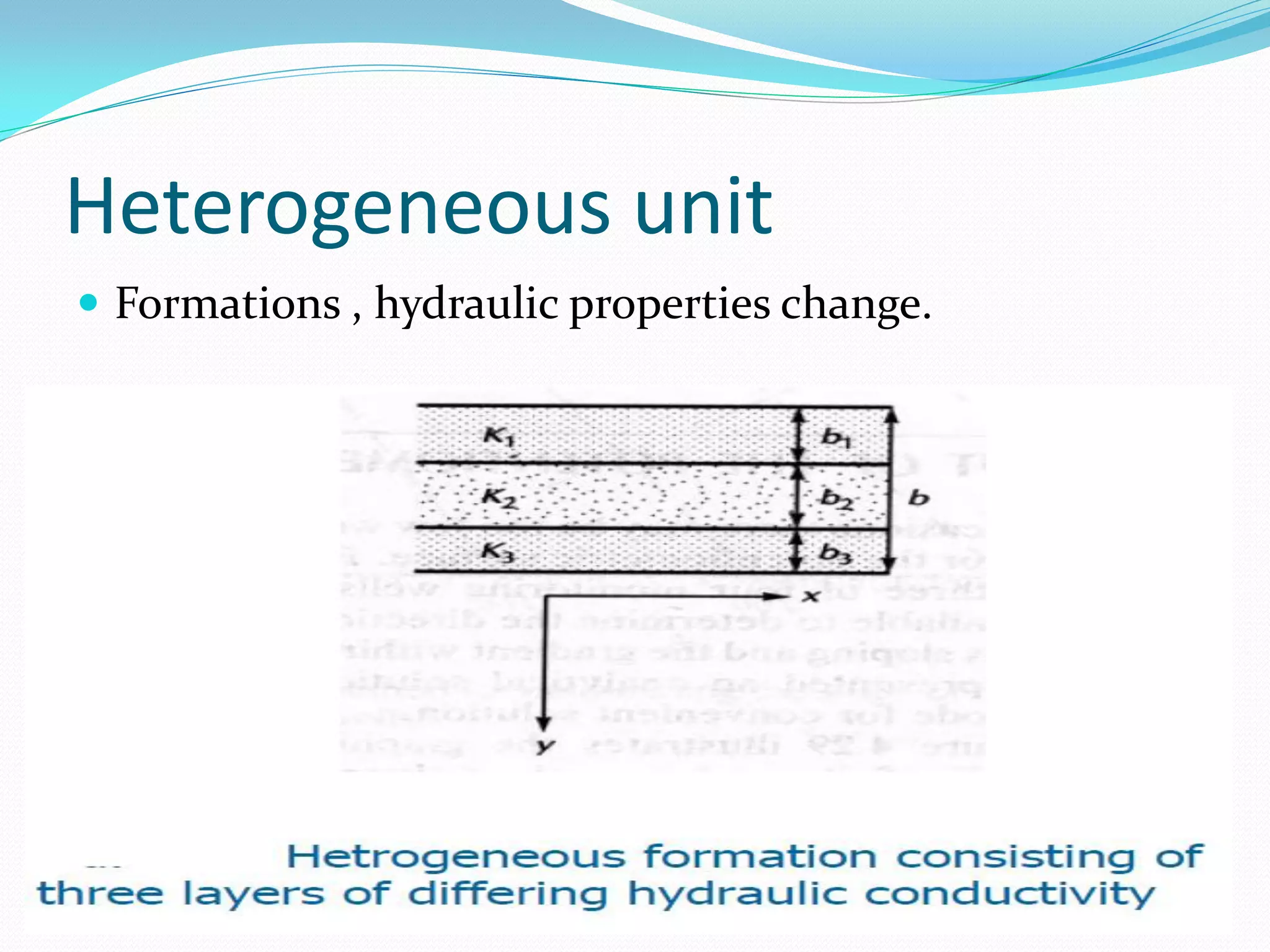
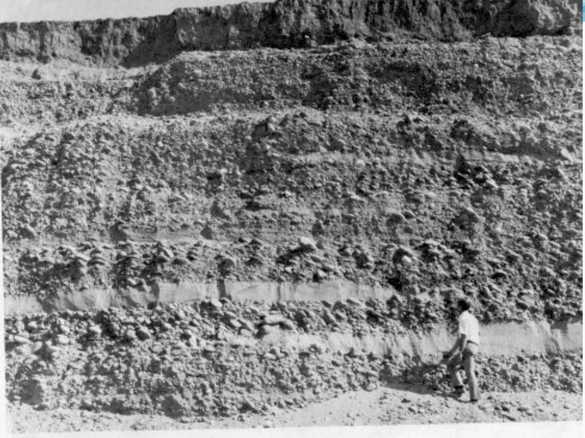
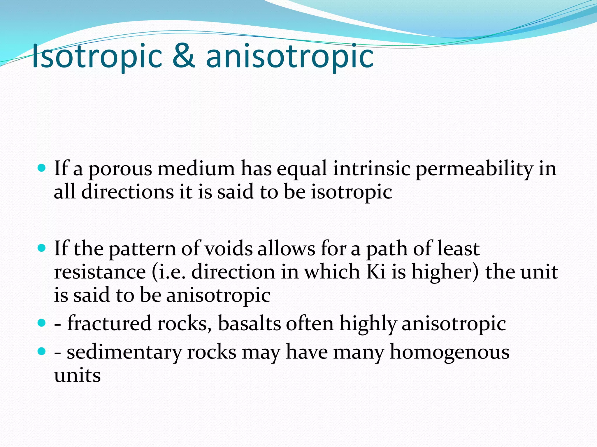

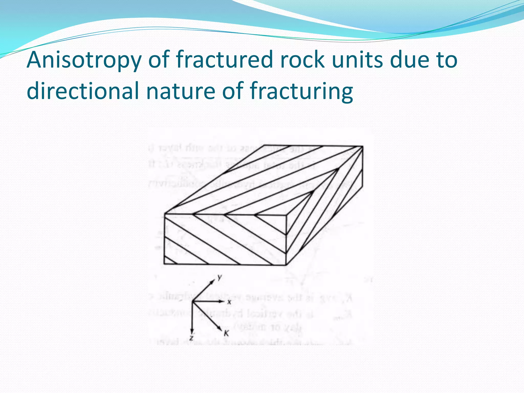
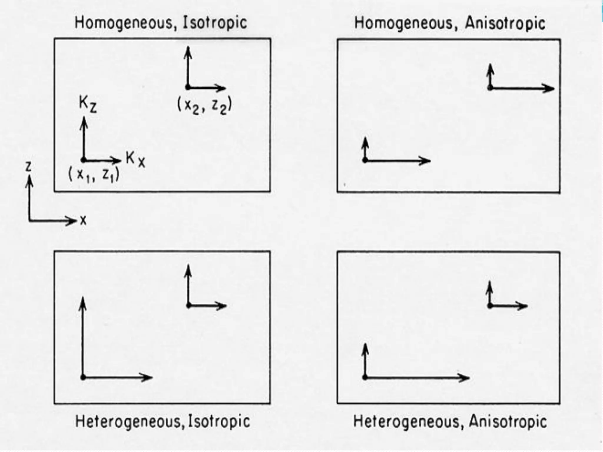

This document discusses key properties and concepts related to aquifers and groundwater flow. It defines terms like porosity, permeability, hydraulic conductivity, specific yield, and water table. It describes different types of aquifers such as unconfined, confined, and perched aquifers. Pumping from confined aquifers can create a cone of depression. Storativity describes how much water an aquifer can gain or lose from storage. Aquifer units can be homogeneous, heterogeneous, isotropic, or anisotropic depending on their properties.