SlideShare a Scribd company logo
CrowdMap: Accurate Reconstruction of
Indoor Floor Plans from Crowdsourced
Sensor-Rich Videos
Si Chen, Muyuan Li, Kui Ren, Chunming Qiao
Department of Computer Science and Engineering
University at Buffalo – State University of New York
Page  2
Outline
 1. Introduction
 2. System Architecture and Design Details
 3. Implementation and Evaluation
 4. Future Work
Page  3
Outdoor Maps
Google Map
OpenStreetMap
Page  4
Indoor Maps (Floor Plans)
 Unlike outdoor environment, acquiring digital indoor floor plan information
is very challenging.
 The state-of-the-art Google Indoor Maps only have 10,000 locations
available worldwide, which is not in a position to compete with the total
number of indoor environments around the world.
Page  5
Indoor Maps
 The complexity of the indoor environment is the major obstacle to
achieve ubiquitous coverage.
 Existing centralized collection and on-site calibration techniques
demand professional devices and multi-party coordination, which are time
consuming, inconvenient and costly.
Google Trekker http://www.navvis.lmt.ei.tum.de/about/
Page  6
Crowdsourcing
http://cdn.thephonebulletin.com/wp-content/uploads/2013/01/smartphone-sensors.jpg
Recently, the wide availability of smartphones and wearable devices (e.g.
google glasses) equipped with built-in visual, acoustic and inertial
sensors makes the mobile user easier than ever to devote themselves to
contribute mobile data.
Page  7
Crowdsourcing
http://senda.uab.es/node/15
Page  8
Indoor Floor Plan Reconstruction by Crowdsourcing
There have been several studies trying to explore the possibility of using
crowdsourced inertial sensory data to generate an indoor floor plan
automatically.
Alzantot, Moustafa, and Moustafa Youssef. "Crowdinside: automatic construction of indoor
floorplans." Proceedings of the 20th International Conference on Advances in Geographic Information
Systems. ACM, 2012.
Page  9
Drawback of Inertial Sensor Only Methods
 However, current crowdsourcing floor plan reconstruction systems are not
able to produce accurate enough results.
– Most of existing indoor floor plan reconstruction systems heavily rely on inertial
data.
The premise of their work is that users would be
able to move across all edges and corners in
an indoor environment.
• the edge of an indoor scene is usually
blocked by furniture or other objects,
• some restricted areas in an indoor
environment are also inaccessible for most
of the users
Visual information preserve more context information for an unknown
indoor environment, such as the geometric information, color information,
lighting conditions and text information.
[1].http://www.sigmobile.org/mobicom/2014/talks/slides_6_3.pdf
[1]
Page  10
CrowdMap: Key Idea
 CrowdMap: An accurate indoor floor plan reconstruction system based on
sensor-rich videos.
 Key idea: leverage the spatio-temporal relationship between each
consecutive frame of the crowdsourced video.
Page  11
CrowdMap: Floor Plan
Basic elements of building floor plan
Page  12
Outline
 1. Introduction
 2. System Architecture and Design Details
 3. Implementation and Evaluation
 4. Future Work
Page  13
CrowdMap: System Architecture
mobile front-end
cloud back-end
i) crowdsourced data
collection module
ii) indoor path modeling
module
iii) room layout modeling
module
iv) floor plan modeling module
Page  14
CrowdMap: Crowdsourced Data Collection Module
We assume that users actively get involved in the data collecting tasks.
Example: a user opens our mobile application and inputs the floor
number, starts capturing the room environment by spinning his/her body
(SRS task); then, walks towards the hallway (SWS task).
The walking distance |AB| is calculated by the step counting method. In
addition, the direction change of each step ∆𝜔 is calculated by jointly
using compass, gyroscope and accelerometer.
Page  15
CrowdMap: Crowdsourced Data Collection Module
By using the inertial sensor data, we are able to reconstruct the
trajectory of the user when they perform the SWS task.
Page  16
CrowdMap: Indoor Path Modeling Module
How to aggregate multiple user trajectories and reconstruct the path of
the floor?
Page  17
CrowdMap: Indoor Path Modeling Module
[1].Bay, Herbert, Tinne Tuytelaars, and Luc Van Gool. "Surf: Speeded up robust features." Computer
vision–ECCV 2006. Springer Berlin Heidelberg, 2006. 404-417.
We select the state-of-the-art SURF [1] algorithm to precisely match two
candidate key-frames
Page  18
CrowdMap: Indoor Path Modeling Module
Correct Matching
Page  19
CrowdMap: Indoor Path Modeling Module
Incorrect Matching
Page  20
CrowdMap: Indoor Path Modeling Module
 We use multiple key-frames to determine whether the two user
trajectories can be merged.
 If there is a match between the two trajectories generated in the same
floor, there should be a common path between them in a high
probability. Hence, we use the longest common subsequence to
capture this notion.
Where Ta and Tb are the two user trajectories with length of i
and j, respectively. Parameter 𝛿 represents the maximum
length difference between two user trajectories and 𝜀 is the
distance threshold.
Page  21
CrowdMap: Indoor Path Modeling Module
Page  22
CrowdMap: Room Layout Modeling Module
We utilize crowdsourced images to create the panorama for each
place, and then use computer vision techniques to process the
panorama, and thereby, generate the room layout.
Page  23
CrowdMap: Room Layout Modeling Module
Page  24
CrowdMap: Room Layout Modeling Module
Page  25
CrowdMap: Floor Plan Modeling Module
Page  26
CrowdMap: Floor Plan Modeling Module
Page  27
CrowdMap: Floor Plan Modeling Module
Page  28
Outline
 1. Introduction
 2. System Architecture and Design Details
 3. Implementation and Evaluation
 4. Future Work
Page  29
CrowdMap: Implementation
Page  30
CrowdMap: Implementation
Screenshot for CrowdMap Mobile Frontend
Page  31
Microsoft Azure Platform
Page  32
CrowdMap: Evaluation
Page  33
CrowdMap: Evaluation
Page  34
Compare with Structure from Motion (SfM)
Page  35
Outline
 1. Introduction
 2. System Architecture and Design Details
 3. Implementation and Evaluation
 4. Future Work
Page  36
CrowdMap: Future Work
We will focus on further processing of the room panorama to extract
more context information of the room:
• object detection
• object recognition.
We also plan to further study several issues:
• user incentive mechanism
• privacy preservation mechanism.
Page  37

More Related Content

What's hot

DSM Extraction from Pleiades Images using Micmac
DSM Extraction from Pleiades Images using MicmacDSM Extraction from Pleiades Images using Micmac
DSM Extraction from Pleiades Images using Micmac
National Cheng Kung University
 
Satellite image processing
Satellite image processingSatellite image processing
Satellite image processing
alok ray
 
An Authoring Solution for a Façade-Based AR Platform: Infrastructure, Annota...
An Authoring Solution for  a Façade-Based AR Platform: Infrastructure, Annota...An Authoring Solution for  a Façade-Based AR Platform: Infrastructure, Annota...
An Authoring Solution for a Façade-Based AR Platform: Infrastructure, Annota...
Guillaume Gales
 
How is photogrammetry useful in gis
How is photogrammetry useful in gisHow is photogrammetry useful in gis
How is photogrammetry useful in gis
NI BT
 
Drone flight planning - Principles and Practices
Drone flight planning - Principles and PracticesDrone flight planning - Principles and Practices
Drone flight planning - Principles and Practices
Dany Laksono
 
A Vision-Based Mobile Platform for Seamless Indoor/Outdoor Positioning
A Vision-Based Mobile Platform for Seamless Indoor/Outdoor PositioningA Vision-Based Mobile Platform for Seamless Indoor/Outdoor Positioning
A Vision-Based Mobile Platform for Seamless Indoor/Outdoor Positioning
Guillaume Gales
 
Digital Elevation Model (DEM)
Digital Elevation Model (DEM)Digital Elevation Model (DEM)
Digital Elevation Model (DEM)
Malla Reddy University
 
PREPARATION OF ROAD NETWORK FROM SATELLITE IMAGERY
PREPARATION OF ROAD NETWORK FROM SATELLITE IMAGERYPREPARATION OF ROAD NETWORK FROM SATELLITE IMAGERY
PREPARATION OF ROAD NETWORK FROM SATELLITE IMAGERYPhilson Philipose
 
Geospatial Applications in Civil Engineering
Geospatial Applications in Civil EngineeringGeospatial Applications in Civil Engineering
Geospatial Applications in Civil Engineering
Sriharsha Rangineni
 
Modified Resource Google Presentation
Modified Resource Google PresentationModified Resource Google Presentation
Modified Resource Google Presentation
William Worford
 
High_resolution_GEC
High_resolution_GECHigh_resolution_GEC
High_resolution_GECKenneth Kay
 
Practical 02: Modern Survey Instrument
Practical 02: Modern Survey InstrumentPractical 02: Modern Survey Instrument
Practical 02: Modern Survey Instrument
Sarhat Adam
 
geodata are sexy and openstreetmap is energy
geodata are sexy and openstreetmap is energygeodata are sexy and openstreetmap is energy
geodata are sexy and openstreetmap is energy
Maurizio Napolitano
 
Applications of GIS to Logistics and Transportation
Applications of GIS to Logistics and TransportationApplications of GIS to Logistics and Transportation
Applications of GIS to Logistics and Transportation
sorbi
 
Crowd sourcing and high resolution satellite imagery in public health
Crowd sourcing and high resolution satellite imagery in public healthCrowd sourcing and high resolution satellite imagery in public health
Crowd sourcing and high resolution satellite imagery in public health
London School of Hygiene and Tropical Medicine
 
Photogrammetry: Latest Technology to Create Maps Using Drones?
Photogrammetry: Latest Technology to Create Maps Using Drones?Photogrammetry: Latest Technology to Create Maps Using Drones?
Photogrammetry: Latest Technology to Create Maps Using Drones?
NI BT
 
Introduction to gis and its application
Introduction to gis and its application Introduction to gis and its application
Introduction to gis and its application
gandhinagar
 
Aerial Photo Ballon Technique Mapasia2006
Aerial Photo Ballon Technique  Mapasia2006Aerial Photo Ballon Technique  Mapasia2006
Aerial Photo Ballon Technique Mapasia2006
Jan-Peter Mund
 

What's hot (20)

DSM Extraction from Pleiades Images using Micmac
DSM Extraction from Pleiades Images using MicmacDSM Extraction from Pleiades Images using Micmac
DSM Extraction from Pleiades Images using Micmac
 
Satellite image processing
Satellite image processingSatellite image processing
Satellite image processing
 
An Authoring Solution for a Façade-Based AR Platform: Infrastructure, Annota...
An Authoring Solution for  a Façade-Based AR Platform: Infrastructure, Annota...An Authoring Solution for  a Façade-Based AR Platform: Infrastructure, Annota...
An Authoring Solution for a Façade-Based AR Platform: Infrastructure, Annota...
 
How is photogrammetry useful in gis
How is photogrammetry useful in gisHow is photogrammetry useful in gis
How is photogrammetry useful in gis
 
Drone flight planning - Principles and Practices
Drone flight planning - Principles and PracticesDrone flight planning - Principles and Practices
Drone flight planning - Principles and Practices
 
A Vision-Based Mobile Platform for Seamless Indoor/Outdoor Positioning
A Vision-Based Mobile Platform for Seamless Indoor/Outdoor PositioningA Vision-Based Mobile Platform for Seamless Indoor/Outdoor Positioning
A Vision-Based Mobile Platform for Seamless Indoor/Outdoor Positioning
 
Digital Elevation Model (DEM)
Digital Elevation Model (DEM)Digital Elevation Model (DEM)
Digital Elevation Model (DEM)
 
PREPARATION OF ROAD NETWORK FROM SATELLITE IMAGERY
PREPARATION OF ROAD NETWORK FROM SATELLITE IMAGERYPREPARATION OF ROAD NETWORK FROM SATELLITE IMAGERY
PREPARATION OF ROAD NETWORK FROM SATELLITE IMAGERY
 
Geospatial Applications in Civil Engineering
Geospatial Applications in Civil EngineeringGeospatial Applications in Civil Engineering
Geospatial Applications in Civil Engineering
 
Modified Resource Google Presentation
Modified Resource Google PresentationModified Resource Google Presentation
Modified Resource Google Presentation
 
High_resolution_GEC
High_resolution_GECHigh_resolution_GEC
High_resolution_GEC
 
Photogrammetry chandu
Photogrammetry chanduPhotogrammetry chandu
Photogrammetry chandu
 
Practical 02: Modern Survey Instrument
Practical 02: Modern Survey InstrumentPractical 02: Modern Survey Instrument
Practical 02: Modern Survey Instrument
 
Maps
MapsMaps
Maps
 
geodata are sexy and openstreetmap is energy
geodata are sexy and openstreetmap is energygeodata are sexy and openstreetmap is energy
geodata are sexy and openstreetmap is energy
 
Applications of GIS to Logistics and Transportation
Applications of GIS to Logistics and TransportationApplications of GIS to Logistics and Transportation
Applications of GIS to Logistics and Transportation
 
Crowd sourcing and high resolution satellite imagery in public health
Crowd sourcing and high resolution satellite imagery in public healthCrowd sourcing and high resolution satellite imagery in public health
Crowd sourcing and high resolution satellite imagery in public health
 
Photogrammetry: Latest Technology to Create Maps Using Drones?
Photogrammetry: Latest Technology to Create Maps Using Drones?Photogrammetry: Latest Technology to Create Maps Using Drones?
Photogrammetry: Latest Technology to Create Maps Using Drones?
 
Introduction to gis and its application
Introduction to gis and its application Introduction to gis and its application
Introduction to gis and its application
 
Aerial Photo Ballon Technique Mapasia2006
Aerial Photo Ballon Technique  Mapasia2006Aerial Photo Ballon Technique  Mapasia2006
Aerial Photo Ballon Technique Mapasia2006
 

Similar to CrowdMap: Accurate Reconstruction of Indoor Floor Plan from Crowdsourced Sensor-Rich Videos

A case study: Grid services for satellite image processing
A case study: Grid services for satellite image processingA case study: Grid services for satellite image processing
A case study: Grid services for satellite image processing
BOHRInternationalJou1
 
SD-miner System to Retrieve Probabilistic Neighborhood Points in Spatial Dat...
SD-miner System to Retrieve Probabilistic Neighborhood Points  in Spatial Dat...SD-miner System to Retrieve Probabilistic Neighborhood Points  in Spatial Dat...
SD-miner System to Retrieve Probabilistic Neighborhood Points in Spatial Dat...
IOSR Journals
 
A Transfer Learning Approach to Traffic Sign Recognition
A Transfer Learning Approach to Traffic Sign RecognitionA Transfer Learning Approach to Traffic Sign Recognition
A Transfer Learning Approach to Traffic Sign Recognition
IRJET Journal
 
Three dimensional (3D) GIS
Three dimensional (3D) GISThree dimensional (3D) GIS
Three dimensional (3D) GIS
Wellington Gwavava
 
Handheld augmented reality_for_underground_infrast
Handheld augmented reality_for_underground_infrastHandheld augmented reality_for_underground_infrast
Handheld augmented reality_for_underground_infrast
HelloWorld121381
 
Ijciet 10 01_068
Ijciet 10 01_068Ijciet 10 01_068
Ijciet 10 01_068
IAEME Publication
 
[Paper research] GOSELO: for Robot navigation using Reactive neural networks
[Paper research] GOSELO: for Robot navigation using Reactive neural networks[Paper research] GOSELO: for Robot navigation using Reactive neural networks
[Paper research] GOSELO: for Robot navigation using Reactive neural networks
Jehong Lee
 
Ijsartv6 i336124
Ijsartv6 i336124Ijsartv6 i336124
Ijsartv6 i336124
aissmsblogs
 
Introduction of construction management
Introduction of construction managementIntroduction of construction management
Introduction of construction management
rajlaxmipardeshi
 
Location Data - Finding the needle in the haystack
Location Data - Finding the needle in the haystackLocation Data - Finding the needle in the haystack
Location Data - Finding the needle in the haystack
Lucy Woods
 
What we've done so far with mago3D, an open source based 'Digital Twin' platf...
What we've done so far with mago3D, an open source based 'Digital Twin' platf...What we've done so far with mago3D, an open source based 'Digital Twin' platf...
What we've done so far with mago3D, an open source based 'Digital Twin' platf...
SANGHEE SHIN
 
A L -H ARM E XPANSION M OVIE B ASED ON V IRTUAL R EALITY
A L -H ARM E XPANSION M OVIE B ASED ON V IRTUAL R EALITYA L -H ARM E XPANSION M OVIE B ASED ON V IRTUAL R EALITY
A L -H ARM E XPANSION M OVIE B ASED ON V IRTUAL R EALITY
csandit
 
Rendering Process of Digital Terrain Model on Mobile Devices
Rendering Process of Digital Terrain Model on Mobile DevicesRendering Process of Digital Terrain Model on Mobile Devices
Rendering Process of Digital Terrain Model on Mobile Devices
Waqas Tariq
 
Introduction to mago3D, an Open Source Based Digital Twin Platform
Introduction to mago3D, an Open Source Based Digital Twin PlatformIntroduction to mago3D, an Open Source Based Digital Twin Platform
Introduction to mago3D, an Open Source Based Digital Twin Platform
SANGHEE SHIN
 
Autonomous Vehicle and Augmented Reality Usage
Autonomous Vehicle and Augmented Reality UsageAutonomous Vehicle and Augmented Reality Usage
Autonomous Vehicle and Augmented Reality Usage
Dr. Amarjeet Singh
 
Mobile Graphics (part2)
Mobile Graphics (part2)Mobile Graphics (part2)
Mobile Graphics (part2)
CRS4 Research Center in Sardinia
 
Artificial Intelligence for Vision: A walkthrough of recent breakthroughs
Artificial Intelligence for Vision:  A walkthrough of recent breakthroughsArtificial Intelligence for Vision:  A walkthrough of recent breakthroughs
Artificial Intelligence for Vision: A walkthrough of recent breakthroughs
Nikolas Markou
 
3D-ICONS Guidelines
3D-ICONS Guidelines 3D-ICONS Guidelines
3D-ICONS Guidelines
3D ICONS Project
 

Similar to CrowdMap: Accurate Reconstruction of Indoor Floor Plan from Crowdsourced Sensor-Rich Videos (20)

A case study: Grid services for satellite image processing
A case study: Grid services for satellite image processingA case study: Grid services for satellite image processing
A case study: Grid services for satellite image processing
 
SD-miner System to Retrieve Probabilistic Neighborhood Points in Spatial Dat...
SD-miner System to Retrieve Probabilistic Neighborhood Points  in Spatial Dat...SD-miner System to Retrieve Probabilistic Neighborhood Points  in Spatial Dat...
SD-miner System to Retrieve Probabilistic Neighborhood Points in Spatial Dat...
 
A Transfer Learning Approach to Traffic Sign Recognition
A Transfer Learning Approach to Traffic Sign RecognitionA Transfer Learning Approach to Traffic Sign Recognition
A Transfer Learning Approach to Traffic Sign Recognition
 
Three dimensional (3D) GIS
Three dimensional (3D) GISThree dimensional (3D) GIS
Three dimensional (3D) GIS
 
Handheld augmented reality_for_underground_infrast
Handheld augmented reality_for_underground_infrastHandheld augmented reality_for_underground_infrast
Handheld augmented reality_for_underground_infrast
 
Ijciet 10 01_068
Ijciet 10 01_068Ijciet 10 01_068
Ijciet 10 01_068
 
paper
paperpaper
paper
 
[Paper research] GOSELO: for Robot navigation using Reactive neural networks
[Paper research] GOSELO: for Robot navigation using Reactive neural networks[Paper research] GOSELO: for Robot navigation using Reactive neural networks
[Paper research] GOSELO: for Robot navigation using Reactive neural networks
 
Ijsartv6 i336124
Ijsartv6 i336124Ijsartv6 i336124
Ijsartv6 i336124
 
Introduction of construction management
Introduction of construction managementIntroduction of construction management
Introduction of construction management
 
Location Data - Finding the needle in the haystack
Location Data - Finding the needle in the haystackLocation Data - Finding the needle in the haystack
Location Data - Finding the needle in the haystack
 
What we've done so far with mago3D, an open source based 'Digital Twin' platf...
What we've done so far with mago3D, an open source based 'Digital Twin' platf...What we've done so far with mago3D, an open source based 'Digital Twin' platf...
What we've done so far with mago3D, an open source based 'Digital Twin' platf...
 
A L -H ARM E XPANSION M OVIE B ASED ON V IRTUAL R EALITY
A L -H ARM E XPANSION M OVIE B ASED ON V IRTUAL R EALITYA L -H ARM E XPANSION M OVIE B ASED ON V IRTUAL R EALITY
A L -H ARM E XPANSION M OVIE B ASED ON V IRTUAL R EALITY
 
Rendering Process of Digital Terrain Model on Mobile Devices
Rendering Process of Digital Terrain Model on Mobile DevicesRendering Process of Digital Terrain Model on Mobile Devices
Rendering Process of Digital Terrain Model on Mobile Devices
 
TECHNICAL REPORT
TECHNICAL REPORTTECHNICAL REPORT
TECHNICAL REPORT
 
Introduction to mago3D, an Open Source Based Digital Twin Platform
Introduction to mago3D, an Open Source Based Digital Twin PlatformIntroduction to mago3D, an Open Source Based Digital Twin Platform
Introduction to mago3D, an Open Source Based Digital Twin Platform
 
Autonomous Vehicle and Augmented Reality Usage
Autonomous Vehicle and Augmented Reality UsageAutonomous Vehicle and Augmented Reality Usage
Autonomous Vehicle and Augmented Reality Usage
 
Mobile Graphics (part2)
Mobile Graphics (part2)Mobile Graphics (part2)
Mobile Graphics (part2)
 
Artificial Intelligence for Vision: A walkthrough of recent breakthroughs
Artificial Intelligence for Vision:  A walkthrough of recent breakthroughsArtificial Intelligence for Vision:  A walkthrough of recent breakthroughs
Artificial Intelligence for Vision: A walkthrough of recent breakthroughs
 
3D-ICONS Guidelines
3D-ICONS Guidelines 3D-ICONS Guidelines
3D-ICONS Guidelines
 

Recently uploaded

Sharpen existing tools or get a new toolbox? Contemporary cluster initiatives...
Sharpen existing tools or get a new toolbox? Contemporary cluster initiatives...Sharpen existing tools or get a new toolbox? Contemporary cluster initiatives...
Sharpen existing tools or get a new toolbox? Contemporary cluster initiatives...
Orkestra
 
Media as a Mind Controlling Strategy In Old and Modern Era
Media as a Mind Controlling Strategy In Old and Modern EraMedia as a Mind Controlling Strategy In Old and Modern Era
Media as a Mind Controlling Strategy In Old and Modern Era
faizulhassanfaiz1670
 
Eureka, I found it! - Special Libraries Association 2021 Presentation
Eureka, I found it! - Special Libraries Association 2021 PresentationEureka, I found it! - Special Libraries Association 2021 Presentation
Eureka, I found it! - Special Libraries Association 2021 Presentation
Access Innovations, Inc.
 
Getting started with Amazon Bedrock Studio and Control Tower
Getting started with Amazon Bedrock Studio and Control TowerGetting started with Amazon Bedrock Studio and Control Tower
Getting started with Amazon Bedrock Studio and Control Tower
Vladimir Samoylov
 
International Workshop on Artificial Intelligence in Software Testing
International Workshop on Artificial Intelligence in Software TestingInternational Workshop on Artificial Intelligence in Software Testing
International Workshop on Artificial Intelligence in Software Testing
Sebastiano Panichella
 
Bonzo subscription_hjjjjjjjj5hhhhhhh_2024.pdf
Bonzo subscription_hjjjjjjjj5hhhhhhh_2024.pdfBonzo subscription_hjjjjjjjj5hhhhhhh_2024.pdf
Bonzo subscription_hjjjjjjjj5hhhhhhh_2024.pdf
khadija278284
 
Acorn Recovery: Restore IT infra within minutes
Acorn Recovery: Restore IT infra within minutesAcorn Recovery: Restore IT infra within minutes
Acorn Recovery: Restore IT infra within minutes
IP ServerOne
 
Obesity causes and management and associated medical conditions
Obesity causes and management and associated medical conditionsObesity causes and management and associated medical conditions
Obesity causes and management and associated medical conditions
Faculty of Medicine And Health Sciences
 
Supercharge your AI - SSP Industry Breakout Session 2024-v2_1.pdf
Supercharge your AI - SSP Industry Breakout Session 2024-v2_1.pdfSupercharge your AI - SSP Industry Breakout Session 2024-v2_1.pdf
Supercharge your AI - SSP Industry Breakout Session 2024-v2_1.pdf
Access Innovations, Inc.
 
Competition and Regulation in Professional Services – KLEINER – June 2024 OEC...
Competition and Regulation in Professional Services – KLEINER – June 2024 OEC...Competition and Regulation in Professional Services – KLEINER – June 2024 OEC...
Competition and Regulation in Professional Services – KLEINER – June 2024 OEC...
OECD Directorate for Financial and Enterprise Affairs
 
Doctoral Symposium at the 17th IEEE International Conference on Software Test...
Doctoral Symposium at the 17th IEEE International Conference on Software Test...Doctoral Symposium at the 17th IEEE International Conference on Software Test...
Doctoral Symposium at the 17th IEEE International Conference on Software Test...
Sebastiano Panichella
 
Announcement of 18th IEEE International Conference on Software Testing, Verif...
Announcement of 18th IEEE International Conference on Software Testing, Verif...Announcement of 18th IEEE International Conference on Software Testing, Verif...
Announcement of 18th IEEE International Conference on Software Testing, Verif...
Sebastiano Panichella
 
0x01 - Newton's Third Law: Static vs. Dynamic Abusers
0x01 - Newton's Third Law:  Static vs. Dynamic Abusers0x01 - Newton's Third Law:  Static vs. Dynamic Abusers
0x01 - Newton's Third Law: Static vs. Dynamic Abusers
OWASP Beja
 
somanykidsbutsofewfathers-140705000023-phpapp02.pptx
somanykidsbutsofewfathers-140705000023-phpapp02.pptxsomanykidsbutsofewfathers-140705000023-phpapp02.pptx
somanykidsbutsofewfathers-140705000023-phpapp02.pptx
Howard Spence
 
María Carolina Martínez - eCommerce Day Colombia 2024
María Carolina Martínez - eCommerce Day Colombia 2024María Carolina Martínez - eCommerce Day Colombia 2024
María Carolina Martínez - eCommerce Day Colombia 2024
eCommerce Institute
 
Bitcoin Lightning wallet and tic-tac-toe game XOXO
Bitcoin Lightning wallet and tic-tac-toe game XOXOBitcoin Lightning wallet and tic-tac-toe game XOXO
Bitcoin Lightning wallet and tic-tac-toe game XOXO
Matjaž Lipuš
 

Recently uploaded (16)

Sharpen existing tools or get a new toolbox? Contemporary cluster initiatives...
Sharpen existing tools or get a new toolbox? Contemporary cluster initiatives...Sharpen existing tools or get a new toolbox? Contemporary cluster initiatives...
Sharpen existing tools or get a new toolbox? Contemporary cluster initiatives...
 
Media as a Mind Controlling Strategy In Old and Modern Era
Media as a Mind Controlling Strategy In Old and Modern EraMedia as a Mind Controlling Strategy In Old and Modern Era
Media as a Mind Controlling Strategy In Old and Modern Era
 
Eureka, I found it! - Special Libraries Association 2021 Presentation
Eureka, I found it! - Special Libraries Association 2021 PresentationEureka, I found it! - Special Libraries Association 2021 Presentation
Eureka, I found it! - Special Libraries Association 2021 Presentation
 
Getting started with Amazon Bedrock Studio and Control Tower
Getting started with Amazon Bedrock Studio and Control TowerGetting started with Amazon Bedrock Studio and Control Tower
Getting started with Amazon Bedrock Studio and Control Tower
 
International Workshop on Artificial Intelligence in Software Testing
International Workshop on Artificial Intelligence in Software TestingInternational Workshop on Artificial Intelligence in Software Testing
International Workshop on Artificial Intelligence in Software Testing
 
Bonzo subscription_hjjjjjjjj5hhhhhhh_2024.pdf
Bonzo subscription_hjjjjjjjj5hhhhhhh_2024.pdfBonzo subscription_hjjjjjjjj5hhhhhhh_2024.pdf
Bonzo subscription_hjjjjjjjj5hhhhhhh_2024.pdf
 
Acorn Recovery: Restore IT infra within minutes
Acorn Recovery: Restore IT infra within minutesAcorn Recovery: Restore IT infra within minutes
Acorn Recovery: Restore IT infra within minutes
 
Obesity causes and management and associated medical conditions
Obesity causes and management and associated medical conditionsObesity causes and management and associated medical conditions
Obesity causes and management and associated medical conditions
 
Supercharge your AI - SSP Industry Breakout Session 2024-v2_1.pdf
Supercharge your AI - SSP Industry Breakout Session 2024-v2_1.pdfSupercharge your AI - SSP Industry Breakout Session 2024-v2_1.pdf
Supercharge your AI - SSP Industry Breakout Session 2024-v2_1.pdf
 
Competition and Regulation in Professional Services – KLEINER – June 2024 OEC...
Competition and Regulation in Professional Services – KLEINER – June 2024 OEC...Competition and Regulation in Professional Services – KLEINER – June 2024 OEC...
Competition and Regulation in Professional Services – KLEINER – June 2024 OEC...
 
Doctoral Symposium at the 17th IEEE International Conference on Software Test...
Doctoral Symposium at the 17th IEEE International Conference on Software Test...Doctoral Symposium at the 17th IEEE International Conference on Software Test...
Doctoral Symposium at the 17th IEEE International Conference on Software Test...
 
Announcement of 18th IEEE International Conference on Software Testing, Verif...
Announcement of 18th IEEE International Conference on Software Testing, Verif...Announcement of 18th IEEE International Conference on Software Testing, Verif...
Announcement of 18th IEEE International Conference on Software Testing, Verif...
 
0x01 - Newton's Third Law: Static vs. Dynamic Abusers
0x01 - Newton's Third Law:  Static vs. Dynamic Abusers0x01 - Newton's Third Law:  Static vs. Dynamic Abusers
0x01 - Newton's Third Law: Static vs. Dynamic Abusers
 
somanykidsbutsofewfathers-140705000023-phpapp02.pptx
somanykidsbutsofewfathers-140705000023-phpapp02.pptxsomanykidsbutsofewfathers-140705000023-phpapp02.pptx
somanykidsbutsofewfathers-140705000023-phpapp02.pptx
 
María Carolina Martínez - eCommerce Day Colombia 2024
María Carolina Martínez - eCommerce Day Colombia 2024María Carolina Martínez - eCommerce Day Colombia 2024
María Carolina Martínez - eCommerce Day Colombia 2024
 
Bitcoin Lightning wallet and tic-tac-toe game XOXO
Bitcoin Lightning wallet and tic-tac-toe game XOXOBitcoin Lightning wallet and tic-tac-toe game XOXO
Bitcoin Lightning wallet and tic-tac-toe game XOXO
 

CrowdMap: Accurate Reconstruction of Indoor Floor Plan from Crowdsourced Sensor-Rich Videos

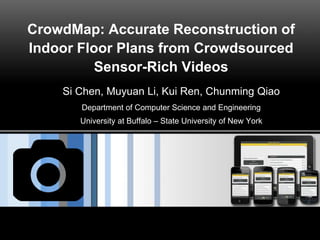
  • 1. CrowdMap: Accurate Reconstruction of Indoor Floor Plans from Crowdsourced Sensor-Rich Videos Si Chen, Muyuan Li, Kui Ren, Chunming Qiao Department of Computer Science and Engineering University at Buffalo – State University of New York
  • 2. Page  2 Outline  1. Introduction  2. System Architecture and Design Details  3. Implementation and Evaluation  4. Future Work
  • 3. Page  3 Outdoor Maps Google Map OpenStreetMap
  • 4. Page  4 Indoor Maps (Floor Plans)  Unlike outdoor environment, acquiring digital indoor floor plan information is very challenging.  The state-of-the-art Google Indoor Maps only have 10,000 locations available worldwide, which is not in a position to compete with the total number of indoor environments around the world.
  • 5. Page  5 Indoor Maps  The complexity of the indoor environment is the major obstacle to achieve ubiquitous coverage.  Existing centralized collection and on-site calibration techniques demand professional devices and multi-party coordination, which are time consuming, inconvenient and costly. Google Trekker http://www.navvis.lmt.ei.tum.de/about/
  • 6. Page  6 Crowdsourcing http://cdn.thephonebulletin.com/wp-content/uploads/2013/01/smartphone-sensors.jpg Recently, the wide availability of smartphones and wearable devices (e.g. google glasses) equipped with built-in visual, acoustic and inertial sensors makes the mobile user easier than ever to devote themselves to contribute mobile data.
  • 8. Page  8 Indoor Floor Plan Reconstruction by Crowdsourcing There have been several studies trying to explore the possibility of using crowdsourced inertial sensory data to generate an indoor floor plan automatically. Alzantot, Moustafa, and Moustafa Youssef. "Crowdinside: automatic construction of indoor floorplans." Proceedings of the 20th International Conference on Advances in Geographic Information Systems. ACM, 2012.
  • 9. Page  9 Drawback of Inertial Sensor Only Methods  However, current crowdsourcing floor plan reconstruction systems are not able to produce accurate enough results. – Most of existing indoor floor plan reconstruction systems heavily rely on inertial data. The premise of their work is that users would be able to move across all edges and corners in an indoor environment. • the edge of an indoor scene is usually blocked by furniture or other objects, • some restricted areas in an indoor environment are also inaccessible for most of the users Visual information preserve more context information for an unknown indoor environment, such as the geometric information, color information, lighting conditions and text information. [1].http://www.sigmobile.org/mobicom/2014/talks/slides_6_3.pdf [1]
  • 10. Page  10 CrowdMap: Key Idea  CrowdMap: An accurate indoor floor plan reconstruction system based on sensor-rich videos.  Key idea: leverage the spatio-temporal relationship between each consecutive frame of the crowdsourced video.
  • 11. Page  11 CrowdMap: Floor Plan Basic elements of building floor plan
  • 12. Page  12 Outline  1. Introduction  2. System Architecture and Design Details  3. Implementation and Evaluation  4. Future Work
  • 13. Page  13 CrowdMap: System Architecture mobile front-end cloud back-end i) crowdsourced data collection module ii) indoor path modeling module iii) room layout modeling module iv) floor plan modeling module
  • 14. Page  14 CrowdMap: Crowdsourced Data Collection Module We assume that users actively get involved in the data collecting tasks. Example: a user opens our mobile application and inputs the floor number, starts capturing the room environment by spinning his/her body (SRS task); then, walks towards the hallway (SWS task). The walking distance |AB| is calculated by the step counting method. In addition, the direction change of each step ∆𝜔 is calculated by jointly using compass, gyroscope and accelerometer.
  • 15. Page  15 CrowdMap: Crowdsourced Data Collection Module By using the inertial sensor data, we are able to reconstruct the trajectory of the user when they perform the SWS task.
  • 16. Page  16 CrowdMap: Indoor Path Modeling Module How to aggregate multiple user trajectories and reconstruct the path of the floor?
  • 17. Page  17 CrowdMap: Indoor Path Modeling Module [1].Bay, Herbert, Tinne Tuytelaars, and Luc Van Gool. "Surf: Speeded up robust features." Computer vision–ECCV 2006. Springer Berlin Heidelberg, 2006. 404-417. We select the state-of-the-art SURF [1] algorithm to precisely match two candidate key-frames
  • 18. Page  18 CrowdMap: Indoor Path Modeling Module Correct Matching
  • 19. Page  19 CrowdMap: Indoor Path Modeling Module Incorrect Matching
  • 20. Page  20 CrowdMap: Indoor Path Modeling Module  We use multiple key-frames to determine whether the two user trajectories can be merged.  If there is a match between the two trajectories generated in the same floor, there should be a common path between them in a high probability. Hence, we use the longest common subsequence to capture this notion. Where Ta and Tb are the two user trajectories with length of i and j, respectively. Parameter 𝛿 represents the maximum length difference between two user trajectories and 𝜀 is the distance threshold.
  • 21. Page  21 CrowdMap: Indoor Path Modeling Module
  • 22. Page  22 CrowdMap: Room Layout Modeling Module We utilize crowdsourced images to create the panorama for each place, and then use computer vision techniques to process the panorama, and thereby, generate the room layout.
  • 23. Page  23 CrowdMap: Room Layout Modeling Module
  • 24. Page  24 CrowdMap: Room Layout Modeling Module
  • 25. Page  25 CrowdMap: Floor Plan Modeling Module
  • 26. Page  26 CrowdMap: Floor Plan Modeling Module
  • 27. Page  27 CrowdMap: Floor Plan Modeling Module
  • 28. Page  28 Outline  1. Introduction  2. System Architecture and Design Details  3. Implementation and Evaluation  4. Future Work
  • 29. Page  29 CrowdMap: Implementation
  • 30. Page  30 CrowdMap: Implementation Screenshot for CrowdMap Mobile Frontend
  • 31. Page  31 Microsoft Azure Platform
  • 32. Page  32 CrowdMap: Evaluation
  • 33. Page  33 CrowdMap: Evaluation
  • 34. Page  34 Compare with Structure from Motion (SfM)
  • 35. Page  35 Outline  1. Introduction  2. System Architecture and Design Details  3. Implementation and Evaluation  4. Future Work
  • 36. Page  36 CrowdMap: Future Work We will focus on further processing of the room panorama to extract more context information of the room: • object detection • object recognition. We also plan to further study several issues: • user incentive mechanism • privacy preservation mechanism.