Download as PDF, PPTX

![A New Dimension
J10199
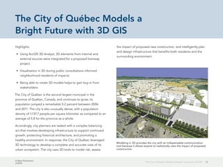
17Balancing Past and Future
Balancing Past and Future
Using 3D GIS analysis to route light rail through historic Mesa
By Cory Whittaker, City of Mesa, Arizona
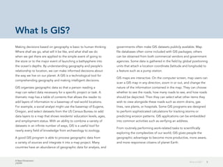
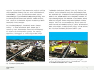
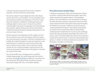
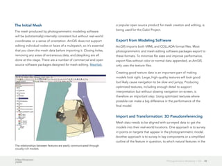
In December 2008, the Valley Metro Light Rail system debuted
in the Phoenix Metro area. [Valley Metro Rail Inc., a nonprofit
public corporation, operates a high-capacity transit system in this
region.] In the months that followed, the City of Mesa's single
station had more passengers than any other stop on the system.
When this trend continued, Valley Metro decided to expand the
light rail system through downtown Mesa. This announcement
was seen as a victory for revitalization efforts in the city.
Neighboring cities have seen that light rail is a catalyst for transit-
oriented development of nearby properties.
The proposed route takes the light rail line through the heart of
downtown Mesa to cultural venues such as the Mesa Arts Center
and the Arizona Museum of Natural History. The route also
passes through the historical center of the city of Mesa, where
buildings and places of historic significance—some listed on the
National Register of Historic Places—are located.
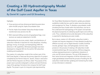
To better understand how this project would interact with the
nearby historic buildings, 3D GIS visualization tools were used.
These tools gave decision makers and the public a virtual view of
what downtown Mesa might look like after the light rail system
was completed.
Modeling Downtown Mesa
Before the light rail expansion was proposed, the City of Mesa
GIS staff conducted a pilot project to assess the feasibility of
modeling downtown Mesa in 3D given existing departmental
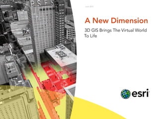
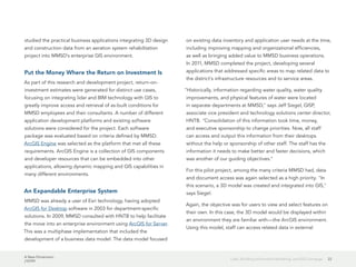
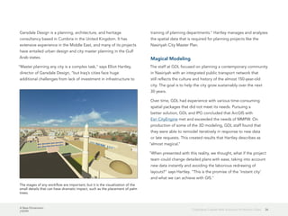
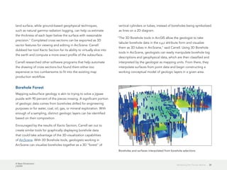
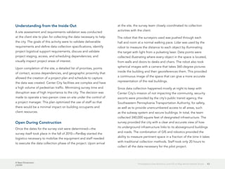
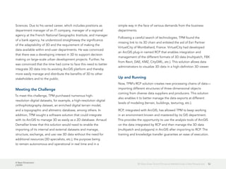
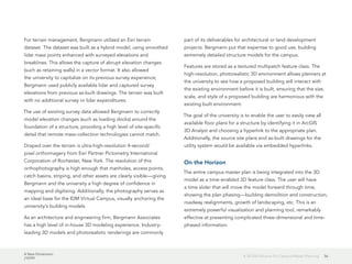
The Valley Metro Light Rail's Sycamore Station in Mesa has had the highest
ridership of any station in the light rail system.](https://image.slidesharecdn.com/a-new-dimension-130905130649-/85/A-New-Dimension-17-320.jpg)

![A New Dimension
J10199
46Photogrammetric Modeling + GIS
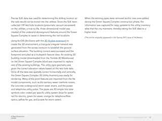
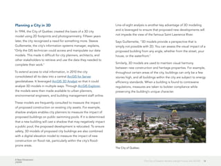
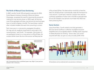
Photogrammetric models are typically assembled and processed
in specialized software including PhotoModeler Scanner,
Autodesk's 123D Catch, and Agisoft's PhotoScan. Information on
photogrammetric modeling is available from these companies.
A typical final product from a photogrammetry project is a
textured polygonal mesh combining color and geometry data.
In archaeology, the geometry of the features recorded is often
complex, and both the position and shape of these features are
important, so keeping the data in a mesh format—designed to
handle complex geometries—is desirable rather than converting
to a simpler geometry type or a voxel model. [Voxel models
use elements that represent a value on a regular grid in three-
dimensional space.]
Looking at these models on their own can be useful, but to really
exploit their potential, they should be viewed in context along
with other data, such as survey data, photos, descriptions, and
models of adjacent features that are collected in the course of a
project.
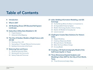
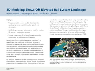
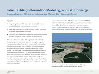
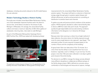
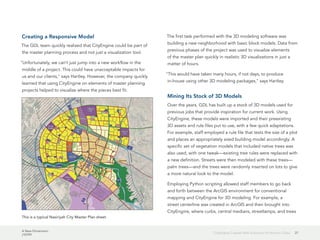
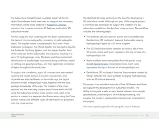
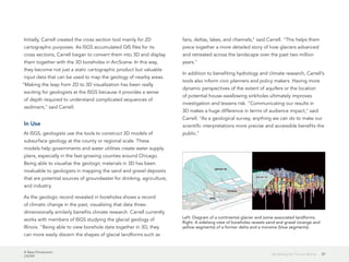
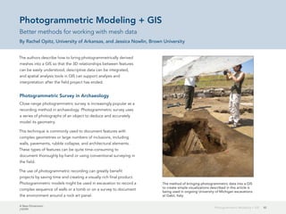
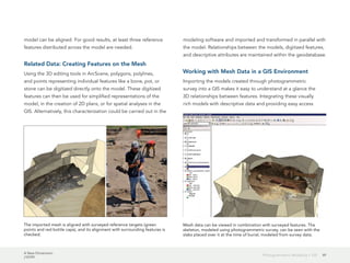
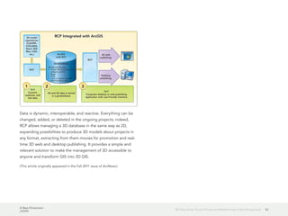
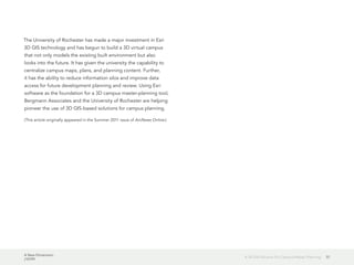
A textured mesh of a typical archaeological feature, a pile of rubble,
viewed in Meshlab Working in Meshlab, unwanted polygon faces are selected and deleted.](https://image.slidesharecdn.com/a-new-dimension-130905130649-/85/A-New-Dimension-46-320.jpg)


The document discusses how Honolulu, Hawaii is using 3D modeling and GIS to plan for an elevated rail system and transit-oriented development (TOD). Three core models were created - walkability, urban growth, and densification. Esri CityEngine was used to develop 3D geometry and textures of the proposed rail corridor and TOD. Holograms were also created from the 3D models to provide unique views for stakeholders and the public to communicate how the changes could positively impact the community by controlling urban sprawl and reducing traffic. The goal was to build support for the rail project and TOD approach through collaborative planning and visualization tools.


