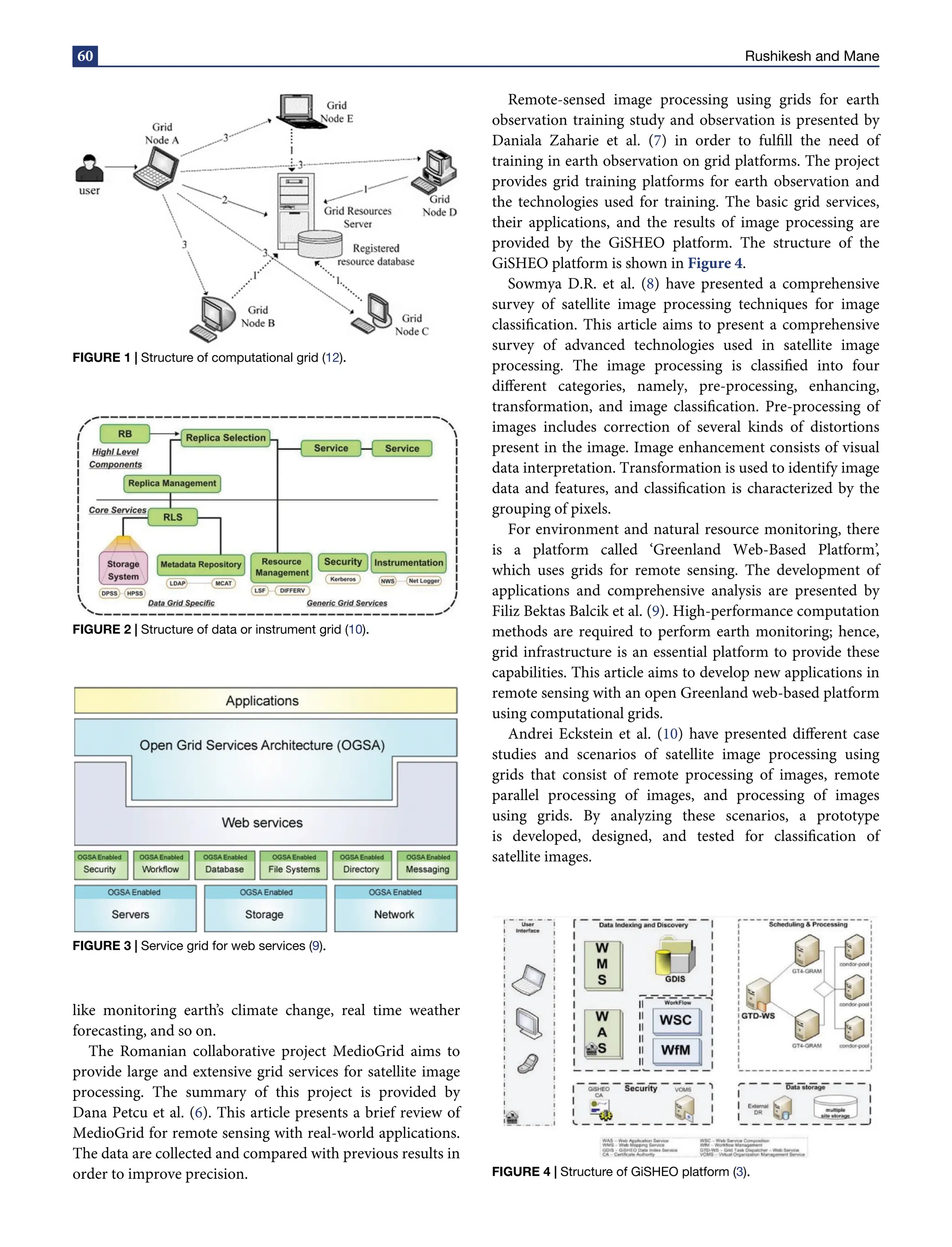
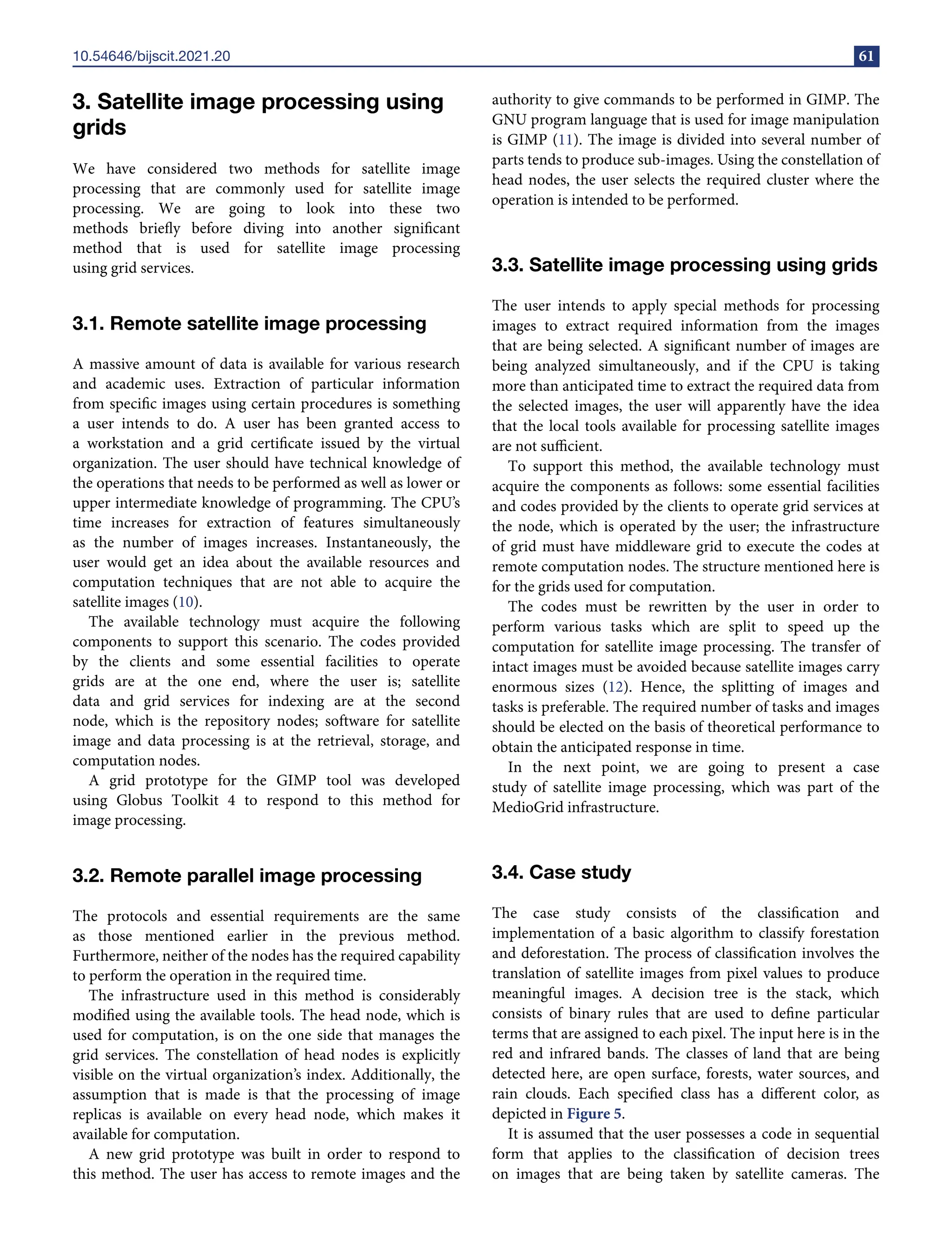
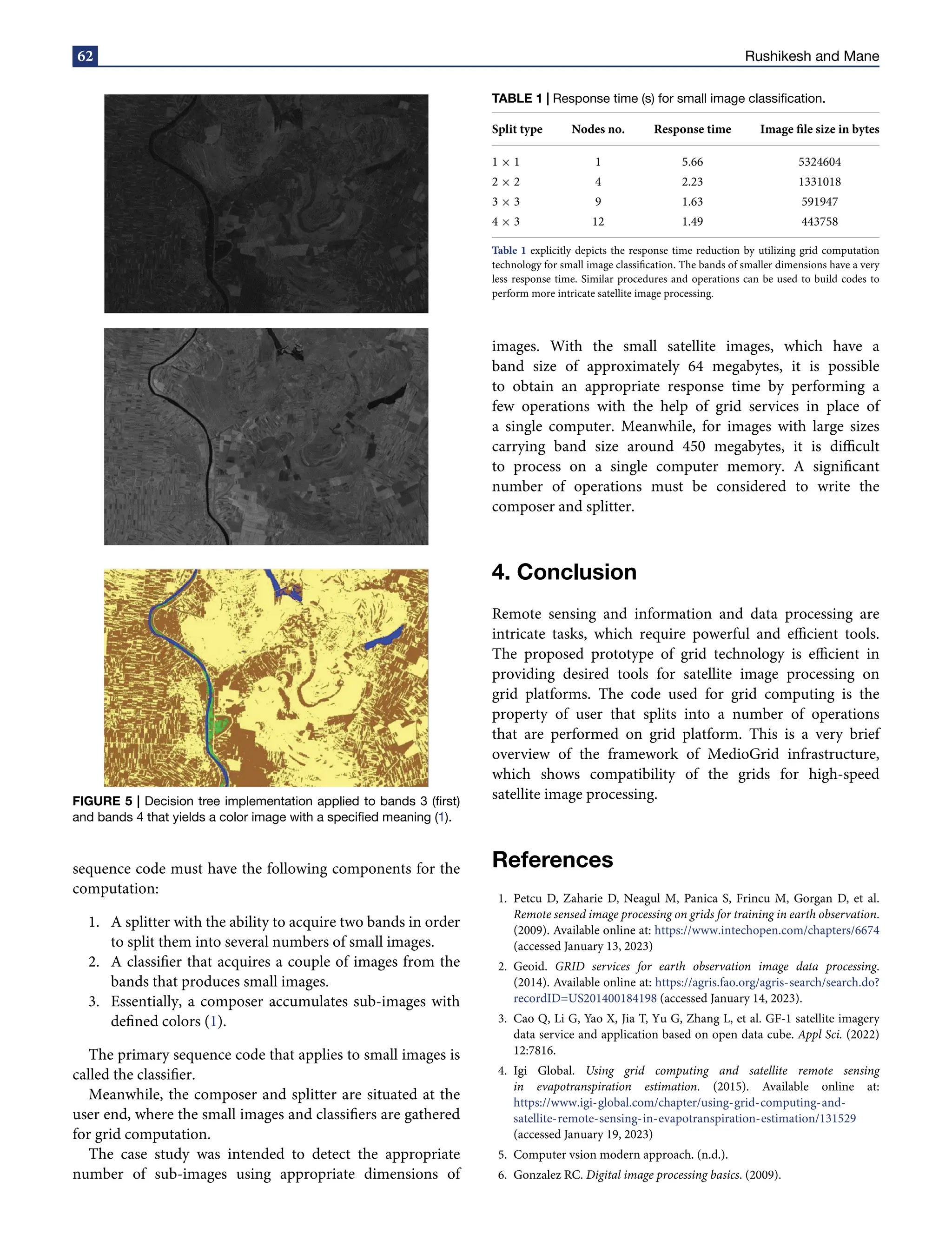
This article reviews the use of grid computing for satellite image processing, highlighting its necessity due to the vast data and computation needs that cannot be handled by a single computer. It discusses various types of grid services, such as computational and data grids, and methodologies for efficient image processing, including remote and parallel processing. The research illustrates the advantages of grid infrastructure through case studies, demonstrating improved performance in processing satellite images for applications like monitoring climate change.


![Apporach to lung biopsy [Auto-saved].pptx latest](https://cdn.slidesharecdn.com/ss_thumbnails/apporachtolungbiopsyauto-saved-251211225655-93258539-thumbnail.jpg?width=640&height=640&fit=bounds)

