Application of GIS in Flood Hazard Mapping - GIS I Fundamentals - CEI40 - AGA
High_resolution_GEC
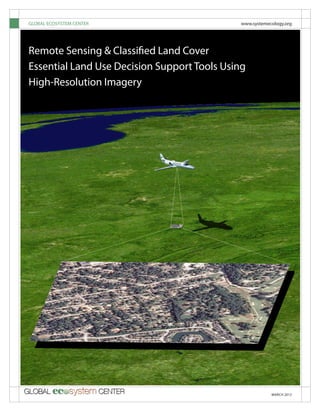
1. MARCH 2012
GLOBAL ECOSYSTEM CENTER www.systemecology.org
Remote Sensing & Classified Land Cover
Essential Land Use Decision Support Tools Using
High-Resolution Imagery
2. Remote Sensing & Classified Land Cover: Essential Land Use Decision Support Tools
2 GLOBAL ECOSYSTEM CENTER
High-resolution imagery is collected by a“camera-like”device called a data collector. The
data collector is a sophisticated technical instrument which captures four or more spectral
bands of data for analysis by sensing the electromagnetic waves emitted by the landscape.
The data collector can be carried on an aerial or satellite platform. Once the imagery has been
collected, it is transferred to a ground station. Once on the ground and ready for distribution,
the data can be downloaded over the internet by an image analyst for use. The data contained
in the files can be extracted with scientific precision and classified into distinctive land cover
categories.
High-resolution imagery provides detailed information regarding a landscape including
the size and location of objects as large as roads, houses and trees, or as small as cars and back-
yard sheds. Once high-resolution imagery has been classified into land cover categories and
incorporated into a Geographic Information System, it provides municipal managers and plan-
ners the resources to immediately gather and analyze data. This process includes investigating
complex growth and development scenarios that require ancillary data such as demographics,
transportation, precipitation and soils.
The collection of high-resolution imagery can be placed in two categories:
• Leaf-on imagery for analyzing green infrastructure
• Leaf-off imagery for analyzing gray infrastructure
H
igh-resolution imagery collected through remote sensing may visually resem-
ble a photograph, but it is not. The remotely sensed image is a robust data file,
not just a picture pleasing to our eyes. The image reveals intricate detail, often
invisible to the human eye, about the objects in the landscape. Technically, a high-reso-
lution, remotely sensed (RS) image is a digital, multispectral, geo-referenced file with a
pixel size of less than four meters. The image also provides detailed data that documents
the landscape and can be used to produce accurate decision-making models.
“There is nothing insignificant in the world. It all depends on the point of view.”
—Johann Wolfgang Von Goethe
3. 3MARCH 2012
Green Infrastructure from High-Resolution Imagery
Green infrastructure data is produced by conducting a
land cover classification of leaf-on high-resolution imagery.
While this process has always been an accurate technique
for mapping urban ecosystems, it has also been expensive.
Developing green infrastructure data has recently become
very affordable for two reasons, the imagery necessary for
the analysis can now be obtained at no cost from the Na-
tional Agriculture Inventory Program (NAIP), and the Global
Ecosystem Center (GEC) has developed a methodology to
produce accurate land cover classifications for five to six
hundred dollars per square mile.
The information derived from a green infrastructure
analysis allows communities to dramatically reduce spend-
ing on unnecessary maintenance and construction by
utilizing the natural benefits provided by vegetation and
soils. With the high-resolution land cover product, scenario
modeling techniques can be conducted before decisions
are made. The scenario models allow planners, managers
and community leaders options to evaluate and maximize
their resources. Technical reports demonstrating the value
of green infrastructure analysis and scenario modeling can
be reviewed at www.systemecology.org/pastprojects.html
Figure 1 – An example of high-resolution sprectral imagery (left) and the image classified into land cover categories (right).
High-Resolution Imagery Classified Land Cover - Green Infrastructure
High-Resolution Imagery & Urban Infrastructure
High-resolution imagery has been used for the man-
agement of city infrastructures for over two decades.
This imagery is used to map, analyze and manage urban
infrastructure. City management has been revolutionized
by Geographic Information Systems (GIS) and the robust
data gathering technology emanating from the analysis of
high-resolution imagery. Imagery used for measuring gray
infrastructure (the things we build) is often less than one
meter resolution and the imagery used for green infra-
structure is between one and three meters resolution.
Management of gray infrastructure is the dominate
use for high-resolution imagery in urban areas. Almost
all urban areas with full time staff utilize high-resolution
imagery and GIS technology to plan for growth and
development and to manage the built infrastructure, while
few use it to manage its green counterpart. Both green
and gray data are needed for decision support and the
costs of creating the gray data layer is huge when com-
pared to the green.
The imagery needed for managing green infrastruc-
ture can be obtained at no cost to the community,
is only needed on a three year schedule, and a new
methodology developed by the Global Ecosystem Center
reduces the processing of the data to about $550 per
square mile. For details on developing a low cost green
infrastructure assessment go to www.systemecology.org/
greeninfrastructure.
4. Remote Sensing & Classified Land Cover: Essential Land Use Decision Support Tools
4 GLOBAL ECOSYSTEM CENTER
Image Scale, Applications and Interaction
There are three general scales of imagery used
for remote sensing: high, moderate and low-res-
olution. Each resolution is designed for a specific
purpose; for example, low-resolution satellite data
is appropriate for global or continental-scale issues
such as global climate measurements or weather
forecasts. Moderate-resolution imagery provides
regional land cover data for planning, and high-
resolution imagery supplies data required for urban
infrastructure mapping and analysis.
Generally speaking, high-resolution imagery pro-
vides detail while moderate resolution imagery pro-
vides perspective. The differences are obvious when
you examine the pixel size of each type of imagery.
There are 900 one-meter high-resolution pixels in a
single 30 meter Landsat pixel. A single landsat pixel
is slightly larger than two tennis courts, while a high-res-
olution pixel is approximately the size of an office desk.
The initial step in selecting imagery for analysis is
determining the reasons for the analysis. When the pur-
pose is to identify major land cover features (forest scale
versus individual tree data), a Landsat analysis is logical.
While both Landsat and high-resolution imagery can be
used to identify landscape changes, Landsat provides a
historic record extending several decades while the high-
resolution comparisons are often limited to less than a
decade.
Figure 2 is an example of two map scales. Moder-
ate-resolution Landsat imagery (left) provides a broad
perspective (see publication listed on the back page
for more explanation) but does not have the resolution
needed to provide accurate descriptions of individual
objects compared to high-resolution imagery.
Figure 2 – A comparison of image resolution. 30-meter Landsat imagery (left) contrasted to 1-meter high-resolution imagery (right).
5. 5MARCH 2012
Ecosystem Services from Green Infrastructure
In 1992, the staff at the Center developed the first meth-
odology for mapping green infrastructure and calculating
ecosystem services using remote sensing and GIS technol-
ogy. The value of green infrastructure to a municipality
for producing basic services, like managing stormwater
or improving air and water quality, has been documented
by hundreds of green infrastructure analysis since the mid
90s. Even though these analysis document huge financial
benefits of green infrastructure to a city, it is rare to find a
city seriously investigating the options to balance green
and gray infrastructure.
The Global Ecosystem Center (GEC) developed a low
cost Urban Tree Canopy (UTC) assessment product that
utilizes free imagery from the National Agricultural Im-
agery Program (NAIP) in tandem with an efficient feature
extraction method. This allows the production of a report,
and development of GIS technical data, and presentation
material for use by local experts.
The cost for obtaining green infrastructure analyses is
so inexpensive that discretionary spending limits within
departments is often adequate to pay for the analysis. In
addition, further cost saving can be obtained when local
landscape ecologists or urban foresters work directly with
the municipal officials to interpret the findings.
Figure 3 -“Leaf-off”imagery is used to create greay infrastructure (left). ”Leaf-
on”imagery is utilized for green infrastructure (right).
Ecosystem Services
People benefit from a multitude of resources and pro-
cesses that are supplied by natural systems. Collectively, these
benefits are known as ecosystem services and include things
like air and water quality. The task of identifying an extensive list
of ecosystem services is a scientific endeavor well beyond the
scope of this publication. However, urban decision makers will
likely make very different decisions about the management of
green infrastructure if they calculate the value of just three eco-
system services; stormwater management, water quality and air
quality.
Here is a short description of the technical models used by
the GEC to calculate these ecosystem services:
The stormwater analysis estimates the amount of stormwa-
ter that runs off a land area during a 2 yr. 24 hour storm event.
It calculates the volume of runoff using the TR-55 hydraulic
engineering formula developed for small urban watersheds by
the U.S. Natural Resource Conservation Service.
The water quality assessment is based on the Long-Term
Hydrological Impact Assessment (L-THIA) used by the EPA. This
model calculates the change in the pollutant concentrations
resulting from the change in land cover during a typical storm
event (2 year/24 hour).
Air quality is determined using the UFORE Model for air
pollution developed by the USDA Forest Service. The urban for-
est effects (UFORE) model is based on data collected in 55 cities.
6. Remote Sensing & Classified Land Cover: Essential Land Use Decision Support Tools
6 GLOBAL ECOSYSTEM CENTER
Figure 4 – An overview of an Urban Tree Cover Analysis
Steps in Green Infrastructure Development
1. High-resolution imagery is collected
2. The imagery is processed into land cover classes by an image analyst
3. Existing natural resource data is added (rainfall, soils, etc.)
4. Additional ancillary data is identified from city management files
5. Data is combined in a Geographic Information System
6. Ecosystem services calculations are processed and the following data produced:
• Green infrastructure statistics
• Storm water calculation
• Carbon storage and sequestration
• Air and water quality
• Scenario modeling
7. 7MARCH 2012
Land Cover
Land cover metrics are measurements of Earth’s land
surface, including vegetation, geology, hydrology, or anthro-
pogenic features. Land cover directly impacts biological diver-
sity while contributing to local, regional, and global change.
Classifying high-resolution imagery into discrete land cover
classes gives managers the data needed to model development
scenarios and test management strategies.
Remotely sensed imagery is an accurate, effective and least
costly means of obtaining data describing the landscape. High-
resolution imagery is used to develop data for managing urban
landscapes. The imagery becomes a powerful data source for
decision-making when it is classified into discrete land cover
types. Once the land cover data is in a digital form, it can be
used by the community’s GIS. The GIS allows the image data to
interact with other ancillary data to produce critical decision-
making information.
This imagery provides snapshots of land cover. The data is
collected as a spectral image and is translated into discrete land
cover categories by image analysts. The land cover classifica-
tions derived from high-resolution imagery provide accurate
assessments of both green and gray infrastructure.
Converting the high-resolution image from its original
spectral form to a digital file requires the skills of an image
analyst who is trained in the classification of remote sensed
imagery. The technical field of study is called digital image
analysis. Highly accurate descriptions of the land can be devel-
oped using this approach. Different land covers like trees, water
and roads reflect light in different wavelengths or bands. Our
eyes can see the visible bands while a digital image can record
beyond the visible spectrum to the infrared and other bands.
For example: Trees look green to our eyes because they
reflect green light that our eyes see. They also reflect infrared
light that our eyes cannot see. The more wave lengths that an
image can sense, the easier it is to separate the different land
cover types. In the case above, the infrared portion of the spec-
trum increases our ability to tell trees and crops apart.
Common land cover classes for high-resolution green infra-
structure are:
Trees
Grass
Impervious surfaces
Bare soil
Water
NAIP Imagery
The National Agricultural Image Program
(NAIP) was established in 2003 to provide high-
resolution land cover imagery needed to support
agricultural programs at the federal, state and local
level. This program has been extremely effective
and evolved into the largest single civilian mapping
program in US history. Imagery has been collected
over every state many times since 2003 and in most
states, imagery is available for five different years.
All the imagery collected is in the public domain.
Although the original purpose of the program
was to serve the agricultural community in rural
areas, it has proven to be an ideal source of data for
urban areas. NAIP imagery is obtained at the height
of the growing season and therefore documents
green infrastructure in urban areas as well as crop
and pasture land in rural areas. Urban areas have a
great need for green infrastructure data, but have
been slow to develop green data layers in their
Geographic Information System because of the
perceived cost. With the availability of this data at
no cost, this is no longer a concern.
The quality of the NAIP imagery has kept pace
with the rapidly evolving technology of Remote
Sensing (RS) imagery collection. In recent years,
almost all the data has been collected with digital
RS gear that produces four digital bands of spectral
data (Red, Green, Blue, and Near Infrared). Since
2009, all the data has been collected at one meter
resolution or better and the collection interval is
generally three years. This four-band multi-spectral
data provides image analysts with robust data for
analysis.
For more information about NAIP imagery go
to http://gis.apfo.usda.gov/gisviewer/
8. Remote Sensing & Classified Land Cover: Essential Land Use Decision Support Tools
8 GLOBAL ECOSYSTEM CENTER
Figure 5 – High-resolution land cover classifications are able to
be temporally updated through re-classifying only areas that
have changed. The 2005 classification is the“base”(below-left)
and only the areas that have changed are re-classified, creating a
updated land cover classification (below-right).
Case Study: Decatur, Georgia - Low-Cost Urban
Tree Canopy Assessment
o Low cost analysis
o Ideal for small towns and cities
o Uses NAIP imagery (no cost)
o High-resolution change analysis
o Urban Tree Canopy assessment
o Ecosystem services
Decatur, Georgia
2005 2010
45%
27%
28%
Landcover Categories
9. 9MARCH 2012
Case Study: Berkeley Heights, New Jersey - Mid Level Analysis
Percent land cover:
o Tree canopy 51%
Impervious understory 6%
Impervious 21%
Open Space 22%
Bare .4%
Water .3%
o Highest tree cover in county parks
o Scenario modelling +1% impervious change =
$23.8 million stormwater runoff values
Landcover Categories
51%
21% 22%
6%
10. Remote Sensing & Classified Land Cover: Essential Land Use Decision Support Tools
10 GLOBAL ECOSYSTEM CENTER MARCH 2012
Case Study: Bellevue, Washington - High-End Analysis
o Detailed analysis designed to address
specific management needs of the community
o Requires detailed interaction with managers and
GIS department
Figure 6 – Bellevue Washington - When the land
cover results are analyzed through zoning pat-
terns, different perspectives emerge (need more
work here).
Bellevue, Washington
Central Business District Zoning Suburban Residential Zoning
Tree Canopy by City Zoning:
Citywide 36% Commercial 21%
Urban Residential 30% Industrial 19%
Suburban Residential 35% Parks 67%
Central Business District 7% Right 0f-Way 20%
Landcover Categories
21%
16%
20%
15%10%
14%
51%
8%
32%
27%
17%
15%
16%
9%
14%
11. MARCH 2012 11
Conclusion
Every municipality in the United States should have
a green data layer in their Geographic Information Sys-
tem (GIS) so they can manage their green infrastructure.
Studies of the land cover in hundreds of municipalities
show that maintaining a robust green infrastructure is an
extremely good financial investment. The value of invest-
ing in green infrastructure becomes obvious to decision-
makers as soon as they have the opportunity to evaluate
growth, development and management options with
both gray and green infrastructure data on-the-table.
The most fundamental piece of data needed is a
digital map of the community’s foundation i.e. infrastruc-
ture. This map is processed from high-resolution imagery.
The imagery must be collected at two different times of
the year, once when the leaves are off the trees and once
when they are on. Finally, both imagery-derived data sets
are merged using GIS software and analyzed.
Unfortunately almost all municipal management
decisions being made today are based on gray infrastruc-
ture data alone. It is rare for a municipality to have data
on its green infrastructure and this condition is clearly
a mistake. A healthy green infrastructure is more than a
nicety. While aesthetic benefits of greening a community
are well known, the financial value of this green system
is not. The work performed by the green infrastructure or
natural system can be calculated and used in the decision-
making process. The value of the work performed can be
calculated by measuring the structure of the landscape
using high-resolution imagery in a Geographic Informa-
tion System, calculating the function of the landscape by
programming mathematical algorithms into the computer
software, and finally converting the functional metrics to
financial currency.
Developing a green infrastructure for use in a com-
munity’s GIS has never been easier or less expensive. There
are several reasons for this, the first is that the imagery
is now available at no cost from the National Agriculture
Imagery Program (NAIP), and second, because the Global
Ecosystem Center has develop a low-cost classification
technique that use high-resolution imagery, a unique
analysis technique, and third, the expertise of local urban
foresters and landscape ecologists to help communities
interpret the data.
SS
Calculating Stormwater Value
1. Data from the gray and green infrastructure maps are
combined in a GIS project to determine the structure of
the landscape.
2. Ancillary data documenting rainfall and soil condi-
tions are added to the project.
3. The findings from 1&2 above are imported into a
hydraulic engineering model developed by the Natural
Resource Conservation Service and the stormwater run-off
volume is determined.
4. A scenario model is developed to test a proposed
change in the community infrastructure.
5. The difference between the existing landscape and
the future scenario is determined. The difference in the
stormwater volume is the gain or loss in ecosystem service.
6. Once the volume is known, a dollar value can be
placed on that volume commensurate with the incremen-
tal cost of increasing or reducing the size of a stormwater
facility.
12. Remote Sensing & Classified Land Cover: Essential Land Use Decision Support Tools
GLOBAL ECOSYSTEM CENTER
1607 22nd St. NW, Washington, DC 20008
Phone: 202.290.3530
Fax: 202.683.6729
http://www.systemecology.org
Gary Moll, President
Kenneth Kay, Geospatial Specialist
Binesh Maharjan, Geospatial Specialist
FEBRUARY 2012
Remote Sensing & Classified Land Cover
Essential Land Use Decision Support Tools Using
Moderate-Resolution Imagery
GLOBAL ECOSYSTEM CENTER www.systemecology.org
Also available:
Essential Land Use Decision
Support Tools Using
Moderate-Resolution Imagery
12