
Download as PDF, PPTX
![“The
“Th researchers … h
h have already th
l d thrown
much darkness on this subject, and it is
probable that if they continue [their
investigations] we shall soon know nothing
at all about it. “ (Mark Twain)](https://image.slidesharecdn.com/bfp1-2bfp-andes-090618093344-phpapp01/85/BFP-Andes-Project-Plans-10-320.jpg)
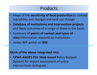
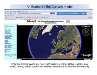
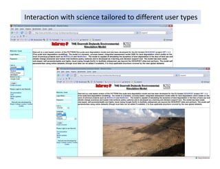
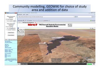
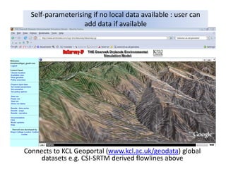
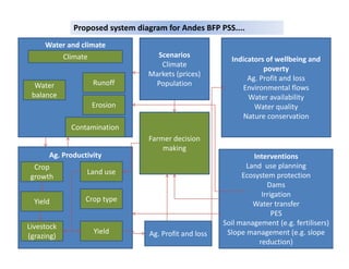

This document summarizes the BFP-ANDES project. It is led by Mark Mulligan of KCL and coordinated by Jorge Rubiano of UNAL. The project aims to use the best available science to inform land and water policy formulation and testing in the Andes to improve livelihoods. It has 6 work packages focused on poverty, water availability, production, institutions, interventions, and knowledge. The project will produce maps, databases, summaries and a policy support system to help stakeholders assess impacts of policy interventions on poverty, food production, and the environment.


