This baseline study summarizes the physical, biological, and socio-economic conditions of the area surrounding a proposed road upgrading project from Chakdara to Madyan in Swat, Pakistan. Key findings include:
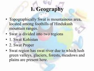
1) The project area has a mountainous terrain located along the Swat River valley with forests, meadows, and agricultural lands. Surface water sources include the Swat River and tributaries.
2) Socio-economically, the population relies on agriculture as the primary occupation and land use.
3) Environmentally, the area has good quality groundwater resources but is at risk for flooding based on a devastating flood in 2010. No endangered species or protected areas were identified in the
Baseline data is a significant part of EIA. As the proverb says "Look before you leap". Every environmental aspect should be considered before initiating each and everything. The baseline should be well-known about an environment.
Detailed description of Environmental Impact Assessment - Historical Background - Objectives - Assessment procedure - Necessity in Water resources projects - Environmental discourse on DAM construction - Case study
The Gaussian plume model is the most common air pollution model. It is based on a simple formula that describes the three-dimensional concentration field generated by a point source under stationary meteorological and emission conditions.
EIAM unit 5(Assessment of Impact of development Activities on Vegetation an...GantaKalyan1
Assessment of Impact of development Activities on Vegetation and wildlife- Environmental Impact
of Deforestation. Environmental Risk Assessment and Risk management in EIA: Risk assessment and
treatment of uncertainty-key stages in performing an Environmental Risk Assessment-advantages of
Environmental Risk Assessment.
Environmental impact assessment methodology by Dr. I.M. Mishra Professor, Dep...Arvind Kumar
Environmental impact assessment methodology by Dr. I.M. Mishra Professor, Dept. of Chemical Engineering Dean, Saharanpur Campus Indian Institute of Technology, Roorkee
Levels in planning, Functional requirements of water resources projects, steps in
water resources planning, Environmental aspects in water resources planning.
EIA is a process of evaluating the likely environmental impacts of a proposed project or development, taking into account inter-related socio-economic, cultural and human-health impacts, both beneficial and adverse.
EIA 1994 and the further amendments are explained i.e. 2006 and 2020.
These slides could be helpful to those who want to know about the screening process in EIA. Also, these slides give brief information about the initial environmental examination(IEE).
EIA for Major development projects - Mining projectsJenson Samraj
EIA is a decision making tool for developmental projects (Mining, construction of dams).
It will have environmental implication in changing the variables such as quality of air, ground water, soil in that area.
The purpose of assessment is to ensure that decision makers consider the environmental impacts to implement the project
EIA helps us to measure or predict the impact of any developmental projects on the environment. Mining refers to Extraction of valuable minerals or other geological materials from the Earth, usually from an ore body, lode, vein, seam, reef, or placer deposit.
Metals, coal, oil shale, gemstones, limestone, chalk, dimension stone, rock salt, potash, gravel, and clay. Large scale mining pollution contaminates all living organisms within the body of water
Affects environment adversely
Results in deforestation
Factor considered for Environment Impact assessment (EIA) in legal procedure ...Himanshu Goyal
This PPT is about the factor that one need to consider for getting an EIA in mining project.This report describe all of the above factor for vedanta mining project EIA report with through analysis given in notes section. It also describe the various laws that one need to compile with in Indian Scinerio.And finally analyse the shortcoming of the procedure and the flaws in it.
Public Participation in Environmental Decision-Making Ashwani Kumar
Public participation can be defined as a continuous, two way communication process which involves promoting full public understanding of the processes and mechanisms through which environmental problems and needs are investigated and solved by responsible agencies; keeping the public fully informed about the progress of studies or implications of the project
The presentation was from the Business as Mutual conference held at Anglia Ruskin University on 12th September 2012. To find out more visit www.businessasmutual.co.uk
This is the 8th lesson of the course 'Poverty and Environment ' taught at the Faculty of Social Sciences and Humanities, Rajarata University of Sri Lanka
This is the first lecture delivered at the Training Workshop on Participatory Land Use Planning through Participatory Rural Appraisal Tools – 6th – 7th December 2021 at SLFI, Colombo
The Tehri Dam is the highest dam in India and one of the highest in the world.
Location : On the Bhagirathi River. 200 miles north east of Delhi.
Height : 855 feet (261 m) 5th tallest dam in the world.
Capacity : power generation capacity of 2400 MW provision of irrigation to an area of 270,000 hectares.
The Tehri Dam withholds a reservoir for irrigation, municipal water supply and the generation of 1,000 megawatts of hydroelectricity.
Tehri Development Project approved in 1972
Construction started 1978
Cofferdam completed 1996
Closure of last two tunnels December 2002
Projected completion August 2003
Benefits to Nation / Region
2400MW of environment friendly Peaking power.
Irrigation of 2.7 lakh hactors Of new area.
162 million gallons per day of water supply to Delhi.
All round development of the region through better infrastructure and easy avalaibility of electricity.
Development of pisciculture.
This is the 9th lesson of the course - Foundation of Environmental Management taught at the Faculty of Social Sciences and Humanities, Rajarata University of Sri Lanka
An EIA carry out to identify the future possible environmental impacts of a proposed project. In this case show the how to do a rough baseline study for selected area.
Presentation includes all the steps involved in EIA and Project management
there is also an Interrelationship of EIA and project management in this presentation
Its for help
Brief Process of paper production covering all steps of paper production mechanism. presentation also contains video showing animated paper production process.
WRI’s brand new “Food Service Playbook for Promoting Sustainable Food Choices” gives food service operators the very latest strategies for creating dining environments that empower consumers to choose sustainable, plant-rich dishes. This research builds off our first guide for food service, now with industry experience and insights from nearly 350 academic trials.
Characterization and the Kinetics of drying at the drying oven and with micro...Open Access Research Paper
The objective of this work is to contribute to valorization de Nephelium lappaceum by the characterization of kinetics of drying of seeds of Nephelium lappaceum. The seeds were dehydrated until a constant mass respectively in a drying oven and a microwawe oven. The temperatures and the powers of drying are respectively: 50, 60 and 70°C and 140, 280 and 420 W. The results show that the curves of drying of seeds of Nephelium lappaceum do not present a phase of constant kinetics. The coefficients of diffusion vary between 2.09.10-8 to 2.98. 10-8m-2/s in the interval of 50°C at 70°C and between 4.83×10-07 at 9.04×10-07 m-8/s for the powers going of 140 W with 420 W the relation between Arrhenius and a value of energy of activation of 16.49 kJ. mol-1 expressed the effect of the temperature on effective diffusivity.
UNDERSTANDING WHAT GREEN WASHING IS!.pdfJulietMogola
Many companies today use green washing to lure the public into thinking they are conserving the environment but in real sense they are doing more harm. There have been such several cases from very big companies here in Kenya and also globally. This ranges from various sectors from manufacturing and goes to consumer products. Educating people on greenwashing will enable people to make better choices based on their analysis and not on what they see on marketing sites.
Willie Nelson Net Worth: A Journey Through Music, Movies, and Business Venturesgreendigital
Willie Nelson is a name that resonates within the world of music and entertainment. Known for his unique voice, and masterful guitar skills. and an extraordinary career spanning several decades. Nelson has become a legend in the country music scene. But, his influence extends far beyond the realm of music. with ventures in acting, writing, activism, and business. This comprehensive article delves into Willie Nelson net worth. exploring the various facets of his career that have contributed to his large fortune.
Follow us on: Pinterest
Introduction
Willie Nelson net worth is a testament to his enduring influence and success in many fields. Born on April 29, 1933, in Abbott, Texas. Nelson's journey from a humble beginning to becoming one of the most iconic figures in American music is nothing short of inspirational. His net worth, which estimated to be around $25 million as of 2024. reflects a career that is as diverse as it is prolific.
Early Life and Musical Beginnings
Humble Origins
Willie Hugh Nelson was born during the Great Depression. a time of significant economic hardship in the United States. Raised by his grandparents. Nelson found solace and inspiration in music from an early age. His grandmother taught him to play the guitar. setting the stage for what would become an illustrious career.
First Steps in Music
Nelson's initial foray into the music industry was fraught with challenges. He moved to Nashville, Tennessee, to pursue his dreams, but success did not come . Working as a songwriter, Nelson penned hits for other artists. which helped him gain a foothold in the competitive music scene. His songwriting skills contributed to his early earnings. laying the foundation for his net worth.
Rise to Stardom
Breakthrough Albums
The 1970s marked a turning point in Willie Nelson's career. His albums "Shotgun Willie" (1973), "Red Headed Stranger" (1975). and "Stardust" (1978) received critical acclaim and commercial success. These albums not only solidified his position in the country music genre. but also introduced his music to a broader audience. The success of these albums played a crucial role in boosting Willie Nelson net worth.
Iconic Songs
Willie Nelson net worth is also attributed to his extensive catalog of hit songs. Tracks like "Blue Eyes Crying in the Rain," "On the Road Again," and "Always on My Mind" have become timeless classics. These songs have not only earned Nelson large royalties but have also ensured his continued relevance in the music industry.
Acting and Film Career
Hollywood Ventures
In addition to his music career, Willie Nelson has also made a mark in Hollywood. His distinctive personality and on-screen presence have landed him roles in several films and television shows. Notable appearances include roles in "The Electric Horseman" (1979), "Honeysuckle Rose" (1980), and "Barbarosa" (1982). These acting gigs have added a significant amount to Willie Nelson net worth.
Television Appearances
Nelson's char
"Understanding the Carbon Cycle: Processes, Human Impacts, and Strategies for...MMariSelvam4
The carbon cycle is a critical component of Earth's environmental system, governing the movement and transformation of carbon through various reservoirs, including the atmosphere, oceans, soil, and living organisms. This complex cycle involves several key processes such as photosynthesis, respiration, decomposition, and carbon sequestration, each contributing to the regulation of carbon levels on the planet.
Human activities, particularly fossil fuel combustion and deforestation, have significantly altered the natural carbon cycle, leading to increased atmospheric carbon dioxide concentrations and driving climate change. Understanding the intricacies of the carbon cycle is essential for assessing the impacts of these changes and developing effective mitigation strategies.
By studying the carbon cycle, scientists can identify carbon sources and sinks, measure carbon fluxes, and predict future trends. This knowledge is crucial for crafting policies aimed at reducing carbon emissions, enhancing carbon storage, and promoting sustainable practices. The carbon cycle's interplay with climate systems, ecosystems, and human activities underscores its importance in maintaining a stable and healthy planet.
In-depth exploration of the carbon cycle reveals the delicate balance required to sustain life and the urgent need to address anthropogenic influences. Through research, education, and policy, we can work towards restoring equilibrium in the carbon cycle and ensuring a sustainable future for generations to come.
Artificial Reefs by Kuddle Life Foundation - May 2024punit537210
Situated in Pondicherry, India, Kuddle Life Foundation is a charitable, non-profit and non-governmental organization (NGO) dedicated to improving the living standards of coastal communities and simultaneously placing a strong emphasis on the protection of marine ecosystems.
One of the key areas we work in is Artificial Reefs. This presentation captures our journey so far and our learnings. We hope you get as excited about marine conservation and artificial reefs as we are.
Please visit our website: https://kuddlelife.org
Our Instagram channel:
@kuddlelifefoundation
Our Linkedin Page:
https://www.linkedin.com/company/kuddlelifefoundation/
and write to us if you have any questions:
info@kuddlelife.org
3. Baseline Study
• Work done to collect and interpret
information on the condition/trends of the
existing environment.
4. Area of Influence
• Immediate Area of influence
• It includes surroundings of road (500m width
on either side of road).
• Extended area of Influence
• It covers the entire area of district swat.
5. Types of Baseline Study
• Baseline study is of three types:
• Baseline study of physical environment
• Baseline study of biological environment
• Baseline study of socio-economic environment
6. Physical Environment
• Geography
• Geology
• Seismicity
• Land use
• Water Resources
• Climate
• Ambient Air Quality
• Noise Level
• Minerals
• Natural Event History
• Physical Cultural Heritage
8. Social Environment
• Population
• Community Structure
• Poverty Status
• Industries
• Political Parties
• Marriages
• Social Organization
• Religious Beliefs
• Role, Position and status of women
• Child Labor and Apprenticeship
• Services and Amenities Available in the Area(drinking water,
housing, telecommunication etc.)
• Tourism and Recreational Opportunities
10. 1. Geography
• Topographically Swat is mountainous area,
located among foothills of Hindukush
mountain ranges.
• Swat is divided into two regions
• 1. Swat Kohistan
• 2. Swat Proper
• Swat region has swat river due to which lush
green valleys, glaciers, forests, meadows and
plains are present here.
11. 2. Geology
• Project area is located at Peshawar Basin.
• Sediments of Peshawar are:
• Lacustrine Silt
• Fluvial Sand
• Clasts of Kohistan
12. Cont..
• Geology of project area is comprise of:
• Gneiss product of metamorphism.
• Schists composed of quartz.
• Alluvial deposits of weathered material with
clay, gravel and boulders.
13. 3. Seismicity
• Project area is located at Seismic zone A as
reported by Geological Survey of Pakistan
as it is located close fault line between
Indian and Eurasian plate.
15. 4. Land Use
• Total area of Swat is 5337 sq km.
• It is divided into two tehseels
• Matta ( 628 sq km )
• Kabal (4654 sq km )
16. Description Area ( in Acres) AREA (in Hectares)
Reported Area 1,251,653 506,528
Cultivated Area 242,296 98,054
Irrigated Area 227,336 92,000
Net Sown Area 232,046 93,906
Current Fallow Area 10,250 4,148
Total Cropped Area 467,153 189,051
Area Sown
Repeatedly
160,976 65,145
Un–cultivated 1,009,357 408,474
Cultivable Waste 208,862 84,524
Forest Area 337,804 136,705
Unavailable for
Cultivation
462,690 187,245
Source: Land Utilization Statistics, NWFP,
18. Cont..
Sources of Surface Water
• Swat river
• Other rivers ( Daral khwar, Harnoi khwar
etc)
• Nalas
19. Cont..
• Sources of Groundwater
• Recharge takes place during rains by
infiltration.
• Groundwater is present in the form of
springs also.
20. Groundwater Quality Parameters
SR. NO. Parameters Units Results WHO
MAXIMUM
ALLOWABLE
GUIDELINE
VALUE
1 Lead (Pb) mg/L N.D. -
2
Biochemical
Oxygen
Demand
(BOD5) at 20°C
°C 33.2 -
3 Total Coliform Number/100ml N.D. 0/100 ml
4 Fecal Coliform Number/100ml N.D. 0/100 ml
21. Cont..
• Quality of Water is good, potable and sweet as
reported by locals.
• Water quality in project area was tested by
taking water samples from various sites.
• Result: Water quality is good and in
permissible limit for human consumption.
22. 6. Climate
• Climate is usually cold and upper Swat
remains under snow in January and
February.
• Spring starts form middle of March.
• Summer starts from middle of May and
remains at the end of August. Monsoon
rains start in the month of July during
summer.
23. Cont..
• Rainfall
• Distribution of rainfall is unpredictable
throughout the year.
• No meteorological station is present in Swat.
28. 10. Natural Event History
• Flood of July 2010 devastated vast area of
Swat including destruction of houses,
bridges and erosion of vegetation.
• As flood causes damage to life, property etc.
So volume, velocity and timing of flash
floods should be incorporated in
hydrological design of project.
30. Fauna
• No endangered species are reported in the
selected reach of the section.
• No game reserves and wildlife sanctuaries exist in
the vicinity of Project Area.
• No wetland lies within close vicinity of the
Project corridor.
• There is very little significance of the Project
Area for migratory birds.
• Commercial and recreational fishing was
observed along the project corridor.
Editor's Notes
The main difference between geography and geology is that geography is mostly dealing with the physical overall shapes of the land. Geology is a science that is interested in how the land got into the shape it did.
Geology is mostly about what the ground is made up of from a natural perspective. What kind of rocks it contains and how those rocks or layers of rocks got there.
Geography is mostly dealing with mapping the extent of landforms, how far rivers are, how long mountain ranges are, how long the coast line is. This is often from the perspective of people or culture.
The Constitution of Pakistan 1973
Pakistan Penal Code (PPC)
The Drainage Act 1973 Local Government Ordinance 1979
The Forest Act 1927 The Antiquities Act 1976 Factories Act 1934 The Public Health (Emergency Provision Act 1954 read with West Pakistan Epidemic Control Act 1958) Act
Explosive Act 1884
Schist is a medium-grade metamorphic rock[1] with medium to large, flat, sheet-like grains in a preferred orientation
Alluvium (from the Latin, alluvius, from alluere, "to wash against") is loose, unconsolidated (not cemented together into a solid rock) soil or sediments, which has been eroded, reshaped by water in some form, and redeposited in a non-marine setting.[1][2] Alluvium is typically made up of a variety of materials, including fine particles of silt and clay and larger particles of sand and gravel. When this loose alluvial material is deposited or cemented into a lithological unit, or lithified, it is called an alluvial deposit.
Gneiss /ˈnaɪs/ is a common and widely distributed type of rock formed by high-grade regional metamorphic processes from pre-existing formations that were originally either igneous or sedimentary rocks.