Global Positioning System (GPS)
•Download as PPTX, PDF•
17 likes•24,802 views
A group presentation for the Technology Strategy and Organisation module focusing on the Global Positioning System (GPS) .
Report
Share
Report
Share

Recommended
Gps
Global Positioning System (GPS) is a satellite-based navigation system that provides location and time information to receivers anywhere on Earth. The system uses a constellation of 27 satellites that orbit Earth every 12 hours. GPS was developed by the U.S. Department of Defense and was originally only accurate for military use, but has since become accurate for civilian use with applications in vehicle navigation, mapping, precision agriculture and more. GPS works by satellites transmitting coded signals that receivers use to calculate the time it takes for signals to arrive and determine distance from multiple satellites to triangulate the user's position.
GPS
GPS is a global navigation satellite system that provides location and time information to GPS receivers anywhere on Earth. It consists of three segments - the space segment with 24 satellites orbiting Earth, the control segment of ground stations that monitor the satellites, and the user segment of GPS receivers used by individuals. GPS works by precisely measuring the travel time of signals from multiple satellites to triangulate the receiver's position. It provides accurate positioning 24/7 globally and has many applications including navigation, mapping, and tracking.
Gps
GPS is a satellite-based navigation system that provides location and time information to users around the world. It consists of 24 satellites in orbit that transmit signals used by GPS receivers to calculate the user's position. The system was developed by the United States military in the 1970s and became fully operational in 1994. GPS provides accurate positioning for applications like navigation and tracking of vehicles, ships, and other assets. It is maintained by the US government and accessible to all with a GPS receiver.
Global Positioning System (GPS)
The Global Positioning System (GPS), originally Navstar GPS, is a satellite-based radionavigation system owned by the United States government and operated by the United States Space Force.
It is one of the global navigation satellite systems (GNSS) that provides geolocation and time information to a GPS receiver anywhere on or near the Earth where there is an unobstructed line of sight to four or more GPS satellites.
Obstacles such as mountains and buildings block the relatively weak GPS signals.
GPS (GLOBAL POSITIONING SYSTEM)
The GPS system uses a constellation of 31 satellites operated by the U.S. Department of Defense to provide location and timing information worldwide. Each satellite continuously transmits radio signals containing unique identifying codes, precise orbital data, and timing information. GPS receivers triangulate their position by measuring the travel time of signals from at least three satellites, determining distance through speed of light calculations. A fourth satellite measurement is needed to correct for differences between satellite and receiver clocks. The system provides navigation to both military and civilian users globally, any time, and in all weather conditions.
Global Positing System
The document discusses the Global Positioning System (GPS). GPS is a satellite-based navigation system consisting of three segments - space, control, and user. The space segment includes 24 satellites that transmit radio signals used by GPS receivers to determine location, velocity, and time. The control segment monitors the satellites and updates their clocks. The user segment includes GPS receivers that calculate position by precisely timing signals from at least three satellites. Common sources of error and differential GPS for improving accuracy are also covered, as well as many applications of GPS technology.
Global Positioning System
The document provides an overview of the Global Positioning System (GPS). It describes how GPS works using trilateration based on signal timing from multiple satellites. It discusses the space, control, and user segments. It also covers GPS signals, frequencies, accuracy issues, and methods to improve accuracy such as augmentation systems. Applications of GPS are outlined for civilian, military, and other uses.
Gps
The Global Positioning System (GPS) is a satellite-based navigation system consisting of a constellation of over two dozen satellites. GPS satellites broadcast precise timing signals that allow GPS receivers to determine their longitude, latitude, and altitude on Earth. Originally developed by the U.S. military, GPS has become vital for navigation worldwide in applications like automobiles, ships, aircraft, and smartphones. It provides location services, timing references, and is used for surveying, agriculture, and more.
GPS (Global Positioning System)
The document provides information about the Global Positioning System (GPS). It discusses how GPS uses a constellation of 24 satellites with atomic clocks to accurately determine the location of a GPS receiver anywhere on Earth. It explains how GPS measures the distance to multiple satellites to triangulate a user's 2D or 3D position via calculations based on the speed of light and signal travel times. Sources of error and techniques to improve accuracy like differential GPS are also summarized. The document outlines applications of GPS technology and its importance for navigation and other location-based services.
GLOBAL POSITIONING SYSTEM
This document provides an overview of the Global Positioning System (GPS). It discusses the three main aspects of GPS which are determining position, speed, and time anywhere on Earth. It explains the basic principles of how GPS works by measuring the signal transit time between satellites and a receiver to calculate the receiver's location. It describes the three segments that make up the full GPS system - the space segment consisting of satellites, the control segment of ground stations, and the user segment of GPS receivers. It also provides a brief overview of differential GPS which improves location accuracy.
Gps
The document discusses the Global Positioning System (GPS), which uses satellites to provide location and time information anywhere on Earth. It can be used for automobile navigation, tracking vehicles and people, mapping, mining, and recreation. GPS works in all weather conditions and provides accurate positioning from millimeters to meters depending on the technique used. While GPS has wide coverage and low costs, it requires line of sight to satellites and may not work as well indoors or in locations with metal or concrete barriers. The use of GPS in phones in India is growing, with over 25% of phones including the feature starting around Rs. 5,000.
GNSS - Global Navigation Satellite System
A satellite navigation system uses a network of satellites to provide geo-spatial positioning by calculating the location of a receiver on Earth from signals from multiple satellites. There are currently two global satellite navigation systems, GPS and GLONASS, as well as two more in development, Compass and Galileo. Satellite phones connect to communications satellites instead of terrestrial cell towers to provide mobile service anywhere. They have both military and civilian applications including precision weapons guidance, aircraft passenger information, and personal satellite communications.
Satellite Navigation
Satellite navigation systems use satellites to allow receivers to determine their precise location using time signals from satellites. Global Navigation Satellite Systems (GNSS) provide global coverage and include GPS, GLONASS, Galileo, BeiDou, and IRNSS. Regional systems augment global systems to improve accuracy through corrections broadcast by geostationary satellites.
Global Positioning system GPS - Dr. S. Balamurugan
Brilliant Lecture delivered to me in Alagappa Engineering college Workshop.
The Global Positioning System (GPS) is a satellite
based radio navigation system provided by the
United States Department of Defence. It gives
unequaled accuracy and flexibility in positioning
for navigation, surveying and GIS data collection.
Introduction to global position system
The document provides an overview of the Global Positioning System (GPS) in 3 segments: the space segment consists of 24+ satellites in orbit that broadcast timing and position data; the control segment includes 5 monitoring stations that track satellites and upload corrections; the user segment comprises over 3 billion GPS receivers used for navigation, mapping, and other purposes by both military and civilian users. GPS determines position by precisely measuring the time it takes signals from at least 4 satellites to reach a receiver.
GPS introduction
The document provides an introduction to the Global Positioning System (GPS). It discusses that GPS uses orbiting satellites that transmit position and time data to handheld receivers, which can then calculate location details like latitude, longitude, altitude and velocity. The system was developed by the US Department of Defense, with the first satellites launched in 1978. It became fully operational in 1995 and available for civilian use in 2000. The document outlines the various components that make up GPS including the space, user and ground control segments.
GNSS
Global Navigation Satellite System (GNSS) allows mappers and resource managers to locate features using satellite positioning. GNSS receivers determine position by measuring distances to at least 4 satellites via signal travel time. Accuracy is typically 10-20 meters but can be improved to 1-5 meters using real-time differential corrections which account for errors. GNSS data can be incorporated into a GIS by converting point, line and polygon features collected using GNSS receivers.
Global navigation satellite system based positioning combined
This document provides an overview of global navigation satellite systems (GNSS) such as GPS, GLONASS, Galileo, and Compass. It discusses the history and development of satellite navigation systems, comparing the key aspects of different GNSS. It also describes the typical three-segment architecture of GNSS including space, ground, and user segments. Finally, it outlines several applications of satellite-based positioning in areas like agriculture, aviation, marine, and more.
Introduction-of-GNSS-2
The document discusses various global and regional satellite navigation systems:
- GLONASS is Russia's system with 24 operational satellites. It provides improved precision and reliability when integrated with GPS.
- EGNOS and Galileo are Europe's systems to enhance GPS. EGNOS went live in 2004 as a precursor to Galileo, which launched its first satellites in 2016.
- BeiDou is China's system with 5 geostationary and 30 non-geostationary satellites. It began covering Asia-Pacific in 2012 and will cover the world by 2020.
- IRNSS is India's system consisting of 7 satellites, 3 geostationary and 4 geosynchronous, providing accuracy of 20 meters over India
IRNSS by Sree Bhargava
The document discusses the Indian Regional Navigational Satellite System (IRNSS). It provides details about:
1. IRNSS is India's independent regional satellite navigation system consisting of 7 satellites and ground stations to provide positioning services over India and surrounding areas with 20m accuracy.
2. The system architecture includes space, ground, and user segments. The space segment consists of 7 satellites in geostationary and geosynchronous orbits. The ground segment includes ranging and monitoring stations, a navigation control center, and telecommand stations.
3. IRNSS will provide positioning, navigation, and timing services to users through receivers utilizing L5, S-band, and CDMA signals from the satellites.
Introduction to GNSS (1)
This content introduces the Global Navigation Satellite System (GNSS), its example, earth observation orbit types, coordinate systems, GNSS time system, converting height (ellipsoidal, geoid, orthometric heights) and various GNSS applications.
Dgps concept
Differential Global Positioning System (DGPS) is an enhancement to Global Positioning System that provides improved location accuracy, from the
15-meter nominal GPS accuracy to about 10 cm in case of the best implementations. Differential Global Positioning System (DGPS) is a method of providing differential corrections to a Global Positioning System (GPS) receiver in order to improve the accuracy of the navigation solution. DGPS corrections originate from a reference station at a known location. The receivers in these reference stations can estimate errors in the GPS because, unlike the general population of GPS receivers, they have an accurate knowledge of their position.
DGPS uses a network of fixed, ground-based reference stations to broadcast the difference between the positions indicated by the GPS (satellite) systems and the known fixed positions. These stations broadcast the difference between the measured satellite pseudoranges and actual (internally computed) pseudoranges, and receiver stations may correct their pseudoranges by the same amount. The digital correction signal is typically broadcast locally over ground-based transmitters of shorter range.
Gps
This document discusses the Global Positioning System (GPS). It describes GPS as a satellite-based navigation system with three segments: space (24 operational satellites), control (5 ground stations), and user (GPS receivers). GPS uses triangulation of signals from multiple satellites to determine a user's 3D position and velocity on Earth. The document outlines how GPS works, potential sources of signal interference, differential GPS, applications of GPS such as mapping and tracking, and concludes that GPS has become predominantly used for civilian rather than military purposes.
Global positioning system (gps)
The Global Positioning System (GPS) uses 24 satellites and their signals to allow GPS receivers to determine their precise location on Earth by calculating latitude, longitude, and altitude. It has three segments - the space segment consisting of GPS satellites, the control segment of ground stations that monitor the satellites, and the user segment of GPS receivers. GPS was developed by the U.S. Department of Defense and achieved full operational capability in 1995, making highly accurate positioning available for civilian use.
Global positioning system (GPS)
The Global Positioning System (GPS) is a satellite-based navigation system that provides location and time information to users with GPS receivers. It was developed by the U.S. Department of Defense in the 1970s to overcome limitations of previous navigation systems. GPS uses 24 satellites that orbit the Earth and transmit signals that allow receivers to determine their precise location, speed and direction. The system works by calculating the time delay of signals from at least 3 satellites to determine the user's position through trilateration. GPS has both military and civilian applications including vehicle navigation, map-making, tracking valuable assets, and outdoor recreational activities.
Presentation on GPS (Global Positioning System)
Shivani Singh Chauhan presented a seminar on the Global Positioning System (GPS) to faculty at Govt. Girls Polytechnic. The presentation covered an overview of GPS, including its architecture, how it works using satellite geometry and signal triangulation, sources of errors, other global navigation systems, and applications. GPS is a satellite-based system consisting of 24 orbiting satellites used to determine location by calculating distance from satellites using radio signals. It has uses in navigation, mapping, military operations, and more.
Introduction to GPS
GPS stands for Global Positioning System. It is a satellite-based navigation system consisting of three segments: the space segment with 24 satellites, the control segment that monitors and controls the satellites, and the user segment where receivers calculate their position. GPS was developed by the US Department of Defense over 20 years and became fully operational in 1995, allowing civilian use. It is now used widely for navigation in vehicles, outdoor activities, and location-based services on phones.
Global positioning system ppt
GPS uses a constellation of 24 satellites orbiting Earth to provide location and time information to GPS receivers. The satellites circle the planet every 12 hours across multiple orbital planes inclined at 55 degrees to the equator, ensuring signals from 8-10 satellites are visible from any point on Earth. GPS receivers triangulate their position by measuring the time delay of signals from 3 or more satellites, determining distance based on the time required for signals to travel. Factors like ionosphere delays, multipath signals, and satellite geometry can introduce errors, but parallel channel receivers maintain locks on satellites to provide accuracy within 15 meters.
Gps ppt
GPS is a satellite-based navigation system consisting of 24 satellites operated by the US Department of Defense. It provides positioning anywhere in the world without subscription fees. GPS determines location by measuring the time it takes signals from satellites to reach a receiver and using that to calculate the distance to the satellites, whose locations are known. Combining distance measurements to multiple satellites triangulates the receiver's position.
Presentation on GPS
GPS is a satellite-based navigation system consisting of 24 satellites used worldwide to determine precise locations. It was developed by the U.S. Department of Defense and first launched satellites in 1974 for military purposes. GPS works by triangulating the distance and timing signals from multiple satellites to determine a receiver's position. It has many uses including navigation in vehicles, boats and planes as well as applications on smartphones.
More Related Content
What's hot
GPS (Global Positioning System)
The document provides information about the Global Positioning System (GPS). It discusses how GPS uses a constellation of 24 satellites with atomic clocks to accurately determine the location of a GPS receiver anywhere on Earth. It explains how GPS measures the distance to multiple satellites to triangulate a user's 2D or 3D position via calculations based on the speed of light and signal travel times. Sources of error and techniques to improve accuracy like differential GPS are also summarized. The document outlines applications of GPS technology and its importance for navigation and other location-based services.
GLOBAL POSITIONING SYSTEM
This document provides an overview of the Global Positioning System (GPS). It discusses the three main aspects of GPS which are determining position, speed, and time anywhere on Earth. It explains the basic principles of how GPS works by measuring the signal transit time between satellites and a receiver to calculate the receiver's location. It describes the three segments that make up the full GPS system - the space segment consisting of satellites, the control segment of ground stations, and the user segment of GPS receivers. It also provides a brief overview of differential GPS which improves location accuracy.
Gps
The document discusses the Global Positioning System (GPS), which uses satellites to provide location and time information anywhere on Earth. It can be used for automobile navigation, tracking vehicles and people, mapping, mining, and recreation. GPS works in all weather conditions and provides accurate positioning from millimeters to meters depending on the technique used. While GPS has wide coverage and low costs, it requires line of sight to satellites and may not work as well indoors or in locations with metal or concrete barriers. The use of GPS in phones in India is growing, with over 25% of phones including the feature starting around Rs. 5,000.
GNSS - Global Navigation Satellite System
A satellite navigation system uses a network of satellites to provide geo-spatial positioning by calculating the location of a receiver on Earth from signals from multiple satellites. There are currently two global satellite navigation systems, GPS and GLONASS, as well as two more in development, Compass and Galileo. Satellite phones connect to communications satellites instead of terrestrial cell towers to provide mobile service anywhere. They have both military and civilian applications including precision weapons guidance, aircraft passenger information, and personal satellite communications.
Satellite Navigation
Satellite navigation systems use satellites to allow receivers to determine their precise location using time signals from satellites. Global Navigation Satellite Systems (GNSS) provide global coverage and include GPS, GLONASS, Galileo, BeiDou, and IRNSS. Regional systems augment global systems to improve accuracy through corrections broadcast by geostationary satellites.
Global Positioning system GPS - Dr. S. Balamurugan
Brilliant Lecture delivered to me in Alagappa Engineering college Workshop.
The Global Positioning System (GPS) is a satellite
based radio navigation system provided by the
United States Department of Defence. It gives
unequaled accuracy and flexibility in positioning
for navigation, surveying and GIS data collection.
Introduction to global position system
The document provides an overview of the Global Positioning System (GPS) in 3 segments: the space segment consists of 24+ satellites in orbit that broadcast timing and position data; the control segment includes 5 monitoring stations that track satellites and upload corrections; the user segment comprises over 3 billion GPS receivers used for navigation, mapping, and other purposes by both military and civilian users. GPS determines position by precisely measuring the time it takes signals from at least 4 satellites to reach a receiver.
GPS introduction
The document provides an introduction to the Global Positioning System (GPS). It discusses that GPS uses orbiting satellites that transmit position and time data to handheld receivers, which can then calculate location details like latitude, longitude, altitude and velocity. The system was developed by the US Department of Defense, with the first satellites launched in 1978. It became fully operational in 1995 and available for civilian use in 2000. The document outlines the various components that make up GPS including the space, user and ground control segments.
GNSS
Global Navigation Satellite System (GNSS) allows mappers and resource managers to locate features using satellite positioning. GNSS receivers determine position by measuring distances to at least 4 satellites via signal travel time. Accuracy is typically 10-20 meters but can be improved to 1-5 meters using real-time differential corrections which account for errors. GNSS data can be incorporated into a GIS by converting point, line and polygon features collected using GNSS receivers.
Global navigation satellite system based positioning combined
This document provides an overview of global navigation satellite systems (GNSS) such as GPS, GLONASS, Galileo, and Compass. It discusses the history and development of satellite navigation systems, comparing the key aspects of different GNSS. It also describes the typical three-segment architecture of GNSS including space, ground, and user segments. Finally, it outlines several applications of satellite-based positioning in areas like agriculture, aviation, marine, and more.
Introduction-of-GNSS-2
The document discusses various global and regional satellite navigation systems:
- GLONASS is Russia's system with 24 operational satellites. It provides improved precision and reliability when integrated with GPS.
- EGNOS and Galileo are Europe's systems to enhance GPS. EGNOS went live in 2004 as a precursor to Galileo, which launched its first satellites in 2016.
- BeiDou is China's system with 5 geostationary and 30 non-geostationary satellites. It began covering Asia-Pacific in 2012 and will cover the world by 2020.
- IRNSS is India's system consisting of 7 satellites, 3 geostationary and 4 geosynchronous, providing accuracy of 20 meters over India
IRNSS by Sree Bhargava
The document discusses the Indian Regional Navigational Satellite System (IRNSS). It provides details about:
1. IRNSS is India's independent regional satellite navigation system consisting of 7 satellites and ground stations to provide positioning services over India and surrounding areas with 20m accuracy.
2. The system architecture includes space, ground, and user segments. The space segment consists of 7 satellites in geostationary and geosynchronous orbits. The ground segment includes ranging and monitoring stations, a navigation control center, and telecommand stations.
3. IRNSS will provide positioning, navigation, and timing services to users through receivers utilizing L5, S-band, and CDMA signals from the satellites.
Introduction to GNSS (1)
This content introduces the Global Navigation Satellite System (GNSS), its example, earth observation orbit types, coordinate systems, GNSS time system, converting height (ellipsoidal, geoid, orthometric heights) and various GNSS applications.
Dgps concept
Differential Global Positioning System (DGPS) is an enhancement to Global Positioning System that provides improved location accuracy, from the
15-meter nominal GPS accuracy to about 10 cm in case of the best implementations. Differential Global Positioning System (DGPS) is a method of providing differential corrections to a Global Positioning System (GPS) receiver in order to improve the accuracy of the navigation solution. DGPS corrections originate from a reference station at a known location. The receivers in these reference stations can estimate errors in the GPS because, unlike the general population of GPS receivers, they have an accurate knowledge of their position.
DGPS uses a network of fixed, ground-based reference stations to broadcast the difference between the positions indicated by the GPS (satellite) systems and the known fixed positions. These stations broadcast the difference between the measured satellite pseudoranges and actual (internally computed) pseudoranges, and receiver stations may correct their pseudoranges by the same amount. The digital correction signal is typically broadcast locally over ground-based transmitters of shorter range.
Gps
This document discusses the Global Positioning System (GPS). It describes GPS as a satellite-based navigation system with three segments: space (24 operational satellites), control (5 ground stations), and user (GPS receivers). GPS uses triangulation of signals from multiple satellites to determine a user's 3D position and velocity on Earth. The document outlines how GPS works, potential sources of signal interference, differential GPS, applications of GPS such as mapping and tracking, and concludes that GPS has become predominantly used for civilian rather than military purposes.
Global positioning system (gps)
The Global Positioning System (GPS) uses 24 satellites and their signals to allow GPS receivers to determine their precise location on Earth by calculating latitude, longitude, and altitude. It has three segments - the space segment consisting of GPS satellites, the control segment of ground stations that monitor the satellites, and the user segment of GPS receivers. GPS was developed by the U.S. Department of Defense and achieved full operational capability in 1995, making highly accurate positioning available for civilian use.
Global positioning system (GPS)
The Global Positioning System (GPS) is a satellite-based navigation system that provides location and time information to users with GPS receivers. It was developed by the U.S. Department of Defense in the 1970s to overcome limitations of previous navigation systems. GPS uses 24 satellites that orbit the Earth and transmit signals that allow receivers to determine their precise location, speed and direction. The system works by calculating the time delay of signals from at least 3 satellites to determine the user's position through trilateration. GPS has both military and civilian applications including vehicle navigation, map-making, tracking valuable assets, and outdoor recreational activities.
Presentation on GPS (Global Positioning System)
Shivani Singh Chauhan presented a seminar on the Global Positioning System (GPS) to faculty at Govt. Girls Polytechnic. The presentation covered an overview of GPS, including its architecture, how it works using satellite geometry and signal triangulation, sources of errors, other global navigation systems, and applications. GPS is a satellite-based system consisting of 24 orbiting satellites used to determine location by calculating distance from satellites using radio signals. It has uses in navigation, mapping, military operations, and more.
Introduction to GPS
GPS stands for Global Positioning System. It is a satellite-based navigation system consisting of three segments: the space segment with 24 satellites, the control segment that monitors and controls the satellites, and the user segment where receivers calculate their position. GPS was developed by the US Department of Defense over 20 years and became fully operational in 1995, allowing civilian use. It is now used widely for navigation in vehicles, outdoor activities, and location-based services on phones.
Global positioning system ppt
GPS uses a constellation of 24 satellites orbiting Earth to provide location and time information to GPS receivers. The satellites circle the planet every 12 hours across multiple orbital planes inclined at 55 degrees to the equator, ensuring signals from 8-10 satellites are visible from any point on Earth. GPS receivers triangulate their position by measuring the time delay of signals from 3 or more satellites, determining distance based on the time required for signals to travel. Factors like ionosphere delays, multipath signals, and satellite geometry can introduce errors, but parallel channel receivers maintain locks on satellites to provide accuracy within 15 meters.
What's hot (20)
Global Positioning system GPS - Dr. S. Balamurugan
Global Positioning system GPS - Dr. S. Balamurugan
Global navigation satellite system based positioning combined
Global navigation satellite system based positioning combined
Viewers also liked
Gps ppt
GPS is a satellite-based navigation system consisting of 24 satellites operated by the US Department of Defense. It provides positioning anywhere in the world without subscription fees. GPS determines location by measuring the time it takes signals from satellites to reach a receiver and using that to calculate the distance to the satellites, whose locations are known. Combining distance measurements to multiple satellites triangulates the receiver's position.
Presentation on GPS
GPS is a satellite-based navigation system consisting of 24 satellites used worldwide to determine precise locations. It was developed by the U.S. Department of Defense and first launched satellites in 1974 for military purposes. GPS works by triangulating the distance and timing signals from multiple satellites to determine a receiver's position. It has many uses including navigation in vehicles, boats and planes as well as applications on smartphones.
"GPS" Global Positioning System [PDF]
This presentation is about GPS... what is it?why GPS? , how it works? and the applications of GPS. By Mostafa Hussien
facebook profile: http://www.facebook.com/mstfahsin
Twitter @MSTFAHSIN
Tumblr mostafahussien.tumblr.com
Global positioning System
The document provides an introduction to GPS (Global Positioning System). It discusses how early humans navigated using methods like piles of stones or stars, and the development of modern navigation ideas like radar and sonar. It describes the history of GPS, which was developed by the US Department of Defense, launched its first satellites in 1978, and became fully operational in 1995. The document explains that GPS uses triangulation based on distance measurements to satellites to determine precise locations on Earth. It provides examples of GPS applications for military and civilian uses such as navigation, mapping, and tracking fishing fleets.
Global positioning system (gps)
introduction of GPS, satellite navigation system,GPS space segment,control segment,user segment,GPS satellite signals,receivers,static ,kinematics and differential GPS system.
GPS ppt.
The document provides an overview of GPS (Global Positioning System), including its history, core components, working principles, accuracy limitations, and applications. GPS is a satellite-based navigation system consisting of 3 segments - space, control, and user. It works by precisely measuring the time it takes signals from GPS satellites to reach a GPS receiver and triangulating its position based on distances to 4 or more satellites. Various methods can improve its accuracy to within a few centimeters.
Global Positioning System
This document provides an overview of the Global Positioning System (GPS). It discusses what GPS is, its evolution, how it works, and its three segments: the space segment consisting of 24 satellites, the control segment of 5 ground stations, and the user segment of GPS receivers. The document outlines the information contained in GPS signals, how triangulation is used to determine position, and sources of errors like the ionosphere. It also discusses differential GPS, applications of GPS, and concludes with a bibliography.
Viewers also liked (7)
Similar to Global Positioning System (GPS)
GPS Update for USGS Liaisons
Milo Robinson provides USGS Geospatial Liaisons an update on the federal plans for the future of GPS.
What is GNSS Simulation? And how can it reduce your time to market?
Global Navigation Satellite System (GNSS) simulation is a technique used to professionally assess the performance of devices that use satellite navigation and positioning. But how does it work?
Discover:
- How GPS is no longer the only GNSS in town
- The general principles of GNSS simulation, and its role in location-aware device R&D
- How simulation can help get higher-performance products to market faster
Matthew-Bester-and-Neil-Slatcher
The document discusses the evolution of mobile laser scanning technology from large, bulky systems mounted on vehicles in 2004 to now miniaturized systems that can be used while walking, driving, or flying. As the technology has advanced and become more versatile, the required level of support for users has also had to advance, with multi-level support now available 24/7. Effective support requires understanding the complexities of the technology, ensuring proper training, and having technical experts available to assist users.
Timeline Dr Bob Williams
The document provides a timeline and commentary on the development of geospatial capabilities in Australia from 1968 to 1986. Some key points:
- Early experiments with computer-assisted mapping in the 1960s and 1970s led to increasingly advanced digital mapping systems through the 1980s, but the vision of a fully digital geospatial database was never achieved.
- Initiatives to establish standards and exchange of digital geospatial data internationally began in the early 1980s but concepts around ensuring quality and fitness for use were still not fully implemented over 25 years later.
- Advances in technology outpaced the capabilities of Australia's systems, with visions for applications in areas like navigation and military planning not realized even decades later due to decisions that prior
Beyond the sky
Space research : space research projects under the 7th framework programme for research (5th call)
Civilisations have always wondered what is beyond the sky. But it is only recently that the limitless possibilities provided by space science and technology came into stronger spotlight and started to be used to the full. The EU has been playing a significant role in this process, in particular through the FP7 space research programme. The 5th FP7 space call brochure – through presentation of 50 projects divided into four categories (Copernicus applications and data; space technologies; space science and data exploitation; cross-cutting issues) – aims at giving a comprehensive overview of Europe's endeavours to fully, yet sustainably, use space for purposes ranging from excellent reception of TV signal to helping victims of earthquakes and other natural disasters
H2020 Status of Galileo and Egnos
Since last year:
THIRD SUCCESSFUL QUAD LAUNCH in July 2018 with ARIANE V
26 Satellites in orbit
Initial SERVICES beyond expectation
New procurement initiated for subsequent satellites
Commercial Service re-baselined
Emergency Warning Service under definition
Launch of User Consultation Platform
Towards Galileo 2nd GENERATION decision
Satellite manufacturing~upstream & downstream analysis
The document provides an overview of the space sector, including the value chain from satellite manufacturing to services. It discusses major players in upstream manufacturing (Boeing, Lockheed Martin, etc.) and downstream services (telecom providers, satellite TV, etc.). The business models are described as institutional, government owned/operated, concession, and mature private. Sustainability challenges are noted when applications are emerging but investment is large. Potential influencers and investors in the sector are also mentioned, such as Elon Musk, Mark Zuckerberg, and Bill Gates.
Vehicle tracking system using gps and google map
This project describe how vehicle can be tracked through help of GPS (Global Positioning System) and then using Google Map we can easily put coordinates on the map to find exact locations. with that a software which monitoring every routine of vehicle.
1 gps the-first-global-satellite-navigation-system-by-trimble
GPS is a global navigation satellite system that uses 24 satellites to provide location and time information to GPS receivers worldwide. A GPS receiver calculates its position by precisely measuring the time it takes signals from at least four satellites to reach it. There are three segments to GPS - space (satellites), control (ground stations), and user (receivers). GPS provides location accuracy from around 15 meters for basic receivers to less than one centimeter for specialized survey-grade receivers.
Trimble GPS
GPS uses a constellation of 24 satellites that continuously transmit radio signals. These signals allow GPS receivers on the ground to determine their location by precisely calculating distances to 4 or more satellites. The system provides positioning anywhere in the world to within 15 meters using basic receivers, and to within 1 meter using differential GPS which accounts for errors. Surveyors can achieve centimeter accuracy using Real-Time Kinematic techniques.
Navstar
The document provides an overview of the Global Positioning System (GPS). It discusses the history and development of GPS from 1969 to 1995. It describes the three segments that make up the GPS architecture: the space segment consisting of 24 satellites, the control segment of earth-based stations, and the user segment of any device receiving GPS signals. It then explains how GPS works by using triangulation of signals from three or more satellites to calculate a user's position and discusses applications such as vehicle navigation, mapping, and tracking stolen devices. Advantages listed include usability in all weather and coverage of the entire planet. The conclusion discusses expanding civilian uses of GPS for navigation and future autonomous vehicles.
Global positioning system (GPS)
The document provides information about the Global Positioning System (GPS). It discusses how GPS works using a constellation of satellites and trilateration to determine a user's location. The key segments of GPS are the space, control, and user segments. GPS is used for both military and civilian navigation and applications across various industries like automobiles, aircraft, agriculture, and more. Future developments aim to improve the accuracy, reliability, and capabilities of GPS through modernization efforts.
It presentation[1][1]final
This presentation discusses the history, functions, applications, advantages and disadvantages of GPS technology. It explains that GPS was developed by the US Department of Defense and MIT for military use starting in 1978. It functions by using trilateration to determine location based on signals from multiple satellites. Applications include social uses like navigation and telecommunications as well as military, aviation and scientific uses. Advantages include portability and usefulness for navigation, while disadvantages include potential signal blockage, high costs and limited battery life.
Gps geodetic cors
1) GNSS CORS networks provide continuously operating reference stations that allow real-time positioning and link regional networks to global reference frames like ITRF.
2) The paper discusses procedures for transforming positions between reference frames like ITRF, and outlines positioning services that can be provided by GNSS CORS networks.
3) GNSS CORS networks are important for geoscience applications requiring accurate, real-time positioning tied to a geodetic datum.
Big Data, Data and Information Mining for Earth Observation
The document provides an overview of the European Space Agency's (ESA) activities in the area of image information mining (IIM) and knowledge discovery from Earth observation data. It discusses ESA's motivation to foster the use of IIM technologies to improve access and exploitation of data from past, current, and future Earth observation missions like Sentinels. It summarizes several of ESA's key initiatives and systems in this area over the past decade, including the Image Information Mining Coordination Group, the Knowledge-based Information Mining prototype, Knowledge-centered Earth Observation platform, and Multi-temporal Evolution Analysis prototype. It also describes exploitation platforms and services ESA has developed to support the scientific use and mining of Earth observation data.
5.3 Produits & Services en Observation de la Terre au service de la coopérati...
The document discusses how the Galileo satellite navigation system can help with earth observation products and services. It describes Spot Image's mission to provide geographic information solutions using satellite imagery. Galileo could improve the accuracy of satellite imagery and derived maps by providing precise positioning without ground control points. This would increase the value of earth observation data and enable new location-based services.
Military Mapmakers of Fortuna
This presentation describes activities at the Australian Army Survey Regiment, Fortuna, Bendigo, Victoria related to the introduction of digital mapping in the 1970s and 80s.
Military Mapmakers of Fortuna
A presentation by Dr Bob Williams - retired topographic surveyor and cartographer. Fortuna was the 'home' of the Royal Australian Survey Corps' Army Survey Regiment and was an amazing place that deserves being recognised for its role in the development of computer mapping.
25 Years of GNSS Testing with Spirent
For 25 years, Spirent has been at the forefront of testing for Global Navigation Systems (GNSS) and alternative positioning technologies – supporting military to consumer device developers.
Discover:
- A review of the GNSS landscape: space, control and user segments
- The importance of professional testing of GNSS-based systems
- An introduction to Spirent’s market-leading GNSS test products and services
Scaling up globally: 30 years of FOSS4G development. Keynote at FOSS4G-CEE 20...
In my presentation I briefly review 3 decades of Open Source GIS development, from the 80th to the present.
Similar to Global Positioning System (GPS) (20)
What is GNSS Simulation? And how can it reduce your time to market?
What is GNSS Simulation? And how can it reduce your time to market?
Satellite manufacturing~upstream & downstream analysis
Satellite manufacturing~upstream & downstream analysis
1 gps the-first-global-satellite-navigation-system-by-trimble
1 gps the-first-global-satellite-navigation-system-by-trimble
Big Data, Data and Information Mining for Earth Observation
Big Data, Data and Information Mining for Earth Observation
5.3 Produits & Services en Observation de la Terre au service de la coopérati...
5.3 Produits & Services en Observation de la Terre au service de la coopérati...
Scaling up globally: 30 years of FOSS4G development. Keynote at FOSS4G-CEE 20...
Scaling up globally: 30 years of FOSS4G development. Keynote at FOSS4G-CEE 20...
Recently uploaded
Trusted Execution Environment for Decentralized Process Mining
Presentation of the paper "Trusted Execution Environment for Decentralized Process Mining" given during the CAiSE 2024 Conference in Cyprus on June 7, 2024.
Let's Integrate MuleSoft RPA, COMPOSER, APM with AWS IDP along with Slack
Discover the seamless integration of RPA (Robotic Process Automation), COMPOSER, and APM with AWS IDP enhanced with Slack notifications. Explore how these technologies converge to streamline workflows, optimize performance, and ensure secure access, all while leveraging the power of AWS IDP and real-time communication via Slack notifications.
System Design Case Study: Building a Scalable E-Commerce Platform - Hiike
This case study explores designing a scalable e-commerce platform, covering key requirements, system components, and best practices.
Digital Marketing Trends in 2024 | Guide for Staying Ahead
https://www.wask.co/ebooks/digital-marketing-trends-in-2024
Feeling lost in the digital marketing whirlwind of 2024? Technology is changing, consumer habits are evolving, and staying ahead of the curve feels like a never-ending pursuit. This e-book is your compass. Dive into actionable insights to handle the complexities of modern marketing. From hyper-personalization to the power of user-generated content, learn how to build long-term relationships with your audience and unlock the secrets to success in the ever-shifting digital landscape.
Energy Efficient Video Encoding for Cloud and Edge Computing Instances
Energy Efficient Video Encoding for Cloud and Edge Computing Instances
Skybuffer SAM4U tool for SAP license adoption
Manage and optimize your license adoption and consumption with SAM4U, an SAP free customer software asset management tool.
SAM4U, an SAP complimentary software asset management tool for customers, delivers a detailed and well-structured overview of license inventory and usage with a user-friendly interface. We offer a hosted, cost-effective, and performance-optimized SAM4U setup in the Skybuffer Cloud environment. You retain ownership of the system and data, while we manage the ABAP 7.58 infrastructure, ensuring fixed Total Cost of Ownership (TCO) and exceptional services through the SAP Fiori interface.
Operating System Used by Users in day-to-day life.pptx
Dive into the realm of operating systems (OS) with Pravash Chandra Das, a seasoned Digital Forensic Analyst, as your guide. 🚀 This comprehensive presentation illuminates the core concepts, types, and evolution of OS, essential for understanding modern computing landscapes.
Beginning with the foundational definition, Das clarifies the pivotal role of OS as system software orchestrating hardware resources, software applications, and user interactions. Through succinct descriptions, he delineates the diverse types of OS, from single-user, single-task environments like early MS-DOS iterations, to multi-user, multi-tasking systems exemplified by modern Linux distributions.
Crucial components like the kernel and shell are dissected, highlighting their indispensable functions in resource management and user interface interaction. Das elucidates how the kernel acts as the central nervous system, orchestrating process scheduling, memory allocation, and device management. Meanwhile, the shell serves as the gateway for user commands, bridging the gap between human input and machine execution. 💻
The narrative then shifts to a captivating exploration of prominent desktop OSs, Windows, macOS, and Linux. Windows, with its globally ubiquitous presence and user-friendly interface, emerges as a cornerstone in personal computing history. macOS, lauded for its sleek design and seamless integration with Apple's ecosystem, stands as a beacon of stability and creativity. Linux, an open-source marvel, offers unparalleled flexibility and security, revolutionizing the computing landscape. 🖥️
Moving to the realm of mobile devices, Das unravels the dominance of Android and iOS. Android's open-source ethos fosters a vibrant ecosystem of customization and innovation, while iOS boasts a seamless user experience and robust security infrastructure. Meanwhile, discontinued platforms like Symbian and Palm OS evoke nostalgia for their pioneering roles in the smartphone revolution.
The journey concludes with a reflection on the ever-evolving landscape of OS, underscored by the emergence of real-time operating systems (RTOS) and the persistent quest for innovation and efficiency. As technology continues to shape our world, understanding the foundations and evolution of operating systems remains paramount. Join Pravash Chandra Das on this illuminating journey through the heart of computing. 🌟
Nunit vs XUnit vs MSTest Differences Between These Unit Testing Frameworks.pdf
When it comes to unit testing in the .NET ecosystem, developers have a wide range of options available. Among the most popular choices are NUnit, XUnit, and MSTest. These unit testing frameworks provide essential tools and features to help ensure the quality and reliability of code. However, understanding the differences between these frameworks is crucial for selecting the most suitable one for your projects.
Main news related to the CCS TSI 2023 (2023/1695)
An English 🇬🇧 translation of a presentation to the speech I gave about the main changes brought by CCS TSI 2023 at the biggest Czech conference on Communications and signalling systems on Railways, which was held in Clarion Hotel Olomouc from 7th to 9th November 2023 (konferenceszt.cz). Attended by around 500 participants and 200 on-line followers.
The original Czech 🇨🇿 version of the presentation can be found here: https://www.slideshare.net/slideshow/hlavni-novinky-souvisejici-s-ccs-tsi-2023-2023-1695/269688092 .
The videorecording (in Czech) from the presentation is available here: https://youtu.be/WzjJWm4IyPk?si=SImb06tuXGb30BEH .
Finale of the Year: Apply for Next One!
Presentation for the event called "Finale of the Year: Apply for Next One!" organized by GDSC PJATK
Generating privacy-protected synthetic data using Secludy and Milvus
During this demo, the founders of Secludy will demonstrate how their system utilizes Milvus to store and manipulate embeddings for generating privacy-protected synthetic data. Their approach not only maintains the confidentiality of the original data but also enhances the utility and scalability of LLMs under privacy constraints. Attendees, including machine learning engineers, data scientists, and data managers, will witness first-hand how Secludy's integration with Milvus empowers organizations to harness the power of LLMs securely and efficiently.
Azure API Management to expose backend services securely
How to use Azure API Management to expose backend service securely
Your One-Stop Shop for Python Success: Top 10 US Python Development Providers
Simplify your search for a reliable Python development partner! This list presents the top 10 trusted US providers offering comprehensive Python development services, ensuring your project's success from conception to completion.
dbms calicut university B. sc Cs 4th sem.pdf
Its a seminar ppt on database management system using sql
Salesforce Integration for Bonterra Impact Management (fka Social Solutions A...
Sidekick Solutions uses Bonterra Impact Management (fka Social Solutions Apricot) and automation solutions to integrate data for business workflows.
We believe integration and automation are essential to user experience and the promise of efficient work through technology. Automation is the critical ingredient to realizing that full vision. We develop integration products and services for Bonterra Case Management software to support the deployment of automations for a variety of use cases.
This video focuses on integration of Salesforce with Bonterra Impact Management.
Interested in deploying an integration with Salesforce for Bonterra Impact Management? Contact us at sales@sidekicksolutionsllc.com to discuss next steps.
Skybuffer AI: Advanced Conversational and Generative AI Solution on SAP Busin...
Skybuffer AI, built on the robust SAP Business Technology Platform (SAP BTP), is the latest and most advanced version of our AI development, reaffirming our commitment to delivering top-tier AI solutions. Skybuffer AI harnesses all the innovative capabilities of the SAP BTP in the AI domain, from Conversational AI to cutting-edge Generative AI and Retrieval-Augmented Generation (RAG). It also helps SAP customers safeguard their investments into SAP Conversational AI and ensure a seamless, one-click transition to SAP Business AI.
With Skybuffer AI, various AI models can be integrated into a single communication channel such as Microsoft Teams. This integration empowers business users with insights drawn from SAP backend systems, enterprise documents, and the expansive knowledge of Generative AI. And the best part of it is that it is all managed through our intuitive no-code Action Server interface, requiring no extensive coding knowledge and making the advanced AI accessible to more users.
Letter and Document Automation for Bonterra Impact Management (fka Social Sol...
Sidekick Solutions uses Bonterra Impact Management (fka Social Solutions Apricot) and automation solutions to integrate data for business workflows.
We believe integration and automation are essential to user experience and the promise of efficient work through technology. Automation is the critical ingredient to realizing that full vision. We develop integration products and services for Bonterra Case Management software to support the deployment of automations for a variety of use cases.
This video focuses on automated letter generation for Bonterra Impact Management using Google Workspace or Microsoft 365.
Interested in deploying letter generation automations for Bonterra Impact Management? Contact us at sales@sidekicksolutionsllc.com to discuss next steps.
Recently uploaded (20)
WeTestAthens: Postman's AI & Automation Techniques
WeTestAthens: Postman's AI & Automation Techniques
Trusted Execution Environment for Decentralized Process Mining
Trusted Execution Environment for Decentralized Process Mining
Let's Integrate MuleSoft RPA, COMPOSER, APM with AWS IDP along with Slack
Let's Integrate MuleSoft RPA, COMPOSER, APM with AWS IDP along with Slack
System Design Case Study: Building a Scalable E-Commerce Platform - Hiike
System Design Case Study: Building a Scalable E-Commerce Platform - Hiike
Digital Marketing Trends in 2024 | Guide for Staying Ahead
Digital Marketing Trends in 2024 | Guide for Staying Ahead
Energy Efficient Video Encoding for Cloud and Edge Computing Instances
Energy Efficient Video Encoding for Cloud and Edge Computing Instances
Operating System Used by Users in day-to-day life.pptx
Operating System Used by Users in day-to-day life.pptx
Nunit vs XUnit vs MSTest Differences Between These Unit Testing Frameworks.pdf
Nunit vs XUnit vs MSTest Differences Between These Unit Testing Frameworks.pdf
Generating privacy-protected synthetic data using Secludy and Milvus
Generating privacy-protected synthetic data using Secludy and Milvus
Azure API Management to expose backend services securely
Azure API Management to expose backend services securely
Your One-Stop Shop for Python Success: Top 10 US Python Development Providers
Your One-Stop Shop for Python Success: Top 10 US Python Development Providers
Salesforce Integration for Bonterra Impact Management (fka Social Solutions A...
Salesforce Integration for Bonterra Impact Management (fka Social Solutions A...
Skybuffer AI: Advanced Conversational and Generative AI Solution on SAP Busin...
Skybuffer AI: Advanced Conversational and Generative AI Solution on SAP Busin...
Letter and Document Automation for Bonterra Impact Management (fka Social Sol...
Letter and Document Automation for Bonterra Impact Management (fka Social Sol...
Global Positioning System (GPS)
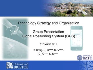
- 1. Technology Strategy and OrganisationGroup Presentation Global Positioning System (GPS) 11th March 2011 R. Craig, S. G****, R. V****, C. A****, S. D****
- 2. Outline Background Chronological GPS Evolution Technology S Curve Multiple S Curves Product Process Cycle Dominant Design Model Diffusion Curve
- 3. Background The Global Positioning System (GPS) is a space-based Global navigation satellite system that provides location and time information. The project was started in 1973 to overcome the limitations of previous navigation systems. GPS was created by the US department of defence and was originally run with 24 satellites. It became fully operational in 1994 at the cost of twelve billion US taxpayer dollars. Freely accessible by anyone with a GPS receiver. Navigation by radio as an aid has been practiced in Germany since 1907 (Telefunken) First used as radio directional finder (RDF) between radio towers.
- 4. GPS Timeline In 1972, the US Air Force developmental flight tests of two prototype GPS receivers In 1978 the first experimental Block-I GPS satellite was launched. In 1983, civilian airliner strayed into restricted Soviet airspace due to navigational errors and shot , GPS made available for civilian use.February 14, 1989, the first modern Block-II satellite was launched. December 1993 the GPS achieved initial operational capability[51] January 17, 1994 a complete constellation of 24 satellites was in orbit. Full Operational Capability was declared by NAVSTAR in April 1995. In 1996, US declaring GPS to be a dual-use system (national asset). In 1998, two new civilian signals for enhanced user accuracy and reliability, particularly with respect to aviation safety. On May 2, 2000 "Selective Availability" was discontinued In 2004, US and European Community establishing cooperation related to Garmin GPS and Europe's planned Galileo system. November 2004, successful tests of Assisted-GPS for mobile phones.In 2005, the first modernized GPS satellite was launched and began transmitting a second civilian signal for enhanced user performance.
- 5. Technology S Curve GPS ‘System’ Product Performance Estimated position of GPS system Time or Engineering Effort
- 6. GPS Application S Curve GPS Dependent Use – Children, pets, objects Product Performance Personal Use – Outdoors - phone Civil Applications - Land, sea, air BIG BROTHER Military Applications Time or Engineering Effort
- 7. GPS in the news
- 8. Multiple S Curves for Accuracy Reliability Cost S Curves could also be applied to other factors such as size, battery life, ease of use etc.............
- 9. Product-Process Cycle Difficult to apply with our vision of the GPS system with product process cycle. A better application is with GPS mobile phones. Each product would have its own product process cycle. Product Estimated position of GPS system Process Fluid Transition Specific Mature
- 11. Dominant Design Model 2000BC (Egypt) 1859AD (Canada) 312 BC (Rome) 1940AD (Great Britain + Allies) 290BC (Egypt) 1990AD (US) 247BC (China) 1993AD (US) 1730AD (Great Britain) 1995AD (US) 1761AD (Great Britain) 1999AD (US)
- 12. Diffusion Curve GPS Systems Europe China/India Time
- 13. Implications of this analysis for technology strategy for these organisations and potential entrants. Works well for a physical product evolution, but has difficulty contextually complex systems. System was too big to handle within the set time scale, the team boundaries were too big to manage. Boundaries would need to be rationalized (reduced, simplified). Market evolution not product specific More questions than answers, systems understanding expanded. In application of the dominant design model highlighted how complex the system is
- 14. Conclusions (Models)Presentation Critique for ease of use and their utility for decision making in technology strategy S-Curve Helps to indicate when to invest in new tech/products Dominant Systems Model Models too basic for multi dimensional technology convergence Diffusion Model Promotes understanding of current technology trajectory Product-Process Cycle Product specific, different applications Abstract level, N-dimensions
- 15. Conclusions (Reflections) Presentation Critique for ease of use and their utility for decision making in technology strategy Models used for indication only (creates discussion) All models are wrong but some are useful Enables visibility of technological paradigms Epistemological evolution Not a panacea Group had no tacit knowledge for successful application
- 16. References Bauer, A. “Some historical and technical aspects of radio navigation, in Germany, over the period 1907 to 1945”, 2004 http://www.xs4all.nl/~aobauer/Navigati.pdf