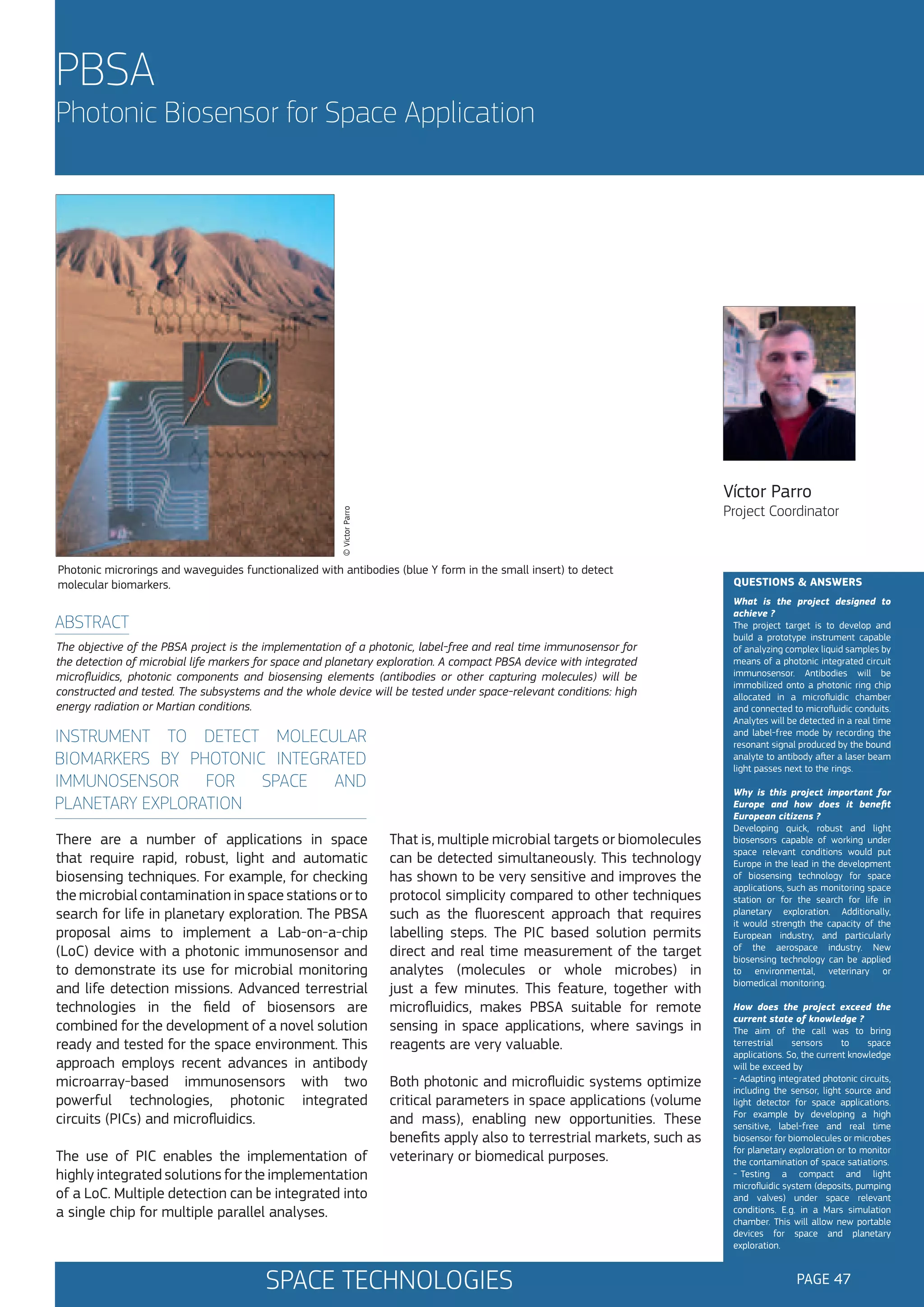
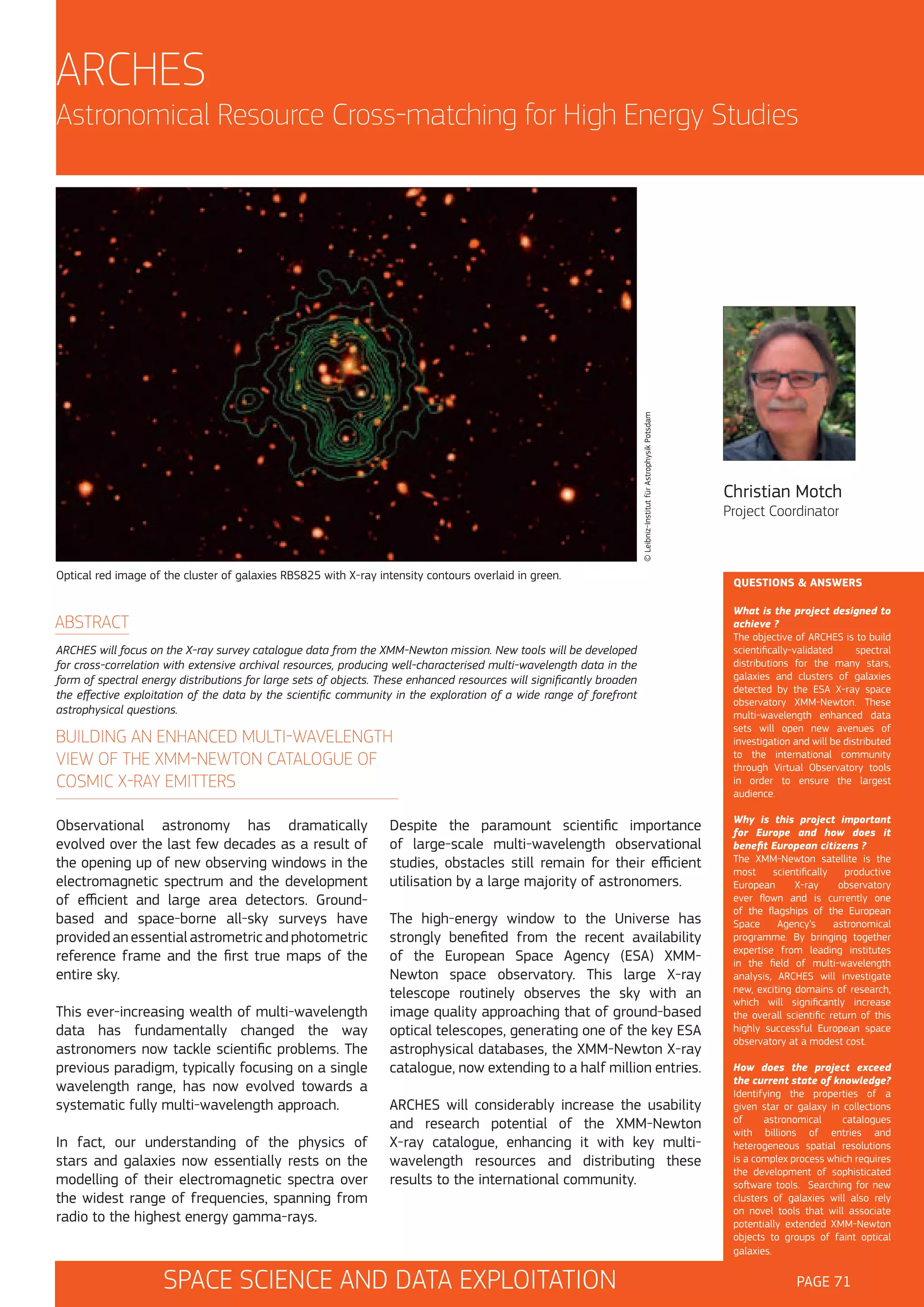
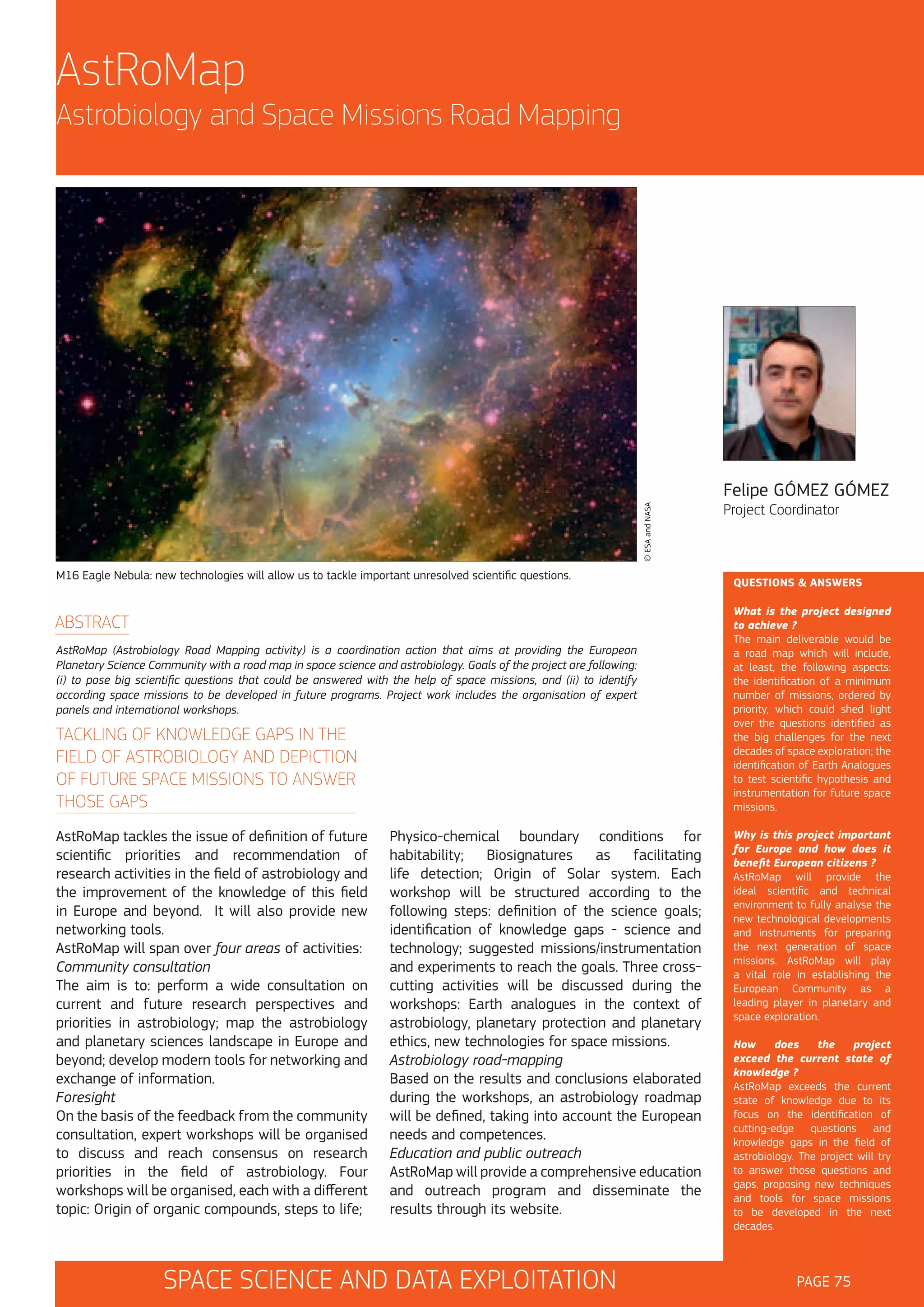
Download to read offline


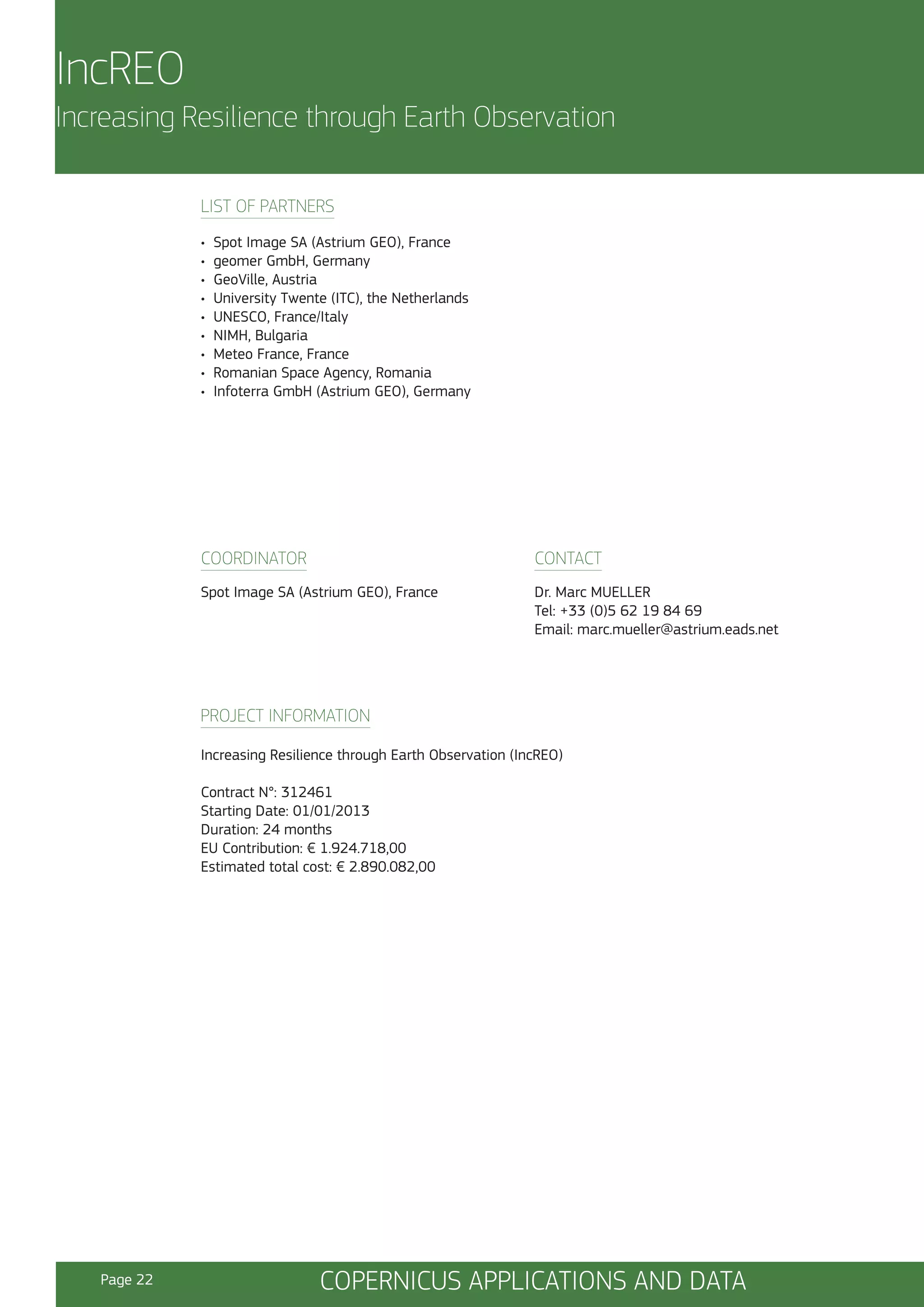
![IncREO
© geomer GmbH & Astrium GEO
Increasing Resilience through Earth Observation
BEAM products (Basic European Assets Maps) for Hungary and Romania - enabling cross-border evaluation of
damage potential.
ABSTRACT
The objective of IncREO is to provide actors responsible for civil protection and disaster management with EObased solutions, contributing to an improved preparedness and mitigation planning for areas highly vulnerable to
natural disasters and already noticeable climate change trends. As a multi-risk designed project, any type of natural
disaster is addressed. However, selected use cases and the transfer of solutions to a specifically multi-risk prone
area are covered as well.
ASSETS MAPPING, MULTI-RISK AND
VULNERABILITY MAPPING ENHANCING
MITIGATION AND PREPAREDNESS
Within IncREO, “Resilience” is understood as
the capacity of a system, community or society
(potentially) exposed to hazards to adapt – by
resisting or changing – in order to reach and
maintain an acceptable level of functioning and
structure.
Relevant national and European legislature plus
national and supranational legal frameworks incl.
global mechanisms, if applicable, are taken into
account as well to provide solutions, meeting
the respective administrative and technical user
requirements.
The “Increase” of resilience is achieved by providing
actors responsible for civil protection and disaster
management with Earth Observation (EO)-based
solutions contributing particularly to an improved
preparedness and mitigation planning in areas
highly vulnerable to natural disasters and with
already noticeable climate change trends.
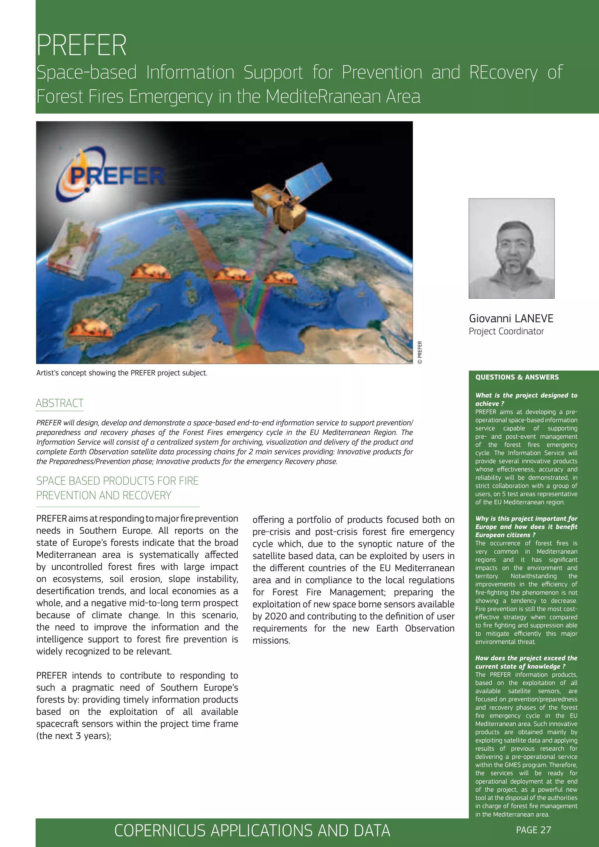
The types of products to be provided are mainly
“assets maps” and “hazard / risk and vulnerability
maps”. Whereas “crisis phase” products, such as
damage extent / assessment maps and emergency
support maps are already based on consolidated
user requirements with corresponding product
specifications available, there is still a certain R&D
need in this regard concerning the aforementioned
“non crisis phase” products.
Besides the objective to increase resilience,
IncREO also pursues a multi-hazard approach –
either hazards triggered simultaneously (coupled
hazards) or concatenated hazards (domino effect)
– as a fundamental basis to identify highly
vulnerable and risk-prone areas.
The geo-information content of the final products
usually corresponds to a multiple set incl. valueadding of EO data and various geo-formation
layers, among them, for example, optical and / or
radar satellite data, information about topography,
population density and critical infrastructure.
COPERNICUS APPLICATIONS AND DATA
Marc MUELLER
Project Coordinator
QUESTIONS & ANSWERS
What is the project designed to
achieve ?
The project is designed to achieve
a significant contribution to
the operational capacities
of
Copernicus (formerly GMES) by
developing customized mapping
and geo-information products ready
for deployment in the prevention
and preparedness phases – as a
complementary to the Emergency
Management (crisis) Service of
the Copernicus Initial Operations.
To achieve this, the transferability
of solutions to other geographical
areas is essential.
Why is this project important
for Europe and how does it
benefit European citizens ?
IncREO is important for Europe
because it contributes to an upto-date assessment of areas
vulnerable to natural disaster(s)
incl. state-of-the-art mapping,
supporting civil protection, disaster
management and spatial planning
actors, for the benefit of every
single European citizen. The latter
applies also to the project’s assets
mapping approach, as it provides
cross-border and regional/local
solutions.
How does the project exceed
the current state of knowledge?
By reviewing existing Copernicus
solutions and defining those as the
starting point. Progress will then
be achieved by the use of new
EO data with higher resolution,
refined mapping concepts (e.g.
assets mapping) and customized
workflows (e.g. for producing
[multi-]risk and vulnerability maps).
The analysis of newly available EObased products (e.g. terrain data)
for risk-related applications is the
purpose of the research, too.
PAGE 21](https://image.slidesharecdn.com/nb3112308enc002-131230043136-phpapp01/75/Beyond-the-sky-23-2048.jpg)


The document outlines the European Union's FP7 space research initiatives focused on utilizing space science and technology for various applications, including climate monitoring and disaster response. It presents 50 projects funded under the 5th call of the program, categorized into copernicus applications and data, space technologies, space science and data exploitation, and cross-cutting issues. The brochure serves as a comprehensive overview of Europe’s efforts to leverage space-based solutions for societal benefits, emphasizing the importance of accessible climate data and improved monitoring capabilities.


![Vibe Coding vs. Spec-Driven Development [Free Meetup]](https://cdn.slidesharecdn.com/ss_thumbnails/vibecodingvsspecdrivendevelopment-251209105622-43f455e7-thumbnail.jpg?width=640&height=640&fit=bounds)


