IRJET-Water Quality Assessment in Terms of Water Quality Index using Remote Sensing and GIS
•
0 likes•51 views

This document analyzes the water quality assessment in Hyderabad, India in terms of the Water Quality Index (WQI) using remote sensing and GIS techniques. Water samples were collected from various locations and analyzed for physio-chemical parameters to generate an attribute database. The WQI was calculated based on parameters like pH, hardness, TDS, chlorides, sulfates, nitrates, carbonates, and bicarbonates. Spatial distribution maps of WQI were generated for pre- and post-monsoon periods from 2006 to 2011. The WQI analysis helped classify water samples as excellent, good, poor, very poor, or unfit. The spatial maps can aid long-term water resource monitoring.
![International Research Journal of Engineering and Technology (IRJET) e-ISSN: 2395 -0056
Volume: 04 Issue: 06 | June -2017 www.irjet.net p-ISSN: 2395-0072
© 2017, IRJET | Impact Factor value: 5.181 | ISO 9001:2008 Certified Journal | Page 3232
WQI is calculated by the method :
Qni =(Vactual – Videal) / Vstandard – Videal)* 100
Where,
Qni = Quality rating of ith parameter for a total of n water
quality parameters
Vactual = Value of water quality parameter obtained from
laboratory analysis
Vstandard = Value of water quality parameter obtainedfrom
standard tables.
Videal for pH = 7 and zero for other parameters. (A.K.
Srivastava and D.K. Sinha,IJEP,volume14,
No. 5, May 1994 and Mahuya Dasgupta
Adak etal, IJEP, Volume 8, No. 3, 2001)
In order to calculate the suitability of potable water,
a new indexing system called Water Quality Index has been
found from WQR which is formulated as:
WQI = Antilog [Wnn=1 log10 qn]
Where,
Wn = K / Sn and
K=1 / nn=1 1/Si
by substituting this K value in the equation
Wn = K/Si
4. RESULTS AND CONCLUSIONS
WQI of water is found from the values of pH, hardness of
Magnesium and Calcium,TDS,Chlorides, Sulphates,Nitrates,
Carbonates, Bi-carbonates, TH. For six years Spatial
Distribution Maps are generated for WQI for both pre and
post monsoon periods from 2006 to 2011. The analysis of
the physio-chemical properties and the WQI are helpful in
the grouping of potable water samples into excellent, good,
poor, very poor and unfit.
Table -1: Water Quality Rating for Drinking Purposes
WQI Water Quality Rating
0 – 25 Excellent
26 – 50 Good
51 – 75 Poor
76 – 100 Very Poor
>100 Unfit for Drinking
Table -2: The computed weightage factor
S.No.
Weightage
Factor (Wn) Standard
Wn =
K/Sn
1 pH 8.5 0.5576
2 TDS 500 0.0094
3 Chlorides 250 0.0189
4 Carbonates 200 0.0237
5 Bicarbonates 200 0.0237
6 Calcium 75 0.0632
7 Magnesium 30 0.158
8 Nitrates 45 0.1053
9 Sulphates 200 0.0237
10
Total
hardness 300 0.0158
Table -3: Water Quality Parameters, Their ICMR/WHO
Standards, and Assigned Unit weights.
qni is computed for all the ten water quality parameters](data:image/gif;base64,R0lGODlhAQABAIAAAAAAAP///yH5BAEAAAAALAAAAAABAAEAAAIBRAA7)
Recommended
Recommended
More Related Content
What's hot
What's hot (19)
Similar to IRJET-Water Quality Assessment in Terms of Water Quality Index using Remote Sensing and GIS
Similar to IRJET-Water Quality Assessment in Terms of Water Quality Index using Remote Sensing and GIS (20)
More from IRJET Journal
More from IRJET Journal (20)
Recently uploaded
Recently uploaded (20)
IRJET-Water Quality Assessment in Terms of Water Quality Index using Remote Sensing and GIS
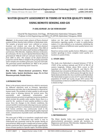
- 1. International Research Journal of Engineering and Technology (IRJET) e-ISSN: 2395 -0056 Volume: 04 Issue: 06 | June -2017 www.irjet.net p-ISSN: 2395-0072 © 2017, IRJET | Impact Factor value: 5.181 | ISO 9001:2008 Certified Journal | Page 3231 WATER QUALITY ASSESSMENT IN TERMS OF WATER QUALITY INDEX USING REMOTE SENSING AND GIS P ANIL KUMAR1, Dr GK VISWANADH2 1 Head Of The Department, Civil Engg., KN Polytechnic Hyderabad, Telangana, INDIA 2 Professor in Civil Engineering and OSD to VC, JNTUH, Hyderabad, Telangana, INDIA ---------------------------------------------------------------------***--------------------------------------------------------------------- Abstract - In the present study, anlaysis of Physio-chemical analysis & Water Quality Index of Water in Hyderabad, India. The samples of ground water were collected at various locations and analysis was done for Physio-chemical parameters for attribute data base generation. Then WQI of Water is found from the values of pH, hardness of Magnesium and Calcium, TDS, Chlorides, Sulphates, Nitrates, Carbonates, Bi-carbonates, TH. For six years Spatial Distribution Mapsare generated for WQI for both pre and post monsoon periods from 2006 to 2011. The analysis of the physio-chemical properties and the WQI are helpful in the grouping of potable water samples into excellent, good, poor, very poor and unfit. The generated spatial distribution for WQI in the present study is useful for monitoring water resources. Key Words: Physio-chemical parameters, Water Quality Index, Spatial distribution maps, Pre & Post Monsoon periods, Potable Water. 1.INTRODUCTION Water is the primary natural resources, which is necessary for different objectives such as Forestry, Agriculture, Urbanization and other day to day demands as required for human needs. The problem of water quality in and around urban areas is drawing interest for several years. The unscientific and unplanned urbanization and industrialization practices are getting a numerousproblems which include the potable water quality. Hence there is a need for the analysis of water quality problem in urban areas. Since the changes in the climatic conditions, the annual rainfall is continuously reducing every year and also increasing runoff due to urbanization and industrialization. Such human activities may continuously result in the reduction of water bodies, adulteratingthe qualityofground water, contamination of potable water and different health hazards. The main goal of WQI is to transform complicated water quality data in an informative way which is easy to understand and commonly used by the people. Basing on several factors, WQI can give a simple note on water quality. By this a particular idea is generated in public regarding the issues of water quality in a specific region.TheWaterQuality indices are the most effective ways to convey the information regarding quality of water to public/policy makers. It is also defined as an evaluation exhibiting the composite influence of different water quality factors over quality of water. Based on various water quality factors, WQI gives a single number (grading) to know complete water quality in a location at a point of time. 2. STUDY AREA The study area Hyderabad is situated between 1720’ & 17025’ of the northern latitude and 7825' & 780 35’ of eastern longitude, 520mts above M.S.L covers in SOI toposheet nos 56k/6, 56k/7, 56k/10 and 56k/11. The Hyderabad city is located on Krishna basin. Musi River, the tributary of river Krishna, which passes through the city of Hyderabad and divides the city as north & south Hyderabad. The Hyderabad occupies an area of 217 sq km with density population of 14,497 per sq km. As per 2011 census The total population of district is 6,809,970. The study area map is shown in Fig 1 Fig 1: Map of the Study area Hyderabad 3. METHODOLOGY The Water Quality Index was computed using Ten physicochemical parameters namely pH, hardness of Magnesium and Calcium,TDS,Chlorides, Sulphates,Nitrates, Carbonates, Bi-carbonates, TH.
- 2. International Research Journal of Engineering and Technology (IRJET) e-ISSN: 2395 -0056 Volume: 04 Issue: 06 | June -2017 www.irjet.net p-ISSN: 2395-0072 © 2017, IRJET | Impact Factor value: 5.181 | ISO 9001:2008 Certified Journal | Page 3232 WQI is calculated by the method : Qni =(Vactual – Videal) / Vstandard – Videal)* 100 Where, Qni = Quality rating of ith parameter for a total of n water quality parameters Vactual = Value of water quality parameter obtained from laboratory analysis Vstandard = Value of water quality parameter obtainedfrom standard tables. Videal for pH = 7 and zero for other parameters. (A.K. Srivastava and D.K. Sinha,IJEP,volume14, No. 5, May 1994 and Mahuya Dasgupta Adak etal, IJEP, Volume 8, No. 3, 2001) In order to calculate the suitability of potable water, a new indexing system called Water Quality Index has been found from WQR which is formulated as: WQI = Antilog [Wnn=1 log10 qn] Where, Wn = K / Sn and K=1 / nn=1 1/Si by substituting this K value in the equation Wn = K/Si 4. RESULTS AND CONCLUSIONS WQI of water is found from the values of pH, hardness of Magnesium and Calcium,TDS,Chlorides, Sulphates,Nitrates, Carbonates, Bi-carbonates, TH. For six years Spatial Distribution Maps are generated for WQI for both pre and post monsoon periods from 2006 to 2011. The analysis of the physio-chemical properties and the WQI are helpful in the grouping of potable water samples into excellent, good, poor, very poor and unfit. Table -1: Water Quality Rating for Drinking Purposes WQI Water Quality Rating 0 – 25 Excellent 26 – 50 Good 51 – 75 Poor 76 – 100 Very Poor >100 Unfit for Drinking Table -2: The computed weightage factor S.No. Weightage Factor (Wn) Standard Wn = K/Sn 1 pH 8.5 0.5576 2 TDS 500 0.0094 3 Chlorides 250 0.0189 4 Carbonates 200 0.0237 5 Bicarbonates 200 0.0237 6 Calcium 75 0.0632 7 Magnesium 30 0.158 8 Nitrates 45 0.1053 9 Sulphates 200 0.0237 10 Total hardness 300 0.0158 Table -3: Water Quality Parameters, Their ICMR/WHO Standards, and Assigned Unit weights. qni is computed for all the ten water quality parameters
- 3. International Research Journal of Engineering and Technology (IRJET) e-ISSN: 2395 -0056 Volume: 04 Issue: 06 | June -2017 www.irjet.net p-ISSN: 2395-0072 © 2017, IRJET | Impact Factor value: 5.181 | ISO 9001:2008 Certified Journal | Page 3233 Table –4: Estimated WQI values of pre and post monsoon for the year 2006 Table – 5: Estimated WQI values of pre and post monsoon for the year 2007 Table –6: Estimated WQI values of pre and post monsoon for the year 2008 Table –7: Estimated WQI values of pre and post monsoon for the year 2009
- 4. International Research Journal of Engineering and Technology (IRJET) e-ISSN: 2395 -0056 Volume: 04 Issue: 06 | June -2017 www.irjet.net p-ISSN: 2395-0072 © 2017, IRJET | Impact Factor value: 5.181 | ISO 9001:2008 Certified Journal | Page 3234 Table –8: Estimated WQI values of pre and post monsoon for the year 2010 Table –9: Estimated WQI values of pre and post monsoon for the year 2011 Fig 2: Spatial Distribution Map of Water Quality Index REFERENCES [1] Abdel-Aziz Ismail Kashef, ground water Engineering, Mc Graw Hill International Editions, 1986. [2] Anjaneyulu Y., (Editor Prof.P.Narasimha Rao), "Introduction to Environmental Science", BS Publications, Hyderabad, (First reprint 2005) [3] Reddy M., Text Book of Anji RS and GIS, Second edition, B.S Publications, Hyderabad, 2001. [4] APHA, AWWA, WPCF, Standard Methods for the Examination of Water and Wastewater, 16th edition, American Public Health Association, New York, 1985. [5] Mahuya Das Gupta Adak, K.M Purohit and Jayita Datta, Assessment of drinking water quality of river Brahmani, Journal of environment and Pollution, Vol.8, No.3, 2001, pp. 285-291. [6] Srivastava A.K. Mishra D.K. Sarika Tripathi and Priti singh , “Calculation of water quality Index considering important physicochemical parameters”, Nature Environment and pollution Technology”, 2000, 16 , pp 315-319. [7] Tiwari T.N and M. Mishra, 1995, IJEP, Vol.5, No.4, pp. 276-279. [8] Rao, A. L. India’s water wealth. Its assessment, uses and projections. Published by Orient Longman Limited, 1975. [9] David Keith Todd, Ground Water Hydrology, John Wiley and Sons, 1980. [10] Chand S and Dara S.S, “A Textbook of environmental chemistry and pollution control”, S.Chand & Co Ltd., New Delhi, India, 1997.