SlideShare a Scribd company logo
1 of 3
Download to read offline
International Research Journal of Engineering and Technology (IRJET) e-ISSN: 2395-0056
Volume: 06 Issue: 06 | June 2019 www.irjet.net p-ISSN: 2395-0072
© 2019, IRJET | Impact Factor value: 7.211 | ISO 9001:2008 Certified Journal | Page 513
Hydraulic Redesign and Analysis of Kotmara Dam: Kas River Basin
Shelke Dipti Pratap1, Devgadkar Swati Arvind2, Memane Priyanka Suryakant3, Mhetre K. V4,
Dr. Paigude D. G5
1,2,3Graduate Students, Department of Civil Engineering, APCOER, Pune, Maharashtra, India
4Assistant Professor, Department of Civil Engineering, APCOER, Pune, Maharashtra, India
5Adjunct Professor, Department Civil Engineering, APCOER, Pune, Maharashtra, India
---------------------------------------------------------------------***----------------------------------------------------------------------
Abstract -GeographicalInformationSystem(GIS)isan
effective tool top performs many operations such as
digitization, delineation of streams in watershed. This
tool can be efficiently used to carry out hydrological
analysis and hence used for sustainable watershed
management projects such as redesign of the dam or
reservoir planning. In this process, the watershed of the
Kas river was delineated and discharge estimation was
carried out using toposheet from survey of India (scale
1:50000) and satellite based remote sensing digital
elevation model (DEM). GIS tool (QGIS) was used to
performed Morphomatric analysis for the above to
derive the stream characteristics and stream orders.
Using Strange’s table, the yield of runoff from the
catchment was estimated. This is useful to find out the
actual storage available at the study site. So that we can
analyze whether the existing dam reservoir is sufficient
or not. And can give the best measures such as hydraulic
redesign of the existing Kotmara dam.
Key Words: River Kas, Delineation, QGIS, yield of runoff,
rainfall, hydraulic design
1. INTRODUCTION
The availability of fresh water is limited resource and
needs sustainable management of this resource. Given
the varied bio-climatic zones, rain fall patterns vary
and each geographic area receives a certain mean
annual rainfall. However, in certain areas with
changing water demand, there is an apparent sense
inadequate rainfall over the years and hence overall
yield resulting of the precipitation. One such case is
applicable for the upstream catchment of small river
Kas that originates in Bota Village in Ahmednagar
district of Maharashtra. There is a small dam named as
Kotmara constructed on river Kas with 7899.463 Ha
catchment area.
The main objective of this dam is to be providing the
water supply to the agriculture and domestic purpose
to the nearby villages. With changing agriculture
practices and increaseinpopulationinnearbyvillages.,
water demand has increased that was oftenpushedfor
the need to draw water from other watersheds.
Consequently, the nearby villages in the existing dam
are fed with water drawn from river Kas through
human made channels and closed conduits.
According to thesurveyandobservationtheareahas
quite good rainfall pattern (25mm); so there may be a
scope to increase the water storage of the dam. In this
backdrop it becomes pertinent to access the potential
yield of runoff from rainfall in catchment. This can be
achieved by delineating the watershed andanalyzethe
stream network appropriate methods that is by
manually using toposheet or through software using
Digital Elevation Model. On the basis of runoff results
we can find the either new site for dam or redesign the
hydraulic dimension of the dam.
The Geographical Information System is an effective
tool to perform various operations such as
digitalization, delineationofstreamofawatershedand
carry out a variety of spatial analysis. The tool can be
efficiently used to carry out hydrological analysis and
hence used for sustainable watershed management
projects.
Thus, this study aims to delineate the River Kas
watershed and estimate the potential discharge from
runoff in the catchment using QGIS software and
manual drawing methods. In the next stage design the
gravity dam and comparison is to be done.
QGIS (Previously known as Quantum Geographical
Information System) is a cross platform free and open
source desktop geographic information system
application that provides data viewing, editing and
analysis. The application is available from
http://qgis.org/.QGISallowsuserstocreatemapswith
many layers using different map projections. Mapscan
assemble in different formats and for different uses.
QGIS allows maps to be composed of raster or vector
layers. Typical ofthiskindofsoftware’s,thevectordata
is stored as point, line or polygon features. Different
International Research Journal of Engineering and Technology (IRJET) e-ISSN: 2395-0056
Volume: 06 Issue: 06 | June 2019 www.irjet.net p-ISSN: 2395-0072
© 2019, IRJET | Impact Factor value: 7.211 | ISO 9001:2008 Certified Journal | Page 514
kinds of raster images are supported and the software
cans geo-referenced images.
1.1 STUDY AREA
Fig No.1: Google Earth View of Dam
1.2 OBJECTIVES
1. To calculate the actual geometric, hydrologicaland
cost related data for existing dam.
2. To find out the catchment area for river Kas basin
by toposheet and Digital Elevation Model (DEM).
3. To design the earthen dam on the basis of data
collected.
4. To compare redesign parameters with respect to
existing structure.
5. To suggest improvement measures to exiting dam
2. PROBLEM STATEMENT
The rainfall occurringinexistingcatchmentareaofthe
dam is heavy, whereas the storage capacity of the dam
is not sufficient to store all the water available in the
catchment area.
3. METHODOLOGY
3.1Data collection: we visited irrigation department at
Sangamner taluka and collected existing dam details.
3.2 Rain fall assessment: from collected last five years
rainfall data average annual rainfall was calculated.
3.3 Catchment area delineations: catchment area
delineation was done by two methods that are by
toposheet and by using QGIS software.
3.4 Redesign of dam: from data collection, rain fall
assessment and catchment area delineation. It is
observed that there is need of redesigning of dam.
3.5 Suggestions:Afteridentifyingcausesofaccidentson
those black spots remedialmeasureswillbesuggested.
4. RESULT AND CONCLUSION
4.1 The catchment area obtained:
The catchment area calculated by the software is
4.43% more than the catchment area calculated by
manual toposheetmethod.QGISsoftwareusegoodand
accurate resultsthanthemanualmethodwhichisopen
source software available worldwide.
Catchmentarea
by toposheet
method(sqkm)
Catchment area
by QGIS
software
method (sq km)
% of increase in
area
80.952 84.7 4.43
4.2 Factor of safety for various cases:
We have started to increase the height of the dam by 3
meter then by 5 meter than existing condition of the
dam. And the factor of safety obtained for these
conditions are greater than minimum limit 1.35 for
downstream side and 1.5 for upstream side which
states that the dam is safe for respective scenarios.
No. Height of
Dam
Trial
no. 1
Trial
no. 2
Trial
no. 3
Remark
1 29.10M SAFE
Upstream
Dam
2.04 1.98 1.90 SAFE
Downstream
side
1.59 1.67 1.79 SAFE
2 32M
Upstream
side
2.1 2.3 2.5 SAFE
Downstream
side
1.648 1.749 1.81 SAFE
3 34M
Upstream
side
2.1 2.15 2.1 SAFE
Downstream
side
2.01 2.3 2.36 SAFE
REFERENCES
1. Indra Prakash,NarendraJ.ShrimaliandUmang
S. Visharolia (May-2017). “Watershed
International Research Journal of Engineering and Technology (IRJET) e-ISSN: 2395-0056
Volume: 06 Issue: 06 | June 2019 www.irjet.net p-ISSN: 2395-0072
© 2019, IRJET | Impact Factor value: 7.211 | ISO 9001:2008 Certified Journal | Page 515
Delineation of Purna River using Geographical
Information System (GIS).”4(5), 690-695.
2. B. Kaviya, Omkumar, Ram Chandra Verma,
Ramesh Kumar Ram, Ritesh Pal Singh (2017).
“Watershed Delineation using GIS in Selaiyur
Area.”116(13), 417-423.
3. Muhammad Jehanzeb Masud and Wim G. M.
Bastiaanssen (Dec-2017). 351-373.
4. Arbind K. Verma and Madan K. Jha (July-2017).
“Extraction of Watershed Characteristicsusing
GIS and Digital Elevation Model.” 6(7), 1-6.
5. Shweta Ramchandra Nale (May-2017).
“Identification, Delineation and mapping of
micro watershed of Kaneri.” 5(5), 2147-2153.
6. A. Krishnakumar, Revathy Das and Dhanya. T.
Dharan (Nov-2017). “Land Cover Change
Analysis with Special Reference to Forests and
PaddyWetlandsofNeyyarandRiverKaramana
Basin, Kerala, SW India Using GIS and Remote
Sensing.”7(11), 190-198.
7. Viswanathan K. E., Manikandan M.,
Bharanitharan S.(June-2015). “Watershed
Delineation for Varahanadhi Basin Using
OpensourceGeospatialTechnology.”2(6),7-13.
8. Chaya G. Manju Naik andPravinKumar(2014).
“Water Resource Management in Hassan
District using Arc GIS.”
9. Sampad Kumar Panda, B. Sukumar (2010).
“DelineationofAreasforwaterConservationin
Peruvamba River Basin, Kannur District,
Kerala, Using Remote Sensing and GIS.” 1(1),
76-83.
10. N. Donia (2009). “Application of Remotely
Sensed Imagery to Watershed Analysis; A Case
Study of Lake Karoun Catchment,Egypt.”1035-
1049
11. M. A. E. Bastawesy, R. R. Ali and A. H. Nasr
(2008). “The use of Remote SensingandGISfor
Catchment Delineation in NW Coast of Egypt:
An assessment of Water Resource and Soil
Potential.” 11, 3-16.
12. Pandey, V. K., Pandey, A. and Panda, S. N.
(2007).“ApplicationofRemoteSensingandGIS
for Watershed Characterization.” 7(1), 3-15.
13. S.Srinivasa Vittala, S. Govindaiah and H. Honne
Gowda (2006). “Digital ElevationModel(DEM)
for Identification of Ground Water Prospective
Zones.”34(3),306-310.
14. Maathuis, B. H. P. (2006). “Digital Elevation
Model Based Hydro-processing.”21, 21-26.
15. Takahiro Sayama, Yasuto Tachikawa, Kaoru
Takara and Yutaka Ichikawa (April-2005).
“Distributed Rainfall- RunoffAnalysisinaFlow
RegulatedBasinHavingMultipleMulti-Purpose
Dams.” 371-381.
16. Singh, R., Tiwari, K. N. and Mal, B. C. (2005).
“Hydrological Studies for Small Watershed in
India Using the ANSWERS model.”318, 184-
199.
17. Gangodagamane Chandana (2001).
“Hydrological Modeling using remote sensing
and GIS”. Asian Conference on remote sensing,
5-9, Singapore- Centre for remote Imaging and
sensing and processing (CRISP).
18. Hase Hideaki and Taro Tonegawa, Furuta
Hitoshi. (1996) “Application of genetic
algorithm to aesthetic design of dam
structures.”

More Related Content

What's hot

Geographical information system (gis) for water
Geographical information system (gis) for waterGeographical information system (gis) for water
Geographical information system (gis) for watereSAT Publishing House
 
Rainfall-Runoff Modelling using Modified NRCS-CN,RS and GIS -A Case Study
Rainfall-Runoff Modelling using Modified NRCS-CN,RS and GIS -A Case StudyRainfall-Runoff Modelling using Modified NRCS-CN,RS and GIS -A Case Study
Rainfall-Runoff Modelling using Modified NRCS-CN,RS and GIS -A Case StudyIJERA Editor
 
23 - NRSC - Remote Satellite Imgae - Hydrology and Water Management-Sep-17
23 - NRSC - Remote Satellite Imgae - Hydrology and Water Management-Sep-1723 - NRSC - Remote Satellite Imgae - Hydrology and Water Management-Sep-17
23 - NRSC - Remote Satellite Imgae - Hydrology and Water Management-Sep-17indiawrm
 
WATER RESOURCES MODELING OF THE GANGES-BRAHMAPUTRA-MEGHNA RIVER BASINS USING ...
WATER RESOURCES MODELING OF THE GANGES-BRAHMAPUTRA-MEGHNA RIVER BASINS USING ...WATER RESOURCES MODELING OF THE GANGES-BRAHMAPUTRA-MEGHNA RIVER BASINS USING ...
WATER RESOURCES MODELING OF THE GANGES-BRAHMAPUTRA-MEGHNA RIVER BASINS USING ...Moudud Hasan
 
Tamil nadu wb review tn_hpii_delhi_may2014
Tamil nadu wb review tn_hpii_delhi_may2014Tamil nadu wb review tn_hpii_delhi_may2014
Tamil nadu wb review tn_hpii_delhi_may2014hydrologyproject0
 
Study on gis simulated water quality model
Study on gis simulated water quality modelStudy on gis simulated water quality model
Study on gis simulated water quality modelprjpublications
 
A case study on GIS application
A case study on GIS applicationA case study on GIS application
A case study on GIS applicationAxay Sharma
 
IRJET - Remote Sensing, GIS and Geophysical Techniques to Find Suitable Sites...
IRJET - Remote Sensing, GIS and Geophysical Techniques to Find Suitable Sites...IRJET - Remote Sensing, GIS and Geophysical Techniques to Find Suitable Sites...
IRJET - Remote Sensing, GIS and Geophysical Techniques to Find Suitable Sites...IRJET Journal
 
2 - MoWR - HP-III presentation-16th Sep
2 - MoWR - HP-III presentation-16th Sep2 - MoWR - HP-III presentation-16th Sep
2 - MoWR - HP-III presentation-16th Sepindiawrm
 
Narayan Shrestha [Calibration and Validation of SWAT Model for Low Lying Wate...
Narayan Shrestha [Calibration and Validation of SWAT Model for Low Lying Wate...Narayan Shrestha [Calibration and Validation of SWAT Model for Low Lying Wate...
Narayan Shrestha [Calibration and Validation of SWAT Model for Low Lying Wate...Narayan Shrestha
 
Sediment Assessment of UJJANI Reservoir in Maharashtra by using Remote Sensin...
Sediment Assessment of UJJANI Reservoir in Maharashtra by using Remote Sensin...Sediment Assessment of UJJANI Reservoir in Maharashtra by using Remote Sensin...
Sediment Assessment of UJJANI Reservoir in Maharashtra by using Remote Sensin...IRJET Journal
 
IDENTIFICATION OF GROUNDWATER POTENTIAL ZONES USING REMOTE SENSING AND GEOGRA...
IDENTIFICATION OF GROUNDWATER POTENTIAL ZONES USING REMOTE SENSING AND GEOGRA...IDENTIFICATION OF GROUNDWATER POTENTIAL ZONES USING REMOTE SENSING AND GEOGRA...
IDENTIFICATION OF GROUNDWATER POTENTIAL ZONES USING REMOTE SENSING AND GEOGRA...IAEME Publication
 
Surface Water modelling using Remote Sensing
Surface Water modelling using Remote SensingSurface Water modelling using Remote Sensing
Surface Water modelling using Remote SensingArk Arjun
 
The Development of a Catchment Management Modelling System for the Googong Re...
The Development of a Catchment Management Modelling System for the Googong Re...The Development of a Catchment Management Modelling System for the Googong Re...
The Development of a Catchment Management Modelling System for the Googong Re...GavanThomas
 
Mapping of ground water quality using geographical information system
Mapping of ground water quality using geographical information systemMapping of ground water quality using geographical information system
Mapping of ground water quality using geographical information systemAmul Patwal
 

What's hot (20)

Geographical information system (gis) for water
Geographical information system (gis) for waterGeographical information system (gis) for water
Geographical information system (gis) for water
 
Rainfall-Runoff Modelling using Modified NRCS-CN,RS and GIS -A Case Study
Rainfall-Runoff Modelling using Modified NRCS-CN,RS and GIS -A Case StudyRainfall-Runoff Modelling using Modified NRCS-CN,RS and GIS -A Case Study
Rainfall-Runoff Modelling using Modified NRCS-CN,RS and GIS -A Case Study
 
23 - NRSC - Remote Satellite Imgae - Hydrology and Water Management-Sep-17
23 - NRSC - Remote Satellite Imgae - Hydrology and Water Management-Sep-1723 - NRSC - Remote Satellite Imgae - Hydrology and Water Management-Sep-17
23 - NRSC - Remote Satellite Imgae - Hydrology and Water Management-Sep-17
 
Kerala sw
Kerala swKerala sw
Kerala sw
 
WATER RESOURCES MODELING OF THE GANGES-BRAHMAPUTRA-MEGHNA RIVER BASINS USING ...
WATER RESOURCES MODELING OF THE GANGES-BRAHMAPUTRA-MEGHNA RIVER BASINS USING ...WATER RESOURCES MODELING OF THE GANGES-BRAHMAPUTRA-MEGHNA RIVER BASINS USING ...
WATER RESOURCES MODELING OF THE GANGES-BRAHMAPUTRA-MEGHNA RIVER BASINS USING ...
 
Tamil nadu wb review tn_hpii_delhi_may2014
Tamil nadu wb review tn_hpii_delhi_may2014Tamil nadu wb review tn_hpii_delhi_may2014
Tamil nadu wb review tn_hpii_delhi_may2014
 
Study on gis simulated water quality model
Study on gis simulated water quality modelStudy on gis simulated water quality model
Study on gis simulated water quality model
 
A case study on GIS application
A case study on GIS applicationA case study on GIS application
A case study on GIS application
 
IRJET - Remote Sensing, GIS and Geophysical Techniques to Find Suitable Sites...
IRJET - Remote Sensing, GIS and Geophysical Techniques to Find Suitable Sites...IRJET - Remote Sensing, GIS and Geophysical Techniques to Find Suitable Sites...
IRJET - Remote Sensing, GIS and Geophysical Techniques to Find Suitable Sites...
 
Smart ICT for Weather and Water
Smart ICT for Weather and WaterSmart ICT for Weather and Water
Smart ICT for Weather and Water
 
2 - MoWR - HP-III presentation-16th Sep
2 - MoWR - HP-III presentation-16th Sep2 - MoWR - HP-III presentation-16th Sep
2 - MoWR - HP-III presentation-16th Sep
 
Narayan Shrestha [Calibration and Validation of SWAT Model for Low Lying Wate...
Narayan Shrestha [Calibration and Validation of SWAT Model for Low Lying Wate...Narayan Shrestha [Calibration and Validation of SWAT Model for Low Lying Wate...
Narayan Shrestha [Calibration and Validation of SWAT Model for Low Lying Wate...
 
Sediment Assessment of UJJANI Reservoir in Maharashtra by using Remote Sensin...
Sediment Assessment of UJJANI Reservoir in Maharashtra by using Remote Sensin...Sediment Assessment of UJJANI Reservoir in Maharashtra by using Remote Sensin...
Sediment Assessment of UJJANI Reservoir in Maharashtra by using Remote Sensin...
 
Intergrated Water Resourcses system
Intergrated Water Resourcses systemIntergrated Water Resourcses system
Intergrated Water Resourcses system
 
IDENTIFICATION OF GROUNDWATER POTENTIAL ZONES USING REMOTE SENSING AND GEOGRA...
IDENTIFICATION OF GROUNDWATER POTENTIAL ZONES USING REMOTE SENSING AND GEOGRA...IDENTIFICATION OF GROUNDWATER POTENTIAL ZONES USING REMOTE SENSING AND GEOGRA...
IDENTIFICATION OF GROUNDWATER POTENTIAL ZONES USING REMOTE SENSING AND GEOGRA...
 
2004 jh cypruspp
2004 jh cypruspp2004 jh cypruspp
2004 jh cypruspp
 
Surface Water modelling using Remote Sensing
Surface Water modelling using Remote SensingSurface Water modelling using Remote Sensing
Surface Water modelling using Remote Sensing
 
The Development of a Catchment Management Modelling System for the Googong Re...
The Development of a Catchment Management Modelling System for the Googong Re...The Development of a Catchment Management Modelling System for the Googong Re...
The Development of a Catchment Management Modelling System for the Googong Re...
 
29 cej-2730.f
29 cej-2730.f29 cej-2730.f
29 cej-2730.f
 
Mapping of ground water quality using geographical information system
Mapping of ground water quality using geographical information systemMapping of ground water quality using geographical information system
Mapping of ground water quality using geographical information system
 

Similar to IRJET- Hydraulic Redesign and Analysis of Kotmara Dam: Kas River Basin

DEM GENERATION AND RIVER ANALYSIS USING HEC-RAS MODEL, HARIDWAR DISTRICT, UTT...
DEM GENERATION AND RIVER ANALYSIS USING HEC-RAS MODEL, HARIDWAR DISTRICT, UTT...DEM GENERATION AND RIVER ANALYSIS USING HEC-RAS MODEL, HARIDWAR DISTRICT, UTT...
DEM GENERATION AND RIVER ANALYSIS USING HEC-RAS MODEL, HARIDWAR DISTRICT, UTT...IRJET Journal
 
Flood modeling of river godavari using hec ras
Flood modeling of river godavari using hec rasFlood modeling of river godavari using hec ras
Flood modeling of river godavari using hec raseSAT Publishing House
 
DESIGN OF SOFTWARE BASED WATER DISTRIBUTION SYSTEM FOR A VILLAGE
DESIGN OF SOFTWARE BASED WATER DISTRIBUTION SYSTEM FOR A VILLAGEDESIGN OF SOFTWARE BASED WATER DISTRIBUTION SYSTEM FOR A VILLAGE
DESIGN OF SOFTWARE BASED WATER DISTRIBUTION SYSTEM FOR A VILLAGEIRJET Journal
 
IRJET- GIS based Quantitative Morphometric Analysis of Warna Watershed, Mahar...
IRJET- GIS based Quantitative Morphometric Analysis of Warna Watershed, Mahar...IRJET- GIS based Quantitative Morphometric Analysis of Warna Watershed, Mahar...
IRJET- GIS based Quantitative Morphometric Analysis of Warna Watershed, Mahar...IRJET Journal
 
WATERSHED PRIORITIZATION IN RELATION TO SOIL EROSION USING GEOSPATIAL TECHNIQ...
WATERSHED PRIORITIZATION IN RELATION TO SOIL EROSION USING GEOSPATIAL TECHNIQ...WATERSHED PRIORITIZATION IN RELATION TO SOIL EROSION USING GEOSPATIAL TECHNIQ...
WATERSHED PRIORITIZATION IN RELATION TO SOIL EROSION USING GEOSPATIAL TECHNIQ...IRJET Journal
 
RIVER INTERLINKING (BY CANAL AND TUNNELS)
RIVER INTERLINKING (BY CANAL AND TUNNELS)RIVER INTERLINKING (BY CANAL AND TUNNELS)
RIVER INTERLINKING (BY CANAL AND TUNNELS)IRJET Journal
 
Quantitative evaluation and analysis of morphometric parameters derived from ...
Quantitative evaluation and analysis of morphometric parameters derived from ...Quantitative evaluation and analysis of morphometric parameters derived from ...
Quantitative evaluation and analysis of morphometric parameters derived from ...AM Publications
 
Flood Inundation Mapping(FIM) and Climate Change Impacts(CCI) using Simulatio...
Flood Inundation Mapping(FIM) and Climate Change Impacts(CCI) using Simulatio...Flood Inundation Mapping(FIM) and Climate Change Impacts(CCI) using Simulatio...
Flood Inundation Mapping(FIM) and Climate Change Impacts(CCI) using Simulatio...IRJET Journal
 
Morphometric Analysis of Indrayani River Basin using Remote Sensing and GIS T...
Morphometric Analysis of Indrayani River Basin using Remote Sensing and GIS T...Morphometric Analysis of Indrayani River Basin using Remote Sensing and GIS T...
Morphometric Analysis of Indrayani River Basin using Remote Sensing and GIS T...IRJET Journal
 
IRJET- Quantitative Morphometric Analysis of Panchganga Basin using GIS
IRJET- Quantitative Morphometric Analysis of Panchganga Basin using GISIRJET- Quantitative Morphometric Analysis of Panchganga Basin using GIS
IRJET- Quantitative Morphometric Analysis of Panchganga Basin using GISIRJET Journal
 
IRJET- Quantitative Morphometric Analysis of a Manganga Basin, Maharashtr...
IRJET-  	  Quantitative Morphometric Analysis of a Manganga Basin, Maharashtr...IRJET-  	  Quantitative Morphometric Analysis of a Manganga Basin, Maharashtr...
IRJET- Quantitative Morphometric Analysis of a Manganga Basin, Maharashtr...IRJET Journal
 
Review Paper for floodplain mapping with applications of HEC-HMS, HEC-RAS and...
Review Paper for floodplain mapping with applications of HEC-HMS, HEC-RAS and...Review Paper for floodplain mapping with applications of HEC-HMS, HEC-RAS and...
Review Paper for floodplain mapping with applications of HEC-HMS, HEC-RAS and...IRJET Journal
 
Integrated Water Resources Development And Management Of Suvarnamukhi Watersh...
Integrated Water Resources Development And Management Of Suvarnamukhi Watersh...Integrated Water Resources Development And Management Of Suvarnamukhi Watersh...
Integrated Water Resources Development And Management Of Suvarnamukhi Watersh...IRJET Journal
 
A CASE STUDY OF BANAWADI VILLAGE OPTIMUM DESIGN AND ESTIMATION OF SEWER NETWORK
A CASE STUDY OF BANAWADI VILLAGE OPTIMUM DESIGN AND ESTIMATION OF SEWER NETWORKA CASE STUDY OF BANAWADI VILLAGE OPTIMUM DESIGN AND ESTIMATION OF SEWER NETWORK
A CASE STUDY OF BANAWADI VILLAGE OPTIMUM DESIGN AND ESTIMATION OF SEWER NETWORKIRJET Journal
 
IRJET- Watershed Delineation of Kumbhoj Nala Basin by using QGIS
IRJET-  	  Watershed Delineation of Kumbhoj Nala Basin by using QGISIRJET-  	  Watershed Delineation of Kumbhoj Nala Basin by using QGIS
IRJET- Watershed Delineation of Kumbhoj Nala Basin by using QGISIRJET Journal
 
IRJET- A Study of Application of Qanat System using Modern Techniques for Oas...
IRJET- A Study of Application of Qanat System using Modern Techniques for Oas...IRJET- A Study of Application of Qanat System using Modern Techniques for Oas...
IRJET- A Study of Application of Qanat System using Modern Techniques for Oas...IRJET Journal
 
IRJET- Design and Mapping of Underground Sewerage Network using GIS & GPS - A...
IRJET- Design and Mapping of Underground Sewerage Network using GIS & GPS - A...IRJET- Design and Mapping of Underground Sewerage Network using GIS & GPS - A...
IRJET- Design and Mapping of Underground Sewerage Network using GIS & GPS - A...IRJET Journal
 
Mapping of Flood Analysis using GIS in Mettur River Basin
Mapping of Flood Analysis using GIS in Mettur River BasinMapping of Flood Analysis using GIS in Mettur River Basin
Mapping of Flood Analysis using GIS in Mettur River BasinIRJET Journal
 
RNK - GIS Brochure
RNK - GIS BrochureRNK - GIS Brochure
RNK - GIS BrochureRonak Ashar
 

Similar to IRJET- Hydraulic Redesign and Analysis of Kotmara Dam: Kas River Basin (20)

DEM GENERATION AND RIVER ANALYSIS USING HEC-RAS MODEL, HARIDWAR DISTRICT, UTT...
DEM GENERATION AND RIVER ANALYSIS USING HEC-RAS MODEL, HARIDWAR DISTRICT, UTT...DEM GENERATION AND RIVER ANALYSIS USING HEC-RAS MODEL, HARIDWAR DISTRICT, UTT...
DEM GENERATION AND RIVER ANALYSIS USING HEC-RAS MODEL, HARIDWAR DISTRICT, UTT...
 
Flood modeling of river godavari using hec ras
Flood modeling of river godavari using hec rasFlood modeling of river godavari using hec ras
Flood modeling of river godavari using hec ras
 
DESIGN OF SOFTWARE BASED WATER DISTRIBUTION SYSTEM FOR A VILLAGE
DESIGN OF SOFTWARE BASED WATER DISTRIBUTION SYSTEM FOR A VILLAGEDESIGN OF SOFTWARE BASED WATER DISTRIBUTION SYSTEM FOR A VILLAGE
DESIGN OF SOFTWARE BASED WATER DISTRIBUTION SYSTEM FOR A VILLAGE
 
IRJET- GIS based Quantitative Morphometric Analysis of Warna Watershed, Mahar...
IRJET- GIS based Quantitative Morphometric Analysis of Warna Watershed, Mahar...IRJET- GIS based Quantitative Morphometric Analysis of Warna Watershed, Mahar...
IRJET- GIS based Quantitative Morphometric Analysis of Warna Watershed, Mahar...
 
WATERSHED PRIORITIZATION IN RELATION TO SOIL EROSION USING GEOSPATIAL TECHNIQ...
WATERSHED PRIORITIZATION IN RELATION TO SOIL EROSION USING GEOSPATIAL TECHNIQ...WATERSHED PRIORITIZATION IN RELATION TO SOIL EROSION USING GEOSPATIAL TECHNIQ...
WATERSHED PRIORITIZATION IN RELATION TO SOIL EROSION USING GEOSPATIAL TECHNIQ...
 
RIVER INTERLINKING (BY CANAL AND TUNNELS)
RIVER INTERLINKING (BY CANAL AND TUNNELS)RIVER INTERLINKING (BY CANAL AND TUNNELS)
RIVER INTERLINKING (BY CANAL AND TUNNELS)
 
Quantitative evaluation and analysis of morphometric parameters derived from ...
Quantitative evaluation and analysis of morphometric parameters derived from ...Quantitative evaluation and analysis of morphometric parameters derived from ...
Quantitative evaluation and analysis of morphometric parameters derived from ...
 
Flood Inundation Mapping(FIM) and Climate Change Impacts(CCI) using Simulatio...
Flood Inundation Mapping(FIM) and Climate Change Impacts(CCI) using Simulatio...Flood Inundation Mapping(FIM) and Climate Change Impacts(CCI) using Simulatio...
Flood Inundation Mapping(FIM) and Climate Change Impacts(CCI) using Simulatio...
 
Morphometric Analysis of Indrayani River Basin using Remote Sensing and GIS T...
Morphometric Analysis of Indrayani River Basin using Remote Sensing and GIS T...Morphometric Analysis of Indrayani River Basin using Remote Sensing and GIS T...
Morphometric Analysis of Indrayani River Basin using Remote Sensing and GIS T...
 
IRJET- Quantitative Morphometric Analysis of Panchganga Basin using GIS
IRJET- Quantitative Morphometric Analysis of Panchganga Basin using GISIRJET- Quantitative Morphometric Analysis of Panchganga Basin using GIS
IRJET- Quantitative Morphometric Analysis of Panchganga Basin using GIS
 
IRJET- Quantitative Morphometric Analysis of a Manganga Basin, Maharashtr...
IRJET-  	  Quantitative Morphometric Analysis of a Manganga Basin, Maharashtr...IRJET-  	  Quantitative Morphometric Analysis of a Manganga Basin, Maharashtr...
IRJET- Quantitative Morphometric Analysis of a Manganga Basin, Maharashtr...
 
Review Paper for floodplain mapping with applications of HEC-HMS, HEC-RAS and...
Review Paper for floodplain mapping with applications of HEC-HMS, HEC-RAS and...Review Paper for floodplain mapping with applications of HEC-HMS, HEC-RAS and...
Review Paper for floodplain mapping with applications of HEC-HMS, HEC-RAS and...
 
Integrated Water Resources Development And Management Of Suvarnamukhi Watersh...
Integrated Water Resources Development And Management Of Suvarnamukhi Watersh...Integrated Water Resources Development And Management Of Suvarnamukhi Watersh...
Integrated Water Resources Development And Management Of Suvarnamukhi Watersh...
 
A CASE STUDY OF BANAWADI VILLAGE OPTIMUM DESIGN AND ESTIMATION OF SEWER NETWORK
A CASE STUDY OF BANAWADI VILLAGE OPTIMUM DESIGN AND ESTIMATION OF SEWER NETWORKA CASE STUDY OF BANAWADI VILLAGE OPTIMUM DESIGN AND ESTIMATION OF SEWER NETWORK
A CASE STUDY OF BANAWADI VILLAGE OPTIMUM DESIGN AND ESTIMATION OF SEWER NETWORK
 
IRJET- Watershed Delineation of Kumbhoj Nala Basin by using QGIS
IRJET-  	  Watershed Delineation of Kumbhoj Nala Basin by using QGISIRJET-  	  Watershed Delineation of Kumbhoj Nala Basin by using QGIS
IRJET- Watershed Delineation of Kumbhoj Nala Basin by using QGIS
 
50120140501011
5012014050101150120140501011
50120140501011
 
IRJET- A Study of Application of Qanat System using Modern Techniques for Oas...
IRJET- A Study of Application of Qanat System using Modern Techniques for Oas...IRJET- A Study of Application of Qanat System using Modern Techniques for Oas...
IRJET- A Study of Application of Qanat System using Modern Techniques for Oas...
 
IRJET- Design and Mapping of Underground Sewerage Network using GIS & GPS - A...
IRJET- Design and Mapping of Underground Sewerage Network using GIS & GPS - A...IRJET- Design and Mapping of Underground Sewerage Network using GIS & GPS - A...
IRJET- Design and Mapping of Underground Sewerage Network using GIS & GPS - A...
 
Mapping of Flood Analysis using GIS in Mettur River Basin
Mapping of Flood Analysis using GIS in Mettur River BasinMapping of Flood Analysis using GIS in Mettur River Basin
Mapping of Flood Analysis using GIS in Mettur River Basin
 
RNK - GIS Brochure
RNK - GIS BrochureRNK - GIS Brochure
RNK - GIS Brochure
 

More from IRJET Journal

TUNNELING IN HIMALAYAS WITH NATM METHOD: A SPECIAL REFERENCES TO SUNGAL TUNNE...
TUNNELING IN HIMALAYAS WITH NATM METHOD: A SPECIAL REFERENCES TO SUNGAL TUNNE...TUNNELING IN HIMALAYAS WITH NATM METHOD: A SPECIAL REFERENCES TO SUNGAL TUNNE...
TUNNELING IN HIMALAYAS WITH NATM METHOD: A SPECIAL REFERENCES TO SUNGAL TUNNE...IRJET Journal
 
STUDY THE EFFECT OF RESPONSE REDUCTION FACTOR ON RC FRAMED STRUCTURE
STUDY THE EFFECT OF RESPONSE REDUCTION FACTOR ON RC FRAMED STRUCTURESTUDY THE EFFECT OF RESPONSE REDUCTION FACTOR ON RC FRAMED STRUCTURE
STUDY THE EFFECT OF RESPONSE REDUCTION FACTOR ON RC FRAMED STRUCTUREIRJET Journal
 
A COMPARATIVE ANALYSIS OF RCC ELEMENT OF SLAB WITH STARK STEEL (HYSD STEEL) A...
A COMPARATIVE ANALYSIS OF RCC ELEMENT OF SLAB WITH STARK STEEL (HYSD STEEL) A...A COMPARATIVE ANALYSIS OF RCC ELEMENT OF SLAB WITH STARK STEEL (HYSD STEEL) A...
A COMPARATIVE ANALYSIS OF RCC ELEMENT OF SLAB WITH STARK STEEL (HYSD STEEL) A...IRJET Journal
 
Effect of Camber and Angles of Attack on Airfoil Characteristics
Effect of Camber and Angles of Attack on Airfoil CharacteristicsEffect of Camber and Angles of Attack on Airfoil Characteristics
Effect of Camber and Angles of Attack on Airfoil CharacteristicsIRJET Journal
 
A Review on the Progress and Challenges of Aluminum-Based Metal Matrix Compos...
A Review on the Progress and Challenges of Aluminum-Based Metal Matrix Compos...A Review on the Progress and Challenges of Aluminum-Based Metal Matrix Compos...
A Review on the Progress and Challenges of Aluminum-Based Metal Matrix Compos...IRJET Journal
 
Dynamic Urban Transit Optimization: A Graph Neural Network Approach for Real-...
Dynamic Urban Transit Optimization: A Graph Neural Network Approach for Real-...Dynamic Urban Transit Optimization: A Graph Neural Network Approach for Real-...
Dynamic Urban Transit Optimization: A Graph Neural Network Approach for Real-...IRJET Journal
 
Structural Analysis and Design of Multi-Storey Symmetric and Asymmetric Shape...
Structural Analysis and Design of Multi-Storey Symmetric and Asymmetric Shape...Structural Analysis and Design of Multi-Storey Symmetric and Asymmetric Shape...
Structural Analysis and Design of Multi-Storey Symmetric and Asymmetric Shape...IRJET Journal
 
A Review of “Seismic Response of RC Structures Having Plan and Vertical Irreg...
A Review of “Seismic Response of RC Structures Having Plan and Vertical Irreg...A Review of “Seismic Response of RC Structures Having Plan and Vertical Irreg...
A Review of “Seismic Response of RC Structures Having Plan and Vertical Irreg...IRJET Journal
 
A REVIEW ON MACHINE LEARNING IN ADAS
A REVIEW ON MACHINE LEARNING IN ADASA REVIEW ON MACHINE LEARNING IN ADAS
A REVIEW ON MACHINE LEARNING IN ADASIRJET Journal
 
Long Term Trend Analysis of Precipitation and Temperature for Asosa district,...
Long Term Trend Analysis of Precipitation and Temperature for Asosa district,...Long Term Trend Analysis of Precipitation and Temperature for Asosa district,...
Long Term Trend Analysis of Precipitation and Temperature for Asosa district,...IRJET Journal
 
P.E.B. Framed Structure Design and Analysis Using STAAD Pro
P.E.B. Framed Structure Design and Analysis Using STAAD ProP.E.B. Framed Structure Design and Analysis Using STAAD Pro
P.E.B. Framed Structure Design and Analysis Using STAAD ProIRJET Journal
 
A Review on Innovative Fiber Integration for Enhanced Reinforcement of Concre...
A Review on Innovative Fiber Integration for Enhanced Reinforcement of Concre...A Review on Innovative Fiber Integration for Enhanced Reinforcement of Concre...
A Review on Innovative Fiber Integration for Enhanced Reinforcement of Concre...IRJET Journal
 
Survey Paper on Cloud-Based Secured Healthcare System
Survey Paper on Cloud-Based Secured Healthcare SystemSurvey Paper on Cloud-Based Secured Healthcare System
Survey Paper on Cloud-Based Secured Healthcare SystemIRJET Journal
 
Review on studies and research on widening of existing concrete bridges
Review on studies and research on widening of existing concrete bridgesReview on studies and research on widening of existing concrete bridges
Review on studies and research on widening of existing concrete bridgesIRJET Journal
 
React based fullstack edtech web application
React based fullstack edtech web applicationReact based fullstack edtech web application
React based fullstack edtech web applicationIRJET Journal
 
A Comprehensive Review of Integrating IoT and Blockchain Technologies in the ...
A Comprehensive Review of Integrating IoT and Blockchain Technologies in the ...A Comprehensive Review of Integrating IoT and Blockchain Technologies in the ...
A Comprehensive Review of Integrating IoT and Blockchain Technologies in the ...IRJET Journal
 
A REVIEW ON THE PERFORMANCE OF COCONUT FIBRE REINFORCED CONCRETE.
A REVIEW ON THE PERFORMANCE OF COCONUT FIBRE REINFORCED CONCRETE.A REVIEW ON THE PERFORMANCE OF COCONUT FIBRE REINFORCED CONCRETE.
A REVIEW ON THE PERFORMANCE OF COCONUT FIBRE REINFORCED CONCRETE.IRJET Journal
 
Optimizing Business Management Process Workflows: The Dynamic Influence of Mi...
Optimizing Business Management Process Workflows: The Dynamic Influence of Mi...Optimizing Business Management Process Workflows: The Dynamic Influence of Mi...
Optimizing Business Management Process Workflows: The Dynamic Influence of Mi...IRJET Journal
 
Multistoried and Multi Bay Steel Building Frame by using Seismic Design
Multistoried and Multi Bay Steel Building Frame by using Seismic DesignMultistoried and Multi Bay Steel Building Frame by using Seismic Design
Multistoried and Multi Bay Steel Building Frame by using Seismic DesignIRJET Journal
 
Cost Optimization of Construction Using Plastic Waste as a Sustainable Constr...
Cost Optimization of Construction Using Plastic Waste as a Sustainable Constr...Cost Optimization of Construction Using Plastic Waste as a Sustainable Constr...
Cost Optimization of Construction Using Plastic Waste as a Sustainable Constr...IRJET Journal
 

More from IRJET Journal (20)

TUNNELING IN HIMALAYAS WITH NATM METHOD: A SPECIAL REFERENCES TO SUNGAL TUNNE...
TUNNELING IN HIMALAYAS WITH NATM METHOD: A SPECIAL REFERENCES TO SUNGAL TUNNE...TUNNELING IN HIMALAYAS WITH NATM METHOD: A SPECIAL REFERENCES TO SUNGAL TUNNE...
TUNNELING IN HIMALAYAS WITH NATM METHOD: A SPECIAL REFERENCES TO SUNGAL TUNNE...
 
STUDY THE EFFECT OF RESPONSE REDUCTION FACTOR ON RC FRAMED STRUCTURE
STUDY THE EFFECT OF RESPONSE REDUCTION FACTOR ON RC FRAMED STRUCTURESTUDY THE EFFECT OF RESPONSE REDUCTION FACTOR ON RC FRAMED STRUCTURE
STUDY THE EFFECT OF RESPONSE REDUCTION FACTOR ON RC FRAMED STRUCTURE
 
A COMPARATIVE ANALYSIS OF RCC ELEMENT OF SLAB WITH STARK STEEL (HYSD STEEL) A...
A COMPARATIVE ANALYSIS OF RCC ELEMENT OF SLAB WITH STARK STEEL (HYSD STEEL) A...A COMPARATIVE ANALYSIS OF RCC ELEMENT OF SLAB WITH STARK STEEL (HYSD STEEL) A...
A COMPARATIVE ANALYSIS OF RCC ELEMENT OF SLAB WITH STARK STEEL (HYSD STEEL) A...
 
Effect of Camber and Angles of Attack on Airfoil Characteristics
Effect of Camber and Angles of Attack on Airfoil CharacteristicsEffect of Camber and Angles of Attack on Airfoil Characteristics
Effect of Camber and Angles of Attack on Airfoil Characteristics
 
A Review on the Progress and Challenges of Aluminum-Based Metal Matrix Compos...
A Review on the Progress and Challenges of Aluminum-Based Metal Matrix Compos...A Review on the Progress and Challenges of Aluminum-Based Metal Matrix Compos...
A Review on the Progress and Challenges of Aluminum-Based Metal Matrix Compos...
 
Dynamic Urban Transit Optimization: A Graph Neural Network Approach for Real-...
Dynamic Urban Transit Optimization: A Graph Neural Network Approach for Real-...Dynamic Urban Transit Optimization: A Graph Neural Network Approach for Real-...
Dynamic Urban Transit Optimization: A Graph Neural Network Approach for Real-...
 
Structural Analysis and Design of Multi-Storey Symmetric and Asymmetric Shape...
Structural Analysis and Design of Multi-Storey Symmetric and Asymmetric Shape...Structural Analysis and Design of Multi-Storey Symmetric and Asymmetric Shape...
Structural Analysis and Design of Multi-Storey Symmetric and Asymmetric Shape...
 
A Review of “Seismic Response of RC Structures Having Plan and Vertical Irreg...
A Review of “Seismic Response of RC Structures Having Plan and Vertical Irreg...A Review of “Seismic Response of RC Structures Having Plan and Vertical Irreg...
A Review of “Seismic Response of RC Structures Having Plan and Vertical Irreg...
 
A REVIEW ON MACHINE LEARNING IN ADAS
A REVIEW ON MACHINE LEARNING IN ADASA REVIEW ON MACHINE LEARNING IN ADAS
A REVIEW ON MACHINE LEARNING IN ADAS
 
Long Term Trend Analysis of Precipitation and Temperature for Asosa district,...
Long Term Trend Analysis of Precipitation and Temperature for Asosa district,...Long Term Trend Analysis of Precipitation and Temperature for Asosa district,...
Long Term Trend Analysis of Precipitation and Temperature for Asosa district,...
 
P.E.B. Framed Structure Design and Analysis Using STAAD Pro
P.E.B. Framed Structure Design and Analysis Using STAAD ProP.E.B. Framed Structure Design and Analysis Using STAAD Pro
P.E.B. Framed Structure Design and Analysis Using STAAD Pro
 
A Review on Innovative Fiber Integration for Enhanced Reinforcement of Concre...
A Review on Innovative Fiber Integration for Enhanced Reinforcement of Concre...A Review on Innovative Fiber Integration for Enhanced Reinforcement of Concre...
A Review on Innovative Fiber Integration for Enhanced Reinforcement of Concre...
 
Survey Paper on Cloud-Based Secured Healthcare System
Survey Paper on Cloud-Based Secured Healthcare SystemSurvey Paper on Cloud-Based Secured Healthcare System
Survey Paper on Cloud-Based Secured Healthcare System
 
Review on studies and research on widening of existing concrete bridges
Review on studies and research on widening of existing concrete bridgesReview on studies and research on widening of existing concrete bridges
Review on studies and research on widening of existing concrete bridges
 
React based fullstack edtech web application
React based fullstack edtech web applicationReact based fullstack edtech web application
React based fullstack edtech web application
 
A Comprehensive Review of Integrating IoT and Blockchain Technologies in the ...
A Comprehensive Review of Integrating IoT and Blockchain Technologies in the ...A Comprehensive Review of Integrating IoT and Blockchain Technologies in the ...
A Comprehensive Review of Integrating IoT and Blockchain Technologies in the ...
 
A REVIEW ON THE PERFORMANCE OF COCONUT FIBRE REINFORCED CONCRETE.
A REVIEW ON THE PERFORMANCE OF COCONUT FIBRE REINFORCED CONCRETE.A REVIEW ON THE PERFORMANCE OF COCONUT FIBRE REINFORCED CONCRETE.
A REVIEW ON THE PERFORMANCE OF COCONUT FIBRE REINFORCED CONCRETE.
 
Optimizing Business Management Process Workflows: The Dynamic Influence of Mi...
Optimizing Business Management Process Workflows: The Dynamic Influence of Mi...Optimizing Business Management Process Workflows: The Dynamic Influence of Mi...
Optimizing Business Management Process Workflows: The Dynamic Influence of Mi...
 
Multistoried and Multi Bay Steel Building Frame by using Seismic Design
Multistoried and Multi Bay Steel Building Frame by using Seismic DesignMultistoried and Multi Bay Steel Building Frame by using Seismic Design
Multistoried and Multi Bay Steel Building Frame by using Seismic Design
 
Cost Optimization of Construction Using Plastic Waste as a Sustainable Constr...
Cost Optimization of Construction Using Plastic Waste as a Sustainable Constr...Cost Optimization of Construction Using Plastic Waste as a Sustainable Constr...
Cost Optimization of Construction Using Plastic Waste as a Sustainable Constr...
 

Recently uploaded

Biology for Computer Engineers Course Handout.pptx
Biology for Computer Engineers Course Handout.pptxBiology for Computer Engineers Course Handout.pptx
Biology for Computer Engineers Course Handout.pptxDeepakSakkari2
 
Study on Air-Water & Water-Water Heat Exchange in a Finned Tube Exchanger
Study on Air-Water & Water-Water Heat Exchange in a Finned Tube ExchangerStudy on Air-Water & Water-Water Heat Exchange in a Finned Tube Exchanger
Study on Air-Water & Water-Water Heat Exchange in a Finned Tube ExchangerAnamika Sarkar
 
Past, Present and Future of Generative AI
Past, Present and Future of Generative AIPast, Present and Future of Generative AI
Past, Present and Future of Generative AIabhishek36461
 
CCS355 Neural Network & Deep Learning Unit II Notes with Question bank .pdf
CCS355 Neural Network & Deep Learning Unit II Notes with Question bank .pdfCCS355 Neural Network & Deep Learning Unit II Notes with Question bank .pdf
CCS355 Neural Network & Deep Learning Unit II Notes with Question bank .pdfAsst.prof M.Gokilavani
 
complete construction, environmental and economics information of biomass com...
complete construction, environmental and economics information of biomass com...complete construction, environmental and economics information of biomass com...
complete construction, environmental and economics information of biomass com...asadnawaz62
 
Gurgaon ✡️9711147426✨Call In girls Gurgaon Sector 51 escort service
Gurgaon ✡️9711147426✨Call In girls Gurgaon Sector 51 escort serviceGurgaon ✡️9711147426✨Call In girls Gurgaon Sector 51 escort service
Gurgaon ✡️9711147426✨Call In girls Gurgaon Sector 51 escort servicejennyeacort
 
Application of Residue Theorem to evaluate real integrations.pptx
Application of Residue Theorem to evaluate real integrations.pptxApplication of Residue Theorem to evaluate real integrations.pptx
Application of Residue Theorem to evaluate real integrations.pptx959SahilShah
 
Risk Assessment For Installation of Drainage Pipes.pdf
Risk Assessment For Installation of Drainage Pipes.pdfRisk Assessment For Installation of Drainage Pipes.pdf
Risk Assessment For Installation of Drainage Pipes.pdfROCENODodongVILLACER
 
Electronically Controlled suspensions system .pdf
Electronically Controlled suspensions system .pdfElectronically Controlled suspensions system .pdf
Electronically Controlled suspensions system .pdfme23b1001
 
Arduino_CSE ece ppt for working and principal of arduino.ppt
Arduino_CSE ece ppt for working and principal of arduino.pptArduino_CSE ece ppt for working and principal of arduino.ppt
Arduino_CSE ece ppt for working and principal of arduino.pptSAURABHKUMAR892774
 
What are the advantages and disadvantages of membrane structures.pptx
What are the advantages and disadvantages of membrane structures.pptxWhat are the advantages and disadvantages of membrane structures.pptx
What are the advantages and disadvantages of membrane structures.pptxwendy cai
 
IVE Industry Focused Event - Defence Sector 2024
IVE Industry Focused Event - Defence Sector 2024IVE Industry Focused Event - Defence Sector 2024
IVE Industry Focused Event - Defence Sector 2024Mark Billinghurst
 
Internship report on mechanical engineering
Internship report on mechanical engineeringInternship report on mechanical engineering
Internship report on mechanical engineeringmalavadedarshan25
 
UNIT III ANALOG ELECTRONICS (BASIC ELECTRONICS)
UNIT III ANALOG ELECTRONICS (BASIC ELECTRONICS)UNIT III ANALOG ELECTRONICS (BASIC ELECTRONICS)
UNIT III ANALOG ELECTRONICS (BASIC ELECTRONICS)Dr SOUNDIRARAJ N
 
Oxy acetylene welding presentation note.
Oxy acetylene welding presentation note.Oxy acetylene welding presentation note.
Oxy acetylene welding presentation note.eptoze12
 

Recently uploaded (20)

Biology for Computer Engineers Course Handout.pptx
Biology for Computer Engineers Course Handout.pptxBiology for Computer Engineers Course Handout.pptx
Biology for Computer Engineers Course Handout.pptx
 
Study on Air-Water & Water-Water Heat Exchange in a Finned Tube Exchanger
Study on Air-Water & Water-Water Heat Exchange in a Finned Tube ExchangerStudy on Air-Water & Water-Water Heat Exchange in a Finned Tube Exchanger
Study on Air-Water & Water-Water Heat Exchange in a Finned Tube Exchanger
 
Past, Present and Future of Generative AI
Past, Present and Future of Generative AIPast, Present and Future of Generative AI
Past, Present and Future of Generative AI
 
young call girls in Rajiv Chowk🔝 9953056974 🔝 Delhi escort Service
young call girls in Rajiv Chowk🔝 9953056974 🔝 Delhi escort Serviceyoung call girls in Rajiv Chowk🔝 9953056974 🔝 Delhi escort Service
young call girls in Rajiv Chowk🔝 9953056974 🔝 Delhi escort Service
 
CCS355 Neural Network & Deep Learning Unit II Notes with Question bank .pdf
CCS355 Neural Network & Deep Learning Unit II Notes with Question bank .pdfCCS355 Neural Network & Deep Learning Unit II Notes with Question bank .pdf
CCS355 Neural Network & Deep Learning Unit II Notes with Question bank .pdf
 
complete construction, environmental and economics information of biomass com...
complete construction, environmental and economics information of biomass com...complete construction, environmental and economics information of biomass com...
complete construction, environmental and economics information of biomass com...
 
9953056974 Call Girls In South Ex, Escorts (Delhi) NCR.pdf
9953056974 Call Girls In South Ex, Escorts (Delhi) NCR.pdf9953056974 Call Girls In South Ex, Escorts (Delhi) NCR.pdf
9953056974 Call Girls In South Ex, Escorts (Delhi) NCR.pdf
 
Gurgaon ✡️9711147426✨Call In girls Gurgaon Sector 51 escort service
Gurgaon ✡️9711147426✨Call In girls Gurgaon Sector 51 escort serviceGurgaon ✡️9711147426✨Call In girls Gurgaon Sector 51 escort service
Gurgaon ✡️9711147426✨Call In girls Gurgaon Sector 51 escort service
 
Application of Residue Theorem to evaluate real integrations.pptx
Application of Residue Theorem to evaluate real integrations.pptxApplication of Residue Theorem to evaluate real integrations.pptx
Application of Residue Theorem to evaluate real integrations.pptx
 
Exploring_Network_Security_with_JA3_by_Rakesh Seal.pptx
Exploring_Network_Security_with_JA3_by_Rakesh Seal.pptxExploring_Network_Security_with_JA3_by_Rakesh Seal.pptx
Exploring_Network_Security_with_JA3_by_Rakesh Seal.pptx
 
Risk Assessment For Installation of Drainage Pipes.pdf
Risk Assessment For Installation of Drainage Pipes.pdfRisk Assessment For Installation of Drainage Pipes.pdf
Risk Assessment For Installation of Drainage Pipes.pdf
 
Electronically Controlled suspensions system .pdf
Electronically Controlled suspensions system .pdfElectronically Controlled suspensions system .pdf
Electronically Controlled suspensions system .pdf
 
Arduino_CSE ece ppt for working and principal of arduino.ppt
Arduino_CSE ece ppt for working and principal of arduino.pptArduino_CSE ece ppt for working and principal of arduino.ppt
Arduino_CSE ece ppt for working and principal of arduino.ppt
 
What are the advantages and disadvantages of membrane structures.pptx
What are the advantages and disadvantages of membrane structures.pptxWhat are the advantages and disadvantages of membrane structures.pptx
What are the advantages and disadvantages of membrane structures.pptx
 
IVE Industry Focused Event - Defence Sector 2024
IVE Industry Focused Event - Defence Sector 2024IVE Industry Focused Event - Defence Sector 2024
IVE Industry Focused Event - Defence Sector 2024
 
🔝9953056974🔝!!-YOUNG call girls in Rajendra Nagar Escort rvice Shot 2000 nigh...
🔝9953056974🔝!!-YOUNG call girls in Rajendra Nagar Escort rvice Shot 2000 nigh...🔝9953056974🔝!!-YOUNG call girls in Rajendra Nagar Escort rvice Shot 2000 nigh...
🔝9953056974🔝!!-YOUNG call girls in Rajendra Nagar Escort rvice Shot 2000 nigh...
 
Internship report on mechanical engineering
Internship report on mechanical engineeringInternship report on mechanical engineering
Internship report on mechanical engineering
 
UNIT III ANALOG ELECTRONICS (BASIC ELECTRONICS)
UNIT III ANALOG ELECTRONICS (BASIC ELECTRONICS)UNIT III ANALOG ELECTRONICS (BASIC ELECTRONICS)
UNIT III ANALOG ELECTRONICS (BASIC ELECTRONICS)
 
Oxy acetylene welding presentation note.
Oxy acetylene welding presentation note.Oxy acetylene welding presentation note.
Oxy acetylene welding presentation note.
 
POWER SYSTEMS-1 Complete notes examples
POWER SYSTEMS-1 Complete notes  examplesPOWER SYSTEMS-1 Complete notes  examples
POWER SYSTEMS-1 Complete notes examples
 

IRJET- Hydraulic Redesign and Analysis of Kotmara Dam: Kas River Basin

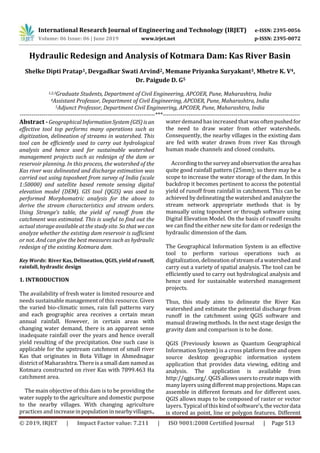
  • 1. International Research Journal of Engineering and Technology (IRJET) e-ISSN: 2395-0056 Volume: 06 Issue: 06 | June 2019 www.irjet.net p-ISSN: 2395-0072 © 2019, IRJET | Impact Factor value: 7.211 | ISO 9001:2008 Certified Journal | Page 513 Hydraulic Redesign and Analysis of Kotmara Dam: Kas River Basin Shelke Dipti Pratap1, Devgadkar Swati Arvind2, Memane Priyanka Suryakant3, Mhetre K. V4, Dr. Paigude D. G5 1,2,3Graduate Students, Department of Civil Engineering, APCOER, Pune, Maharashtra, India 4Assistant Professor, Department of Civil Engineering, APCOER, Pune, Maharashtra, India 5Adjunct Professor, Department Civil Engineering, APCOER, Pune, Maharashtra, India ---------------------------------------------------------------------***---------------------------------------------------------------------- Abstract -GeographicalInformationSystem(GIS)isan effective tool top performs many operations such as digitization, delineation of streams in watershed. This tool can be efficiently used to carry out hydrological analysis and hence used for sustainable watershed management projects such as redesign of the dam or reservoir planning. In this process, the watershed of the Kas river was delineated and discharge estimation was carried out using toposheet from survey of India (scale 1:50000) and satellite based remote sensing digital elevation model (DEM). GIS tool (QGIS) was used to performed Morphomatric analysis for the above to derive the stream characteristics and stream orders. Using Strange’s table, the yield of runoff from the catchment was estimated. This is useful to find out the actual storage available at the study site. So that we can analyze whether the existing dam reservoir is sufficient or not. And can give the best measures such as hydraulic redesign of the existing Kotmara dam. Key Words: River Kas, Delineation, QGIS, yield of runoff, rainfall, hydraulic design 1. INTRODUCTION The availability of fresh water is limited resource and needs sustainable management of this resource. Given the varied bio-climatic zones, rain fall patterns vary and each geographic area receives a certain mean annual rainfall. However, in certain areas with changing water demand, there is an apparent sense inadequate rainfall over the years and hence overall yield resulting of the precipitation. One such case is applicable for the upstream catchment of small river Kas that originates in Bota Village in Ahmednagar district of Maharashtra. There is a small dam named as Kotmara constructed on river Kas with 7899.463 Ha catchment area. The main objective of this dam is to be providing the water supply to the agriculture and domestic purpose to the nearby villages. With changing agriculture practices and increaseinpopulationinnearbyvillages., water demand has increased that was oftenpushedfor the need to draw water from other watersheds. Consequently, the nearby villages in the existing dam are fed with water drawn from river Kas through human made channels and closed conduits. According to thesurveyandobservationtheareahas quite good rainfall pattern (25mm); so there may be a scope to increase the water storage of the dam. In this backdrop it becomes pertinent to access the potential yield of runoff from rainfall in catchment. This can be achieved by delineating the watershed andanalyzethe stream network appropriate methods that is by manually using toposheet or through software using Digital Elevation Model. On the basis of runoff results we can find the either new site for dam or redesign the hydraulic dimension of the dam. The Geographical Information System is an effective tool to perform various operations such as digitalization, delineationofstreamofawatershedand carry out a variety of spatial analysis. The tool can be efficiently used to carry out hydrological analysis and hence used for sustainable watershed management projects. Thus, this study aims to delineate the River Kas watershed and estimate the potential discharge from runoff in the catchment using QGIS software and manual drawing methods. In the next stage design the gravity dam and comparison is to be done. QGIS (Previously known as Quantum Geographical Information System) is a cross platform free and open source desktop geographic information system application that provides data viewing, editing and analysis. The application is available from http://qgis.org/.QGISallowsuserstocreatemapswith many layers using different map projections. Mapscan assemble in different formats and for different uses. QGIS allows maps to be composed of raster or vector layers. Typical ofthiskindofsoftware’s,thevectordata is stored as point, line or polygon features. Different
  • 2. International Research Journal of Engineering and Technology (IRJET) e-ISSN: 2395-0056 Volume: 06 Issue: 06 | June 2019 www.irjet.net p-ISSN: 2395-0072 © 2019, IRJET | Impact Factor value: 7.211 | ISO 9001:2008 Certified Journal | Page 514 kinds of raster images are supported and the software cans geo-referenced images. 1.1 STUDY AREA Fig No.1: Google Earth View of Dam 1.2 OBJECTIVES 1. To calculate the actual geometric, hydrologicaland cost related data for existing dam. 2. To find out the catchment area for river Kas basin by toposheet and Digital Elevation Model (DEM). 3. To design the earthen dam on the basis of data collected. 4. To compare redesign parameters with respect to existing structure. 5. To suggest improvement measures to exiting dam 2. PROBLEM STATEMENT The rainfall occurringinexistingcatchmentareaofthe dam is heavy, whereas the storage capacity of the dam is not sufficient to store all the water available in the catchment area. 3. METHODOLOGY 3.1Data collection: we visited irrigation department at Sangamner taluka and collected existing dam details. 3.2 Rain fall assessment: from collected last five years rainfall data average annual rainfall was calculated. 3.3 Catchment area delineations: catchment area delineation was done by two methods that are by toposheet and by using QGIS software. 3.4 Redesign of dam: from data collection, rain fall assessment and catchment area delineation. It is observed that there is need of redesigning of dam. 3.5 Suggestions:Afteridentifyingcausesofaccidentson those black spots remedialmeasureswillbesuggested. 4. RESULT AND CONCLUSION 4.1 The catchment area obtained: The catchment area calculated by the software is 4.43% more than the catchment area calculated by manual toposheetmethod.QGISsoftwareusegoodand accurate resultsthanthemanualmethodwhichisopen source software available worldwide. Catchmentarea by toposheet method(sqkm) Catchment area by QGIS software method (sq km) % of increase in area 80.952 84.7 4.43 4.2 Factor of safety for various cases: We have started to increase the height of the dam by 3 meter then by 5 meter than existing condition of the dam. And the factor of safety obtained for these conditions are greater than minimum limit 1.35 for downstream side and 1.5 for upstream side which states that the dam is safe for respective scenarios. No. Height of Dam Trial no. 1 Trial no. 2 Trial no. 3 Remark 1 29.10M SAFE Upstream Dam 2.04 1.98 1.90 SAFE Downstream side 1.59 1.67 1.79 SAFE 2 32M Upstream side 2.1 2.3 2.5 SAFE Downstream side 1.648 1.749 1.81 SAFE 3 34M Upstream side 2.1 2.15 2.1 SAFE Downstream side 2.01 2.3 2.36 SAFE REFERENCES 1. Indra Prakash,NarendraJ.ShrimaliandUmang S. Visharolia (May-2017). “Watershed
  • 3. International Research Journal of Engineering and Technology (IRJET) e-ISSN: 2395-0056 Volume: 06 Issue: 06 | June 2019 www.irjet.net p-ISSN: 2395-0072 © 2019, IRJET | Impact Factor value: 7.211 | ISO 9001:2008 Certified Journal | Page 515 Delineation of Purna River using Geographical Information System (GIS).”4(5), 690-695. 2. B. Kaviya, Omkumar, Ram Chandra Verma, Ramesh Kumar Ram, Ritesh Pal Singh (2017). “Watershed Delineation using GIS in Selaiyur Area.”116(13), 417-423. 3. Muhammad Jehanzeb Masud and Wim G. M. Bastiaanssen (Dec-2017). 351-373. 4. Arbind K. Verma and Madan K. Jha (July-2017). “Extraction of Watershed Characteristicsusing GIS and Digital Elevation Model.” 6(7), 1-6. 5. Shweta Ramchandra Nale (May-2017). “Identification, Delineation and mapping of micro watershed of Kaneri.” 5(5), 2147-2153. 6. A. Krishnakumar, Revathy Das and Dhanya. T. Dharan (Nov-2017). “Land Cover Change Analysis with Special Reference to Forests and PaddyWetlandsofNeyyarandRiverKaramana Basin, Kerala, SW India Using GIS and Remote Sensing.”7(11), 190-198. 7. Viswanathan K. E., Manikandan M., Bharanitharan S.(June-2015). “Watershed Delineation for Varahanadhi Basin Using OpensourceGeospatialTechnology.”2(6),7-13. 8. Chaya G. Manju Naik andPravinKumar(2014). “Water Resource Management in Hassan District using Arc GIS.” 9. Sampad Kumar Panda, B. Sukumar (2010). “DelineationofAreasforwaterConservationin Peruvamba River Basin, Kannur District, Kerala, Using Remote Sensing and GIS.” 1(1), 76-83. 10. N. Donia (2009). “Application of Remotely Sensed Imagery to Watershed Analysis; A Case Study of Lake Karoun Catchment,Egypt.”1035- 1049 11. M. A. E. Bastawesy, R. R. Ali and A. H. Nasr (2008). “The use of Remote SensingandGISfor Catchment Delineation in NW Coast of Egypt: An assessment of Water Resource and Soil Potential.” 11, 3-16. 12. Pandey, V. K., Pandey, A. and Panda, S. N. (2007).“ApplicationofRemoteSensingandGIS for Watershed Characterization.” 7(1), 3-15. 13. S.Srinivasa Vittala, S. Govindaiah and H. Honne Gowda (2006). “Digital ElevationModel(DEM) for Identification of Ground Water Prospective Zones.”34(3),306-310. 14. Maathuis, B. H. P. (2006). “Digital Elevation Model Based Hydro-processing.”21, 21-26. 15. Takahiro Sayama, Yasuto Tachikawa, Kaoru Takara and Yutaka Ichikawa (April-2005). “Distributed Rainfall- RunoffAnalysisinaFlow RegulatedBasinHavingMultipleMulti-Purpose Dams.” 371-381. 16. Singh, R., Tiwari, K. N. and Mal, B. C. (2005). “Hydrological Studies for Small Watershed in India Using the ANSWERS model.”318, 184- 199. 17. Gangodagamane Chandana (2001). “Hydrological Modeling using remote sensing and GIS”. Asian Conference on remote sensing, 5-9, Singapore- Centre for remote Imaging and sensing and processing (CRISP). 18. Hase Hideaki and Taro Tonegawa, Furuta Hitoshi. (1996) “Application of genetic algorithm to aesthetic design of dam structures.”