SlideShare a Scribd company logo
1 of 11
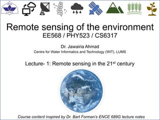
Remote sensing of the environment
EE568 / PHY523 / CS6317
Dr. Jawairia Ahmad
Centre for Water Informatics and Technology (WIT), LUMS
Lecture- 1: Remote sensing in the 21st century
Course content inspired by Dr. Bart Forman’s ENCE 689G lecture notes
Remote sensing of the environment- Spring 2022
Topics covered
1
Assignment
Supplementary video
 Syllabus
 Introduction to remote sensing
 Motivating questions
 Implications for society
 Earth observing satellite constellations
 Questionnaire
Remote sensing of the environment- Spring 2022
Syllabus
2
Course outline
Course website: https://wit.lums.edu.pk/EE568
Classroom Dos and Don'ts
- No cheating or plagiarism
- Be respectful towards the instructor and your fellow students
- No eating
- Please keep your cellphone on silent
- Please submit your assignment on time; late submissions will not be accepted
- For any queries, please avail the office hours
Remote sensing of the environment- Spring 2022
Introduction to remote sensing
3
Remote sensing:
Remote sensing is the process of detecting and monitoring the physical characteristics of an
area by measuring its reflected and emitted radiation at a distance (typically from satellite or
aircraft). Special cameras collect remotely sensed images, which help researchers "sense"
things about the Earth. (USGS)
Remote sensing is the acquiring of information from a distance..... using sensors aboard
satellites and aircraft that detect and record reflected or emitted energy. (NASA)
Image credit: NASA Earthdata
Remote sensing of the environment- Spring 2022
Motivating questions
4
Why remote sensing?
 Access to inaccessible regions
 Real-time or near real-time global information
 Global analysis
 Proxy for missing ground information
Historical perspective
 Driven by military application during WWI- airplane photography
 WWII- research and development
 Space race- USA vs. Soviet union
 First land surface satellite- LANDSAT-1 launched in July 1972
Remote sensing of the environment- Spring 2022
Implications for society
5
Clouds
Fires
Land use/ change
Photo credit: NASA
Topography
Ocean floor Agriculture
Remote sensing of the environment- Spring 2022
Earth observing satellites
6
Photo credit: NASA
Remote sensing of the environment- Spring 2022
Earth observing satellites- Pakistan
7
Pakistan Space and Upper Atmosphere Research Organization (SUPARCO)
established 1961
Testing indigenous capabilities- Badr-1 and Badr-B
Commercial use (broadcasting, broadband, Mobile Back-hauling, etc.)
PakSAT-1R
PakSAT-MM1
PakSAT-MM1R
Commercial/ Federal use
PRSS-1
PakTES-1A
Future
PRSC-EOS
Remote sensing of the environment- Spring 2022
Key concepts of remote sensing
8
Physical objects
Sensor data
Information extraction from
remotely sensed data
Applications (e.g.,
hydrology, atmospheric
analysis, vegetation,
topography
Flowchart adapted from Campbell and Wynne (2011)
Remote sensing of the environment- Spring 2022
Questionnaire
9
Please fill out the questionnaire
Remote sensing of the environment- Spring 2022
Point to ponder on ….
10
What happens to satellites after they stop working?

More Related Content

Similar to Lecture1_EE568.pptx

Twinsat presentation
Twinsat presentationTwinsat presentation
Twinsat presentation
GEOSCAN
 
Indian remote sensing satellite mission
Indian remote sensing satellite missionIndian remote sensing satellite mission
Indian remote sensing satellite mission
adevekar
 
WE4.L10.1: OPERATIONAL ENVIRONMENTAL DATA IN 2010: CONNECTING GLOBAL AND LOCA...
WE4.L10.1: OPERATIONAL ENVIRONMENTAL DATA IN 2010: CONNECTING GLOBAL AND LOCA...WE4.L10.1: OPERATIONAL ENVIRONMENTAL DATA IN 2010: CONNECTING GLOBAL AND LOCA...
WE4.L10.1: OPERATIONAL ENVIRONMENTAL DATA IN 2010: CONNECTING GLOBAL AND LOCA...
grssieee
 

Similar to Lecture1_EE568.pptx (20)

MODIS (Moderate Resolution Imaging Spectrometer)
MODIS (Moderate Resolution Imaging Spectrometer)MODIS (Moderate Resolution Imaging Spectrometer)
MODIS (Moderate Resolution Imaging Spectrometer)
 
Twinsat presentation
Twinsat presentationTwinsat presentation
Twinsat presentation
 
Remort sensing
Remort sensingRemort sensing
Remort sensing
 
Remote Sensing and its Applications in Agriculture
Remote Sensing and its Applications in AgricultureRemote Sensing and its Applications in Agriculture
Remote Sensing and its Applications in Agriculture
 
Remote Sensing_2020-21 (1).pdf
Remote Sensing_2020-21  (1).pdfRemote Sensing_2020-21  (1).pdf
Remote Sensing_2020-21 (1).pdf
 
Minning Application and Remote Sensing Using Aster Imagery
Minning Application and Remote Sensing Using Aster ImageryMinning Application and Remote Sensing Using Aster Imagery
Minning Application and Remote Sensing Using Aster Imagery
 
Indian remote sensing satellite mission
Indian remote sensing satellite missionIndian remote sensing satellite mission
Indian remote sensing satellite mission
 
Sensornets and Global Change
Sensornets and Global ChangeSensornets and Global Change
Sensornets and Global Change
 
Concept of remote sensing
Concept of remote sensingConcept of remote sensing
Concept of remote sensing
 
2014_Remote Sensing.pptx
2014_Remote Sensing.pptx2014_Remote Sensing.pptx
2014_Remote Sensing.pptx
 
WE4.L10.1: OPERATIONAL ENVIRONMENTAL DATA IN 2010: CONNECTING GLOBAL AND LOCA...
WE4.L10.1: OPERATIONAL ENVIRONMENTAL DATA IN 2010: CONNECTING GLOBAL AND LOCA...WE4.L10.1: OPERATIONAL ENVIRONMENTAL DATA IN 2010: CONNECTING GLOBAL AND LOCA...
WE4.L10.1: OPERATIONAL ENVIRONMENTAL DATA IN 2010: CONNECTING GLOBAL AND LOCA...
 
Scientific platforms
Scientific platformsScientific platforms
Scientific platforms
 
Remote sensing and Gis
Remote sensing and GisRemote sensing and Gis
Remote sensing and Gis
 
Remote sensing
Remote sensingRemote sensing
Remote sensing
 
AAS National Conference 2008: Graham Gibbs
AAS National Conference 2008: Graham GibbsAAS National Conference 2008: Graham Gibbs
AAS National Conference 2008: Graham Gibbs
 
Monitoring Oceans - Chris Atherton - SRD23
Monitoring Oceans - Chris Atherton - SRD23Monitoring Oceans - Chris Atherton - SRD23
Monitoring Oceans - Chris Atherton - SRD23
 
rs&gis-theena.pptx
rs&gis-theena.pptxrs&gis-theena.pptx
rs&gis-theena.pptx
 
Geo imaging satellite
Geo imaging satelliteGeo imaging satellite
Geo imaging satellite
 
Geo Stationary Earth Orbit imaging satellite
Geo Stationary Earth Orbit imaging satelliteGeo Stationary Earth Orbit imaging satellite
Geo Stationary Earth Orbit imaging satellite
 
Introduction to Remote Sensing
Introduction to Remote SensingIntroduction to Remote Sensing
Introduction to Remote Sensing
 

Recently uploaded

Harnessing Passkeys in the Battle Against AI-Powered Cyber Threats.pptx
Harnessing Passkeys in the Battle Against AI-Powered Cyber Threats.pptxHarnessing Passkeys in the Battle Against AI-Powered Cyber Threats.pptx
Harnessing Passkeys in the Battle Against AI-Powered Cyber Threats.pptx
FIDO Alliance
 
CORS (Kitworks Team Study 양다윗 발표자료 240510)
CORS (Kitworks Team Study 양다윗 발표자료 240510)CORS (Kitworks Team Study 양다윗 발표자료 240510)
CORS (Kitworks Team Study 양다윗 발표자료 240510)
Wonjun Hwang
 

Recently uploaded (20)

The Zero-ETL Approach: Enhancing Data Agility and Insight
The Zero-ETL Approach: Enhancing Data Agility and InsightThe Zero-ETL Approach: Enhancing Data Agility and Insight
The Zero-ETL Approach: Enhancing Data Agility and Insight
 
Working together SRE & Platform Engineering
Working together SRE & Platform EngineeringWorking together SRE & Platform Engineering
Working together SRE & Platform Engineering
 
How we scaled to 80K users by doing nothing!.pdf
How we scaled to 80K users by doing nothing!.pdfHow we scaled to 80K users by doing nothing!.pdf
How we scaled to 80K users by doing nothing!.pdf
 
Six Myths about Ontologies: The Basics of Formal Ontology
Six Myths about Ontologies: The Basics of Formal OntologySix Myths about Ontologies: The Basics of Formal Ontology
Six Myths about Ontologies: The Basics of Formal Ontology
 
How to Check GPS Location with a Live Tracker in Pakistan
How to Check GPS Location with a Live Tracker in PakistanHow to Check GPS Location with a Live Tracker in Pakistan
How to Check GPS Location with a Live Tracker in Pakistan
 
2024 May Patch Tuesday
2024 May Patch Tuesday2024 May Patch Tuesday
2024 May Patch Tuesday
 
Introduction to use of FHIR Documents in ABDM
Introduction to use of FHIR Documents in ABDMIntroduction to use of FHIR Documents in ABDM
Introduction to use of FHIR Documents in ABDM
 
Observability Concepts EVERY Developer Should Know (DevOpsDays Seattle)
Observability Concepts EVERY Developer Should Know (DevOpsDays Seattle)Observability Concepts EVERY Developer Should Know (DevOpsDays Seattle)
Observability Concepts EVERY Developer Should Know (DevOpsDays Seattle)
 
Easier, Faster, and More Powerful – Notes Document Properties Reimagined
Easier, Faster, and More Powerful – Notes Document Properties ReimaginedEasier, Faster, and More Powerful – Notes Document Properties Reimagined
Easier, Faster, and More Powerful – Notes Document Properties Reimagined
 
الأمن السيبراني - ما لا يسع للمستخدم جهله
الأمن السيبراني - ما لا يسع للمستخدم جهلهالأمن السيبراني - ما لا يسع للمستخدم جهله
الأمن السيبراني - ما لا يسع للمستخدم جهله
 
WebRTC and SIP not just audio and video @ OpenSIPS 2024
WebRTC and SIP not just audio and video @ OpenSIPS 2024WebRTC and SIP not just audio and video @ OpenSIPS 2024
WebRTC and SIP not just audio and video @ OpenSIPS 2024
 
Harnessing Passkeys in the Battle Against AI-Powered Cyber Threats.pptx
Harnessing Passkeys in the Battle Against AI-Powered Cyber Threats.pptxHarnessing Passkeys in the Battle Against AI-Powered Cyber Threats.pptx
Harnessing Passkeys in the Battle Against AI-Powered Cyber Threats.pptx
 
Vector Search @ sw2con for slideshare.pptx
Vector Search @ sw2con for slideshare.pptxVector Search @ sw2con for slideshare.pptx
Vector Search @ sw2con for slideshare.pptx
 
Google I/O Extended 2024 Warsaw
Google I/O Extended 2024 WarsawGoogle I/O Extended 2024 Warsaw
Google I/O Extended 2024 Warsaw
 
AI in Action: Real World Use Cases by Anitaraj
AI in Action: Real World Use Cases by AnitarajAI in Action: Real World Use Cases by Anitaraj
AI in Action: Real World Use Cases by Anitaraj
 
Overview of Hyperledger Foundation
Overview of Hyperledger FoundationOverview of Hyperledger Foundation
Overview of Hyperledger Foundation
 
Intro to Passkeys and the State of Passwordless.pptx
Intro to Passkeys and the State of Passwordless.pptxIntro to Passkeys and the State of Passwordless.pptx
Intro to Passkeys and the State of Passwordless.pptx
 
CORS (Kitworks Team Study 양다윗 발표자료 240510)
CORS (Kitworks Team Study 양다윗 발표자료 240510)CORS (Kitworks Team Study 양다윗 발표자료 240510)
CORS (Kitworks Team Study 양다윗 발표자료 240510)
 
UiPath manufacturing technology benefits and AI overview
UiPath manufacturing technology benefits and AI overviewUiPath manufacturing technology benefits and AI overview
UiPath manufacturing technology benefits and AI overview
 
ERP Contender Series: Acumatica vs. Sage Intacct
ERP Contender Series: Acumatica vs. Sage IntacctERP Contender Series: Acumatica vs. Sage Intacct
ERP Contender Series: Acumatica vs. Sage Intacct
 

Lecture1_EE568.pptx

  • 1. Remote sensing of the environment EE568 / PHY523 / CS6317 Dr. Jawairia Ahmad Centre for Water Informatics and Technology (WIT), LUMS Lecture- 1: Remote sensing in the 21st century Course content inspired by Dr. Bart Forman’s ENCE 689G lecture notes
  • 2. Remote sensing of the environment- Spring 2022 Topics covered 1 Assignment Supplementary video  Syllabus  Introduction to remote sensing  Motivating questions  Implications for society  Earth observing satellite constellations  Questionnaire
  • 3. Remote sensing of the environment- Spring 2022 Syllabus 2 Course outline Course website: https://wit.lums.edu.pk/EE568 Classroom Dos and Don'ts - No cheating or plagiarism - Be respectful towards the instructor and your fellow students - No eating - Please keep your cellphone on silent - Please submit your assignment on time; late submissions will not be accepted - For any queries, please avail the office hours
  • 4. Remote sensing of the environment- Spring 2022 Introduction to remote sensing 3 Remote sensing: Remote sensing is the process of detecting and monitoring the physical characteristics of an area by measuring its reflected and emitted radiation at a distance (typically from satellite or aircraft). Special cameras collect remotely sensed images, which help researchers "sense" things about the Earth. (USGS) Remote sensing is the acquiring of information from a distance..... using sensors aboard satellites and aircraft that detect and record reflected or emitted energy. (NASA) Image credit: NASA Earthdata
  • 5. Remote sensing of the environment- Spring 2022 Motivating questions 4 Why remote sensing?  Access to inaccessible regions  Real-time or near real-time global information  Global analysis  Proxy for missing ground information Historical perspective  Driven by military application during WWI- airplane photography  WWII- research and development  Space race- USA vs. Soviet union  First land surface satellite- LANDSAT-1 launched in July 1972
  • 6. Remote sensing of the environment- Spring 2022 Implications for society 5 Clouds Fires Land use/ change Photo credit: NASA Topography Ocean floor Agriculture
  • 7. Remote sensing of the environment- Spring 2022 Earth observing satellites 6 Photo credit: NASA
  • 8. Remote sensing of the environment- Spring 2022 Earth observing satellites- Pakistan 7 Pakistan Space and Upper Atmosphere Research Organization (SUPARCO) established 1961 Testing indigenous capabilities- Badr-1 and Badr-B Commercial use (broadcasting, broadband, Mobile Back-hauling, etc.) PakSAT-1R PakSAT-MM1 PakSAT-MM1R Commercial/ Federal use PRSS-1 PakTES-1A Future PRSC-EOS
  • 9. Remote sensing of the environment- Spring 2022 Key concepts of remote sensing 8 Physical objects Sensor data Information extraction from remotely sensed data Applications (e.g., hydrology, atmospheric analysis, vegetation, topography Flowchart adapted from Campbell and Wynne (2011)
  • 10. Remote sensing of the environment- Spring 2022 Questionnaire 9 Please fill out the questionnaire
  • 11. Remote sensing of the environment- Spring 2022 Point to ponder on …. 10 What happens to satellites after they stop working?