Orange County Great Park & Neighborhoods - Sustainable Features and Design Elements
•Download as PPTX, PDF•
1 like•2,532 views

Presentation by Darlene Nicandro, Principal Planner at the City of Irvine, at the ASCE-OC "Sustainability in Site Development" seminar held in October 2015.

Recommended
Recommended
More Related Content
What's hot
What's hot (20)
Similar to Orange County Great Park & Neighborhoods - Sustainable Features and Design Elements
Similar to Orange County Great Park & Neighborhoods - Sustainable Features and Design Elements (20)
More from American Society of Civil Engineers, Orange County Branch
More from American Society of Civil Engineers, Orange County Branch (20)
Recently uploaded
Recently uploaded (20)
Orange County Great Park & Neighborhoods - Sustainable Features and Design Elements
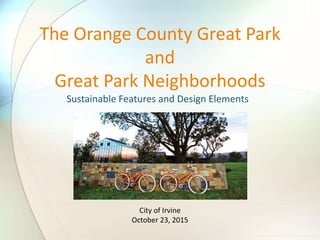
- 1. Sustainable Features and Design Elements The Orange County Great Park and Great Park Neighborhoods City of Irvine October 23, 2015
- 2. • Overview • Former Marine Corps Air Station El Toro • Great Park Neighborhoods • Orange County Great Park • Quiz Agenda
- 3. Project Location 51 Planning Area 51 – Orange County Great Park
- 4. District 5 IRVINE BLVD District 7 Portola High School COI OCGP 688-ac Future Broadcom TRABUCO RD MARINE WAY CULTIVATE RIDGEVALLEY District 1-North District 1-South District 4 Senior Affordable “C”ST 8TH ST District 2 COI Wildlife CorridorFuture Cultural Terrace OCGP (“Western Sector”) Civic Site Marshburn Basin “LV” ST BOSQUE OCTA 21.3 ac. Planning Area 6 UC Regents FAA FAA District 6 County Property Upper Bee Bosque Sports Park District 8 [Completed in 2015] Planning Area 35 ALTONPKWY SCE
- 5. Former Marine Corps Air Station El Toro
- 10. District 8: Pavilion Park
- 11. • Bike pavilion • Community greenhouse • Pool and spa • Playground and tot lot • Arts house • Bocce ball court • Neighborhood gathering spaces • Walkable trails • Natural looking landscaping with relocated “Heritage Trees” • Tree-lined shaded streets
- 18. District 1: Beacon Park
- 27. • 2,000,000-square foot research and development campus • 78.5 gross acres • Development District 3 District 3: Broadcom Campus
- 28. • Area-wide employment center • Low- and mid-rise buildings • High tech, manufacturing, research and development, and office-style businesses DISTRICT 3
- 30. • Alternate Modes of Transportation • Sidewalks, Trails, Bicycle Lanes, Planned Transit • Retail Opportunities 8’ sidewalk 11’ Bike Trail Class II Bike Lane 8’ Class II Bike Lane Existing Proposed Community Commercial ParkPark District 4
- 31. Reuse of Existing Facilities • 39,150 SF single-story building • 2,400 SF roof top deck • Seven Quonset-style huts • Sustainable alternative to new construction Existing Warehouse 415 Proposed Warehouse 415
- 34. Agriculture
- 36. Reuse of Existing Buildings
- 40. Water Quality
- 44. QUIZ TIME!
- 45. 1. Which of the following is an example of Green Infrastructure and Buildings? a) Going up in the Orange Balloon b) Reuse of existing Warehouse 415 for commercial uses? c) Designing tree-lined and shaded streets
- 46. 2. Which of the following is an example of Neighborhood Pattern and Design? a) Stormwater management b) Infrastructure energy efficiency c) Open community interconnected by a series of pedestrian and bicycle trails, as delineated in the approved Great Park Master Landscape and Trails Plan
- 47. 3. Which of the following is an example of Smart Location and Linkage? a) The Great Park Farm and Food Lab as a local, sustainable food source b) Long-term conservation management of bobcats and coyotes within the Great Park Wildlife Corridor c) Close proximity between housing and jobs (i.e. Broadcom)
Editor's Notes
- Took themes from the Neighborhood Development Project Scorecard
- Smart Location Close to major freeways and toll roads Located on the former Marine Corps Air Station El Toro; bounded by Interstate 5 to the south, the Eastern Transportation Corridor (State Route 133) to the west, Irvine Blvd to the north, and City of Lake Forest to the east
- 9500 residential units and non-residential such as medical and science, community commercial, institutional/childcare, office, public facilities, and multiuse Eight development districts within Planning Area 51 outlined in the Zoning Ordinance Redevelopment of a former Marine base- re-purposing land that has been abandoned for years. Surrounded by a variety of land uses- residential, neighborhood retail/commercial use, open space, office, industrial…
- Construction of MCAS El Toro began in 1942 Base originally built as a wartime air station for the purpose of aircraft squadron formation and unit training prior to overseas combat Decommissioned in 1943 During peacetime, the base served the country as a training facility in peacetime and staging area for support of overseas military missions in times of conflict Based formally closed in 1999 Political efforts to turn this area into international airport Voters approved Measure W to amend the County of Orange General Plan and create a park Disposal of the base by means of public auction In February 2005, Heritage Fields El Toro, LLC purchased the project site and subsequently began its master planning process
- Existing runways are located on a substantial portion of the site planned for open space and related uses, including runways, aprons and associated taxiways To reuse the site for urban purposes, the runways are being removed, crushed, and when feasible, are uses as aggregate base or recycled for other roadway or development uses Large slabs of concrete from the demolished runways, dubbed “El Toro Stone,” are being recycled in a variety of ways throughout the site, including stacked for retaining walls and waterfalls, creating bobcat dens, as well as laid down for trail steps. Gravels and cobbles are also reused as roadbed support and a variety of other applications. Example of Brownfield redevelopment: Residual soil contamination exists on portions of the property from its previous use as a military facility Applicant submits documentation and or analysis demonstrating that any residual levels of soil contamination is safe for human activity for the intended use of that site, as defined by state and federal standards and the City’s past development review practices
- Connectivity: Master Landscape and Trails Plan: detailed exhibit showing potential trail connections on site to the City’s existing or planned regional trail network Comprehensive trails network, including class I off street trails and other off-street trails that will link to regional trails and open space opportunties, nearby train station
- Walkable streets, compact development, nearby transit facilities, treelined streets to provide ample shade
- Opened in 2013 726 total residential units Variety of amenities provided to residents
- Apparently the bike pavilion is used by non-residents you stop their to relax and fill up on the free air and relaxing atmosphere- saw that on yelp This neighborhood creates the feel of ‘sense-of place’ and is desirable to hang out in.
- Bike pavilion; orange bikes Orange Bike Program: bike share program incorporated into the development; emphasis on connecting the Great Park Neighborhoods to the Great Park; promoted through the home sales program Get bike with buying new home
- Greenhouse within District 8
- Rooftop solar = standard Wind generation opportunites To the extent feasible, the developer is required to install electric vehicle charging stations at the commercial retail components of the project in District 1 North and District 4
- Refill your water bottle Recycle items
- Senior Housing Affordable Housing (apartments) Attached and Detached Condos Promote diversity of housing types to accommodate a range of economic levels and age groups to live within a community
- District 1: Mixed use community with variety of land uses Modified grid network, creating multiple vehicular, bike, and pedestrian routes Tree lined streets with wide landscaped parkways Small scale community atmosphere
- Six private neighborhood parks All District 1-North residents located within ½ mile from park amenities
- This next slide demonstrates that the modification to District 1-North is still in keeping with the vision of the Great Park Neighborhood by encouraging walkability and alternative modes of transportation. Sidewalks, Trails, Bicycle Lanes, and Planned Transit Continuous sidewalk network provides access throughout District 1-North Pedestrian cut-throughs within product types Off-street trail network eventually links residents to Woodbury Town Center, OCGP, and overall City off-street trail network Non-vehicular connectivity within District 1-North is well-served through a hierarchy of pedestrian sidewalks, trails and bicycle lanes. Specifically, there are Class 1 off-street trails along the northern, and western boundaries of the project site, via Ridge Valley and Cadence that lead to other trails networks outside the Great Park Neighborhoods and the future trail network of the OCGP.
- Taller buildings
- Higher density
- The project site is located within both the Irvine Unified School District and Saddleback Valley Unified School District Construction of K-8 school, shown here Portola Highschool currently completing construction
- Bounded by Barranca Parkway to the north, Alton Parkway to the south, existing Alton Plaza business park to the west, and will be bisected by a segment of Marine Way Previously used for agricultural purposes Project spans over a portion of Marine Way with grade-separated crossings for vehicles and pedestrians over the road, creating a walkable, cohesive, integrated campus environment
- 28
- District 4 will have walkable neighborhoods with sidewalks, Trails, Bicycle Lanes, There is a trail extending from District 1-North through the Upper Bee, along Benchmark that goes through the central park and on to the Warehouse area Sidewalk provides access through the middle of District 4 and includes link to private parks. Pedestrian cut-throughs The trails will connect students to the Beacon Park School and Portola H.S. currently under construction
- An added feature to District 4 is the inclusion of Warehouse 415. Warehouse 415 is an existing structure that is intended for re-use for community event space, flex space, and a market hall similar to other redeveloped buildings throughout Southern California. Located in close proximity to Irvine Boulevard, the 39,150 sq. ft., single story building will include a 2,400 sq. ft. roof top deck. Proposes seven Quonset huts, a café, and bike hut on the Community Commercial site. The reuse of Warehouse 415 is a sustainable alternative to new construction. And the adding the Quonset huts is a nod to the military heritage of the overall development.
- Intended to be a multidestination facilty that will include a variety of educational and recreational activities, including sports fields, museums, gardens, trails, wildlife habitat
- Exclusive public-private partnership between the City of Irvine and Five Point Communities Runways, buildings, and roads are being demolished to allow room for: Residential Neighborhoods Park land, including the Upper Bee, Bosque, Agua Chinon, and Wildlife Corridor. Recreation Opportunities including, the Orange County Great Park Sports Park, a golf course, and various walking and biking trails Agricultural land Community commercial Upper Bee: passive park feature starting at Irvine Blvd to the north and connecting to the Bosque at the south; includes a series of trails, Class I (off-street) bike trail to pedestrian paths, winding through earthen mounds similar to those found in the Jeffrey Open Space Trail Grade separated undercrossings Bosque: pocket parks, childrens play area, pedestrian and bike trails; relocated Food and Farm lab, picnic pavilions, bike pavilions, dog park
- Agriculture is an integral component of the Great Park: Long before it was a military air base, MCAS El Toro was the largest lima bean field in North America 105-acre Great Park Farm consists of citrus and avocado groves, california native gardens, fruit and nut trees, Farm and food lab is an educational facility
- Agriculture is an integral component of the Great Park: Long before it was a military air base, MCAS El Toro was the largest lima bean field in North America 105-acre Great Park Farm consists of citrus and avocado groves, california native gardens, fruit and nut trees, Farm and food lab is an educational facility Approximately 114 acres of interim agriculture is currently being cultivated and in partnerships with farmers, has grown and donated over 100 tons of fresh produce to local food banks and families Staffed by University of California Cooperative Extension Master Gardeners, the two acre Food and Farm Lab is a unique and interactive outdoor classroom for visitors of all ages, featuring themed raised bed gardens, fruit trees, vertical gardening, a chicken coop, worm compost bin, solar and wind powered lights, and now honey bee exposition Themes included pizza and spaghetti garden, showing how ingredients and toppings look before they are made into sauce Farmers Market: Each Sunday, fruits and vegetables sold are grown by local farmers and food vendors, artisans, live entertainment
- Hangar 244
- Focused around educating the youth about conservation ecology and the water cycle Misting shade structures, climbing rocks, “underground tunnels,” seating area made from recycled runway concrete, illustrated lakes and streams on recycled rubber flooring come together to form and educationally unique and environmentally conscious space
- Obligation to maintain clean water for future generations The South Lawn Sports and Fitness Complex features a sophisticated water management system designed to supplement the South Lawn’s irrigation needs The system captures, filters, and stores storm water in four retention ponds on the South Lawn. Has the capacity for more than five million gallons of storm water storage
- Long term conservation management of species One of the most practical and effective measures to maintain wildlife in urban settings is establishing linkages between the coast and inland areas, across potential barriers, such as roadways and developments A wildlife corridor, habitat corridor, or green corridor is an area of habitat connecting wildlife populations separated by human activities or structures (such as roads, development, or logging) Located adjacent to the Borrego Channel Vary in width from 330 feet to an estimated 955 feet Habitat area intended to provide a natural setting to promote biodiversity, wildlife migration, and maintenance of natural resources Human interaction in limited to emergency, maintenance, and scientific monitoring activities; no public access allowed Functional connectivity for bobcats and coyotes to facilitate movement through the corridor that would foster foraging and breeding sites Critical to facilitate the exchange of genetic material among otherwise isolated populations
- Since 2013, the Great Park was a host for the US Department of Energy Solar Decathlon; showcased cutting edge ideas and technologies for sustainability and resource efficiency
- Solar Decathlon: visitors tour highly efficient, solar powered competition houses, and the XPO, a clean and renewable energy exposition that feature visionary and innovative clean energy companies, products and educational opportunties
- Agriculture is an integral component of the Great Park: Long before it was a military air base, MCAS El Toro was the largest lima bean field in North America 105-acre Great Park Farm consists of citrus and avocado groves, california native gardens, fruit and nut trees, Farm and food lab is an educational facility Approximately 114 acres of interim agriculture is currently being cultivated and in partnerships with farmers, has grown and donated over 100 tons of fresh produce to local food banks and families Staffed by University of California Cooperative Extension Master Gardeners, the two acre Food and Farm Lab is a unique and interactive outdoor classroom for visitors of all ages, featuring themed raised bed gardens, fruit trees, vertical gardening, a chicken coop, worm compost bin, solar and wind powered lights, and now honey bee exposition Themes included pizza and spaghetti garden, showing how ingredients and toppings look before they are made into sauce Farmers Market: Each Sunday, fruits and vegetables sold are grown by local farmers and food vendors, artisans, live entertainment