Mongolia
•
3 likes•2,623 views

http://www.fao.org/globalsoilpartnership This presentation was made during the Asian Soil Partnership workshop that took place in Bangkok, Thailand 13-15 May 2015. This presentation was made by Ochirbat Batkhishig, and it presents Soils of Mongolia. ©FAO: http://www.fao.org

Recommended
More Related Content
What's hot
What's hot (20)
Viewers also liked
Viewers also liked (15)
Similar to Mongolia
Similar to Mongolia (20)
More from FAO
More from FAO (20)
Recently uploaded
Recently uploaded (20)
Mongolia
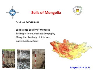
- 1. Soils of Mongolia Ochirbat BATKHISHIG Soil Science Society of Mongolia Soil Department, Institute Geography Mongolian Academy of Sciences batkhishig@gmail.com Bangkok 2015. 05.13
- 2. Topics • Mongolian Soil resources • Soil database development • Soil conservation problems
- 3. Mongolia is Central Asian country, extra-continental climate conditions. Area 1 569 sq. km. Population 3.0 mln. Average elevation is 1580 meter a.s.l. Precipitation about 200 - 300 mm in year South Gobi desert areas less than 100 mm •January average air temperature -20o C •July average air temperature +20о С Transition from Siberian taiga to Steppe and Gobi desert Forest 8% Cultivated land 1% Grazing land 74% other 17%
- 4. Specific of soil properties of Mongolia • High elevation of territory and sporadically distribution of permafrost. More than 80% of territory of Mongolia is higher than 1000 m above sea level • Domination of soil forming process in the minus temperature, short biological active period, 3-5 month in year • Mountain, Forest, Steppe and Desert soils presented • Slow process of chemical weathering and clay formation • Carbonate accumulation in the steppe soils • Gypsum in the Gobi desert soils • Stony soil profile and Organic accumulation layer • Paleo-cryomorphic features in the soil profile
- 5. Soil geographical regions Khangai region: Steppe, Meadow and Forest soils Gobi region: Desert-steppe and Desert soils
- 6. Forest-taiga soil Central Khentei mountain
- 9. Gobi desert Brown soil
- 10. Mountain tundra 8% Forest taiga soil 9% Stony Chernozem 7% Stony Dark Kastanozem 15% Chernozem 1% Dark Kastanozem 10% Kastanozem 13% Stony Gobi Brown 3% Gobi Brown 14% Desert Gypsic 11% Salty soils 3% Sand 2% Peat cryomorphic 2% Alluvial 2% Soil resource of Mongolia 1.8 2.2 8.0 9.5 32.6 46.0 Peat cryomorphic Alluvial Mountain tundra Forest taiga soil Gobi desert soil Steppe soil
- 11. Soil database of Mongolia Soil map data Whole country scale 1 : 500 000, 1 : 1 000 000, 1 : 2 500 000, Central, north regions, scale 1 : 200 000, 1 : 100 000 Soil pedon data Hard copy (More than 10 000 soil profile data) Digital format Excel, Access Soil data (mostly in Mongolian and Russian lang.)
- 12. Soil map database of Mongolia • Bespalov N D, Soil map of Mongolia, 1951. Scale 1 : 5 000 000 • Andreev S I, Soil of Buyant river delta area, 1936 • Land Authority Office data 1970-1980 – Soil map 1 : 500 000, • Soil map of Mongolia, scale 1:2 500 000, 1980 • Soil map of Mongolia, scale 1 : 1 000 000. 1981 – Using air photos Before 2000 After 2000 Most soil maps on hardcopy Digital soil maps Soil maps of different regions of Mongolia Soil map of Mongolia, scale 1: 500 000, 2013. IG MAS
- 13. Converting existing soil maps to the digital format Source data Soil maps of Mongolia , scale 1 : 1 000 000, 1981 Soil maps of Mongolia , scale 1 : 2 500 000, 1979 Soil map of different regions, scale 1 : 100 000, 1 : 200 000 Software ARC Map 10.1 ERDAS Imagine 9.2 SOIL MAPPING OF MONGOLIA
- 14. Compiling New soil maps in different regions of Mongolia
- 15. ArcGIS ArcMap 10.1Soil mapping methods
- 16. Soil pedon data before 2000 • Morphological characteristics • Soil horizon thickness • General chemical properties – Organic content, pH, Calcium carbonate, exchangeable Ca, Mg, texture • No coordinate location (example: west to soum center 10 km) • Not data about water physical properties – Only soil texture (Russian classification, Kachinskii) – Not much data about soil stone gravel content • Soil fine material less than 1 mm (Russian) • International standard is less than 2 mm. Data available Data lack
- 17. Mongolian soils divided by 2 parts • Mountain soil • Plain and intermountain valley soils Distinguished 36 types Soil classification of Mongolia • Mongolia used geographical-genetical classification system, like Russian. • Now renewing classification system
- 19. Soil degradation Climate warming impact • Soil cover drying, compacting and, sealing • Soil organic decay acceleration • Surface runoff increase due of topsoil compaction and sealing, furthermore linear erosion expanding, creating gullies and channels • Soil water capacity decrease • Soil salting Human impact • Agriculture soil fertility loss • Overgrazing • Mining • Road erosion • Forest cut
- 20. Agriculture soil degradation • Total 0,7 million hectare area not more used as a result of degradation. • It is estimated that over the past 30 years about 35– 50 tons of soil have been lost from each hectare of cultivated land due to wind erosion alone. • 46.5% of arable land was degraded: 12.9% - strong, 28.2% - medium, 58.9 % slightly degraded. •
- 21. Agriculture soil degradation • Nearly 60% of total arable land or 0,7 million hectare area not more used as a result of degradation. Strong, 12.9 Medium, 28.2 Sligthly, 58.9 Arable land degradationof Mongolia, (%) 46.5% of arable land was degraded:
- 22. Soil erodibility Number of samples Average humus content % Decrease percentage comparing with non eroded soils Non eroded area 388 2.64 Slight 342 2.50 7.2 Moderate 195 2.08 21.3 Severe 88 1.60 39.4 Changes of soil erosion and humus content
- 23. Climate change Last 70 years air temperature increased by 2.10 C (Ulaanbaatar) Annual precipitation ranges 225.5-269.2 mm, increased slightly by 10 mm y = 0.0768x + 237.33 0.0 50.0 100.0 150.0 200.0 250.0 300.0 350.0 400.0 450.0 1961 1963 1965 1967 1972 1974 1976 1978 1980 1982 1984 1986 1988 1990 1992 1994 1996 1998 2000 2002 2004 2006 2008 Precipitation, mm (UB station) y = 0.0349x - 71.109 -4 -3 -2 -1 0 1 2 1958 1968 1978 1988 1998 2008 Air temperature, C (UB station) •This is 2 - 3 times more than World average World is 0.6-0.7o C
- 24. Soil drying Accelerating organic decay Salinization increase Crusting, sealing Soil fertility loss Wetland decline Biodiversity decreases
- 26. Most soil degraded and polluted area is Central Mongolia, where more human impact Soil erosion risk map 700 thousand km2 area occupied by arid land or Gobi desert vulnerable for soil degradation
- 27. Human impact on soil Forest cut Mining Road erosion Overgrazing
- 28. Recent Activities • In 2003 started Land privatization of Mongolia. Soil resource becoming valuable and important. • In 2010 Ministry of Environment of Mongolia adopted regulatory document “Soil economic-ecological assessment” • In 2012 Mongolian parliament adopted law ”Soil conservation and Combating desertification” • 2012-2014 Land authority department of Mongolia implemented project activities to convert hard copy soil maps of Mongolia 1:100 000, 1:200 000 scale (made in 1970- 80) to the digital formats. • 2011-2013 Soil Science Department of Mongolian Academy of Sciences implemented project “Digital soil mapping and Renewing of Soil classification system” • Soil survey Small projects in different regions of Mongolia related to the mining and road construction activities.
- 29. Conclusions • Soil database development is challenging issue • GIS based database system • Processing of legacy dates • Digital soil mapping methodology • Soil classification renewing • Soil conservation problem