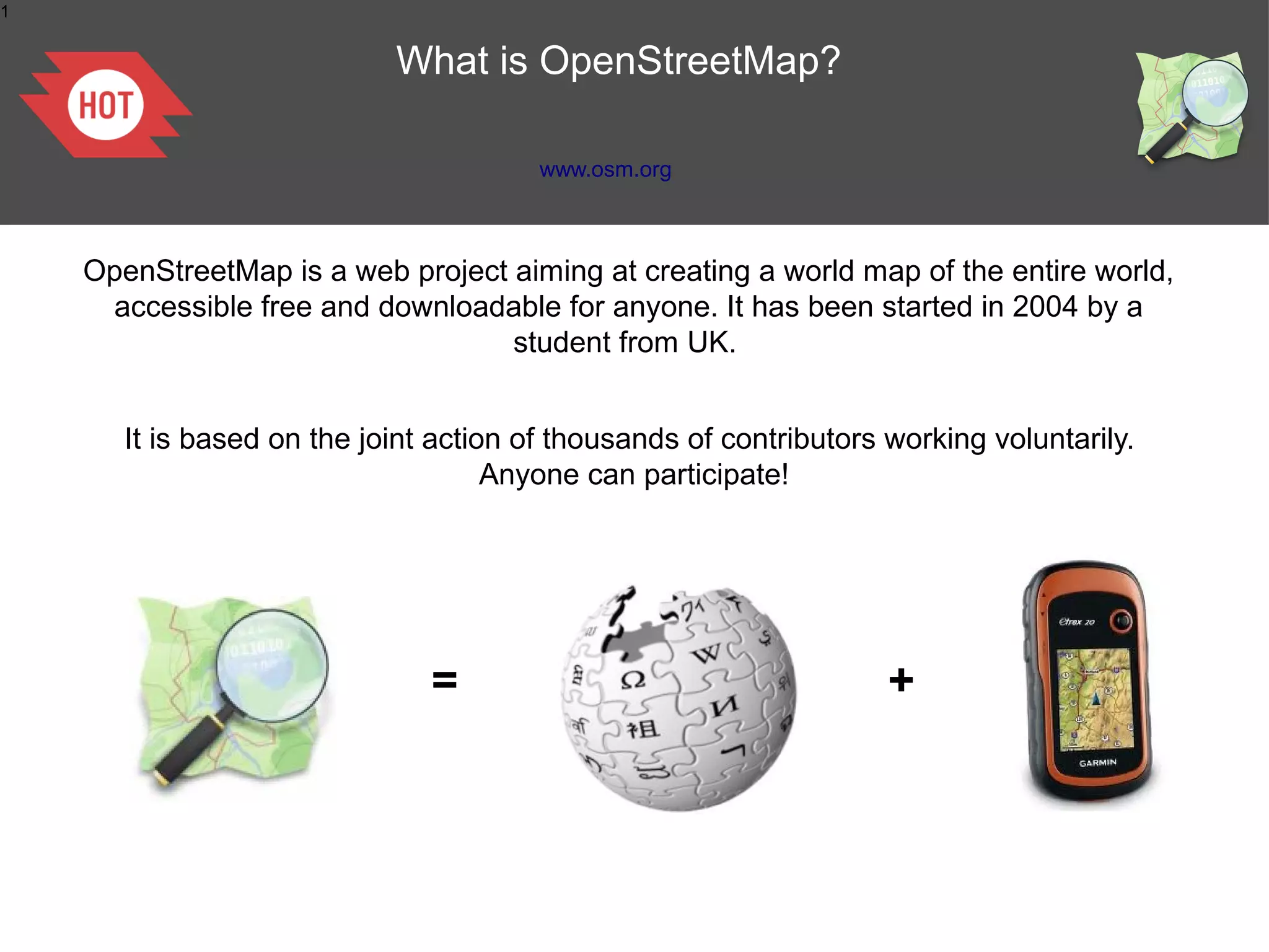
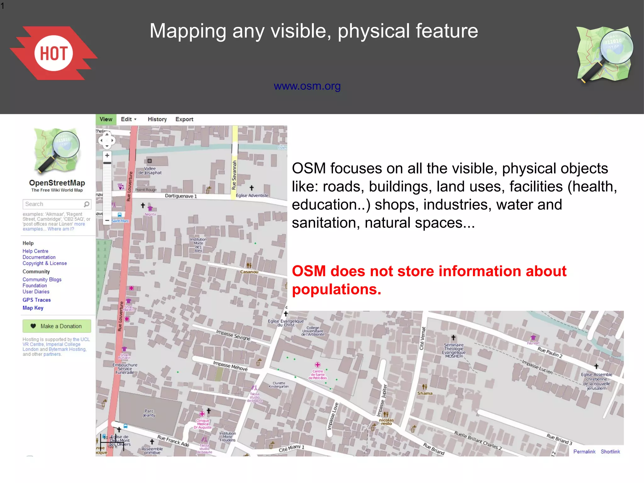
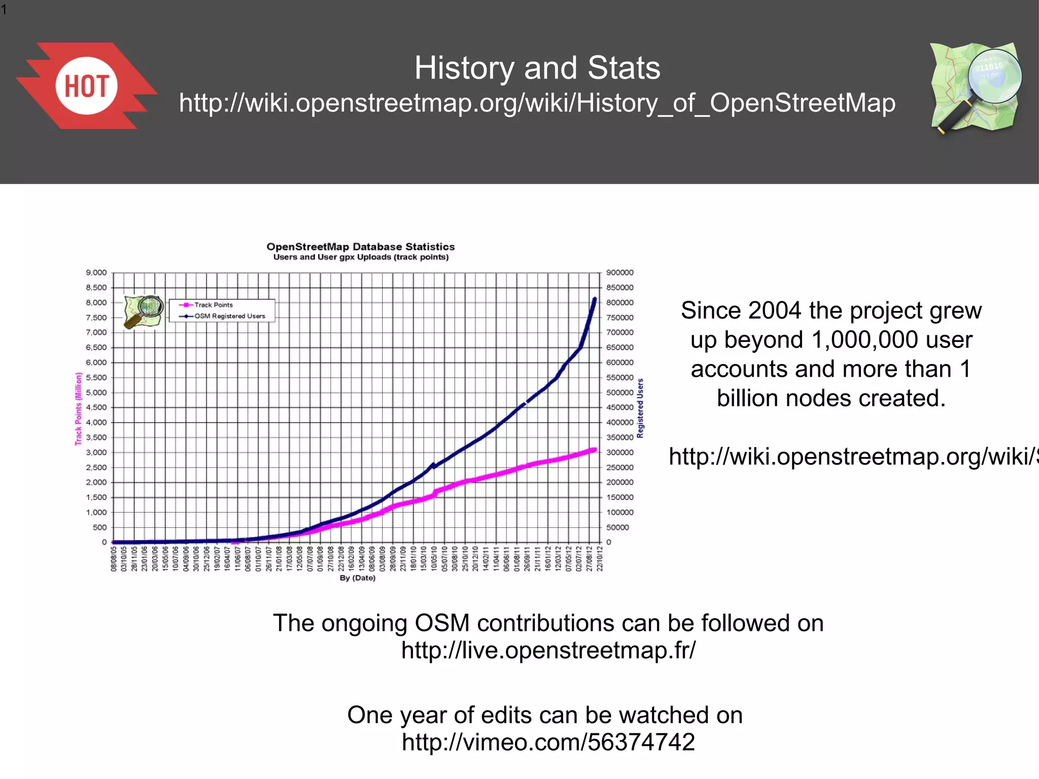
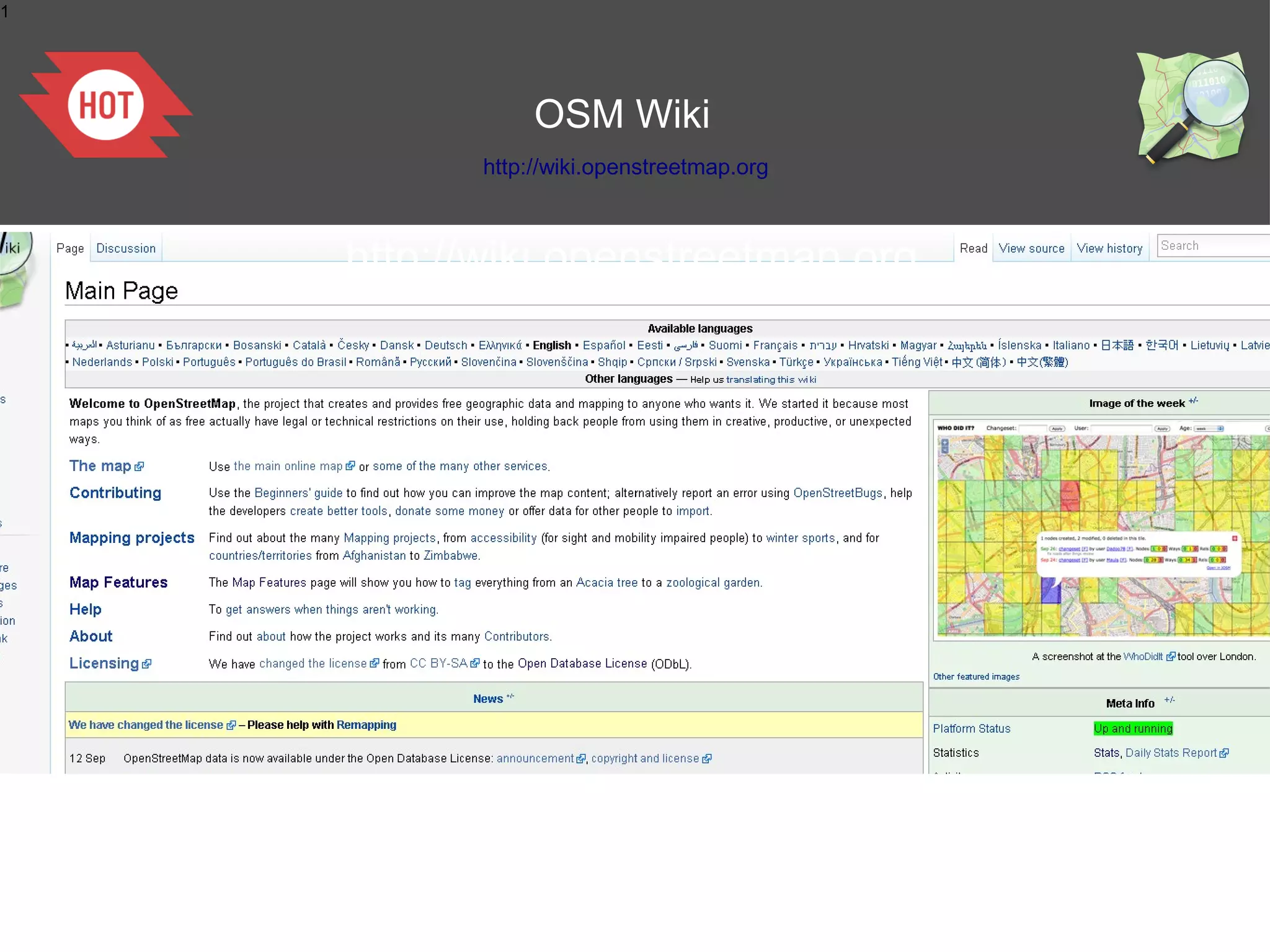
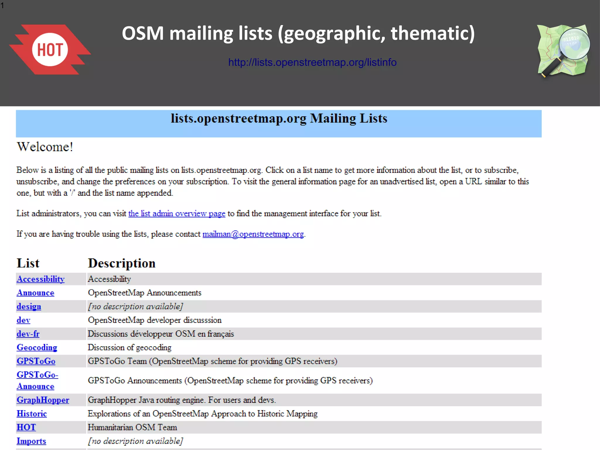
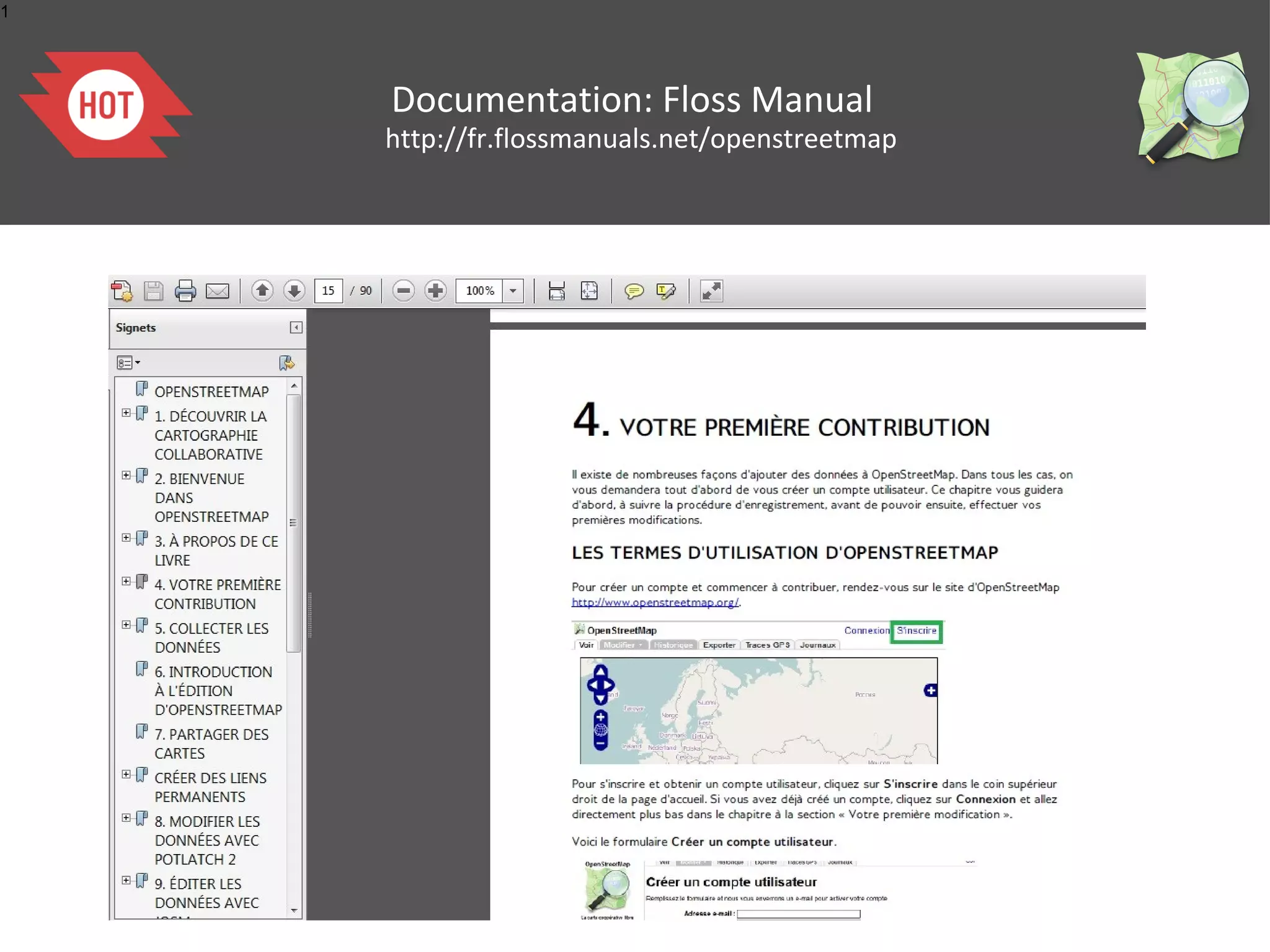
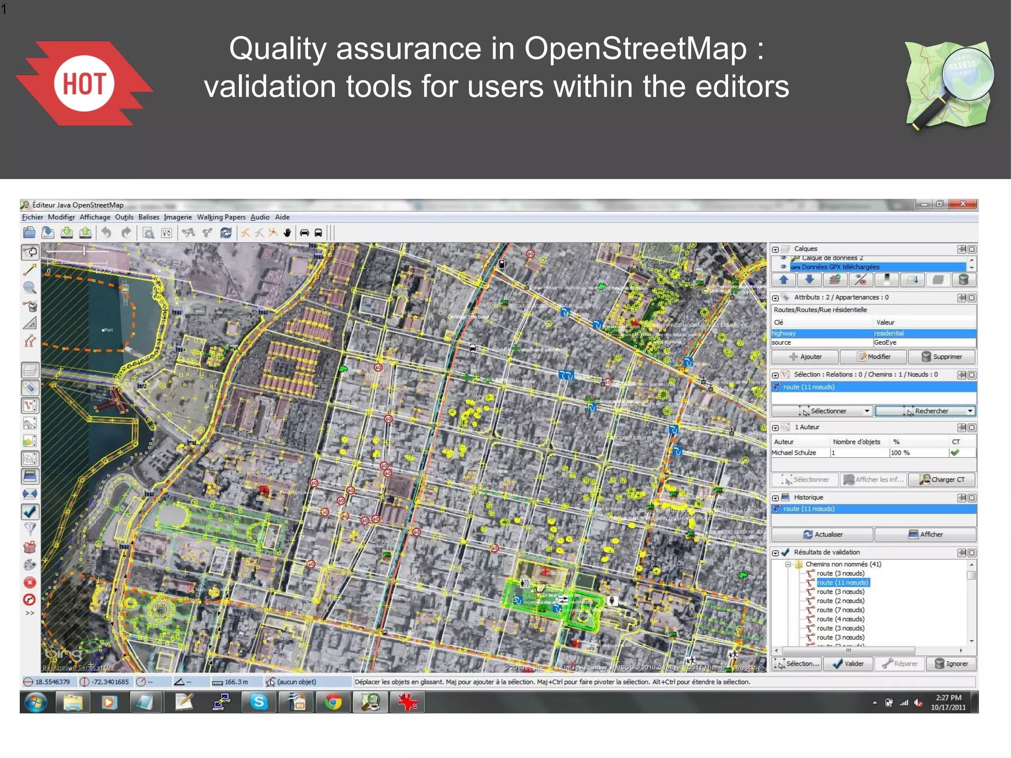
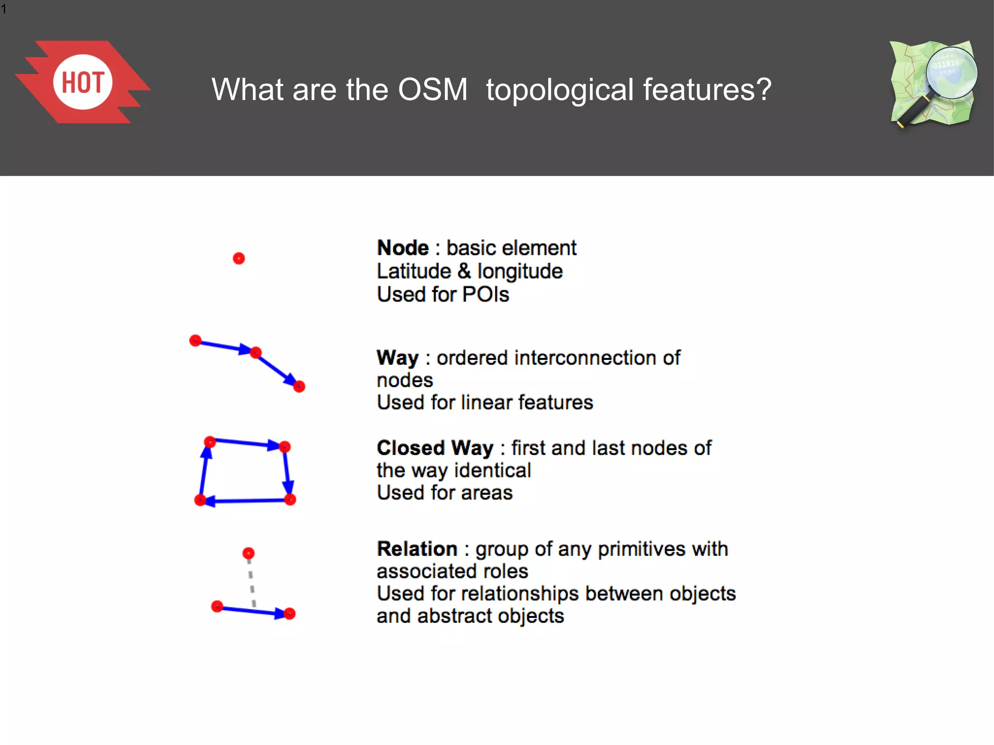
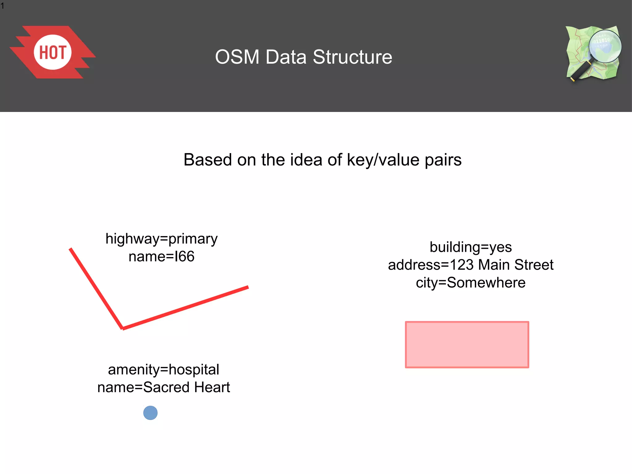
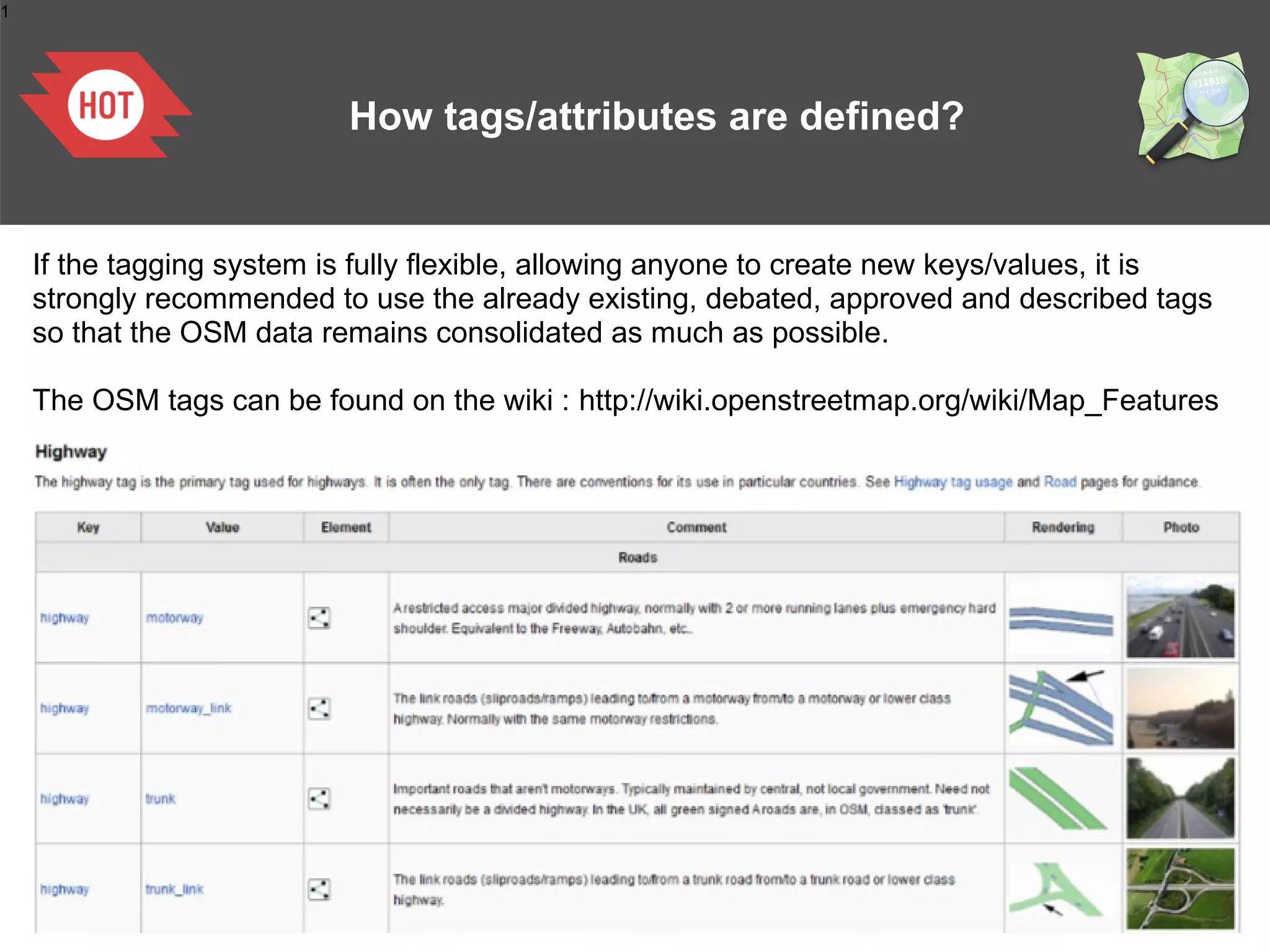
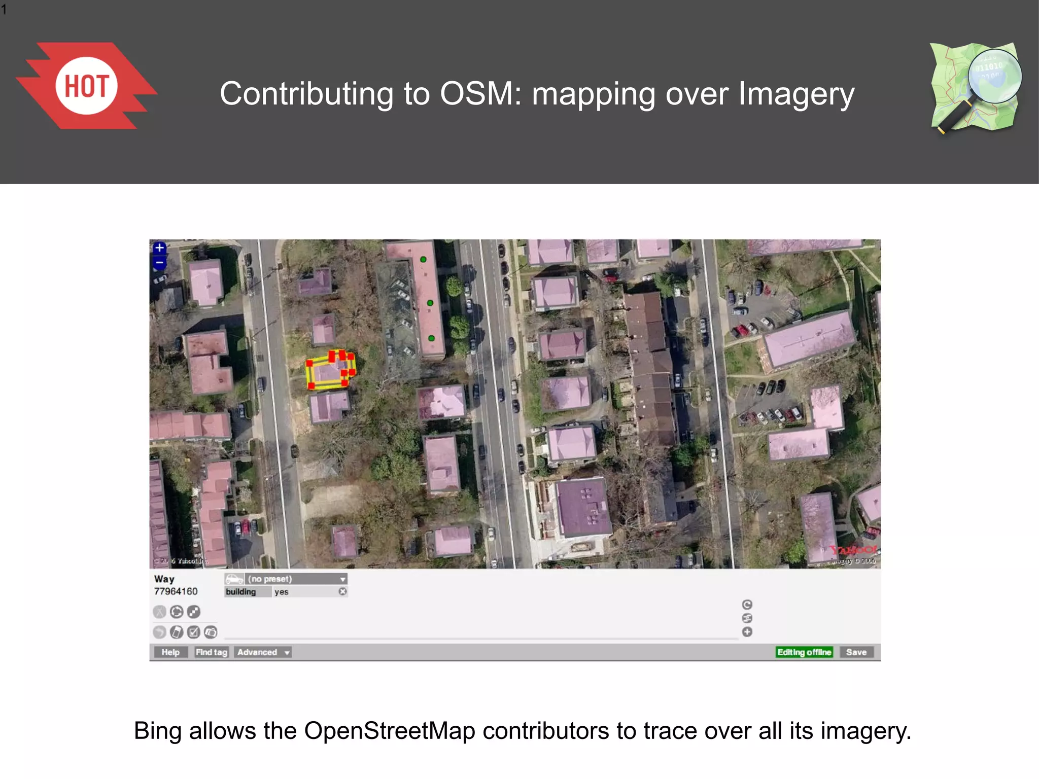
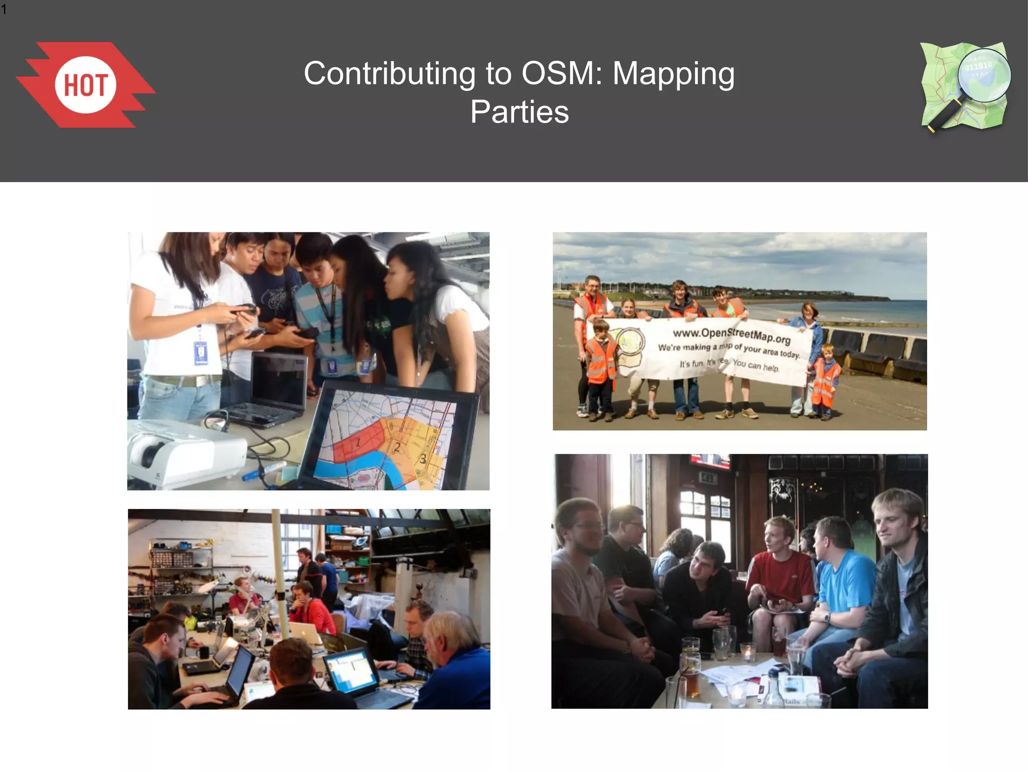
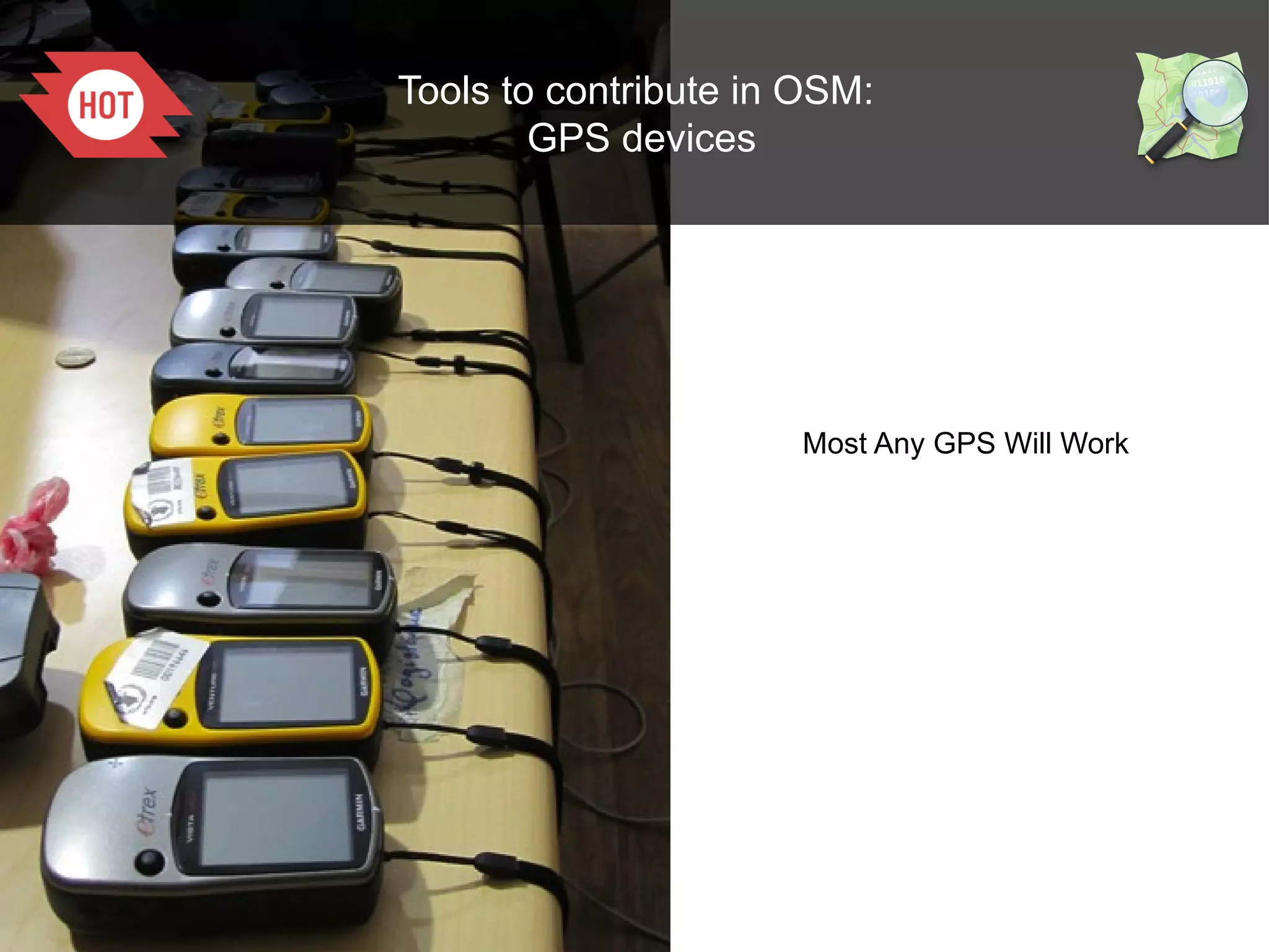
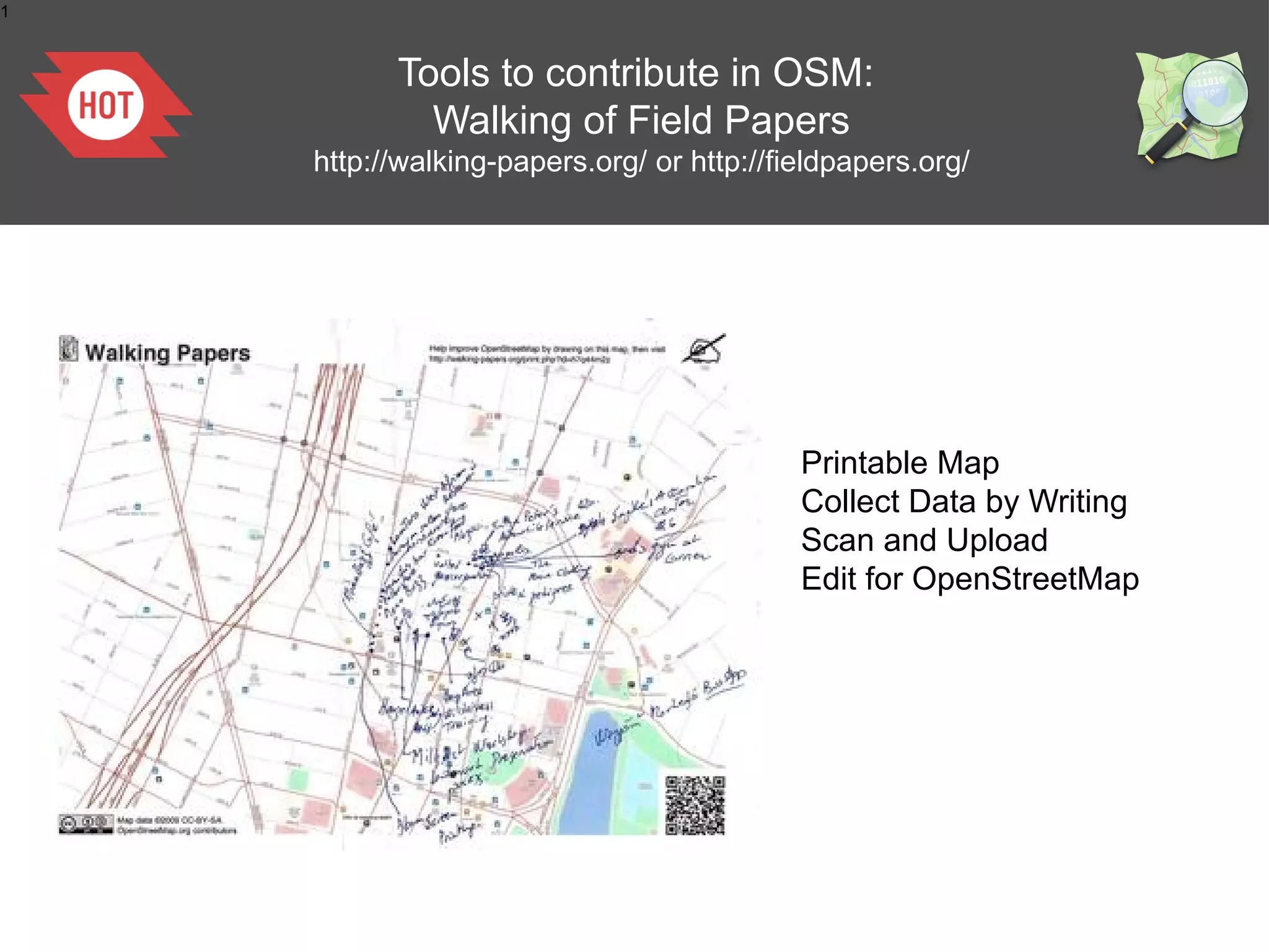
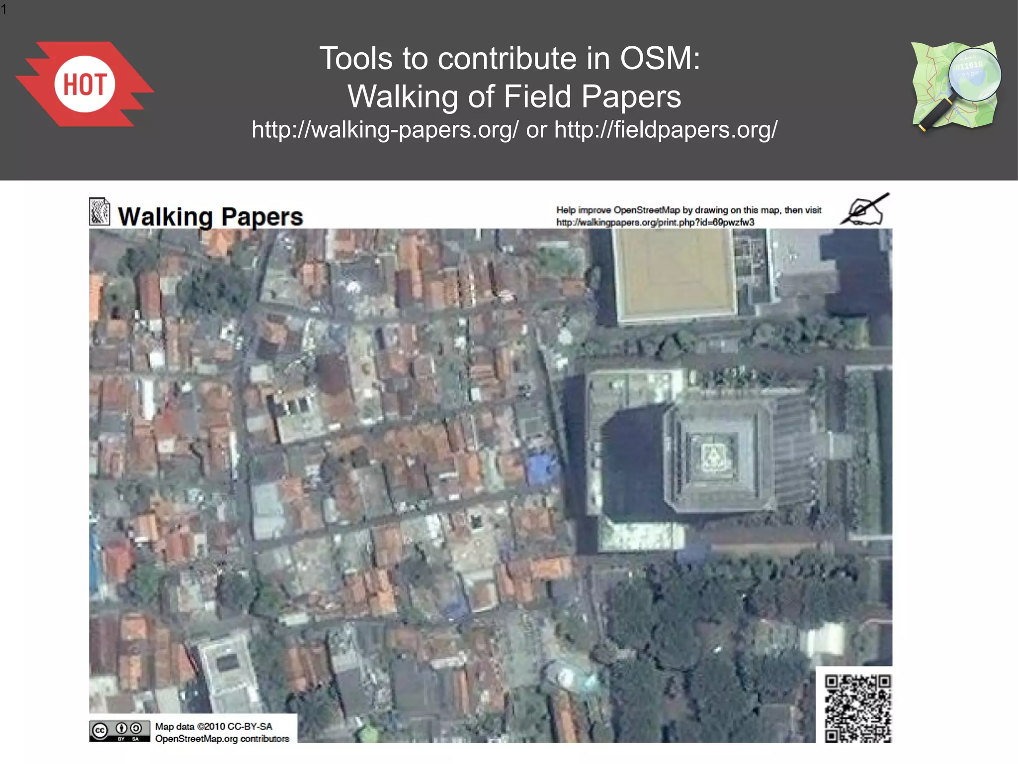
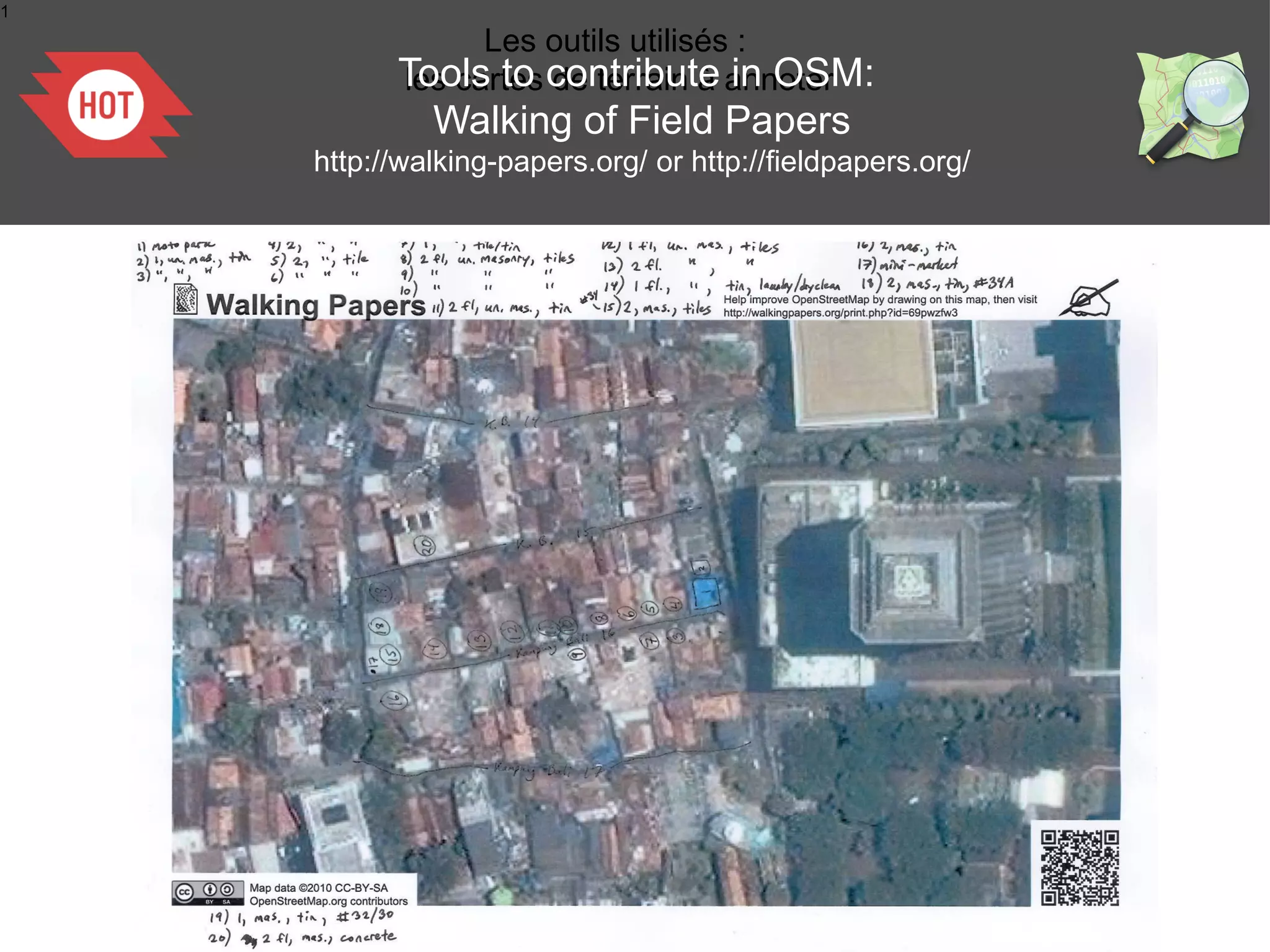
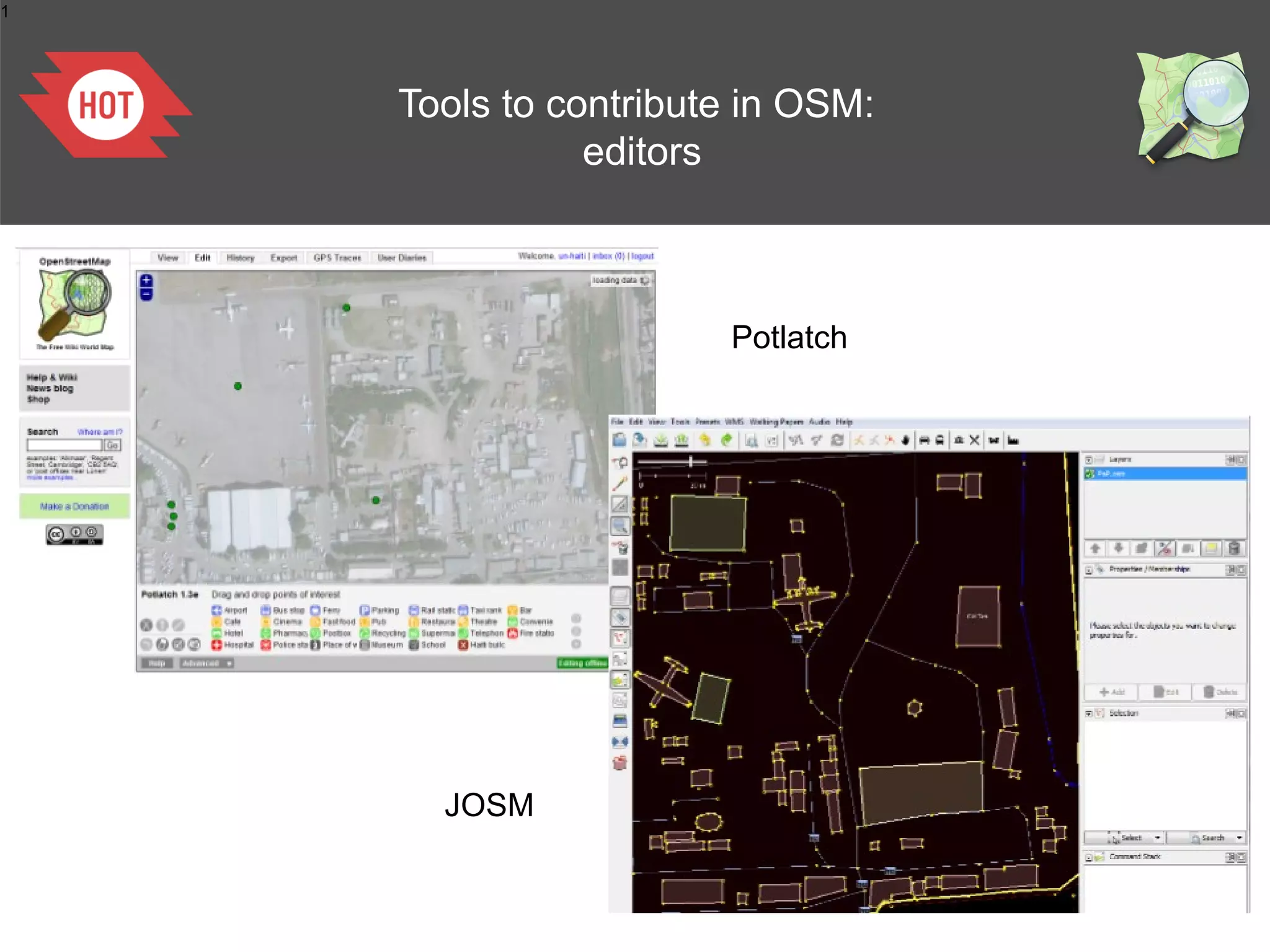
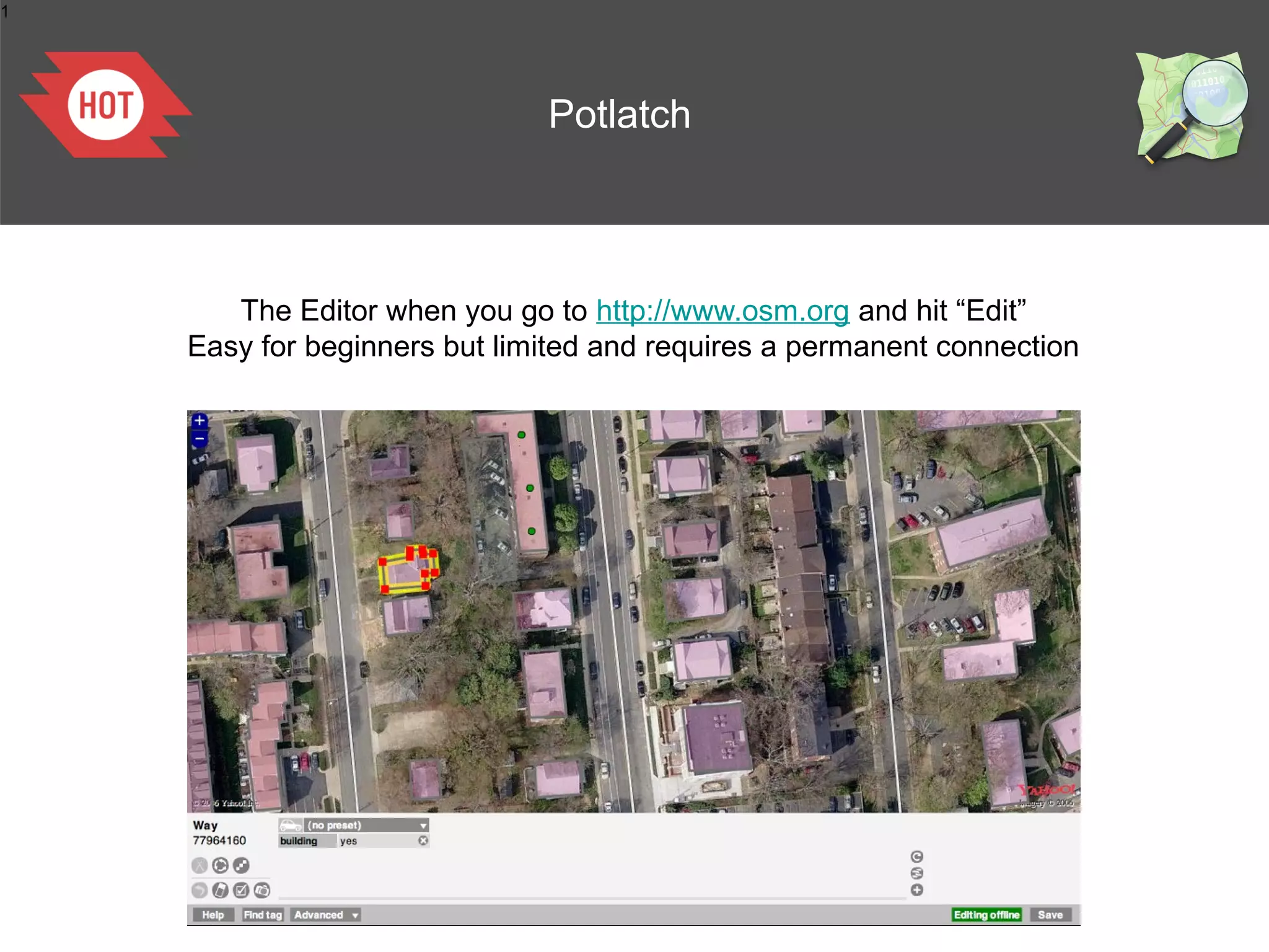
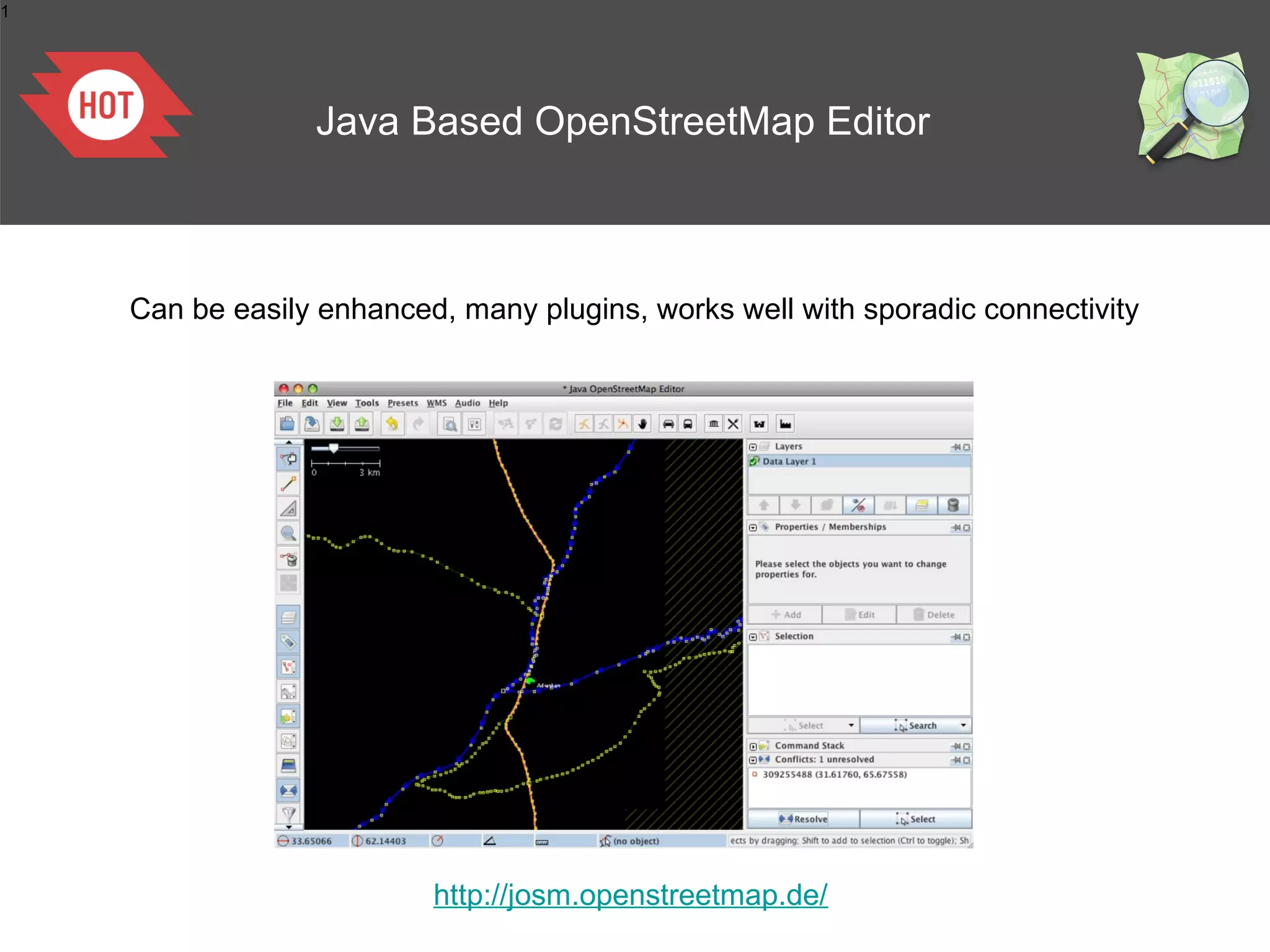
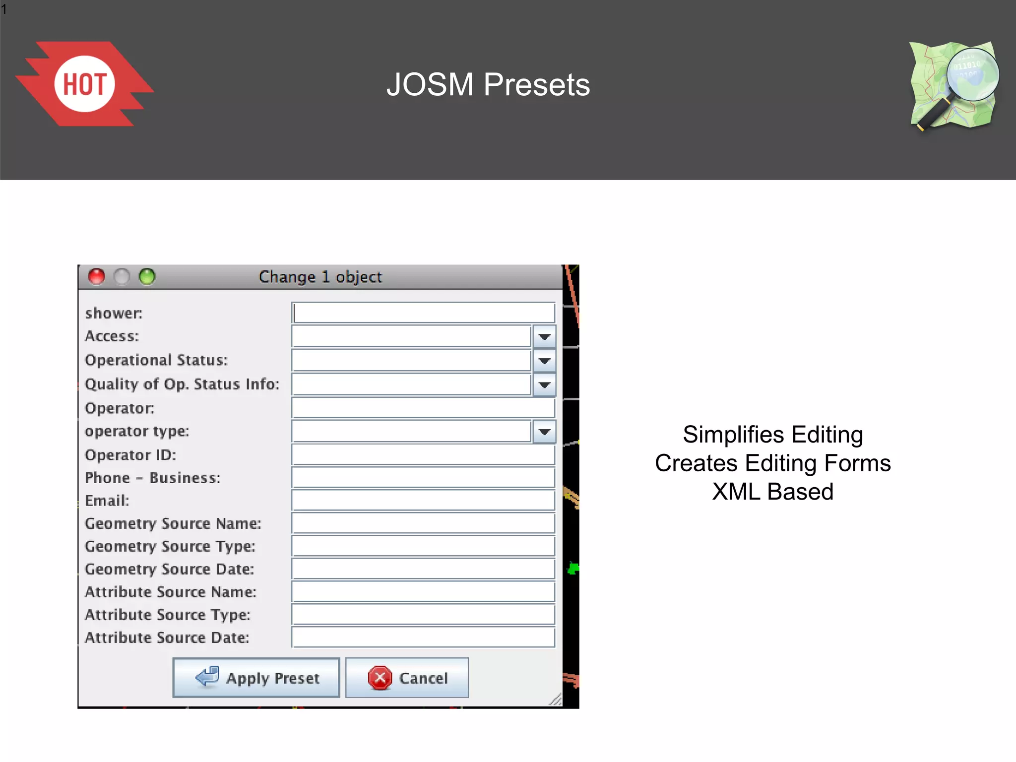
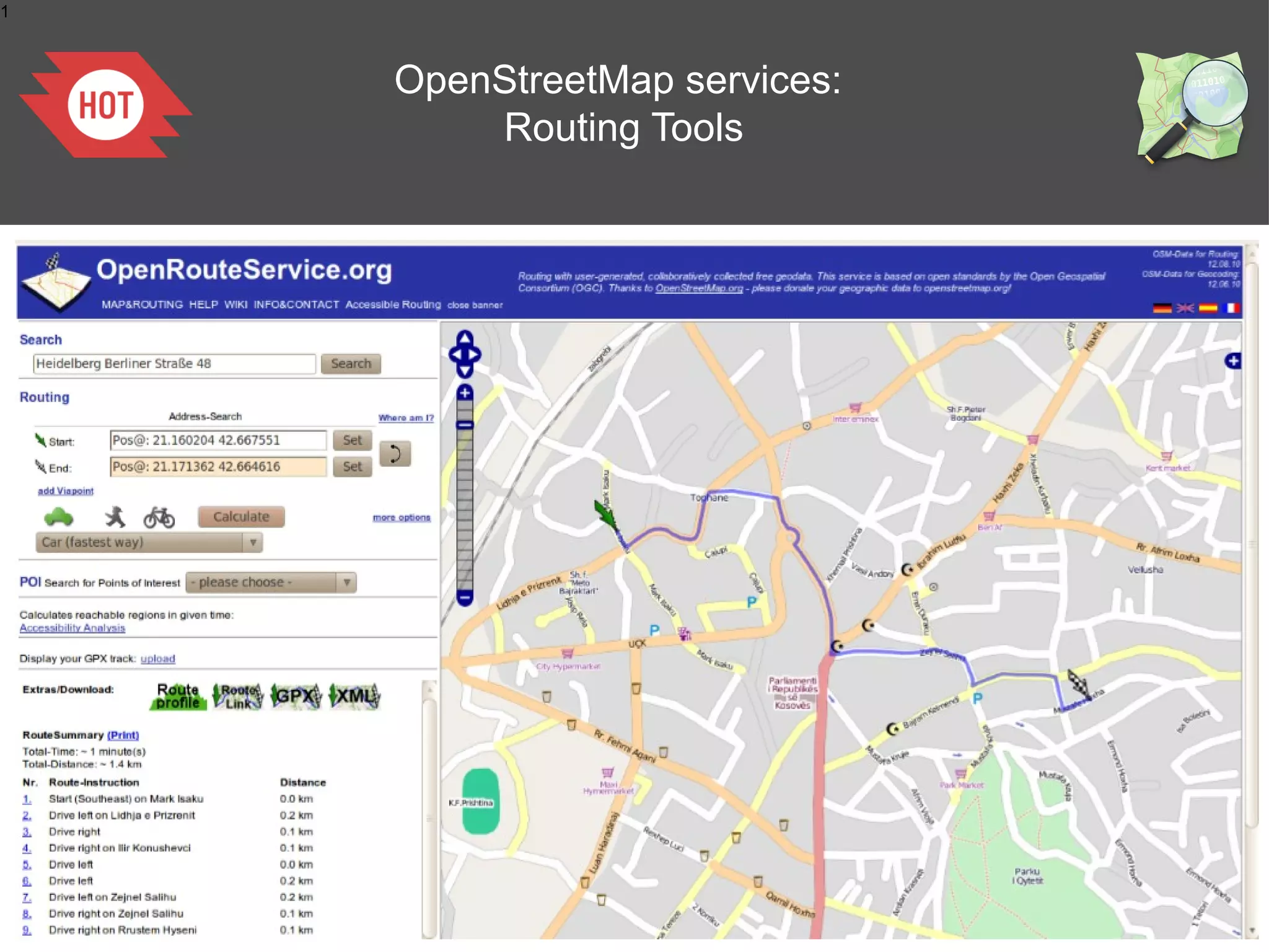
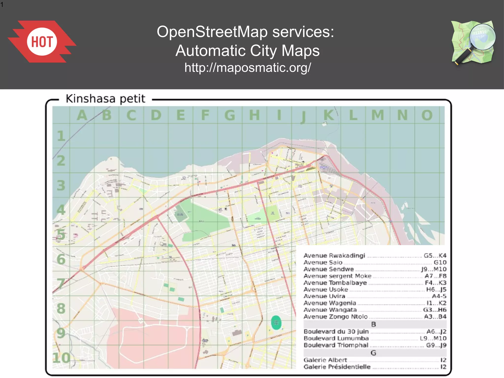
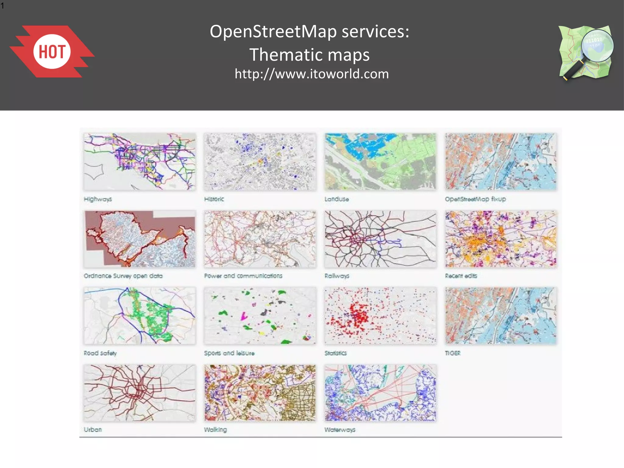
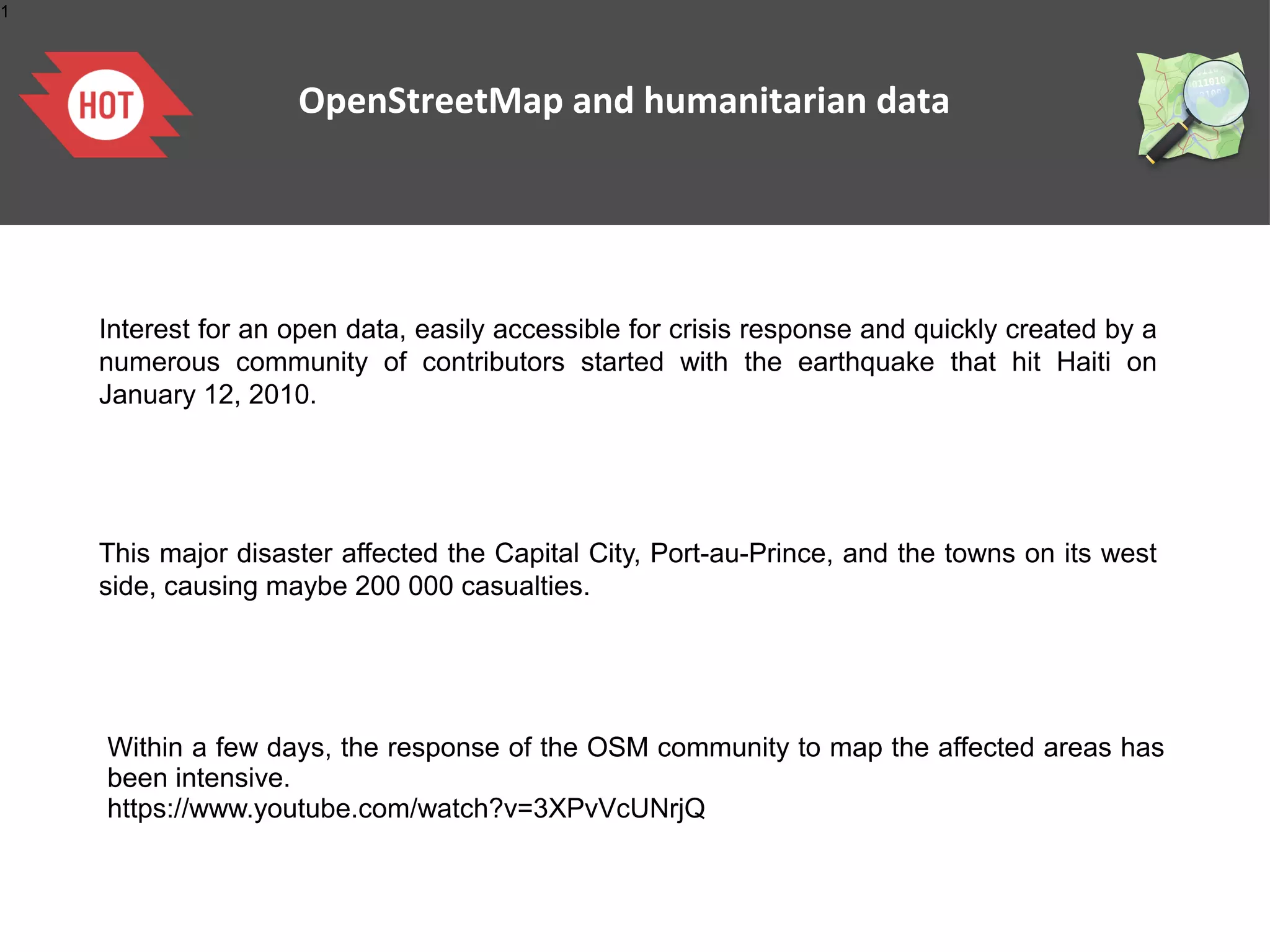
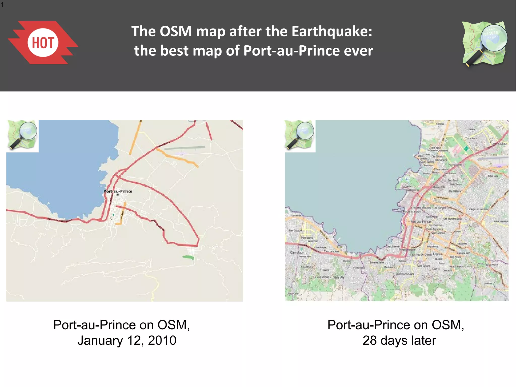
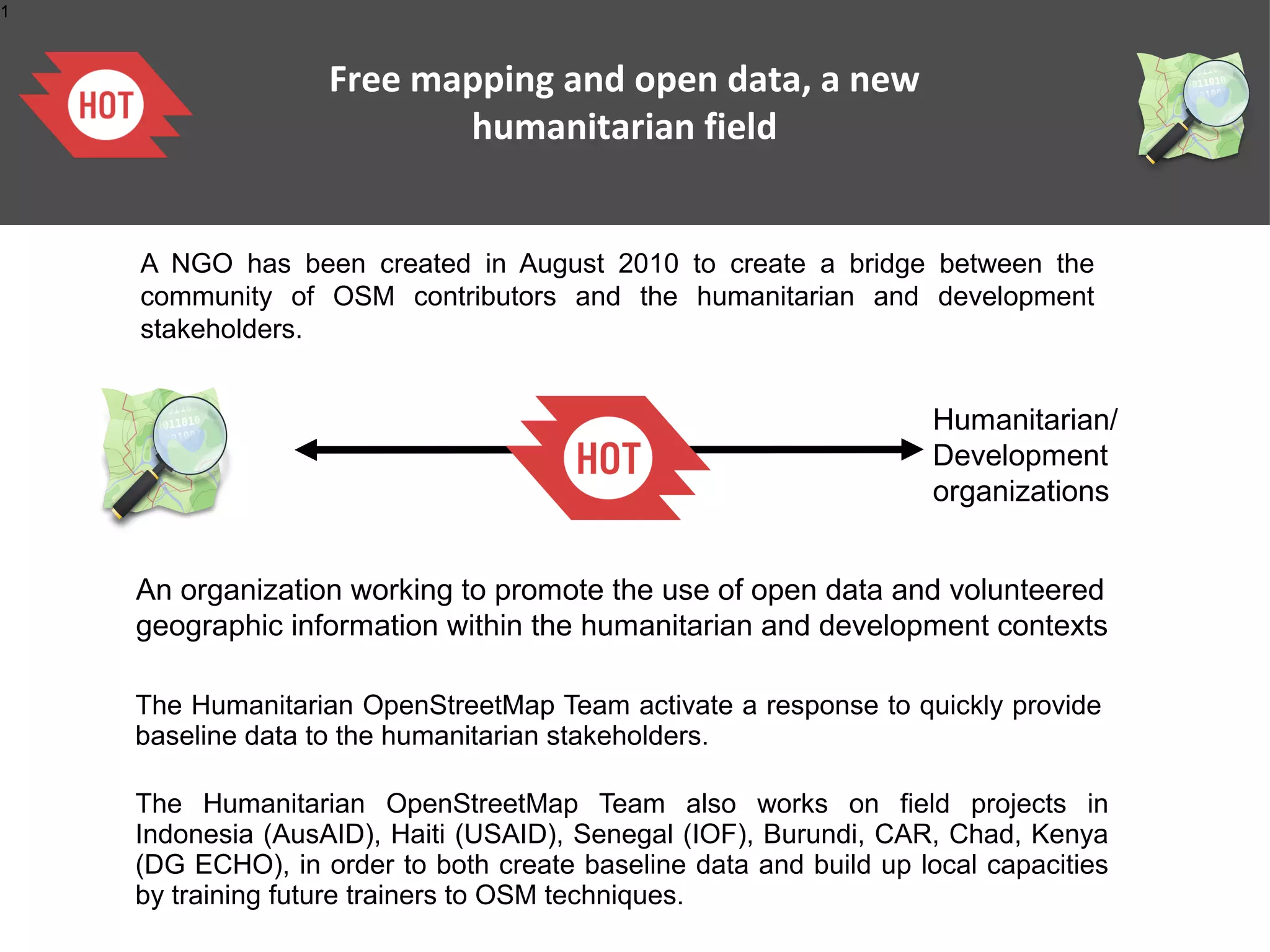
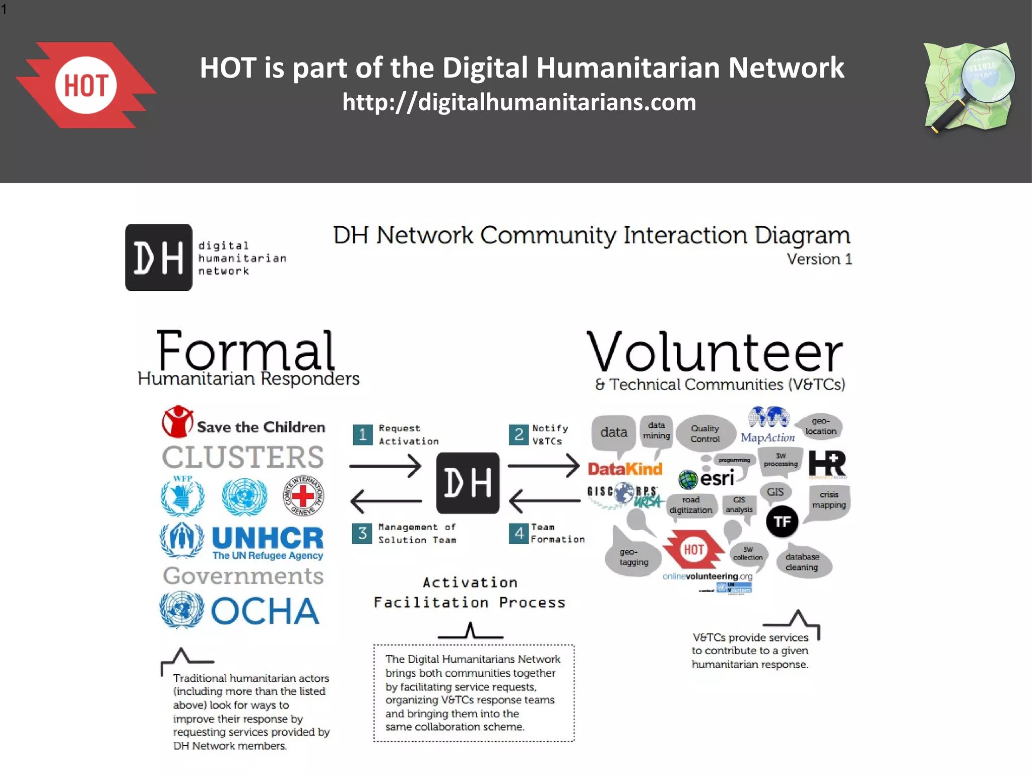
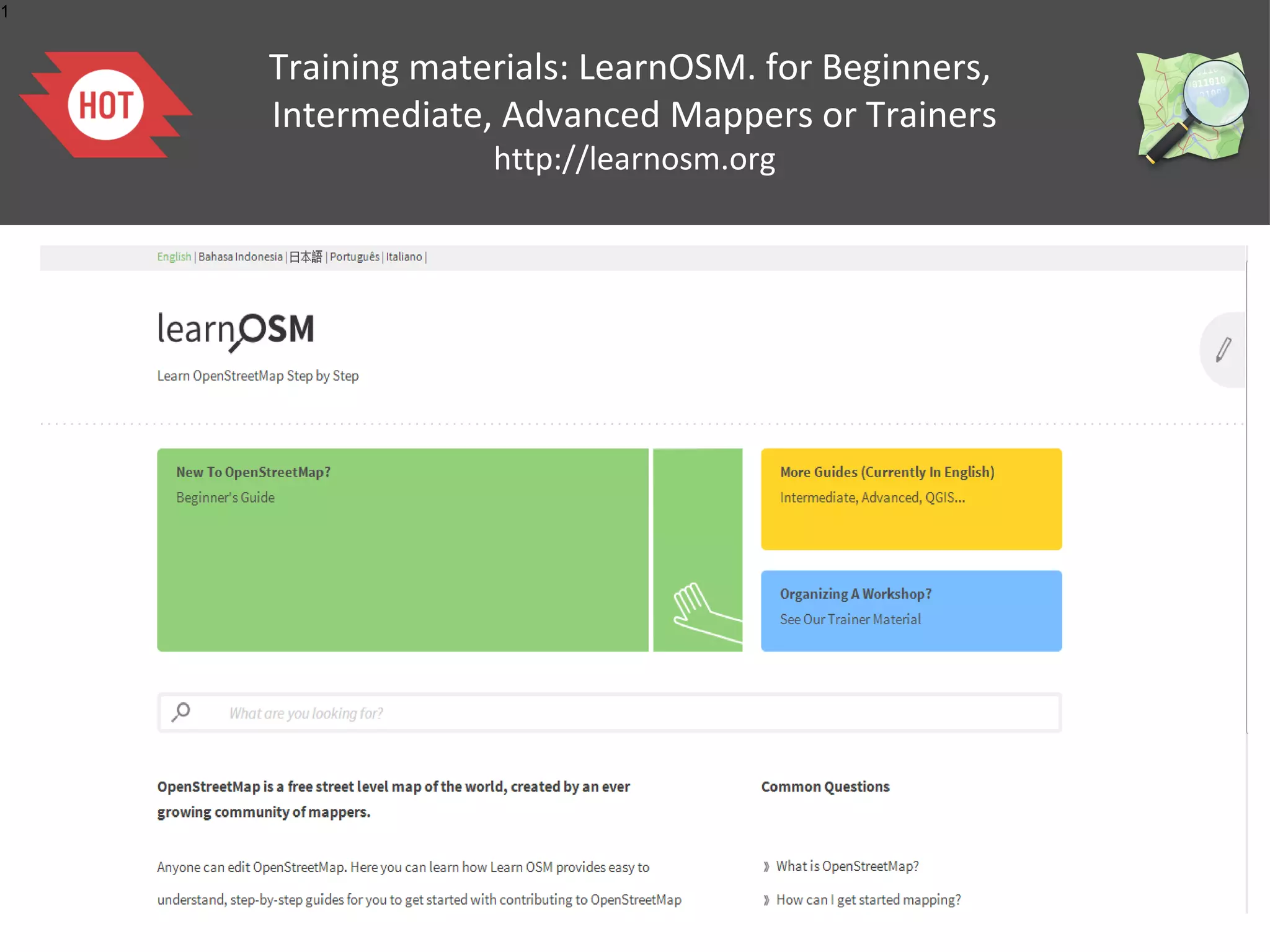
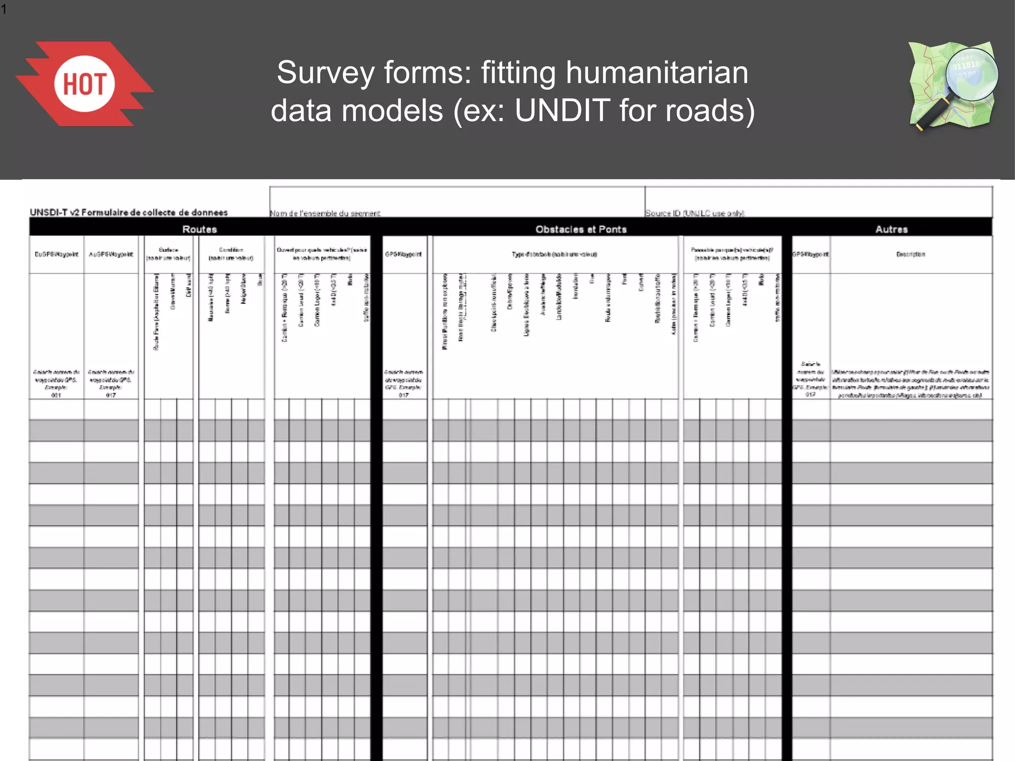
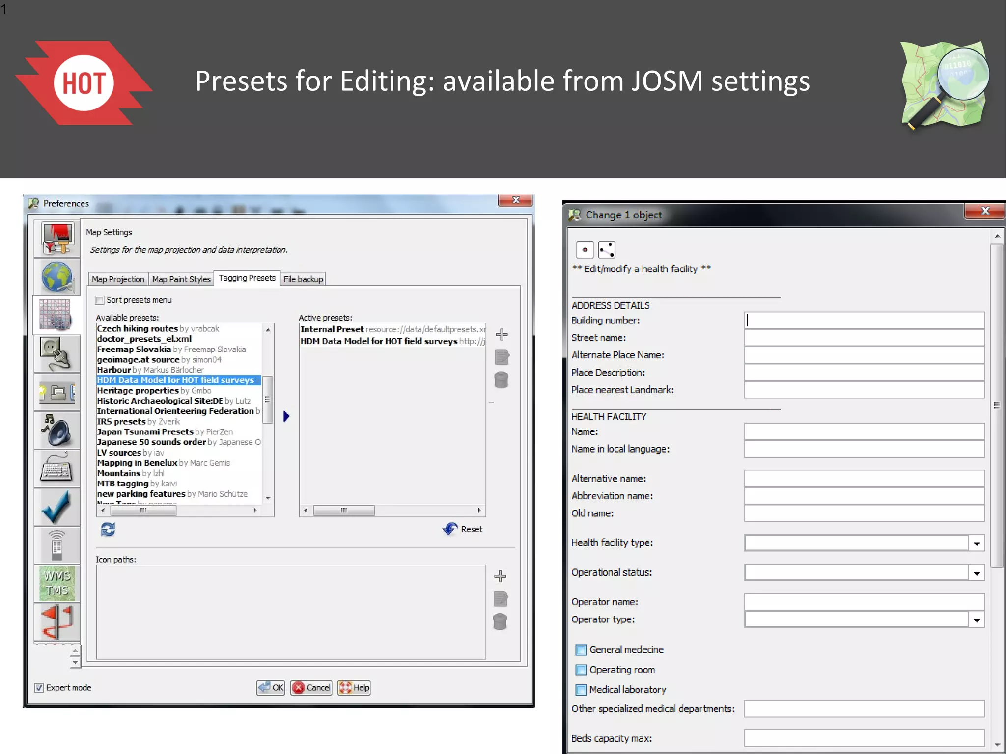
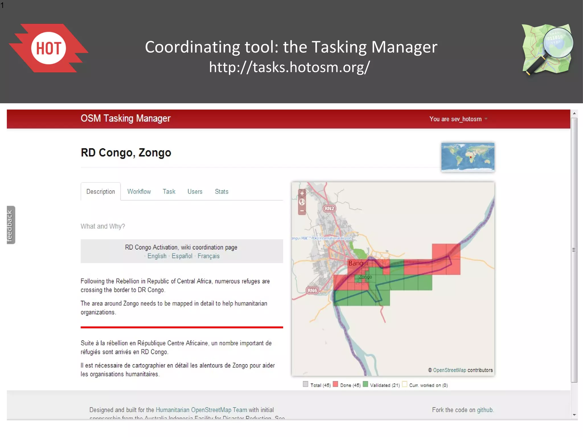
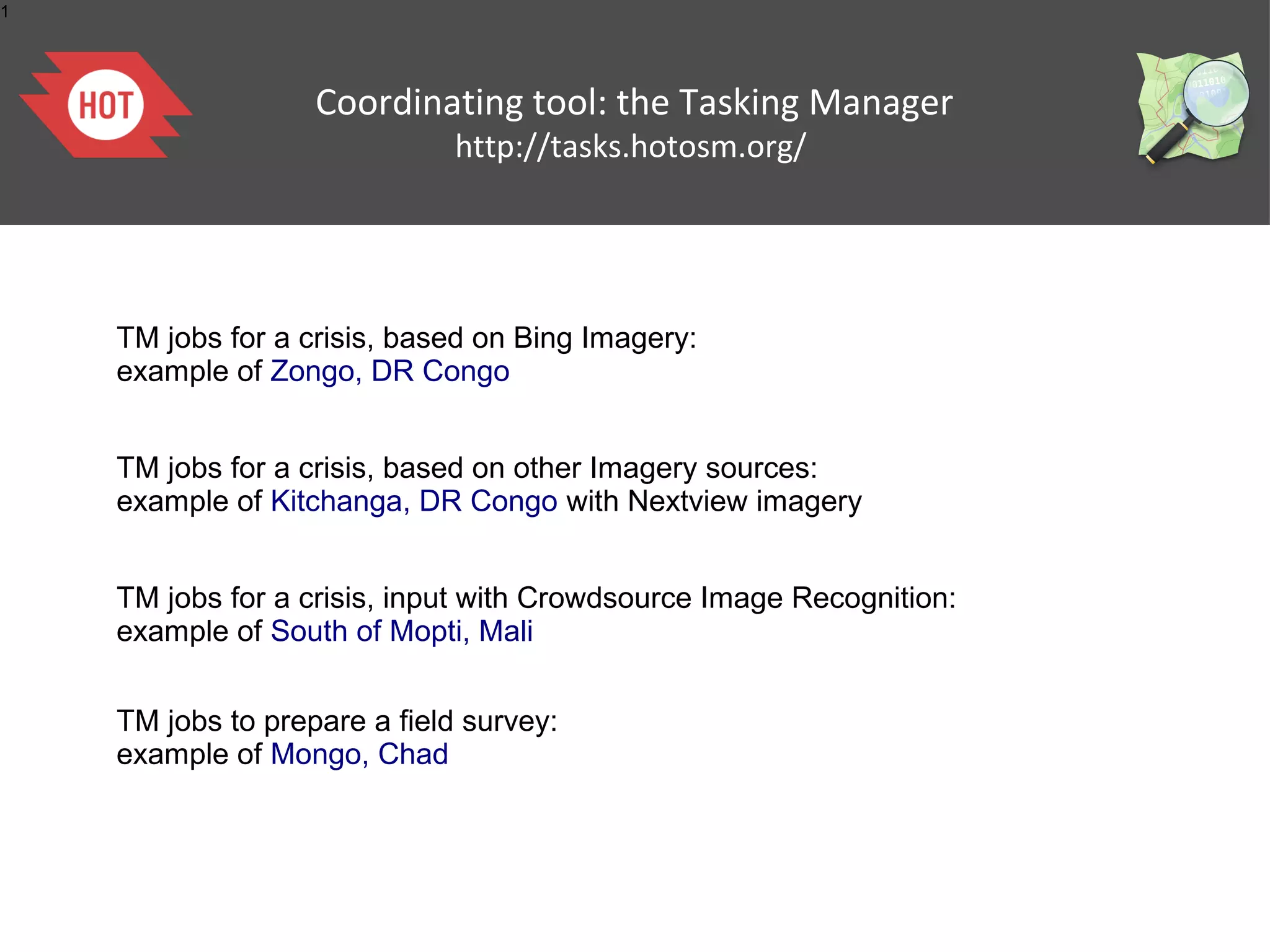
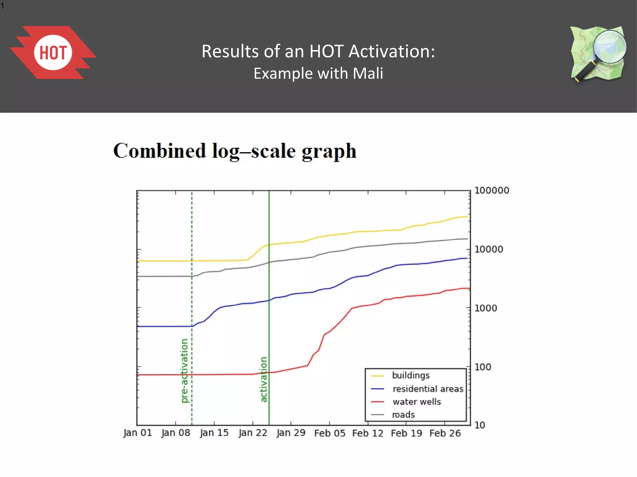
OpenStreetMap: editing
     and tasking mechanisms
                 26/03/2013
               Severin Menard
Humanitarian OpenStreetMap Team (AKA H.O.T.)
1


    What is open data ?


         A piece of data is open if anyone is free to use, reuse,
         and redistribute it — subject only, at most, to the
         requirement to attribute and/or share-alike.
         No discrimination against Persons or Groups, or Fields
         of Endeavor.


         This approach brings at least public savings and
         allows a fair competition between companies, what
         strengthen economics.
1


                            What is OpenStreetMap?

                                        www.osm.org


    OpenStreetMap is a web project aiming at creating a world map of the entire world,
     accessible free and downloadable for anyone. It has been started in 2004 by a
                                   student from UK.


       It is based on the joint action of thousands of contributors working voluntarily.
                                     Anyone can participate!


                               =                                    +
1


    Mapping any visible, physical feature

                 www.osm.org


                    OSM focuses on all the visible, physical objects
                    like: roads, buildings, land uses, facilities (health,
                    education..) shops, industries, water and
                    sanitation, natural spaces...


                    OSM does not store information about
                    populations.
1


                       History and Stats
    http://wiki.openstreetmap.org/wiki/History_of_OpenStreetMap


                                              Since 2004 the project grew
                                               up beyond 1,000,000 user
                                               accounts and more than 1
                                                 billion nodes created.

                                             http://wiki.openstreetmap.org/wiki/S


           The ongoing OSM contributions can be followed on
                     http://live.openstreetmap.fr/

                 One year of edits can be watched on
                     http://vimeo.com/56374742
1


                             “Legal” Details


                 Was Licensed CC-BY-SA 2.0


                      Moved towards ODbL


                       Kate Chapman's article about OdbL:
    http://www.maploser.com/2012/03/03/odbl-what-the-heck-can-you-do-with-it/
1


                            OSM governance


    The ecosystem of the OSM community
    Citizens
    Associations
    Local governments
    NGOs
    International Organizations (UN, WB)
    Academia
    Private actors:
    •
      Google, Microsoft, Foursquare
    •
      Cloudmade, Geofabrik, Camptocamp & DevelopmentSeeds

    The growth of the OSM project is fostered by
    •
     OpenStreetMap Foundation & local Chapters (, )
    •
     Humanitarian OpenStreetMap Team () Hum/Dev contexts
1


    Free mapping and quality


                       Idea: A large number of
                       individuals contributing together
                       will tend to create high quality
                       data.

                       Different kind of practises and
                       tools strengthen this.


           La cartographie Collaborative
1


               OSM Wiki
          http://wiki.openstreetmap.org


    http://wiki.openstreetmap.org
1


    OSM mailing lists (geographic, thematic)
                http://lists.openstreetmap.org/listinfo
1


    Documentation: Floss Manual
    http://fr.flossmanuals.net/openstreetmap
1


      Quality assurance in OpenStreetMap :
    validation tools for users within the editors
1


    Quality assurance in OpenStreetMap :
          Specific checking services
                Eg: Keepright!
1


                  History
    The complete history of every object is accessible
1


         The quality of OSM data
    demonstrated by scientific researches

                      The analysis shows that, where OSM was
                      collected by several
                      users and benefited from some quality
                      assurance, the quality
                      of the data is comparable and can be fit for
                      many applications.
                      The positional accuracy is about 6 metres,
                      which is expected
                      for the data collection methods that are
                      used in OSM. The
                      comparison of motorways shows about
                      80% overlap between
                      OSM and Ordnance Survey .
                                       Quality: Muki Aklay (UCL)
                                       positional accuracy comparisons
                                       United Kingdom: OSM -
                                       Ordnance Survey Meridian II
                                       database
                                       Haiti: OSM - GoogleMapMaker
                                       – MINUSTAH/CNIGS
1


                OSM is a free map,
         not submitted to political constraints
    Example in China where OSM has no random offset
1


    What are the OSM topological features?
1


                   OSM Data Structure


               Based on the idea of key/value pairs


     highway=primary
                                                building=yes
        name=I66
                                         address=123 Main Street
                                             city=Somewhere


     amenity=hospital
    name=Sacred Heart
1


                           How tags/attributes are defined?


    If the tagging system is fully flexible, allowing anyone to create new keys/values, it is
    strongly recommended to use the already existing, debated, approved and described tags
    so that the OSM data remains consolidated as much as possible.

    The OSM tags can be found on the wiki : http://wiki.openstreetmap.org/wiki/Map_Features
1


            Contributing to OSM: mapping over Imagery


    Bing allows the OpenStreetMap contributors to trace over all its imagery.
1


    Contributing to OSM: Mapping
                Parties
1


    Tools to contribute in OSM:
            GPS devices


                          Most Any GPS Will Work
1


          Tools to contribute in OSM:
            Walking of Field Papers
    http://walking-papers.org/ or http://fieldpapers.org/


                                           Printable Map
                                           Collect Data by Writing
                                           Scan and Upload
                                           Edit for OpenStreetMap
1


          Tools to contribute in OSM:
            Walking of Field Papers
    http://walking-papers.org/ or http://fieldpapers.org/
1
                Les outils utilisés :
          Tools to contribute annoter
          les cartes de terrain à in OSM:
             Walking of Field Papers
    http://walking-papers.org/ or http://fieldpapers.org/
1


    Tools to contribute in OSM:
               editors


                      Potlatch


      JOSM
1


                              Potlatch


       The Editor when you go to http://www.osm.org and hit “Edit”
    Easy for beginners but limited and requires a permanent connection
1


                 Java Based OpenStreetMap Editor


    Can be easily enhanced, many plugins, works well with sporadic connectivity


                          http://josm.openstreetmap.de/
1


    JOSM Presets


                     Simplifies Editing
                   Creates Editing Forms
                        XML Based
1


    OpenStreetMap services:
        Routing Tools
1


    OpenStreetMap services:
        Routing Tools
1


    OpenStreetMap services:
      Automatic City Maps
       http://maposmatic.org/
1


    OpenStreetMap services:
        Thematic maps
      http://www.itoworld.com
1


    OpenStreetMap services:
     Maps for GPS devices
1


                    OpenStreetMap services:
                     Maps for smartphones


    OsmAND
    - Routing
    - Pedestrian
    - Edits/Bugs
    - Edits/Bugs
     & transports
1


                            OpenStreetMap services:
                             Editors for smartphones


    OsmTracker
    - Routing
    - Pedestrian
    - Edits/Bugs
    - Edits/Bugs
     & transports


    Vespucci
    - light online editor
    - online
    - Edits/Bugs
1


                    OpenStreetMap and humanitarian data


    Interest for an open data, easily accessible for crisis response and quickly created by a
    numerous community of contributors started with the earthquake that hit Haiti on
    January 12, 2010.


    This major disaster affected the Capital City, Port-au-Prince, and the towns on its west
    side, causing maybe 200 000 casualties.


    Within a few days, the response of the OSM community to map the affected areas has
    been intensive.
    https://www.youtube.com/watch?v=3XPvVcUNrjQ
1


                The OSM map after the Earthquake:
                the best map of Port-au-Prince ever


    Port-au-Prince on OSM,                  Port-au-Prince on OSM,
        January 12, 2010                          28 days later
1

    A new interest from the humanitarian
    organizations to work with the virtual,
            technical communities
1


                   Free mapping and open data, a new
                          humanitarian field


    A NGO has been created in August 2010 to create a bridge between the
    community of OSM contributors and the humanitarian and development
    stakeholders.


                                                                   Humanitarian/
                                                                   Development
                                                                   organizations


    An organization working to promote the use of open data and volunteered
    geographic information within the humanitarian and development contexts

    The Humanitarian OpenStreetMap Team activate a response to quickly provide
    baseline data to the humanitarian stakeholders.

    The Humanitarian OpenStreetMap Team also works on field projects in
    Indonesia (AusAID), Haiti (USAID), Senegal (IOF), Burundi, CAR, Chad, Kenya
    (DG ECHO), in order to both create baseline data and build up local capacities
    by training future trainers to OSM techniques.
Coordination
1


    Coordination is part of the Digital Humanitarian Network
              HOT
                         http://digitalhumanitarians.com
1


      HOT Package


    Training Materials
      Survey Forms
    Presets for Editing
        Softwares
1


    Training materials: LearnOSM. for Beginners,
    Intermediate, Advanced Mappers or Trainers
                 http://learnosm.org
1


    Survey forms: fitting humanitarian
    data models (ex: UNDIT for roads)
1


    Presets for Editing: available from JOSM settings
1


    Coordinating tool: the Tasking Manager
            http://tasks.hotosm.org/
1


                   Coordinating tool: the Tasking Manager
                              http://tasks.hotosm.org/


    TM jobs for a crisis, based on Bing Imagery:
    example of Zongo, DR Congo


    TM jobs for a crisis, based on other Imagery sources:
    example of Kitchanga, DR Congo with Nextview imagery


    TM jobs for a crisis, input with Crowdsource Image Recognition:
    example of South of Mopti, Mali


    TM jobs to prepare a field survey:
    example of Mongo, Chad
1


    Results of an HOT Activation:
          Example with Mali
Questions?
              Kate Chapman
severin.menard@hotosm.org
  Humanitarian OpenStreetMap Team (AKA
                H.O.T.)

JRC OpenStreetMap, editing and tasking mechanisms, 20130326

  • 1.
    OpenStreetMap: editing and tasking mechanisms 26/03/2013 Severin Menard Humanitarian OpenStreetMap Team (AKA H.O.T.)
  • 2.
    1 What is open data ? A piece of data is open if anyone is free to use, reuse, and redistribute it — subject only, at most, to the requirement to attribute and/or share-alike. No discrimination against Persons or Groups, or Fields of Endeavor. This approach brings at least public savings and allows a fair competition between companies, what strengthen economics.
  • 3.
    1 What is OpenStreetMap? www.osm.org OpenStreetMap is a web project aiming at creating a world map of the entire world, accessible free and downloadable for anyone. It has been started in 2004 by a student from UK. It is based on the joint action of thousands of contributors working voluntarily. Anyone can participate! = +
  • 4.
    1 Mapping any visible, physical feature www.osm.org OSM focuses on all the visible, physical objects like: roads, buildings, land uses, facilities (health, education..) shops, industries, water and sanitation, natural spaces... OSM does not store information about populations.
  • 5.
    1 History and Stats http://wiki.openstreetmap.org/wiki/History_of_OpenStreetMap Since 2004 the project grew up beyond 1,000,000 user accounts and more than 1 billion nodes created. http://wiki.openstreetmap.org/wiki/S The ongoing OSM contributions can be followed on http://live.openstreetmap.fr/ One year of edits can be watched on http://vimeo.com/56374742
  • 6.
    1 “Legal” Details Was Licensed CC-BY-SA 2.0 Moved towards ODbL Kate Chapman's article about OdbL: http://www.maploser.com/2012/03/03/odbl-what-the-heck-can-you-do-with-it/
  • 7.
    1 OSM governance The ecosystem of the OSM community Citizens Associations Local governments NGOs International Organizations (UN, WB) Academia Private actors: • Google, Microsoft, Foursquare • Cloudmade, Geofabrik, Camptocamp & DevelopmentSeeds The growth of the OSM project is fostered by • OpenStreetMap Foundation & local Chapters (, ) • Humanitarian OpenStreetMap Team () Hum/Dev contexts
  • 8.
    1 Free mapping and quality Idea: A large number of individuals contributing together will tend to create high quality data. Different kind of practises and tools strengthen this. La cartographie Collaborative
  • 9.
    1 OSM Wiki http://wiki.openstreetmap.org http://wiki.openstreetmap.org
  • 10.
    1 OSM mailing lists (geographic, thematic) http://lists.openstreetmap.org/listinfo
  • 11.
    1 Documentation: Floss Manual http://fr.flossmanuals.net/openstreetmap
  • 12.
    1 Quality assurance in OpenStreetMap : validation tools for users within the editors
  • 13.
    1 Quality assurance in OpenStreetMap : Specific checking services Eg: Keepright!
  • 14.
    1 History The complete history of every object is accessible
  • 15.
    1 The quality of OSM data demonstrated by scientific researches The analysis shows that, where OSM was collected by several users and benefited from some quality assurance, the quality of the data is comparable and can be fit for many applications. The positional accuracy is about 6 metres, which is expected for the data collection methods that are used in OSM. The comparison of motorways shows about 80% overlap between OSM and Ordnance Survey . Quality: Muki Aklay (UCL) positional accuracy comparisons United Kingdom: OSM - Ordnance Survey Meridian II database Haiti: OSM - GoogleMapMaker – MINUSTAH/CNIGS
  • 16.
    1 OSM is a free map, not submitted to political constraints Example in China where OSM has no random offset
  • 17.
    1 What are the OSM topological features?
  • 18.
    1 OSM Data Structure Based on the idea of key/value pairs highway=primary building=yes name=I66 address=123 Main Street city=Somewhere amenity=hospital name=Sacred Heart
  • 19.
    1 How tags/attributes are defined? If the tagging system is fully flexible, allowing anyone to create new keys/values, it is strongly recommended to use the already existing, debated, approved and described tags so that the OSM data remains consolidated as much as possible. The OSM tags can be found on the wiki : http://wiki.openstreetmap.org/wiki/Map_Features
  • 20.
    1 Contributing to OSM: mapping over Imagery Bing allows the OpenStreetMap contributors to trace over all its imagery.
  • 21.
    1 Contributing to OSM: Mapping Parties
  • 22.
    1 Tools to contribute in OSM: GPS devices Most Any GPS Will Work
  • 23.
    1 Tools to contribute in OSM: Walking of Field Papers http://walking-papers.org/ or http://fieldpapers.org/ Printable Map Collect Data by Writing Scan and Upload Edit for OpenStreetMap
  • 24.
    1 Tools to contribute in OSM: Walking of Field Papers http://walking-papers.org/ or http://fieldpapers.org/
  • 25.
    1 Les outils utilisés : Tools to contribute annoter les cartes de terrain à in OSM: Walking of Field Papers http://walking-papers.org/ or http://fieldpapers.org/
  • 26.
    1 Tools to contribute in OSM: editors Potlatch JOSM
  • 27.
    1 Potlatch The Editor when you go to http://www.osm.org and hit “Edit” Easy for beginners but limited and requires a permanent connection
  • 28.
    1 Java Based OpenStreetMap Editor Can be easily enhanced, many plugins, works well with sporadic connectivity http://josm.openstreetmap.de/
  • 29.
    1 JOSM Presets Simplifies Editing Creates Editing Forms XML Based
  • 30.
    1 OpenStreetMap services: Routing Tools
  • 31.
    1 OpenStreetMap services: Routing Tools
  • 32.
    1 OpenStreetMap services: Automatic City Maps http://maposmatic.org/
  • 33.
    1 OpenStreetMap services: Thematic maps http://www.itoworld.com
  • 34.
    1 OpenStreetMap services: Maps for GPS devices
  • 35.
    1 OpenStreetMap services: Maps for smartphones OsmAND - Routing - Pedestrian - Edits/Bugs - Edits/Bugs & transports
  • 36.
    1 OpenStreetMap services: Editors for smartphones OsmTracker - Routing - Pedestrian - Edits/Bugs - Edits/Bugs & transports Vespucci - light online editor - online - Edits/Bugs
  • 37.
    1 OpenStreetMap and humanitarian data Interest for an open data, easily accessible for crisis response and quickly created by a numerous community of contributors started with the earthquake that hit Haiti on January 12, 2010. This major disaster affected the Capital City, Port-au-Prince, and the towns on its west side, causing maybe 200 000 casualties. Within a few days, the response of the OSM community to map the affected areas has been intensive. https://www.youtube.com/watch?v=3XPvVcUNrjQ
  • 38.
    1 The OSM map after the Earthquake: the best map of Port-au-Prince ever Port-au-Prince on OSM, Port-au-Prince on OSM, January 12, 2010 28 days later
  • 39.
    1 A new interest from the humanitarian organizations to work with the virtual, technical communities
  • 40.
    1 Free mapping and open data, a new humanitarian field A NGO has been created in August 2010 to create a bridge between the community of OSM contributors and the humanitarian and development stakeholders. Humanitarian/ Development organizations An organization working to promote the use of open data and volunteered geographic information within the humanitarian and development contexts The Humanitarian OpenStreetMap Team activate a response to quickly provide baseline data to the humanitarian stakeholders. The Humanitarian OpenStreetMap Team also works on field projects in Indonesia (AusAID), Haiti (USAID), Senegal (IOF), Burundi, CAR, Chad, Kenya (DG ECHO), in order to both create baseline data and build up local capacities by training future trainers to OSM techniques.
  • 41.
  • 42.
    1 Coordination is part of the Digital Humanitarian Network HOT http://digitalhumanitarians.com
  • 43.
    1 HOT Package Training Materials Survey Forms Presets for Editing Softwares
  • 44.
    1 Training materials: LearnOSM. for Beginners, Intermediate, Advanced Mappers or Trainers http://learnosm.org
  • 45.
    1 Survey forms: fitting humanitarian data models (ex: UNDIT for roads)
  • 46.
    1 Presets for Editing: available from JOSM settings
  • 47.
    1 Coordinating tool: the Tasking Manager http://tasks.hotosm.org/
  • 48.
    1 Coordinating tool: the Tasking Manager http://tasks.hotosm.org/ TM jobs for a crisis, based on Bing Imagery: example of Zongo, DR Congo TM jobs for a crisis, based on other Imagery sources: example of Kitchanga, DR Congo with Nextview imagery TM jobs for a crisis, input with Crowdsource Image Recognition: example of South of Mopti, Mali TM jobs to prepare a field survey: example of Mongo, Chad
  • 49.
    1 Results of an HOT Activation: Example with Mali
  • 50.
    Questions? Kate Chapman severin.menard@hotosm.org Humanitarian OpenStreetMap Team (AKA H.O.T.)

Editor's Notes