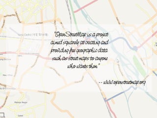
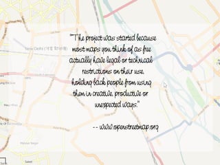
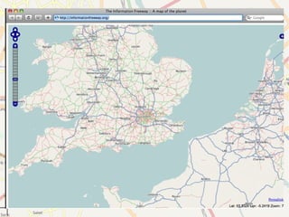
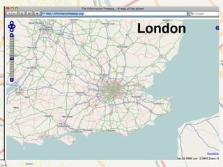
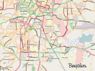
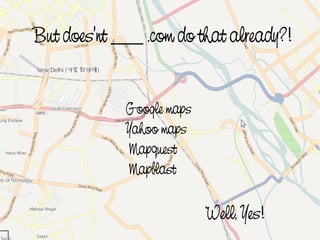
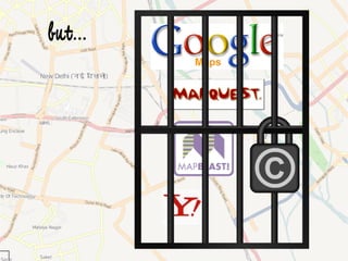
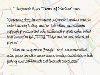
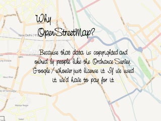
1) OpenStreetMap is a project that aims to create and provide free geographic map data that anyone can use. Unlike other "free" maps, OpenStreetMap data has no legal or technical restrictions on its use.
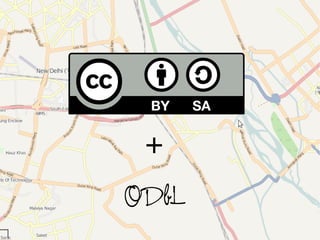
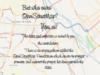
2) OpenStreetMap data is owned by its contributors rather than a single company. Anyone can contribute to mapping and the data is made available under an open license.
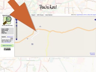
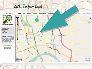
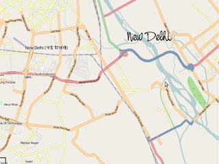
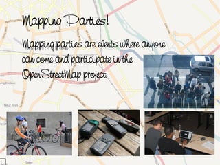
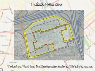
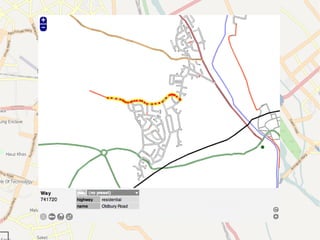
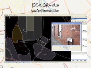
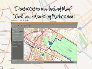
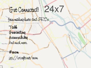
3) The presentation encourages participation in OpenStreetMap by mapping one's local neighborhood, attending mapping parties, using online and offline editors, and getting involved in the OpenStreetMap community.
Remembering Carrawburgh: Using VR to (Re)Create the PastDeborah Mayers
Presentation on using Virtual Reality to (Re)Create the past and the importance of sensory feedback. Case study of the site of Carrawburgh on Hadrian's Wall. The objects from the site are found in various museums in the UK, and the site itself is hard to interpret. So how can we use VR to help bring it back to life?
Dom Breadmore (@predacomdom) 's presentation on GPS and Geolocation ideas for Education delivered as part of Teachmeet Takeover at BETT 2011, Olympia, London.
An overview of current Augmented Reality (AR) technology and potential future applications in libraries. Researched and presented to 9410: Emerging Technologies in Fall 2012 at the University of Missouri School of Information Science and Learning Technologies (SISLT).
OpenStreetMap Philippines was invited by Computer Professionals Union to give a workshop on OpenStreetMap during Software Freedom Day 2012. The workshop was held at a computer laboratory at the College of Education in UP Diliman on September 15, 2012.
Talk given at OpenTech 2011. An overview of the developer ecosystem around OpenStreetMap data, and how web and mobile app developers can use OpenStreetMap.
More details: http://www.harrywood.co.uk/blog/2011/05/22/openstreetmap-at-opentech-2011/
CartoHeritage 2011: Georeferencer & MapRank SearchPetr Pridal
Presentation from the workshop: Digital Approaches in Cartographic Heritage 2011: 6th International Workshop, The Hague, 7-8 April 2011.
http://xeee.web.auth.gr/ICA-Heritage/Commission/6th_Workshop/TheHague/
Presentations:
P. Pridal, Georeferencer: Collaborative online georeferencing tool for scanned maps.
P. Pridal, MapRank Search: Intuitive geographical searching in map collections and metadata catalogs.
In this talk, I will introduce the future technical and social impact of open data on the open platform. Nowadays, web technology, whose process of standardization is open and independent of vendors, has evolved into an application platform on various devices such as PC, mobile and embedded devices. Developers of web-standards and web-based application are now trying to integrate a map technology tightly into the web standards for the future mobile web-based applications. As an organizer of a workshop aiming to discuss the future web-based map technology, I will introduce emerging technology and discussion in this area. At the workshop I held in Tokyo, Japan in 2012, many developers and researchers in various communities such as OpenStreetMap, FOSS4G, HTML5, and Linked OpenData gathered and had an enthusiastic discussion. I will summarize the discussion and future perspective at the workshop in my talk in order to discuss future technical and social possibility of OpenStreetMap on web-based open platform.
DevOps and Testing slides at DASA ConnectKari Kakkonen
My and Rik Marselis slides at 30.5.2024 DASA Connect conference. We discuss about what is testing, then what is agile testing and finally what is Testing in DevOps. Finally we had lovely workshop with the participants trying to find out different ways to think about quality and testing in different parts of the DevOps infinity loop.
GraphRAG is All You need? LLM & Knowledge GraphGuy Korland
Guy Korland, CEO and Co-founder of FalkorDB, will review two articles on the integration of language models with knowledge graphs.
1. Unifying Large Language Models and Knowledge Graphs: A Roadmap.
https://arxiv.org/abs/2306.08302
2. Microsoft Research's GraphRAG paper and a review paper on various uses of knowledge graphs:
https://www.microsoft.com/en-us/research/blog/graphrag-unlocking-llm-discovery-on-narrative-private-data/
Climate Impact of Software Testing at Nordic Testing DaysKari Kakkonen
My slides at Nordic Testing Days 6.6.2024
Climate impact / sustainability of software testing discussed on the talk. ICT and testing must carry their part of global responsibility to help with the climat warming. We can minimize the carbon footprint but we can also have a carbon handprint, a positive impact on the climate. Quality characteristics can be added with sustainability, and then measured continuously. Test environments can be used less, and in smaller scale and on demand. Test techniques can be used in optimizing or minimizing number of tests. Test automation can be used to speed up testing.
Unlocking Productivity: Leveraging the Potential of Copilot in Microsoft 365, a presentation by Christoforos Vlachos, Senior Solutions Manager – Modern Workplace, Uni Systems
GraphSummit Singapore | The Art of the Possible with Graph - Q2 2024Neo4j
Neha Bajwa, Vice President of Product Marketing, Neo4j
Join us as we explore breakthrough innovations enabled by interconnected data and AI. Discover firsthand how organizations use relationships in data to uncover contextual insights and solve our most pressing challenges – from optimizing supply chains, detecting fraud, and improving customer experiences to accelerating drug discoveries.
How to Get CNIC Information System with Paksim Ga.pptxdanishmna97
Pakdata Cf is a groundbreaking system designed to streamline and facilitate access to CNIC information. This innovative platform leverages advanced technology to provide users with efficient and secure access to their CNIC details.
zkStudyClub - Reef: Fast Succinct Non-Interactive Zero-Knowledge Regex ProofsAlex Pruden
This paper presents Reef, a system for generating publicly verifiable succinct non-interactive zero-knowledge proofs that a committed document matches or does not match a regular expression. We describe applications such as proving the strength of passwords, the provenance of email despite redactions, the validity of oblivious DNS queries, and the existence of mutations in DNA. Reef supports the Perl Compatible Regular Expression syntax, including wildcards, alternation, ranges, capture groups, Kleene star, negations, and lookarounds. Reef introduces a new type of automata, Skipping Alternating Finite Automata (SAFA), that skips irrelevant parts of a document when producing proofs without undermining soundness, and instantiates SAFA with a lookup argument. Our experimental evaluation confirms that Reef can generate proofs for documents with 32M characters; the proofs are small and cheap to verify (under a second).
Paper: https://eprint.iacr.org/2023/1886
Pushing the limits of ePRTC: 100ns holdover for 100 daysAdtran
At WSTS 2024, Alon Stern explored the topic of parametric holdover and explained how recent research findings can be implemented in real-world PNT networks to achieve 100 nanoseconds of accuracy for up to 100 days.
UiPath Test Automation using UiPath Test Suite series, part 5DianaGray10
Welcome to UiPath Test Automation using UiPath Test Suite series part 5. In this session, we will cover CI/CD with devops.
Topics covered:
CI/CD with in UiPath
End-to-end overview of CI/CD pipeline with Azure devops
Speaker:
Lyndsey Byblow, Test Suite Sales Engineer @ UiPath, Inc.
Goodbye Windows 11: Make Way for Nitrux Linux 3.5.0!SOFTTECHHUB
As the digital landscape continually evolves, operating systems play a critical role in shaping user experiences and productivity. The launch of Nitrux Linux 3.5.0 marks a significant milestone, offering a robust alternative to traditional systems such as Windows 11. This article delves into the essence of Nitrux Linux 3.5.0, exploring its unique features, advantages, and how it stands as a compelling choice for both casual users and tech enthusiasts.
LF Energy Webinar: Electrical Grid Modelling and Simulation Through PowSyBl -...DanBrown980551
Do you want to learn how to model and simulate an electrical network from scratch in under an hour?
Then welcome to this PowSyBl workshop, hosted by Rte, the French Transmission System Operator (TSO)!
During the webinar, you will discover the PowSyBl ecosystem as well as handle and study an electrical network through an interactive Python notebook.
PowSyBl is an open source project hosted by LF Energy, which offers a comprehensive set of features for electrical grid modelling and simulation. Among other advanced features, PowSyBl provides:
- A fully editable and extendable library for grid component modelling;
- Visualization tools to display your network;
- Grid simulation tools, such as power flows, security analyses (with or without remedial actions) and sensitivity analyses;
The framework is mostly written in Java, with a Python binding so that Python developers can access PowSyBl functionalities as well.
What you will learn during the webinar:
- For beginners: discover PowSyBl's functionalities through a quick general presentation and the notebook, without needing any expert coding skills;
- For advanced developers: master the skills to efficiently apply PowSyBl functionalities to your real-world scenarios.
GridMate - End to end testing is a critical piece to ensure quality and avoid...ThomasParaiso2
End to end testing is a critical piece to ensure quality and avoid regressions. In this session, we share our journey building an E2E testing pipeline for GridMate components (LWC and Aura) using Cypress, JSForce, FakerJS…
In the rapidly evolving landscape of technologies, XML continues to play a vital role in structuring, storing, and transporting data across diverse systems. The recent advancements in artificial intelligence (AI) present new methodologies for enhancing XML development workflows, introducing efficiency, automation, and intelligent capabilities. This presentation will outline the scope and perspective of utilizing AI in XML development. The potential benefits and the possible pitfalls will be highlighted, providing a balanced view of the subject.
We will explore the capabilities of AI in understanding XML markup languages and autonomously creating structured XML content. Additionally, we will examine the capacity of AI to enrich plain text with appropriate XML markup. Practical examples and methodological guidelines will be provided to elucidate how AI can be effectively prompted to interpret and generate accurate XML markup.
Further emphasis will be placed on the role of AI in developing XSLT, or schemas such as XSD and Schematron. We will address the techniques and strategies adopted to create prompts for generating code, explaining code, or refactoring the code, and the results achieved.
The discussion will extend to how AI can be used to transform XML content. In particular, the focus will be on the use of AI XPath extension functions in XSLT, Schematron, Schematron Quick Fixes, or for XML content refactoring.
The presentation aims to deliver a comprehensive overview of AI usage in XML development, providing attendees with the necessary knowledge to make informed decisions. Whether you’re at the early stages of adopting AI or considering integrating it in advanced XML development, this presentation will cover all levels of expertise.
By highlighting the potential advantages and challenges of integrating AI with XML development tools and languages, the presentation seeks to inspire thoughtful conversation around the future of XML development. We’ll not only delve into the technical aspects of AI-powered XML development but also discuss practical implications and possible future directions.
8. Maps tells us a story!
Do you believe?
Where is ____?
How many ____?
Density of ____?
What’s inside ____?
What’s near ____?
How has ____ changed?
How do ____ relate?
What if ____?
10. "OpenStreetMap is a project
aimed squarely at creating and
providing free geographic data
such as street maps to anyone
who wants them."
-- www.openstreetmap.org
11. "The project was started because
most maps you think of as free
actually have legal or technical
restrictions on their use,
holding back people from using
them in creative, productive or
unexpected ways."
-- www.openstreetmap.org
22. The Google Maps “ Terms of Service” says:
"Geocoding data for map content in Google Local is provided
under license by Navteq... and/or Tele Atlas... and subject to
copyright protection and other intellectual property rights owned
by or licensed to NAVTEQ, TANA and/or such other third
parties."
"Also, you may not use Google Local in a manner which
gives you or any other person access to mass downloads or bulk
feeds of numerical latitude and longitude coordinates."
23. Why
OpenStreetMap?
Because that data is copyrighted and
owned by people like the Ordnance Survey.
Google / whoever just license it. If we used
it, we'd have to pay for it.
24. But who owns
OpenStreetMap?
You do!
The data and software is owned by you,
the contributors.
There is an organisation called the
OpenStreetMap Foundation which exists to protect,
promote, and support the project, but does not own the
data.
37. let's map our planet!
Presentation cc-by Sajjad Anwar
Fonts by Hfactor; http://hiran.in
Few slides by Richard (Thanks!)
OSM Map Data ccbysa http://OpenStreetMap.org/
http://wiki.openstreetmap.org/
irc://irc.oftc.net #osm
Mailing lists
http://geohackers.in