Download as PDF, PPTX
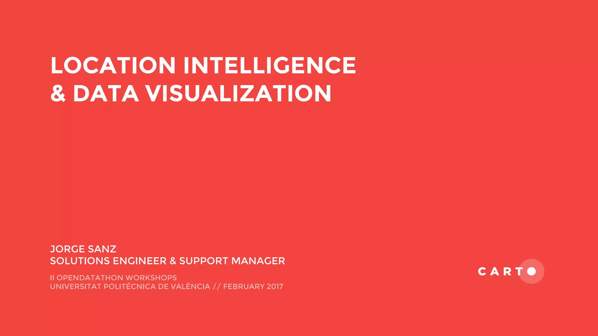

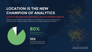


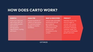
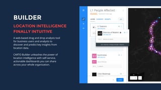
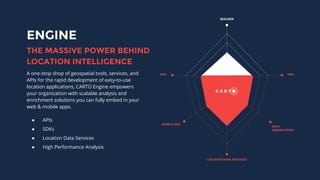
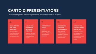


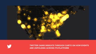

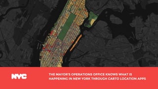

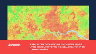


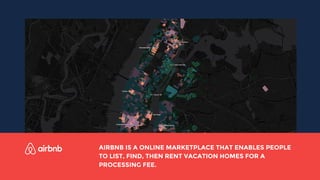


This document discusses location intelligence and data visualization using Carto. It notes that by 2020, 25 billion devices will generate location data and that location data provides opportunities for new insights. Carto provides solutions to analyze large amounts of location data and gain insights through intuitive dashboards. Key features include self-service tools, extensive datasets, and capabilities to integrate location intelligence into other applications. The document outlines Carto's products and shares examples of how various organizations have used Carto's tools.


![Tips and tricks for Working with Demographic Data [CARTOframes & Python]](https://cdn.slidesharecdn.com/ss_thumbnails/webinar-tipsandtricksforworkingwithdemographicdata-190319103145-thumbnail.jpg?width=640&height=640&fit=bounds)


![CARTO en 5 Pasos: del Dato a la Toma de Decisiones [CARTO]](https://cdn.slidesharecdn.com/ss_thumbnails/cartoen5pasosdeldatoalatomadedecisionesrecordedwebinar-190508103941-thumbnail.jpg?width=640&height=640&fit=bounds)


![Supercharging Site Planning in Retail & Real Estate [CARTO Reveal]](https://cdn.slidesharecdn.com/ss_thumbnails/webinarrecodedsuperchargingsiteplanninginretailrealestate-190329084857-thumbnail.jpg?width=640&height=640&fit=bounds)


![Unlock the power of spatial analysis using CARTO and python [CARTOframes]](https://cdn.slidesharecdn.com/ss_thumbnails/unlockthepowerofspatialanalysisusingcartoandpython-190927095046-thumbnail.jpg?width=640&height=640&fit=bounds)


![How to Use Spatial Data Science in your Site Planning Process? [CARTOframes]](https://cdn.slidesharecdn.com/ss_thumbnails/webinardeckhowtousespatialdatascienceinyoursiteplanning-190828105208-thumbnail.jpg?width=640&height=640&fit=bounds)


