Download as PDF, PPTX


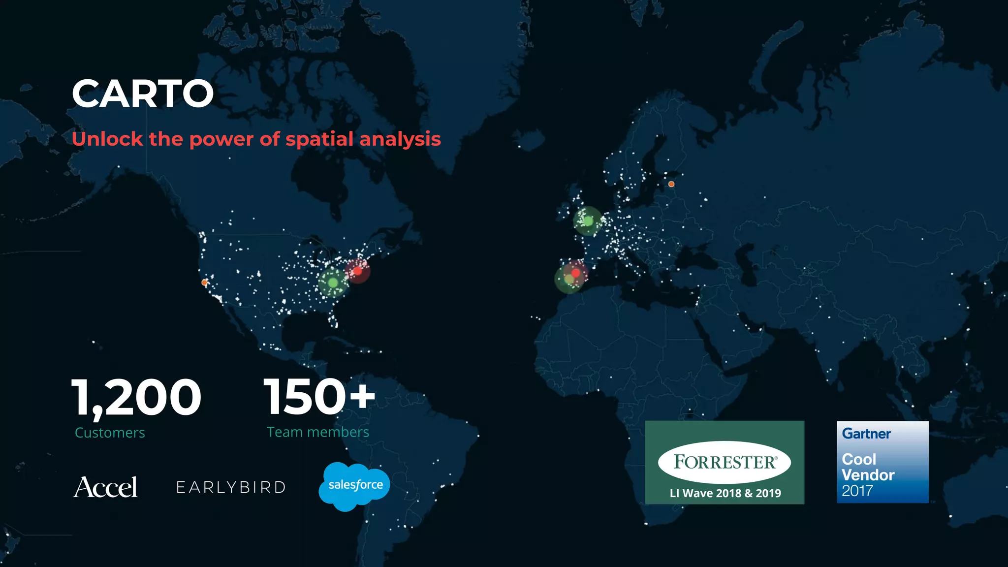
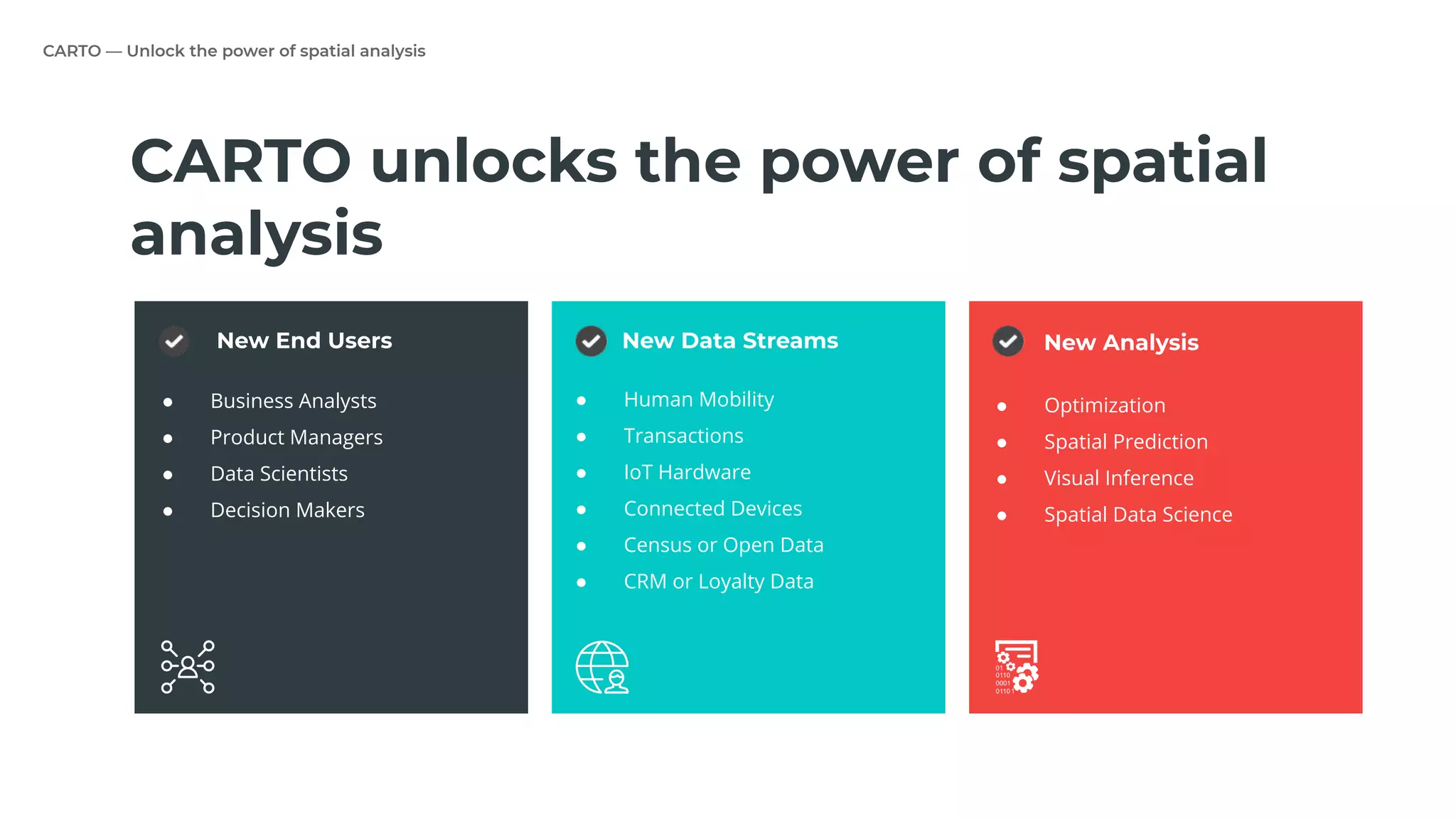
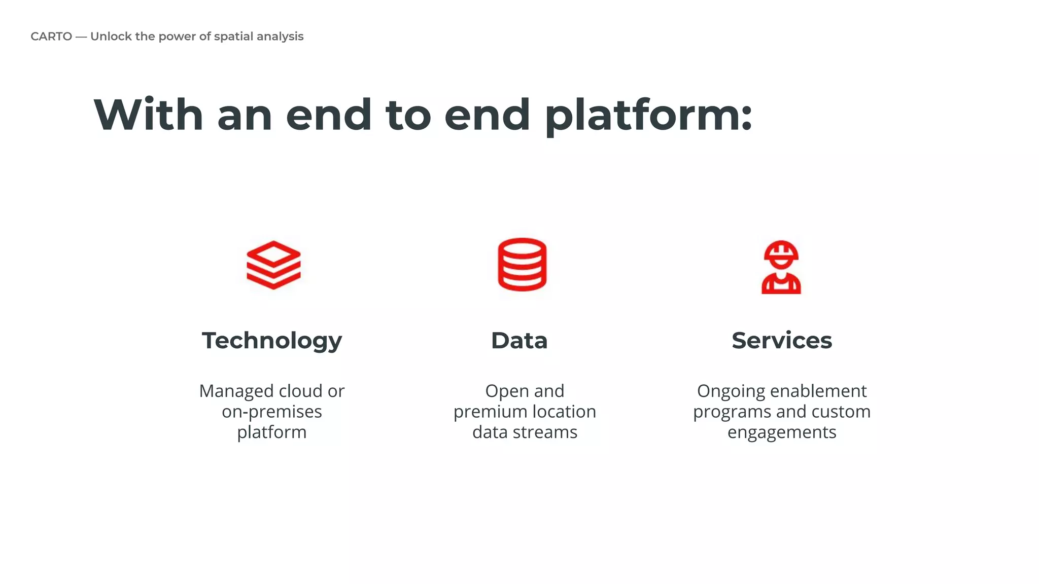

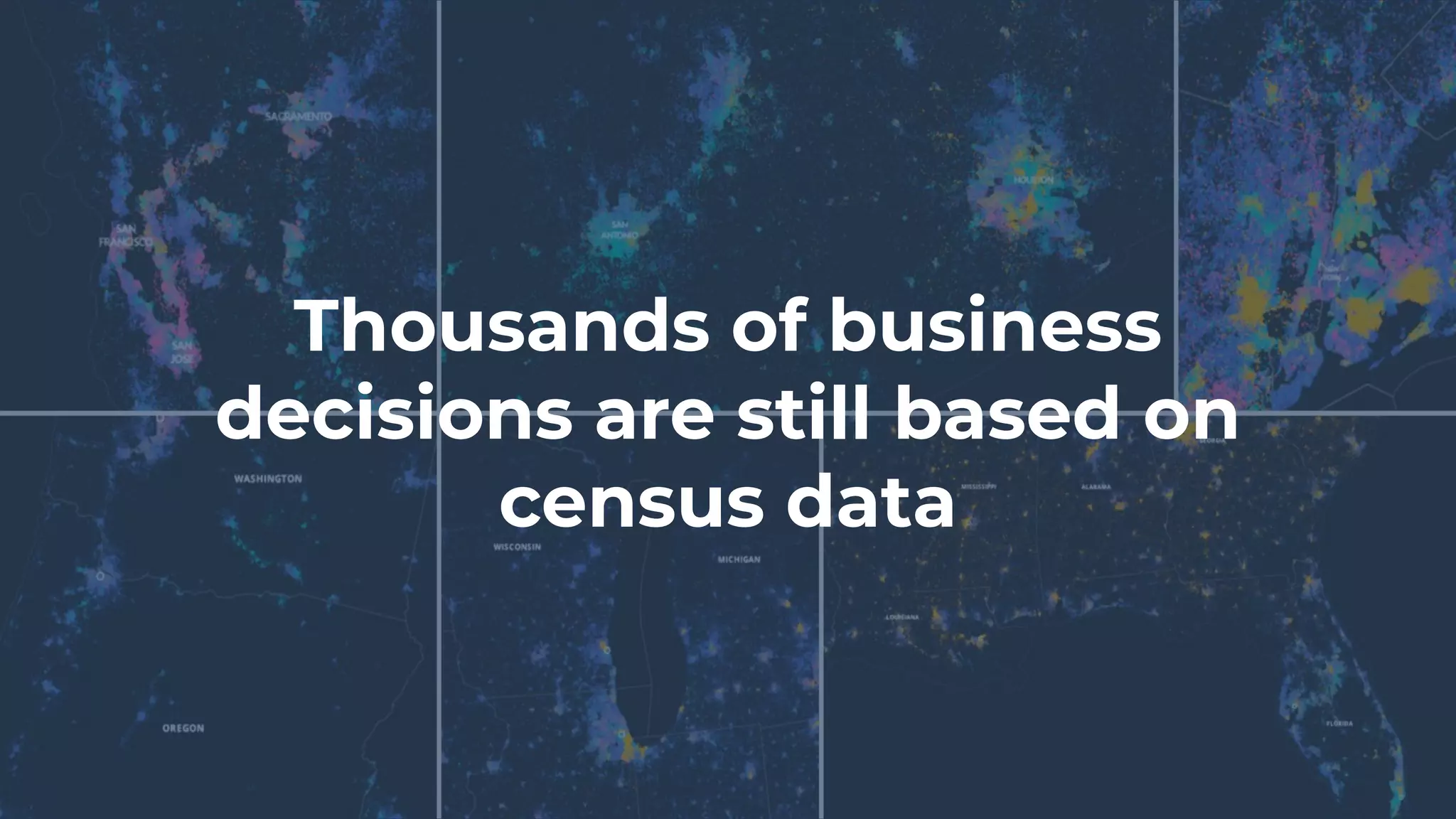
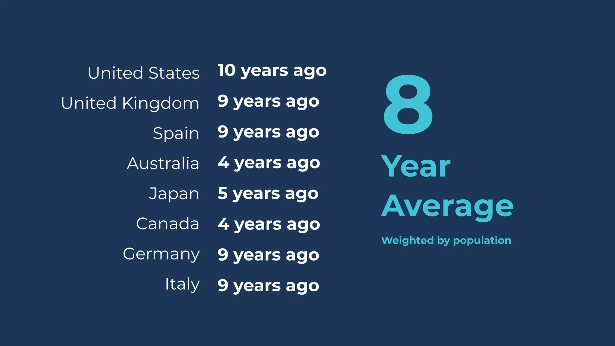
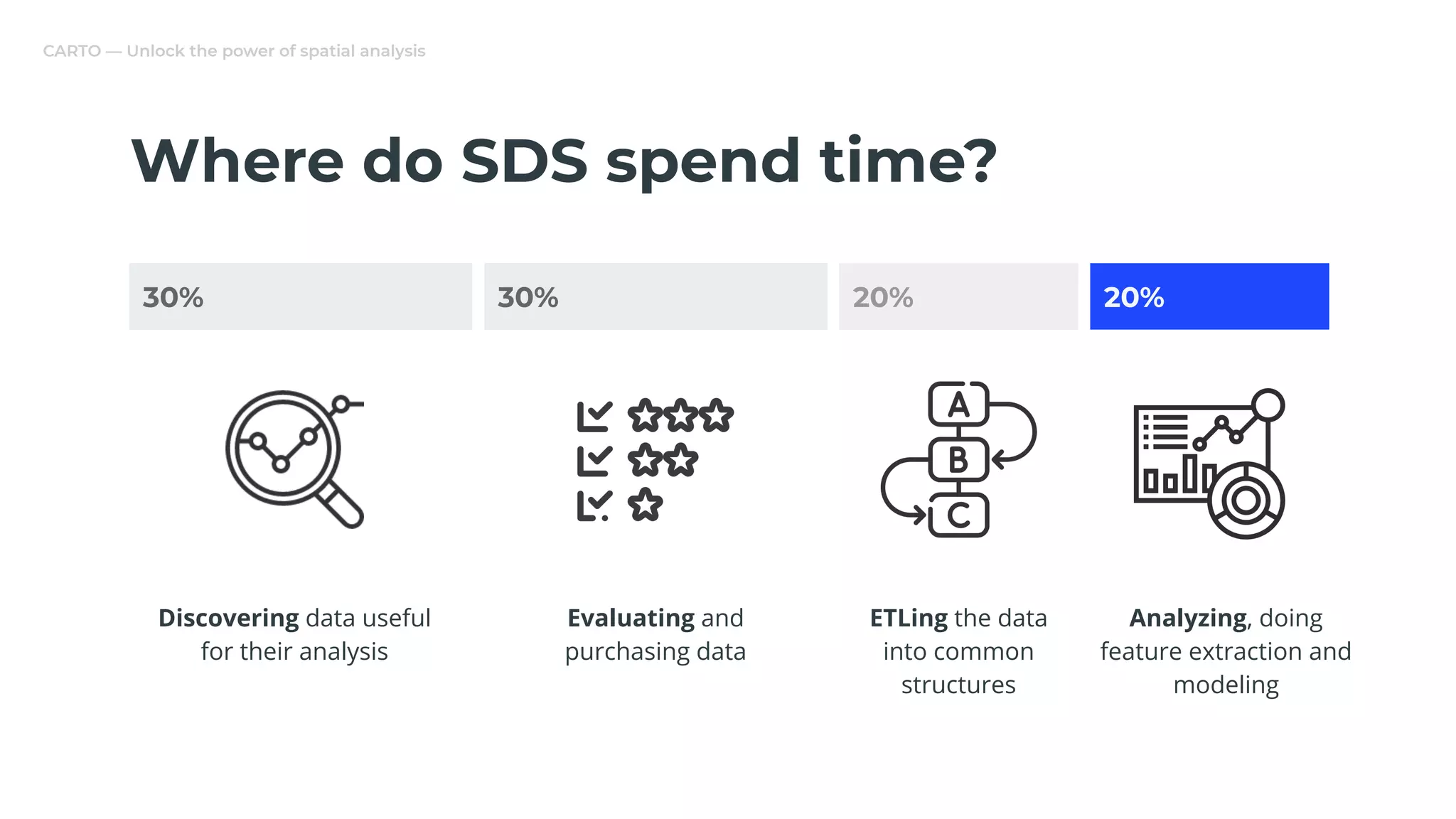
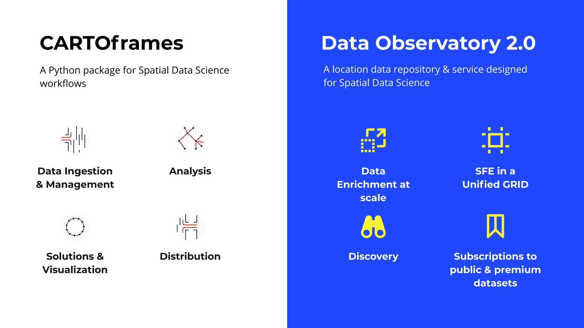
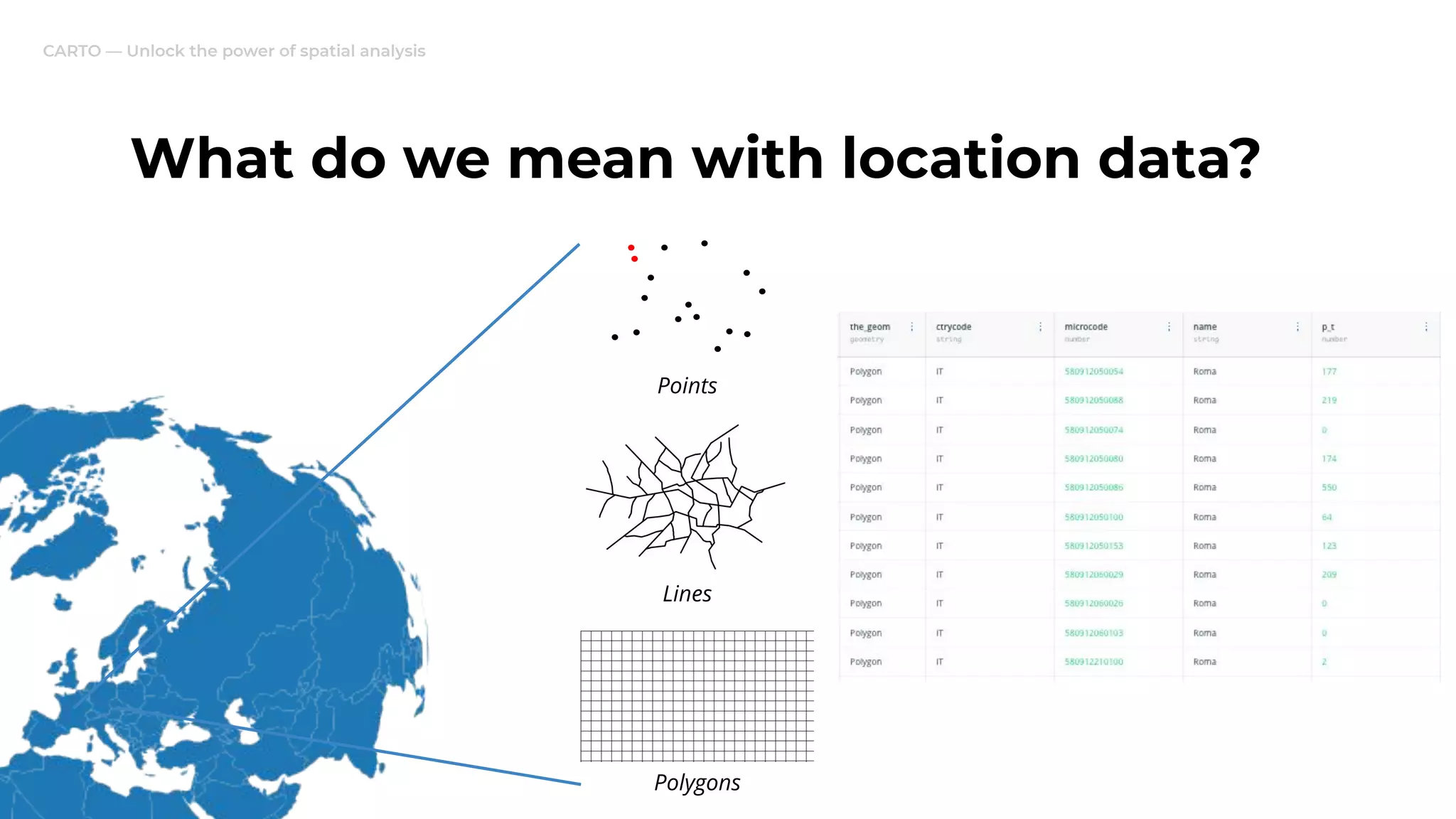

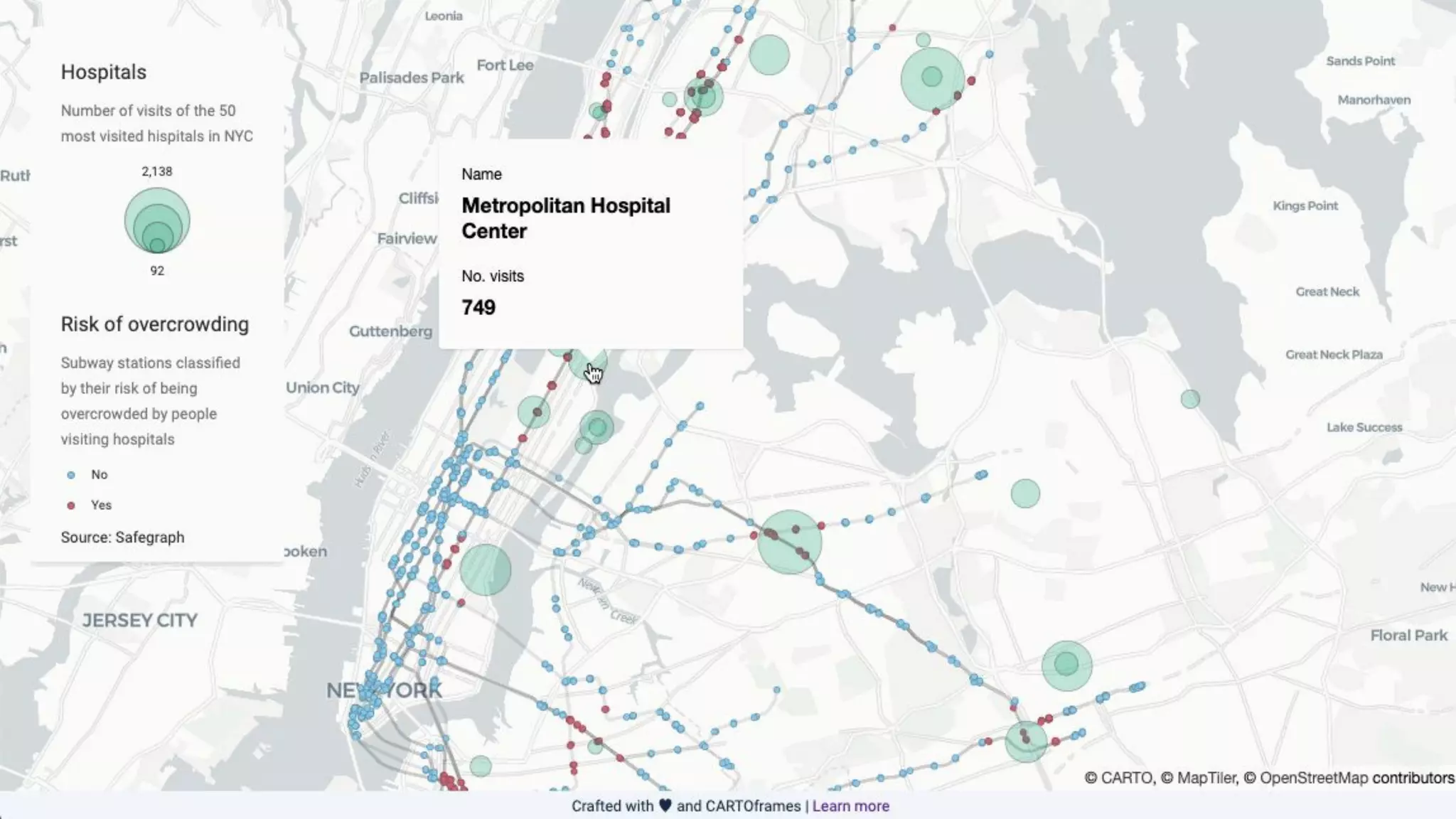
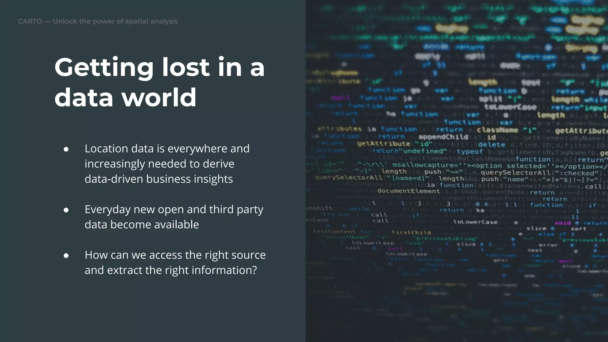
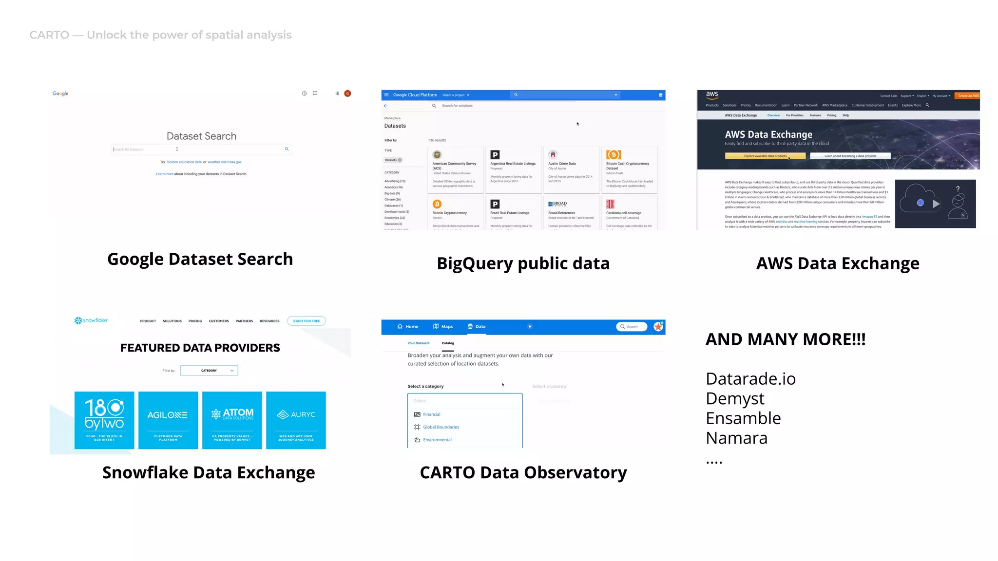
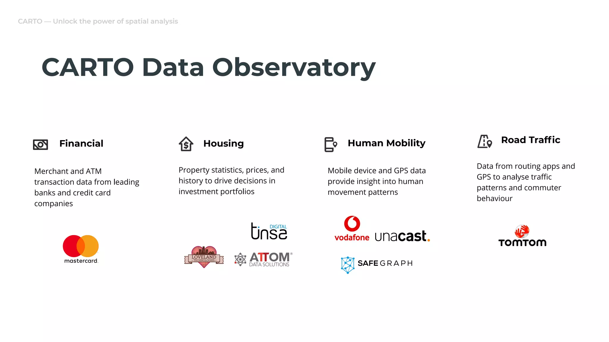
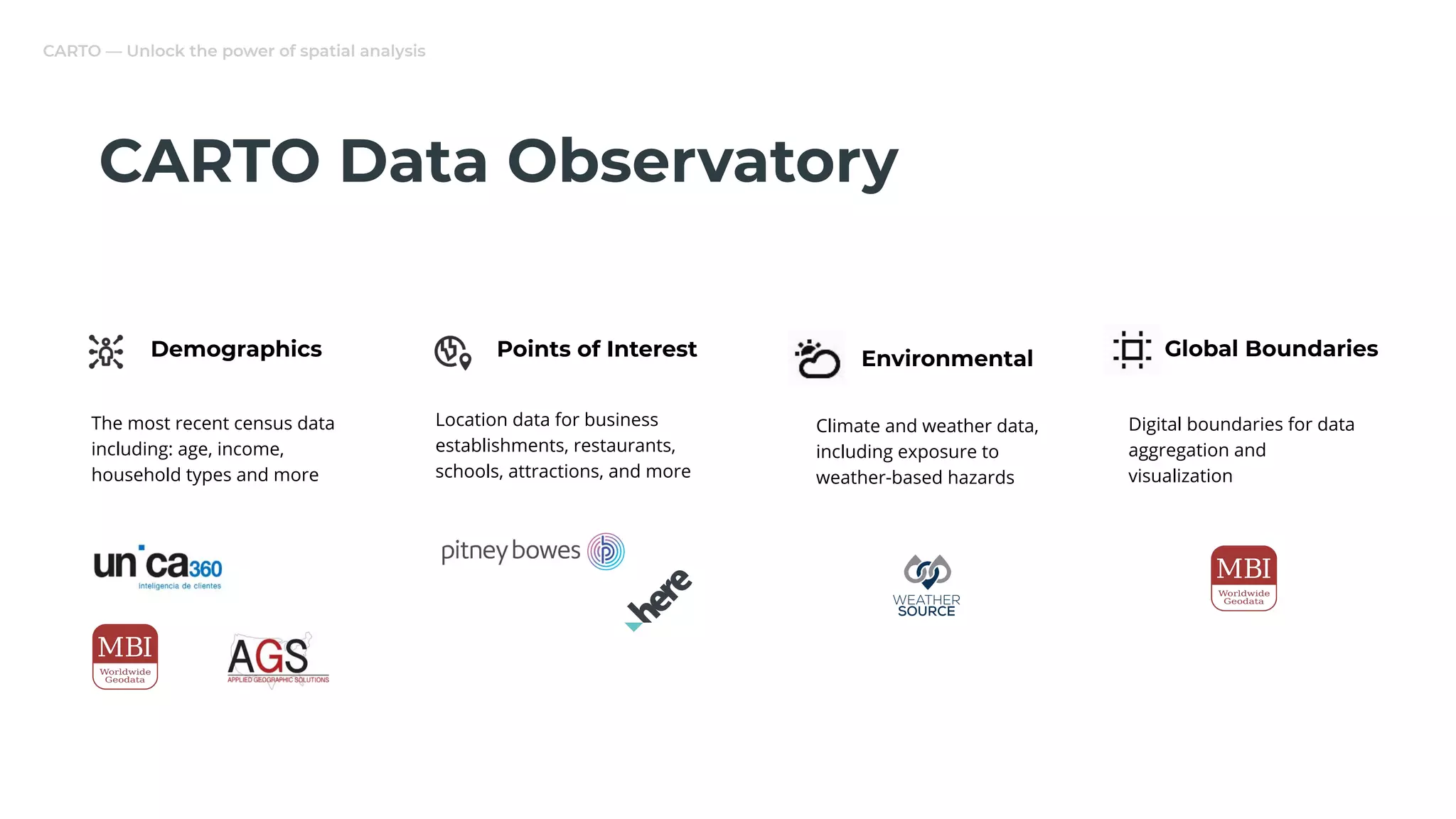
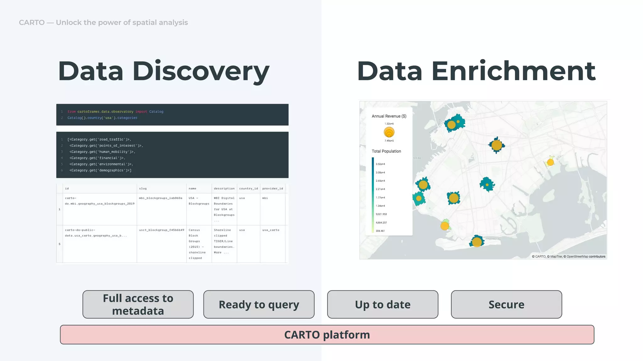
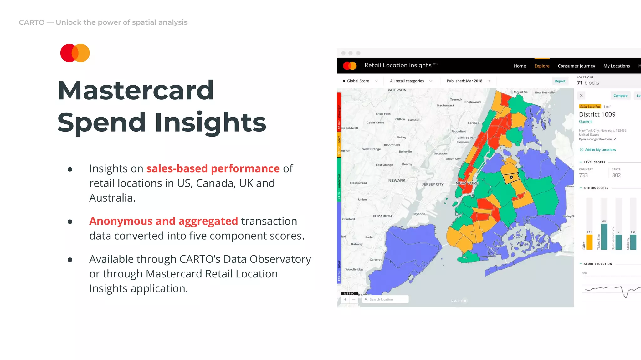
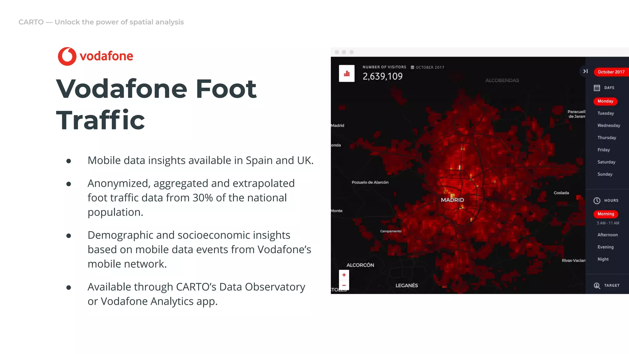
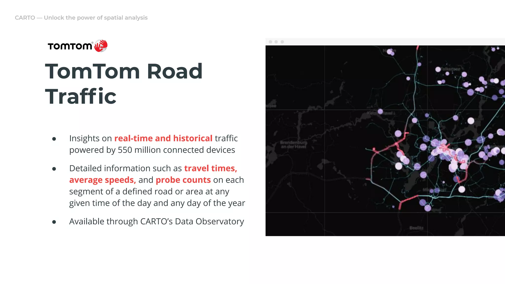
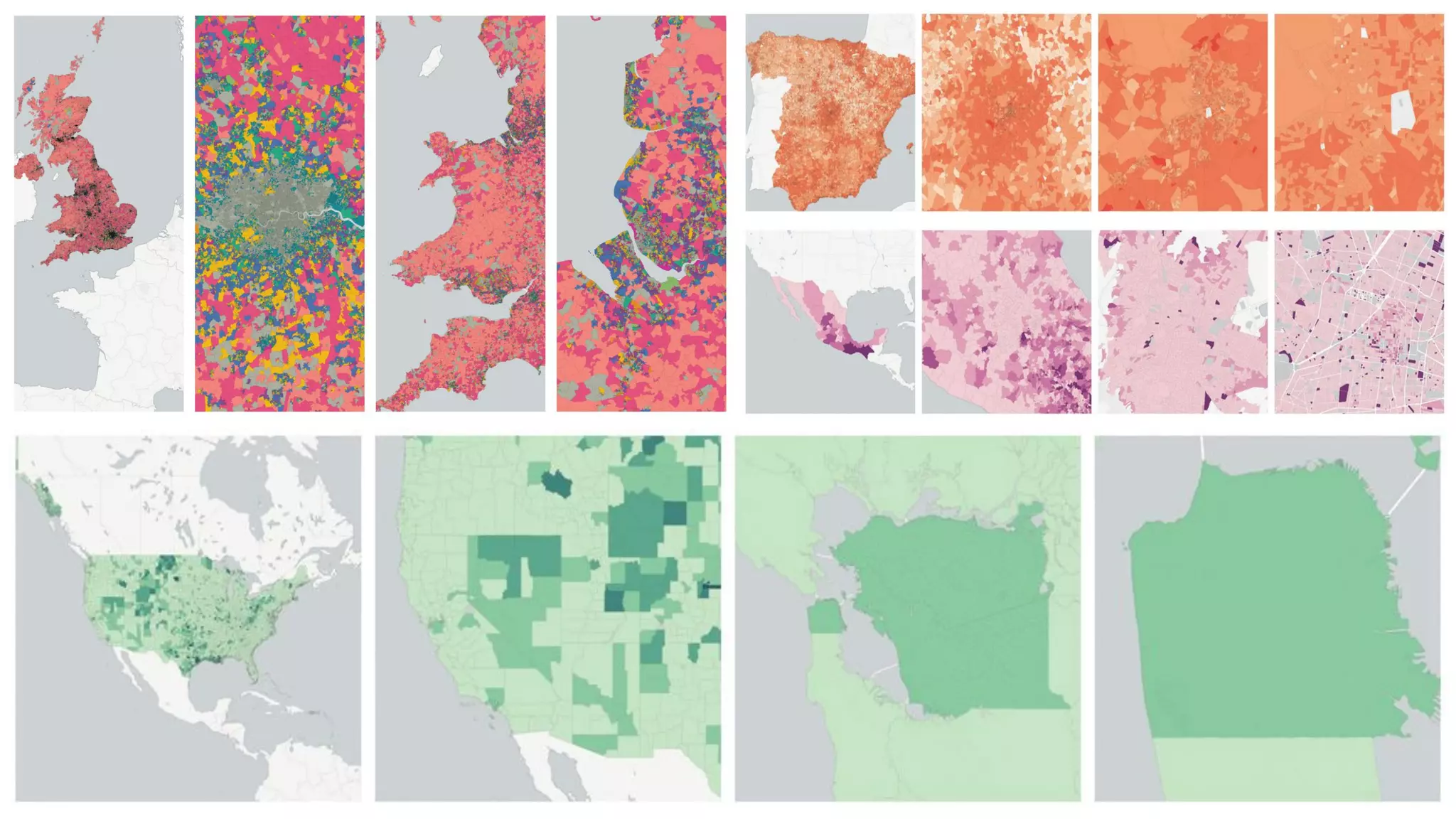
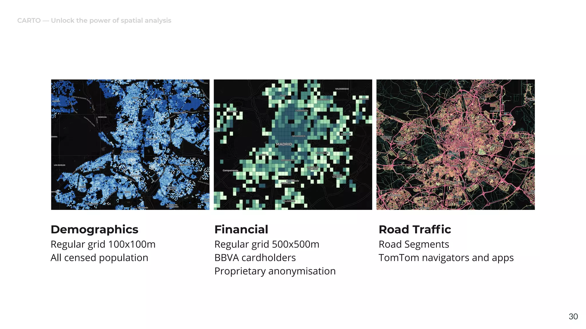
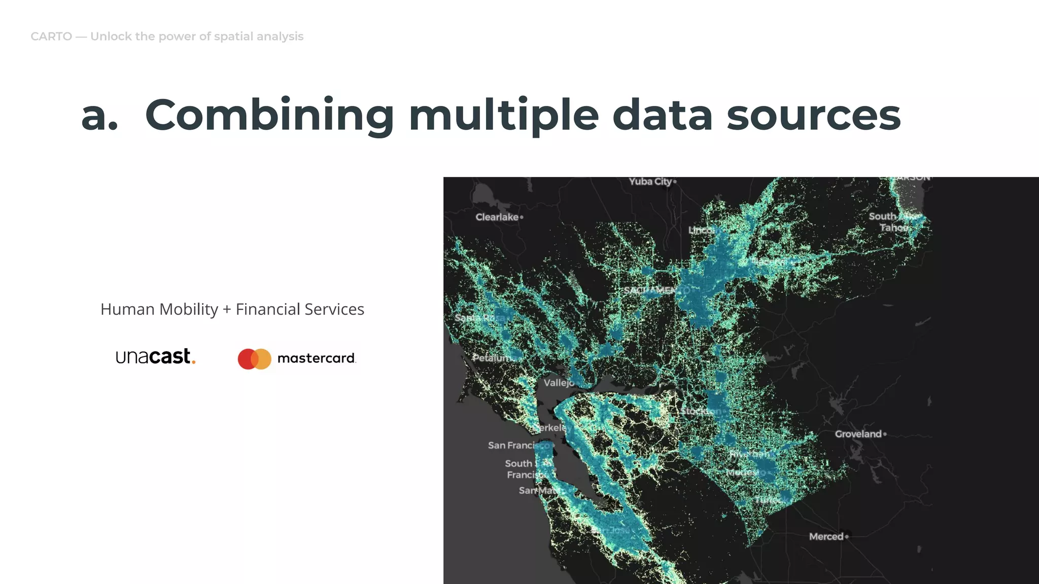
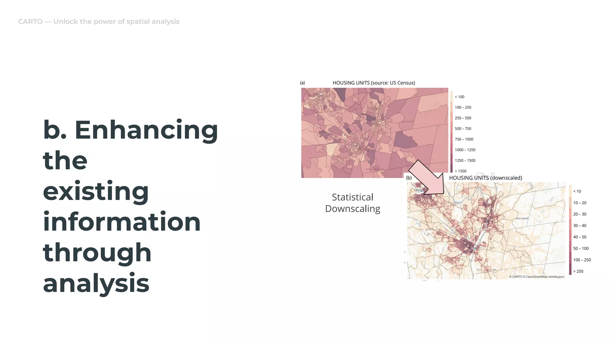
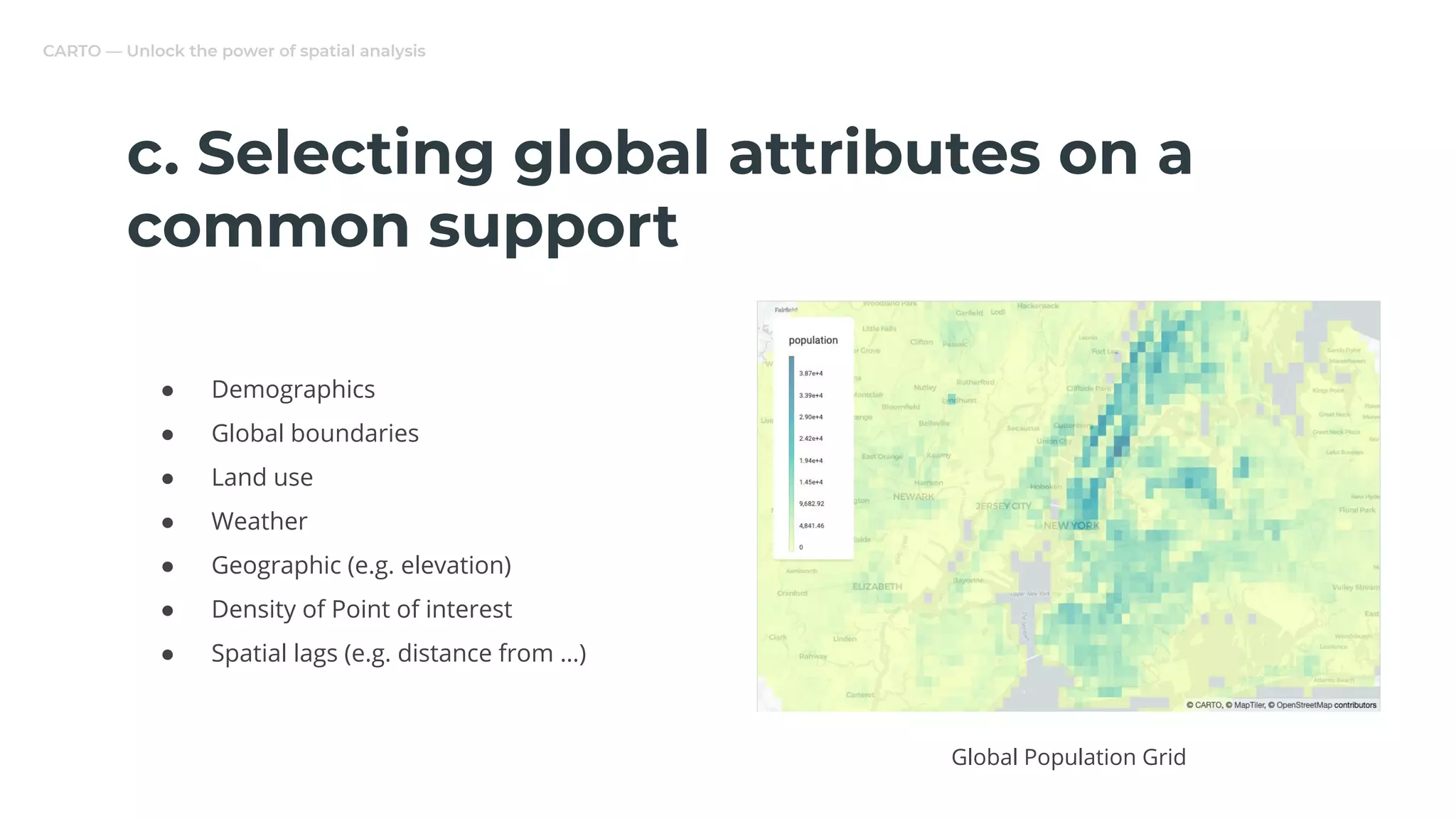
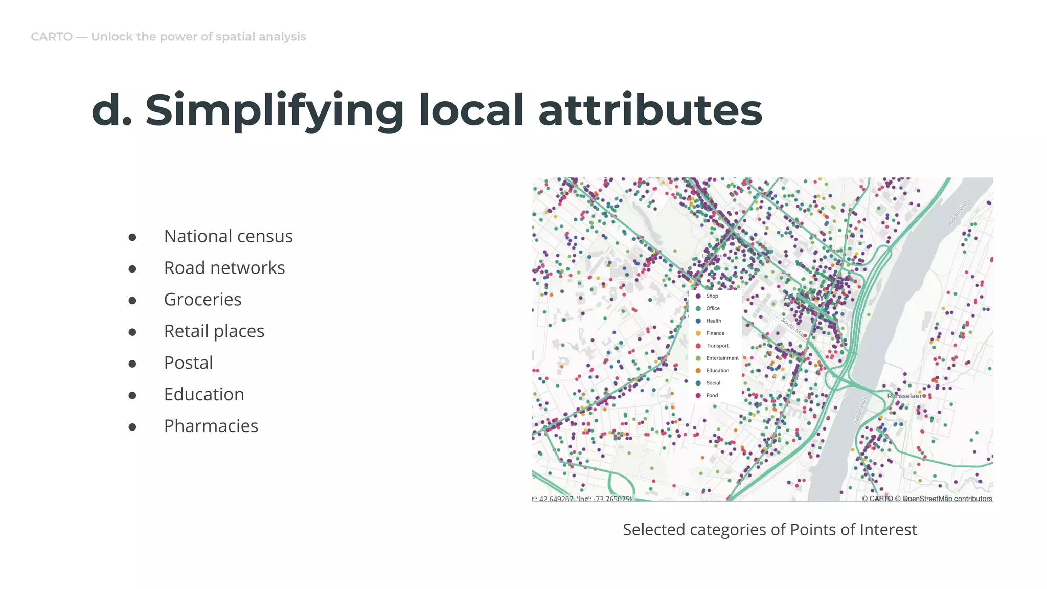
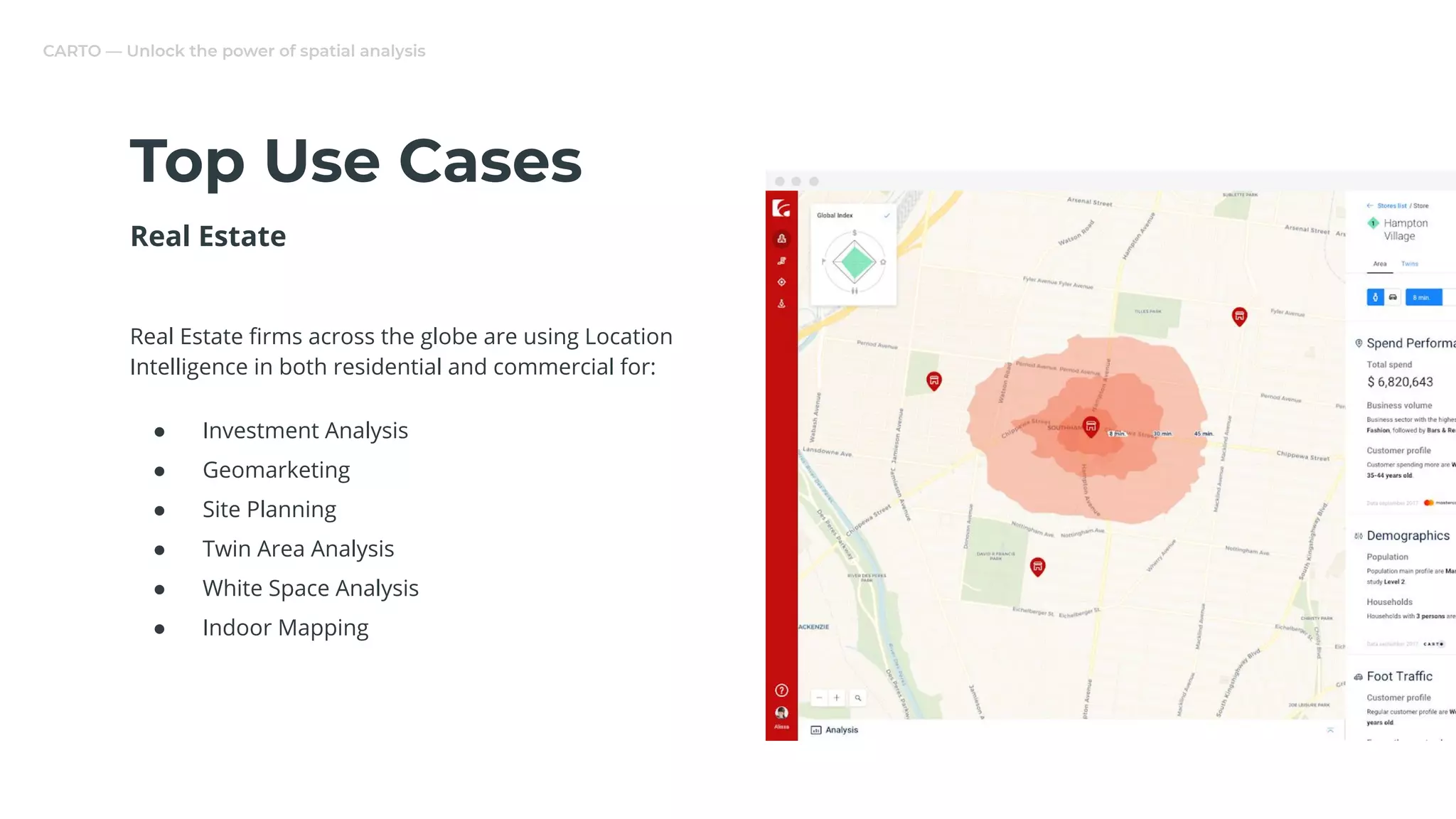
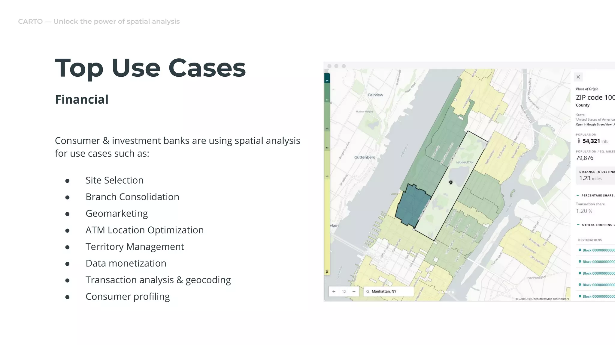
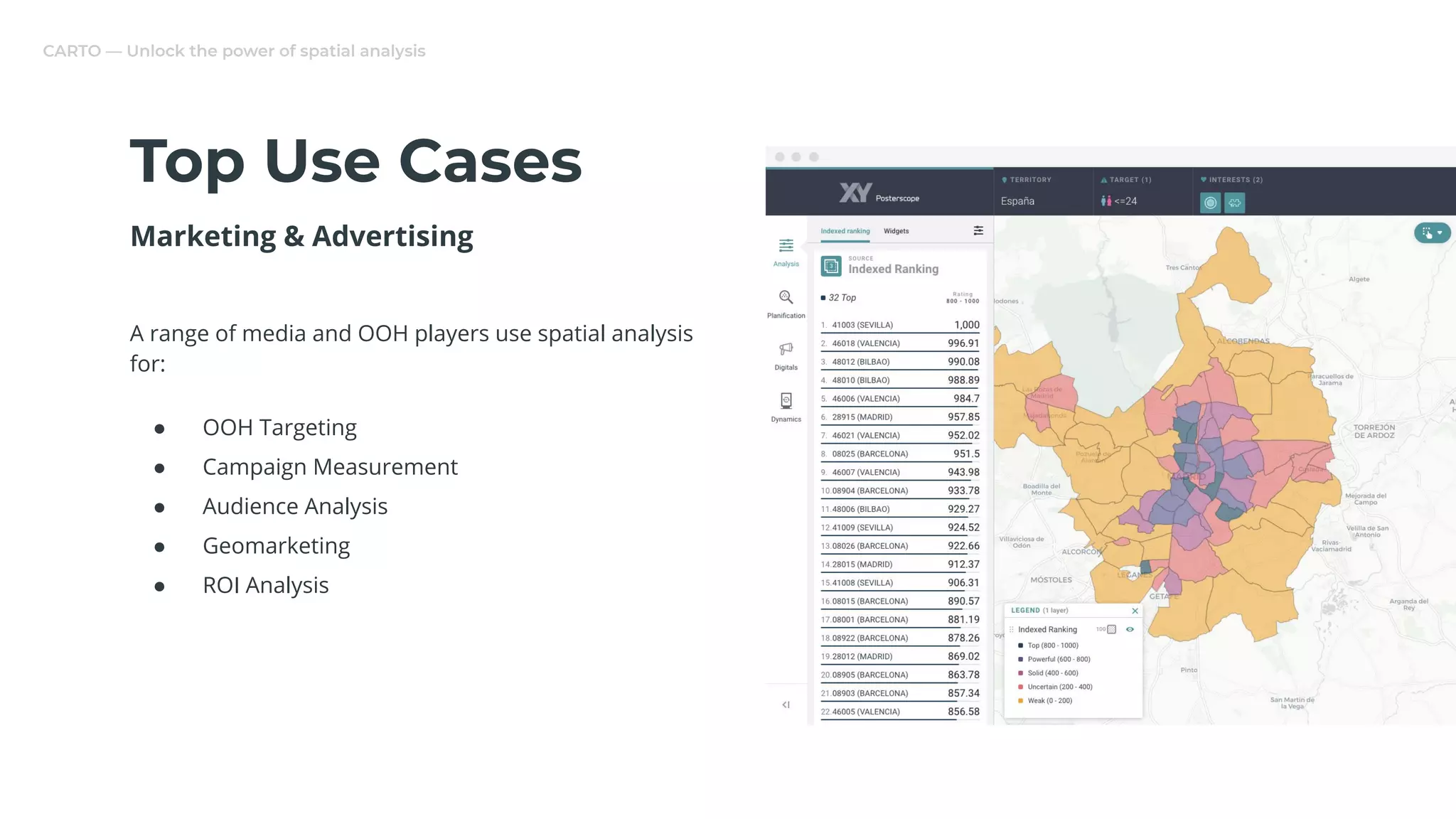


This document discusses location data and spatial analysis. It introduces CARTO, a company that provides an end-to-end platform for spatial data science including data ingestion, enrichment, analysis, visualization, and distribution capabilities. CARTO's Data Observatory provides access to numerous public and premium location datasets. The document outlines several use cases for location data in industries like real estate, financial services, and marketing/advertising and discusses challenges of fusing multiple location data streams from different sources and aggregations.


![How to Use Spatial Data Science in your Site Planning Process? [CARTOframes]](https://cdn.slidesharecdn.com/ss_thumbnails/webinardeckhowtousespatialdatascienceinyoursiteplanning-190828105208-thumbnail.jpg?width=640&height=640&fit=bounds)


![The Sum of our Parts: the Complete CARTO Journey [CARTO]](https://cdn.slidesharecdn.com/ss_thumbnails/recordedwebinarthesumofourpartsthecompletecartojourneydeck-190424092526-thumbnail.jpg?width=640&height=640&fit=bounds)


![Tips and tricks for Working with Demographic Data [CARTOframes & Python]](https://cdn.slidesharecdn.com/ss_thumbnails/webinar-tipsandtricksforworkingwithdemographicdata-190319103145-thumbnail.jpg?width=640&height=640&fit=bounds)


![Unlock the power of spatial analysis using CARTO and python [CARTOframes]](https://cdn.slidesharecdn.com/ss_thumbnails/unlockthepowerofspatialanalysisusingcartoandpython-190927095046-thumbnail.jpg?width=640&height=640&fit=bounds)


![Supercharging Site Planning in Retail & Real Estate [CARTO Reveal]](https://cdn.slidesharecdn.com/ss_thumbnails/webinarrecodedsuperchargingsiteplanninginretailrealestate-190329084857-thumbnail.jpg?width=640&height=640&fit=bounds)


![[DSC Europe 25] Boris Perkovic - Lost in performance.pptx](https://cdn.slidesharecdn.com/ss_thumbnails/uq5hrp7vsuahqkxzifux-1-251204082258-fd2ee09d-thumbnail.jpg?width=640&height=640&fit=bounds)
![[DSC Europe 25] Vid Stimac - Policy Parsimony: Between Oversimplifying and Ov...](https://cdn.slidesharecdn.com/ss_thumbnails/eqlepagzqp2rhg3gbluh-dsc-stimac-251120-251205090438-059e7f54-thumbnail.jpg?width=640&height=640&fit=bounds)


![[DSC Europe 25] Nikola Rajovic - Hardware Technologies Under the Hood: RISC-V...](https://cdn.slidesharecdn.com/ss_thumbnails/o2gptrmtoyqndgoshwgq-dsc2025-tenstorrent-rajovic-251205090438-814685f5-thumbnail.jpg?width=640&height=640&fit=bounds)


![[DSC Europe 25] Max Talanov - Non digital NNs.pptx](https://cdn.slidesharecdn.com/ss_thumbnails/wif8tr3gtua74qvtopke-non-digital-nns-251205090438-26b0eea6-thumbnail.jpg?width=640&height=640&fit=bounds)


