
Recommended
Recommended
More Related Content
What's hot
What's hot (20)
Similar to wasteland mapping
Similar to wasteland mapping (20)
Recently uploaded
Recently uploaded (20)
wasteland mapping
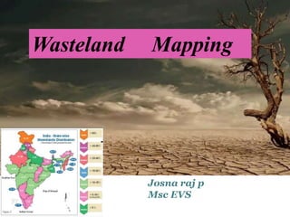
- 1. Wasteland Mapping Josna raj p Msc EVS
- 2. Wasteland may be described as degraded land under utilized lands most of which could brought into productive use with proper soil and water management practices. Culturable wasteland & unculturable wastelands It is very necessary to bring all the wastelands under produce and use through programms like afforestration, cropping pattern ,other economic uses. By reclamming wastelands we can achieve desired one third of geographical area.
- 3. CAUSES OF LAND DEGRADATION OVER CULTIVATION DEFORESTATION OVERGRAZING IMPROPER IRRIGATION PRACTICES
- 4. Wind erosion Water erosion Water logging Salinization Anthropogenic activities ect.
- 5. Wastelands in india Acco.indian wasteland Atlas 2010 wasteland area is now increased to 24% of the total geographical area. Approximately 175 million hectars of lands are degraded. Extent of land under aggriculture is 143 mha and again 56% of the land are suffers from varying degrees of degradation.
- 7. Remote sensing in wasteland mapping
- 8. Amoung the new technologies emerged for studying natural resources RS & GIS are effective techniquies for detecting assessing,mapping and monitoring of wastelands. Mapping of degraded lands ,space born sensors started with the launch of the first Earth Resourse Technology satellite(ERTS-1/Landsat-1 ).
- 9. High resolution satellite data, topographical maps, are used. Multi-season satellites data commonly used. In the visual interpretation of satellite data ,high soil moisture,and surfaced water logged areas are identified as deep dark grey to light black in colour describing that areas with water logging risks.
- 10. To study the spatial dynamics of wastelands , and to evaluate the utility of high resolution data for wasteland mapping ,the IRS P6 satellite data (23.5 * 23.5 m) and topographical maps are generellay used.(scale= 1:50,000).
- 11. The dyanamic nature of wastelands categories warrents the use of multi-season satellite data for their accurate delineation. Hence such images need to be geo-referenced in a common coordinate and projection system.
- 12. Remote sensig imagery is vital for the understanding of land cover changes, and thus forms an essential element of any effort to track land degradation and desertification trends. Change detection is an important process for monitoring and managing natural resourses and urban development because it provides quantitative analysis of the spatial distribution of the population of interest. The geodata base generated using Arc GIS and on screen digitization tech. show the type,extent,and spatial distribution of different wasteland categories.
- 13. Through the mapping we get informations on; geographical location, aerial extent , spatial distribution of wasteland , is essential for their effective management and sustainable development. Wasteland occurs on plateu, pediment and isolated mound and could be delineated and mapped using satellite data as it exhibits very light blue with medium texture , very light greenish blue tone with medium texture ,and dark brown with med.tex.
- 14. The first national wasteland mapping project undertaken by NRSA involved in a national mapping scale 1:1 million. For that purpose a standard classification scheme for the entire country was developed and area estimates of each category were made at both the state and national levels. The 1:50,000 scale wasteland maps produced by the National Remote Sensing Agency were by visual interpretation of enlarged Landsat Thematic mapper (TM) ,False Colour Composite (FCC) imagery having 3D meter resolution generated from 2,3 &4 bands of the spectrum.
- 15. the interpretation elements such as colour ,tone, shape, size,location.association ect enable one to identify and delineate wastelands. These deliations however are tentative and subject to confirmation in the field .so ground truth forms a vital input mapping with remote sensing data. The key for interpretation is subjected to changes depending upon the season, sacle, and resolution of the imagery. Certain categories of wastelands like salt –affected land ,waterlogged /marshy land and sandy areas can be eaily delineated by virtue of their spectral separatibilty, pattern ,and location.
- 16. Methodology… The methodology normally adopted for mapping at any scale consists of the preparation of base map ,on – line visual interpretation of satellite data, development of legend , ground truth collection ,analysis of soil samples, classification of degradation classes , and finalization of maps in the light of field information and analytial data.
- 17. Keywords …. IRS –P6 LISS-3 TOPOGRAPHIC MAPS MULTISPECTRAL IMAGES FALSE COLOUR COMPOSITE IMAGE INTERPRETATION Ect.
- 18. In 1991 , the MOEF embanked upon an ambitious project to apply GIS technology for wasteland management. Based on classification system evolved & approved by the planning commission comprises of the following categories;(NWDB ,1987); Gullied and/ ravenous land Upland with or without scrab Waterlogged and marshy land Land affected by salinity /alkalinity Shifting cultivation area Sandy(desert/coastal Mining/industrial wastelands
- 19. Under –utillized / degraded notified forest land Degraded land under plantation crops Barren rocky /stony wastes/sheet rock areas Steep sloping areas And snow covered and / glacial areas.
- 21. Inventory of waste lands in India Using space borne multi-spetral data,maps,spatial distribution and magnitude of eroded land ,salt affected soils, waterlogged areas,at 1:250,000 and 1:50,000 scales have been generated. The saline soils appear in different shades of white tone with fine to coarse texture on the false colour composite prints of satellite data owing to the presence of salts and are recognizable under normal crop growth.
- 22. For assessing these soils the national remote sensing agency has prepared maos on sacle 1:250,000 using satellite data from Landsat Thematic Mapper /IRS sensors in association with other gov. organizations. A digital atlas of india has prepared. This information being used for planning and land reclammation and soil conservation programmes.
- 27. Wasteland reclammation There is a need to reverse the trend of wasteland generation and to restore them to their production potential. Remote sensing forms early warning system for growth and development Many agencies /reports estimate land degradtion based on remote sensing.
- 28. Case studies…. Birbhum district-LOCATION METHODS FOLLOWED.. The wastelands of the district are identified and categorized through the successive stages of visual interpretation of satellite data on 1:50,000 scale,field checking and final interpretation. The wasteland boundaries as well as area coverage are processed. In this study toposheets of SOI satellite imageries of LISS- 3 ,geological survey map ,district maps ect are collected. Wastelands are identified on the basis of integrated approch through GIS. Visual analysis of IRS,LISS-3 geocoded data on 1:50,000 scale is accepted as the mapping tech. Interpertaion keys like tone, texture,site,association,of field objects wasteland is delineated & classified acco.classification system.
- 29. FINDINGS.. Certain categories of wastelands like degraded forest, sand riverine are easily delineated by virtue of their spectral separability,pattern,and location Gullied land ,minning wasteland are delineated with moderate success. The study has been shown that 6 types of wastelands are present in the district with total coverge 14854 hecters ,that is 3.3 % of total geographic area of the district. In the study area the wastelands are largely inherent-natural causes Some result of imposed factors
- 30. Thank you…..