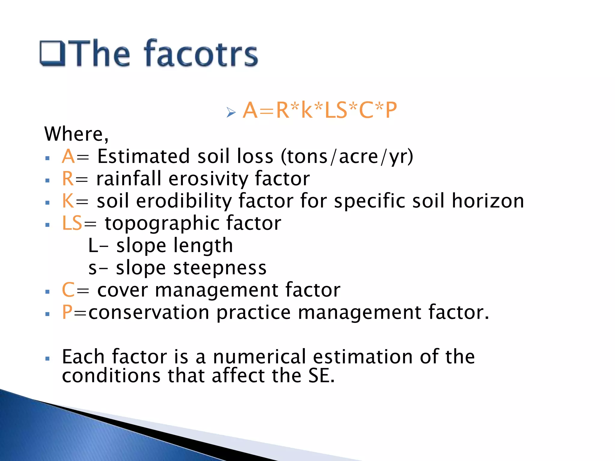
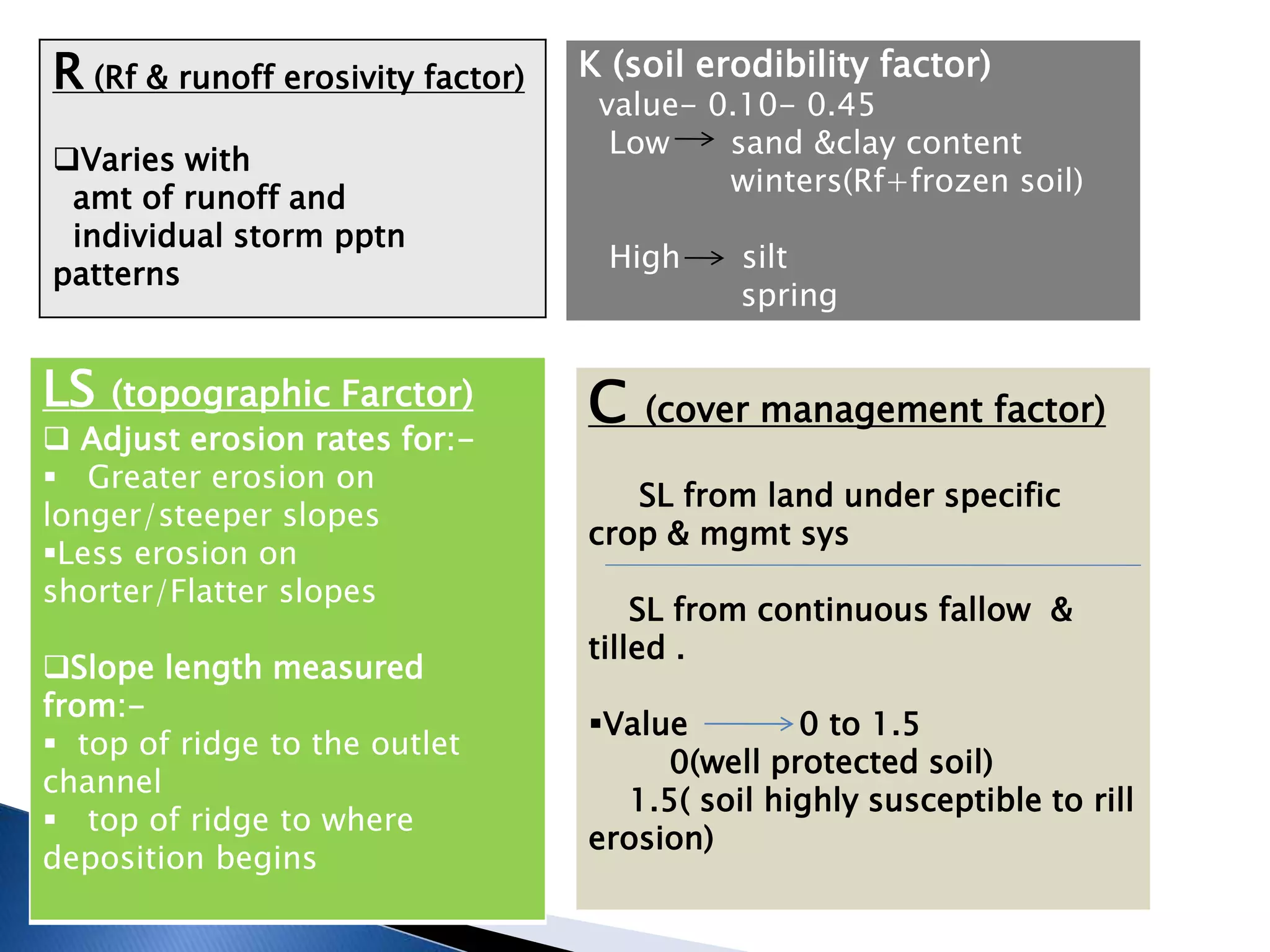
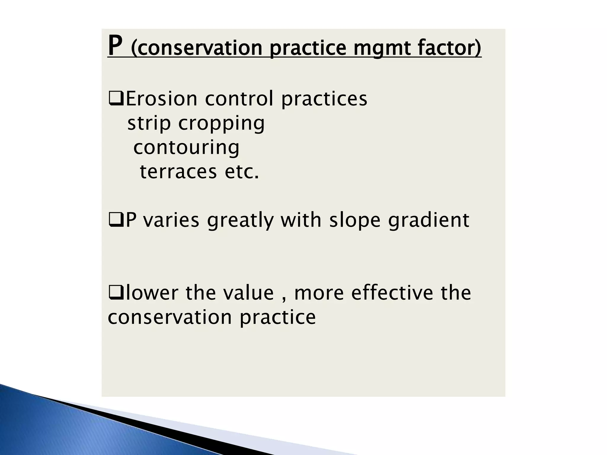
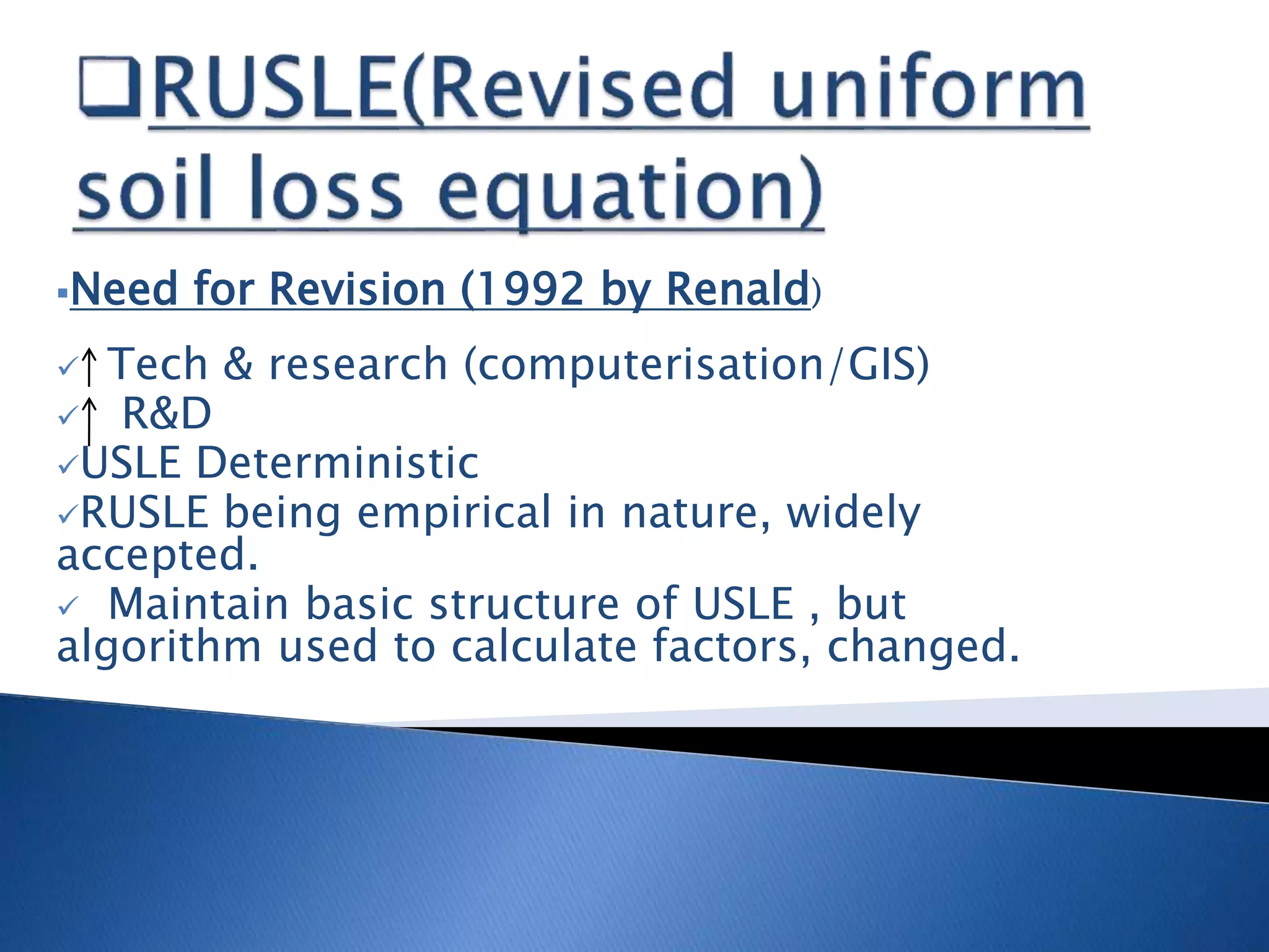
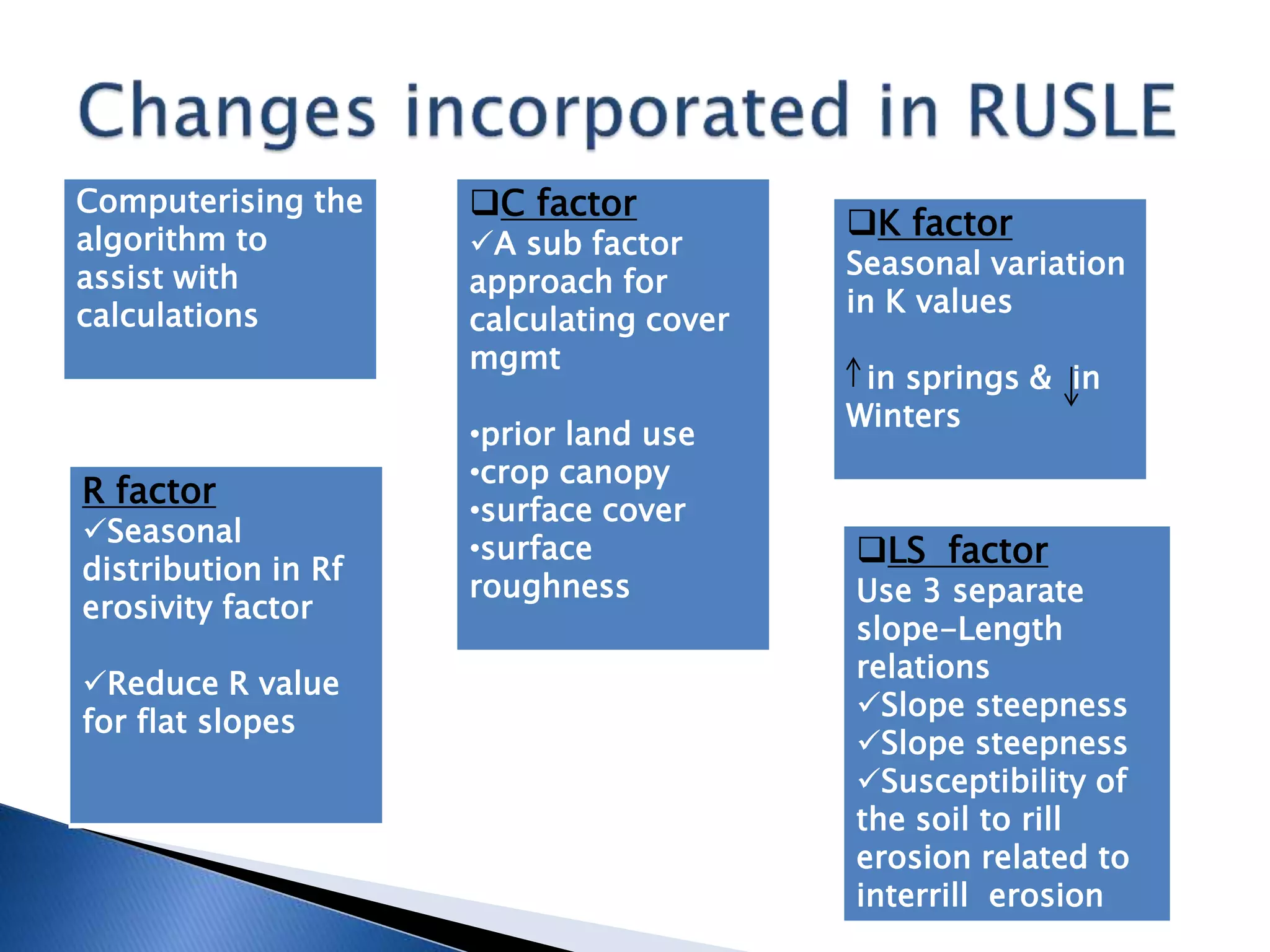
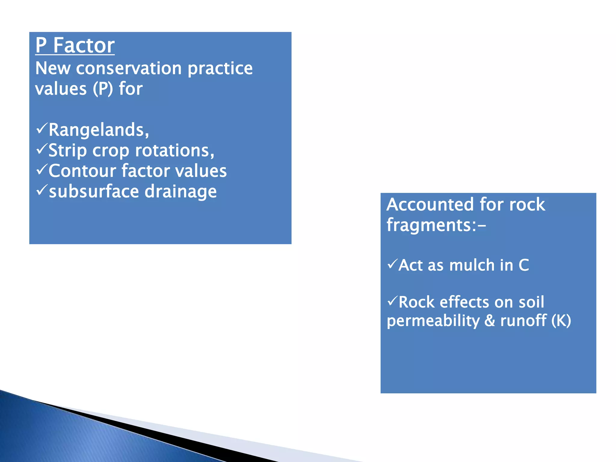
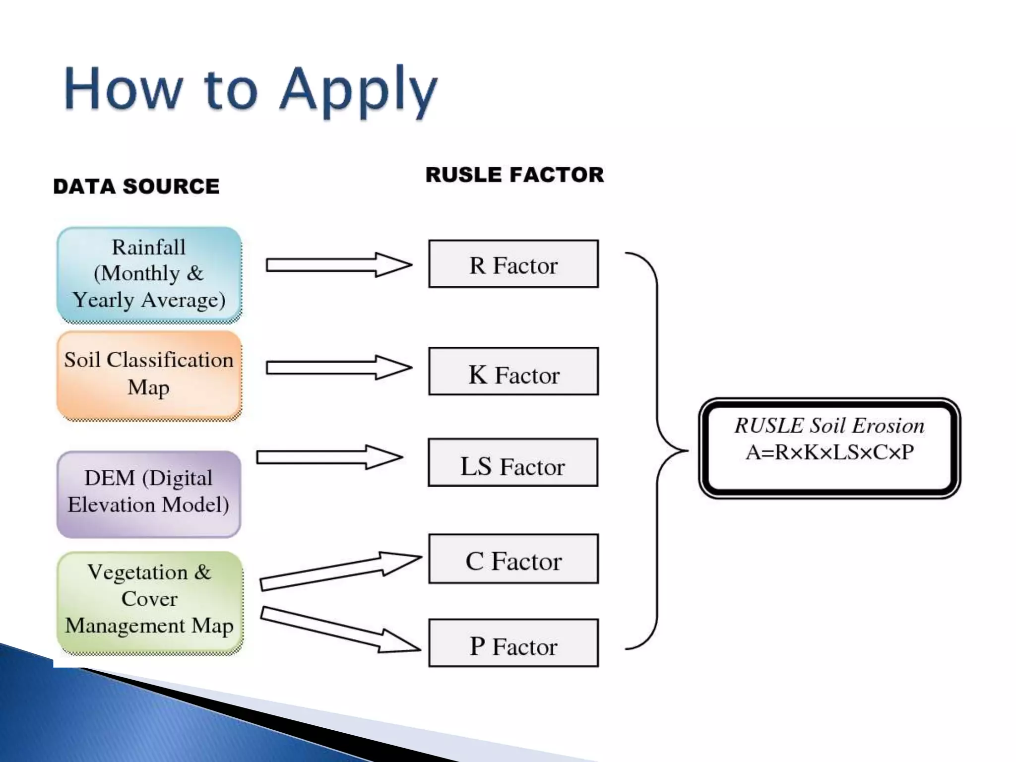
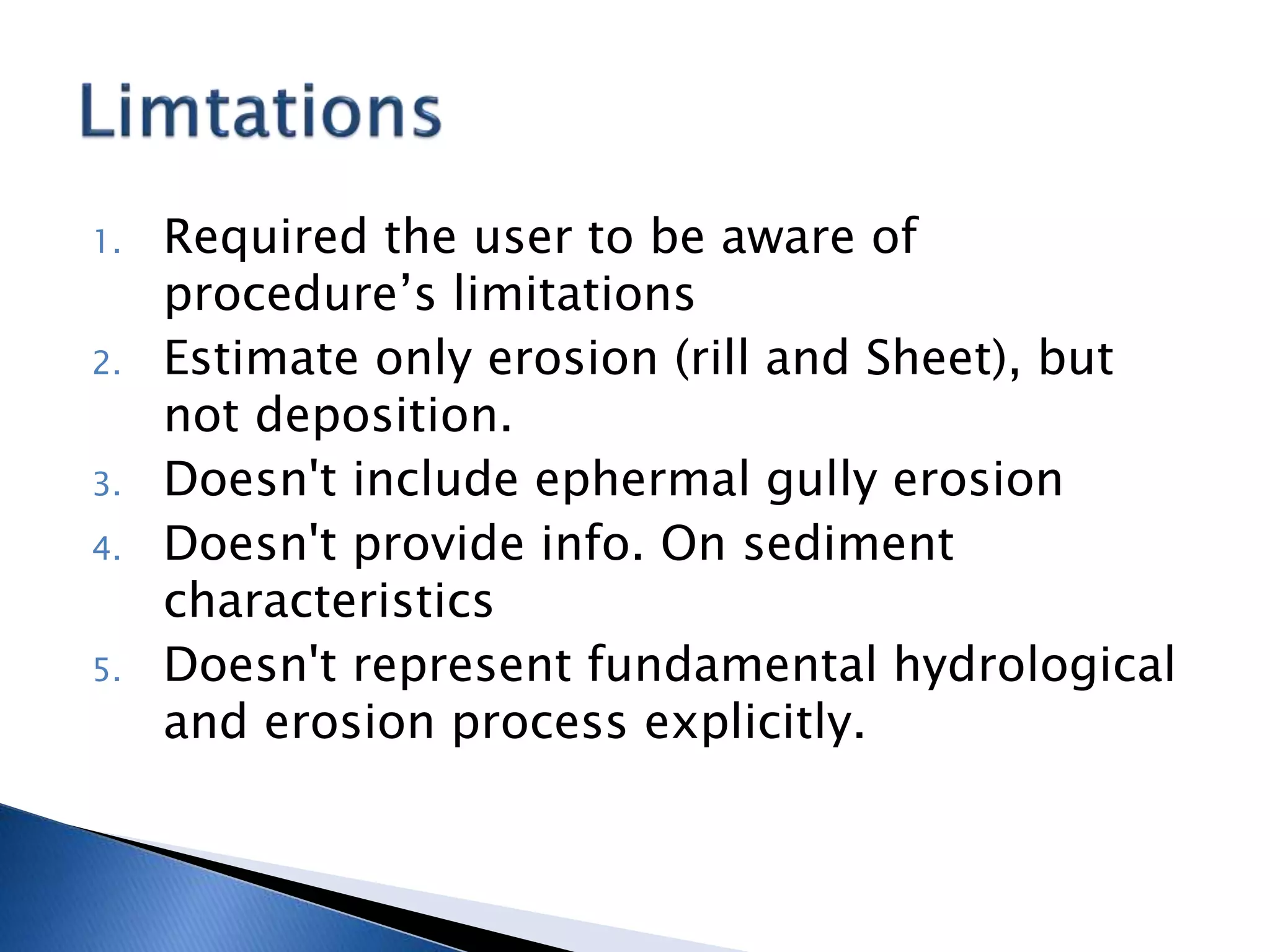
Empirical Models
To predict long term ave. annual soil loss on
a feild
 Developed by W. H. Wischmeier, D. D.
Smith with USDA in late1978
Field trial begun in late 1980s
Estimate soil erosion based on 5 factors
 A=R*k*LS*C*P
Where,
 A= Estimated soil loss (tons/acre/yr)
 R= rainfall erosivity factor
 K= soil erodibility factor for specific soil horizon
 LS= topographic factor
L- slope length
s- slope steepness
 C= cover management factor
 P=conservation practice management factor.
 Each factor is a numerical estimation of the
conditions that affect the SE.
R (Rf & runoff erosivity factor)
Varies with
amt of runoff and
individual storm pptn
patterns
K (soil erodibility factor)
value- 0.10- 0.45
Low sand &clay content
winters(Rf+frozen soil)
High silt
spring
LS (topographic Farctor)
 Adjust erosion rates for:-
 Greater erosion on
longer/steeper slopes
Less erosion on
shorter/Flatter slopes
Slope length measured
from:-
 top of ridge to the outlet
channel
 top of ridge to where
deposition begins
C (cover management factor)
SL from land under specific
crop & mgmt sys
SL from continuous fallow &
tilled .
Value 0 to 1.5
0(well protected soil)
1.5( soil highly susceptible to rill
erosion)
P (conservation practice mgmt factor)
Erosion control practices
strip cropping
contouring
terraces etc.
P varies greatly with slope gradient
lower the value , more effective the
conservation practice
Need for Revision (1992 by Renald)
 Tech & research (computerisation/GIS)
 R&D
USLE Deterministic
RUSLE being empirical in nature, widely
accepted.
 Maintain basic structure of USLE , but
algorithm used to calculate factors, changed.
Computerising the
algorithm to
assist with
calculations
R factor
Seasonal
distribution in Rf
erosivity factor
Reduce R value
for flat slopes
C factor
A sub factor
approach for
calculating cover
mgmt
•prior land use
•crop canopy
•surface cover
•surface
roughness
K factor
Seasonal variation
in K values
in springs & in
Winters
LS factor
Use 3 separate
slope-Length
relations
Slope steepness
Slope steepness
Susceptibility of
the soil to rill
erosion related to
interrill erosion
P Factor
New conservation practice
values (P) for
Rangelands,
Strip crop rotations,
Contour factor values
subsurface drainage
Accounted for rock
fragments:-
Act as mulch in C
Rock effects on soil
permeability & runoff (K)
1. To assist soil conservationist in on farm
planning
2. Developing & implementing public policy
related to soil conservation
3. yield and productivity of soil.
4. Better farm management
1. Required the user to be aware of
procedure’s limitations
2. Estimate only erosion (rill and Sheet), but
not deposition.
3. Doesn't include ephermal gully erosion
4. Doesn't provide info. On sediment
characteristics
5. Doesn't represent fundamental hydrological
and erosion process explicitly.
🤦🤦😒
धन्यवाद, आभार, शुक्रिया

USLE nd RUSLE Presentation.pptx

  • 2.
    Empirical Models To predictlong term ave. annual soil loss on a feild  Developed by W. H. Wischmeier, D. D. Smith with USDA in late1978 Field trial begun in late 1980s Estimate soil erosion based on 5 factors
  • 3.
     A=R*k*LS*C*P Where,  A=Estimated soil loss (tons/acre/yr)  R= rainfall erosivity factor  K= soil erodibility factor for specific soil horizon  LS= topographic factor L- slope length s- slope steepness  C= cover management factor  P=conservation practice management factor.  Each factor is a numerical estimation of the conditions that affect the SE.
  • 4.
    R (Rf &runoff erosivity factor) Varies with amt of runoff and individual storm pptn patterns K (soil erodibility factor) value- 0.10- 0.45 Low sand &clay content winters(Rf+frozen soil) High silt spring LS (topographic Farctor)  Adjust erosion rates for:-  Greater erosion on longer/steeper slopes Less erosion on shorter/Flatter slopes Slope length measured from:-  top of ridge to the outlet channel  top of ridge to where deposition begins C (cover management factor) SL from land under specific crop & mgmt sys SL from continuous fallow & tilled . Value 0 to 1.5 0(well protected soil) 1.5( soil highly susceptible to rill erosion)
  • 5.
    P (conservation practicemgmt factor) Erosion control practices strip cropping contouring terraces etc. P varies greatly with slope gradient lower the value , more effective the conservation practice
  • 6.
    Need for Revision(1992 by Renald)  Tech & research (computerisation/GIS)  R&D USLE Deterministic RUSLE being empirical in nature, widely accepted.  Maintain basic structure of USLE , but algorithm used to calculate factors, changed.
  • 7.
    Computerising the algorithm to assistwith calculations R factor Seasonal distribution in Rf erosivity factor Reduce R value for flat slopes C factor A sub factor approach for calculating cover mgmt •prior land use •crop canopy •surface cover •surface roughness K factor Seasonal variation in K values in springs & in Winters LS factor Use 3 separate slope-Length relations Slope steepness Slope steepness Susceptibility of the soil to rill erosion related to interrill erosion
  • 8.
    P Factor New conservationpractice values (P) for Rangelands, Strip crop rotations, Contour factor values subsurface drainage Accounted for rock fragments:- Act as mulch in C Rock effects on soil permeability & runoff (K)
  • 10.
    1. To assistsoil conservationist in on farm planning 2. Developing & implementing public policy related to soil conservation 3. yield and productivity of soil. 4. Better farm management
  • 11.
    1. Required theuser to be aware of procedure’s limitations 2. Estimate only erosion (rill and Sheet), but not deposition. 3. Doesn't include ephermal gully erosion 4. Doesn't provide info. On sediment characteristics 5. Doesn't represent fundamental hydrological and erosion process explicitly.
  • 13.
  • 14.