SlideShare a Scribd company logo
1 of 29
Geological Map
Presented By:
Kalpajyoti Mazumdar
4th sem, Department of Earth Ecience,
Assam University, Silchar
Content
 Introduction
 Brief history of Geological mapping
 Types of Geological Map
 How geological maps prepared ?
 Field Equipment
 Map scale
 Map key
 Conclusion
 Bibliography
Introduction
• What is a Map?
• A map is a picture or representation of the Earth’s
surface, showing how things are related to each other
by distance, direction , and size.
• Maps are a way of showing many things about a
portion of the Earth’s surface on a flat piece of paper
that can be carried and transported easily.
• A map is not a photograph of the Earth’s surface. It
can show many things that a picture can’t show, and
as a result, a map looks different in many ways from a
photograph of the Earth’s surface
What is a Geological Map?
• Geological map is a special purpose map made to show
geological features.
• A geologic map is a made of the different types of rocks or
structures that are on the surface of the Earth.
• Geologic maps are used to interpret the structure,
Stratigraphy , Mineralogy, Paleontology, and the historical
record of the Earth’s crust.
Brief history of geological mapping
 The map indicating the gold field in Egypt on the 13th century, is the first
recorded attempt in providing graphical geological information.
 In the 16th century D. Owen showed the Carboniferous outcrop in the form
of narrow beds.
 First geological map is known to have been compiled M.Lister at end of the
17th century.
 The first stratigraphic layer by layer geological map is started appearing at
the beginning of the 18th century.
 In India the first geological map was prepared by Dr. Henry Westly Voysey.
 Apt. J D the 1825 and this Herbest prepared the first geological map of the
Himalayan in was published in 1842 for the area between the river Sutlej and
Kali.
Types of Geological Mapping
There are 3 major types of Geologic Maps
1. Topographic Maps
2. Structural Maps
3. Cross-section map
1. Topographical Maps:
Topographic maps, show a 3 dimensional world
in 2 dimensions, by using contour lines (lines of
equal elevation).
Topographic maps refer to a graphical
representation of the three-dimensional
configuration of the surface of the Earth.
Moreover, such maps show the size, shape, and
distribution of landscape features.
2. Structural mapping
• Structural mapping is the identification and characterization of structural
expression. Structures include faults, folds, synclines and anticlines and
lineaments. Understanding structures is the key to interpreting crustal
movements that have shaped the present terrain.
• A synoptic view of regional scale is a much different perspective than point
ground observations when trying to map structural elements. Remote sensing
offers this perspective and allows a geologist to examine other reference
ancillary data simultaneously and synergistically, such as geo-magnetic
information.
3. Cross-sectional map
• A cross-sectional map shows the cross-section from the side. The cross-sectional maps
shows the changes along the line shown on the map.
• Cross-section maps or block diagrams is not a map actually but sometimes it is also
considered as a geological map, because of showing data similar to a geological map
Some other types of maps
Global map of monthly sea surface salinity, May 2022.
NASA's Soil Moisture Active Passive (SMAP) mission
Map of the world showing average annual precipitation
How Geological maps are prepared?
• The aim of geologic mapping is to create a map which summarizes the
geologic data gathered in the field.
• Every place that an observation is made, a sample is gathered, or any type
od data collection takes place, it is positioned on the map at the appropriate
X – Y coordinates.
• The map can be small scale and show much detail, or be large scale and
generalized.
• Different geologic mapping agencies and authorities have different
standards for the colors and symbols to be used for rocks of different types
and ages.
Field
Equipment
A
B
C
D
E
F
G
H
I
J
K
Map
scale
• Map scale can be expressed as the ratio or proportion between a
distance on a map and the actual distance on the land surface.
This ratio is called the Representative Fraction (RF). A RF of
1:100,000 indicates that 1 unit of measure on the map represents
100,000 units on the land surface (i.e. , 1 inch = 100,000 inches, 1.58
miles)
Conclusion
• Geological mapping is the fundamental task of a geologist on
the basis of which all subsequent qualitative and quantitative
geological studies are carried out leading to understanding of
evolution of chosen part of the terrain in space and time.
• The information is represent graphically on a chosen scale, by
use of combination of colours/characters, lines and symbols.
Bibliography
1. Basics of Geological mapping John W. Barnes, formerly of the Department of
Earth Science ,University of Wales Swansea
2. Standards for Regional Geological Mapping: Procedures and Guidelines for
work processes contented digital attributes for products (part II , part I)
Regional Geology and Geochemistry Department Geological Survey of Ethiopia
How to create geological map on
QGIS
Complete guide
• https://youtu.be/I8Wzm2qJsh0
Geological Map.ppt

More Related Content

What's hot (20)

Geomorphology applications
Geomorphology applicationsGeomorphology applications
Geomorphology applications
 
Geomorophology presentation
Geomorophology presentationGeomorophology presentation
Geomorophology presentation
 
Drainage basin morphometry
Drainage basin morphometry Drainage basin morphometry
Drainage basin morphometry
 
Fold & its classification
Fold & its classificationFold & its classification
Fold & its classification
 
Geological mapping
Geological mappingGeological mapping
Geological mapping
 
Dolerite
DoleriteDolerite
Dolerite
 
Groundwater exploration methods
Groundwater exploration methodsGroundwater exploration methods
Groundwater exploration methods
 
Toposheet indexing .
Toposheet indexing .Toposheet indexing .
Toposheet indexing .
 
Gravity Method
Gravity MethodGravity Method
Gravity Method
 
Fault and its classification
 Fault and its classification Fault and its classification
Fault and its classification
 
Tectonc framework of india
Tectonc framework of india Tectonc framework of india
Tectonc framework of india
 
Factors controlling weathering
Factors controlling weathering Factors controlling weathering
Factors controlling weathering
 
Unconformity
UnconformityUnconformity
Unconformity
 
Geological fieldwork report
Geological fieldwork reportGeological fieldwork report
Geological fieldwork report
 
Gravity method
Gravity method Gravity method
Gravity method
 
Ground water exploration
Ground water explorationGround water exploration
Ground water exploration
 
Self Potential Method (Electrical Survey)
Self Potential Method (Electrical Survey)Self Potential Method (Electrical Survey)
Self Potential Method (Electrical Survey)
 
Geophysical exploration
Geophysical exploration Geophysical exploration
Geophysical exploration
 
Stratigraphy
StratigraphyStratigraphy
Stratigraphy
 
Foliation and lineation
Foliation and lineationFoliation and lineation
Foliation and lineation
 

Similar to Geological Map.ppt

Practical work in geography
Practical work in geographyPractical work in geography
Practical work in geographyShivam Kapri
 
Map projections and its types explanation and examples.pptx
Map projections and its types explanation and examples.pptxMap projections and its types explanation and examples.pptx
Map projections and its types explanation and examples.pptxChShakeelAhmedMayo
 
Geological mapping in Exploration Geology( surface and subsurface)
Geological mapping in Exploration Geology( surface and subsurface)Geological mapping in Exploration Geology( surface and subsurface)
Geological mapping in Exploration Geology( surface and subsurface)HARITHA ANIL KUMAR
 
MAP PROJECTION.pdf
MAP PROJECTION.pdfMAP PROJECTION.pdf
MAP PROJECTION.pdfraziaramzan1
 
The geographer’s tools
The geographer’s toolsThe geographer’s tools
The geographer’s toolsAaron Carn
 
World geography intro powerpoint
World geography  intro powerpointWorld geography  intro powerpoint
World geography intro powerpointconfused1913
 
file_1622440466657.pdf
file_1622440466657.pdffile_1622440466657.pdf
file_1622440466657.pdfhabtamu292245
 
Presentation on Introduction of Surveying.
Presentation on Introduction of Surveying.Presentation on Introduction of Surveying.
Presentation on Introduction of Surveying.MaharAliHamzaHansla
 
Exploring our geographic world by tessie calimag bb.
Exploring our geographic world by tessie calimag bb.Exploring our geographic world by tessie calimag bb.
Exploring our geographic world by tessie calimag bb.Tessie Calimag
 
Surveying I Notes By Sudip Khadka.pdf
Surveying I Notes By Sudip Khadka.pdfSurveying I Notes By Sudip Khadka.pdf
Surveying I Notes By Sudip Khadka.pdfSudip khadka
 
Maps as Models of Earth
Maps as Models of EarthMaps as Models of Earth
Maps as Models of Earthmlong24
 
Maps as Models of Earth
Maps as Models of EarthMaps as Models of Earth
Maps as Models of Earthmlong24
 

Similar to Geological Map.ppt (20)

Practical work in geography
Practical work in geographyPractical work in geography
Practical work in geography
 
Map projections and its types explanation and examples.pptx
Map projections and its types explanation and examples.pptxMap projections and its types explanation and examples.pptx
Map projections and its types explanation and examples.pptx
 
Map projection
Map projection Map projection
Map projection
 
Geological mapping in Exploration Geology( surface and subsurface)
Geological mapping in Exploration Geology( surface and subsurface)Geological mapping in Exploration Geology( surface and subsurface)
Geological mapping in Exploration Geology( surface and subsurface)
 
TYPES OF SURVEYING.docx
TYPES OF SURVEYING.docxTYPES OF SURVEYING.docx
TYPES OF SURVEYING.docx
 
Reading a map
Reading a mapReading a map
Reading a map
 
MAP PROJECTION.pdf
MAP PROJECTION.pdfMAP PROJECTION.pdf
MAP PROJECTION.pdf
 
The geographer’s tools
The geographer’s toolsThe geographer’s tools
The geographer’s tools
 
Exploring geographic world
Exploring geographic worldExploring geographic world
Exploring geographic world
 
World geography intro powerpoint
World geography  intro powerpointWorld geography  intro powerpoint
World geography intro powerpoint
 
file_1622440466657.pdf
file_1622440466657.pdffile_1622440466657.pdf
file_1622440466657.pdf
 
Geography Handbook
Geography HandbookGeography Handbook
Geography Handbook
 
LECTURE_1.pdf
LECTURE_1.pdfLECTURE_1.pdf
LECTURE_1.pdf
 
Presentation on Introduction of Surveying.
Presentation on Introduction of Surveying.Presentation on Introduction of Surveying.
Presentation on Introduction of Surveying.
 
SST-1.pptx
SST-1.pptxSST-1.pptx
SST-1.pptx
 
Surveying (introduction)
Surveying (introduction)Surveying (introduction)
Surveying (introduction)
 
Exploring our geographic world by tessie calimag bb.
Exploring our geographic world by tessie calimag bb.Exploring our geographic world by tessie calimag bb.
Exploring our geographic world by tessie calimag bb.
 
Surveying I Notes By Sudip Khadka.pdf
Surveying I Notes By Sudip Khadka.pdfSurveying I Notes By Sudip Khadka.pdf
Surveying I Notes By Sudip Khadka.pdf
 
Maps as Models of Earth
Maps as Models of EarthMaps as Models of Earth
Maps as Models of Earth
 
Maps as Models of Earth
Maps as Models of EarthMaps as Models of Earth
Maps as Models of Earth
 

Recently uploaded

Roles & Responsibilities in Pharmacovigilance
Roles & Responsibilities in PharmacovigilanceRoles & Responsibilities in Pharmacovigilance
Roles & Responsibilities in PharmacovigilanceSamikshaHamane
 
Capitol Tech U Doctoral Presentation - April 2024.pptx
Capitol Tech U Doctoral Presentation - April 2024.pptxCapitol Tech U Doctoral Presentation - April 2024.pptx
Capitol Tech U Doctoral Presentation - April 2024.pptxCapitolTechU
 
CELL CYCLE Division Science 8 quarter IV.pptx
CELL CYCLE Division Science 8 quarter IV.pptxCELL CYCLE Division Science 8 quarter IV.pptx
CELL CYCLE Division Science 8 quarter IV.pptxJiesonDelaCerna
 
Pharmacognosy Flower 3. Compositae 2023.pdf
Pharmacognosy Flower 3. Compositae 2023.pdfPharmacognosy Flower 3. Compositae 2023.pdf
Pharmacognosy Flower 3. Compositae 2023.pdfMahmoud M. Sallam
 
Meghan Sutherland In Media Res Media Component
Meghan Sutherland In Media Res Media ComponentMeghan Sutherland In Media Res Media Component
Meghan Sutherland In Media Res Media ComponentInMediaRes1
 
How to Configure Email Server in Odoo 17
How to Configure Email Server in Odoo 17How to Configure Email Server in Odoo 17
How to Configure Email Server in Odoo 17Celine George
 
Solving Puzzles Benefits Everyone (English).pptx
Solving Puzzles Benefits Everyone (English).pptxSolving Puzzles Benefits Everyone (English).pptx
Solving Puzzles Benefits Everyone (English).pptxOH TEIK BIN
 
How to Make a Pirate ship Primary Education.pptx
How to Make a Pirate ship Primary Education.pptxHow to Make a Pirate ship Primary Education.pptx
How to Make a Pirate ship Primary Education.pptxmanuelaromero2013
 
Framing an Appropriate Research Question 6b9b26d93da94caf993c038d9efcdedb.pdf
Framing an Appropriate Research Question 6b9b26d93da94caf993c038d9efcdedb.pdfFraming an Appropriate Research Question 6b9b26d93da94caf993c038d9efcdedb.pdf
Framing an Appropriate Research Question 6b9b26d93da94caf993c038d9efcdedb.pdfUjwalaBharambe
 
AmericanHighSchoolsprezentacijaoskolama.
AmericanHighSchoolsprezentacijaoskolama.AmericanHighSchoolsprezentacijaoskolama.
AmericanHighSchoolsprezentacijaoskolama.arsicmarija21
 
ENGLISH 7_Q4_LESSON 2_ Employing a Variety of Strategies for Effective Interp...
ENGLISH 7_Q4_LESSON 2_ Employing a Variety of Strategies for Effective Interp...ENGLISH 7_Q4_LESSON 2_ Employing a Variety of Strategies for Effective Interp...
ENGLISH 7_Q4_LESSON 2_ Employing a Variety of Strategies for Effective Interp...JhezDiaz1
 
Like-prefer-love -hate+verb+ing & silent letters & citizenship text.pdf
Like-prefer-love -hate+verb+ing & silent letters & citizenship text.pdfLike-prefer-love -hate+verb+ing & silent letters & citizenship text.pdf
Like-prefer-love -hate+verb+ing & silent letters & citizenship text.pdfMr Bounab Samir
 
call girls in Kamla Market (DELHI) 🔝 >༒9953330565🔝 genuine Escort Service 🔝✔️✔️
call girls in Kamla Market (DELHI) 🔝 >༒9953330565🔝 genuine Escort Service 🔝✔️✔️call girls in Kamla Market (DELHI) 🔝 >༒9953330565🔝 genuine Escort Service 🔝✔️✔️
call girls in Kamla Market (DELHI) 🔝 >༒9953330565🔝 genuine Escort Service 🔝✔️✔️9953056974 Low Rate Call Girls In Saket, Delhi NCR
 
Gas measurement O2,Co2,& ph) 04/2024.pptx
Gas measurement O2,Co2,& ph) 04/2024.pptxGas measurement O2,Co2,& ph) 04/2024.pptx
Gas measurement O2,Co2,& ph) 04/2024.pptxDr.Ibrahim Hassaan
 
Organic Name Reactions for the students and aspirants of Chemistry12th.pptx
Organic Name Reactions  for the students and aspirants of Chemistry12th.pptxOrganic Name Reactions  for the students and aspirants of Chemistry12th.pptx
Organic Name Reactions for the students and aspirants of Chemistry12th.pptxVS Mahajan Coaching Centre
 
Introduction to ArtificiaI Intelligence in Higher Education
Introduction to ArtificiaI Intelligence in Higher EducationIntroduction to ArtificiaI Intelligence in Higher Education
Introduction to ArtificiaI Intelligence in Higher Educationpboyjonauth
 
EPANDING THE CONTENT OF AN OUTLINE using notes.pptx
EPANDING THE CONTENT OF AN OUTLINE using notes.pptxEPANDING THE CONTENT OF AN OUTLINE using notes.pptx
EPANDING THE CONTENT OF AN OUTLINE using notes.pptxRaymartEstabillo3
 
Introduction to AI in Higher Education_draft.pptx
Introduction to AI in Higher Education_draft.pptxIntroduction to AI in Higher Education_draft.pptx
Introduction to AI in Higher Education_draft.pptxpboyjonauth
 

Recently uploaded (20)

Roles & Responsibilities in Pharmacovigilance
Roles & Responsibilities in PharmacovigilanceRoles & Responsibilities in Pharmacovigilance
Roles & Responsibilities in Pharmacovigilance
 
Capitol Tech U Doctoral Presentation - April 2024.pptx
Capitol Tech U Doctoral Presentation - April 2024.pptxCapitol Tech U Doctoral Presentation - April 2024.pptx
Capitol Tech U Doctoral Presentation - April 2024.pptx
 
CELL CYCLE Division Science 8 quarter IV.pptx
CELL CYCLE Division Science 8 quarter IV.pptxCELL CYCLE Division Science 8 quarter IV.pptx
CELL CYCLE Division Science 8 quarter IV.pptx
 
Pharmacognosy Flower 3. Compositae 2023.pdf
Pharmacognosy Flower 3. Compositae 2023.pdfPharmacognosy Flower 3. Compositae 2023.pdf
Pharmacognosy Flower 3. Compositae 2023.pdf
 
Meghan Sutherland In Media Res Media Component
Meghan Sutherland In Media Res Media ComponentMeghan Sutherland In Media Res Media Component
Meghan Sutherland In Media Res Media Component
 
How to Configure Email Server in Odoo 17
How to Configure Email Server in Odoo 17How to Configure Email Server in Odoo 17
How to Configure Email Server in Odoo 17
 
Solving Puzzles Benefits Everyone (English).pptx
Solving Puzzles Benefits Everyone (English).pptxSolving Puzzles Benefits Everyone (English).pptx
Solving Puzzles Benefits Everyone (English).pptx
 
How to Make a Pirate ship Primary Education.pptx
How to Make a Pirate ship Primary Education.pptxHow to Make a Pirate ship Primary Education.pptx
How to Make a Pirate ship Primary Education.pptx
 
Framing an Appropriate Research Question 6b9b26d93da94caf993c038d9efcdedb.pdf
Framing an Appropriate Research Question 6b9b26d93da94caf993c038d9efcdedb.pdfFraming an Appropriate Research Question 6b9b26d93da94caf993c038d9efcdedb.pdf
Framing an Appropriate Research Question 6b9b26d93da94caf993c038d9efcdedb.pdf
 
AmericanHighSchoolsprezentacijaoskolama.
AmericanHighSchoolsprezentacijaoskolama.AmericanHighSchoolsprezentacijaoskolama.
AmericanHighSchoolsprezentacijaoskolama.
 
ENGLISH 7_Q4_LESSON 2_ Employing a Variety of Strategies for Effective Interp...
ENGLISH 7_Q4_LESSON 2_ Employing a Variety of Strategies for Effective Interp...ENGLISH 7_Q4_LESSON 2_ Employing a Variety of Strategies for Effective Interp...
ENGLISH 7_Q4_LESSON 2_ Employing a Variety of Strategies for Effective Interp...
 
Model Call Girl in Bikash Puri Delhi reach out to us at 🔝9953056974🔝
Model Call Girl in Bikash Puri  Delhi reach out to us at 🔝9953056974🔝Model Call Girl in Bikash Puri  Delhi reach out to us at 🔝9953056974🔝
Model Call Girl in Bikash Puri Delhi reach out to us at 🔝9953056974🔝
 
Like-prefer-love -hate+verb+ing & silent letters & citizenship text.pdf
Like-prefer-love -hate+verb+ing & silent letters & citizenship text.pdfLike-prefer-love -hate+verb+ing & silent letters & citizenship text.pdf
Like-prefer-love -hate+verb+ing & silent letters & citizenship text.pdf
 
call girls in Kamla Market (DELHI) 🔝 >༒9953330565🔝 genuine Escort Service 🔝✔️✔️
call girls in Kamla Market (DELHI) 🔝 >༒9953330565🔝 genuine Escort Service 🔝✔️✔️call girls in Kamla Market (DELHI) 🔝 >༒9953330565🔝 genuine Escort Service 🔝✔️✔️
call girls in Kamla Market (DELHI) 🔝 >༒9953330565🔝 genuine Escort Service 🔝✔️✔️
 
Gas measurement O2,Co2,& ph) 04/2024.pptx
Gas measurement O2,Co2,& ph) 04/2024.pptxGas measurement O2,Co2,& ph) 04/2024.pptx
Gas measurement O2,Co2,& ph) 04/2024.pptx
 
Organic Name Reactions for the students and aspirants of Chemistry12th.pptx
Organic Name Reactions  for the students and aspirants of Chemistry12th.pptxOrganic Name Reactions  for the students and aspirants of Chemistry12th.pptx
Organic Name Reactions for the students and aspirants of Chemistry12th.pptx
 
Introduction to ArtificiaI Intelligence in Higher Education
Introduction to ArtificiaI Intelligence in Higher EducationIntroduction to ArtificiaI Intelligence in Higher Education
Introduction to ArtificiaI Intelligence in Higher Education
 
EPANDING THE CONTENT OF AN OUTLINE using notes.pptx
EPANDING THE CONTENT OF AN OUTLINE using notes.pptxEPANDING THE CONTENT OF AN OUTLINE using notes.pptx
EPANDING THE CONTENT OF AN OUTLINE using notes.pptx
 
9953330565 Low Rate Call Girls In Rohini Delhi NCR
9953330565 Low Rate Call Girls In Rohini  Delhi NCR9953330565 Low Rate Call Girls In Rohini  Delhi NCR
9953330565 Low Rate Call Girls In Rohini Delhi NCR
 
Introduction to AI in Higher Education_draft.pptx
Introduction to AI in Higher Education_draft.pptxIntroduction to AI in Higher Education_draft.pptx
Introduction to AI in Higher Education_draft.pptx
 

Geological Map.ppt

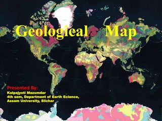
  • 1. Geological Map Presented By: Kalpajyoti Mazumdar 4th sem, Department of Earth Ecience, Assam University, Silchar
  • 2. Content  Introduction  Brief history of Geological mapping  Types of Geological Map  How geological maps prepared ?  Field Equipment  Map scale  Map key  Conclusion  Bibliography
  • 3. Introduction • What is a Map? • A map is a picture or representation of the Earth’s surface, showing how things are related to each other by distance, direction , and size. • Maps are a way of showing many things about a portion of the Earth’s surface on a flat piece of paper that can be carried and transported easily. • A map is not a photograph of the Earth’s surface. It can show many things that a picture can’t show, and as a result, a map looks different in many ways from a photograph of the Earth’s surface
  • 4. What is a Geological Map? • Geological map is a special purpose map made to show geological features. • A geologic map is a made of the different types of rocks or structures that are on the surface of the Earth. • Geologic maps are used to interpret the structure, Stratigraphy , Mineralogy, Paleontology, and the historical record of the Earth’s crust.
  • 5.
  • 6. Brief history of geological mapping  The map indicating the gold field in Egypt on the 13th century, is the first recorded attempt in providing graphical geological information.  In the 16th century D. Owen showed the Carboniferous outcrop in the form of narrow beds.  First geological map is known to have been compiled M.Lister at end of the 17th century.  The first stratigraphic layer by layer geological map is started appearing at the beginning of the 18th century.  In India the first geological map was prepared by Dr. Henry Westly Voysey.  Apt. J D the 1825 and this Herbest prepared the first geological map of the Himalayan in was published in 1842 for the area between the river Sutlej and Kali.
  • 7. Types of Geological Mapping There are 3 major types of Geologic Maps 1. Topographic Maps 2. Structural Maps 3. Cross-section map
  • 8. 1. Topographical Maps: Topographic maps, show a 3 dimensional world in 2 dimensions, by using contour lines (lines of equal elevation). Topographic maps refer to a graphical representation of the three-dimensional configuration of the surface of the Earth. Moreover, such maps show the size, shape, and distribution of landscape features.
  • 9. 2. Structural mapping • Structural mapping is the identification and characterization of structural expression. Structures include faults, folds, synclines and anticlines and lineaments. Understanding structures is the key to interpreting crustal movements that have shaped the present terrain. • A synoptic view of regional scale is a much different perspective than point ground observations when trying to map structural elements. Remote sensing offers this perspective and allows a geologist to examine other reference ancillary data simultaneously and synergistically, such as geo-magnetic information.
  • 10.
  • 11. 3. Cross-sectional map • A cross-sectional map shows the cross-section from the side. The cross-sectional maps shows the changes along the line shown on the map. • Cross-section maps or block diagrams is not a map actually but sometimes it is also considered as a geological map, because of showing data similar to a geological map
  • 12.
  • 13.
  • 14. Some other types of maps
  • 15. Global map of monthly sea surface salinity, May 2022. NASA's Soil Moisture Active Passive (SMAP) mission
  • 16.
  • 17. Map of the world showing average annual precipitation
  • 18.
  • 19. How Geological maps are prepared? • The aim of geologic mapping is to create a map which summarizes the geologic data gathered in the field. • Every place that an observation is made, a sample is gathered, or any type od data collection takes place, it is positioned on the map at the appropriate X – Y coordinates. • The map can be small scale and show much detail, or be large scale and generalized. • Different geologic mapping agencies and authorities have different standards for the colors and symbols to be used for rocks of different types and ages.
  • 21. Map scale • Map scale can be expressed as the ratio or proportion between a distance on a map and the actual distance on the land surface. This ratio is called the Representative Fraction (RF). A RF of 1:100,000 indicates that 1 unit of measure on the map represents 100,000 units on the land surface (i.e. , 1 inch = 100,000 inches, 1.58 miles)
  • 22.
  • 23.
  • 24.
  • 25.
  • 26. Conclusion • Geological mapping is the fundamental task of a geologist on the basis of which all subsequent qualitative and quantitative geological studies are carried out leading to understanding of evolution of chosen part of the terrain in space and time. • The information is represent graphically on a chosen scale, by use of combination of colours/characters, lines and symbols.
  • 27. Bibliography 1. Basics of Geological mapping John W. Barnes, formerly of the Department of Earth Science ,University of Wales Swansea 2. Standards for Regional Geological Mapping: Procedures and Guidelines for work processes contented digital attributes for products (part II , part I) Regional Geology and Geochemistry Department Geological Survey of Ethiopia
  • 28. How to create geological map on QGIS Complete guide • https://youtu.be/I8Wzm2qJsh0