Download as PDF, PPTX
![A Conversation about Capabilities and
Collaboration
By Karen Richardson, Esri Writer
Bringing geography to life and then sharing
that information using the ArcGIS platform
was the talk of this year’s 2013 Esri Federal
GIS Conference, which drew more than
3,600 people to the Walter E. Washington
Convention Center in downtown
Washington, DC.
What attendees also learned from Plenary
Session talks, Exhibit Hall visits, and the tech-
nical and paper sessions was that change is
brewing in the world of geospatial technology.
Solutions are moving away from client/server
architectures to an application and device
framework that gives people services they
can easily use. Esri’s ArcGIS is evolving from a
collection of tools to a framework that is open
and extendable so it fits into an organization’s
systems across many platforms.
“As GIS users, we are bringing information
sets together using geography as a common
framework,” said Jack Dangermond, Esri
president, during the Plenary Session. “We
can create content to be shared, served, and
made into apps for others to easily use. Today
we are realizing that geography is a funda-
mental science for understanding our world,
and GIS makes it come alive in applications.”
New Content Available on
ArcGIS Online
Users can begin creating these new applica-
tions with an amazing amount of new content,
such as imagery and landscape services,
coming soon to Esri’s cloud-based hosting
service ArcGIS Online. Landscape services
are a collection of more than 30 physical, hy-
drologic, and ecological layers for the United
States that will be available to ArcGIS Online
organizational subscribers. The data will be
provided as both feature and image services
instead of cached tile services, so users can
access the underlying data and use it for
analysis as well as viewing. The data layers can
also be brought into desktop applications and
used just like any other local dataset: they can
be mashed up with other data, geoprocessed,
and even exported.
Esri also announced that more than
10 million square kilometers of high-resolution
aerial views from DigitalGlobe are now avail-
able as a free map service via ArcGIS Online.
The imagery is available at 30 centimeters at
1:1,000 scale for the continental United States
and 60 centimeters for areas in Western
Europe down to 1:2,000 scale. This imagery
will be continually updated and eventually in-
clude more than 100 million square kilometers
of high-quality imagery.
The ability to publish and share content
as 3D web scenes is being streamlined with
Esri CityEngine Web Viewer. This viewer is a
browser-based app that lets users capture 3D
content and create visualizations. While these
visualizations can use industry-standard data
imports, new editing tools will allow users to
construct their own 3D data as well.
What Does the Needle in the
Haystack Tell Us?
During the Plenary Session, Sean Gorman, the
founder of GeoIQ and now the chief strategist
at Esri’s R&D Center, Washington, DC, dem-
onstrated how GIS can be used to synthesize
the barrage of data from social media into
meaningful, actionable information.
Gorman studied Twitter feeds from New
Yorkers as Hurricane Sandy made landfall
there in October 2012. He then viewed where
thousands of people in New York City were
Tweeting using the word power by employing
ArcGIS GeoEvent Processor for Server, a new
extension for ArcGIS for Server that allows
people to track real-time data including the
time it occurred. One-kilometer grid cells
were created across a map of Manhattan that
calculated how many Tweets occurred per cell.
This gridded data was then normalized so only
larger-than-average volumes of Tweets were
displayed. By viewing the location of Twitter
feeds, the conference audience could see
spikes in conversations that happened when
the storm hit.
The day after the storm made landfall, the
large cluster of Tweets about power outages
moved north. Gorman began looking at this
cluster and discovered a Tweet with a picture
of a substation that had failed, cutting off
power in southern New York—hence, no more
Tweets from that area. “We can not only find
the needle in the haystack, but we can find
out what else that needle has to tell us,” said
Gorman.
Finding Gold in Downtown DC
Other ways to collect, view, and analyze
real-time data were also demonstrated at
the conference. Esri’s Jo Fraley configured
Esri’s new Operations Dashboard for ArcGIS
and Collector for ArcGIS. She then selected
a group of audience members to collect data
about anything gold they saw on the streets
of Washington, DC, using the Collector for
ArcGIS app on their Android and iOS devices.
“Gold stands for different things to differ-
ent people,” said John Calkins, Esri’s master
of ceremonies. “For homeland security, per-
haps gold means a gold-painted car holding
explosives. For the Environmental Protection
Agency [EPA], gold might mean collecting
water quality samples of heavy metals. For the
Department of Health and Human Services
[HHS], this might mean providing the highest
level of health care—the gold standard—to
those in need.”
ttFraley reported back on the field-workers’
progress throughout the rest of the day.
People could see the number of gold objects,
such as gold-colored signs and doors, and
where they were dispersed on a map. The
map was also configured to display live traffic,
weather, and the metro schedule. To end the
demonstration, Brett Rose from Esri showed
the audience the map and some analysis
he ran during the collection process that
included the positions, statistical distribution,
and orientation of the teams as they moved
through downtown DC. “By bringing analysis
into a real-time operation, analysts can
contribute and improve the mission, helping it
be successful,” said Rose.
Collaboration and Cooperation
Jerry Johnston, the geospatial information
officer at the Department of the Interior (DOI),
5Spring 2013 esri.com/federal
5](https://image.slidesharecdn.com/spring-2013-130905125306-/85/Spring-2013-5-320.jpg)
![initiatives across many government entities
over the years.
“It is much easier if top-down management
support exists, even if there is nothing else
other than a prototype,” said Ball. However,
in some instances, the LaRC GIS team has
resorted to the “build it and they will come”
philosophy in an effort to overcome legacy
processes.
“In our instance, alignment with principal
users, such as Space Utilization, Real Property,
and Master Plan, contributed to our success,”
said Ball. “Now integration with other func-
tions, such as maintenance, communications,
safety, and security, are starting to be better
understood.”
Use It or Lose It
Where GIS is first placed can also be critical.
“My experience has been that linking the GIS
to organizations that routinely use the data
versus organizations that perform oversight or
process functions, such as IT groups, has gen-
erally produced superior results,” said Ball.
Additionally, use of interns is a very
affordable approach to facilitate initial
development as well as major changes to any
program, including GIS.
“Finally, I suggest building FM [facilities
management] on top of core technologies
like GIS and a robust RDBMS as opposed to
pursuit of third-party products,” said Ball.
“This simplifies customization to align with
your organization’s workflow.”
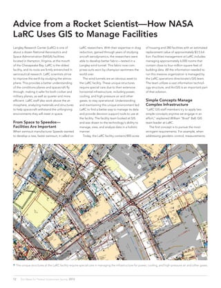
The NASA LaRC facility contains 800 acres of housing and 280 facilities
with an estimated replacement value of approximately $3.5 billion.
For more information on how GIS can help
facilities managers, visit esri.com/fm.](https://image.slidesharecdn.com/spring-2013-130905125306-/85/Spring-2013-14-320.jpg)
![Esri Meet Ups: Where Great Minds Get Together
Come join other GIS insiders for Meet Ups in Washington, DC.
These casual, low-key events provide a great way for you to engage
with the geospatial beltway community. Whether you’re a longtime
member of the GIS community or new to it, you’ll enjoy meeting with
your peers and hearing from Esri thought leaders.
Strengthen your capabilities while enjoying a relaxing evening. Find
out how your peers are using GIS and learn more about the ArcGIS
platform. GIS professionals, analysts, developers, and Esri partners are
welcome. Complimentary hors d’oeuvres and beverages will be served.
Interested in attending the next Meet Up? Register online.
www.govloop.com/page/esri
Watch Meet Ups on Video
You can now view past Meet Ups online. Refresh your memory about a particular topic or see a session you may have missed.
nsp.performedia.com/staging/emu13/gallery
http://api.ning.com/files/XR79wCtsilydrCNXBMXz283dbnXFtsCNlFh9NAzREhTLJqrqMuGlRFWPlFjbOiADvp-VsyFSvo2w7ov1EUpEMuW4CisCwG2g/DSC_0852.JPG[4/23/2013 12:24:00 PM]
http://api.ning.com/...RDwXofFll5azAUV2fPDXfSJwdouuUSdEjq4DftlBioeoeRbf9ovKzXcLNxNavEaQTZhscqbxI0/DSC_1210.JPG[4/23/2013 10:49:10 AM]
http://api.ning.com/files/PYzl81pOEdziiu905VSVhjTDxyxYu794tTXLSX7flg92fiLLqgD6KYrzLrCUSqcXK4neBDyJfS3wKCaS9GsCmj6N0NmZDxre/DSC_0858.JPG[4/23/2013 11:04:33 AM]
http://api.ning.com/...fccCEP6GbN36*hfo4PIWWoXra5QdUDHEwMEjInDSNlH5TtX8F6rysk5rAS/DSC_0231.JPG?transform=rotate(90)[4/23/2013 10:31:30 AM]
http://api.ning.com/...hiSi2nzl5t3iVuShKqegpa6Bx-zlzgl1Chvk-JIPUt*TqWUe9AQFA7PvVp6n*if7x/DSC_0851.JPG?transform=rotate(90)[4/23/2013 12:12:53 PM]
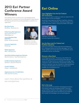
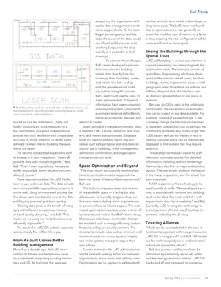
Esri DC R&D Center CTO
Andrew Turner explains about using
Open Source.
Esri solution engineer Bonnie
Stayer discusses the latest features
of ArcGIS.
15Spring 2013 esri.com/federal
Esri News](https://image.slidesharecdn.com/spring-2013-130905125306-/85/Spring-2013-15-320.jpg)

Len Bundra, the IT and GIS director for Toms River Municipal Utilities Authority, built a free public web map in 2004 that included layers of infrastructure, imagery, and other data. This map proved invaluable for emergency response during and after Hurricane Sandy in 2012, when Bundra updated it with post-storm imagery and flood data. It became a one-stop resource for many agencies and helped with tasks like utility restoration and demolition planning. Bundra's creation of the map showed that "if you build it, they will become aware" of its usefulness.


