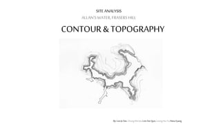
The document analyzes the contour and topography of Allan's Water in Frasers Hill. It finds that the area has varying terrain, with slopes ranging from 8 to 87 degrees and a lake depth between 1 to 9 meters. The steepest and flattest areas of the site are also identified. The topography makes some parts of the area difficult to access. There are views of the surrounding landscape from different vantage points on the slopes. Vegetation varies depending on slope, with taller trees on higher ground.