Download as PDF, PPTX

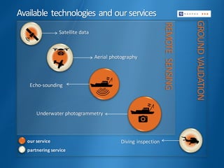
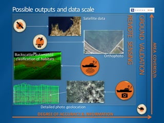
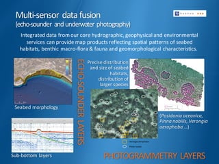
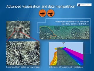
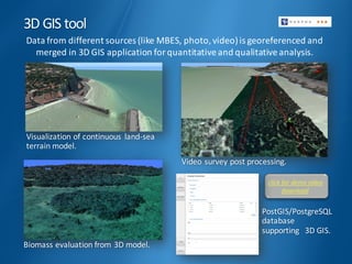
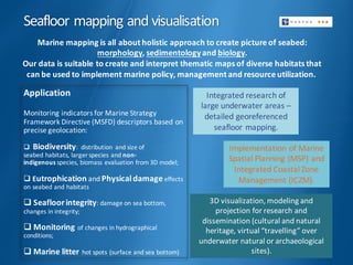

This document summarizes the seafloor mapping and visualization services provided by Harpha Sea, d.o.o. Koper. They use remote sensing technologies like satellite data, aerial photography and echo-sounding as well as ground validation techniques like underwater photogrammetry and diving inspections. The data collected is fused using multi-sensor data fusion of echo-sounder and underwater photography data to create detailed maps of the seafloor morphology, sub-bottom layers, and spatial patterns of seabed habitats, benthic macroflora and fauna, and geomorphological characteristics. Advanced visualization and 3D modeling of the data is also provided to support applications in marine policy, management, research and dissemination.