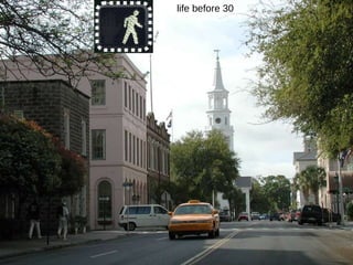
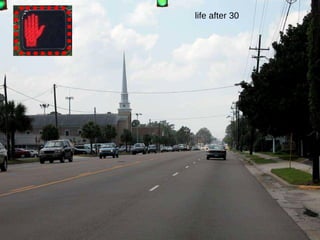
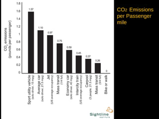
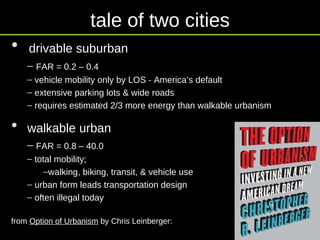
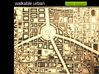
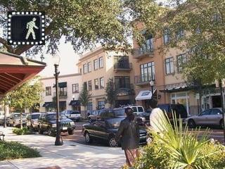
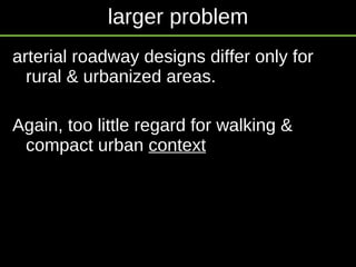
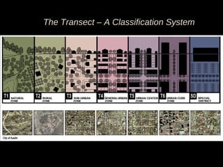
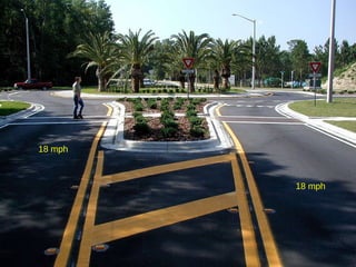
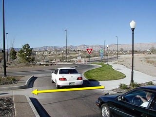
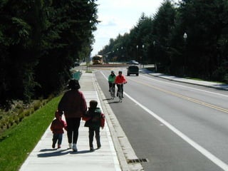
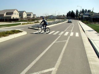
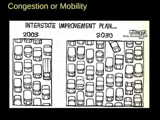
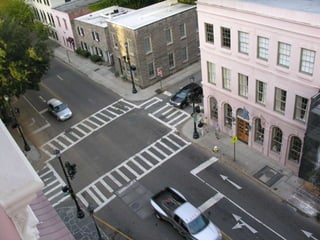
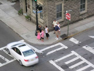
To Walk, or Not to Walk … 2009 CNU  Project for Transportation Reform (PTR) Summit  Portland, Oregon  Richard A. Hall, P.E. HPE Hall Planning & Engineering, Inc.
To walk, or not to walk:  that is the question: Whether 'tis nobler in the mind to suffer Edwin Booth, Hamlet 1870 Wikipedia
the signs and arrows of outrageous proportion,
Or to take arms against a sea of trucks, And by opposing slow them?
To walk: To speed no more;
and by a stroll to say we end D. Burdin
the heart-ache of a thousand annual deaths that flesh is heir to;
To walk, to stroll the street:  perchance to dream ... D. Burdin
life before 30
life after 30
economy development projects must sell Read  Greyfields into Goldfields , CNU Lee Sobel TND property values, 40 to 200% premium health CDC, obesity epidemic astounding highway fatality rate – 45k/year safe walk to school environment – climate it’s a crisis! IPCC  UN Intergovernmental Panel on Climate Change urban design influences VMT, thus a valid solution what we can’t see can hurt us!  1 pound per mile, out window. etc. Why Walk?
CO 2  Emissions per Passenger mile
Drake’s Well  – 150 years ago  Titusville, Pennsylvania  Edwin L. Drake & George Bissell struck oil, at 69 feet  August 27/1859
tale of two cities drivable suburban FAR = 0.2 – 0.4 vehicle mobility only by LOS - America’s default extensive parking lots & wide roads requires estimated 2/3 more energy than walkable urbanism walkable urban FAR = 0.8 – 40.0 total mobility;  walking, biking, transit, & vehicle use urban form leads transportation design often illegal today from  Option of Urbanism  by Chris Leinberger:
Andrew Georgiadis drivable suburban
walkable urban Andrew Georgiadis
It is not without hazard  that change comes
 
 
Top 10  Walkability  Factors 10. Street Trees 9. Lower Volumes 8. Sidewalks 7. Narrow Streets  6. Interconnected Streets 5.  On Street Parking 4.  Lower Traffic Speeds 3.  Mixed Land Use 2.  Buildings Fronting St.  1.  Small Block Size!
 
Gaines Corridor Workshop
Urban Transportation Design  Question of the Century Q.  Can you see DOT treating Gaines Street any differently than Capital Circle by the interstate? A.  No. Arterial
 
 
“ The first step in the (thoroughfare) design process is to define the function that the facility is to serve.”  AASHTO
functional classification  Arterials  - Connecting major areas, long trips for mobility Collectors  - Connecting arterials, intermediate trips Locals  - Serving local access & connecting to collectors, short trips All  trips  are by  auto  or  truck ,  no  pedestrians in the critical  functional   definition Areas  = rural or urbanized, only two major areas Add a third major area type –  Compact Urban
larger problem arterial roadway designs differ only for rural & urbanized areas.  Again, too little regard for walking & compact urban  context
rural urbanized Update the functional classification system  areas
rural suburban compact urban Update the functional classification system  areas
rural suburban compact urban new  compact  urban Update the functional classification system  areas
simulate urbanized travel from past travel patterns apply expensive travel models of capacity size network per vehicle LOS to prevent “failure” simulate urban form based on measured places  prioritize character and function  over  capacity network is sized to yield smaller blocks suburban compact urban  what is the difference?
arterial collector local  proportion of service by functional classification general urban compact urban land access vehicle mobility land access mobility for all modes
trip length by functional classification arterial collector local  general urban compact urban vehicles  all modes
continue valiant efforts to adjust suburban thoroughfares apply complete streets planning & design walking is first set low speeds as 20 & 25 develop ped. scale design parameters  encourage multimodal travel via networks decrease travel modeling and traffic impact analysis reward good design behavior with higher funding levels suburban compact urban  what is the effect?
 
 
The Transect – A Classification System
18 mph 18 mph
 
 
Roslyn, NY
 
Roslyn, NY
Congestion or Mobility


'tis a transformation devoutly to be wish'd.  D. Burdin
To walk: To speed no more;

To Walk or Not to Walk

  • 1.
    To Walk, orNot to Walk … 2009 CNU Project for Transportation Reform (PTR) Summit Portland, Oregon Richard A. Hall, P.E. HPE Hall Planning & Engineering, Inc.
  • 2.
    To walk, ornot to walk: that is the question: Whether 'tis nobler in the mind to suffer Edwin Booth, Hamlet 1870 Wikipedia
  • 3.
    the signs andarrows of outrageous proportion,
  • 4.
    Or to takearms against a sea of trucks, And by opposing slow them?
  • 5.
    To walk: Tospeed no more;
  • 6.
    and by astroll to say we end D. Burdin
  • 7.
    the heart-ache ofa thousand annual deaths that flesh is heir to;
  • 8.
    To walk, tostroll the street: perchance to dream ... D. Burdin
  • 9.
  • 10.
  • 11.
    economy development projectsmust sell Read Greyfields into Goldfields , CNU Lee Sobel TND property values, 40 to 200% premium health CDC, obesity epidemic astounding highway fatality rate – 45k/year safe walk to school environment – climate it’s a crisis! IPCC UN Intergovernmental Panel on Climate Change urban design influences VMT, thus a valid solution what we can’t see can hurt us! 1 pound per mile, out window. etc. Why Walk?
  • 12.
    CO 2 Emissions per Passenger mile
  • 13.
    Drake’s Well – 150 years ago Titusville, Pennsylvania Edwin L. Drake & George Bissell struck oil, at 69 feet August 27/1859
  • 14.
    tale of twocities drivable suburban FAR = 0.2 – 0.4 vehicle mobility only by LOS - America’s default extensive parking lots & wide roads requires estimated 2/3 more energy than walkable urbanism walkable urban FAR = 0.8 – 40.0 total mobility; walking, biking, transit, & vehicle use urban form leads transportation design often illegal today from Option of Urbanism by Chris Leinberger:
  • 15.
  • 16.
  • 17.
    It is notwithout hazard that change comes
  • 18.
  • 19.
  • 20.
    Top 10 Walkability Factors 10. Street Trees 9. Lower Volumes 8. Sidewalks 7. Narrow Streets 6. Interconnected Streets 5. On Street Parking 4. Lower Traffic Speeds 3. Mixed Land Use 2. Buildings Fronting St. 1. Small Block Size!
  • 21.
  • 22.
  • 23.
    Urban Transportation Design Question of the Century Q. Can you see DOT treating Gaines Street any differently than Capital Circle by the interstate? A. No. Arterial
  • 24.
  • 25.
  • 26.
    “ The firststep in the (thoroughfare) design process is to define the function that the facility is to serve.” AASHTO
  • 27.
    functional classification Arterials - Connecting major areas, long trips for mobility Collectors - Connecting arterials, intermediate trips Locals - Serving local access & connecting to collectors, short trips All trips are by auto or truck , no pedestrians in the critical functional definition Areas = rural or urbanized, only two major areas Add a third major area type – Compact Urban
  • 28.
    larger problem arterialroadway designs differ only for rural & urbanized areas. Again, too little regard for walking & compact urban context
  • 29.
    rural urbanized Updatethe functional classification system areas
  • 30.
    rural suburban compacturban Update the functional classification system areas
  • 31.
    rural suburban compacturban new compact urban Update the functional classification system areas
  • 32.
    simulate urbanized travelfrom past travel patterns apply expensive travel models of capacity size network per vehicle LOS to prevent “failure” simulate urban form based on measured places prioritize character and function over capacity network is sized to yield smaller blocks suburban compact urban what is the difference?
  • 33.
    arterial collector local proportion of service by functional classification general urban compact urban land access vehicle mobility land access mobility for all modes
  • 34.
    trip length byfunctional classification arterial collector local general urban compact urban vehicles all modes
  • 35.
    continue valiant effortsto adjust suburban thoroughfares apply complete streets planning & design walking is first set low speeds as 20 & 25 develop ped. scale design parameters encourage multimodal travel via networks decrease travel modeling and traffic impact analysis reward good design behavior with higher funding levels suburban compact urban what is the effect?
  • 36.
  • 37.
  • 38.
    The Transect –A Classification System
  • 39.
  • 40.
  • 41.
  • 42.
  • 43.
  • 44.
  • 45.
  • 46.
  • 47.
  • 48.
  • 49.
  • 50.
  • 51.
  • 52.
  • 53.
  • 54.
  • 55.
  • 56.
    'tis a transformationdevoutly to be wish'd. D. Burdin
  • 57.
    To walk: Tospeed no more;